California Tour

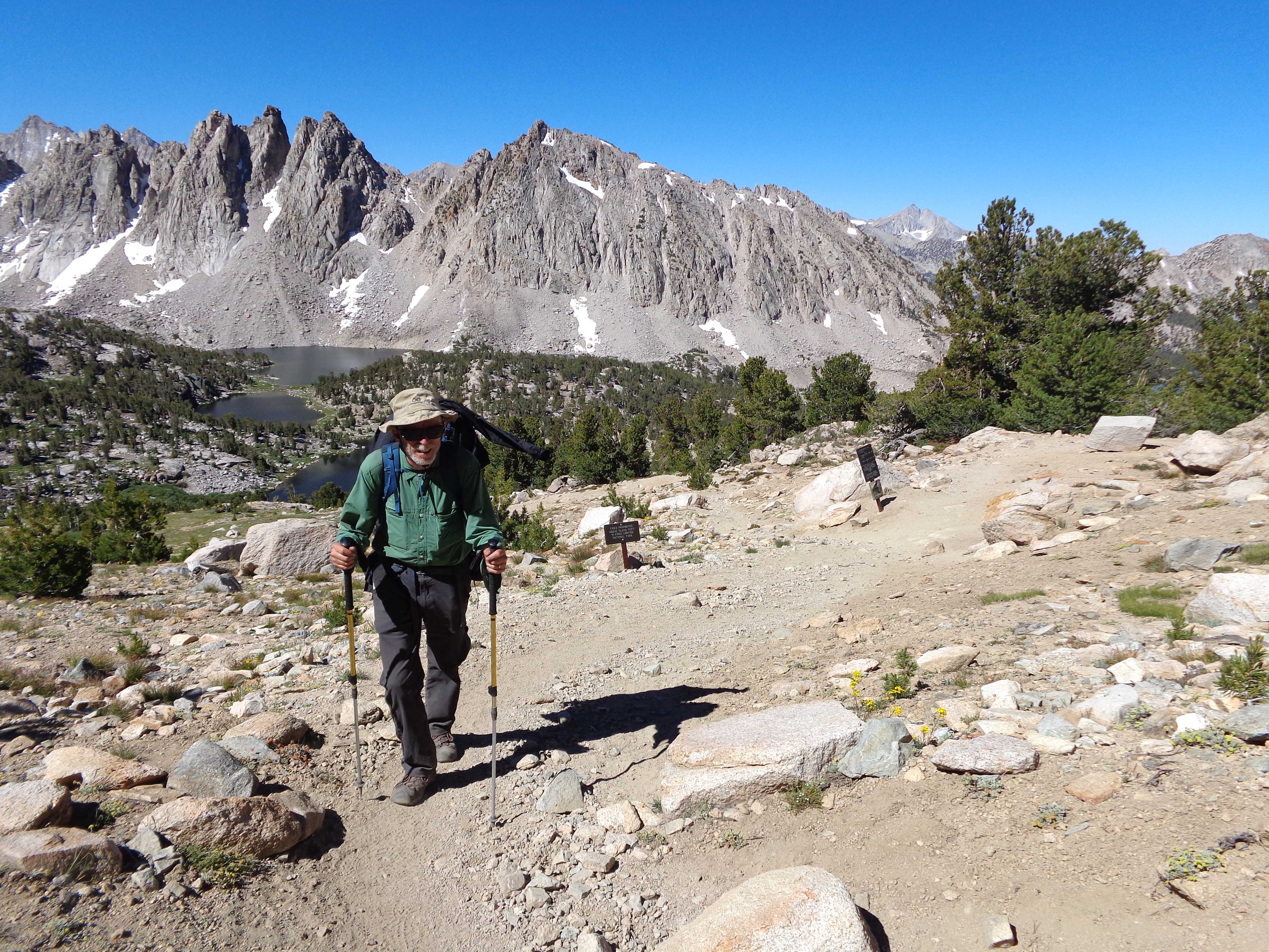
I hiked through the High Sierra Mountains on the John Muir Trail with several friends in 2016. I sometimes describe life as Before John Muir and After John Muir. You can read of that backpacking trip at this link. A Few Steps in Paradise

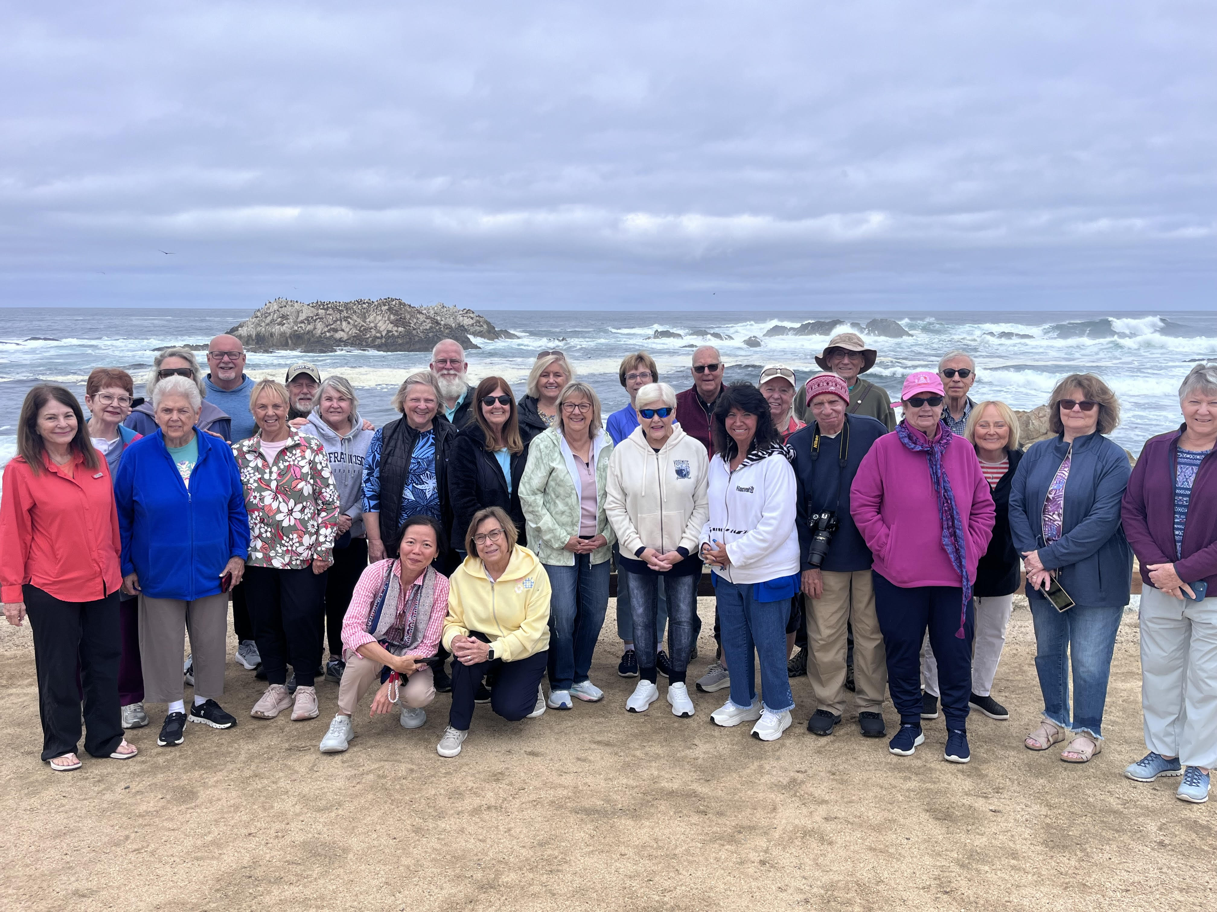
Since 2016, I’ve wanted to share a trip to Yosemite with my wife so she can see firsthand why the High Sierras so impressed me. This May we finally took an organized tour with about twenty-five great folks who were truly interested in learning about the areas we visited. Our tour leader had a background as a park ranger and had grown up in the area. His knowledge was extensive, and his enthusiasm was something to behold.

I’ve been lax about posting on this blog lately but now that I’ve finished the second edition of Five Star Trails: The Ozarks, I want to get back to blogging about the beauty I see out in nature, so our California tour is a good place to start.

Note: This post is an overview of the trip. Due to space, I’ve left out many details and hardly mentioned the food which was very good!

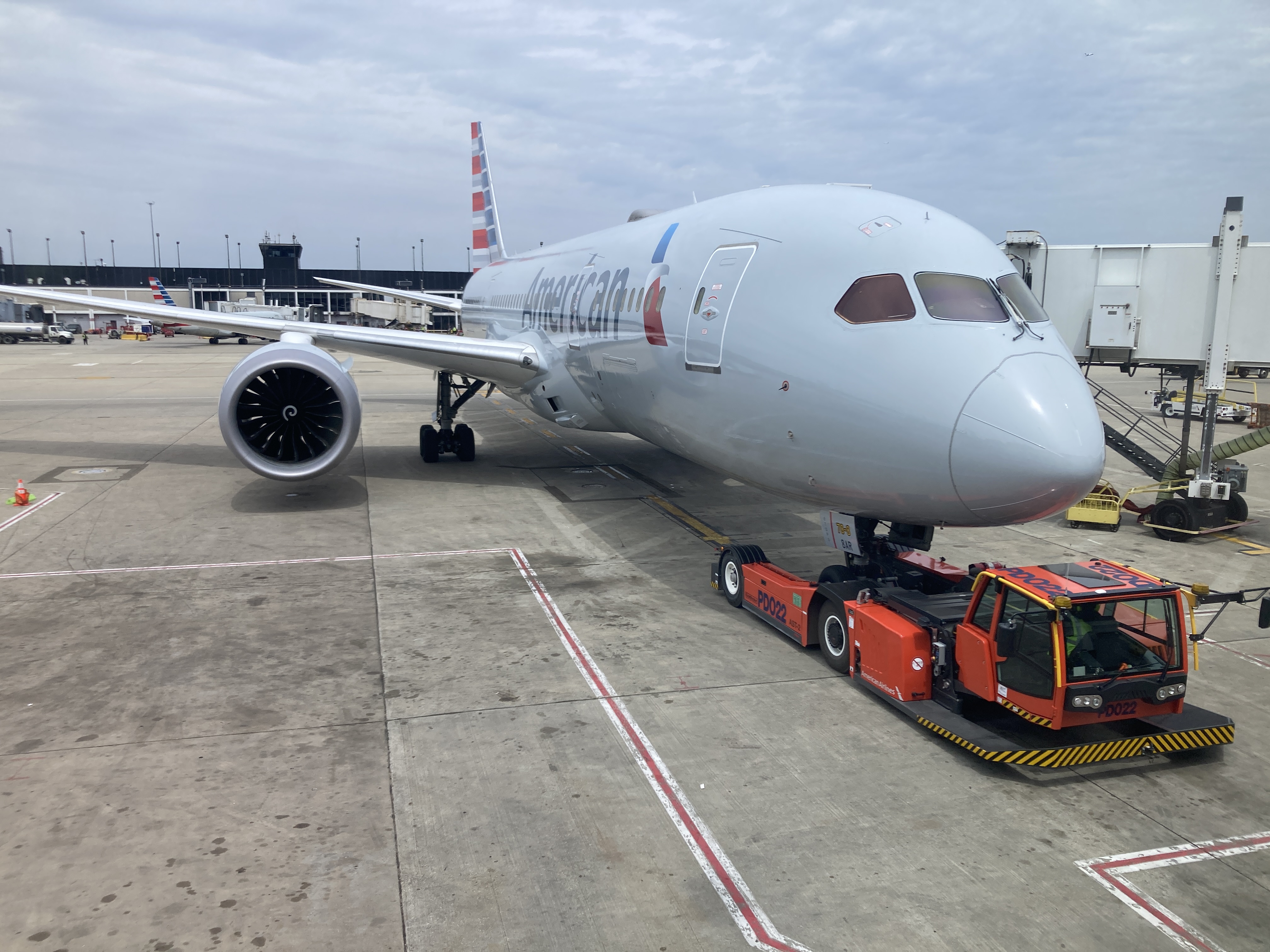
Now back to California. This was my first ever Globus tour and I hope not my last. The smaller number of participants made it easier to connect with others as you share the learning and all logistics are simpler.

Jake, the tour leader, was excellent. His depth of knowledge brought locations to life and his handling of logistics gave us peace of mind. Our driver, JR, was excellent as well. He kept that bus clean and his driving was top-of-the line. 

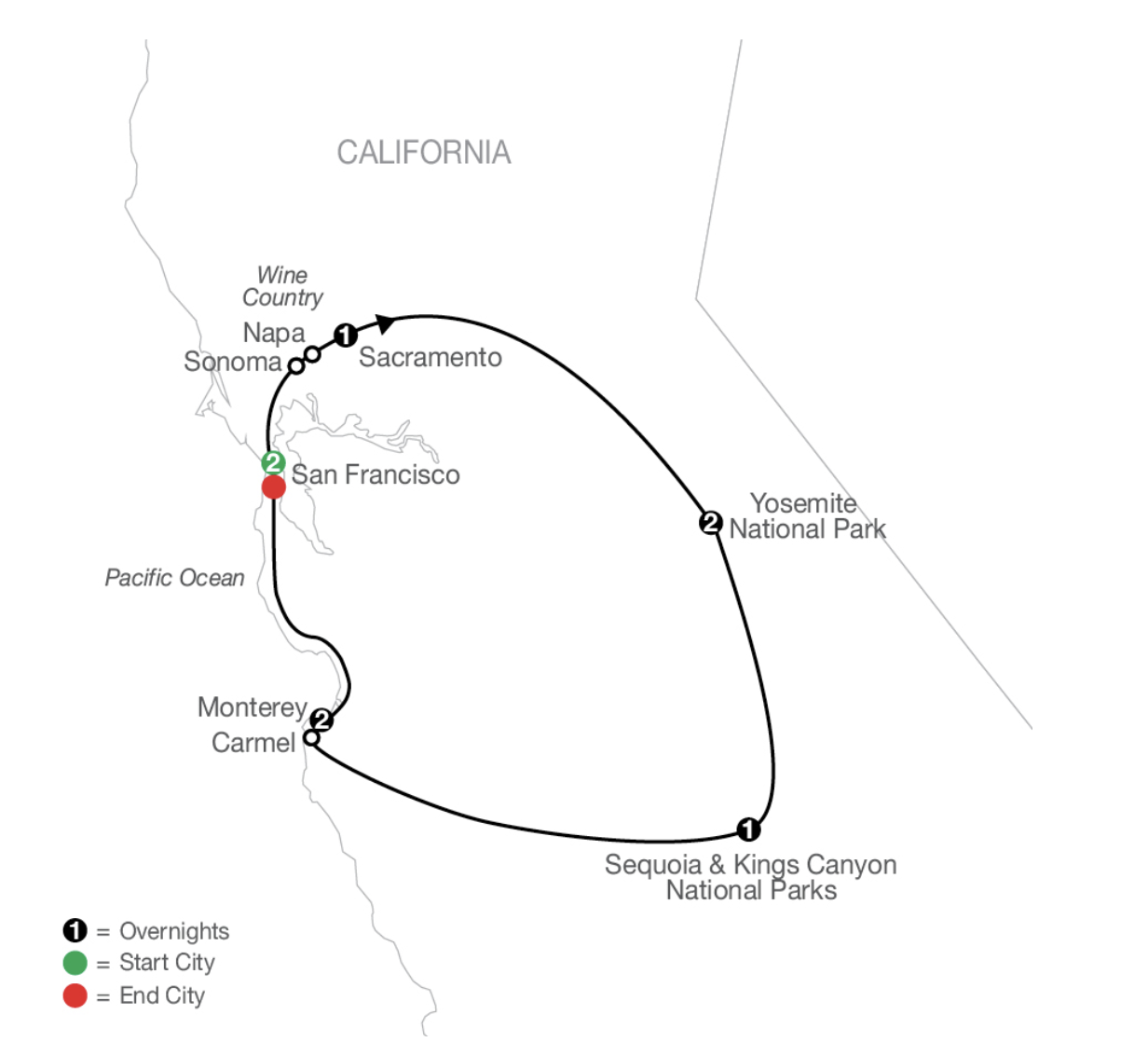
The following illustration shows the general flow of our trip beginning and ending in San Francisco.

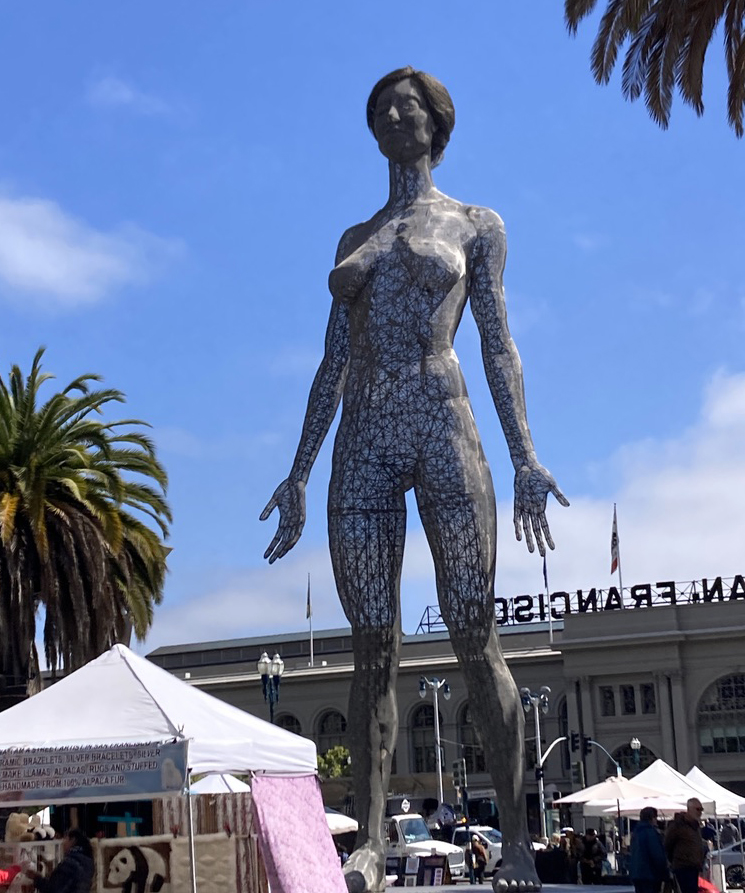
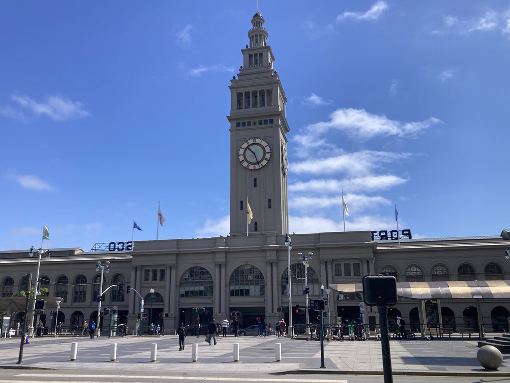
San Francisco is a great urban hiking location. We walked several miles our first morning just exploring a part of the bay not on our scheduled tour on Mission and Market Streets which took us to the Ferry Terminal Building and some nice view out across the bay. The large double deck Oakland Bay Bridge was in the area, and we were fascinated by the sculpture of a large human figure made from metal bracing and screen wire. 
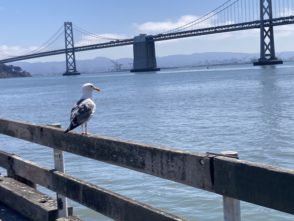
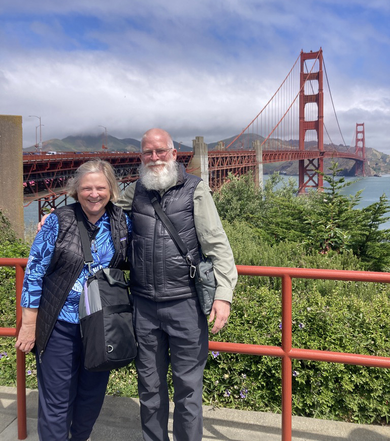
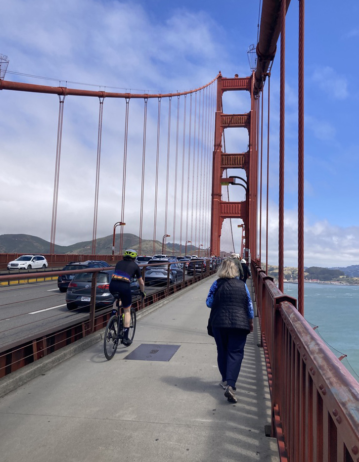
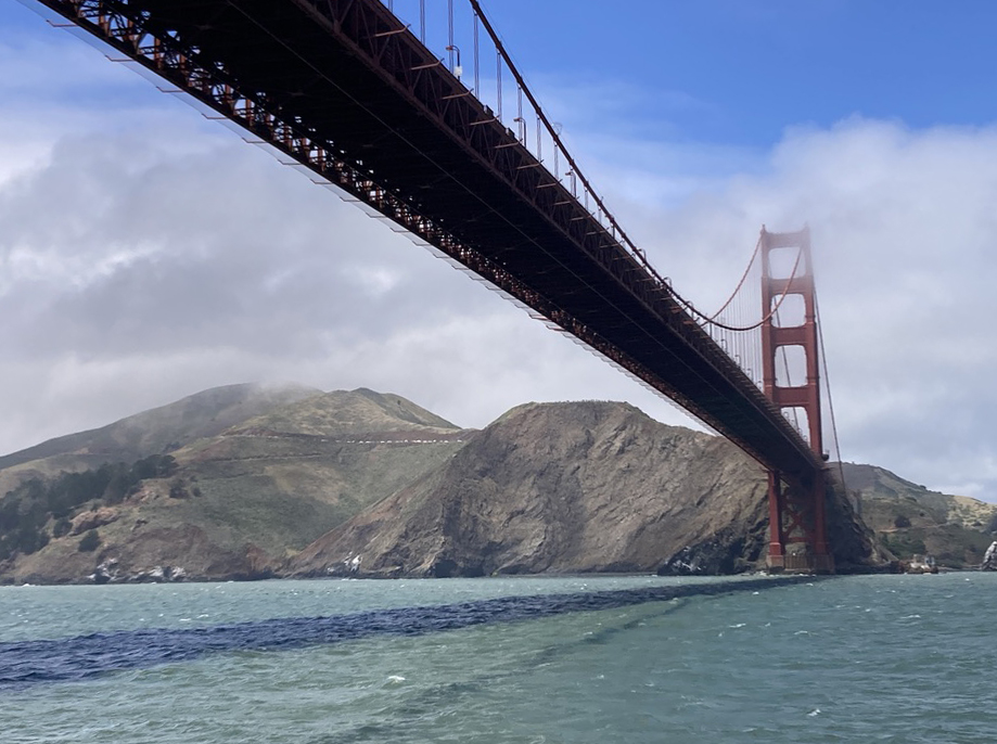
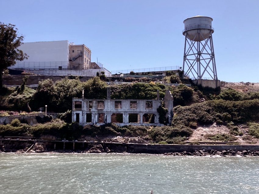
Our tour included an exploration of the city of San Francisco and a walk on the Golden Gate Bridge as well as a boat ride that circled the long-abandoned Alcatraz Island in the San Francisco Bay. Alcatraz Island was once a fort, then a military prison, and lastly, a maximum-security federal penitentiary. The prison closed in 1963 after 29 years in operation.

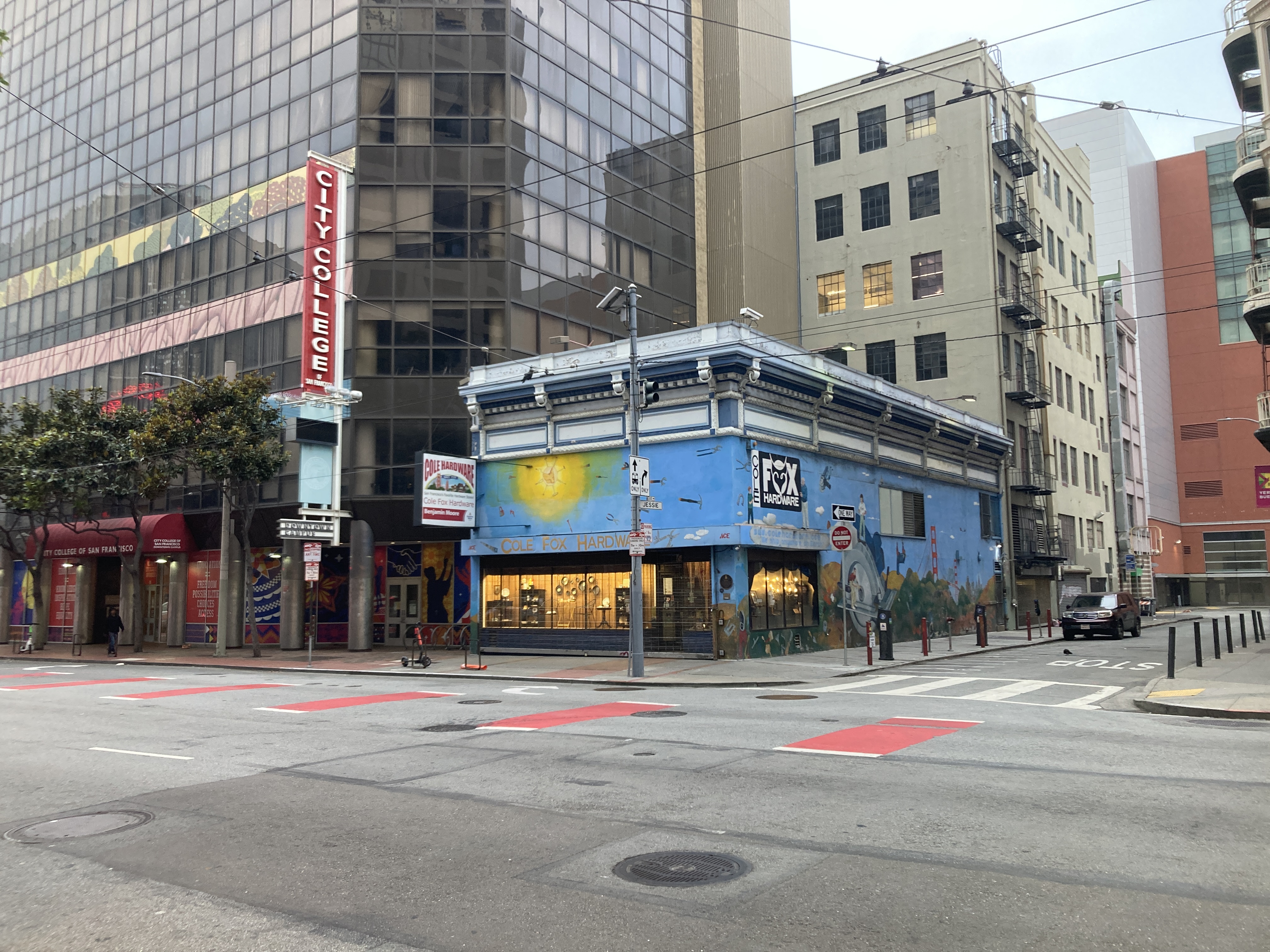
I must mention San Francisco’s historic Cole Hardware perched on a corner across the street from our hotel. Entering was like stepping back in time and their stock was impressive. We found the phone charger we were looking for.

We regularly saw driverless cars. I was impressed. After watching one driverless car easily flowing with the traffic, I saw an angry man gripping his steering wheel and driving erratically just a few cars later . Maybe driverless cars have the advantage where road rage is concerned.
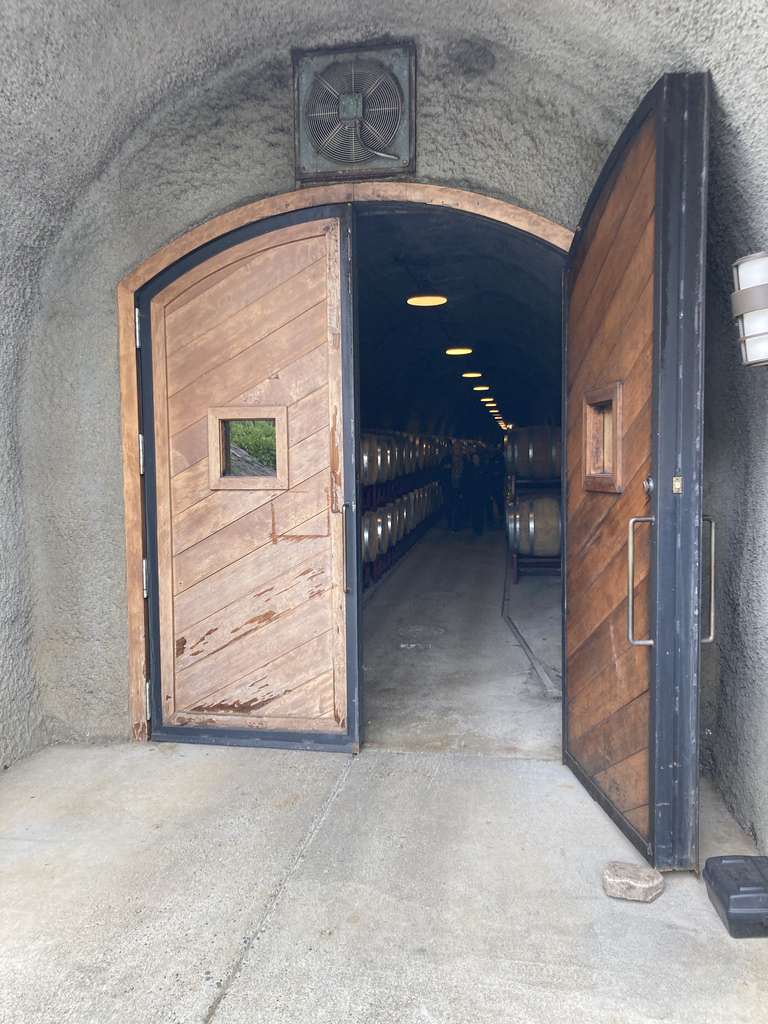
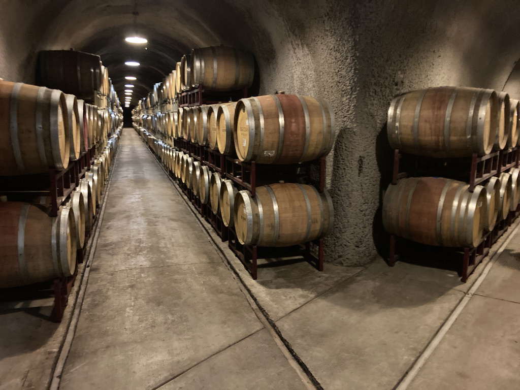
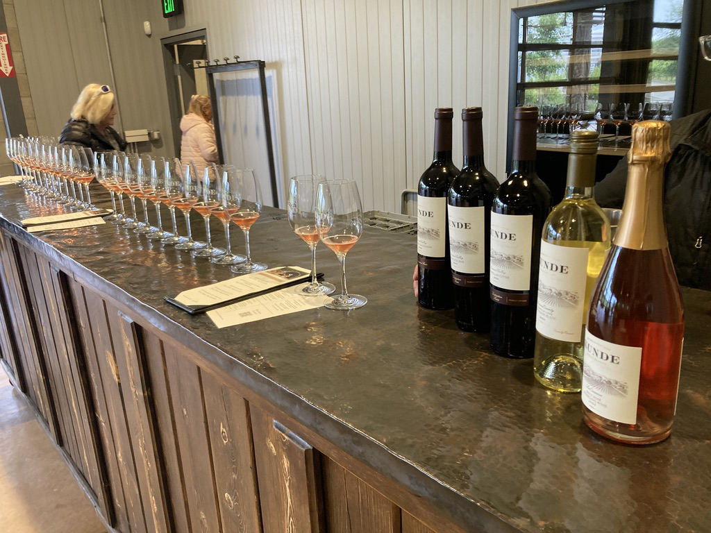
Sanoma and Nappa Valley wowed me more than expected. Spending time at the Kunde Winery was a treat and we enjoyed the wine tasting even though most of us rarely tasted wine before noon. The young man who led our tour seemed knowledgeable beyond his years. We enjoyed visiting a series of caves the Kunde Winery constructed as their storage sellers. 

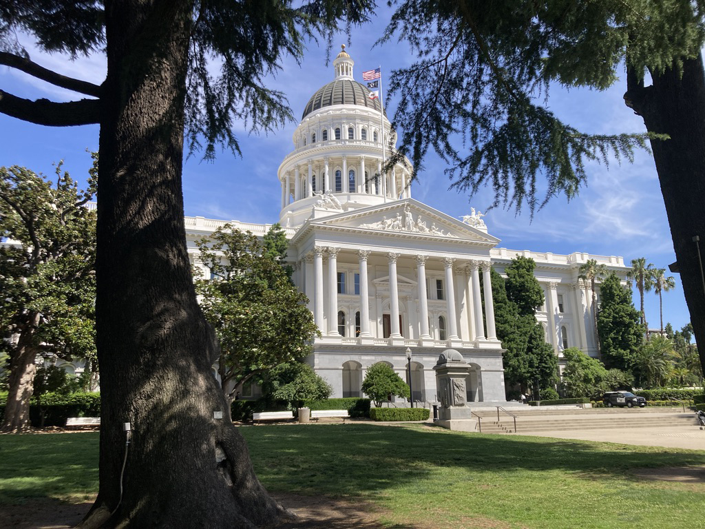
From Nappa Valley it was a short drive into Sacramento, the Capitol of California. The state capitol was memorable because of the huge Deodar Cedar campion tree on the front lawn. 

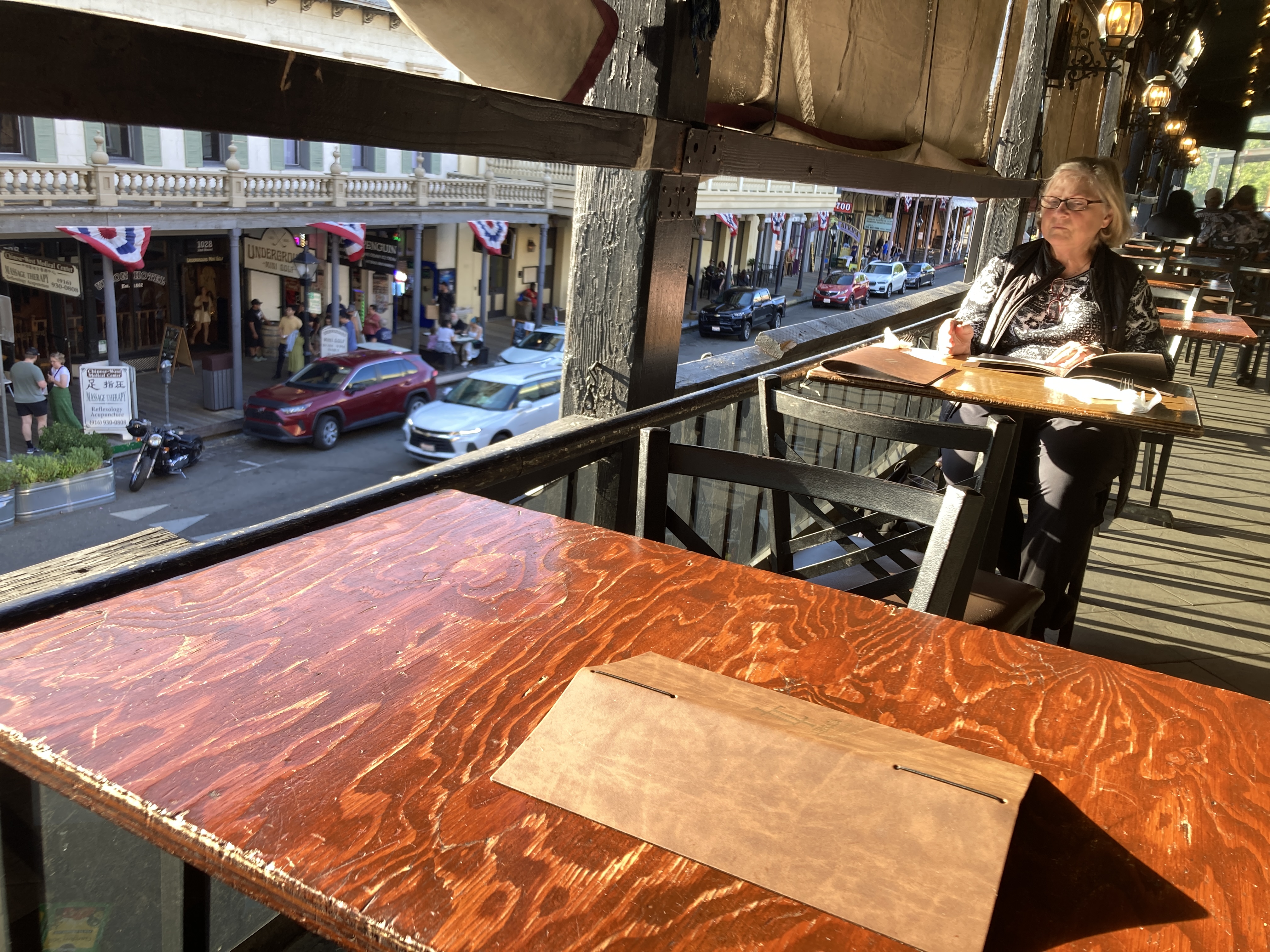
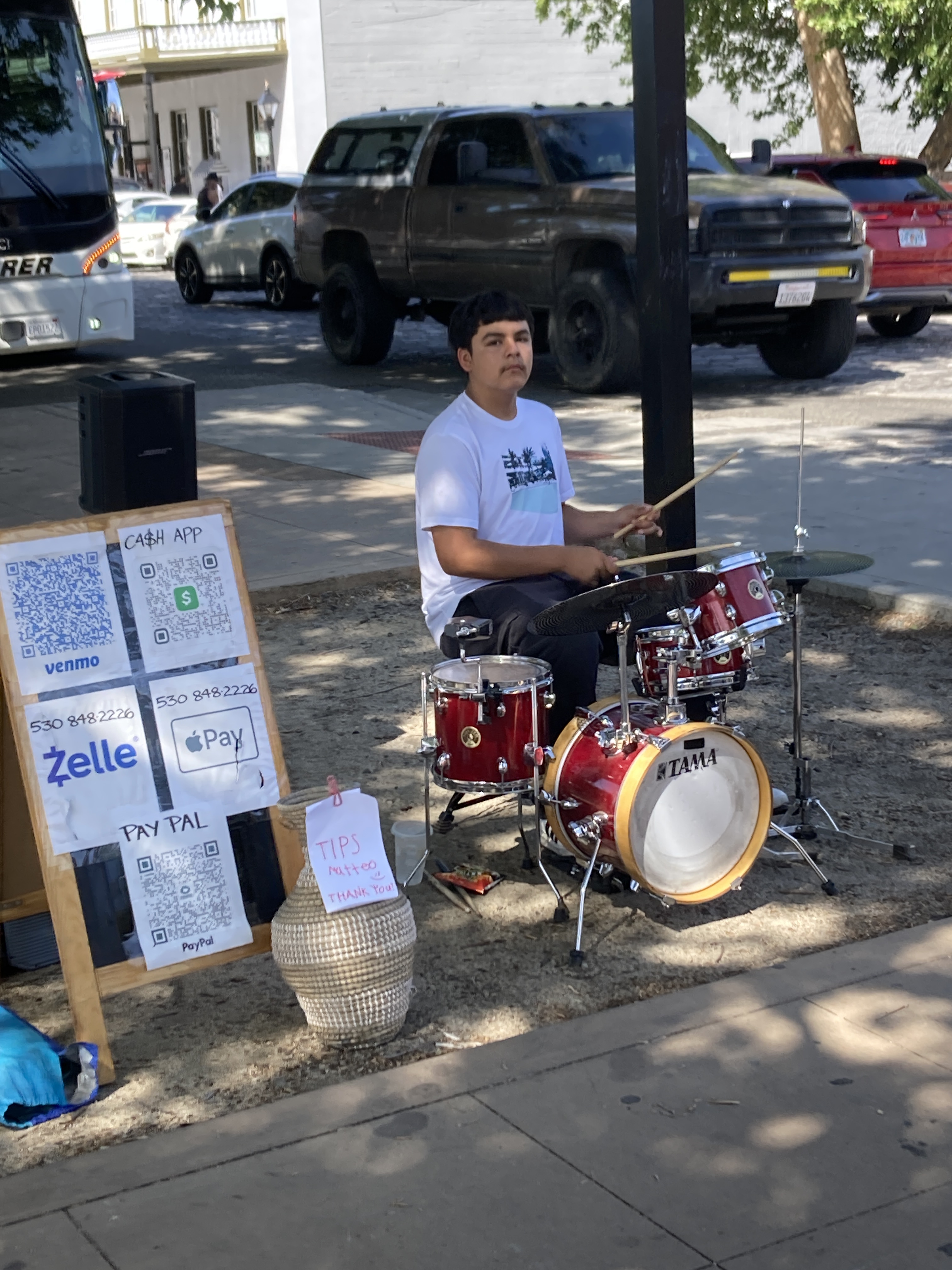
Old Town Sacramento was buzzing with activity. We found a second floor Mexican restaurant and had a good meal while the city noises buzzed away down below. 

I can’t walk past a young street musician without giving a listen and dropping something in the tip hat. Got more good drumming than I expected from this young man and his little brother. 

Seven-year-old drummer

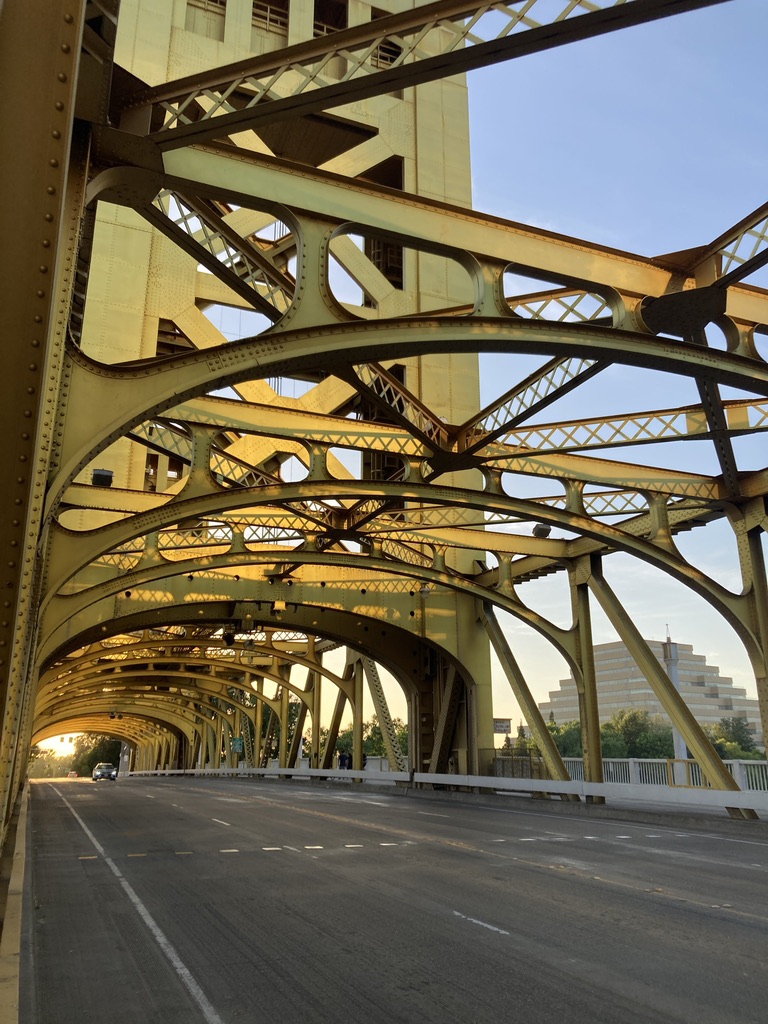
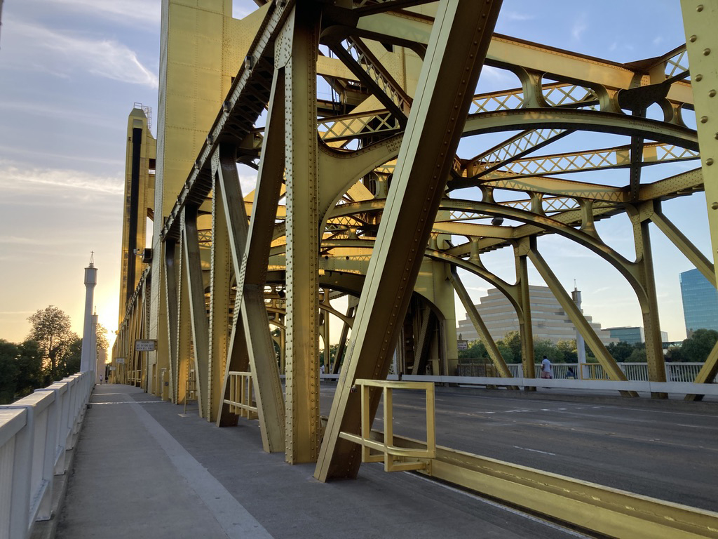
I enjoyed taking a few photos of a historic tower bridge over the Sacramento River close to our hotel. 

On to Yosemite!

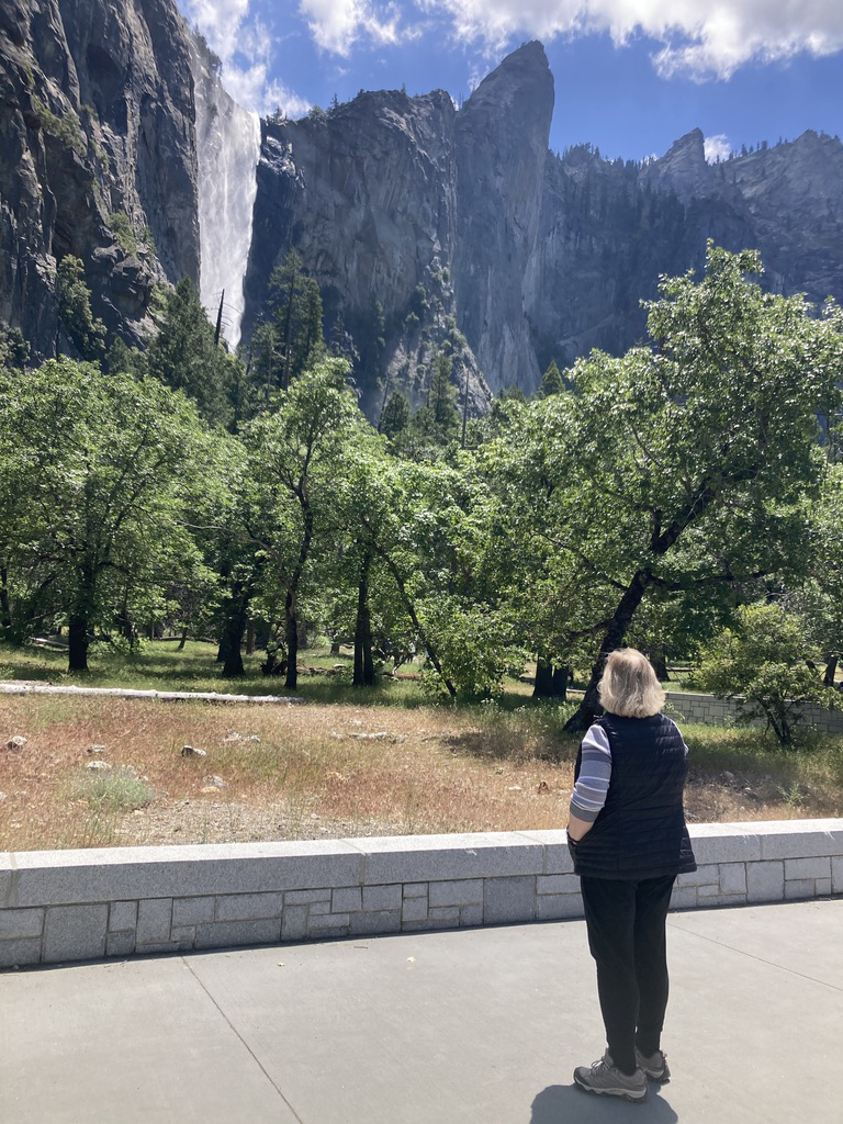
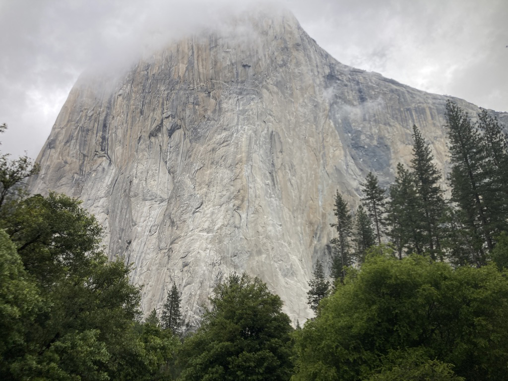
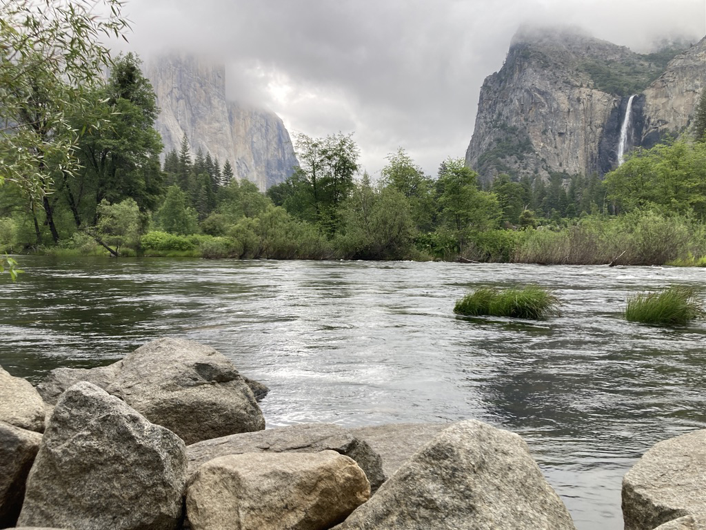
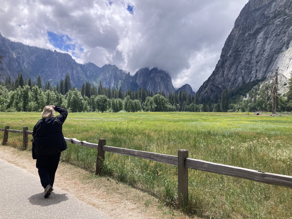
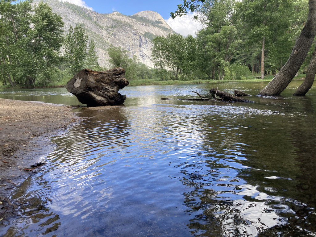
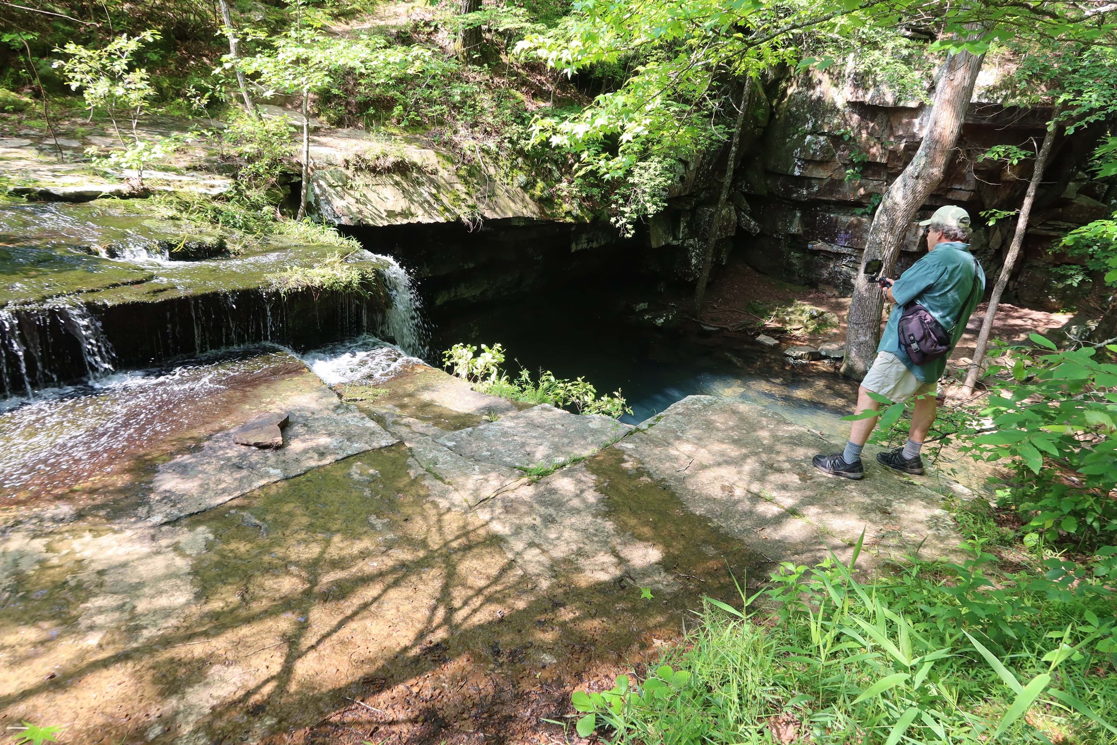
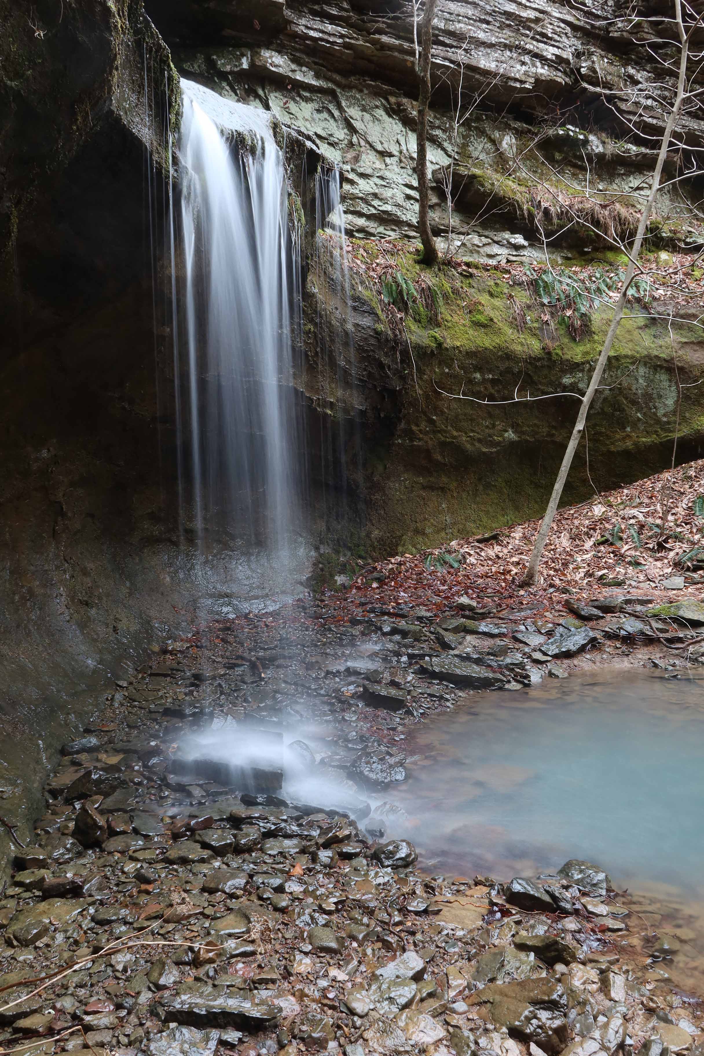
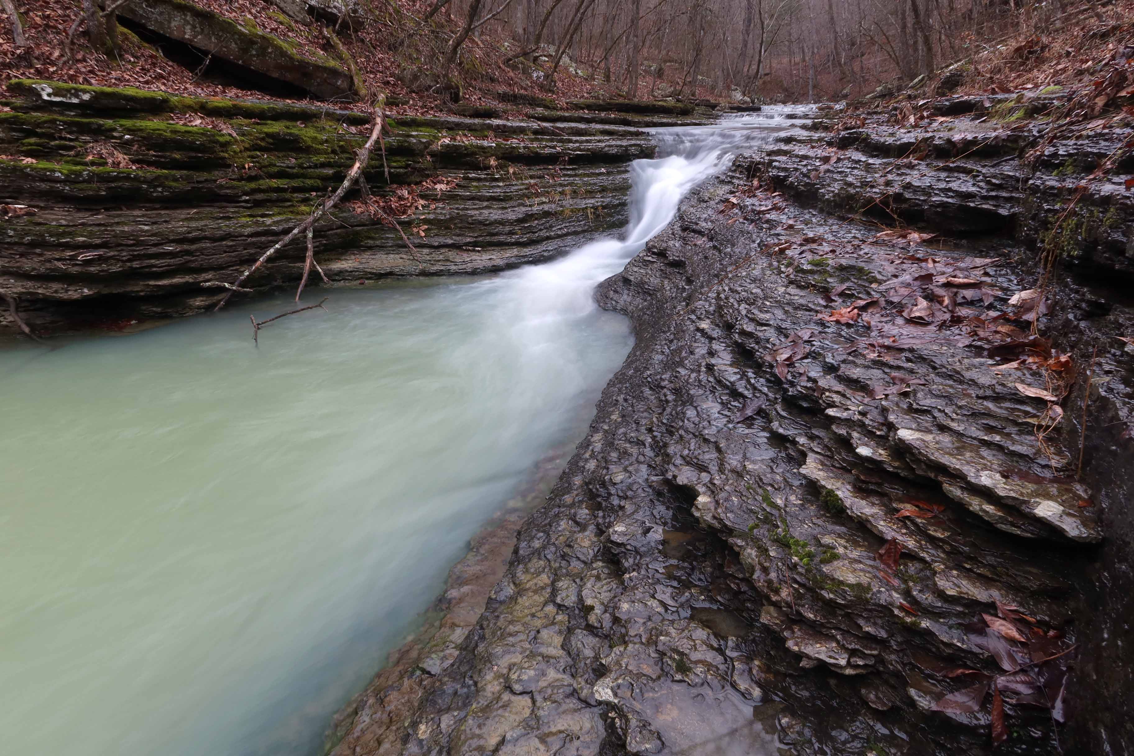
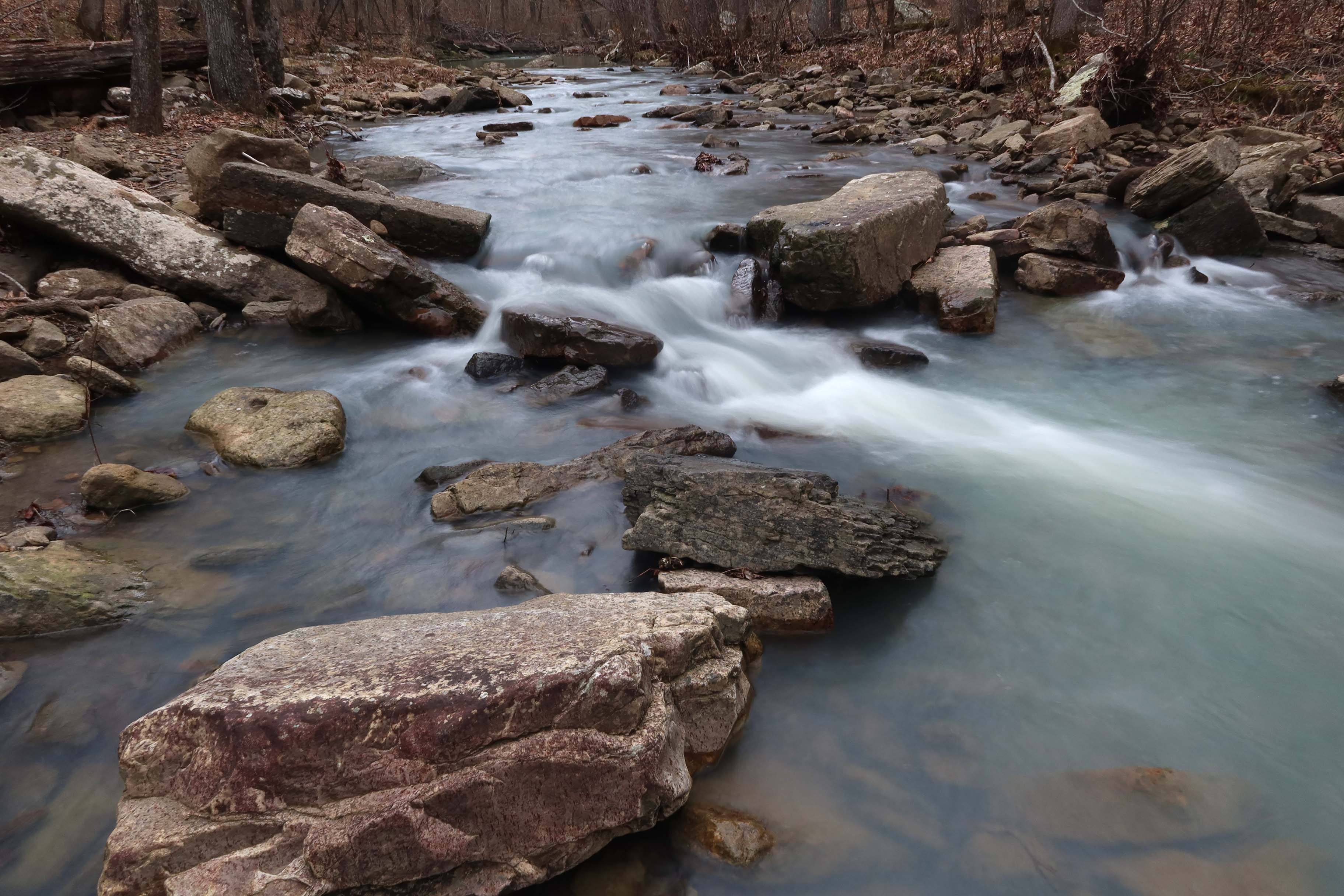
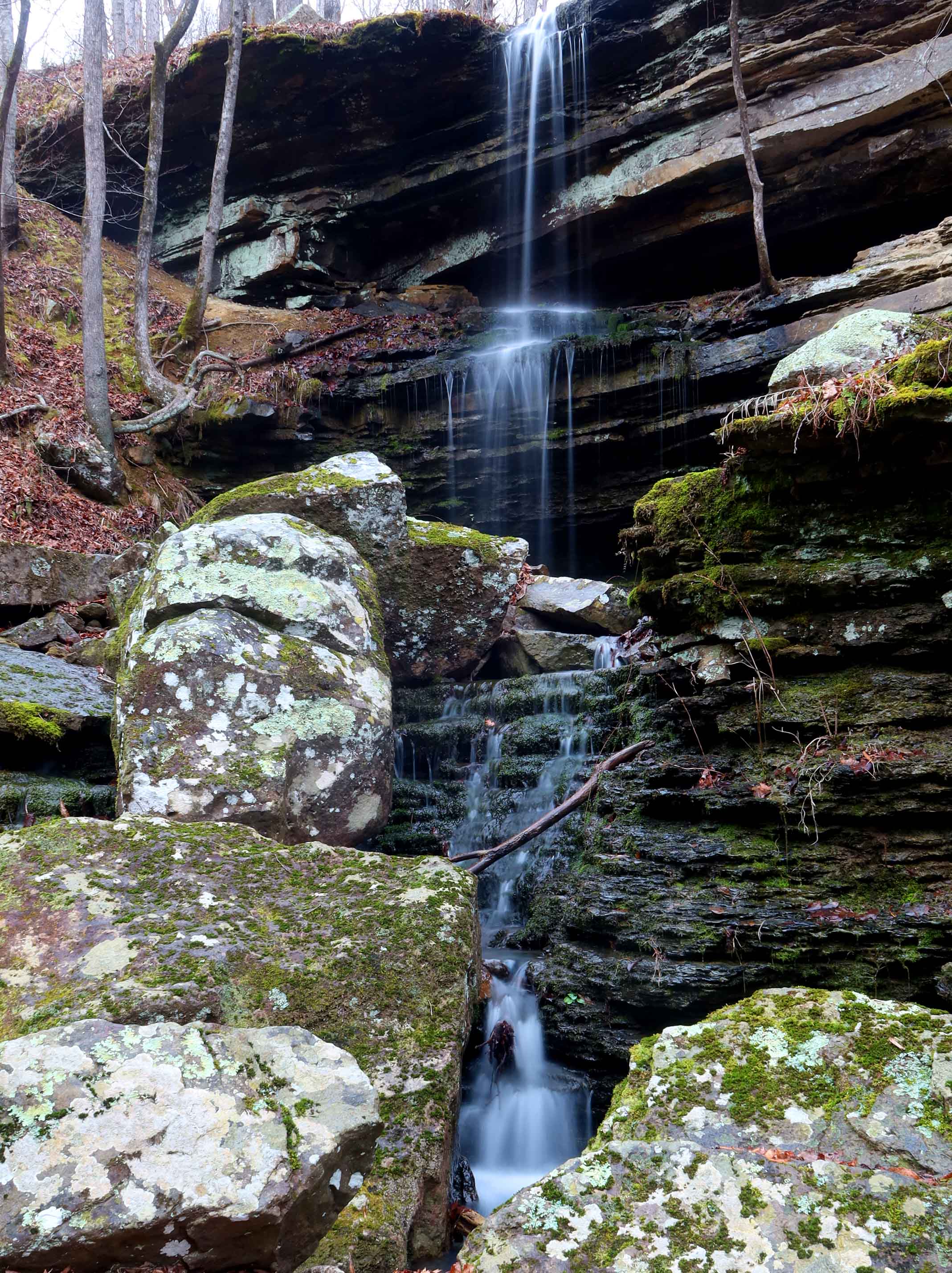
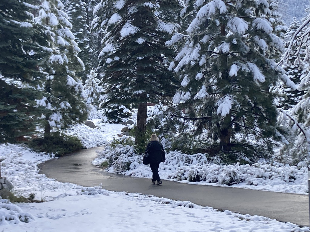
We spent two nights at Tenaya Lodge on the edge of Yosemite National Park which was part of our reason for favoring this itinerary. We had an afternoon to explore waterfalls and the next morning we were able to take a tram ride and explore some more by foot.. At first the tram sounded touristy but it was worthwhile and gave us a better overview of the park than I got on my visit ten years ago. I’d recently read John Muir’s description of Yosemite and his words have stood the test of time. 

…no temple made with hands can compare with Yosemite. Every rock in its walls seems to glow with life.  … Awful in stern, immovable majesty, how softly these rocks are adorned, and how fine and reassuring the company they keep: their feet among beautiful groves and meadows, their brows in the sky, a thousand flowers leaning confidingly against their feet, bathed in floods of water, floods of light, while the snow and waterfalls… Down through the middle of the Valley flows the crystal Merced, River of Mercy, peacefully quiet, reflecting lilies and trees and the onlooking rocks; things frail and fleeting and types of endurance meeting here and blending in countless forms, as if into this one mountain mansion Nature had gathered her choicest treasures, to draw her lovers into close and confiding communion with her. From Yosemite, by John Muir, 1912

Sequoia and King’s Canyon 

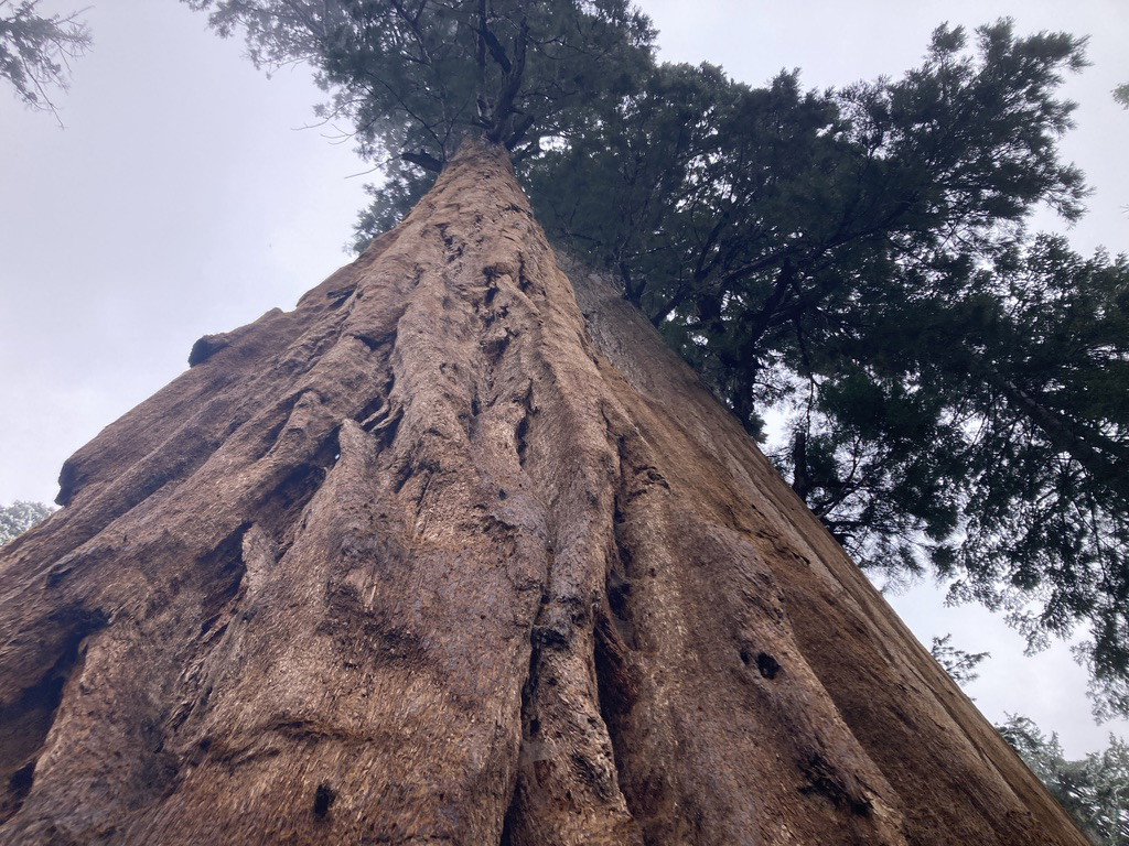
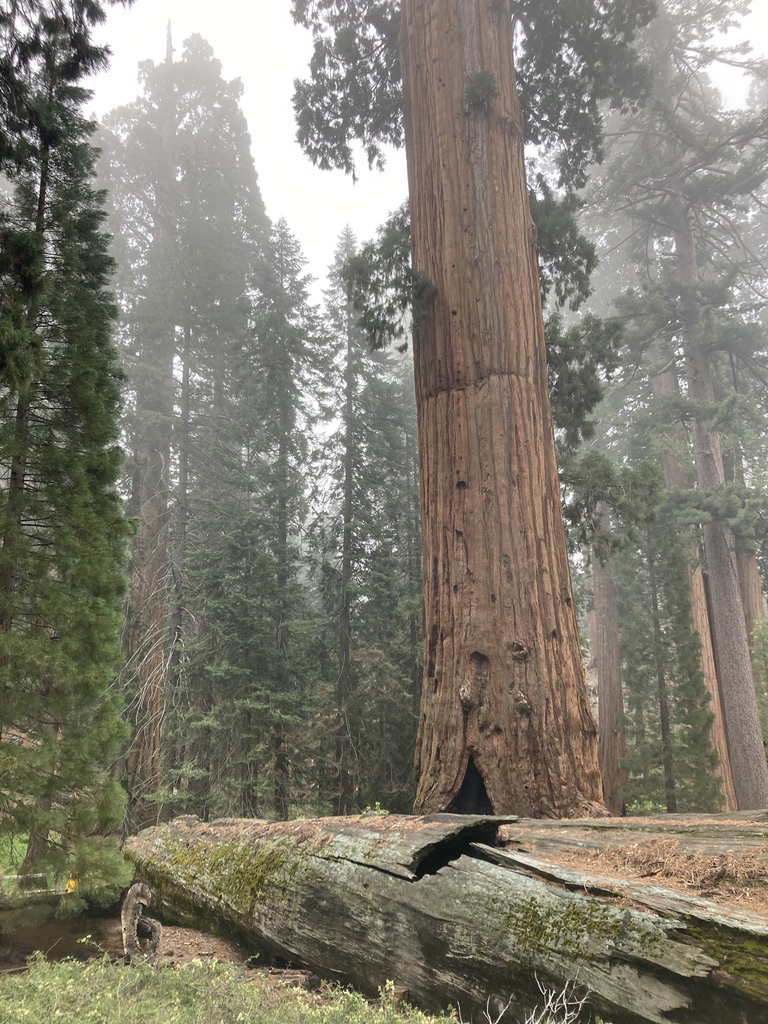
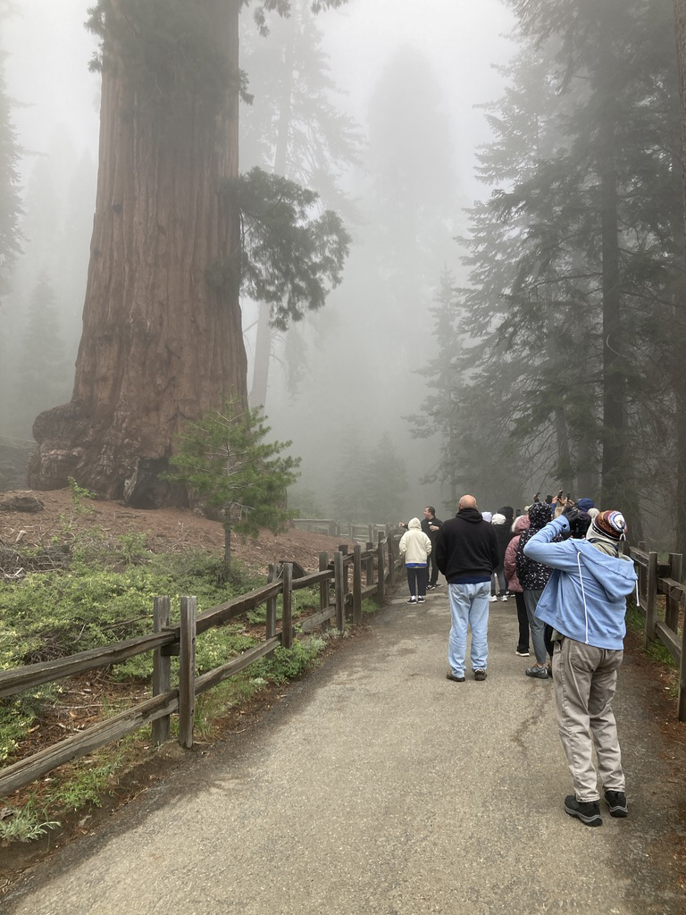
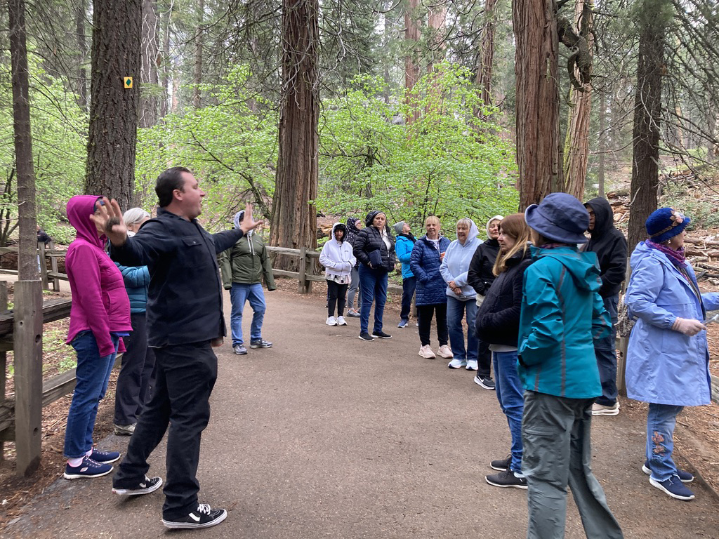
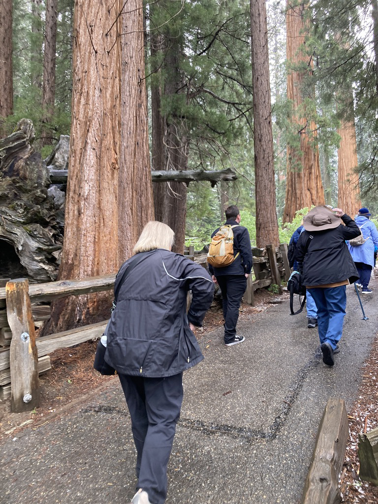
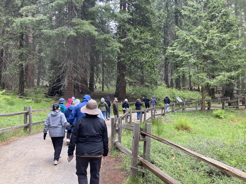
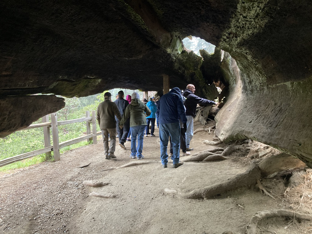
We did a short walk at Grant Grove, home of General Grant Tree, the second largest is the world at 268 feet tall. We walked through a tree tunnel and enjoyed animated interpretations of the area by Jake. 

We made a lunch stop at Grant Grove Restaurant and Visitor Center.

We visited the General Sherman Tree, largest in the world at 275 feet. In 2021 during forest fires, foil quilts were placed around the bases of some of the largest Sequoias as a precaution. Controlled burns are done routinely since it was learned that fire is required to open the small, tight cones 

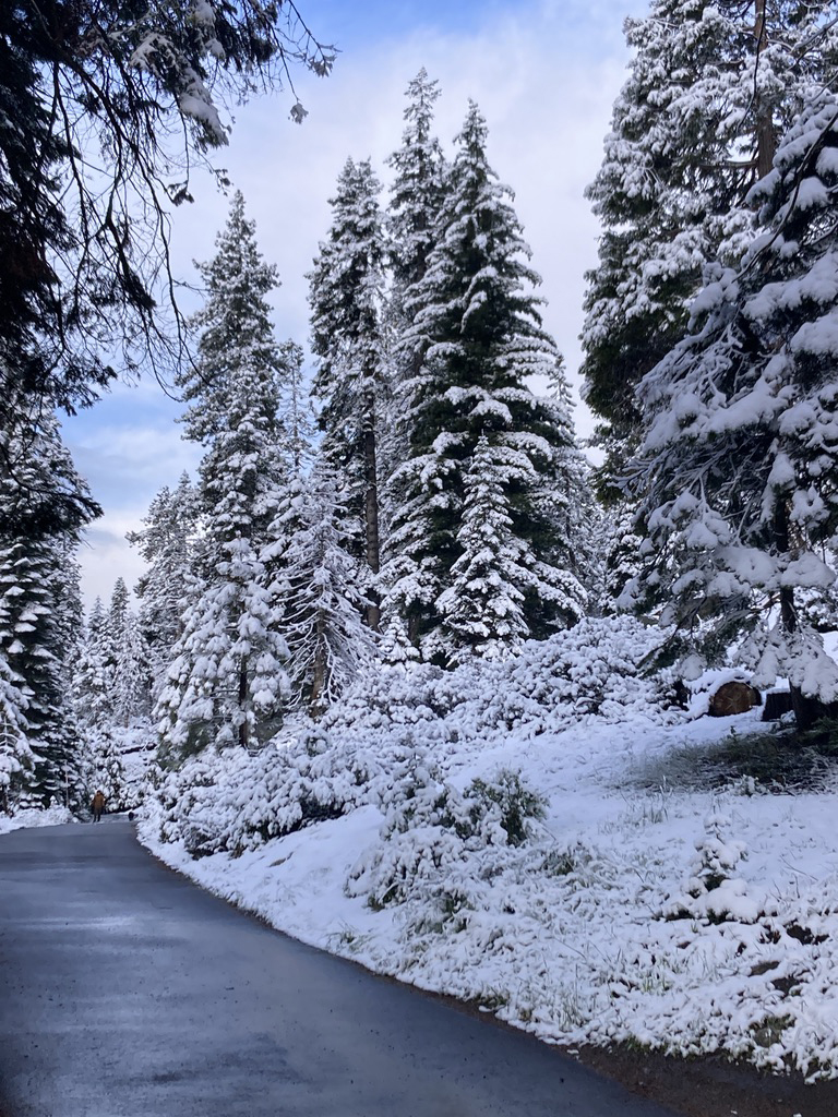
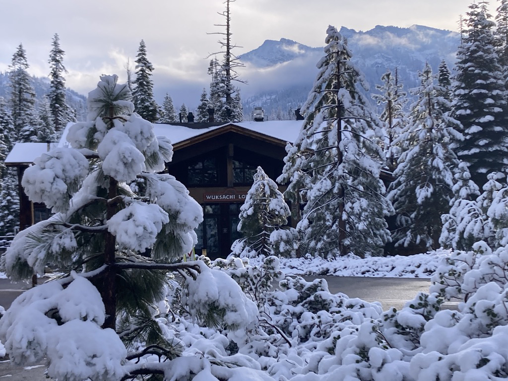
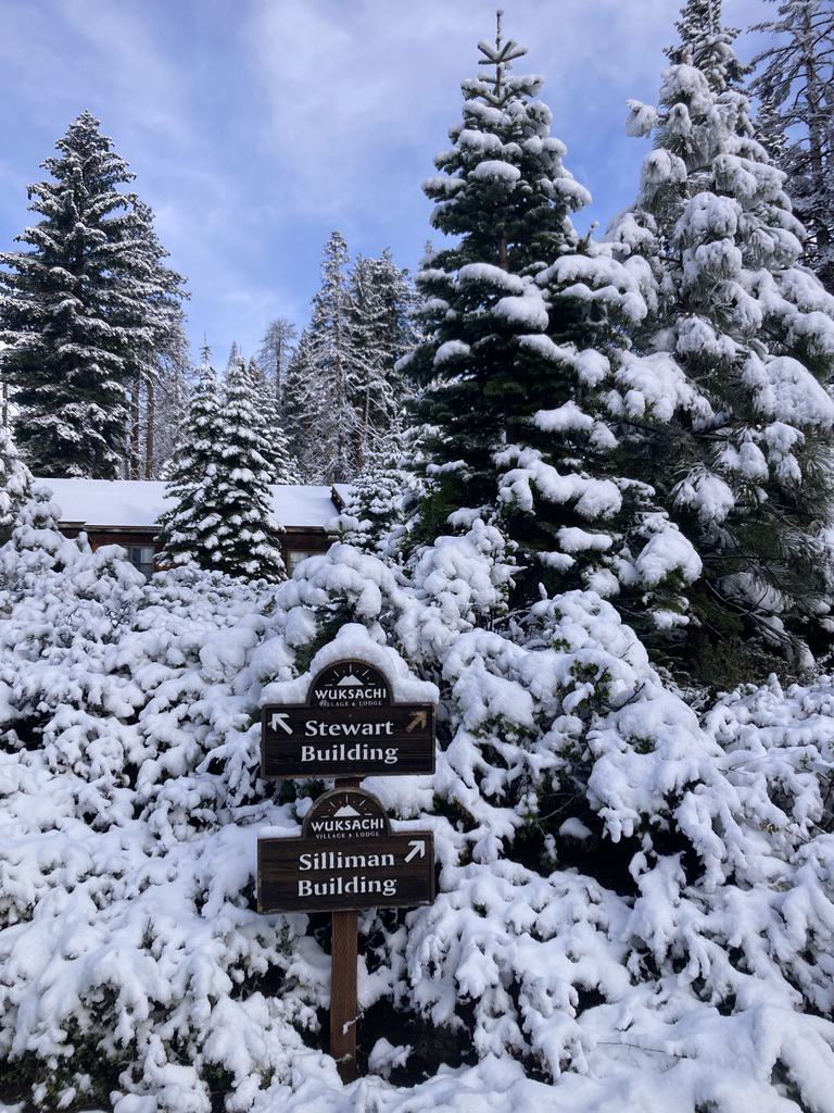
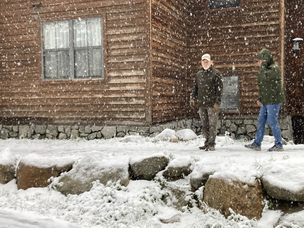
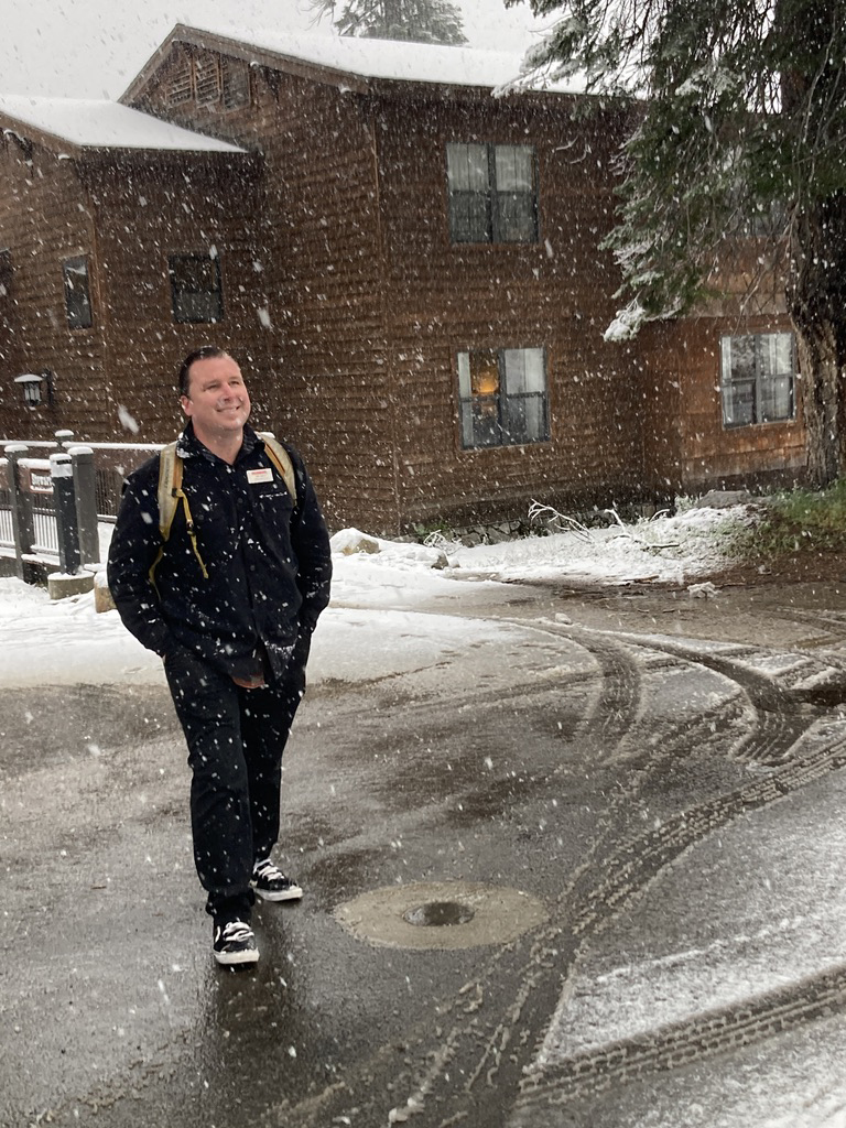
Shortly after arriving at Wuksachi Lodge in Sequoia National Park, we got the bonus of snow at the end of May. It was a beautiful but didn’t interfere with driving.

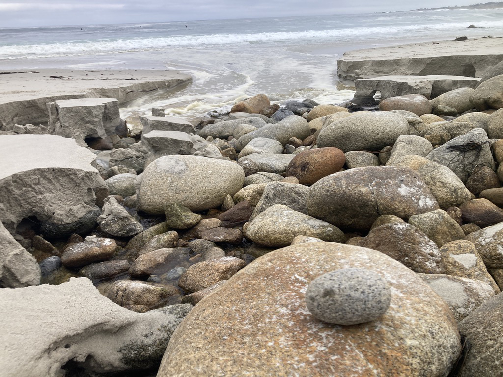
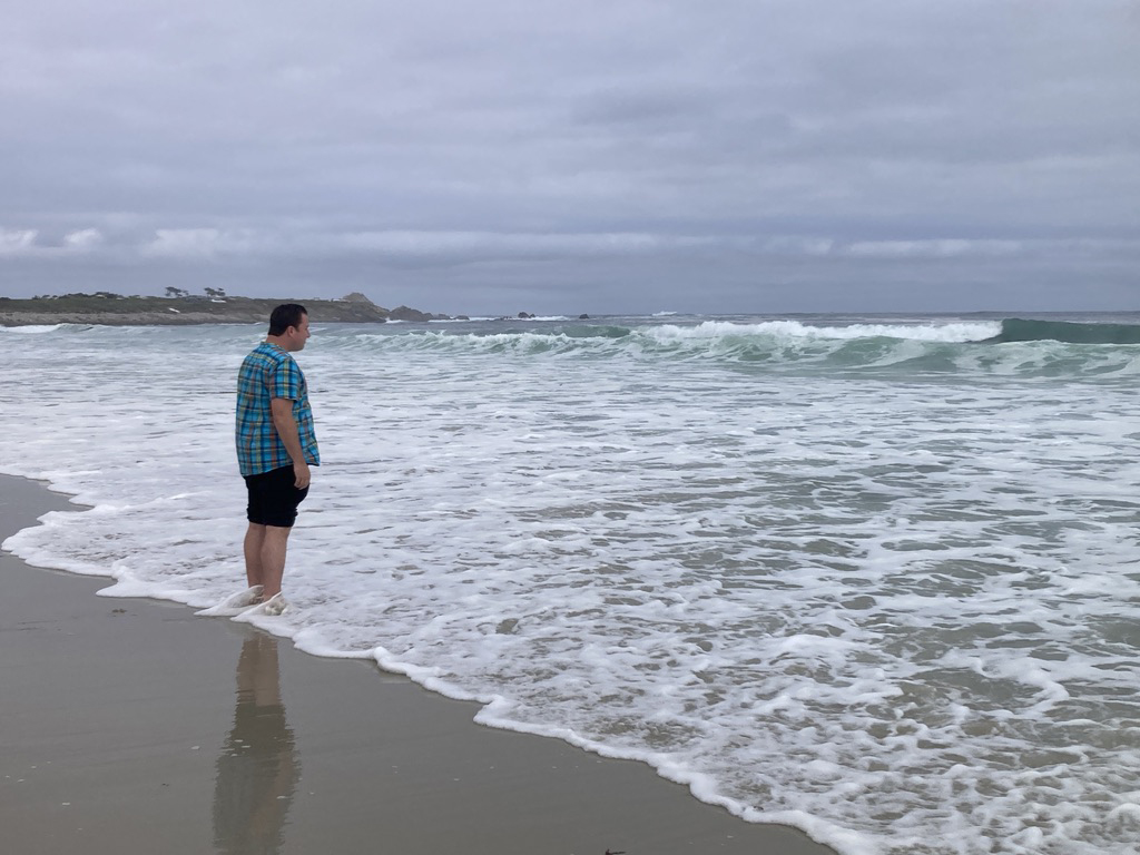
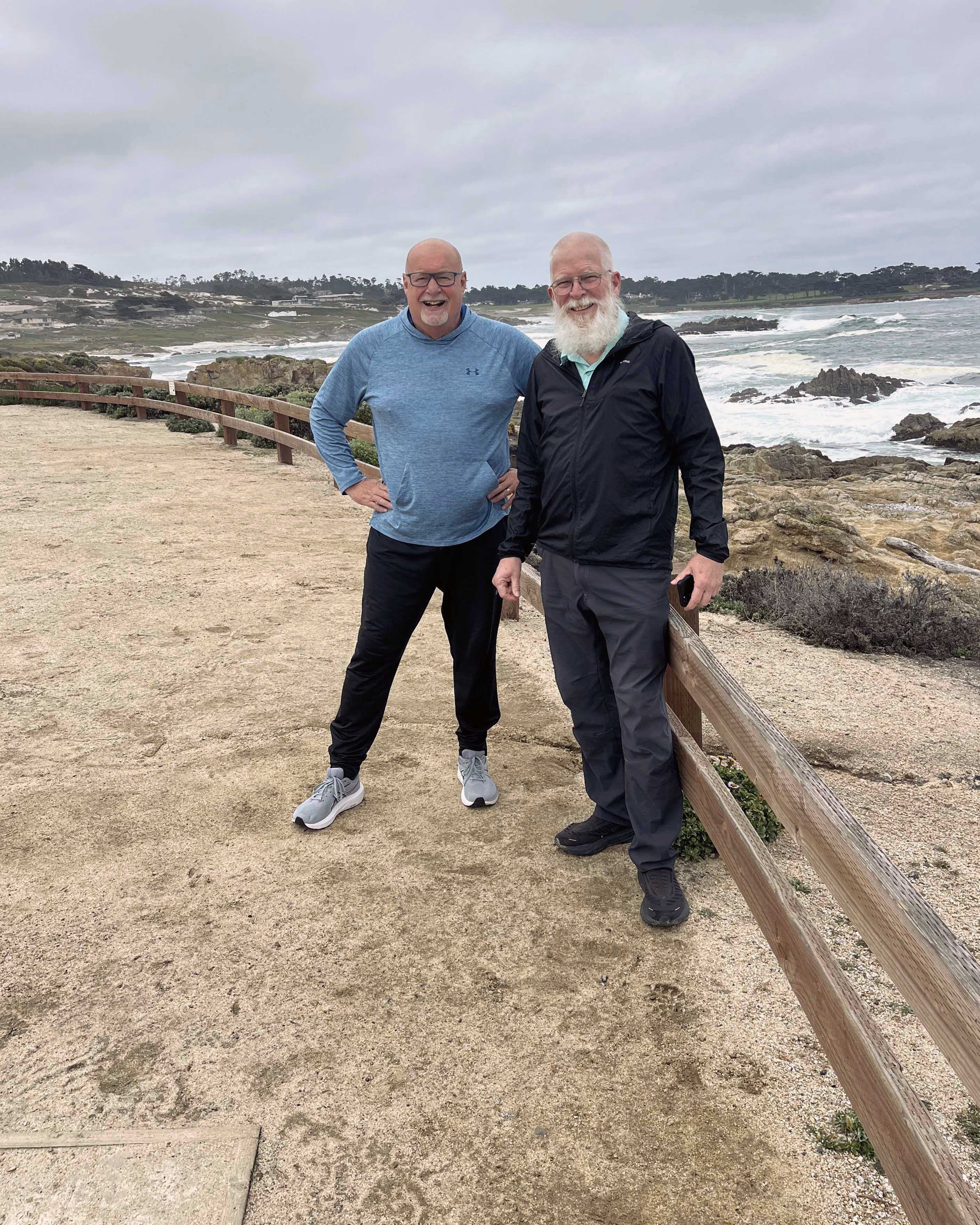
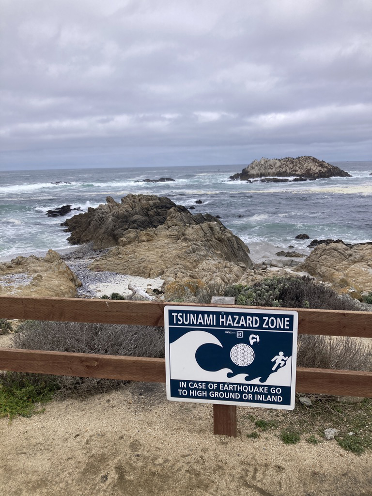
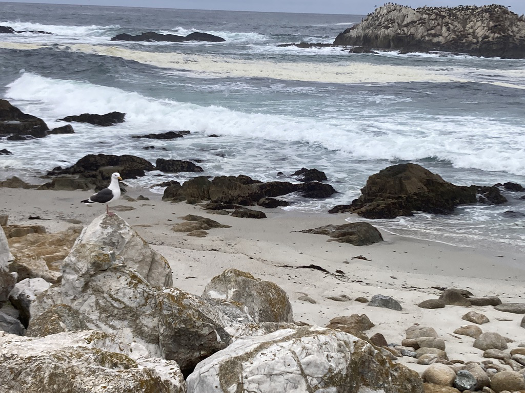
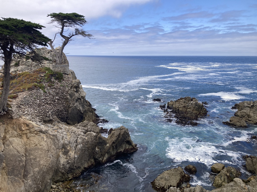
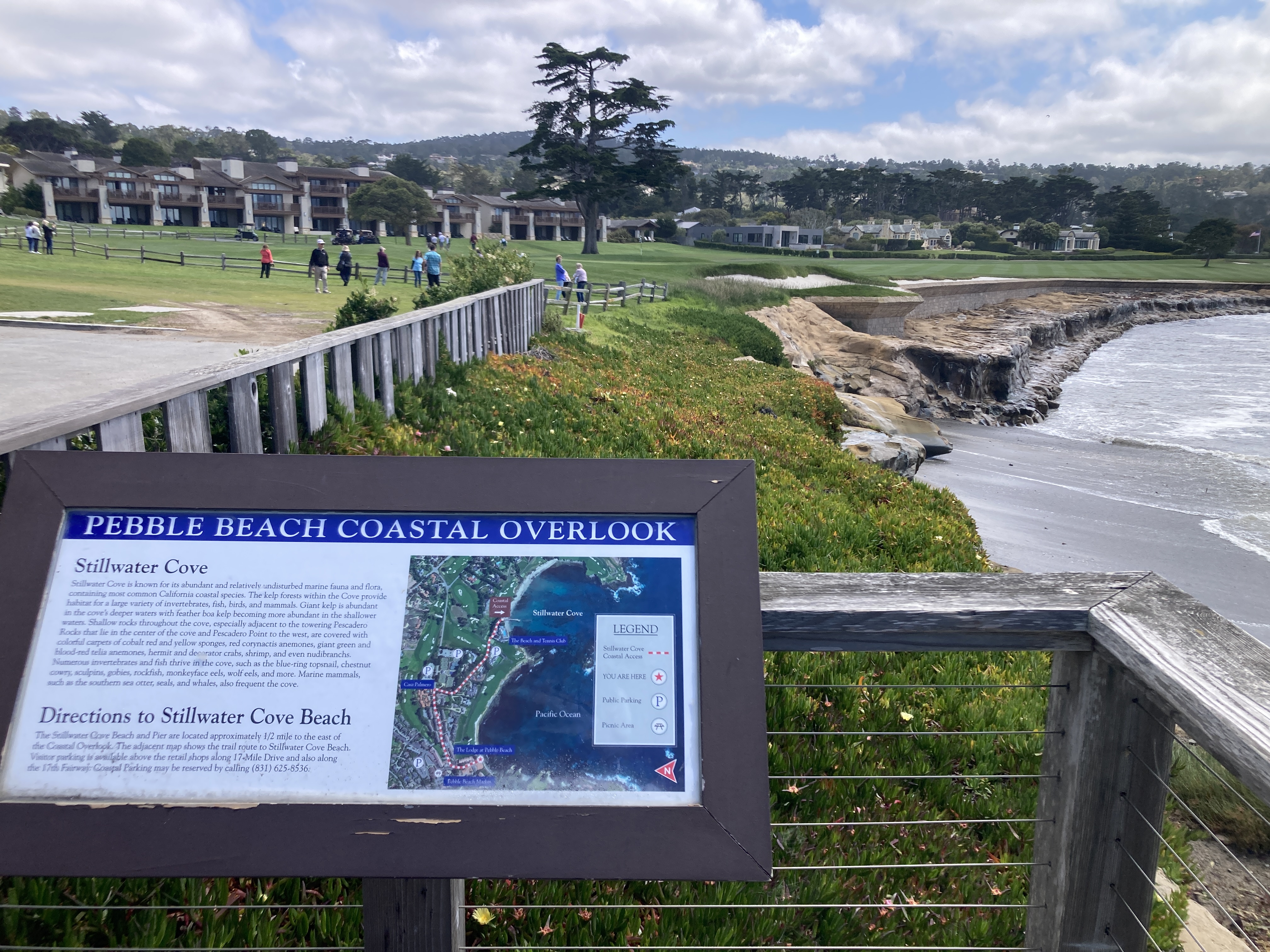
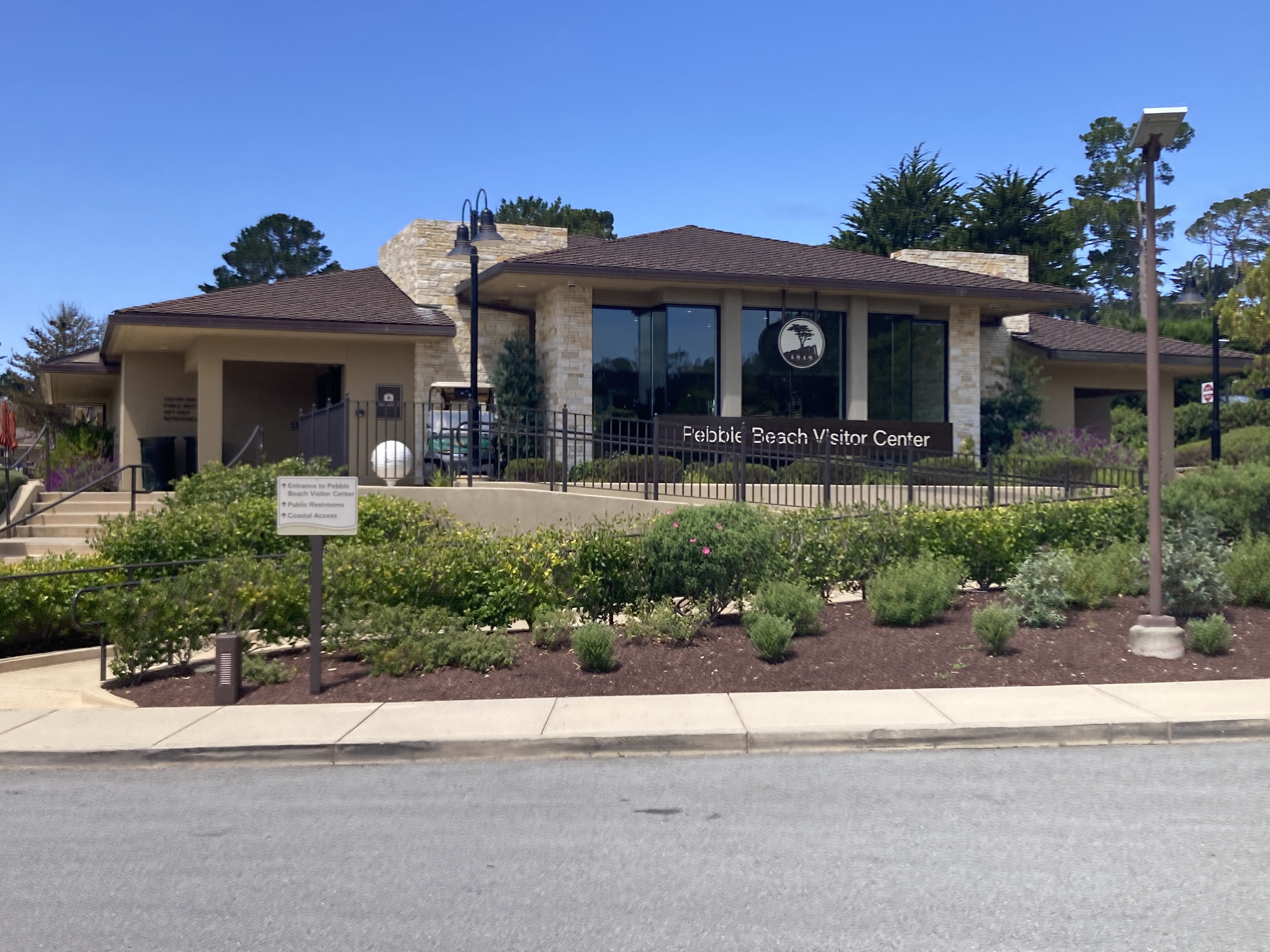
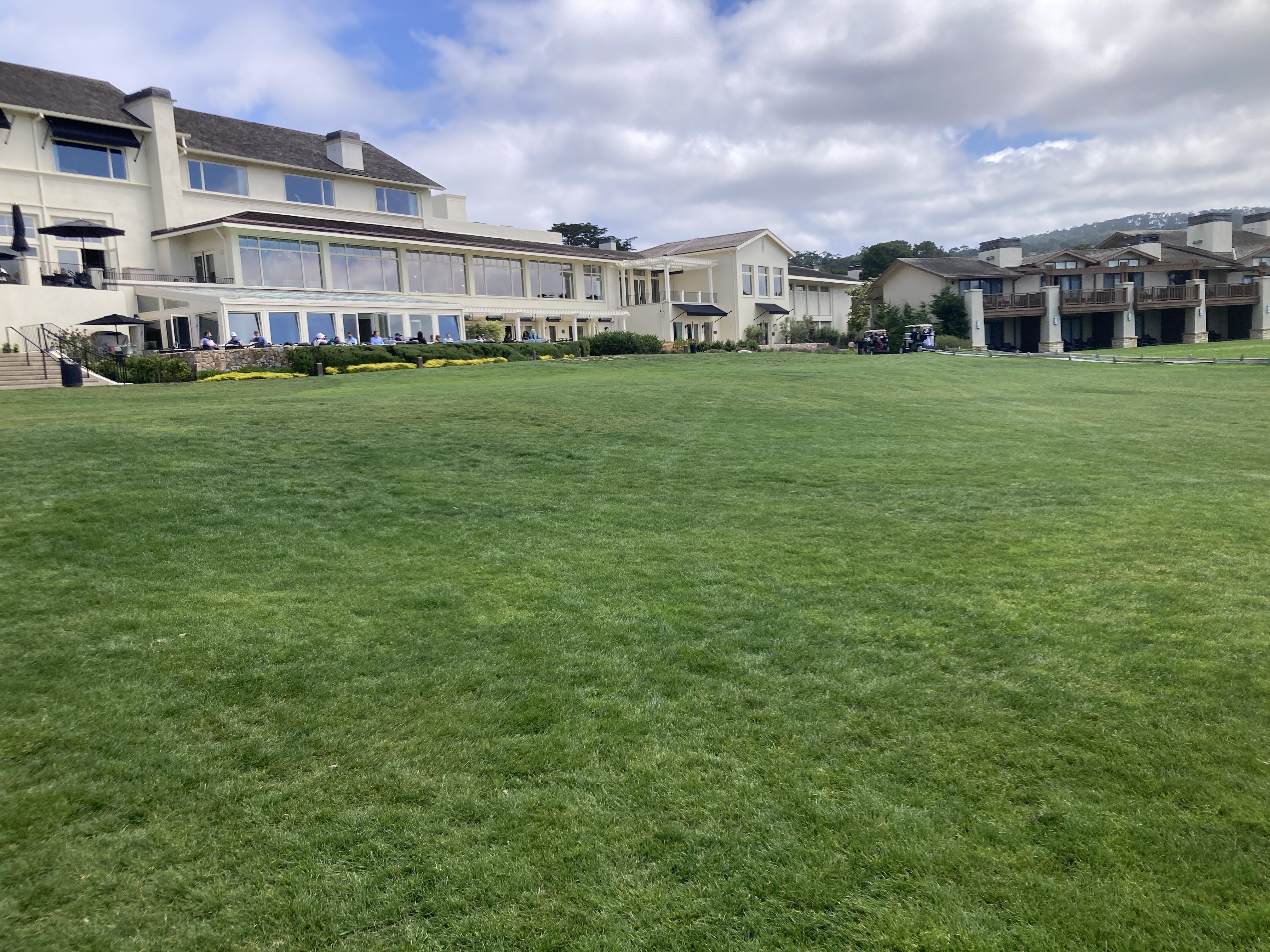
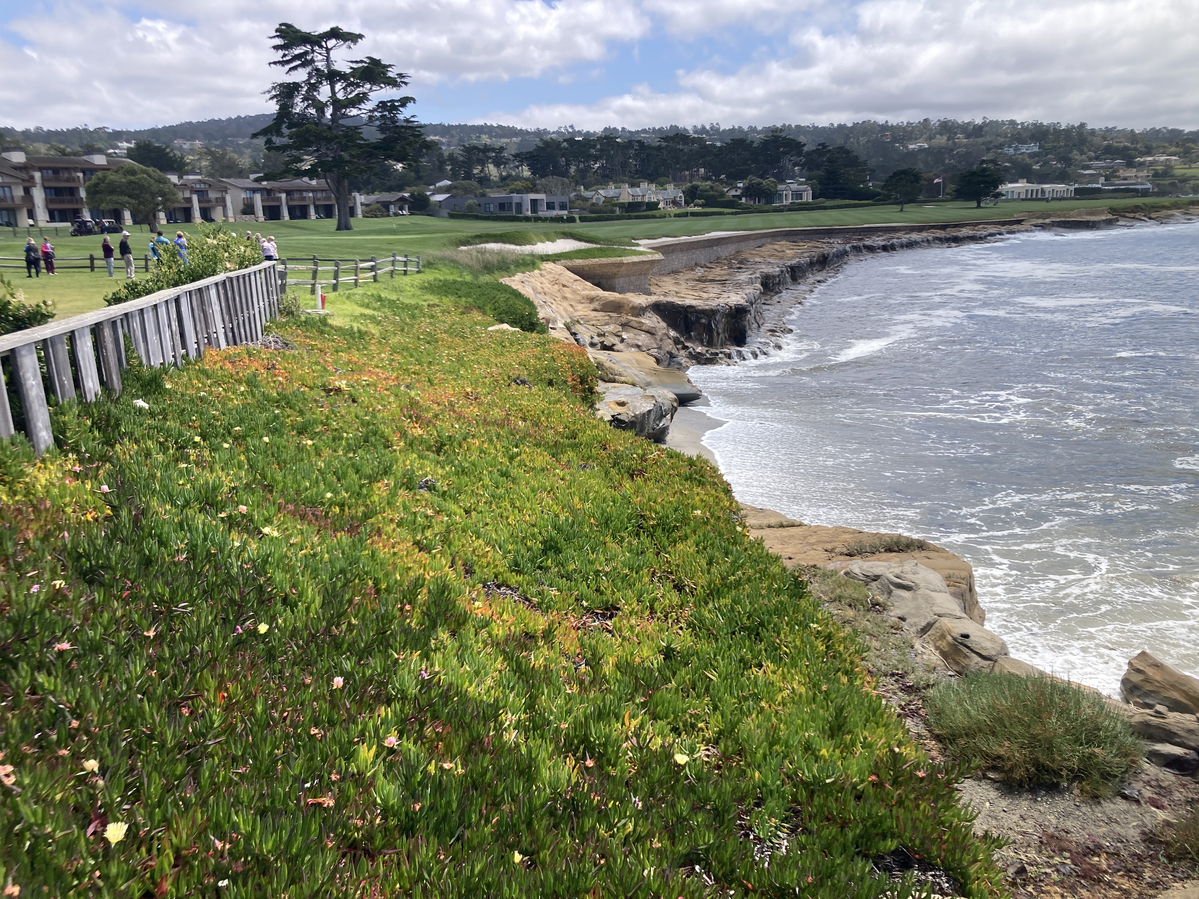
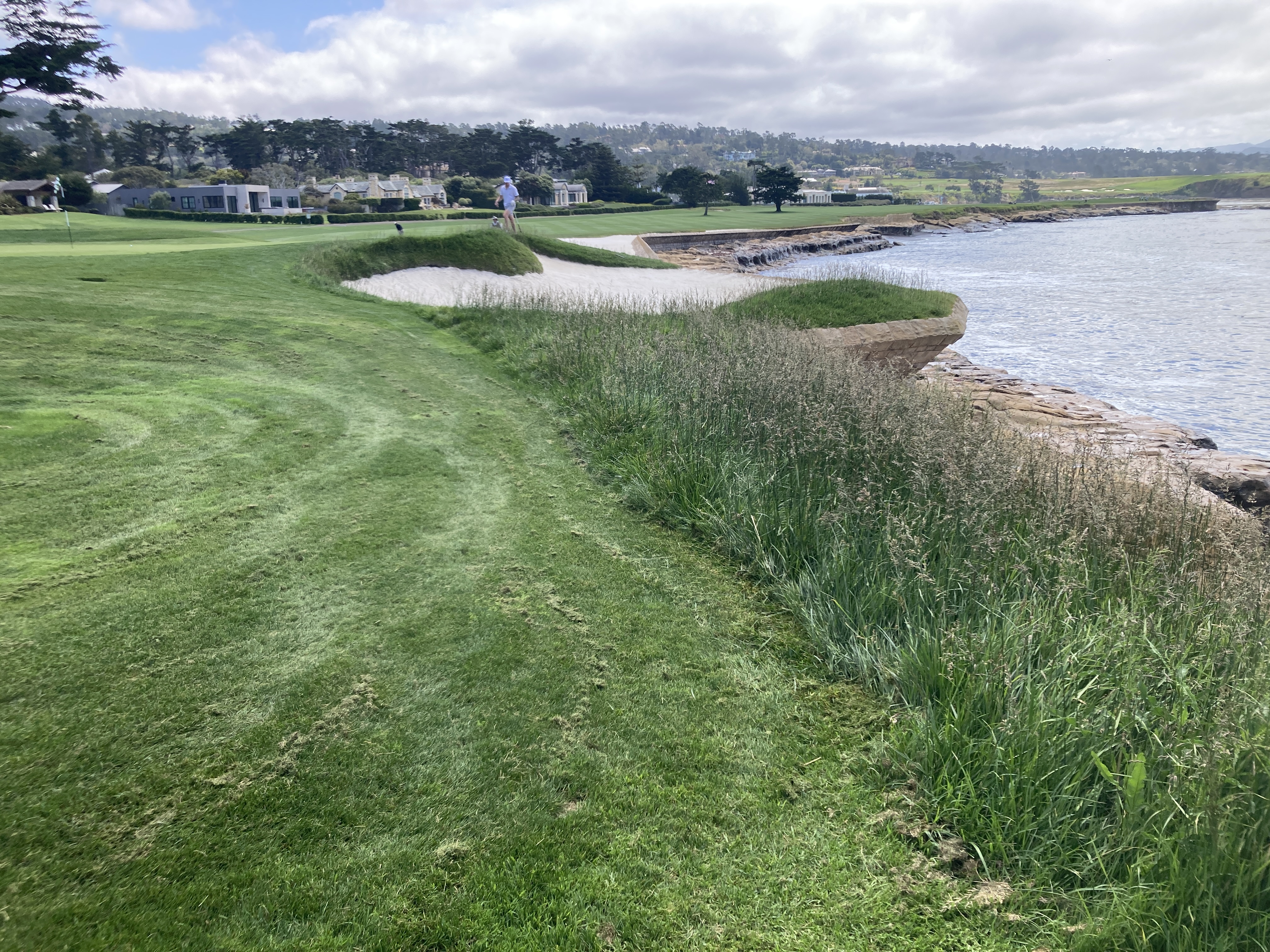
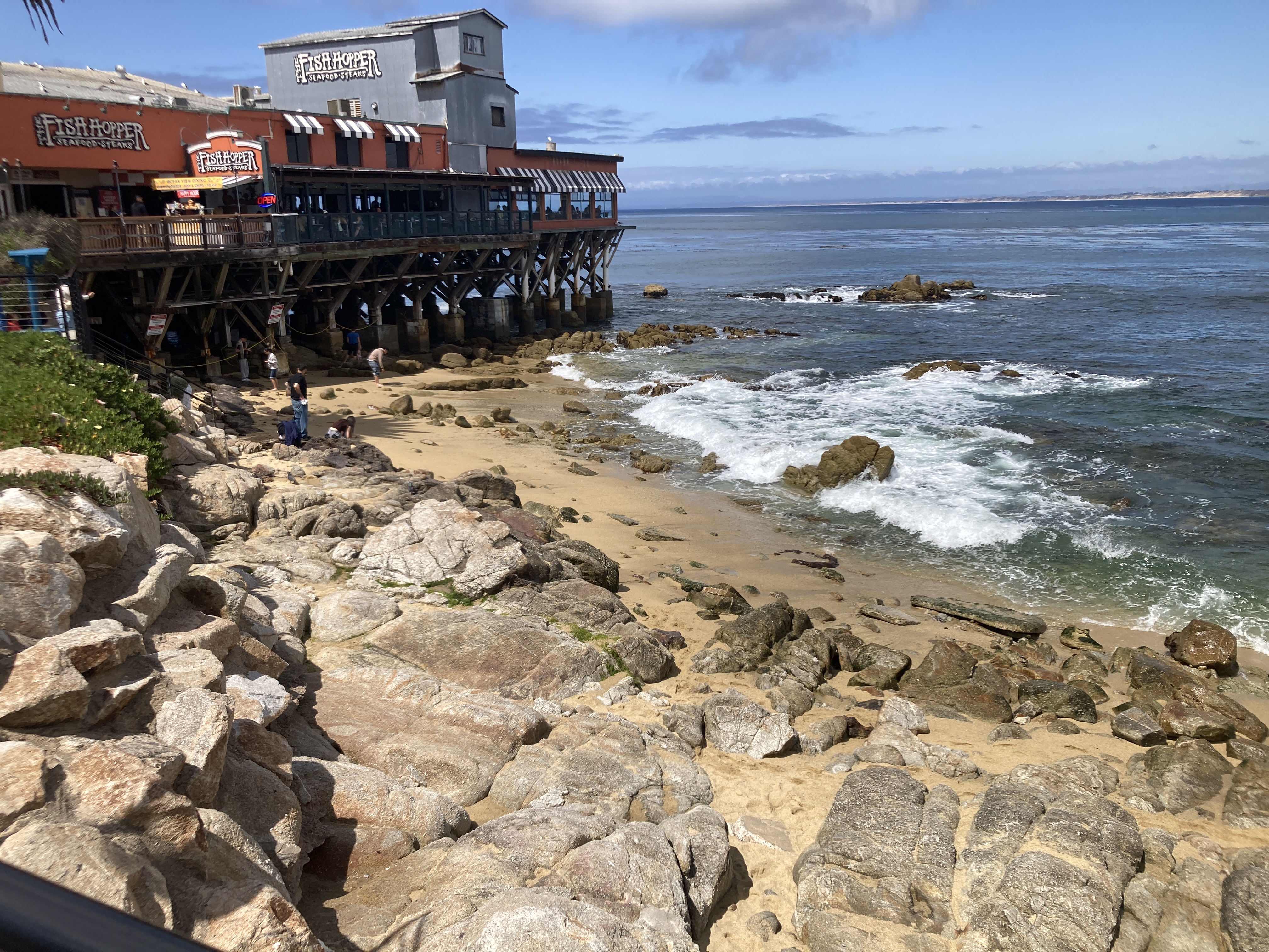
After the amazing Sequoias, we took a turn toward history at Carmel by the Sea, Pebble Beach, and Cannery Row in Monterey. We loved getting our feet wet and seeing a historically significant lone Cypress before continuing to the Pebble Beach Golf Course. 

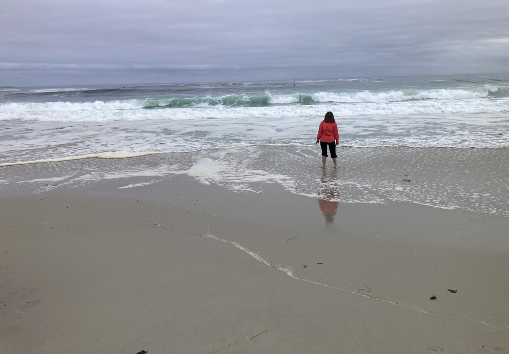
I’m not a golfer but visiting Pebble Beach with its rich history was a treat. Looking through the visitor center I wished that a former boss, Charles B. Dyer, was still alive because he would have enjoyed hearing my report of this stop. I would have been motivated to retrieve two golf balls I saw at the shore close to the eighth hole. Those would have made good souvenirs for Mr. Dyer.

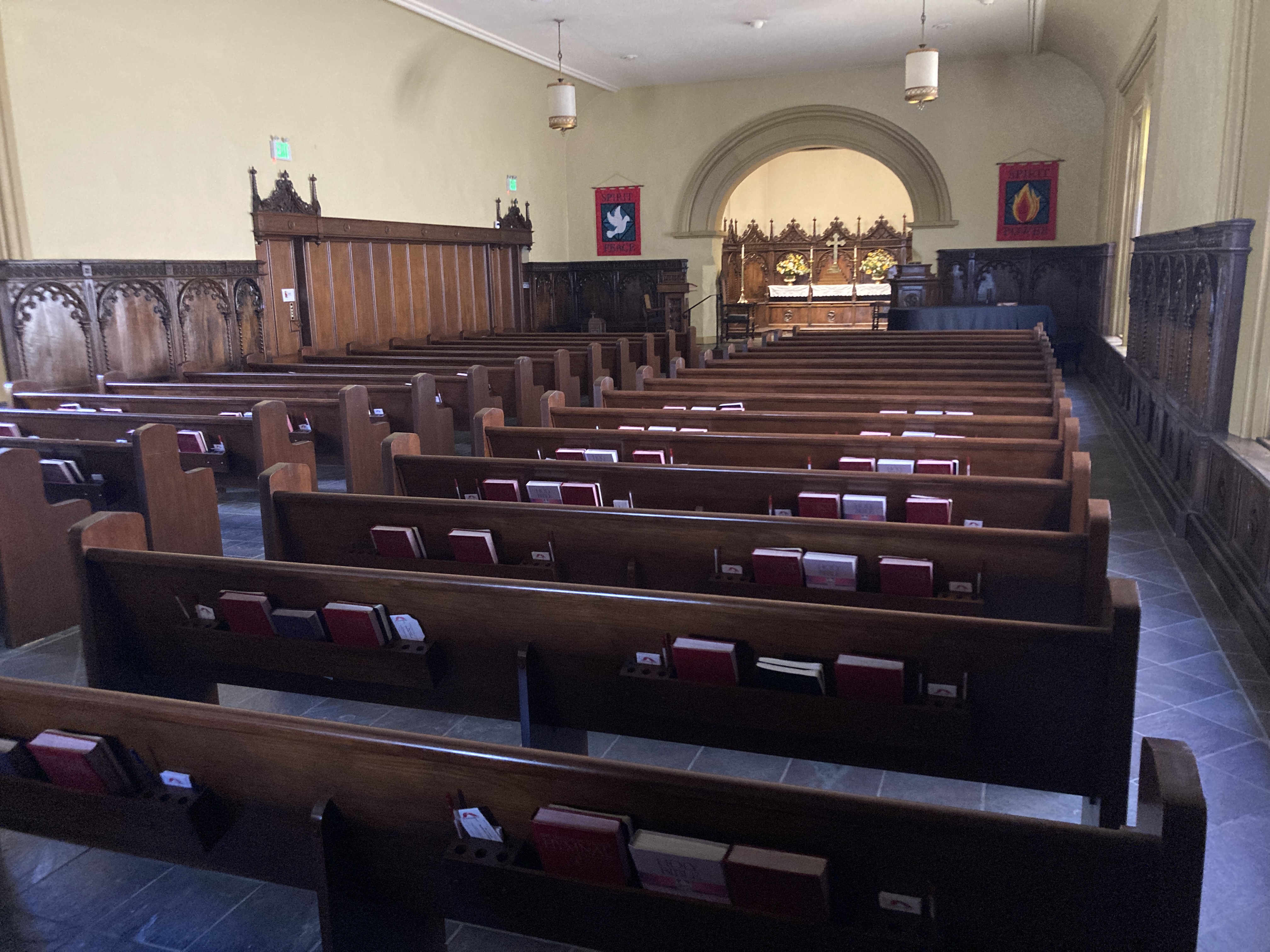
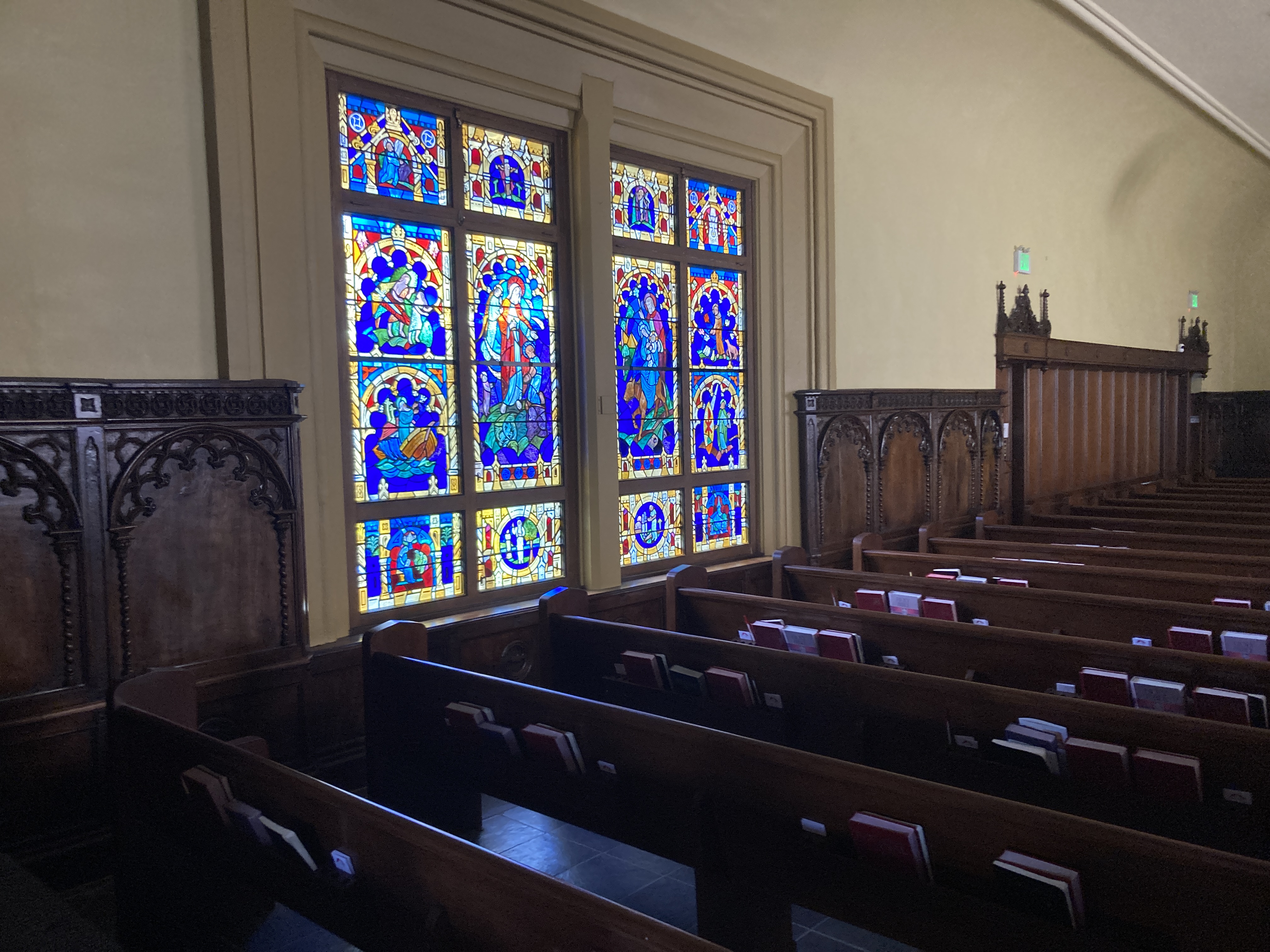
We made a shopping and lunch stop in Carmel by the Sea, notable because Clint Eastwood served one term as major from1986-88.

I enjoyed stepping into a historic church that is still active and open to visitors.

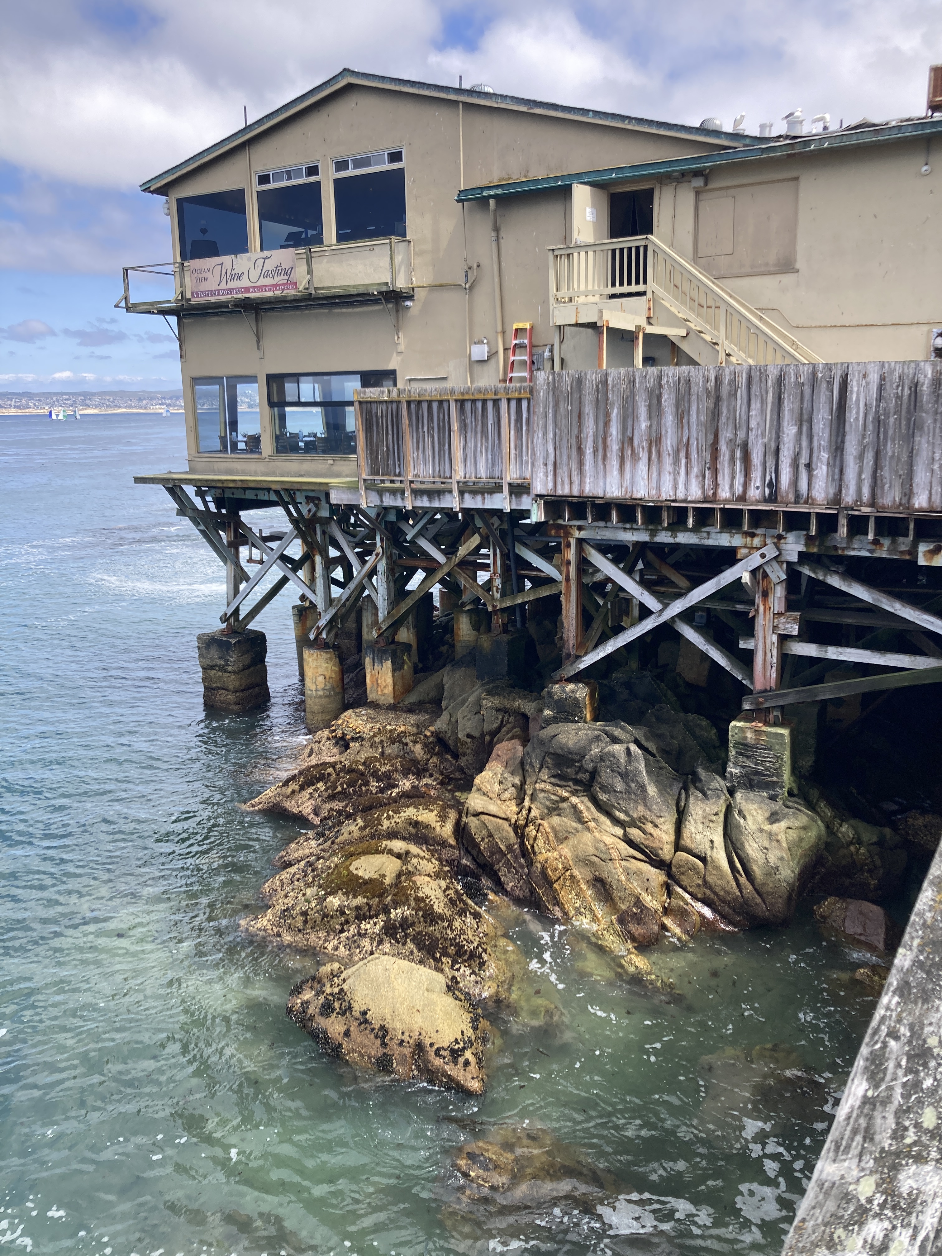
After Carmel, we drove to Cannery Row. During the trip I was reading John Steinbeck’s book, Cannery Row. I thought the following passage describing the rough and ready local workers that describes a truth still relevant today. 

“It has always seemed strange to me,” said Doc, “the things we admire in men, kindness and generosity, openness, honesty, understanding and feeling are the concomitants of failure in our system. And those traits we detest, sharpness, greed, acquisitiveness, meanness, egotism and self-interest are the traits of success. And while men admire the quality of the first they love the produce of the second.” John Steinbeck, Cannery Row, 1945

A few reconditioned structures and footings from Cannery Row remain. The processing of sardines accelerated around 1915 (World War I) as a protein source for soldiers and peaked from 1941-45 during World War II. Due to overfishing and water temperatures changes, the sardine population diminished and the last fishery closed in 1973. What remains is an active tourist destination and some beautiful shore lines.

Shores of Cannery Row

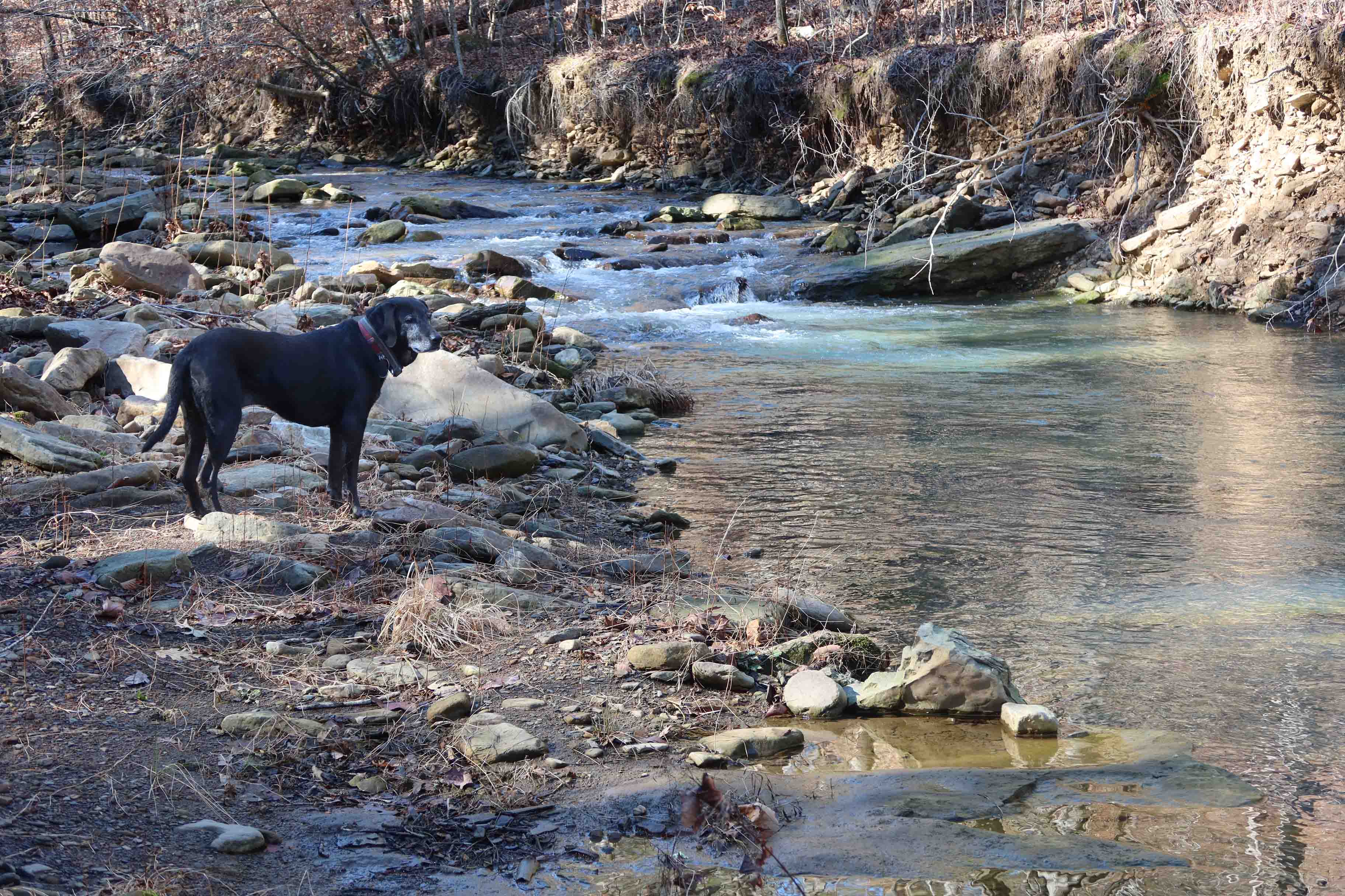
We loved visiting California and meeting a great group of people and wished the trip could have lasted longer, especially in the Yosemite area. Still, we were glad to get back to the Ozarks and the beauty of Arkansas!

Fellow travelers

What’s in My Pack #1: New Home Debt-Free

Shelter: When it comes to backpacking, invest in your feet and the roof overhead. After using my Big Agnus Copper Spur2 since around 2014, I decided to go with the updated version of the same tent and keep the previous tent as a back up and to lend out. That tent did all of my thru hikes so it holds sentimental value.

The new Copper Spur2 is very similar. I set it up to be sure all the pieces were there and working. Seems obvious but never set up a new tent on your first night in the woods.

When purchasing a tent, read the reviews and go with something reputable and as light as possible. My second shelter is a tarp that weighs about 7 ounces. I like using it when there are no bugs and no expected severe rain storms. This tent is around 2 pounds 10 ounces. It’s a 2-person so plenty of room for gear, or even a dog if it’s winter. Avoid anything weighing 4 pounds or more.

tarp
ultra light tarp

Footprint: Tent makers love to sell footprints but I love to avoid buying one. They add weight and bulk to your load. I like cutting window treatment plastic (less than 1 mil.) to fit under my tent. It’s the type you can cover windows with and make a temporary insulating layer by tightening the plastic with a hairdryer. Cut it to fit under the tent with nothing sticking out to catch water. Don’t use a hairdryer on it. Just wad it up and put in the bottom of your pack when not in use. I draw an arrow pointing to the head of the tent just to make it easier to place since my tent is smaller at the bottom end.

Copper Spur2
Copper Spur2 with rain fly

Devil’s Canyon in Fern, AR

Grant taking a photo from a Devil’s Canyon overlook

Saint John’s Episcopal Church in Fort Smith organizes day hikes open to all. The group calls itself Edge Walkers. I’ve visited this beautiful church and decided to join the group’s hike in Devil’s Canyon, located a little over seven miles north of I-40 on Hwy 215.

John capturing a video

While saving photos, I noticed several other trails I’ve hiked with Devil in the name. Seems ironic but if Devil is included in a trail name, it’s likely to have stunning scenery and just might have a challenge or two.

Trails around Devil’s Canyon are not established and maintained, but foot traffic and an old forest road make it possible to walk around the canyon’s edge.

Two waterfalls are the main attractions. Devil’s Canyon Junior Falls are easy to access. If you have time, explore the boulder-filled stream bed downstream from the falls. You could make a whole day of visiting Jr. Falls and the creek above and below the falls but our goal on this particular hike was to make it around the whole loop.

The taller and more difficult to access Devil’s Canyon Falls are on the north side of the canyon. To get to them, you’ll hike a ways and then scramble down into the canyon. A rope is tied to assist hikers and I needed it. After taking photos, I filtered water and climbed out of the canyon using the rope.

A quick word about water filters. I always carry a Sawyer in my daypack. If I know there’ll be access to water, having the filter allows me to carry less knowing I can resupply on the trail. Another benefit is being able to share water with hikers who might be running low. I don’t work for Sawyer but they make a great filter. I usually try to end a hike with some newly filtered creek water so I can make tea when I get home as a little ritual of thanksgiving for the gifts we find in the Ozarks.

It was a great hike in Devil’s Canyon. Thanks to hike leaders John and Grant for their planning. After a short afternoon nap, I enjoyed a cup of tea from Devil’s Canyon water while looking through photos.

Black Fork Mountain

Kerry, Bob, and I wanted to hike Black Fork Mountain. It would not be our first time on this trail, but several years had passed since any of us had been up that trail. Our plan was to begin at Queen Wilhelmina State Park and hike down to where the trail crosses the Ouachita River. There we’d pick up extra water and hike to the Black Fork Shelter for a couple of nights.

Our first night was at Queen Wilhelmina State Park. We were “Glamping” with nice campsites, access to restrooms, and a restaurant close by. I almost felt guilty in my truck camper while Bob and Kerry tent camped but both options gave a good night’s sleep. I look forward to using this campground and the nearby Winding Stairs Campground again. Rich Mountain and the Queen Wilhelmina area are great camping destinations.

As we walked, I thought back to a thru-hike on the Ouachita Trail in the winter of 2018. Back then, flakes of ice hung from the trees and littered the ground. Quite a different scene now as a warm sun beat down on this spring day.

The next morning, we began working our way up Black Fork Mountain through alternating pine groves, hardwood forests, and scrub oaks along high ridges. The hardest part was following a reroute down below a rockslide. Every step down meant another uphill step later to regain the elevation lost.

The views across the valley to Rich Mountain kept us engaged as we tried to identify roads, Queen Wilhelmina Lodge up top, and a little Country Store down below. 

Thanks to occasional survey tape we were able to follow the trail without difficulty. Greenbriers clawed at us on the high ridges and we agreed this was a “long pants trail.” 

We were pleased to find an old chimney still in place along with a few rusty artifacts. I had a close look at the blade of what looked like a small hoe before returning it to where I found it. Bob found what looked like pieces of a horse or mule shoe. All items were left as we found them.

We were pleased to finally arrive at the rock outcrop that marks the top of Black Fork Mountain.

I filled my water bottle at a small murky pond less than a mile from the Black Fork Shelter. I ran that water through my Sawyer filter when we returned to the shelter and it was good! Water options up on Black Fork Mountain are limited unless there’s been recent rain so the pond is a treasured little resource.

The hike back down the mountain included that long uphill from the reroute around an old rock slide. We were thankful for every little cool breeze that came our way as we worked our way back down to Black Fork Shelter for the night. Everyone had a good appetite after their Black Fork workout.

Coffee on the Trail

I haven’t shared my current coffee on the trail. I like both of these options that leave me with a small pice of packaging to pack out. The Starbucks is more expensive and taste slightly better to me. The Mount Hagen is cheaper and taste pretty good, too. Both taste great on the trail when made with filtered water from an Ozarks stream. Until doing this post I’d never noticed the weight. Starbucks is 3.3 grams and the Mount Hagen is 2 grams. I’d have to pack a lot of coffee before weight was a factor in my decision.

I used to put espresso grind in a ziplock bag. After pouring the hot water, I’d put a teaspoon of coffee on top of the water and let it sit a minuet before stirring it and letting it settle. This was the best tasting coffee in my opinion but not as simple to make and you have to be careful not to drink the sludge at the bottom of your cup. I dispersed the sludge by adding water and spreading it over foliage.

Four-star hotel and gourmet coffee next to Briar Branch

Day Hike to Cedar Creek on the OHT

Cedar Creek is a favorite feature of the Ozark Highlands Trail (OHT). I decided it would be a good first real hike in over a week for my dog who recently had minor eye surgery. She’s been held prisoner by an Elizabethan Collar for 24-hours a day for the last full week. Elizabethan Collar seems overly poetic for something so inconvenient.

Monday morning I unceremoniously removed the plastic collar and gave Hiker-dog her freedom. Once we got on the trail, she was one happy dog!

Since this is a hike I plan to use in the second edition of Five Star Trails: The Ozarks, I took my time and made notes during the drive out to Rosetta Trailhead. I’ve driven to this trailhead before, but writing directions that others can follow requires thought and decisions about which details to include.

I enjoyed the whole walk down to the creek while watching Hiker-dog dart through the woods and occasionally following close by. We spent some time at Hobo Falls and Cedar Creek before hammering our way back to the trailhead.

Story has it that Hobo Falls picked up the name because remnants of a hobo camp were found nearby. Next time I visit, I plan to be a hobo and spend a couple of nights in the area. I noticed a nearby cave that would make an easy shelter as long as a critter hasn’t already claimed it.

The next few photos are from 2016 when a great group of trail friends camped here. Hiker-dog and I had been together for a couple of years by that time. She’s at least 12 years old now but still going strong.

The left and center photo below are Hiker-dog in 2016 when she was around three years old. The photo on the right is gray bearded Hiker-dog in 2025.

A Sacred Place in the Ozarks

My Arkansas trail friends probably know exactly where I was when I took this photo. It’s a special place in the Ozarks and one I’ve visited many times. Today was overcast with a slight drizzle and cold…perfect trail conditions when hiking Spirits Creek!

After rock-hopping across Spirits Creek I walked downstream to the established campsite where I’ve camped many times. While spending a few minutes out on the creek I thought about previous trips to this spot and time spent there with friends.

Spirits Creek next to the established campsite.

The drizzling rain increased making me nervous about getting my camera wet. I placed a plastic bag over it and hiked back upstream to the crossing where I enjoyed remembering a morning in 2014 when the swollen creek was verging on dangerous. No worries today but there was still enough water for the creek to be beautiful and create ribbon falls from the nearby bluffs.

You’ll pass several places where water pours over the bluffs.

Before heading up and out of the valley back to Ragtown trailhead, I spent some time with one of my favorite waterfalls a short distance upstream from the V-shaped cascade cover photo for this post.

The climb from Spirits Creek wasn’t as difficult as I’d anticipated. I credit the views I continued to think about for making the hike up and out easier. As I got close to the end, I nodded toward the valley and said a soft, “Thank you” for the beauty that I was able to enjoy this day.

Hiker-dog at Alum Cove Natural Bridge

It doesn’t seem possible that Hiker-dog has been part of our family for over ten years now. She must be around twelve years old now but she still loves the trails and exploring.

Recently we visited Alum Cove Natural Bridge and had the whole trail to ourselves for a little while, so I let her go off leash for a few minutes, especially around the icy spots in the trail. I had visions of her pulling me across the ice as a sled and wanted to avoid that fun.

She provided me with some entertainment underneath the natural bridge as she danced and skated across the icy stream that runs through and down the bottom of the cove. As temperatures warmed, we avoided being underneath massive ice formations that could fall with the impact of small boulders.

View from on top of the natural bridge.

We took a little time to explore the areas around this natural wonder. I always marvel when facing such complex but artistic views formed mostly by water and time.

Hiker-dog liked this little cave on the other side of Alum Cove. Nice view and protection from the elements. I’m pretty certain these caves were shelters for early inhabitants of the Ozarks. While inside, we had to keep an eye overhead to be sure we weren’t walking under icicles hanging from above.

Spotting Becca at the entrance of this cave helped me realize the size.

Hiker-dog says, “Thanks for joining us.” If you’d like to read how Hiker-dog joined up with our family at mile 138 of the Ozark Highlands Trail, it’s available at Chapters on Main in Van Buren, Bookish in Fort Smith, and Amazon.com online.

Ozarks Camping and Trails on the Cheap

If you’re looking for a quiet campground in the Ozarks, the Ozone Campground is a little jewel of a location. It’s less than three miles north of the community of Ozone on Hwy 21 north of Clarksville, AR.

The water faucet at the pavilion worked in January when I visited. No guarantees but when I visited, the outlets on the pavilion were on and available to charge your electronics. The pit toilets are convenient, functional, and filled with that refreshing outhouse aroma that says you’re roughing it. 

The Ozone Campground is located right on the Ozark Highlands Trail (OHT). From campsite #5, it’s a short walk downhill to the trail register. From there either direction promises a beautiful hike. You can make it as strenuous as you like by customizing the length and your pace. The OHT is open to foot traffic only.

 After taking a close look at Camp Ozone, named for the CCC Camp that once stood here, I decided the next trip would include camping. Where else can you get a campsite like this in a beautiful location for $3 a night ($1.50 with a senior pass).

Hiker-dog and I did an out-and-back on the OHT down alongside Little Piney Creek for 3.5 miles which gave us a 7 mile hike with a good workout on the climb back up to the campground.


Had a great meal at the Burger Barn a couple of miles south on Hwy 21 in the community of Ozone. A couple was just finishing when I stopped there and another couple was ordering about the time my catfish plate was ready. That seems pretty busy for a small town in the Ozarks of Arkansas.

Vintage Backpacking

During a recent maintenance camp with the Ozark Highlands Trail Association (OHTA), Duane Woltjen, gave me a Gerry Backpack manufactured in the 1960s. He shared that he used this pack in addition to three others for family adventures with his wife, Judy, and two sons.

Duane is a retired engineer, designer and builder of trails, and a longtime volunteer with the OHTA. During our discussion, he was busily cutting and drilling blazes for use as Ozark Highlands Trail markers.

When I tried that pack on, I decided it should see a few more trail miles. Since this would be a shakedown hike in anticipation of longer hikes to come this fall, I decided to do a simple over-nighter starting at the beginning of the Ozark Highlands Trail. Good friend, Eric Scowden, joined us, us being Hiker-dog and me.

I found the following note in the top compartment while loading the pack.

On the morning we departed from Lake Fort Smith State Park, I asked Eric to snap a photo to share with Duane so he could see the pack in use again.

Our destination was a new campsite location on Jack Creek. To reduce impact close to the creek shoreline, volunteers with the OHTA and Pack Rat Outdoor Center relocated the campsite to a nearby hillside. This site was a short walk from water and offered visual barrier from the trail.

Hiker-dog and home on the trail

While exploring the area, we found another nice campsite farther up the hill that could be an overflow location in case a group is already in the area we used.

There was ample room for several tents. Eric found an ideal spot and built a small fire in the established fire ring.

Evening temperatures made for good campfire conversation and affection time for Hiker-dog. She curled up in leaves close to my tent and remained quiet even when we heard coyotes and owl calls in the distance. Hiker-dog’s around twelve years old but still loves getting out on the trail. A couple of years ago, I wrote the story of our meeting in a little book called Gift From the Ozarks.

Hiker-dog begging for a snack from Eric

We had a great hike and I enjoyed carrying a pack that dated back to the beginning of backpacking’s popularity in the United States. I also found myself thinking of the beauty this pack took Duane’s family to see as he and his wife, Judy, built their family and formed strong bonds of love that serve as an example for others. Thanks to Duane for taking good care of this pack and passing it along to me so I can reflect on the significance of getting outside with family and friends.