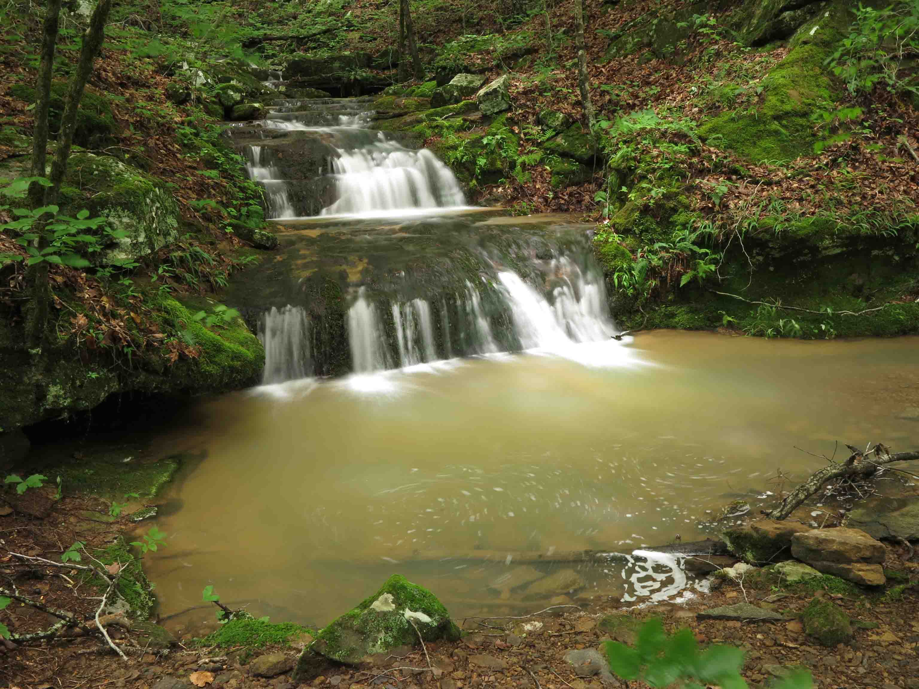
Stream flowing over the top of Marinoni Falls
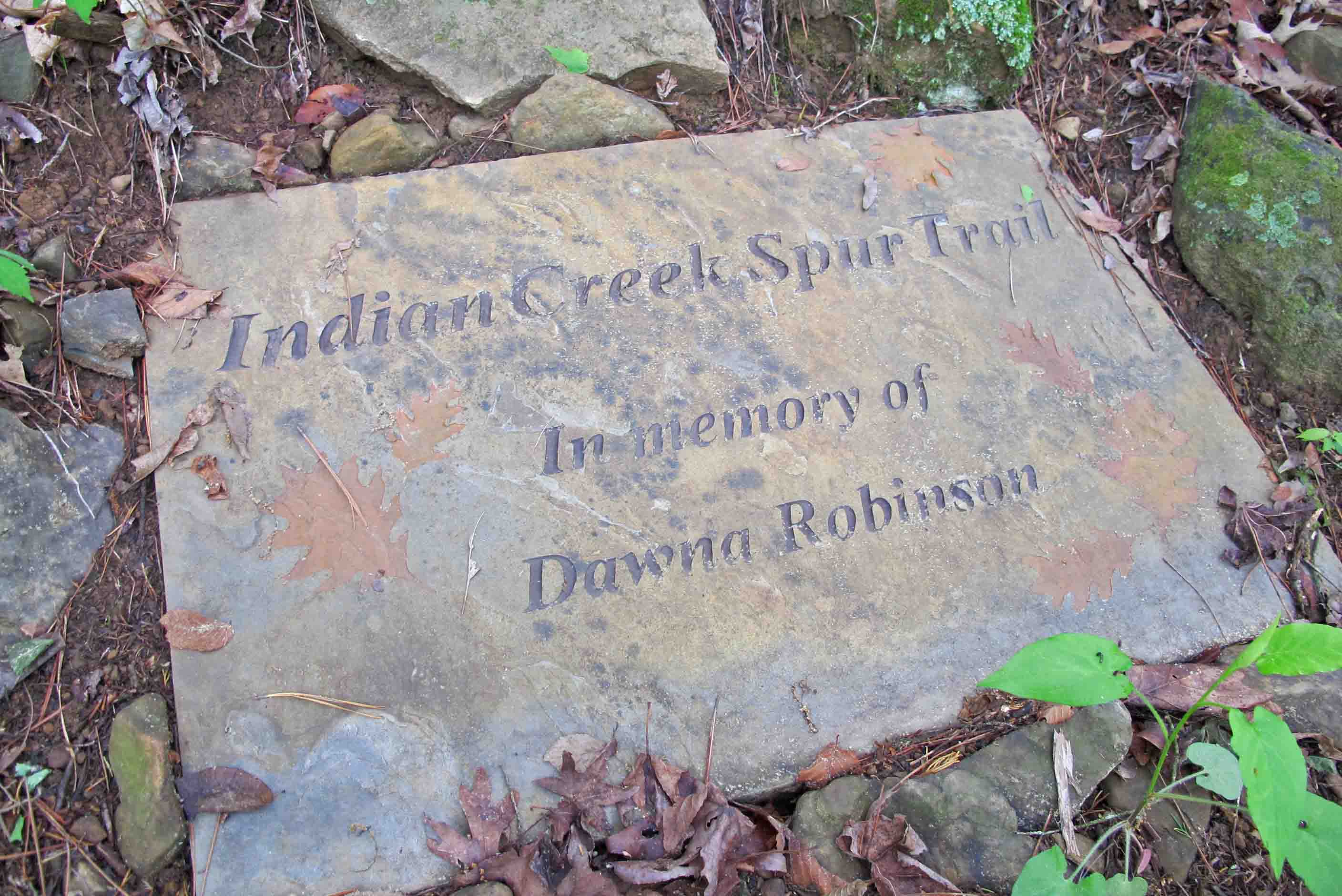
Hiking the Marinoni was my plan B today. Plan A was to check on my adopted section of the Ozark Highlands Trail. I got eleven miles east of Hwy 71 on Old Locke Road when I came upon a downed oak across the road. At first I thought my handsaw might be used to clear a single lane. After making a couple of cuts, I abandoned that idea. It was a chainsaw job. Hiker was restless and probably wondering what I was doing when we should be hiking. When we got back into cell range, I reported the tree and then headed to the Indian Creek Dawna Robinson Spur Trail east of Cass.
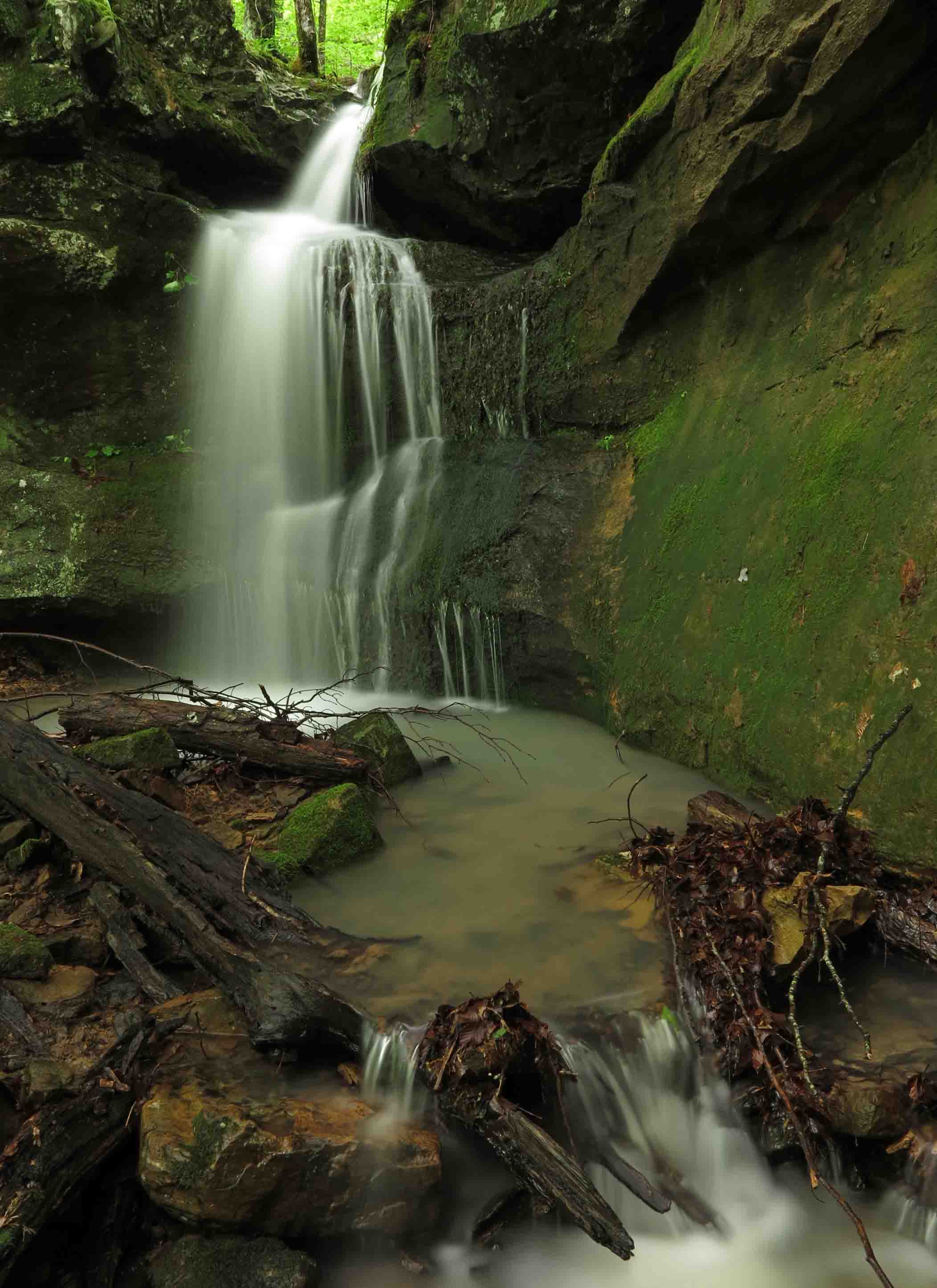
I’ve written about the Marinoni Scenic Area before, but I haven’t hiked it when water was flowing as strong as today. What could have easily been a two to three-hour hike was more like five with all of the photo stops. I felt thankful for that tree that changed my itinerary because the Marinoni was what I needed. Sometimes the best plan is plan B.
View of Marinoni Falls from a short distance.
Marinoni Falls
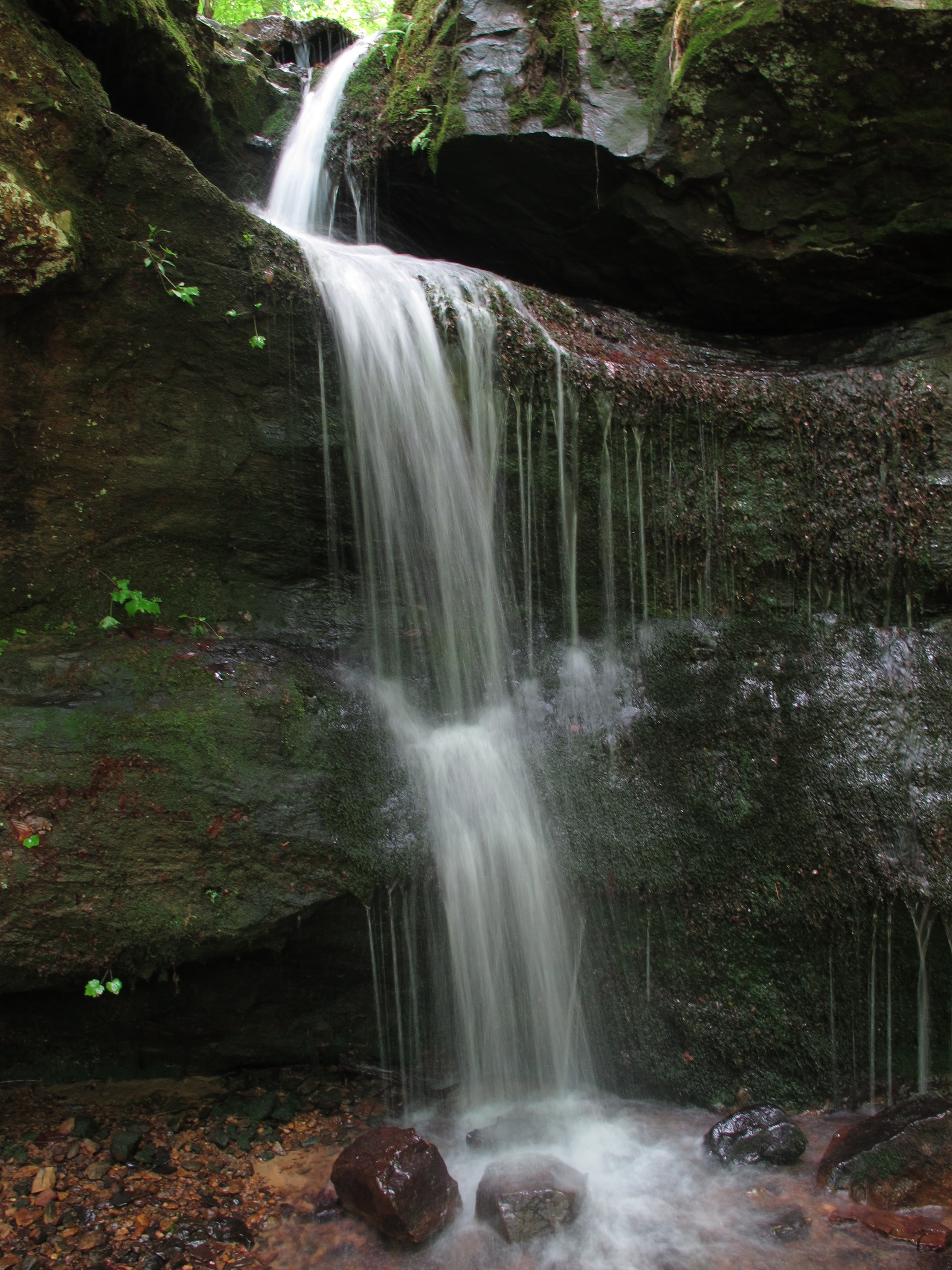
Small falls upstream from Marinoni Falls
I spent enough time around these falls that Hiker-dog got impatient. She begins to bark when she thinks I’ve had enough time at the camera. I noticed that she began to pause and glance my way each time we passed any flowing water as if anticipating a photo stop.
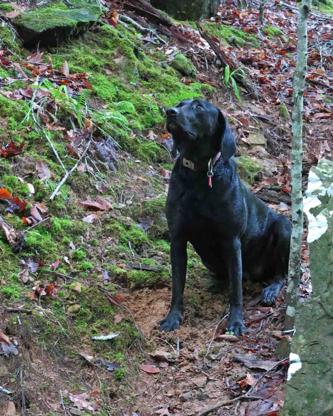
Hiker watching the trees for squirrels while waiting patiently.
I found it difficult to walk away from the Marinoni Falls. They provided an enjoyable time with my camera.
Small falls upstream from Marinoni Falls
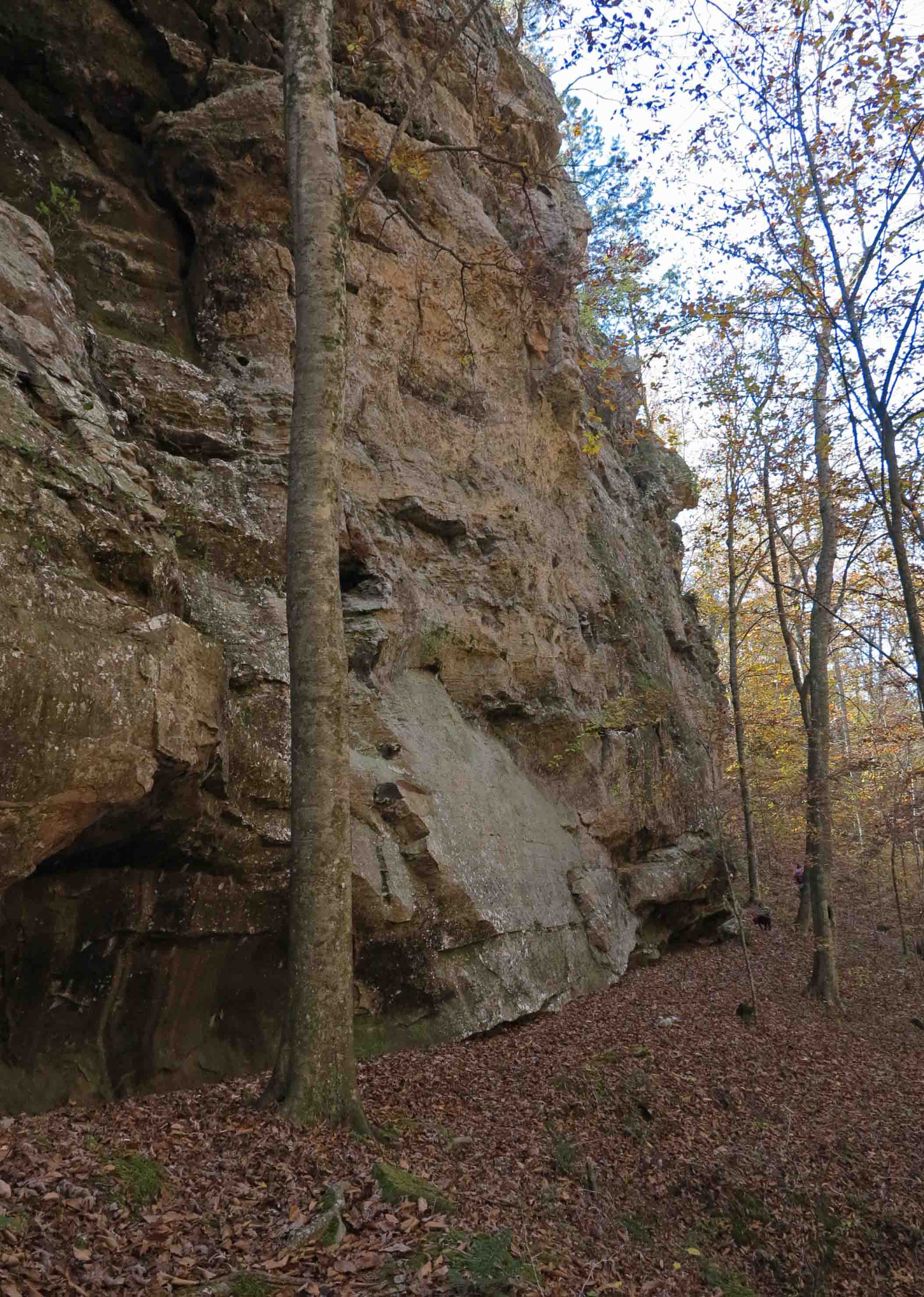
The towering walls above Briar Branch seem to envelop you like cathedral walls.
The bluffs above Briar Branch
Bluffs above Briar Branch
Edge of bluff with Briar Branch in the distance down to the right of the trail
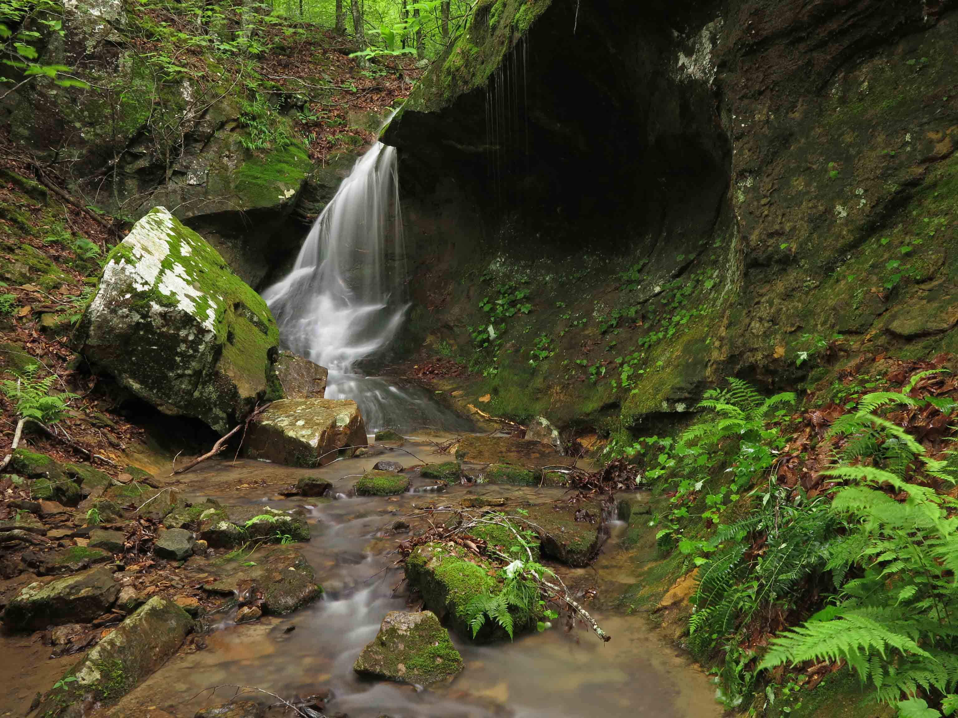
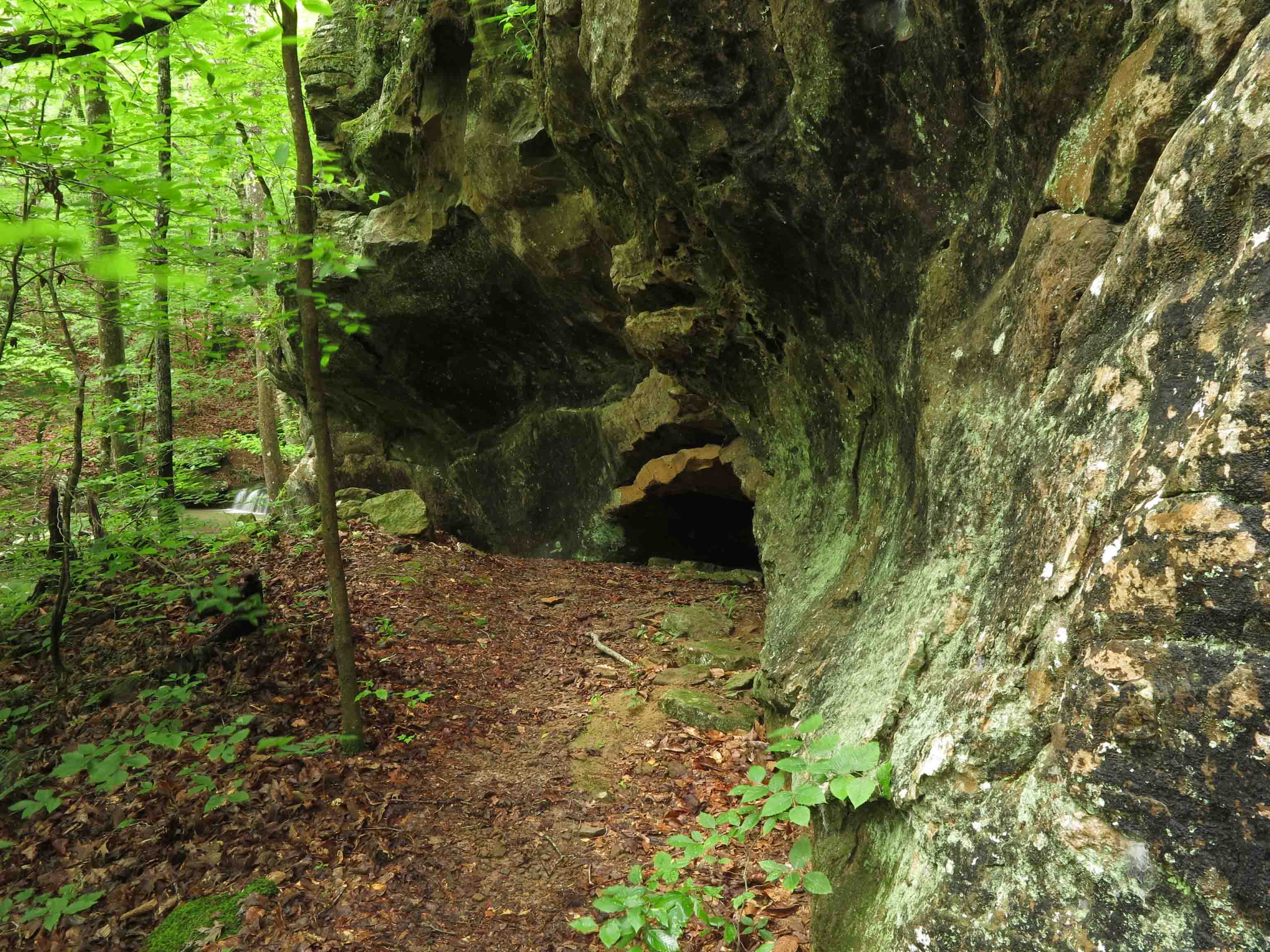
Cascade close to the Marinoni marker
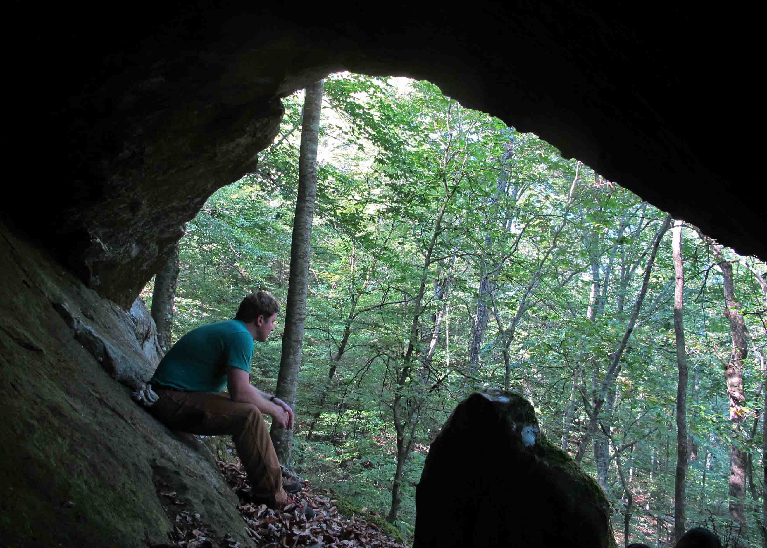
Little cave next to the Marinoni marker
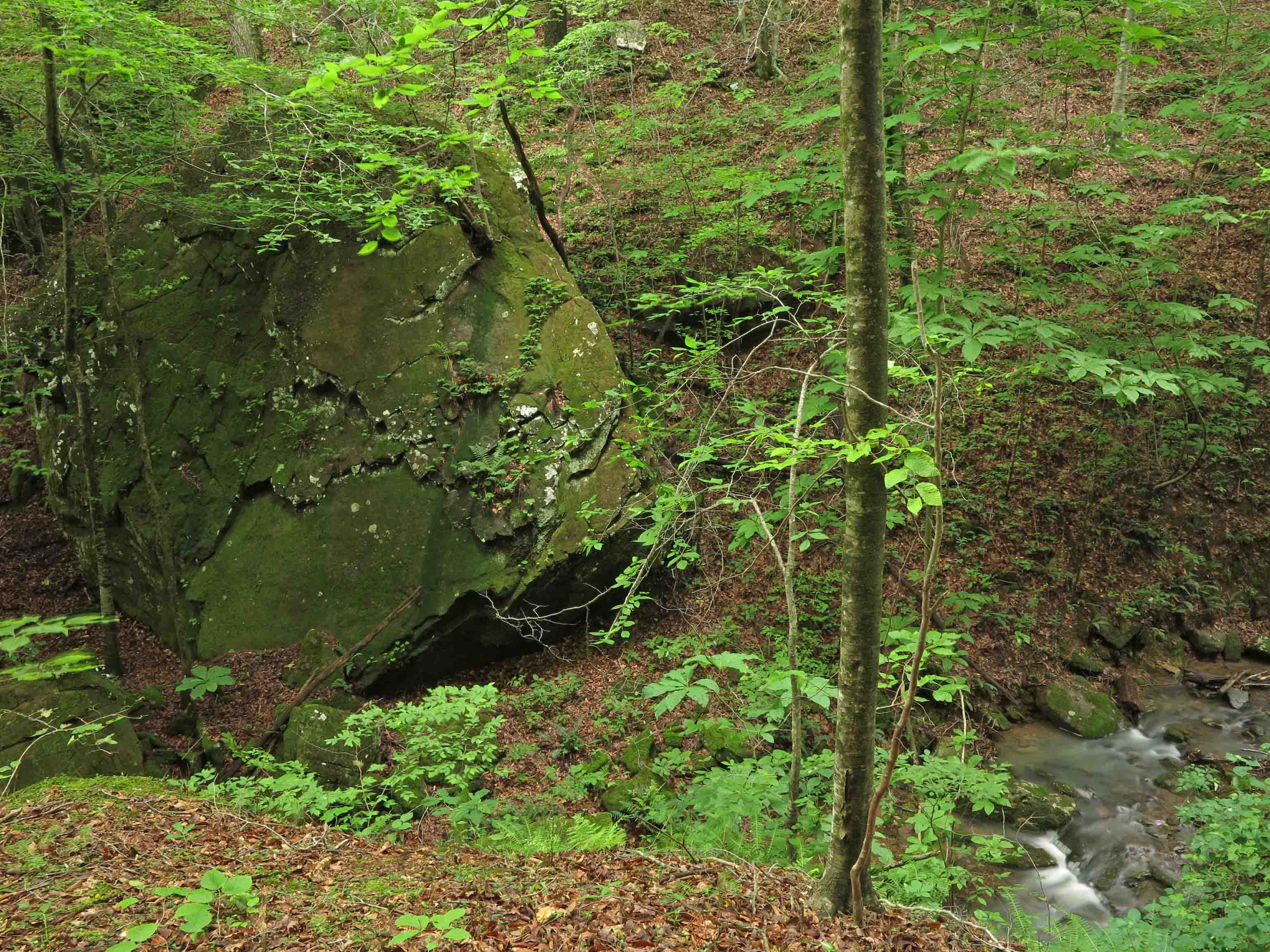
Large boulder across Briar Branch
I never hike this section without pausing to be amazed at the size of this boulder down next to the creek.
Crossing Briar Branch
Stone memorial for Dawna Robinson close to the trailhead
To read more about the Marinoni:
Making Time for Marinoni (includes driving directions to the trailhead)
Marinoni Revisited (Four Star Treatment)
In response to The Daily Post’s weekly photo challenge: “On the Way.”
Tag Archives: Marinoni Scenic Area


Haiku in the Ozarks
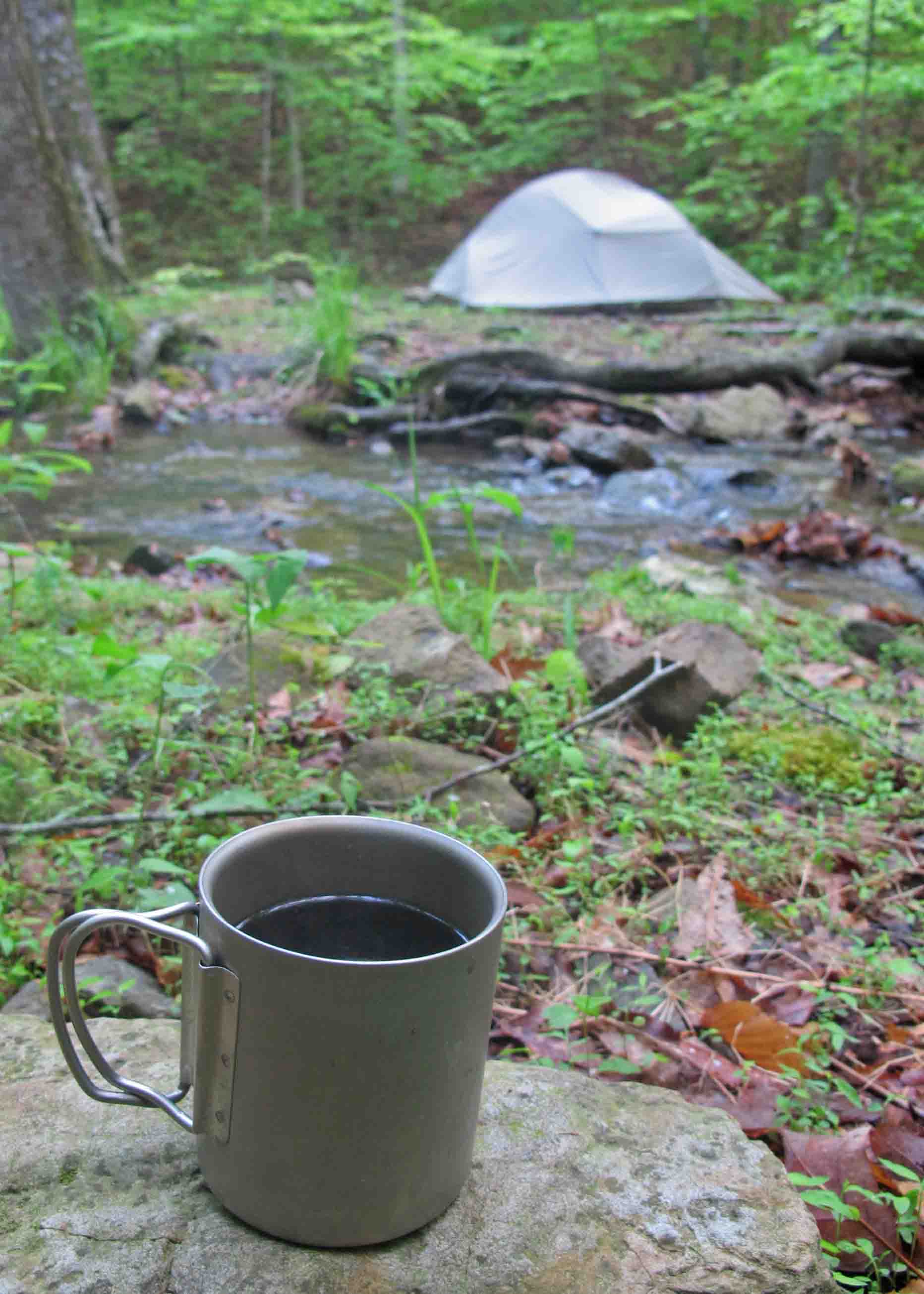
Five-star hotel and gourmet coffee next to Briar Branch
“TJ’s Household Haiku Challenge”
Black coffee on stone.
Table set for the day in
My five-star hotel.
This cup travels with me always, a favorite outdoor household item. On this cold morning, sitting next to Briar Branch in the Marinoni Scenic Area on the Ozark Highlands Trail, I felt intense thankfulness. I was thankful for the morning, the water, the coffee, and the strength that brought me there. How could I want for anything more while enjoying these five-star accommodations?

Redding Loop Trail waterfall
Hard rains have fallen.
Waterfalls flow milky white.
Sit silent and drink.
This extra Haiku came as I thought about last week’s waterfalls. No household item here unless we allow my camera to qualify. It sits in a prominent location in my home, always charged and ready for the trail.
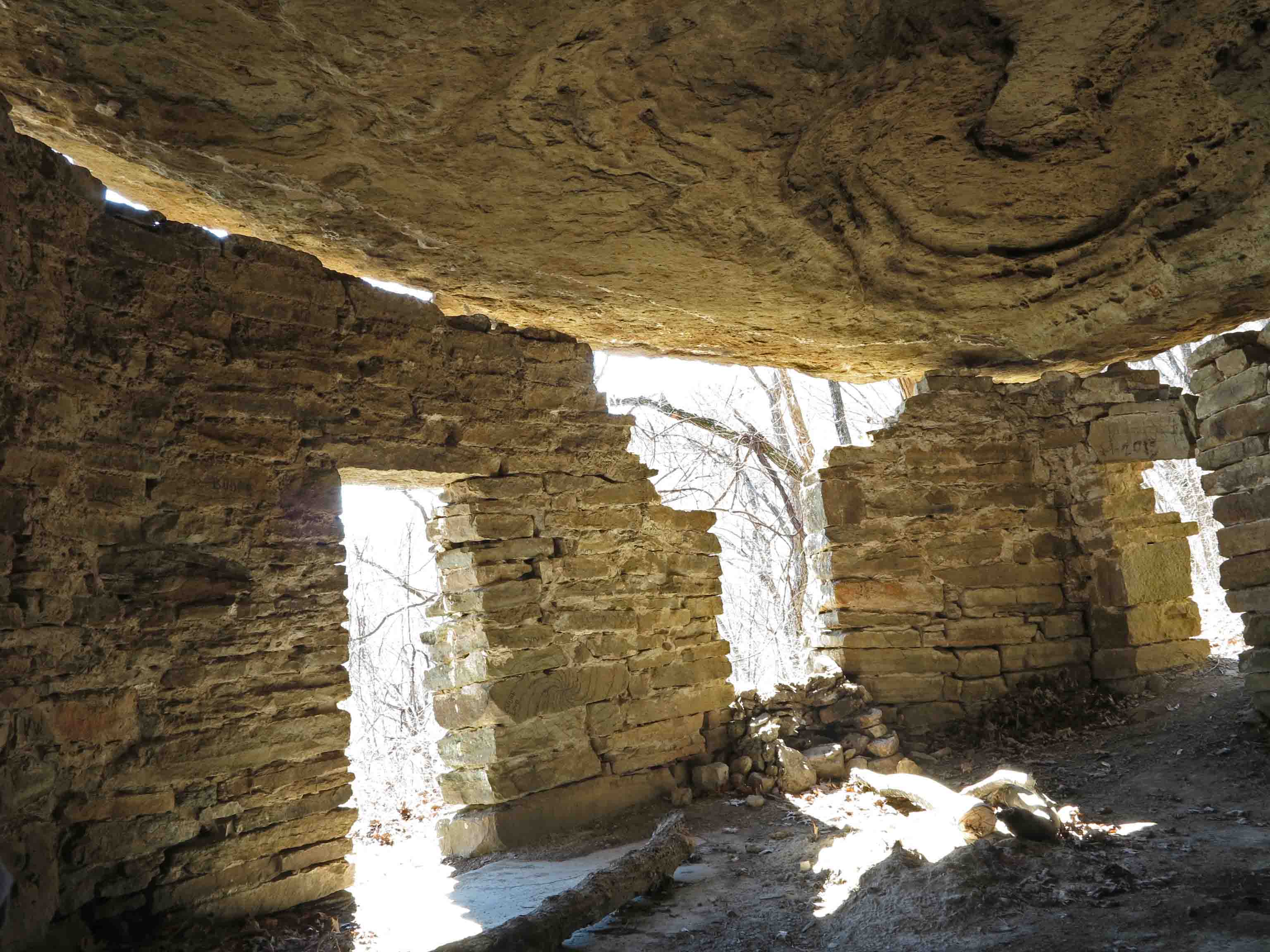
Rock House on the Ozark Highlands Trail

Rock House
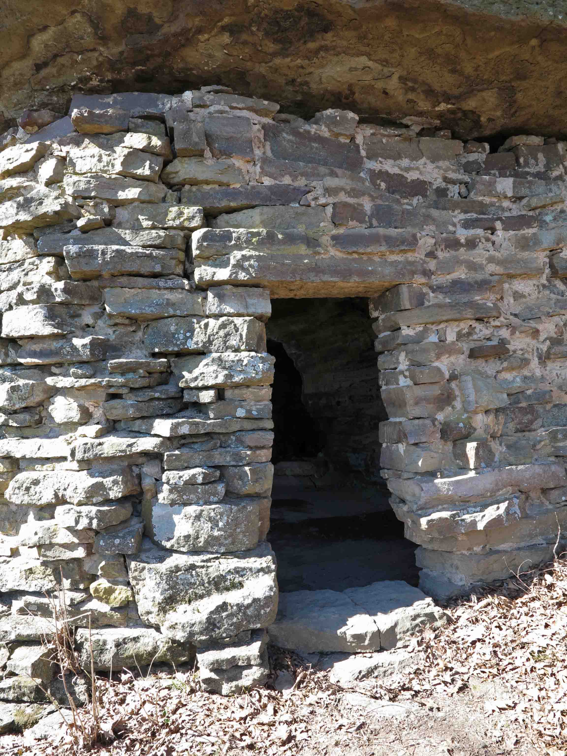
The Rock House is one of my favorite landmarks on the Ozark Highlands Trail (OHT). It’s easily accessed, but most drive Highway 23 unaware of the history perched under a bluff a mere quarter mile walk from the road. As the crow flies, the distance is much closer and during the winter it’s easy to see the highway down below. Don’t let the roundtrip 0.5-mile by trail deceive you. It’s a steep climb on the Ozark Highlands Trail and a short spur trail to the structure. If you walk to see Rock House, wear sturdy walking shoes and carry some water.
The Rock House was probably built as a shelter for loggers sometime during the 1890s to 1920s when the area was heavily logged for white oak, in high demand because of the expansion of railroads across the country. By the 1930s, the old-growth forests were pretty much exhausted. It still makes a good shelter today in spite of some shifting of the ground that has caused a separation between the wall and bluff. It has a rough concrete floor, and a small spring located in the back of the single room.

The short hike to Rock House begins at Cherry Bend Trail Head, located approximately five miles north of Cass on AR 23 (AKA Pig Trail). This is a popular trailhead for accessing the OHT. Watch for fast traffic when crossing the highway as you begin your walk.
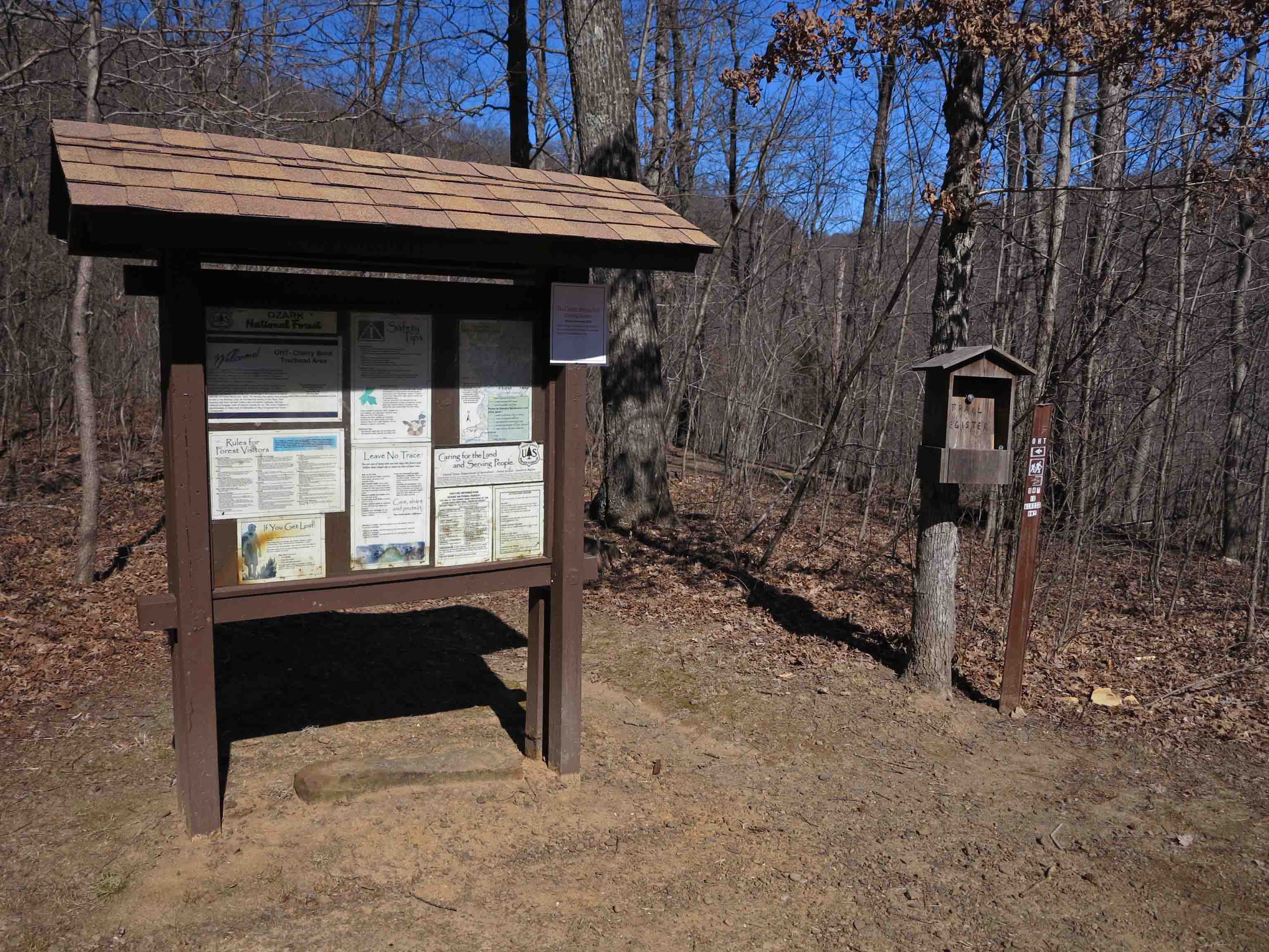
Cherry Bend Trail Head
A spur trail leads to a nice view behind the trailhead sign, but to access the OHT and Rock House, you’ll cross the highway on a short trail marked with blue blazes.

Lost sole…
There is a thru-hike trail register at the intersection with the OHT. We’re going to turn left onto the OHT and head sharply uphill following white blazes. I only saw one “lost sole” on my hike up to Rock House. You’ll often have the OHT all to yourself, but you might encounter thru-hikers and enjoy a short visit about their time on the trail.

Sign indicating spur trail to Rock House blue blazes marking the spur and white blazes marking the OHT
Front door facing the approaching spur trail
On a thru-hike of the Ozark Highlands Trail in December of 2013, a hiking buddy and I spent a cold night in the Rock House sheltered from the rain. Seeing car lights below made me want to rush down and beg someone to bring pizza from Clarksville, but staying warm in my sleeping bag won that short mental argument.
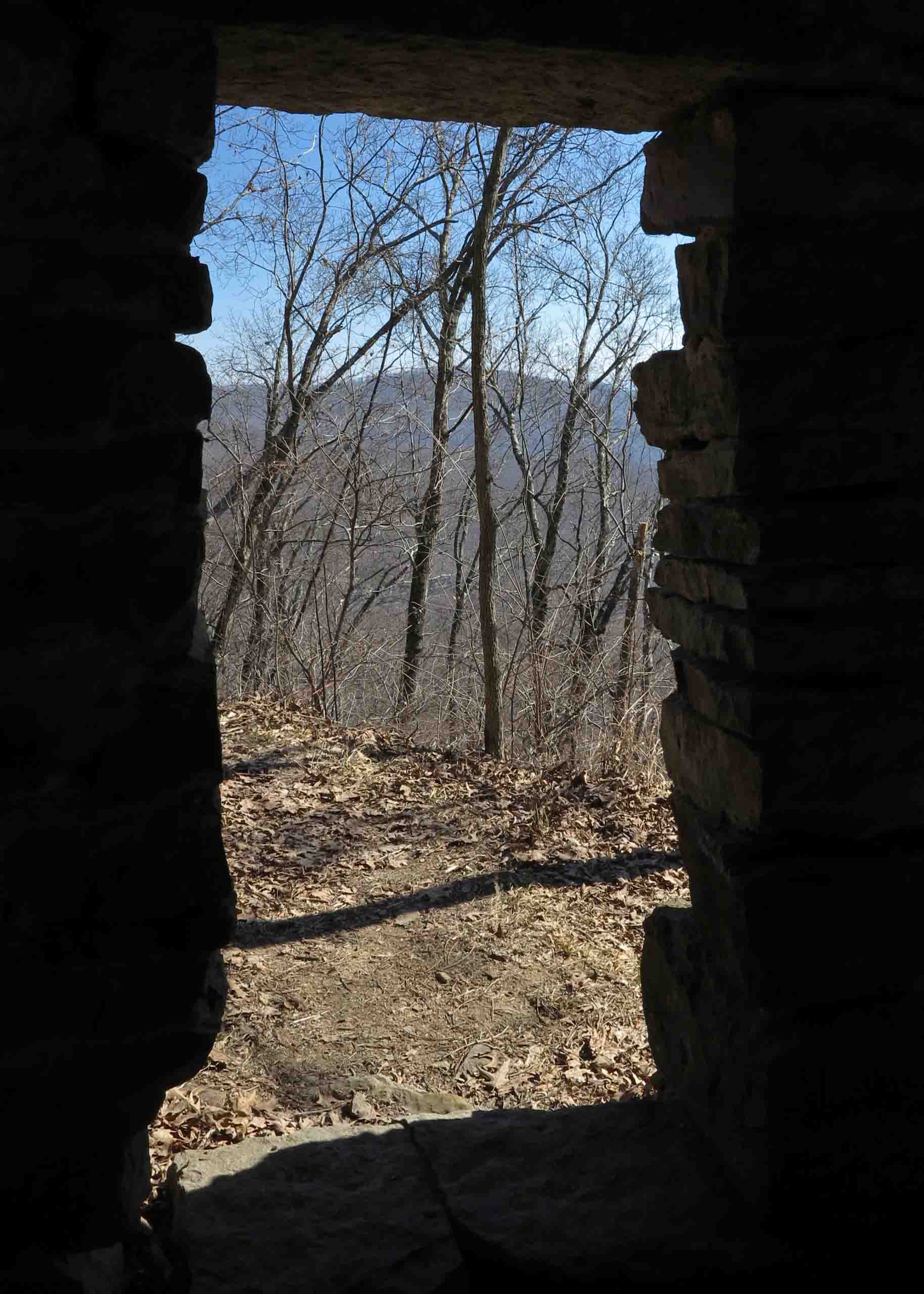
Today as I revisit the Rock House, it’s sunny and mild for February. The views of the Ozark Mountains to the east are enticing. I feel the desire to load my pack and head out for a multi-day hike over Hare Mountain and through the Marinoni Scenic Area to Lick Branch.
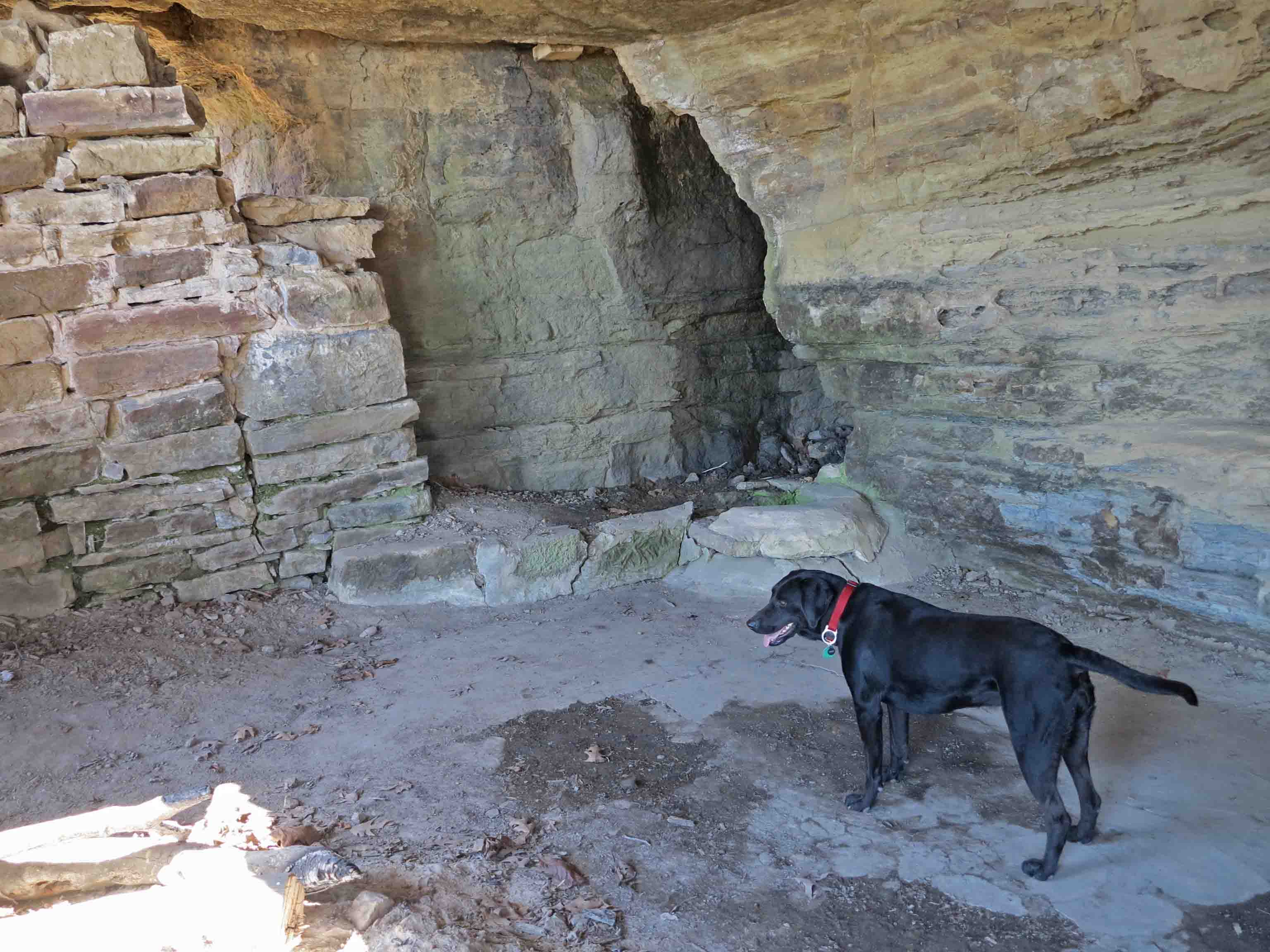
Hiker and spring in the back of the Rock House
Hiker attempted to drink from the spring in the back corner but the water was a couple of feet below the edge, and she didn’t couldn’t reach it. The water from this spring needs to be filtered. The single time I filtered water here, it wasn’t the best. It would be good water if you’re in a bind or have time to filter it through cloth before using your water filter.
Inside the Rock House
You can see the toll that time has taken. The separation of the rock walls from the bluff ceiling are evident as well as the loose rocks around doors and windows. Please leave this fragile structure as you find it. The Rock House is a little historic treasure we’ll want our children and grandchildren to see for years to come!
Note: I’ve enjoyed sharing a glimpse of the rich history surrounding the Ozark Highlands Trail. If you know of other structures in the Arkansas or Missouri Ozarks, please share them with me on my feedback page or comment on this post.

Route from Hwy 23 to Rock House
Cherry Bend Trail Head GPS: N35 44.554 W93 48.799
Cherry Bend Trailhead is located approximately 5 miles north of Cass on Arkansas Highway 23. The second waypoint on the above map is the intersection with the OHT. The OHT route showing on this web map is an approximation. The last waypoint on the east side of Highway 23 is the Rock House.

Back door of the Rock House
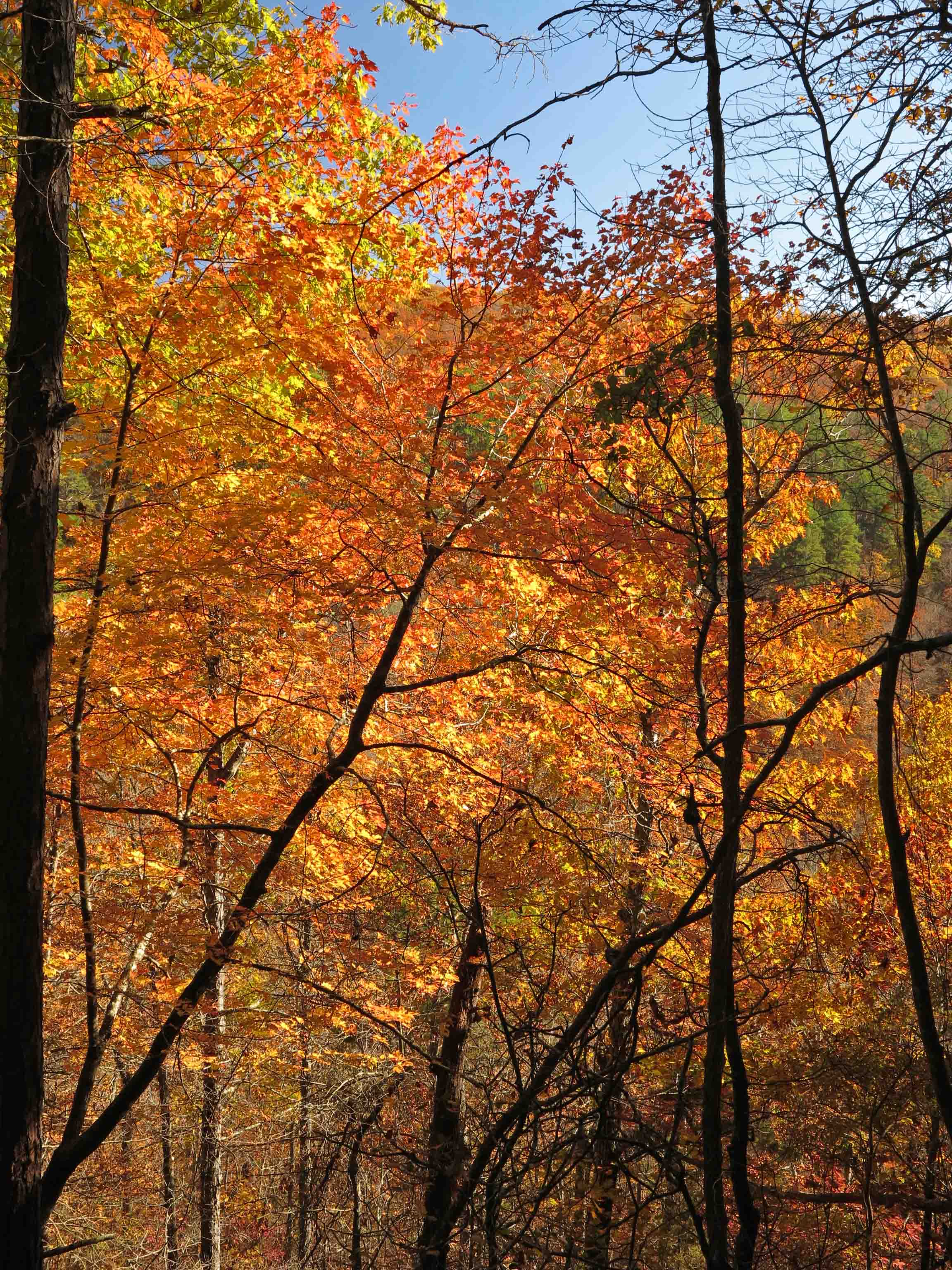
Fall in the Marinoni
View from the trail down into the Briar Creek drainage.
Fall colors, sunny skies, and high temperatures in the 60s. It doesn’t get much better than this! The Marinoni Scenic Area is beautiful in fall.
An unassuming beginning considering the beauty to be found on this trail.
The Dawna Robinson Spur Trail leads to the Ozark Highlands Trail and then east into the Marinoni.

View into the Indian Creek drainage as you climb switch-backs up toward the OHT.

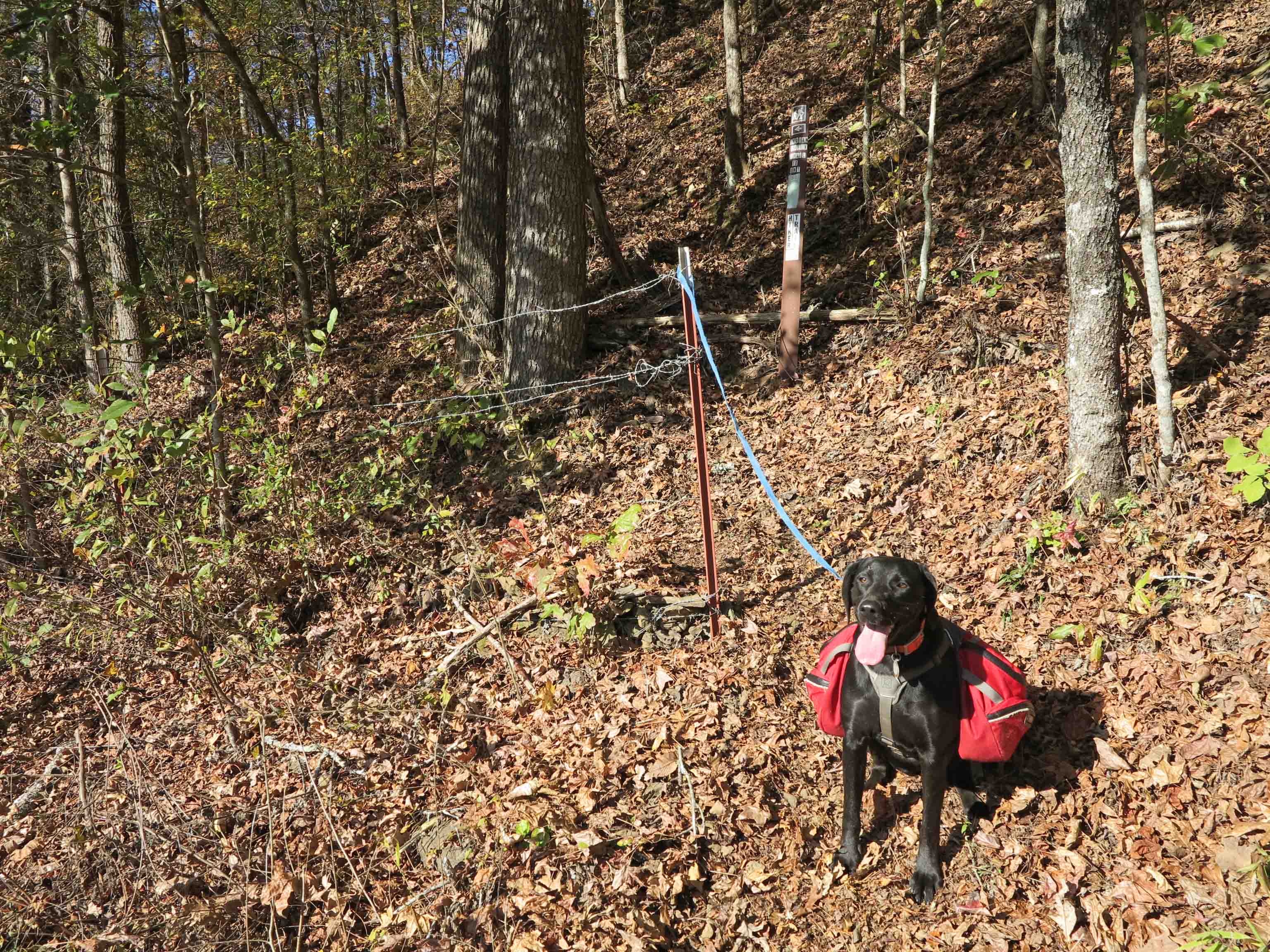
Hiker-dog enjoying walking with new friends.
I never tire of walking alongside the bluffs of the Marinoni.

Hiking with Hiker-dog up the Dawna Robinson Spur Trail.

Hiker says, “Wear orange and don’t act like a deer.”
I learned something new about Hiker-dog on this day. She stayed close to me and on the trail when deer hunters were firing in the area. She had her hunter orange on and didn’t go prancing through the woods. Smart dog!
If you need more information and driving directions to this trail, check Making Time for Marinoni.
Only in the Ozarks of Arkansas
Mike, president of the Ozark Highlands Trail Association, got permission to park on a man’s land close to where we would be doing doing trail maintenance around mile 52 of the Ozark Highlands Trail. While Mike was visiting with the landowner the man asked if Mike liked muscadine wine. He said yes, so the landowner produced this bottle and said he’d picked the muscadines along the trail. He said he didn’t like wine, just enjoyed making and sharing it. Notice the duct tape label.

Muscadine Wine from the Ozark Mountains
Sure enough, we came across some muscadines on the trail. Very tasty.
Muscadines ripe and ready to pick.
We actually did some trail work but throughly enjoyed lopping our way through one of the most beautiful areas of the state. Had a nice lunch while visiting with a father-son duo from Oklahoma. Explored some small caves up above the trail while taking a short break from the lopping. All in all, a pretty nice way to spend a day. Thankful for the beauty of the Arkansas Ozark Mountains.
Small cave in the Marinoni Scenic Area

This little campsite made a nice spot for lunch and conversation.
If you’re interested in hiking this section of the OHT, check out this blog which includes driving directions. http://wp.me/p2VEN9-a
Marinoni Revisited (Four-Star Treatment)
When I first began hiking, I’d check off trails as if that indicated that I’d seen those places. While it did document that I had been at those locations, I later realized that I’d only grazed the surface. This is especially true of the Marinoni Scenic Area.

We entered on the Dawna Robinson Spur Trail that begins at the Indian Creek canoe parking area. Watch for traffic when crossing Hwy 215. We paused a moment to admire the memorial marker just a few steps up the trail.
We were immediately impressed with the condition of the trail which is only about two years old, built by volunteers with the Ozark Highlands Trail Association. The switchbacks climbing up to the base of a bluff line are beautiful and you almost forget you’re climbing because of the steady grade. When we arrived at the top of the climb we began an easy walk through open woods. It was unseasonably cold with occasional rain.

Our group of three included Robert who was visiting family in Missouri before returning home to Hawaii. I wondered what his response would be to hiking in the Ozarks. I was pleasantly surprised because he went on and on about the beauty of our little Ozark Mountains. He was not the least bit disappointed even though he’d hiked some beautiful areas in Hawaii.

This was a short hike designed for novice backpackers with the hope for time to explore after making camp. With only a three mile hike in this hike definitely did not meet Bob’s miles driving to miles hiking ratio. The shorter distance did something nice for us though. It demanded that we slow down and enjoy the passing of scenery. Robert was doing his first backpack trip and Bob’s nights backpacking numbered into the four digits but we all enjoyed learning from each other and sharing tips along the way.
Having hiked through the Marinoni many times, I wanted the chance to camp there. This little spot looked better than a four-star hotel as we approached and pitched our tents.
Four-star hotel and gourmet coffee next to Briar Creek
The Marinoni never disappoints! The soothing sounds of Briar Creek accompanied our walk along rocky bluffs and budding wildflowers. The moist day made it feel like a rain forest with clear water droplets hanging from every leaf. Cascades and waterfalls were flowing nicely.


Briar Creek
A trip highlight and something even four-star hotels can’t offer was a short afternoon nap in dry leaves under a bluff overhang accompanied by Briar Creek and song birds. I was worried that it might be difficult to sleep after napping but slept pretty much straight through from 7:00 p.m. to 7:00 a.m. This was some four-star sleep!

During our hike out on Sunday morning I was already looking forward to my next visit to the Marinoni Scenic Area. No reservations required!
For location and more reading about the Marinoni Scenic Area visit the following link:
Making Time for Marinoni
Making Time for Marinoni
story and images JIM WARNOCK
Published in At Urban magazine of Fort Smith (This magazine is now named Do South)
There’s a treasure waiting for you in Franklin County, near the small town of Cass. One local backpacker recently said, “Hiking there is like walking through a beautiful cathedral!” Those who have experienced the Marinoni Scenic Area would completely understand this statement.
Imagine a place with twisting waterfalls, arching rock bluffs and towering trees. Walk along a gentle stream that flows over rocks into quiet, clear pools. The sounds of gurgling water, windblown trees, and a variety of songbirds will soothe your soul. Leave your cell phone in the car because there’s no coverage here; who wants to hear cold digital sounds in this acoustic setting?
The Marinoni is beautiful in every season. Fall colors glisten and shimmer,appearing as stained glass atop pools of water. Winter brings the possibility of stunning ice formations and frozen splash patterns around waterfalls. Spring brings dwarf crested irises peeking out from the most unlikely cracks and crevices. Their violet-to-purple hues sparkle against damp stone walls. During any season, you’ll find lush green moss-covered sandstone and lichen-speckled bluffs. Your greatest challenge on this hike might just be keeping your footing as you gaze up, entranced by the beauty.
Access to this jewel of a place used to be difficult and limited to strong, long-distance hiking legs. The Ozark Highlands Trail Association (OHTA) held a weeklong work camp in March of 2011 and built a .6 mile spur trail that connects to the Ozark Highlands Trail (OHT) just west of the Marinoni Scenic Area. You’re now able to hike a couple of miles and find yourself in one of the most beautiful places in Arkansas.
“Well worth a 3-hour drive,” says Dale Fudge, a hiker from Oklahoma City. Dale goes on to say, “The Marinoni Scenic Area is one of the most intimate and inspiring sections of the OHT. It’s secluded and packed full of dramatic landmarks. The area is now more accessible than before with the addition of the Dawna Robinson Spur Trail at Indian Creek, making for one of the best day hike opportunities in the entire region.”
It’s fitting that this area feels like a sanctuary and that it memorializes the lives of two special individuals. Paul A. Marinoni was from Fayetteville and was involved in volunteer efforts with Tim Ernst’s father. Tim, renowned outdoor photographer and author of the Ozark Highlands Trail Guide says, “My dad had his first heart attack when I was only six, so he was unable to take me to the woods like he would have wanted to. When I was seven, I began spending a lot of time with Paul Marinoni, hunting and camping during annual retreats into the woods. Paul was a real character, one of the most down-to-earth and honest people you would ever meet.” Given Tim’s sentiments, it seemed proper to name this area after a man who influenced others to appreciate the Ozarks.
The short trail allowing us to enter this natural area is named in memory of Dawna Robinson. Dawna and her husband, Bob, spent years maintaining sections of the OHT. She was well known for her love of the trail and her desire to share it with others. “When the new Indian Creek Spur Trail was first proposed, Dawna’s spirited personality and dedication came to mind as a fitting tribute to memorialize how the entire trail came into existence through the hard work and perseverance of volunteers,” says Mike Lemaster, President of the OHTA.

In many ways the Marinoni Scenic Area reflects qualities of these two lives. Sitting at the edge of Briar Creek, you’d think these bluffs had always been as they appear today but this valley was shaped by centuries of water and ice. There’s an honesty and straightforwardness in its beauty. Giant rocks stand like monuments of strength where they folded down to the creek years ago. Although fragile, there’s a sense of permanence here and although subtle, the beauty is deep and unmistakable in any season.
If you’ve never visited the Marinoni Scenic Area, it’s an experience not to be missed. If you have hiked the area, you will want to return again and experience an even deeper appreciation of its beauty. So, lace up your walking shoes! Let’s go visit an Arkansas natural cathedral and pause there as it becomes our own special place of sanctuary and reflection.
Getting there: From Hwy 23 just north of Cass, turn onto Hwy 215 east. Travel 7.4 miles to Indian Creek Canoe Launch and OHT Access. The trail is on the north side of Hwy 215 and begins at an opening in the fence directly across from the Indian Creek OHT Access sign. The spur trail is marked with 2×6-inch blue metal blazes. You’ll hike .6-miles to the OHT and then turn right, hiking another 2 miles to the Marinoni Scenic Area marker at the base of a bluff. Hiking out-and-back gives you approximately 5.2 miles. With a shuttle you can hike through to the Lick Branch Trailhead which will be a 5-mile hike and cover even more scenery.
For more information:
Ozark Highlands Trail Association ozarkhighlandstrail.com
Ozark Highland Trail Association Facebook page
Ozark Highlands Trail Guide by Tim Ernst

