Elise Falls
The movement of water fascinates me. I feel like I’m recording the movement of divine brushstrokes across stone and air. These photos are from yesterday’s early morning 5-mile hike in the Smith Creek Preserve. Smith Creek flows into the Buffalo River, America’s first National River.
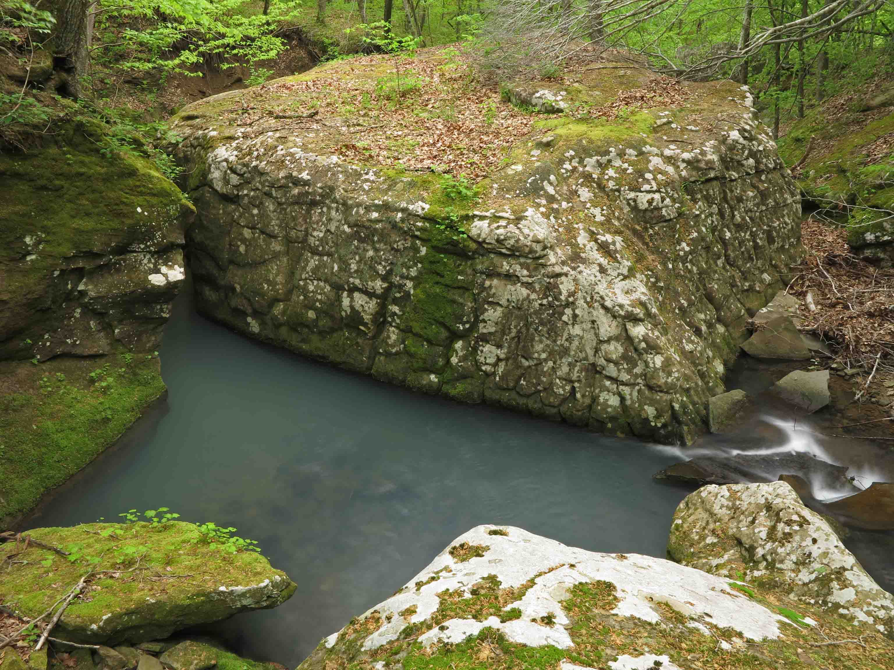
View downstream from a little cascade.
Smith Creek
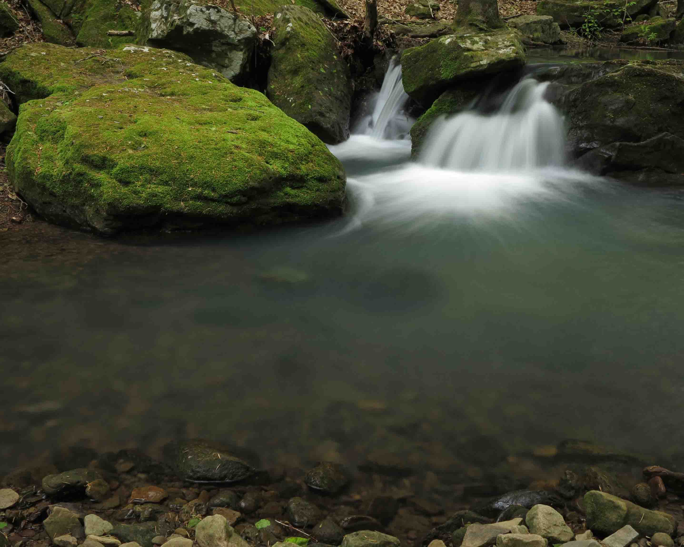
Even in the stillness of this pool there is movement below and lightly dancing reflections on the surface.
In response to The Daily Post’s weekly photo challenge: “Motion.”
Tag Archives: Smith Creek Trail
Smith Creek Preserve Trail: A New Jewel in Arkansas

Smith Creek
Judging from the strata making up the sedimentary bluffs bordering Smith Creek, there’s nothing new about this area geologically, but public access to this jewel is new. Thanks to Marty and Elise Roenigk, who transferred their property to the Nature Conservancy to establish Smith Creek Preserve, this area will be protected from development and destruction.
If you hike this trail, please tread lightly and leave as little impact as possible. The “trails” are almost exclusively old roadbeds. When the trail moves away from the roadbed, watch for round yellow arrows that indicate the route.

Two hikers beginning their hike
Smith Creek is small and unassuming, but its beauty is rich and varied. I began my hike with a headlamp and had no trouble following the main road that leads alongside Smith Creek to Big Spring. I then did the Lower Trail and visited Elise Falls before hiking back to the trailhead. My route was approximately 5 miles. I took almost five hours, not because of the difficulty, but because of the need to stop for photo-breaks. I finished up around 11:00 a.m. and had the whole place to myself. A couple arrived as I finished my hike.
What follows are a few photos from my Saturday morning hike.
Update: October, 2016 – Five Star Trail: The Ozarks includes a map, driving directions, GPS coordinates, and a trail description for Smith Creek Trail.
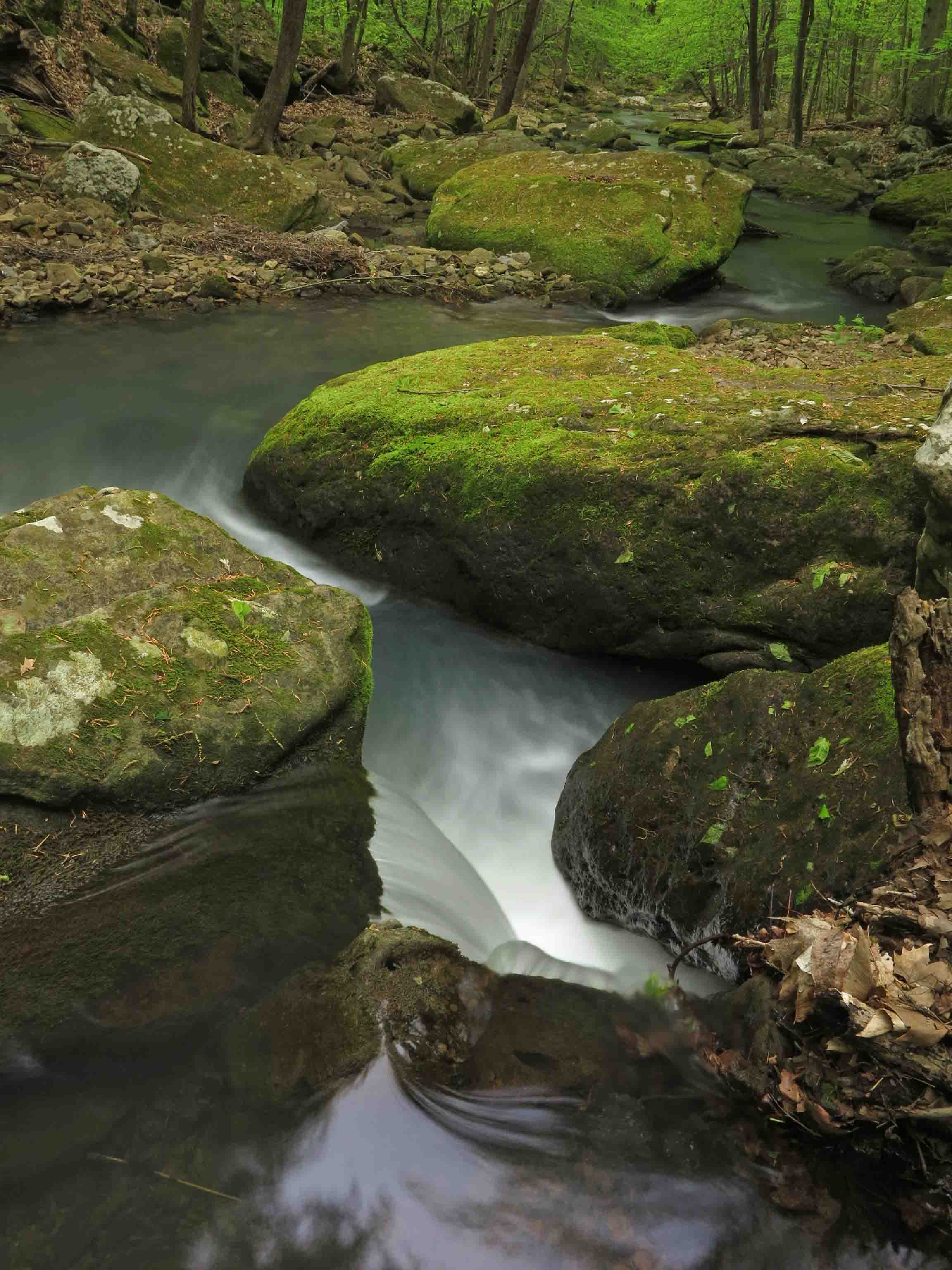
Large boulders in and around the creek
I wanted to step onto the large boulder in the center of Smith Creek, but the gap between rocks is deceptive in this photo. I wasn’t willing to try the jump. The drop looked like more than fifteen feet down to the water. The boulders are much larger than can be communicated with a photo lacking humans for scale.
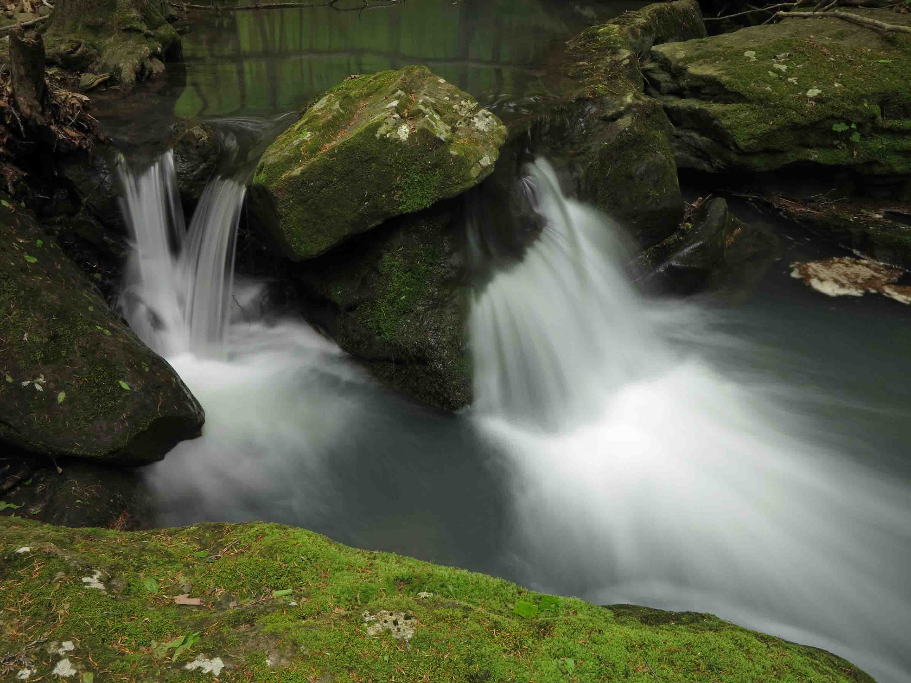
Little falls are sprinkled all along the creek.
View downstream from a little cascade.
Round arrow markers indicate a spur from where the trail crosses the dry wash below. Following these arrows down the drain will bring you to another stream and Elise Falls. Watch your step because weathered limestone can be very slippery!
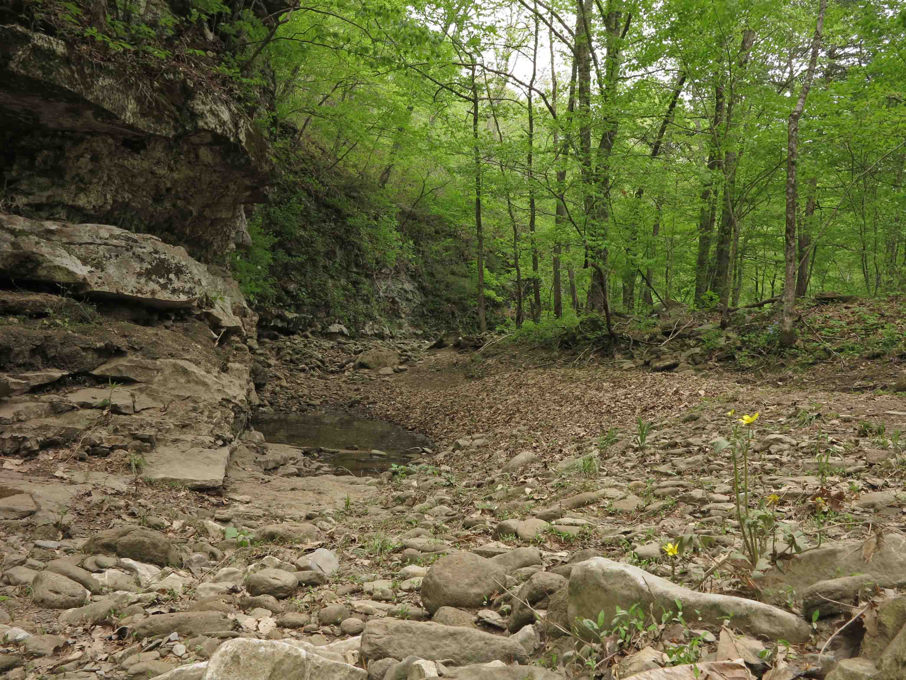
A small bluff next to a dry wash close to Smith Creek.

Elise Falls
Seeing Big Spring was a highlight for me. This is no small seep! It puts out a high volume of water and forms a small stream that flows a short distance before joining with Smith Creek.

Big Spring

Stream flowing away from Big Spring toward Smith Creek
The Smith Creek Trailhead is located on AR 21, eight miles south of Ponca. Visit nature.org and search for Smith Creek Preserve to find more information. The trail kiosk had maps and brochures for visitors similar to what is available online.

Smith Creek Trailhead
