Devil’s Canyon in Fern, AR

Grant taking a photo from a Devil’s Canyon overlook

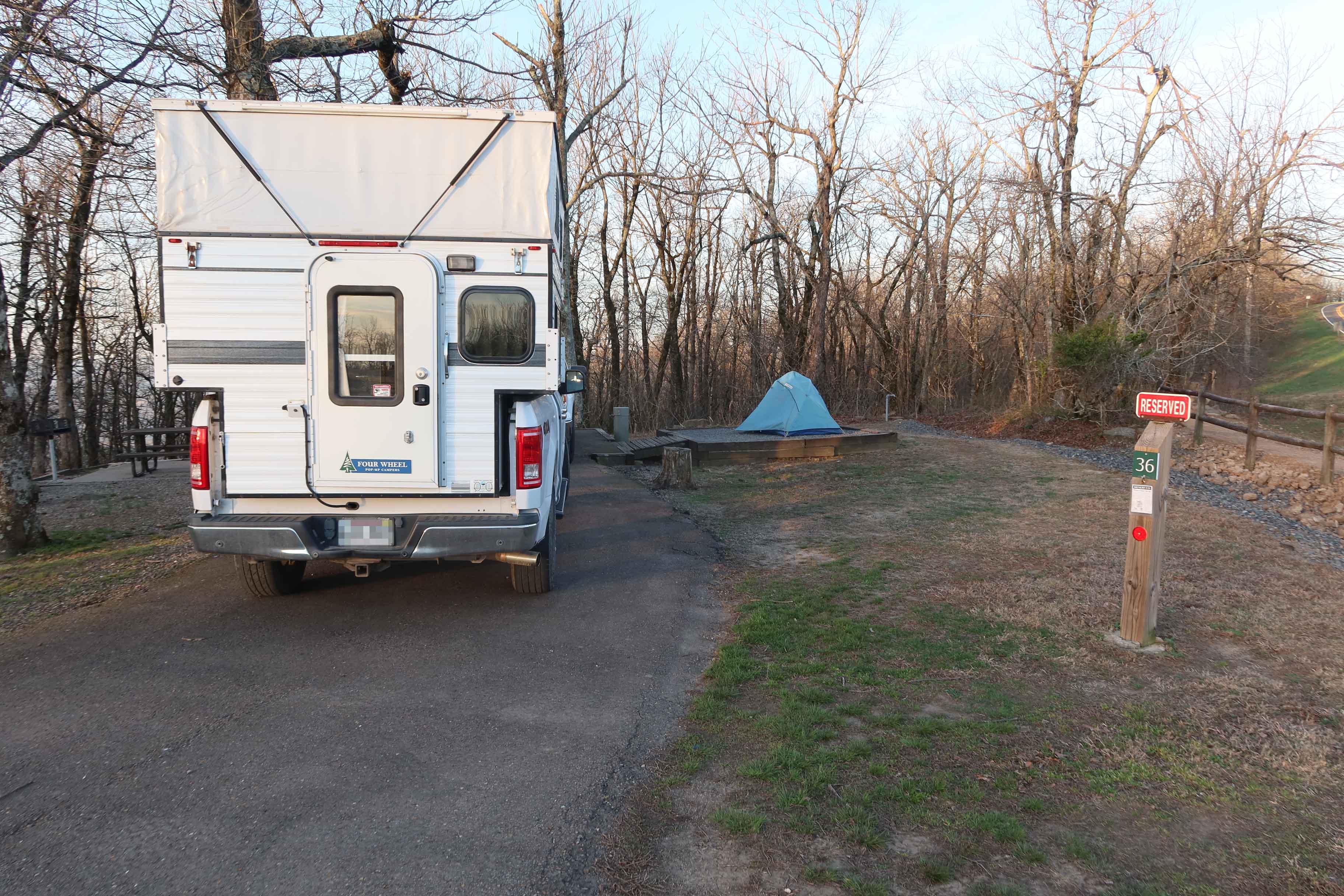
Saint John’s Episcopal Church in Fort Smith organizes day hikes open to all. The group calls itself Edge Walkers. I’ve visited this beautiful church and decided to join the group’s hike in Devil’s Canyon, located a little over seven miles north of I-40 on Hwy 215.

John capturing a video

While saving photos, I noticed several other trails I’ve hiked with Devil in the name. Seems ironic but if Devil is included in a trail name, it’s likely to have stunning scenery and just might have a challenge or two.

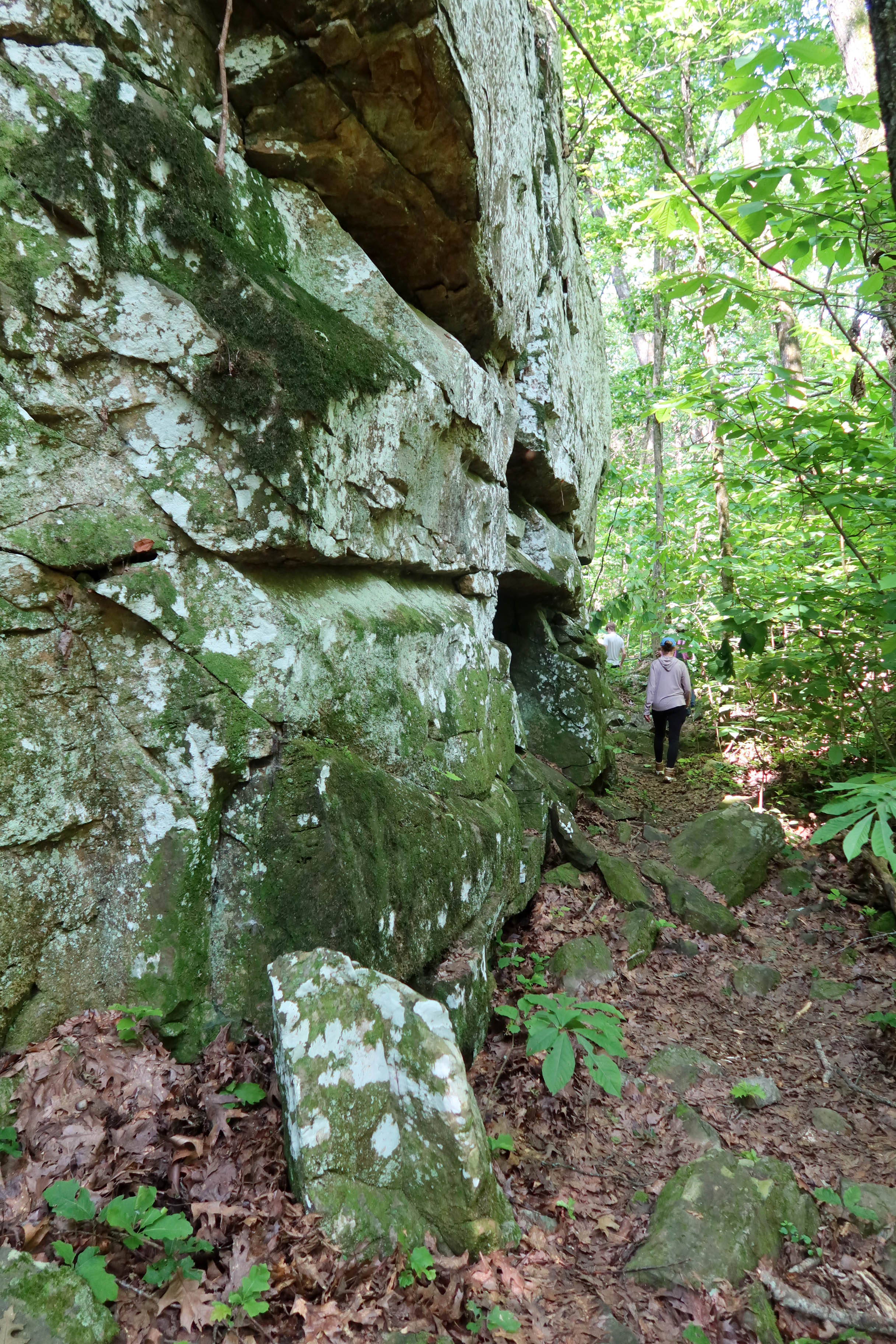
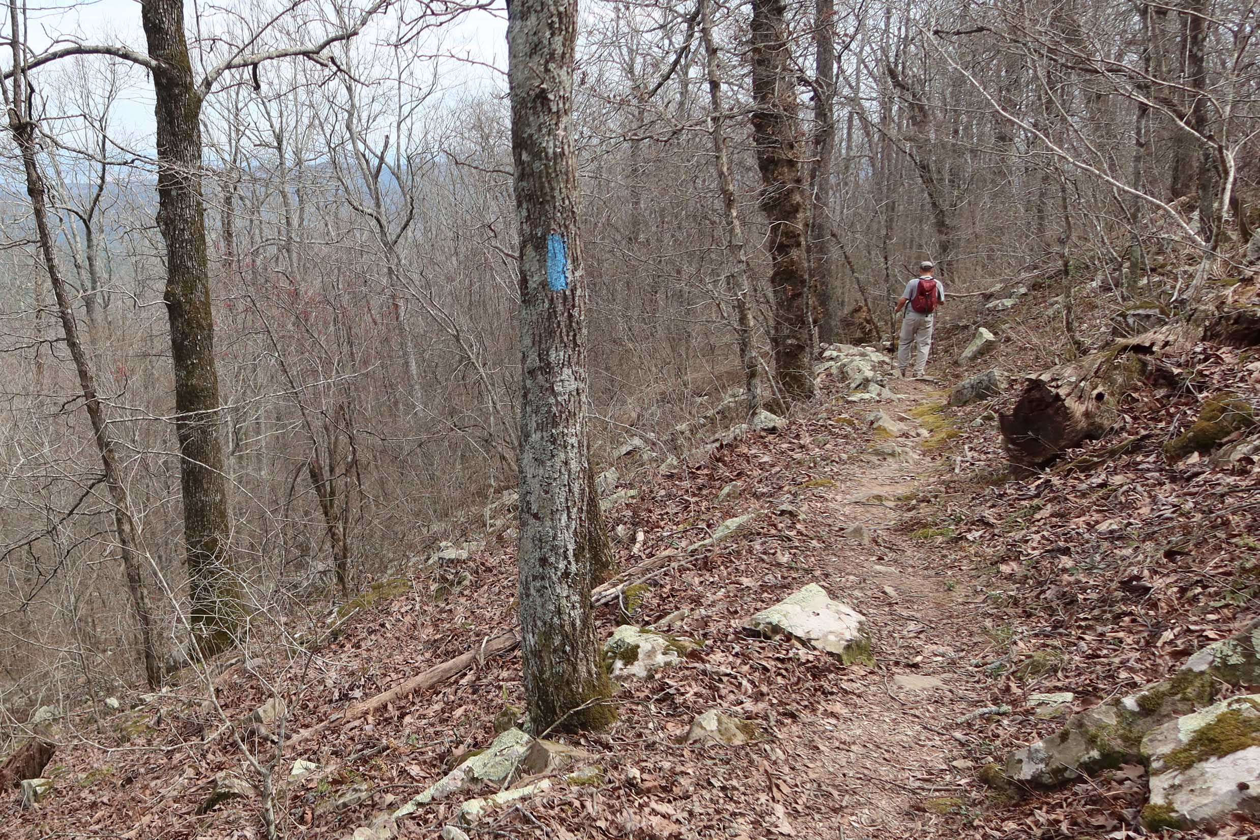
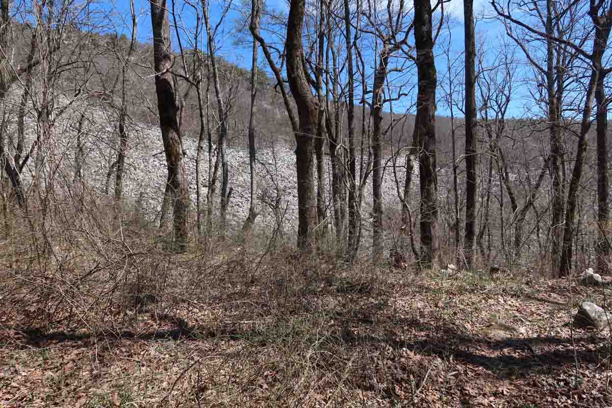
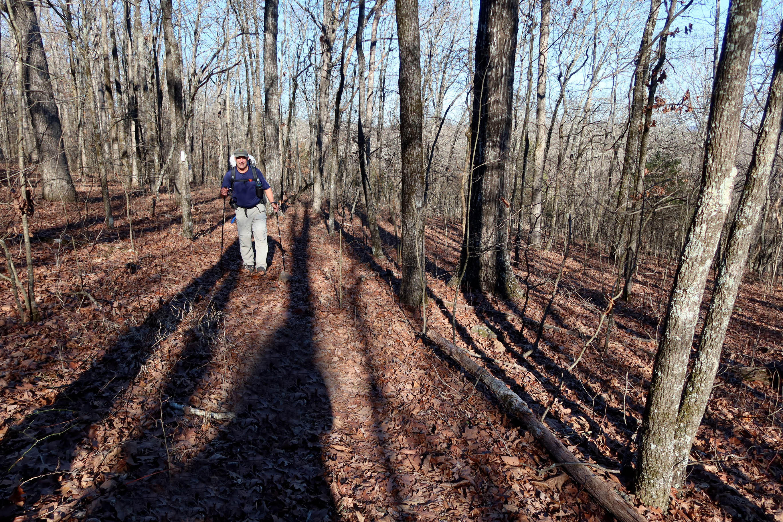
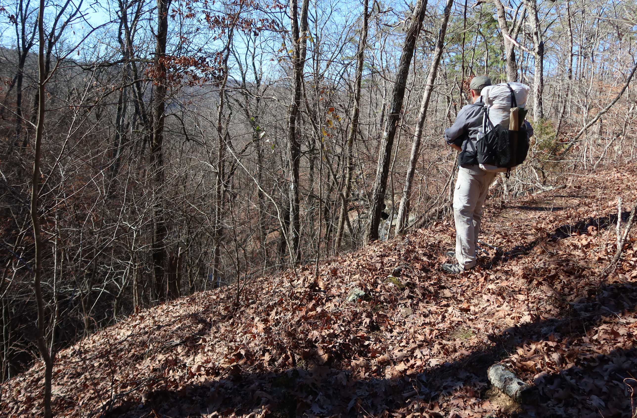
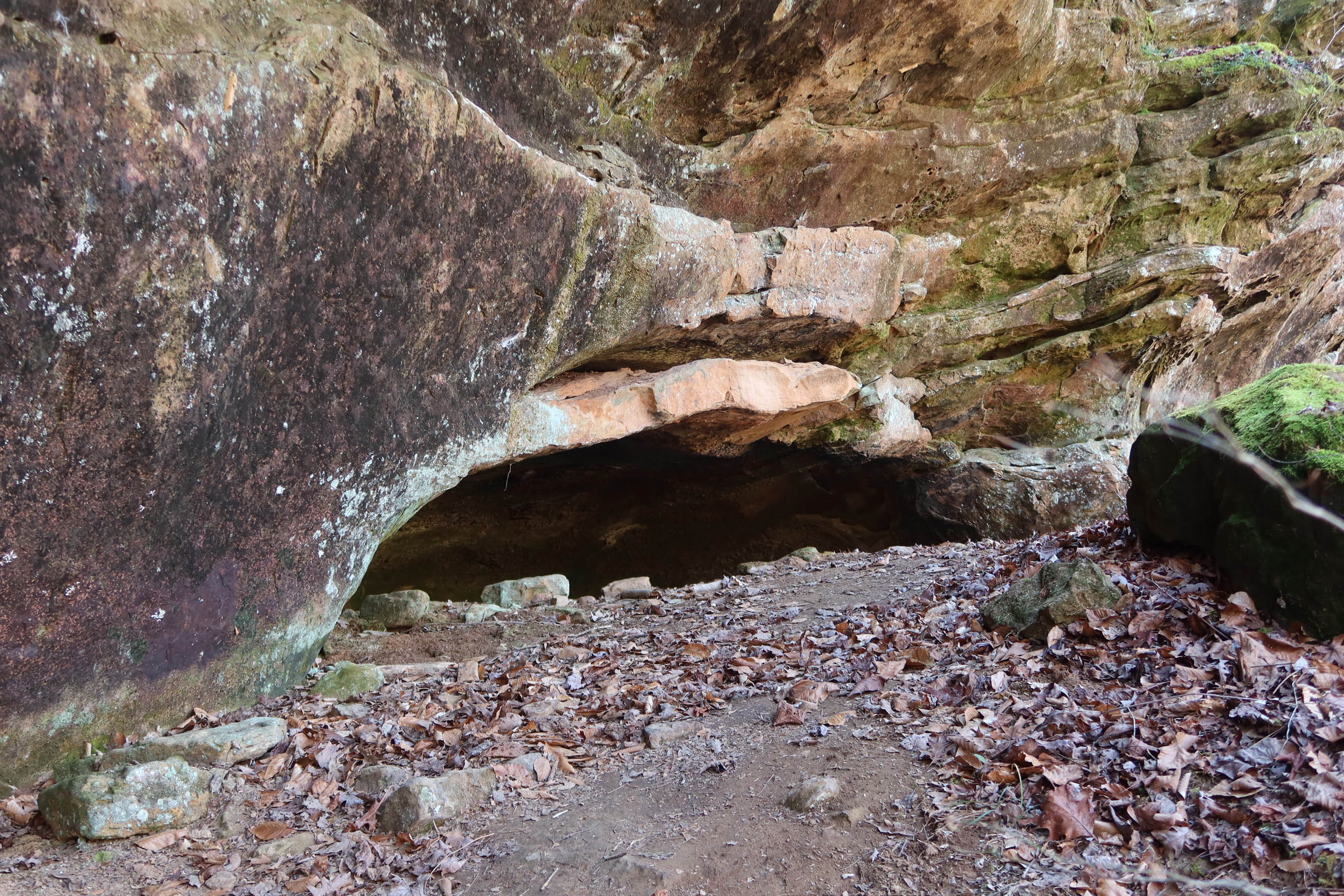
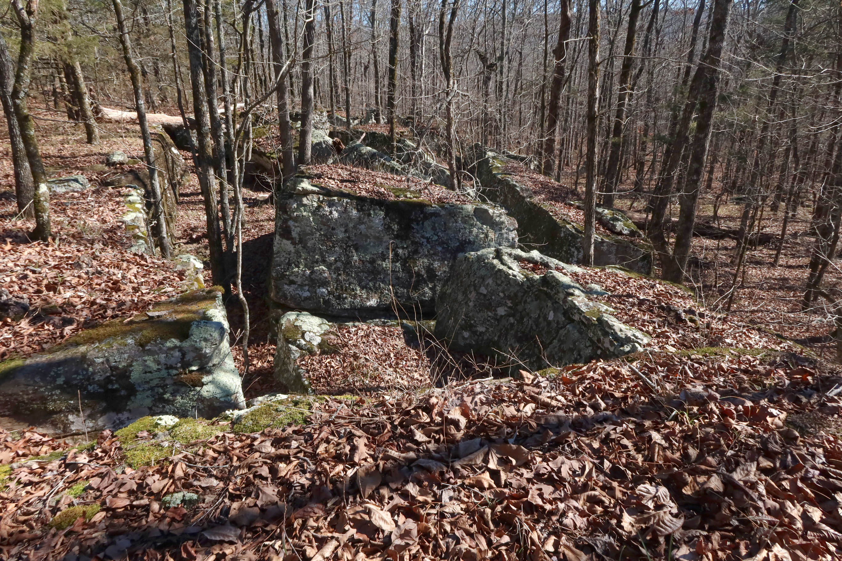
Trails around Devil’s Canyon are not established and maintained, but foot traffic and an old forest road make it possible to walk around the canyon’s edge.

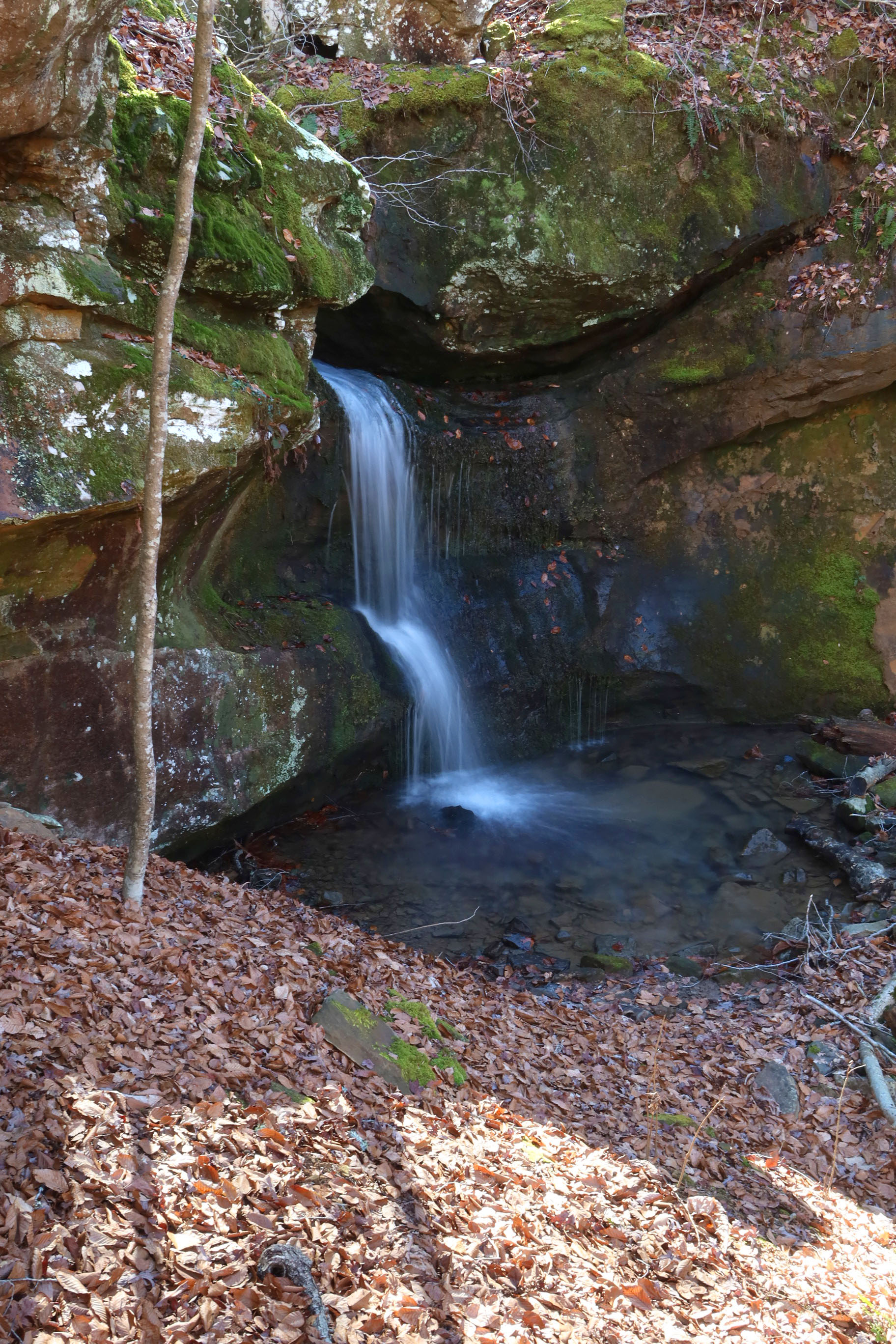
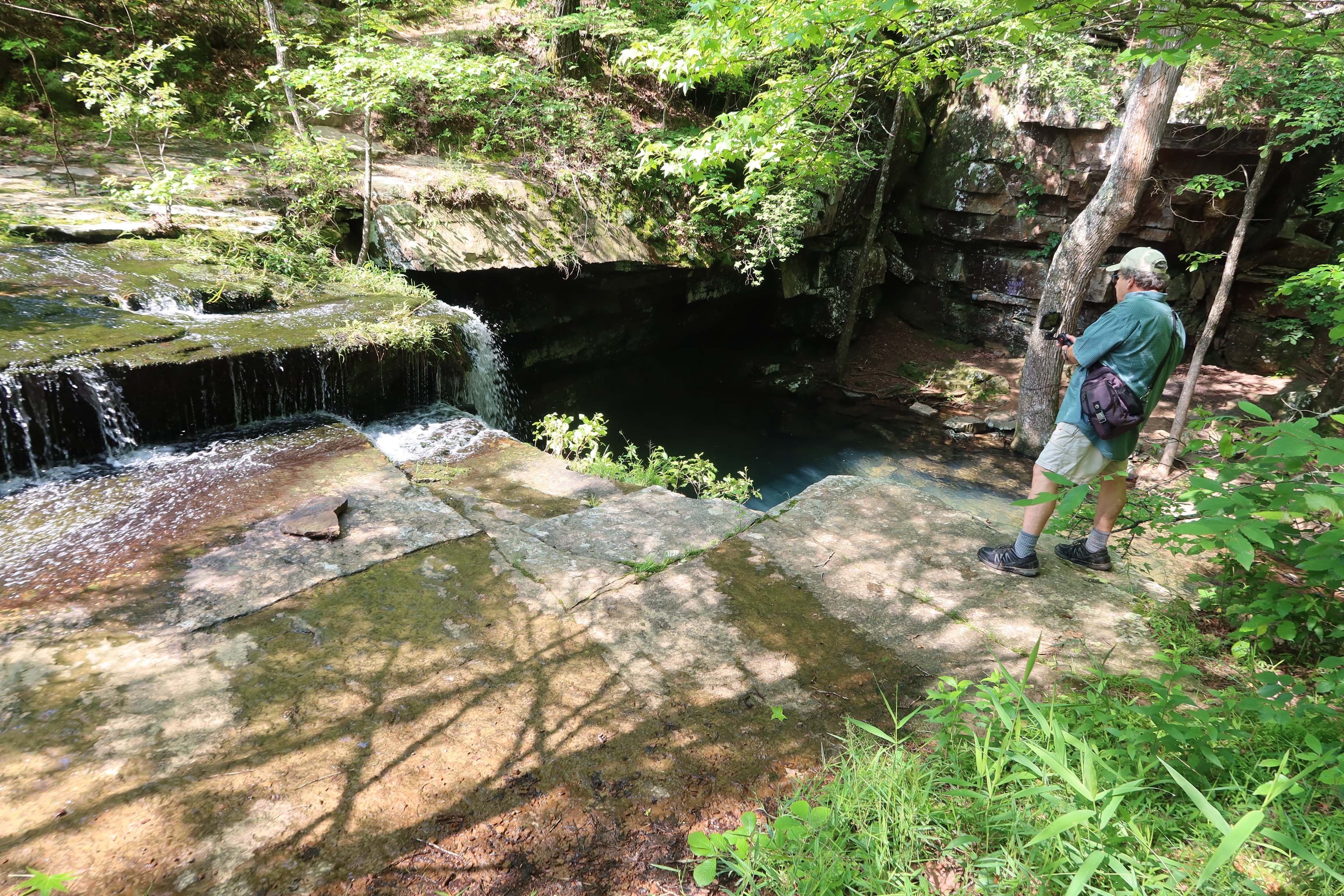
Two waterfalls are the main attractions. Devil’s Canyon Junior Falls are easy to access. If you have time, explore the boulder-filled stream bed downstream from the falls. You could make a whole day of visiting Jr. Falls and the creek above and below the falls but our goal on this particular hike was to make it around the whole loop.

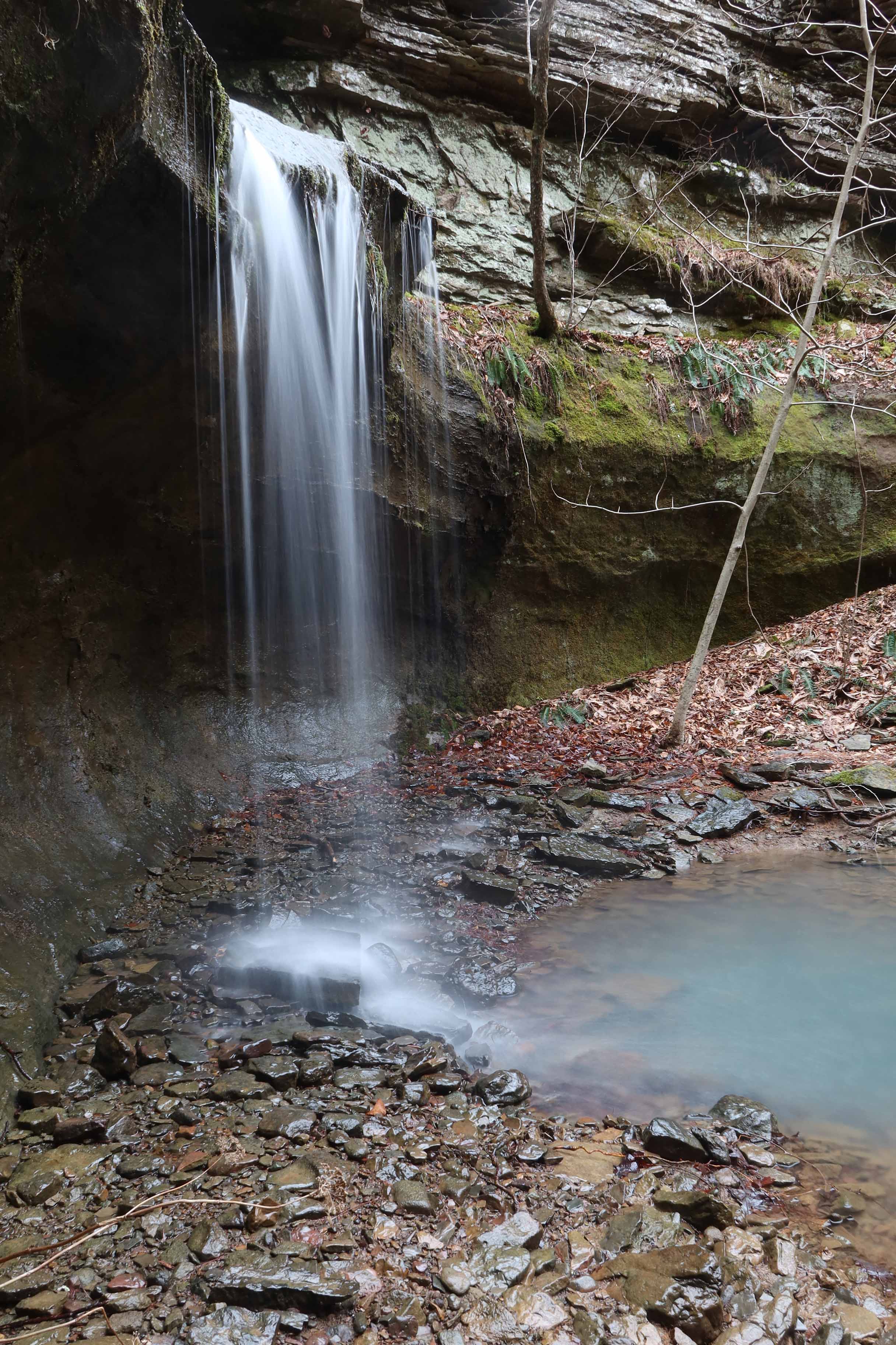
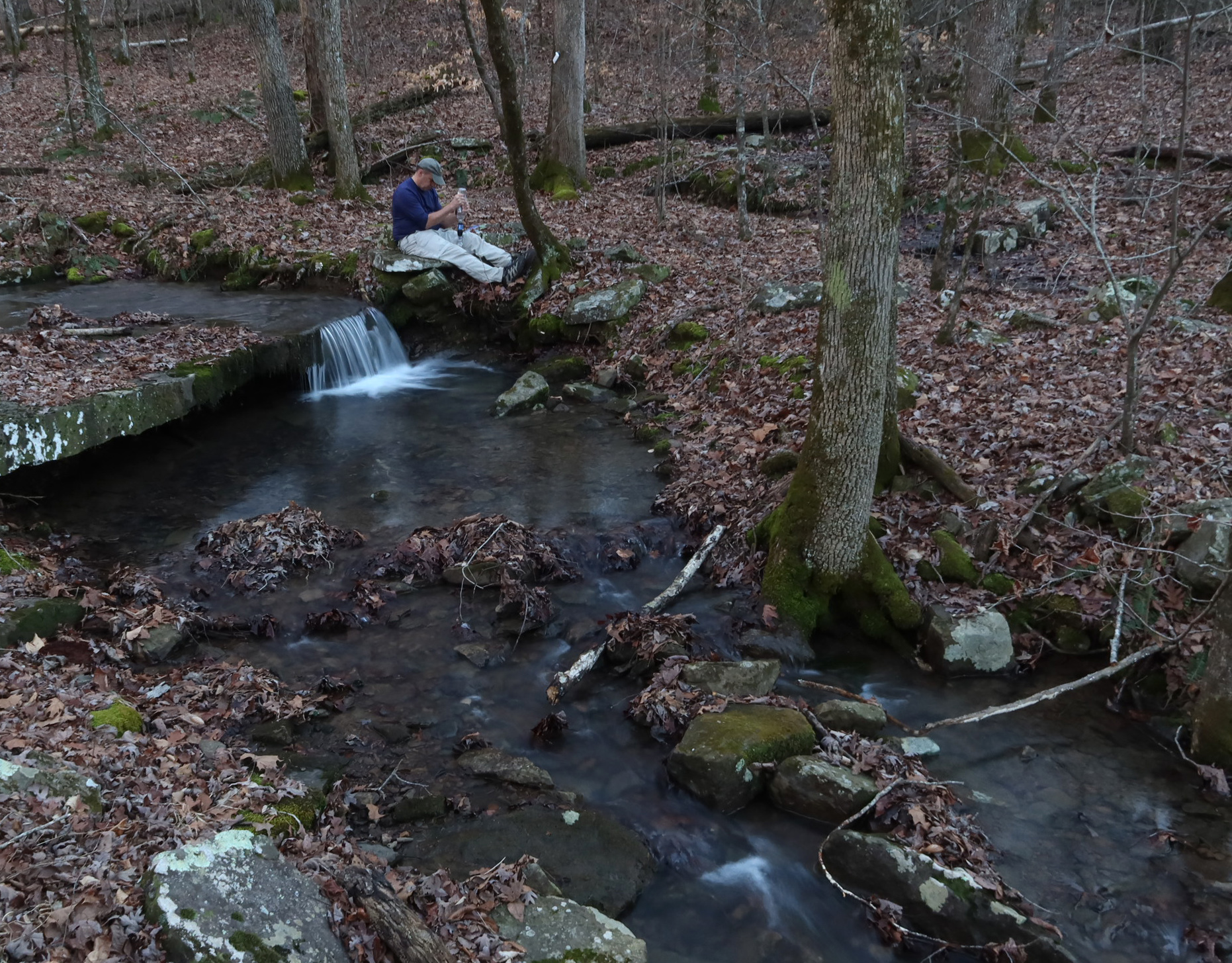
The taller and more difficult to access Devil’s Canyon Falls are on the north side of the canyon. To get to them, you’ll hike a ways and then scramble down into the canyon. A rope is tied to assist hikers and I needed it. After taking photos, I filtered water and climbed out of the canyon using the rope.

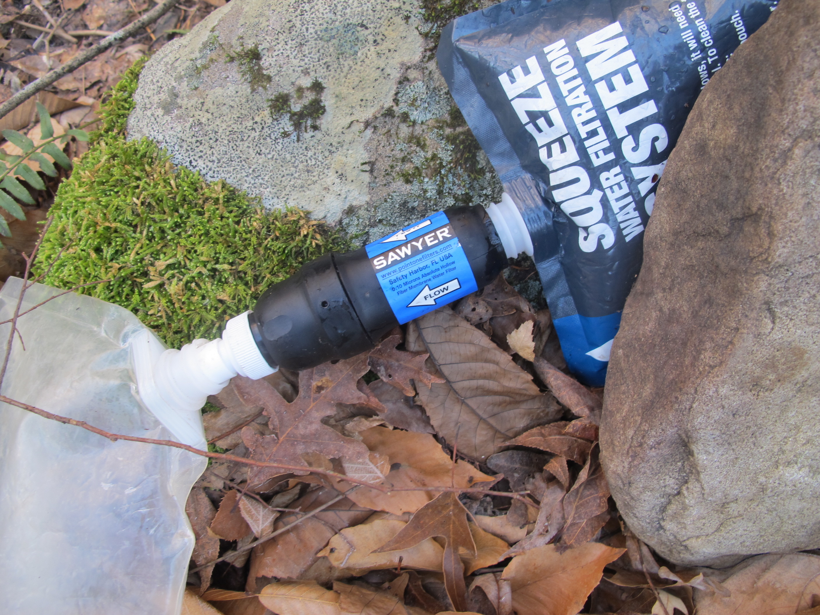
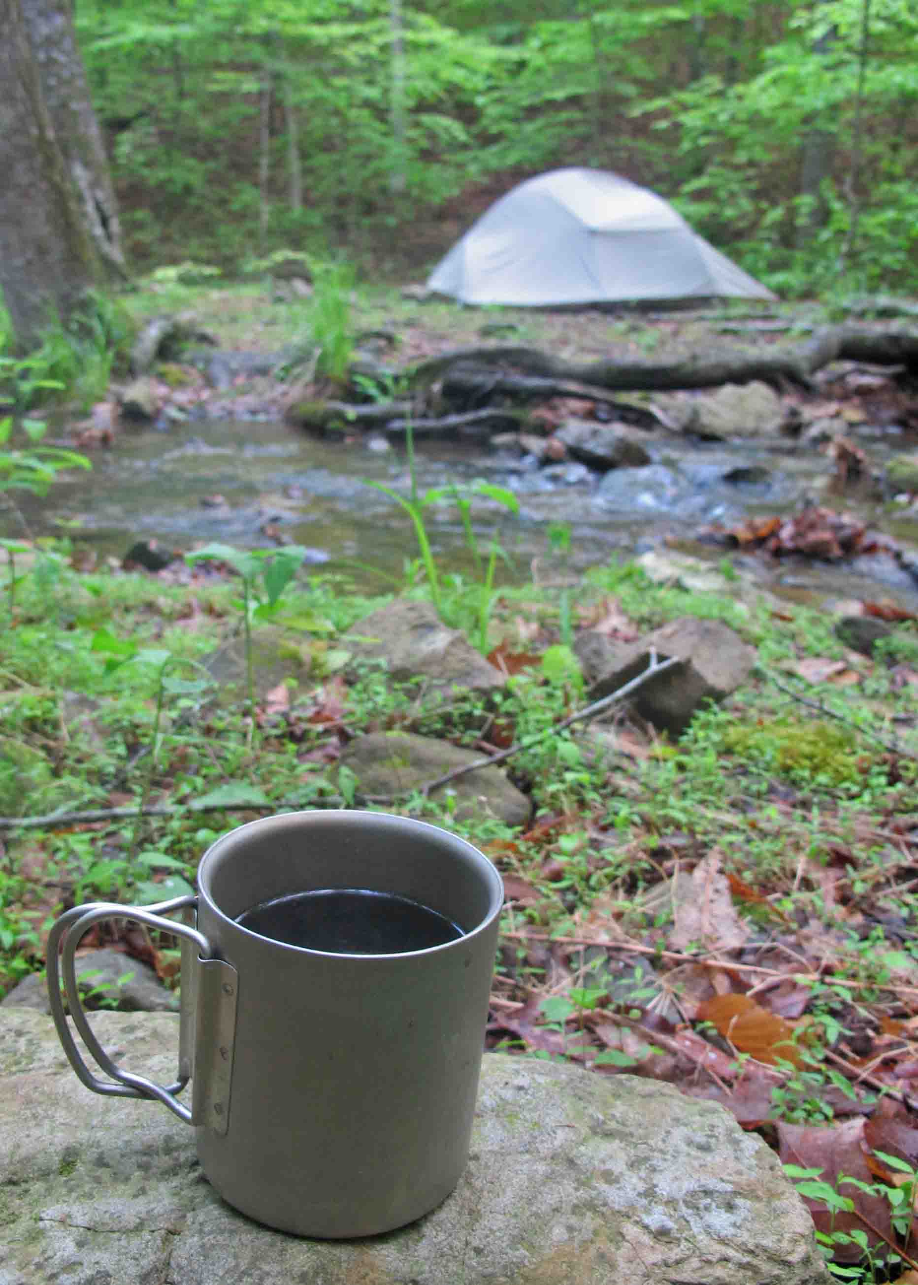
A quick word about water filters. I always carry a Sawyer in my daypack. If I know there’ll be access to water, having the filter allows me to carry less knowing I can resupply on the trail. Another benefit is being able to share water with hikers who might be running low. I don’t work for Sawyer but they make a great filter. I usually try to end a hike with some newly filtered creek water so I can make tea when I get home as a little ritual of thanksgiving for the gifts we find in the Ozarks.

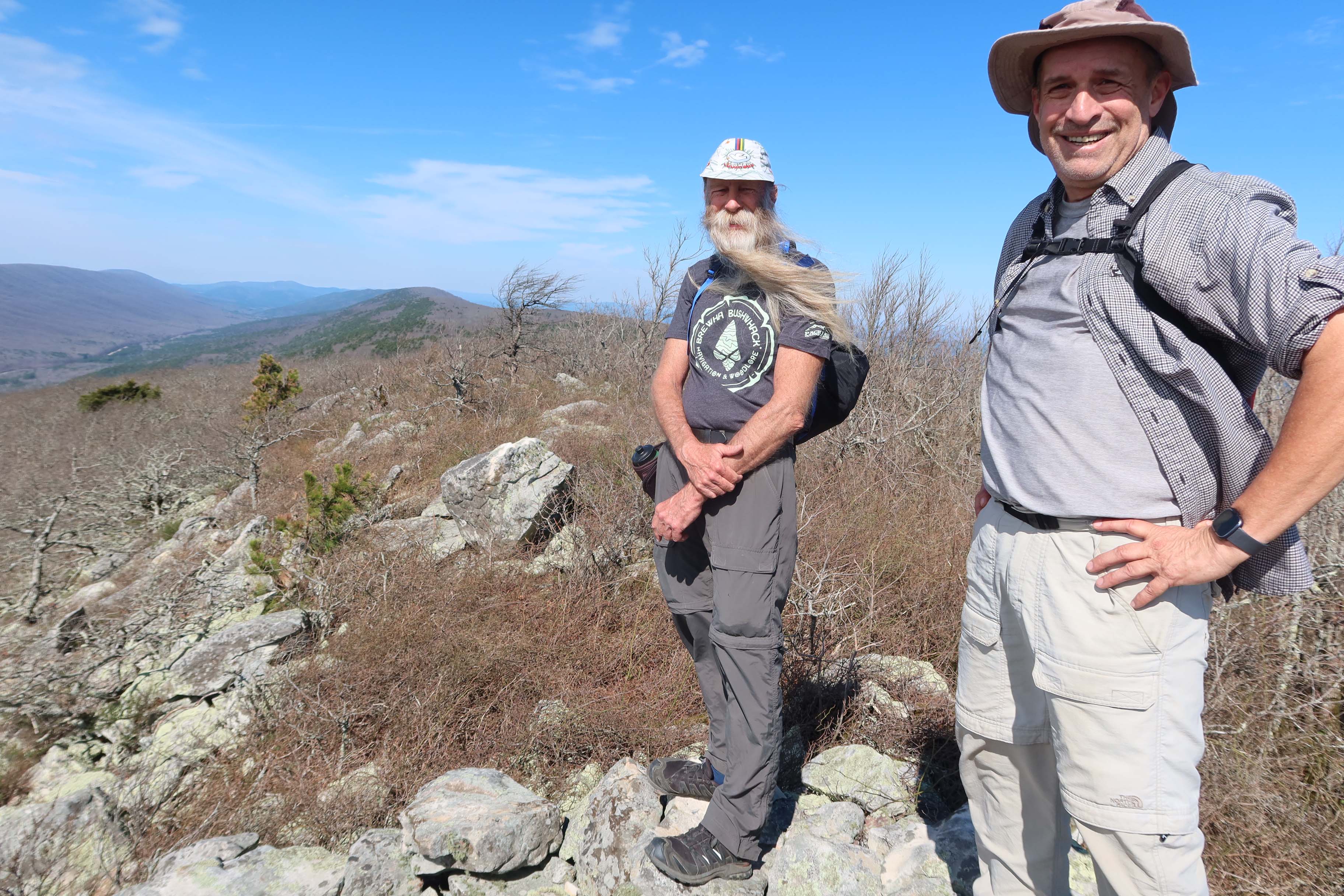
It was a great hike in Devil’s Canyon. Thanks to hike leaders John and Grant for their planning. After a short afternoon nap, I enjoyed a cup of tea from Devil’s Canyon water while looking through photos.

Black Fork Mountain

Kerry, Bob, and I wanted to hike Black Fork Mountain. It would not be our first time on this trail, but several years had passed since any of us had been up that trail. Our plan was to begin at Queen Wilhelmina State Park and hike down to where the trail crosses the Ouachita River. There we’d pick up extra water and hike to the Black Fork Shelter for a couple of nights.

Our first night was at Queen Wilhelmina State Park. We were “Glamping” with nice campsites, access to restrooms, and a restaurant close by. I almost felt guilty in my truck camper while Bob and Kerry tent camped but both options gave a good night’s sleep. I look forward to using this campground and the nearby Winding Stairs Campground again. Rich Mountain and the Queen Wilhelmina area are great camping destinations.

As we walked, I thought back to a thru-hike on the Ouachita Trail in the winter of 2018. Back then, flakes of ice hung from the trees and littered the ground. Quite a different scene now as a warm sun beat down on this spring day.

The next morning, we began working our way up Black Fork Mountain through alternating pine groves, hardwood forests, and scrub oaks along high ridges. The hardest part was following a reroute down below a rockslide. Every step down meant another uphill step later to regain the elevation lost.

The views across the valley to Rich Mountain kept us engaged as we tried to identify roads, Queen Wilhelmina Lodge up top, and a little Country Store down below. 

Thanks to occasional survey tape we were able to follow the trail without difficulty. Greenbriers clawed at us on the high ridges and we agreed this was a “long pants trail.” 

We were pleased to find an old chimney still in place along with a few rusty artifacts. I had a close look at the blade of what looked like a small hoe before returning it to where I found it. Bob found what looked like pieces of a horse or mule shoe. All items were left as we found them.

We were pleased to finally arrive at the rock outcrop that marks the top of Black Fork Mountain.

I filled my water bottle at a small murky pond less than a mile from the Black Fork Shelter. I ran that water through my Sawyer filter when we returned to the shelter and it was good! Water options up on Black Fork Mountain are limited unless there’s been recent rain so the pond is a treasured little resource.

The hike back down the mountain included that long uphill from the reroute around an old rock slide. We were thankful for every little cool breeze that came our way as we worked our way back down to Black Fork Shelter for the night. Everyone had a good appetite after their Black Fork workout.

Coffee on the Trail

I haven’t shared my current coffee on the trail. I like both of these options that leave me with a small pice of packaging to pack out. The Starbucks is more expensive and taste slightly better to me. The Mount Hagen is cheaper and taste pretty good, too. Both taste great on the trail when made with filtered water from an Ozarks stream. Until doing this post I’d never noticed the weight. Starbucks is 3.3 grams and the Mount Hagen is 2 grams. I’d have to pack a lot of coffee before weight was a factor in my decision.

I used to put espresso grind in a ziplock bag. After pouring the hot water, I’d put a teaspoon of coffee on top of the water and let it sit a minuet before stirring it and letting it settle. This was the best tasting coffee in my opinion but not as simple to make and you have to be careful not to drink the sludge at the bottom of your cup. I dispersed the sludge by adding water and spreading it over foliage.

Four-star hotel and gourmet coffee next to Briar Branch

Day Hike to Cedar Creek on the OHT

Cedar Creek is a favorite feature of the Ozark Highlands Trail (OHT). I decided it would be a good first real hike in over a week for my dog who recently had minor eye surgery. She’s been held prisoner by an Elizabethan Collar for 24-hours a day for the last full week. Elizabethan Collar seems overly poetic for something so inconvenient.

Monday morning I unceremoniously removed the plastic collar and gave Hiker-dog her freedom. Once we got on the trail, she was one happy dog!

Since this is a hike I plan to use in the second edition of Five Star Trails: The Ozarks, I took my time and made notes during the drive out to Rosetta Trailhead. I’ve driven to this trailhead before, but writing directions that others can follow requires thought and decisions about which details to include.

I enjoyed the whole walk down to the creek while watching Hiker-dog dart through the woods and occasionally following close by. We spent some time at Hobo Falls and Cedar Creek before hammering our way back to the trailhead.

Story has it that Hobo Falls picked up the name because remnants of a hobo camp were found nearby. Next time I visit, I plan to be a hobo and spend a couple of nights in the area. I noticed a nearby cave that would make an easy shelter as long as a critter hasn’t already claimed it.

The next few photos are from 2016 when a great group of trail friends camped here. Hiker-dog and I had been together for a couple of years by that time. She’s at least 12 years old now but still going strong.

The left and center photo below are Hiker-dog in 2016 when she was around three years old. The photo on the right is gray bearded Hiker-dog in 2025.

Hiker-dog at Alum Cove Natural Bridge

It doesn’t seem possible that Hiker-dog has been part of our family for over ten years now. She must be around twelve years old now but she still loves the trails and exploring.

Recently we visited Alum Cove Natural Bridge and had the whole trail to ourselves for a little while, so I let her go off leash for a few minutes, especially around the icy spots in the trail. I had visions of her pulling me across the ice as a sled and wanted to avoid that fun.

She provided me with some entertainment underneath the natural bridge as she danced and skated across the icy stream that runs through and down the bottom of the cove. As temperatures warmed, we avoided being underneath massive ice formations that could fall with the impact of small boulders.

View from on top of the natural bridge.

We took a little time to explore the areas around this natural wonder. I always marvel when facing such complex but artistic views formed mostly by water and time.

Hiker-dog liked this little cave on the other side of Alum Cove. Nice view and protection from the elements. I’m pretty certain these caves were shelters for early inhabitants of the Ozarks. While inside, we had to keep an eye overhead to be sure we weren’t walking under icicles hanging from above.

Spotting Becca at the entrance of this cave helped me realize the size.

Hiker-dog says, “Thanks for joining us.” If you’d like to read how Hiker-dog joined up with our family at mile 138 of the Ozark Highlands Trail, it’s available at Chapters on Main in Van Buren, Bookish in Fort Smith, and Amazon.com online.

Ozarks Camping and Trails on the Cheap

If you’re looking for a quiet campground in the Ozarks, the Ozone Campground is a little jewel of a location. It’s less than three miles north of the community of Ozone on Hwy 21 north of Clarksville, AR.

The water faucet at the pavilion worked in January when I visited. No guarantees but when I visited, the outlets on the pavilion were on and available to charge your electronics. The pit toilets are convenient, functional, and filled with that refreshing outhouse aroma that says you’re roughing it. 

The Ozone Campground is located right on the Ozark Highlands Trail (OHT). From campsite #5, it’s a short walk downhill to the trail register. From there either direction promises a beautiful hike. You can make it as strenuous as you like by customizing the length and your pace. The OHT is open to foot traffic only.

 After taking a close look at Camp Ozone, named for the CCC Camp that once stood here, I decided the next trip would include camping. Where else can you get a campsite like this in a beautiful location for $3 a night ($1.50 with a senior pass).

Hiker-dog and I did an out-and-back on the OHT down alongside Little Piney Creek for 3.5 miles which gave us a 7 mile hike with a good workout on the climb back up to the campground.


Had a great meal at the Burger Barn a couple of miles south on Hwy 21 in the community of Ozone. A couple was just finishing when I stopped there and another couple was ordering about the time my catfish plate was ready. That seems pretty busy for a small town in the Ozarks of Arkansas.

The Ozark Highlands Trail from Arbaugh to Morgan Fields (27-miles)

Wolf Ridge overlook

Sometimes life gets complicated and backpacking moves to the back burner. There’s plenty to fill the space with trail maintenance, day hiking, finding new trails, playing music, and family obligations. All of these things are important and worthy of attention, but for me to be my best self for others, it’s essential to get out there for a few nights on the trails when possible. 

A couple of longtime friends and I planned a trip but temperatures for the week we had in mind were going to be into the single digits so we decided that might not be a good plan for our first backpacking trip of the winter. Our good friend, Bob, had a scheduling conflict by the time temperatures returned to normal, so it was just Kerry and me for this one.

I spent the night before at Redding Campground, so I’d have a short drive up Morgan Mt. Road on Tuesday when we started out. There was only one other camper there on the other side of the campground, so it felt like I had the place to myself. This is a great little campground without any hookups. There’s a connecting trail to Redding Loop and Spy Rock Spur. 

stove

I fixed a REAL breakfast Tuesday morning with a new stove. I like this stove! It’s like being in a kitchen when compared to my backpacking Esbit Cube stove. 

Esbit stove
Esbit stove and wind shield

We looked at several options. We settled on Arbaugh Trailhead north of Oark hiking west to Morgan Fields for a total of 27 miles. The first 3 miles are Kerry’s adopted section of the Ozark Highlands Trail. Since he had family obligations in the fall, a group of his friends gave his section some attention. I wanted him to see the good work we’d done. Kerry has hiked that section 48 times or more over the years between leading hikes and maintaining. But we both agree, it never gets old. 

Kerry looking down into Lynn Hollow and enjoying a well maintained trail.

The trail descends past a new low impact campsite and then to Lynn Hollow crossing. This whole area is beautiful, especially when water is flowing as it was when we walked through. If you ever need a short over-nighter or shakedown trip, camping here and exploring the Lynn Hollow area would be a good option. 

Lunch spot close to MM66

We hiked 11 miles to the west and camped at MM59, Wolf Ridge. This is a popular spot with plenty of tent sites, a well-established fire ring and great view. 

Filtering water at Wolf Ridge

The small stream close by has never been dry, even during the driest of falls. 

Wednesday, we hiked 9 miles and camped at Indian Creek. While passing through the Marinoni Scenic Area, we met the only other backpacker we’d see over our three-days on the trail. 

On Thursday, we hiked seven miles. We were feeling the climbs, even slight, but the open woods and running streams were a pleasure every step of the way.

Our three-days on the trail ended at Morgan Fields Trailhead. We were tired but already looking forward to our next walk on the Ozark Highlands Trail. 

Luxurious Ouachita Trail Base Camp


IMG_1901rr

Mountain Thyme B&B, a beautiful base camp for the Ouachita Trail

Mike and Rhonda, owners of Mountain Thyme Bed & Breakfast, probably didn’t select their property specifically because it was two miles south of the Ouachita Trail’s intersection with Scenic Highway 7, but I think it was a brilliant choice! If Becca and I truly want to get away for relaxation balanced with exercise, the Mountain Thyme “Base camp” is ideal. Rooms are reasonably priced, and the best part is that there’s nothing to do there but relax and enjoy the woods, delicious breakfasts, and afternoon cookies.

IMG_2090rr

Yogurt and granola to be followed by omelet and sausage

A future trip on my to-do list involves covering the Ouachita Trail from it’s beginning in Oklahoma and concluding the extended backpacking trip with a stay at Mountain Thyme for some post-hike pampering. I’ve told Rhonda and Mike they could hose me off in the yard before letting me inside. This visit was for the celebration of our wedding anniversary and a chance for some early morning day hikes.

IMG_1910rr

Short Mountain overlook on Hunt’s Loop

Hunt’s Loop Trail begins at Iron Spring on Hwy 7 and climbs Short Mountain before intersecting with the Ouachita Trail. Hunt’s Loop has become a favorite over the years and is one of those trails you enjoy doing in all seasons and conditions.

IMG_1971rr

Stream running through Iron Spring Recreation Area with remnants of an iron water gate installed by the CCC.

I’ll hike Hunt’s Loop in different directions to add interest. If I have a little extra time and want some more miles, I’ll tack on the 1-mile out-and-back to the Moonshine Shelter on the Ouachita Trail. No evidence of a whiskey still but a nice place to take a break and read a few entries in the shelter journal.

Moonshiner Shelter 0616

Moonshine Shelter

I like to walk Hunt’s Loop early and then make it back to “base camp” in time for breakfast. At 6:15 p.m. on our most recent trip, I surprised a black bear a few yards off of the trail, or as I said later, “the bear surprised me.”  I heard a low huff and looked toward a pine sapling thicket to see the back side of a black bear’s head and shoulders as it tromped quickly out of sight. I’d never heard that type of stomping on the ground before. I was pleased to have seen my first Ouachita bear! No photos. Barely got a look with the two lenses in my head!

Iron Spring is a great place for a family picnic or a restroom break when driving down Scenic Highway 7. There are pit toilets, but no drinking water unless you filter out of the creek.

GPS for Mountain Thyme B&B “Base Camp”

34°45’05.7″N 93°03’35.0″W

GPS for Iron Spring Recreation Area and location of Hunt’s Loop Trailhead

34°45’44.5″N 93°04’15.4″W 

Just to clarify, I don’t do product or service endorsements. I just like the place!

A few more scenes…

Random Walking with John Muir in the Ozarks

IMG_0082rr

Detail of ice formations at the base of a bluff

I drove up AR 23 (AKA Pigtrail) to collect GPS waypoints for an article I’m working on with photographer and hiking friend, Eric Scowden. My only traveling partner today was Hiker-dog. It was a cold morning, but the sun warmed the air quickly. I enjoyed the “popcorn” ice formations that formed on roots and rock along wet bluff lines.

This morning was like many others over the last eighteen months. I have places to go and data to collect. Working on a trail guide to the Ozarks has been a wonderful experience, but every outing’s purpose has been to hike and collect information about specific trails. I had my to-do list for today though it was shorter than usual.

After hitting the required locations, I picked a random pullout spot on Morgan Mountain Road that I’d driven past many times. On impulse, I walked down an old jeep road just to see what was there. I didn’t jump over a fence but thought of John Muir’s statement that he would often “throw bread and tea in an old sack and jump over the back fence” to begin an exploration of nature.

IMG_0111rr

Large boulders at the edge of an open field

I was surprised at how much I enjoyed the randomness of this walk. I formed my route by following what looked interesting to me. I arrived at an open, level field lined with large boulders along the eastern ridge. They bowed to the forces of gravity, drifting down toward the next bench fifty feet below.

IMG_0116rr

Hiker exploring the field on the eastern side of Morgan Mountain

I walked past a hollow filled with jagged boulders that begged me to enter, but they’ll have to wait for another day when I return with a dry loaf of bread, tea, and hours to spend. I’d like to apply Muir’s “method of study” and his ultra-light packing techniques to my next hike on Morgan Mountain.

“My method of study was to drift from rock to rock and grove to grove. I’d sit for hours watching the birds or squirrels, or looking into the faces of flowers. When I discovered a new plant, I sat beside it for a minute or a day, to make its acquaintance and try to hear what it had to tell me. I asked the boulders where they came from and where they were going. And when I discovered a mountain, I climbed about it and compared it with its neighbors. It’s astonishing how high and far we can climb in the mountains we love, and how little we require for food and clothing.” – John Muir

I look forward to spending an entire day meandering my way down that rugged hollow on Morgan Mountain. I look forward to simply sitting still to listen, watch, and learn. Maybe I’ll even ask a boulder or two where they came from and where they’re going. I think even Hiker-dog might enjoy a little less goal-oriented travel in the Ozarks.

IMG_0132rr

Rock House on the Ozark Highlands Trail Revisited

IMG_5349rr

We began at Cherry Bend Trailhead on AR 23 hiking the Ozark Highlands Trail to the west and stopped at the Rock House before continuing toward Fane Creek. Today I remembered the cold and rainy day when Bob and I sought refuge here on our thru-hike of the OHT. Later in that trip we found Hiker-dog. I should probably plan a camping trip at the Rock House for her in the future.

Today, Bob and his wife, Dana along with Mary, Mike, and his granddaughter took a few minutes to pause and have a look. Below are a few photos from today’s visit that you might enjoy. For a little history of the Rock House, visit my earlier post, Rock House on the OHT.

IMG_5367rr

Hiker investigating the Rock House 

IMG_5352rr

IMG_5373rr

Spring in the back corner

IMG_5382rr

Wondering how much longer this stone will stay in place. 

IMG_5384rr

Hiker seemed to be saying it was time to go.