By Jim Warnock – Published in the @Urban Magazine (now Do South Magazine) of Fort Smith in October, 2012

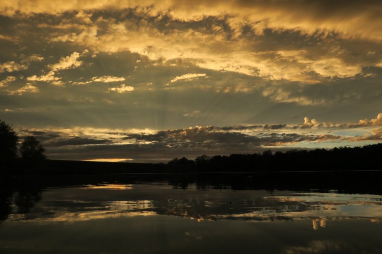
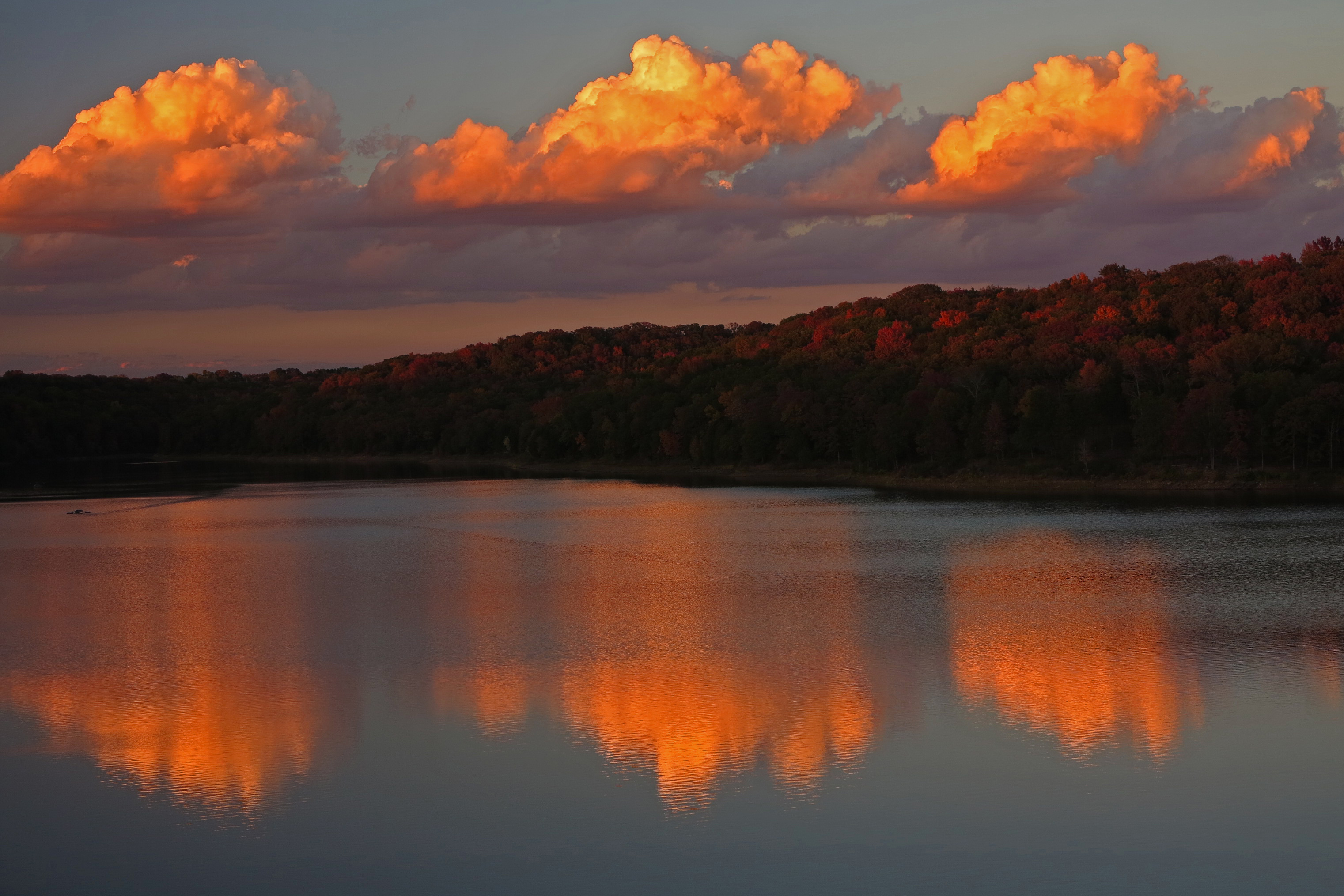
Lake Alma Trail at sunset.
Whether you’re a parent looking for an easy day hike to introduce your children to the gentle pleasures of nature or a trail runner looking for a heart-throbbing, rock-hopping, scrambling good time, Lake Alma Trail is for you!
Chuck Dovish, of Exploring Arkansas with AETN, said, “It’s amazing that so much variety and diversity of scenery is found right inside the town of Alma.”
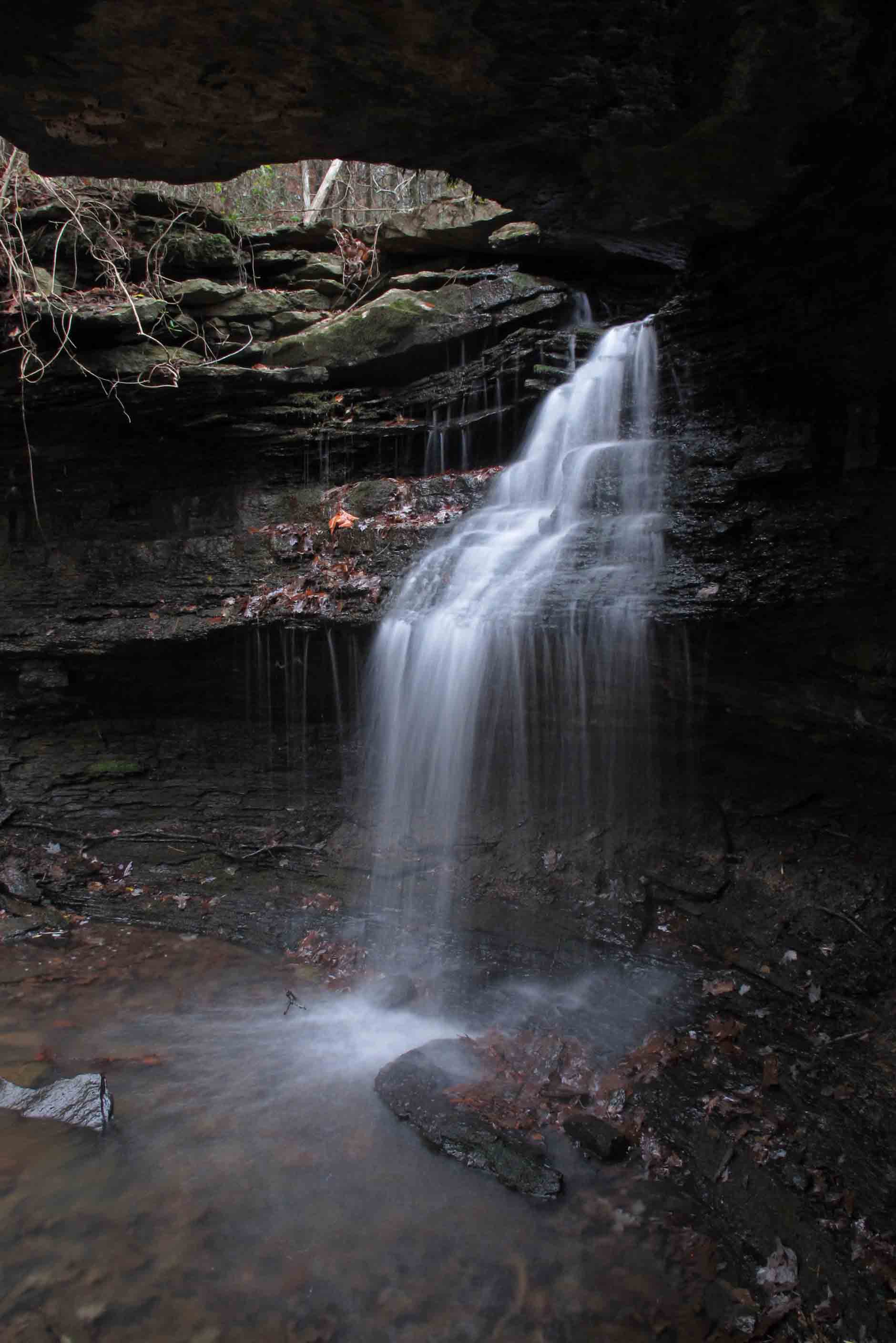
Step onto this little 4-mile trail and your eyes are in for a treat. You’ll see bluff lines and moss-covered boulder fields up close. You’ll walk beside clear streams, rocky cascades and small waterfalls. Situated within a diverse mixed hardwood forest, you may spot deer, rabbit, fox, great blue heron, and a variety of songbirds. Watch your step and give right-of-way to the many terrapin turtles that call Lake Alma home.
On any given day you’ll find families out for a stroll or a nature walk and picnic lunch at McWater Falls, just twenty-minutes into the trail. Said one father, “I want my kids to know how beautiful and fragile our environment is. When they see Little Frog Bayou and realize this is the source of our drinking water, they’ll become caretakers and protectors of places like this.” History buffs will enjoy exploring rock structures located just past mile one. Mystery surrounds the “when” and “why” of these structures which include a small hexagon rock house with fireplace.

Old homesite hexagon house
Continue down the trail and you’re likely to encounter trail runners soaring up “little bluff scramble” and churning around the whole loop in preparation for competition. “I love this trail! It allows for an intense workout in a short amount of time and the scenery makes even the hills enjoyable!” said Tommy Griffin, a local runner. Hike early and you’ll see locals trotting slowly and carefully along the rockier paths preparing for future marathons or just enjoying a morning workout and quick dose of nature.

Trail runners

Harry visiting with Chuck Dovish at Lake Alma as trail volunteer,Laura Seal, looks on.
The beginnings of Lake Alma Trail can be traced to longtime resident, Harry McWater. The idea of a trail around the lake occurred to him during the late 1990s as a member of the Alma City Council. He mentioned the possibility several times only to be told that money for such a project wasn’t available.
Then, about a year ago during a conversation with the mayor he asked, “What if I find volunteers to get that hiking trail built?” Mayor John Ballentine said, “Go for it!” With that, Harry sought expertise and labor from the Arkansas Master Naturalists, Ozark Highlands Trail Association and local volunteers, including Alma School District student organizations and scout troops. Students were enthusiastic about the project. Nathanael Mickelson, then a senior Student Council member said, “I can’t believe I have a hiking trail three minutes from my house!”

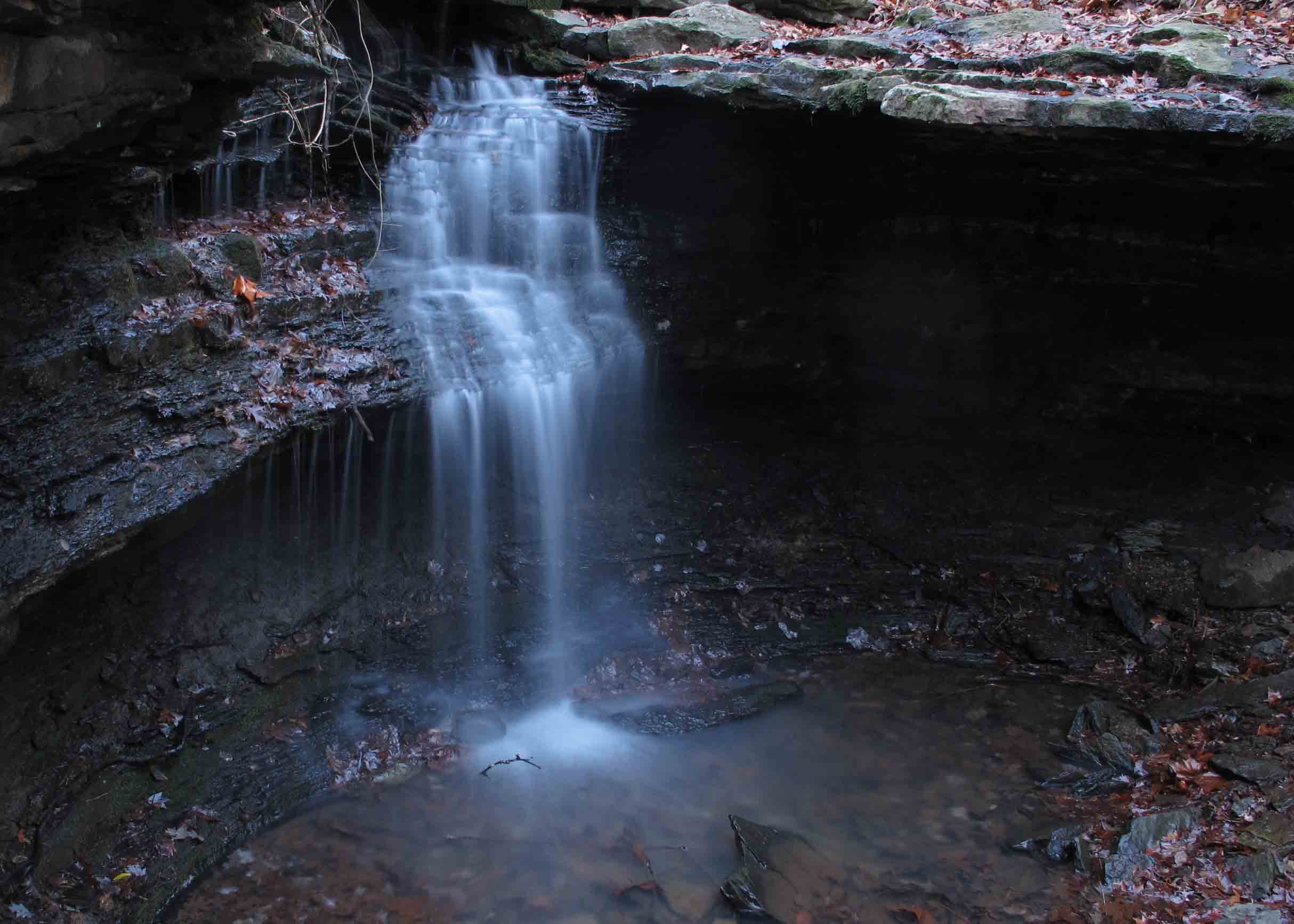
McWater Falls (approx. 12-feet)
The actual work began in March of 2012 and the forward momentum that followed was undeniable. Since that time well over one-hundred pairs of helping hands have spent time making this trail a reality. Volunteers blazed and cleared the route. There was side-hilling, raking, and general cleanup to be done. With each workday, a deeper beauty was revealed. As the route became established, hikers’ feet helped firm up the tread and keep it open. One volunteer said, “It’s like remodeling your kitchen. You use it before it’s finished. Maybe it’s never really finished.” The work continues as constant improvements are made.
The best trail maintenance is use! Give your concrete-weary feet a break or drop the cumbersome baggage of civilization for a few hours. Relax beside a clear, cool stream or let your mind wonder about the early inhabitants of the “hexagon house.” Whatever your reason, Lake Alma Trail is ready to greet you in all its beauty and variety.

Logo design, Ashley Campbell
Getting There Take Alma Exit 13 off I-40, then drive north on Hwy 71 to the first light. Turn right onto Collum Lane East then left onto Mountain Grove Road. Go north past the Alma water tanks on the left then a quick left into a picnic area. The trail begins at the fishing dock. Walk the paved Nature Trail north with the lake to your left. The Lake Alma Trailhead is at the north end of the paved trail where it turns sharply back toward the picnic area. Read the information sign built and installed by volunteers with some help from the City of Alma. If you hike the whole 4-mile trail, you’ll come back to the fishing dock from across the dam. A shorter family-friendly hike is the forty-minute walk to the waterfall and back. To get more information about Lake Alma Trail and volunteer opportunities, follow updates from the Lake Alma Trail Facebook page.

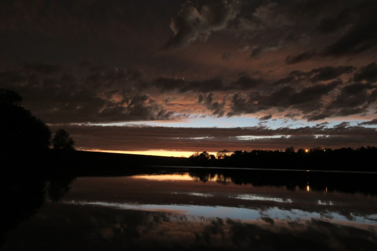
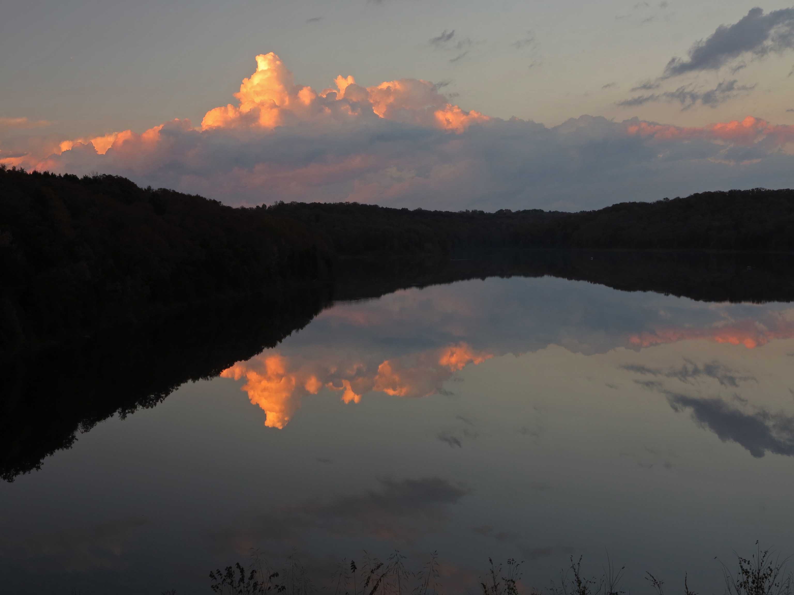
Springtime reflections on Little Frog Bayou

Bridge over west creek built by volunteers, Joe and Laura

Lake Alma fishing dock