Just perfect!

IMG_3727rr

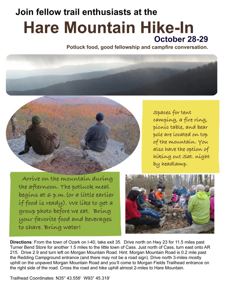
Hiker-dog and I needed a nice long dayhike. The expected rain began about one hour into our hike. The temperature hovered around 44-degrees. Just perfect!

Dogwoods provided accents across the forest understory. I paused to take a photo of a single bloom, causing Hiker-dog to return and do her head-cocking routine as if to say, “What are you doing and why aren’t you making a better pace?”

IMG_3715rr

IMG_3738rr

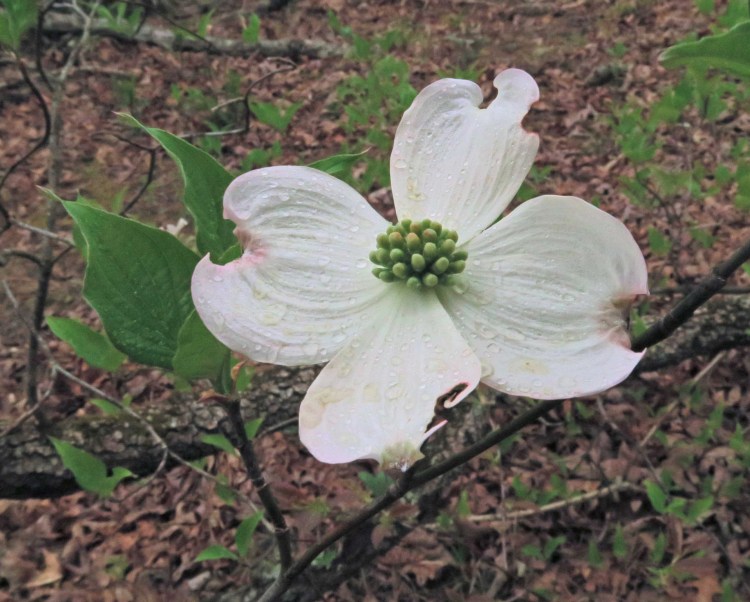
Dogwood on a chilly cloudy morning

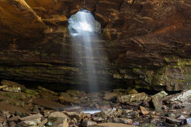
In spite of the thick foliage, I was able to see Spy Rock bluff on the next ridge and looked forward to being there soon.

IMG_3708rr

Spy Rock bluff in the distance

IMG_3719rr

The trail route is clearly marked and signs give good guidance in spite of the ax damage to the Spy Rock sign on top.

Rain increased a little and temperatures seemed to drop though it was probably the strong winds that made if feel colder. I stopped on the spur to Spy Rock to retrieve my windbreaker and a snack when a trail runner approached in the opposite direction. She seemed happy to see Hiker-dog and flew by. She would be the only person I saw on the trail on this day that many would call a bad weather day. For us, it was just perfect!
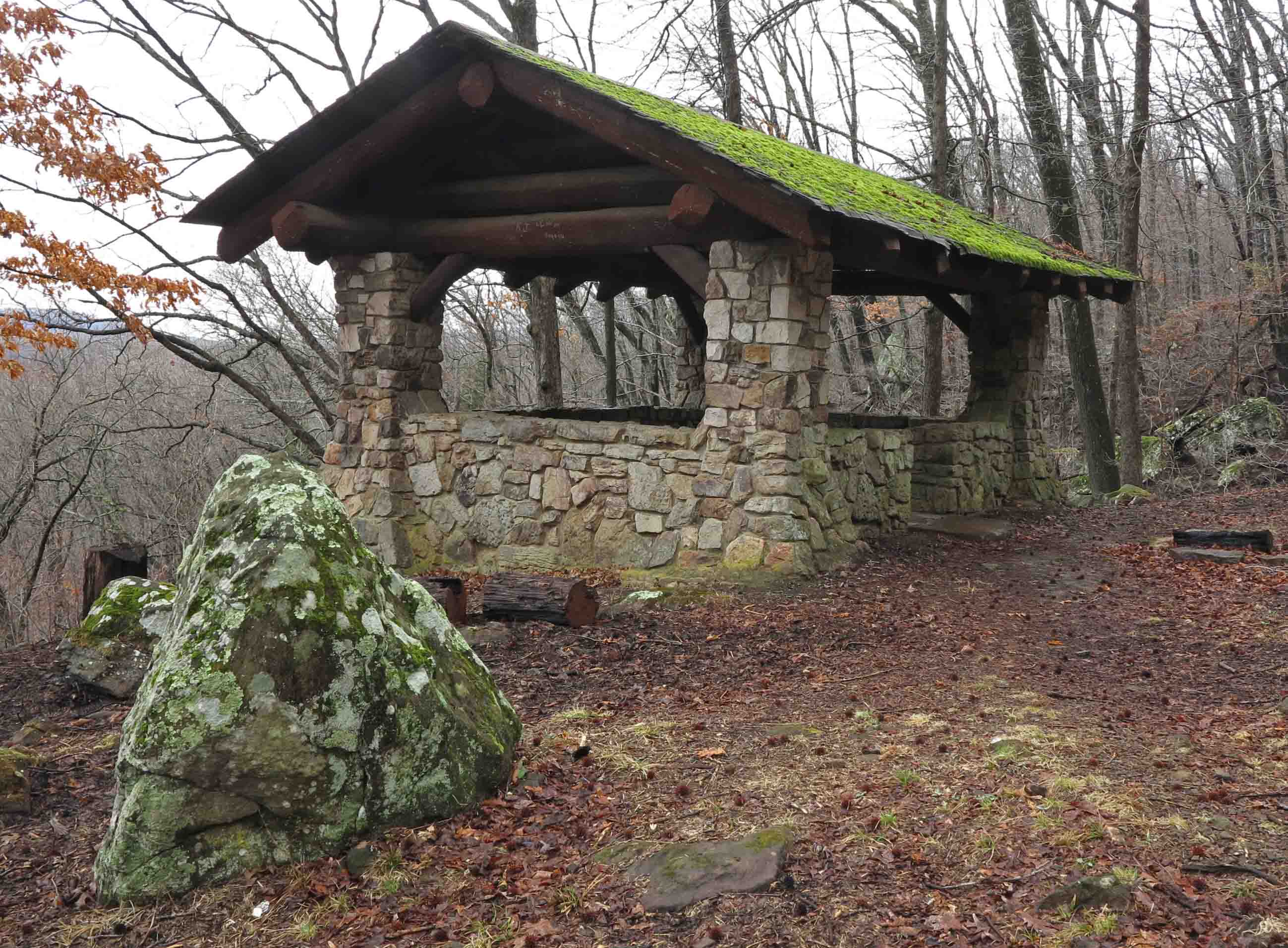
IMG_3725rr

View from Spy Rock

IMG_3731rr

Spy Rock didn’t disappoint even on this overcast and hazy day. Distant pine groves and new spring foliage provided colorful accents across the expansive forest. Hiker-dog found fresh water pockets on the flat rocks atop Spy Rock Bluff. She seems to always have proper respect for high bluffs, stepping with care when she’s close to the edge.

Speaking of pine groves. On this 8.3-mile loop hike, you’ll pass through several patches of pine, a treat for the feet because of their thickness and the soft pine needle forest floor. Smooth, easy walking!

IMG_3747rr

You’ll see several open fields above the trail providing food for deer and visual variety for us humans. I want to do this trail before dawn and sit quietly at the edge of one of these fields to see what wildlife comes around.

IMG_3748rr

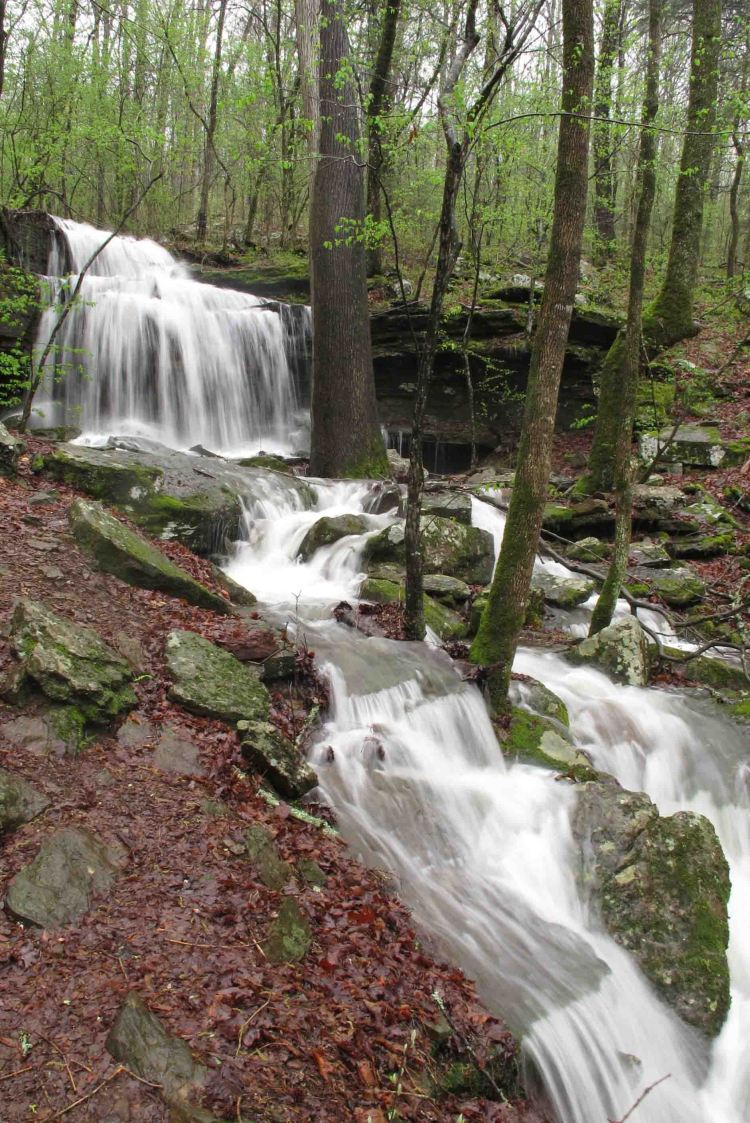
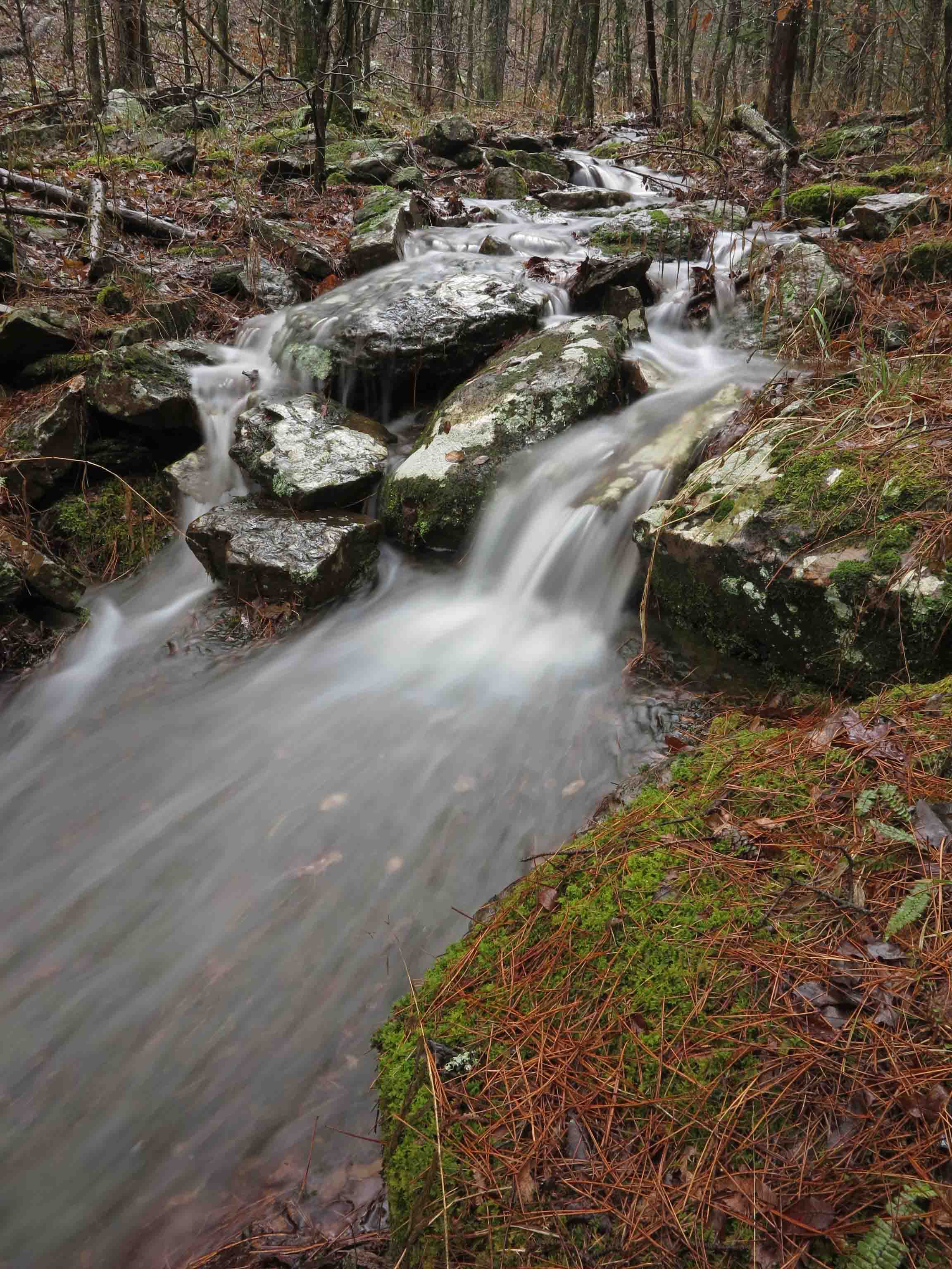
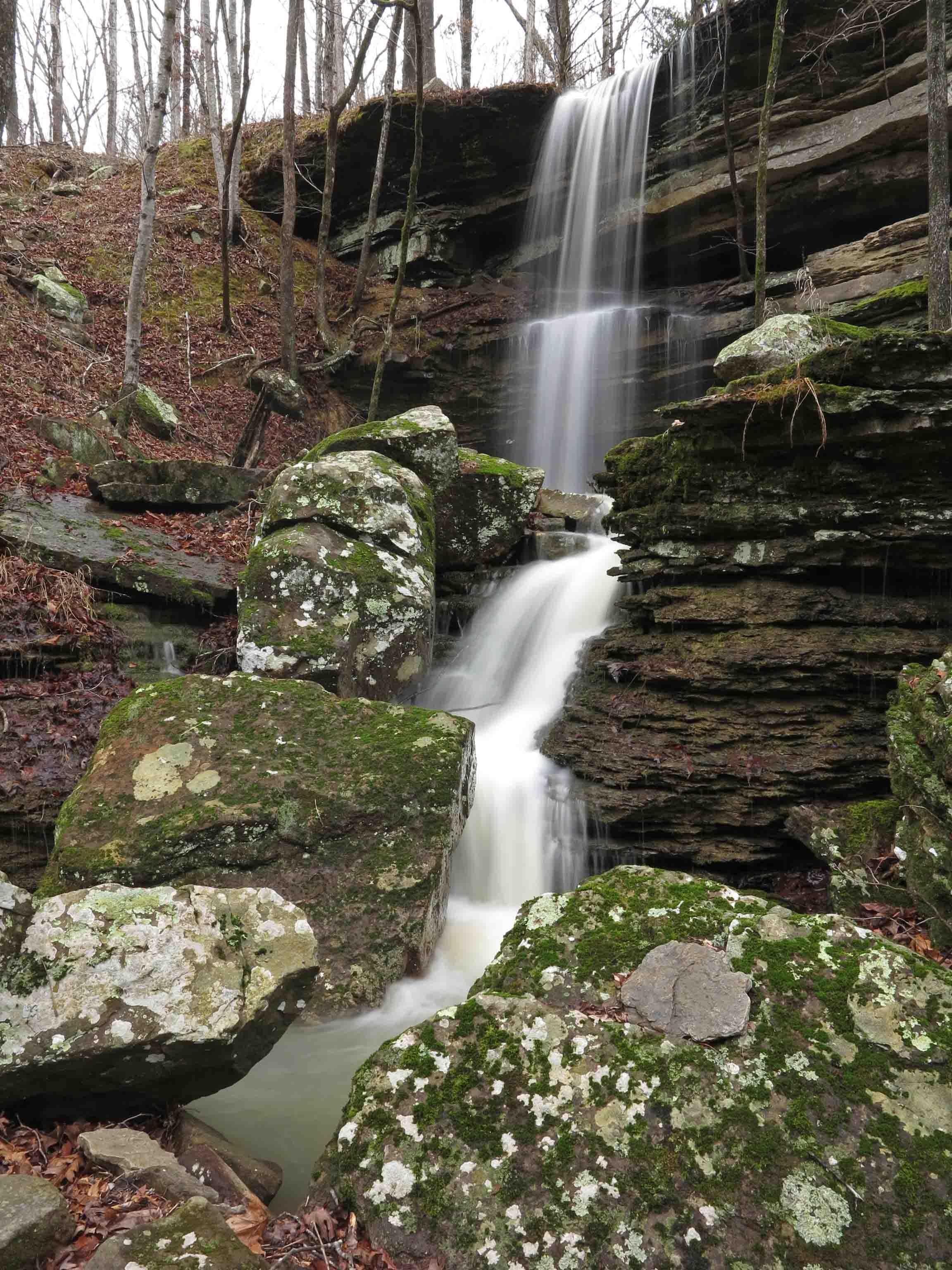
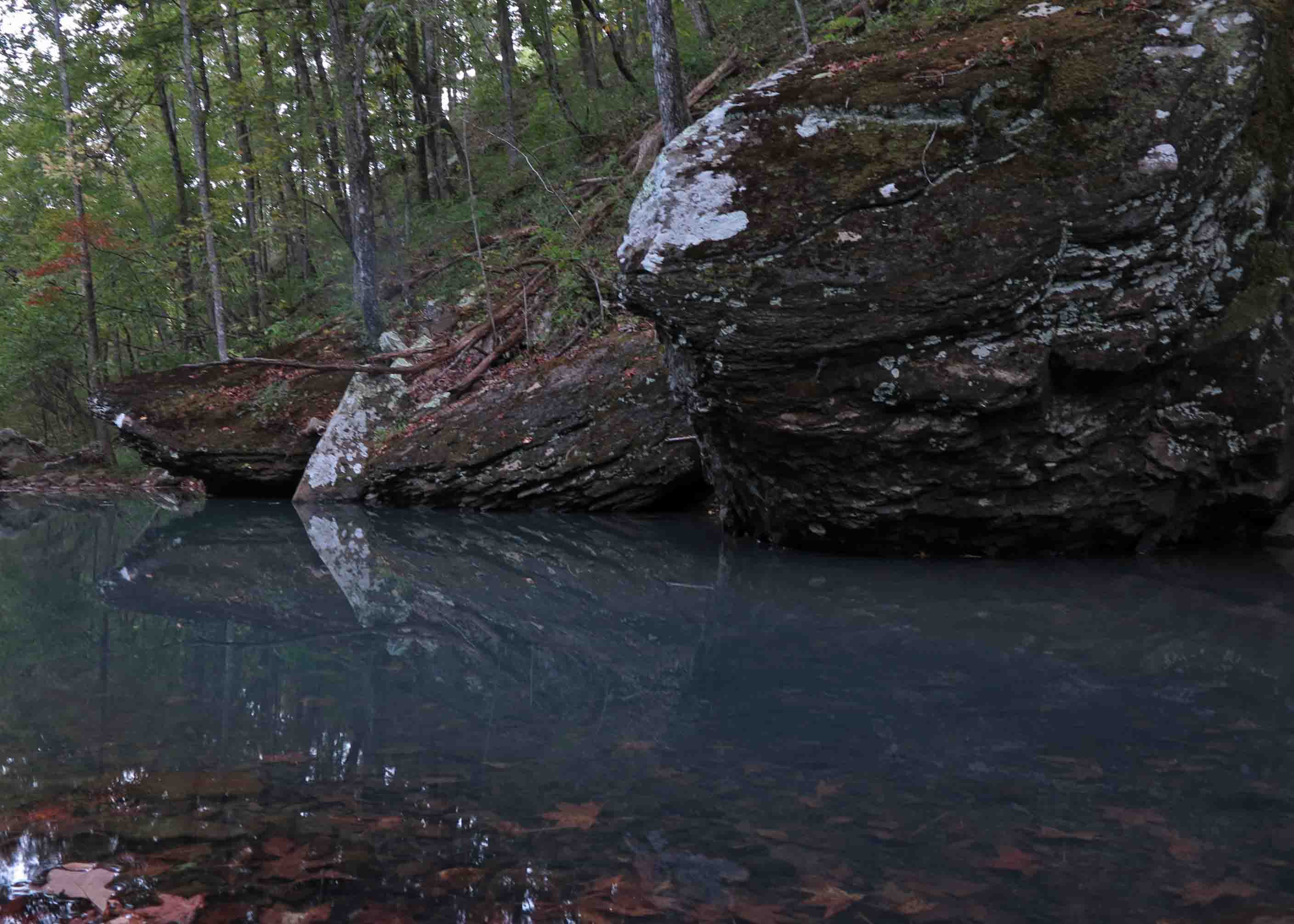
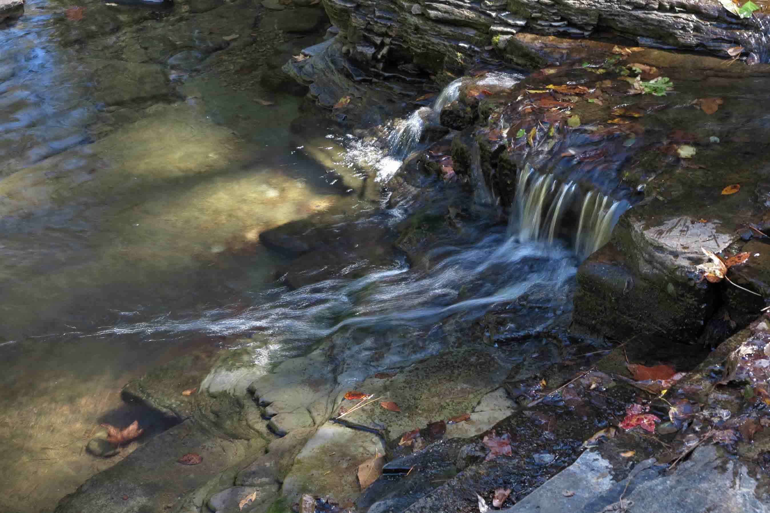
Small streams contained water today, but waterfalls were mere trickles since new rains were just beginning. When I passed Redding Loop Falls, I thought of an earlier trip when we were writing Five Star Trails: The Ozarks. Taking photos of this little waterfall for the book was a special memory because Hiker-dog was totally puzzled by my decision to hang out in this hollow for 30 minutes. One of the resulting photos from that time made it into hike #5, Redding Loop Spy Rock Trail.

redding-loop07-new

Photo from page 44 of Five Star Trail: The Ozarks

I enjoyed every part of doing this book and was especially proud of the maps and accurate route descriptions.

IMG_3781rr

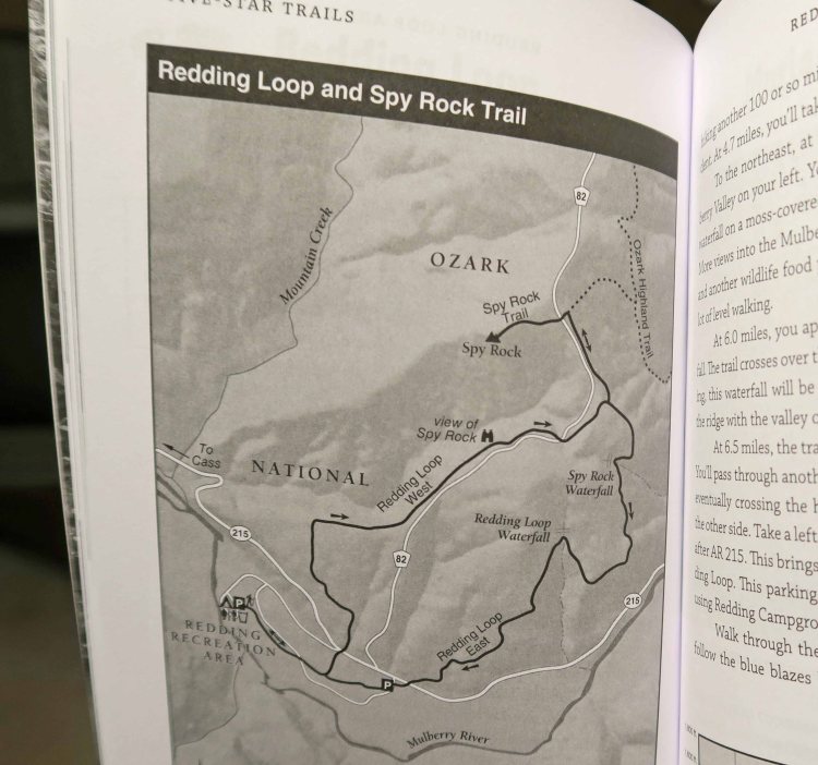
Trail map from Five Star Trails: The Ozarks

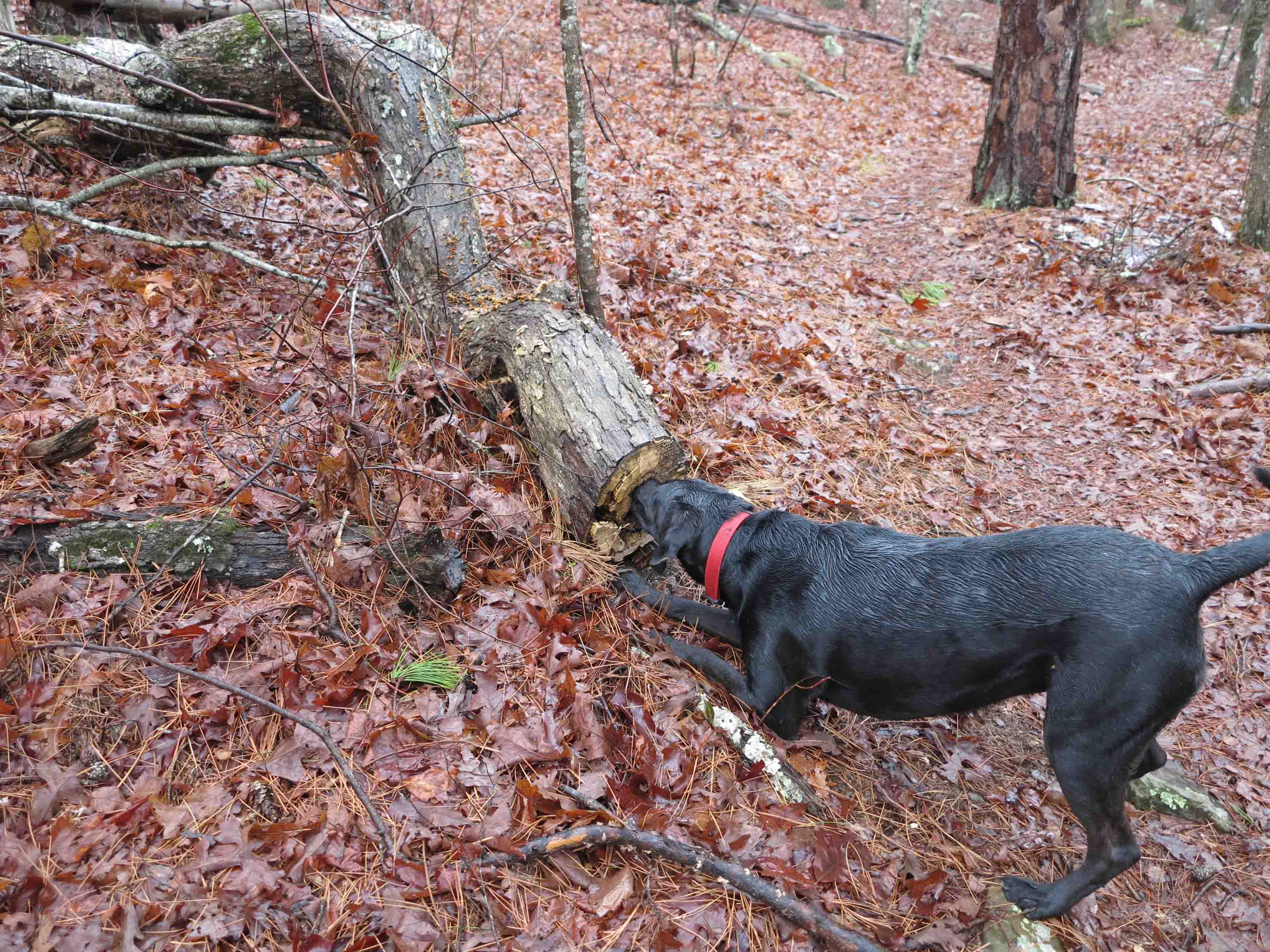
Several times during today’s trek I heard the distinctive call of a pileated woodpecker. I never saw the bird but did see evidence of a variety of woodpeckers on several pine trees next to the trail.

IMG_3760rr

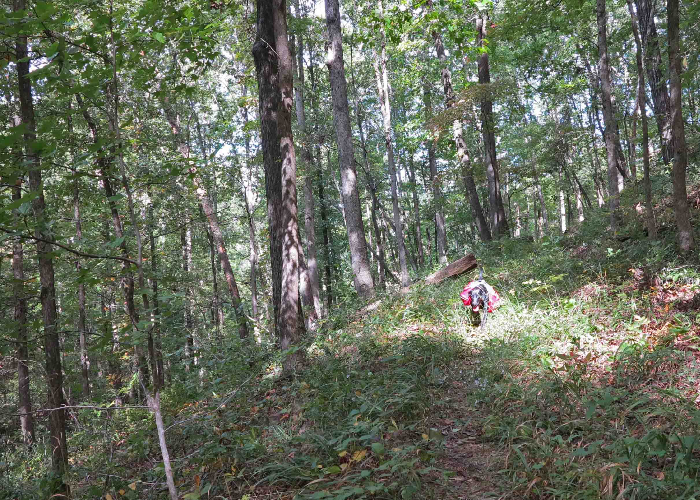
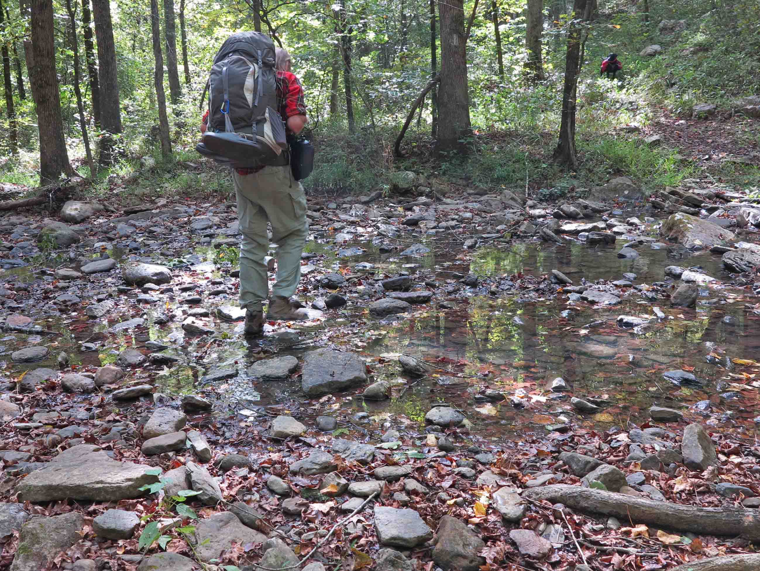
As we got closer to Redding Campground, I leashed Hiker-dog to be sure she didn’t greet any unsuspecting campers. In the photo below, we’re both appreciating the work of trail maintenance volunteers. This trail is always in excellent condition! Thank you, Chris, Steven, Mike, or one of several other sawyers in the Ozark Highlands Trail Association.

IMG_3763rr

Redding Campground was empty which led me to wonder if the gate was closed, but it was open as were the restrooms. I guess the cool temps and rain discouraged campers, but I thought it was pretty perfect! While walking the road back out to the truck, I noticed this broken boulder, reminding me of the work accomplished by time and weathering. The patient work of nature is just perfect!

IMG_3775rr

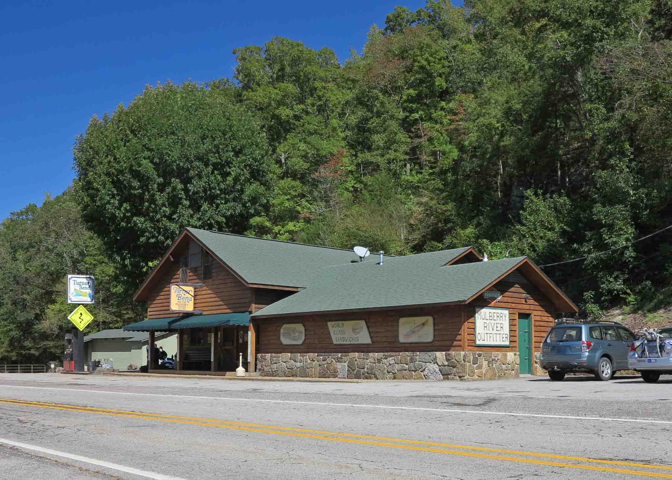
A stop at Turner Bend Store is always a highlight when I’m in this area. I was craving one of their filling fresh sandwiches and was pleased to see my book on the shelf along with many other great titles. Good food and good books? Just perfect!

IMG_3780rr

If you can’t make it to Turner Bend Store for a sandwich and a copy of Five Star Trails: The Ozarks, check any of these locations or your own area bookstores or order online.

Waterfall Cures from Do South Magazine

Glory Hole Falls 2 E Scowden small

Glory Hole Falls, Eric Scowden

I’m proud to be published with friend Eric Scowden in the beautiful Do South Magazine. If you enjoy waterfalls, you’ll like our article that gives detailed information to find nine beauties in our area of Arkansas. The following links take you to the web version of the article.

Digital magazine format with article beginning on p 58:

“Waterfall Cures” Words by Jim Warnock  / Photos by Eric Scowden and Jim Warnock 

Do South Blog format:

“Waterfall Cures” Words by Jim Warnock / Photos by Eric Scowden and Jim Warnock

Turner Bend Falls Warnock 2 small

Turner Bend Falls on the Pig Trail, Jim Warnock

Exploring the Ozarks

Rock House

Rock House

Follow this link to the Do South Magazine to read my article, “Exploring the Ozarks.” I enjoy writing for Do South because it’s a beautiful publication with a diverse readership. Their managing editor is an excellent writer and encouraging to others. My article begins on page 48 (p. 50 of the digital version).

Exploring the Ozarks

Thanks for reading!

Jim Warnock

A Waterfall Day on Redding Loop and Spirits Creek

With rain following a recent snow, I decided it was time to revisit a couple of waterfalls I’ve wanted to see for a while.  The first one is on Redding Loop Trail. I’ve hiked this loop trail many times but never when water was flowing. There are two waterfalls, but this was the one I wanted to see based on the formation of the bluff and rocky drainage below the falls. I was not disappointed!

Redding Loop Trail waterfall

Redding Loop Trail waterfall

IMG_6525rr

I spent several minutes photographing the waterfall. Hiker finally had all she could take and began barking for me to get moving. I must be a puzzle to her when I stand at a tripod with a small black box on top for a while for no apparent reason.

IMG_6528rr

Hiker is easily entertained. She has a recurring desire to crawl inside of a log. I think she must hear something inside raising her curiosity.

IMG_6538rr

On our way back to the trailhead, I couldn’t resist spending a couple of minutes next to a small glade area that crosses the trail.

White Rock Mountain Road

White Rock Mountain Road

After doing part of Redding Loop, the big adventure began. I drove up White Rock Mountain Road with the knowledge that my plans might change at any curve. I cleared large limbs off of the road in two spots and crossed some sections of road that were so muddy I wasn’t sure I would pass all the way through.

I had considered adding Spirits Creek as an out-and-back hike in my trail guide, but today’s drive convinced me that this route doesn’t belong in a day hike trail guide. It’s a great destination for experienced hikers, dirt road drivers, and OHT thru-hikers.

Gray Spring shelter built by the CCC.

Gray Spring shelter built by the CCC.

I’ve driven past Gray Spring several times, but today it was time to stop and admire the work of the depression era Citizens Conservation Corps. It appears that Gray Spring is being maintained by the US Forest Service. On the day I visited, the area was clean following a recent controlled burn.

The rock work has stood the test of time and is still functional today. The spring is located uphill above White Rock Mountain Road and flows past Gray Spring picnic area, eventually feeding into Spirits Creek. If you’re looking for a place for a quiet picnic, Gray Spring fits the bill.

Gray Spring picnic area.

Gray Spring picnic area.

Big fir pit

Big fire pit

Spring up above White Rock Mt. Road

Spring up above White Rock Mt. Road

I’d like to learn more about the spring itself. This pipe ran from farther up the hill, but we decided not to explore any higher on the muddy hillside. The concrete cover appeared to be disconnected from the water source.

spring cover

spring cover

View from the CCC Gray Spring shelter.

View from the CCC Gray Spring shelter.

Ragtown Road TH for the OHT heading west.

Ragtown Road TH for the OHT heading west.

We continued up White Rock Mountain Road for a short distance past Gray Spring and then took a right onto Ragtown Road to the trailhead. We followed the Ozark Highlands Trail down a couple of benches into the Spirits Creek valley.

We passed through a section with lots of devil’s walking sticks that usually indicate a compromised canopy and sure enough, you could see that things were pretty open in that area. Compliments to the trail maintainers for this section. It was in good shape. After the walking stick section, we entered a more open and healthy hardwood forest with little streams everywhere, including the middle of the trail. We just stomped along looking forward to Spirits Creek.

Spirits Creek falls

Spirits Creek falls

I have a photo of this waterfall from my thru-hike of the OHT over Christmas of 2013. That photo was done hurriedly after crossing a swollen Spirits Creek due to hard rains the night before. I camped at Spirits Creek again in the last year, but it wasn’t flowing so I was excited to be here today and spent some time with this waterfall. Hiker explored nooks and crannies of the bluffs behind the waterfalls. I was envious.

IMG_6589rr

Spirits Creek falls

IMG_6620r

Noticed some white trout lilies in the moist hillsides around Spirits Creek. Their scientific name is Erythronium albidum. I don’t know plants well, but enjoy rediscovering the names I can’t remember from year to year. I hope I’ve identified this one correctly.

Spirites Creek

Spirits Creek

A favorite spot on Spirits Creek.

A favorite spot on Spirits Creek.

After the hike, we took the slow and muddy 5-mile drive east on White Rock Mountain Road to AR 23. Then we turned south for a delicious sandwich at Turner Bend Store. Hiker enjoyed making new friends and having a little snack of lunch meat from the Turner Bend crew.

Directions to Ragtown Road Trailhead for Spirits Creek access: Drive 0.6 mile south of Cass watching for White Rock Mountain Road. Drive west on White Rock Mt. Rd. for 4.2 miles, then stay right. Reset the odometer. Drive 0.8 miles farther and watch for Gray Springs down on the left. At 1.3 miles, turn right onto Ragtown Road (Forest Road 1509). The trailhead is about 0.7 miles on Ragtown Road.

Directions to Redding Loop Trail: Just north of Cass, turn onto AR 215 east.  Drive 2.7 miles east and past the Redding Campground entrance.  Drive a short distance (maybe 0.2 mile) beyond the campground entrance and turn right onto a gravel road that will lead you almost immediately to the trailhead.

Hiking Through the Pawpaw Patch – Fanes Creek to Spirits Creek and Back

The plan? Meet at a favorite Ozark landmark, Turner Bend Store on Highway 23 (AKA The Pig Trail).   Then drive a short distance to Fanes Creek Trail Head, near mile 31 of the Ozark Highlands Trail.

Turner Bend Store

Turner Bend Store

Hiker-dog was bouncing and hyper Saturday morning, celebrating cooler fall temperatures; Sunny and 41 degrees!  She was beside herself as I loaded the Jeep.  When I finally said, “up,” she jumped into position, ready for a road trip to whichever trail it might lead.

Hiker heading toward the trail head.

Hiker heading toward the trail head.

We’ll have to call this the “pawpaw  hike.”  Fanes Creek west to Spirits Creek treks through several pawpaw patches.  I was unfamiliar with this little fruit, but Dana, one of our hikers, pointed them out as we passed.  The first ones we saw were overripe and a little bitter.

These two pawpaws were overripe.

These two pawpaws were overripe.

Pawpaw

Pawpaw

Later we passed some that were just right.   I eagerly cut the skin off of this pawpaw and tried a bite.  The taste is described as a blend of banana, mango, pineapple and papaya.  I thought this was an accurate description.  I ended up eating several before I stopped to think maybe I should proceed with caution because of my lack of experience with pawpaws.

Pawpaws are an understory tree and do not self-pollinate so they need other trees in the vicinity.  The upper canopy of oak and sweet gum shaded the tinder looking pawpaw trees.   There seemed to be limited numbers of fruit on each tree and great variation in the maturity of the different trees.

Pawpaw showing the meat and seeds of the fruit.

Pawpaw showing the meat and seeds of the fruit.

If I find pawpaws growing close to the road, I would like to try mixing in some lemon juice and dehydrating a pawpaw “leather” as a backpacking treat.  I saved the seeds from the fruit I ate to see if I can grow a few pawpaw trees underneath some oaks behind our house.

Pawpaw tree with fruit.

Pawpaw tree with fruit.

This section of trail contains a lot of history.  A couple of miles follow an old railroad bed dating to the early 1900s when trees were harvested and transported on a narrow gauge railroad.  During the winter, it is easier to see evidence of the work done here.  Old bridge footings where the rail line crossed drainages can be seen.  Making this railroad must have been a major ordeal, but evidently the line worked for several years.

Hiking the old railroad bed.

Hiking the old railroad bed.

Bolders sliding down the sides of the old excavation for the railroad bed.

Boulders sliding down the sides of the old excavation for the railroad bed.

Water in the creeks was just right for drinking but low enough for dry crossings.  The lower water levels gave an opportunity for Hiker-dog and I to spend a little time after dinner walking down Spirits Creek.

Bob stepping across Spirits Creek.

Bob stepping across Spirits Creek.

Small pool on Spirits Creek

Small pool on Spirits Creek

Hiker with her food supply for two days.

Hiker with her food supply for two days.

Hiker is in her element when walking the trail.  She is poised and confident as she struts along.  One exception to this was on the first day.  She got turned upside down in some brush and spent several seconds frantically trying to right  herself. She looked like a big turtle with a red shell.  Finally, she was able to gain a hand…paw hold and flip herself over. We told her we were laughing with her, not at her.  Unfortunately, I do not have a picture.

Seeing Hiker with others in camp was interesting.  She has a habit of being a little too friendly when people are trying to operate stoves and prepare meals. I’m thankful that she does not chew on tents  or other pieces of equipment.  However, I do wish that she would be a little less affectionate in camp.

I’ve noticed that Hiker does much better in camp after walking ten or more miles for the day.  We only hiked seven so she ended the day with lots of energy.  To divert her attention, we played fetch with sticks and black walnuts.  Finally she bedded down for the night.

Bedding down for the evening.

Bedding down for the evening.

Water was easy to filter at Spirits Creek.  It was clear and looked good enough to drink without filtering, though I wouldn’t recommend it.

Collecting drinking water using a ziplock freezer bag.

Collecting drinking water using a ziplock freezer bag.

Filtering water from Spirits Creek.

Filtering water from Spirits Creek.

I brought plenty of food for this overnighter.  I had a couple of red potatoes in the bottom of my pack (hence, my trail name, Tater).  I cut up the largest and began to boil it adding dehydrated vegetables from the Huntsville Pantry that were a gift from a friend.  Then I added Bear Creek Creamy Potato Soup Mix and let it simmer.  This was a healthy and delicious feast with all of those vegetables!  After a cup of hot tea, I slept soundly.

The next morning I had two cups of coffee which tasted like a gourmet brew on a cool morning in the Ozarks.  I boiled water with dehydrated apples and then added oatmeal.  Outstanding!  Next, I put several slices of pre-cooked bacon in boiling water with the smaller red potato remaining in my pack.  I couldn’t stand the idea of hiking out with that “heavy” potato in my pack.  I was well nourished and ready to hike.

IMG_9497rr

Fane Creek

Fane Creek

Fane Creek was flowing slowly.  We were unable to cross this creek on our winter thru-hike due to high water, so this was a different view of this beautiful creek.  Knowing my trip was drawing to an end, I paused and spent a couple of minutes at the crossing.  I’m thankful for the beauty of the Ozark Mountains and the privilege of hiking them.