The Ozarks Always Astonish

“Pay attention, be astonished, write about it.” ~ Mary Oliver

When I walk into the Ozarks, I expect to see some beauty, but again and again, these woods astonish me. Whether walking a repeated trail or bushwhacking into a valley for the first time, the Ozarks always give more than I expect.

Today, Lindsey Hollow might fall into that typical pattern of exceeding expectations. Steve, Chris, and I each drove in separately and maintained our distance while hiking, which is easy to do. Hiking cures all that ails me during this challenging time of COVID-19 and “social distancing.”

By the end of our walk, my eyes were full of beautiful scenes, I felt zero stress, and my muscles achieved a pleasant level of exhaustion. Best of all, I was left with questions that entice me to return. These woods always leave me loaded with gifts!

What follows are a few photos in the sequence of our walk.

IMG_4500rr

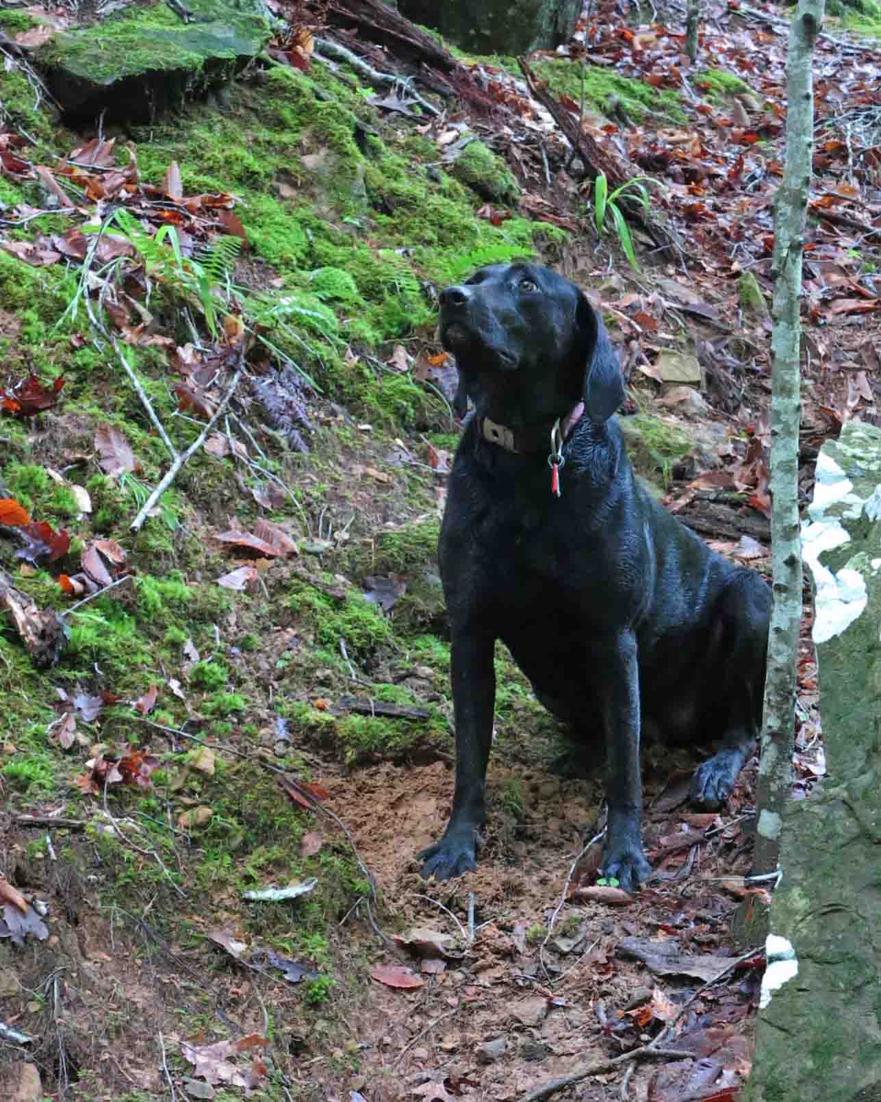
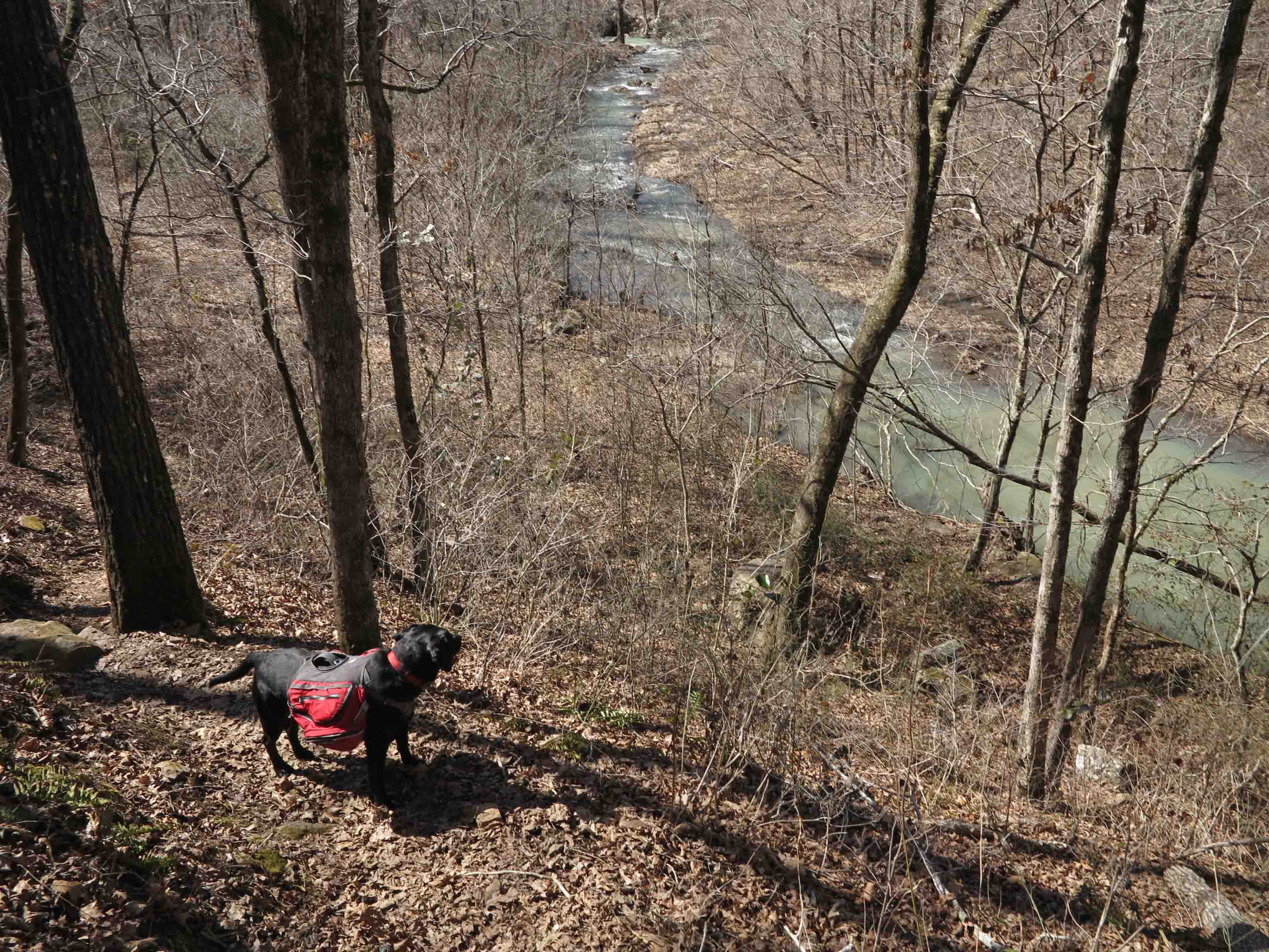
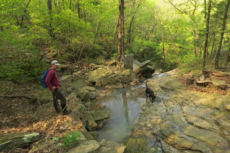
Sure footed Hiker-dog

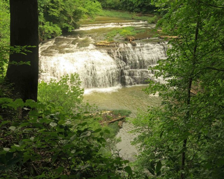
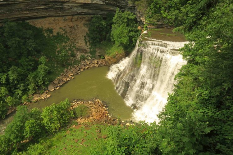
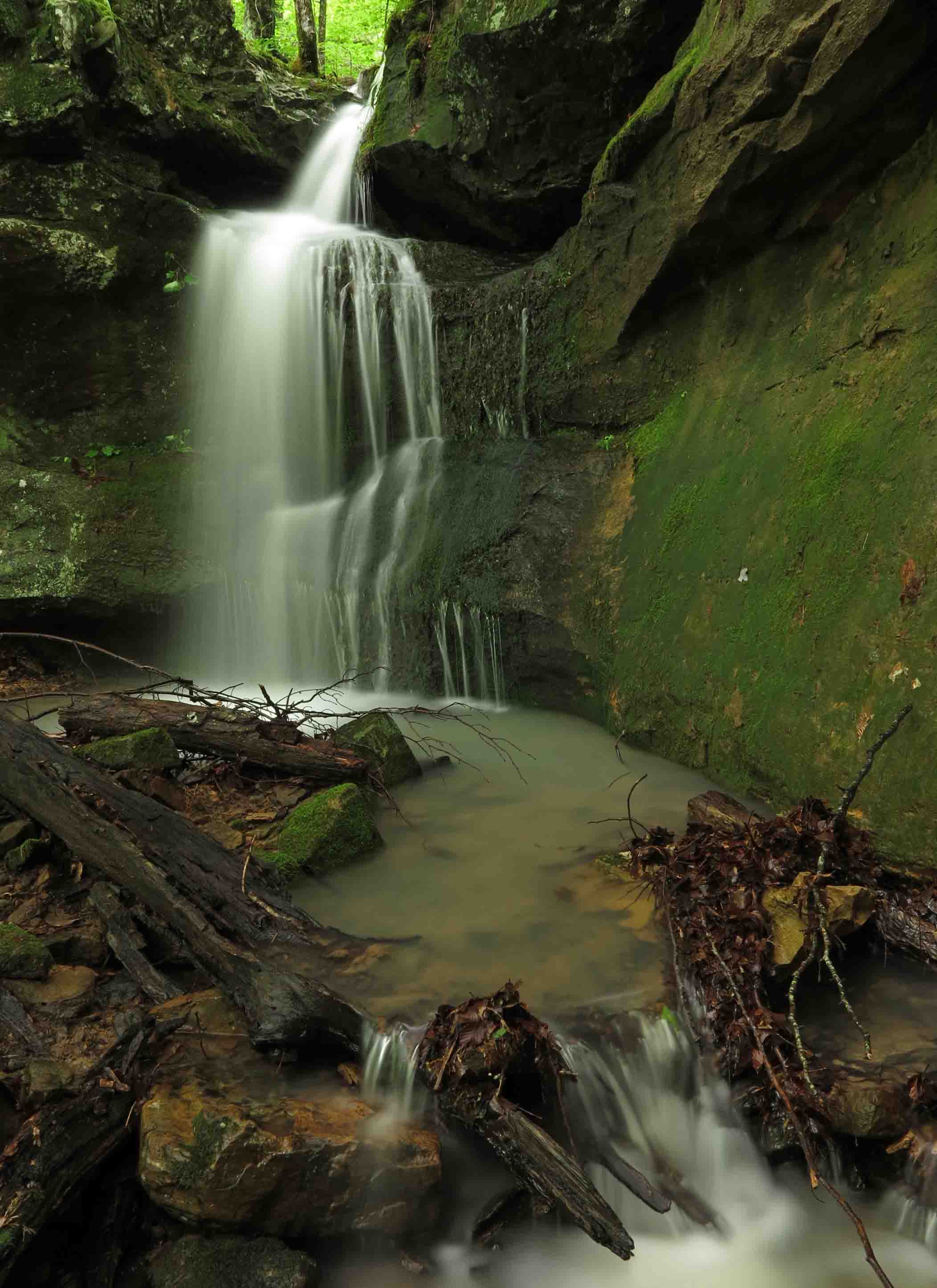
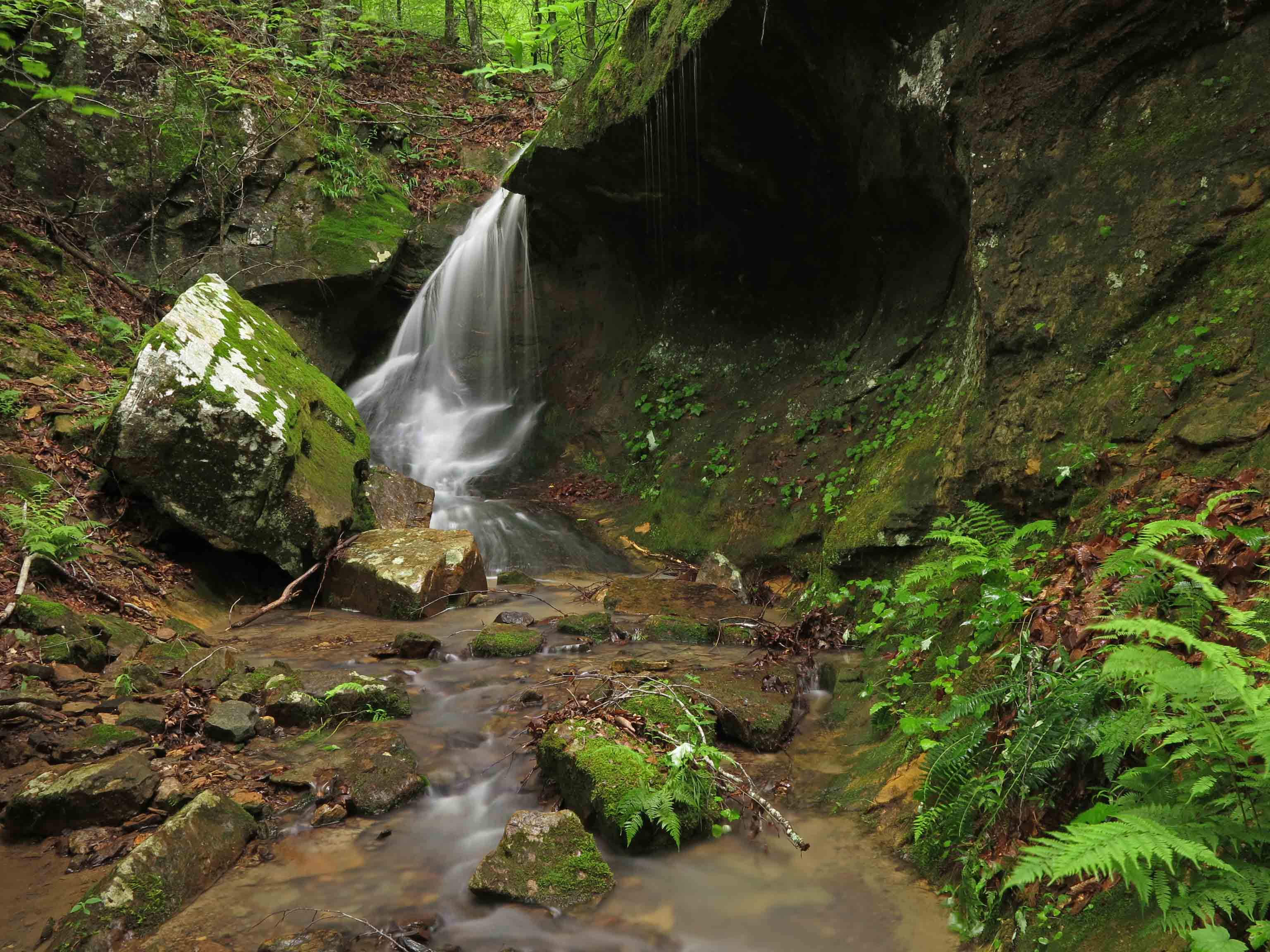
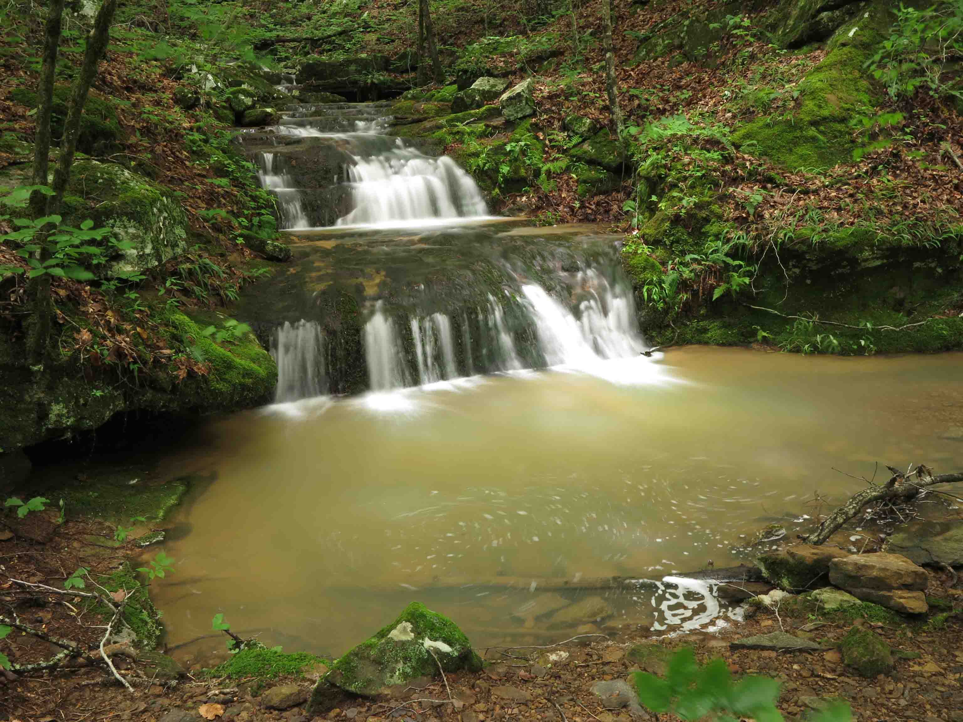
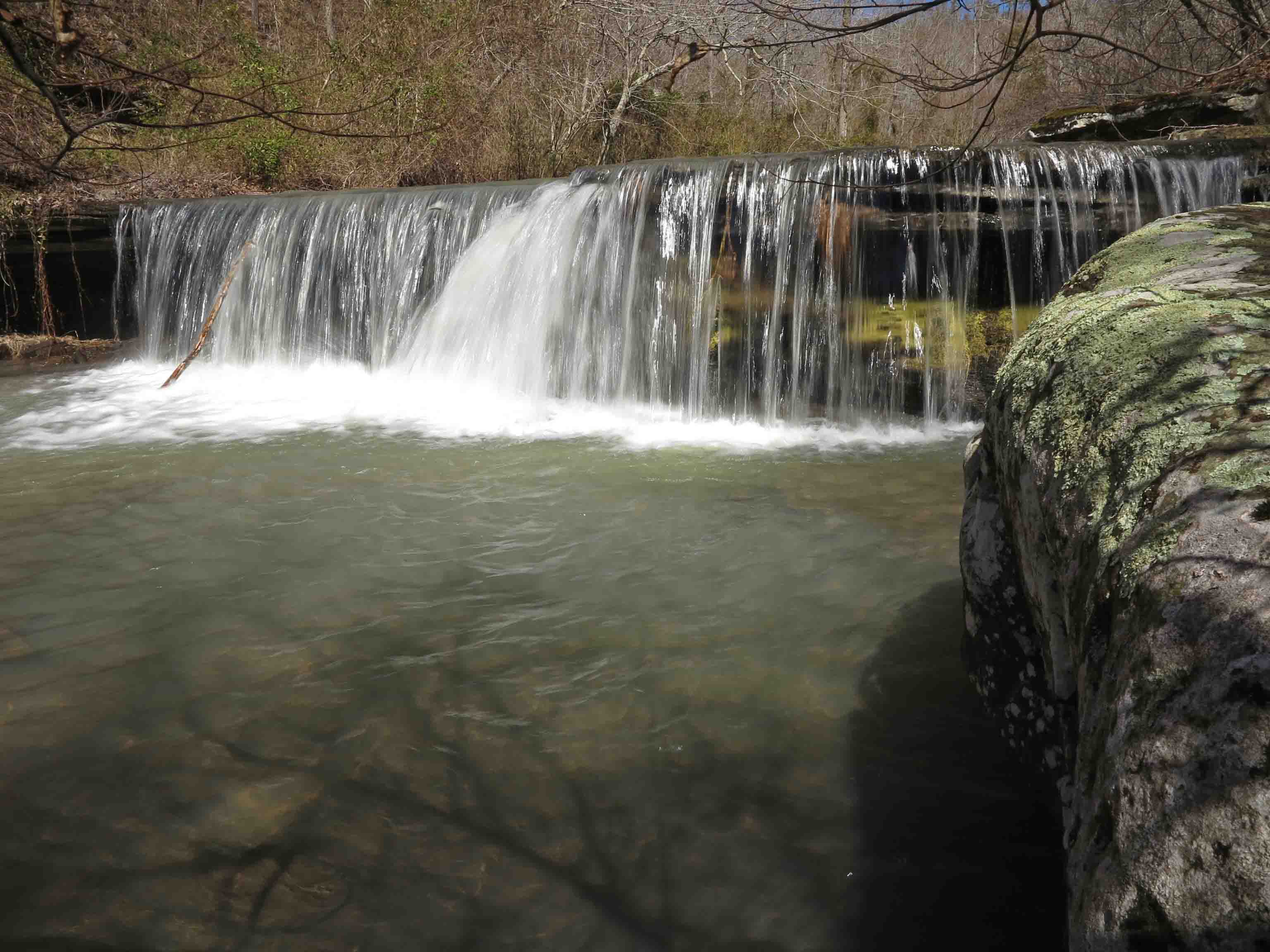
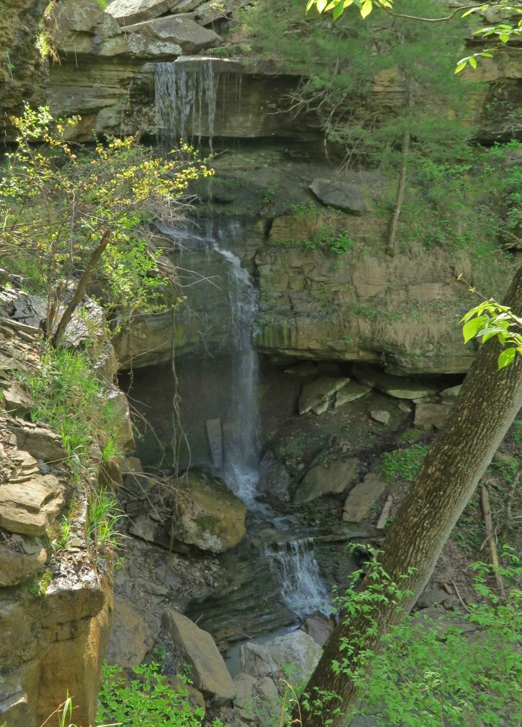
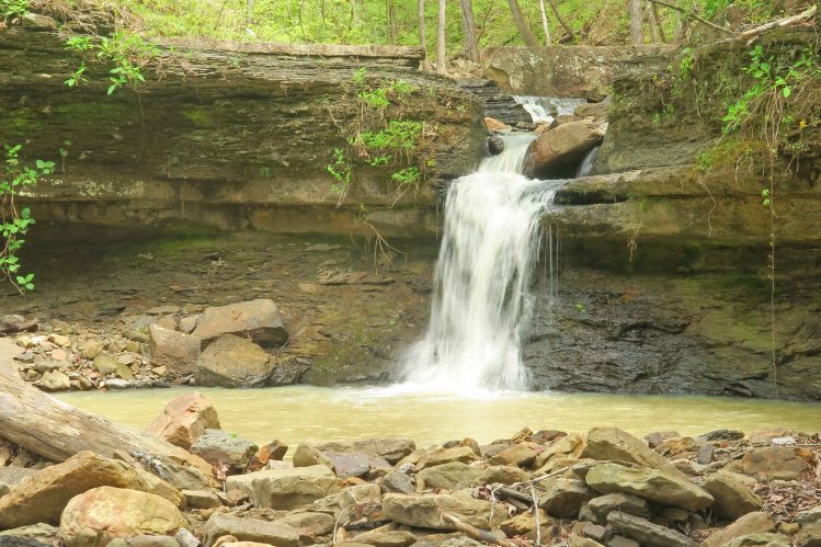
We crossed a couple of waterfalls pouring into Lindsey Hollow from surrounding streams.

IMG_4522rr

IMG_4538rr

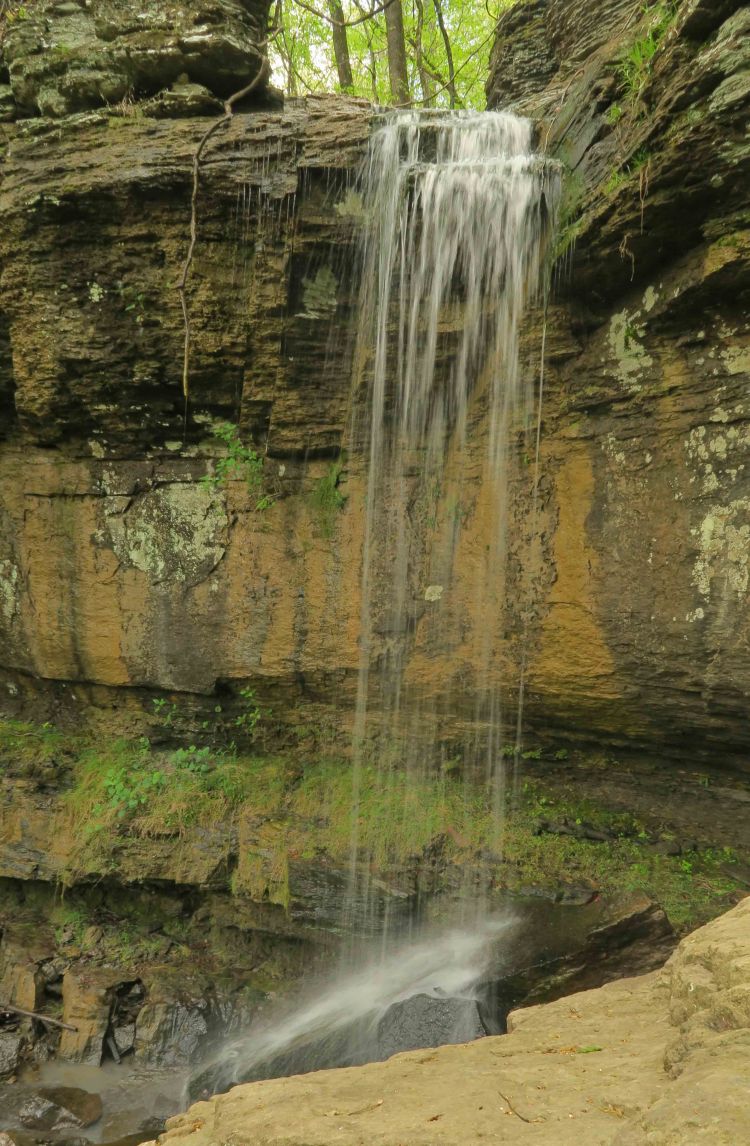
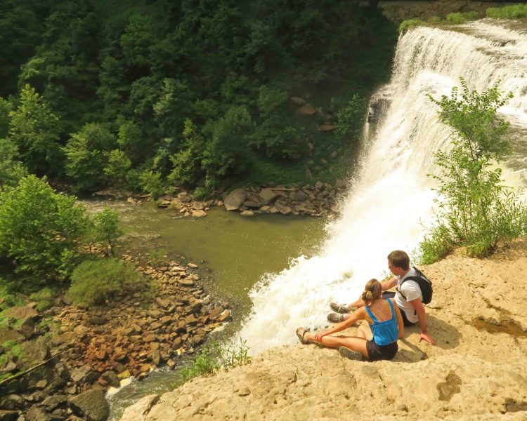
Chris and Hiker-dog above a waterfall

IMG_4553rr

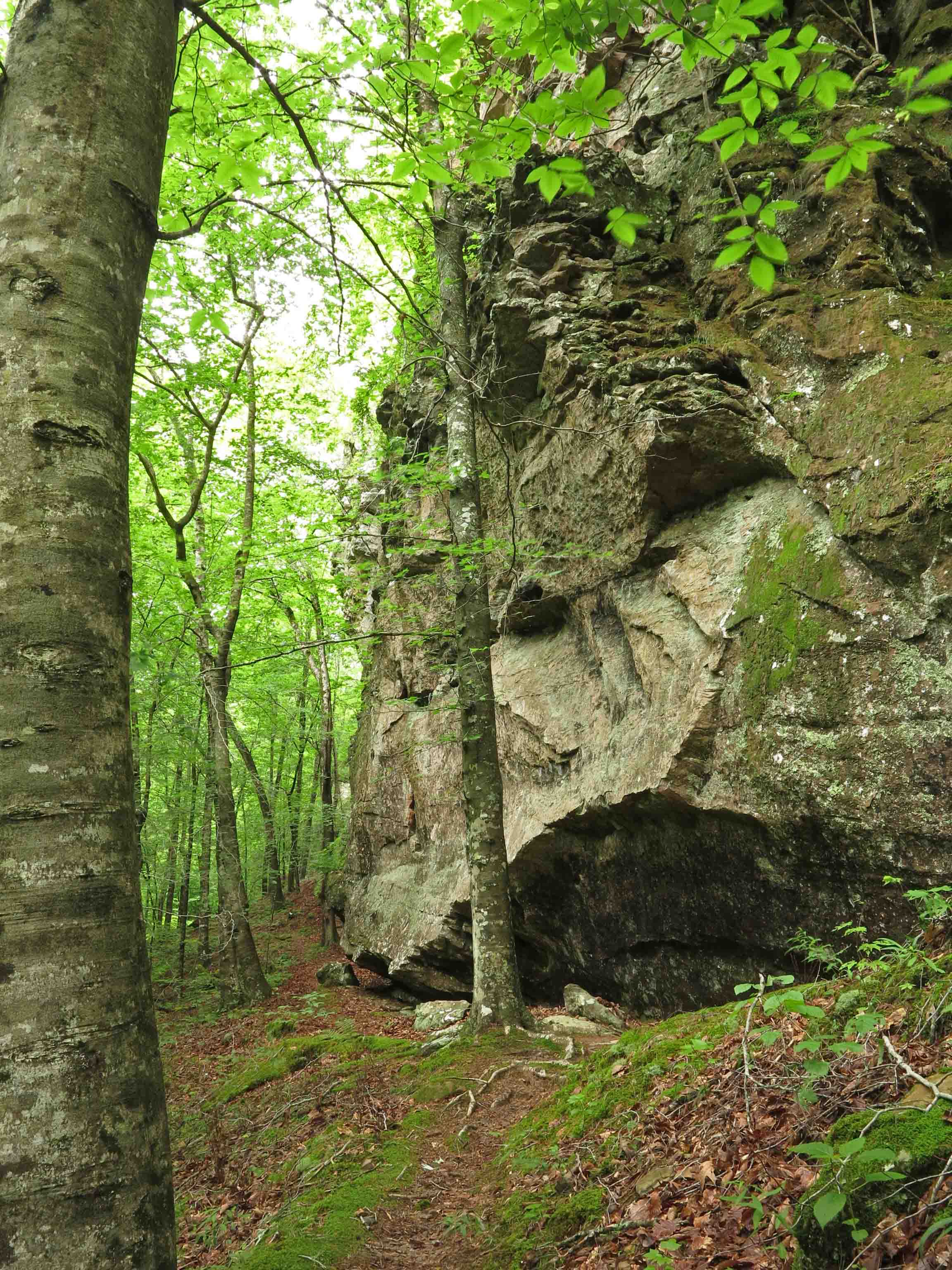
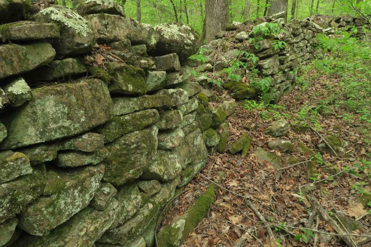
We saw large rock walls. I reached across one of the smaller sections and estimated it to be three-feet on top.

IMG_4564rr

Chris and Steve admiring the builders’ work

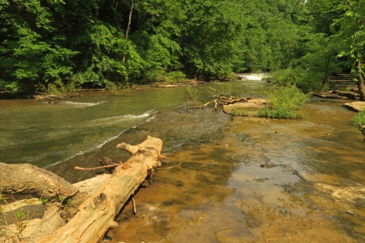
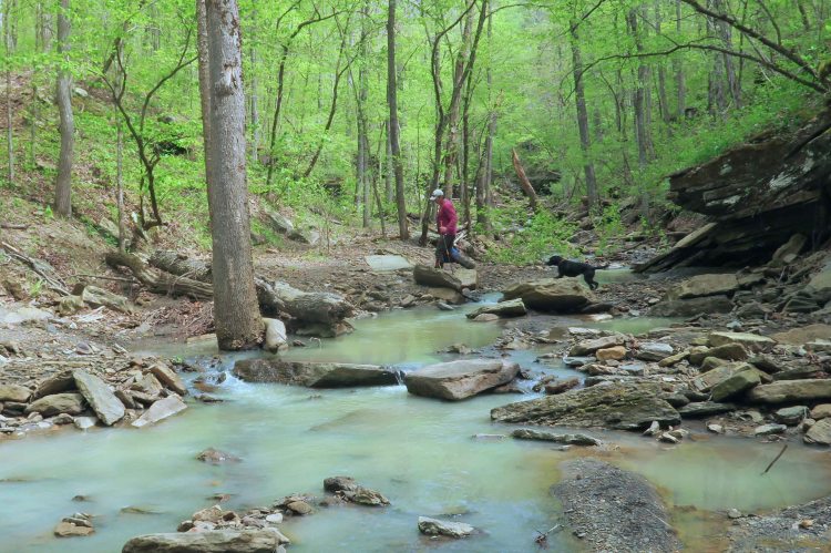
Lindsey Creek was a beautiful place to explore. We soon realized that we’d need return trips to give this place an honest look.

IMG_4589rr

IMG_4613rr

This close-up of one of the rocks we stepped on to cross the creek isn’t concrete as it first appears, but a conglomerate that includes a variety of pebbles and small fossils.

IMG_4630rr

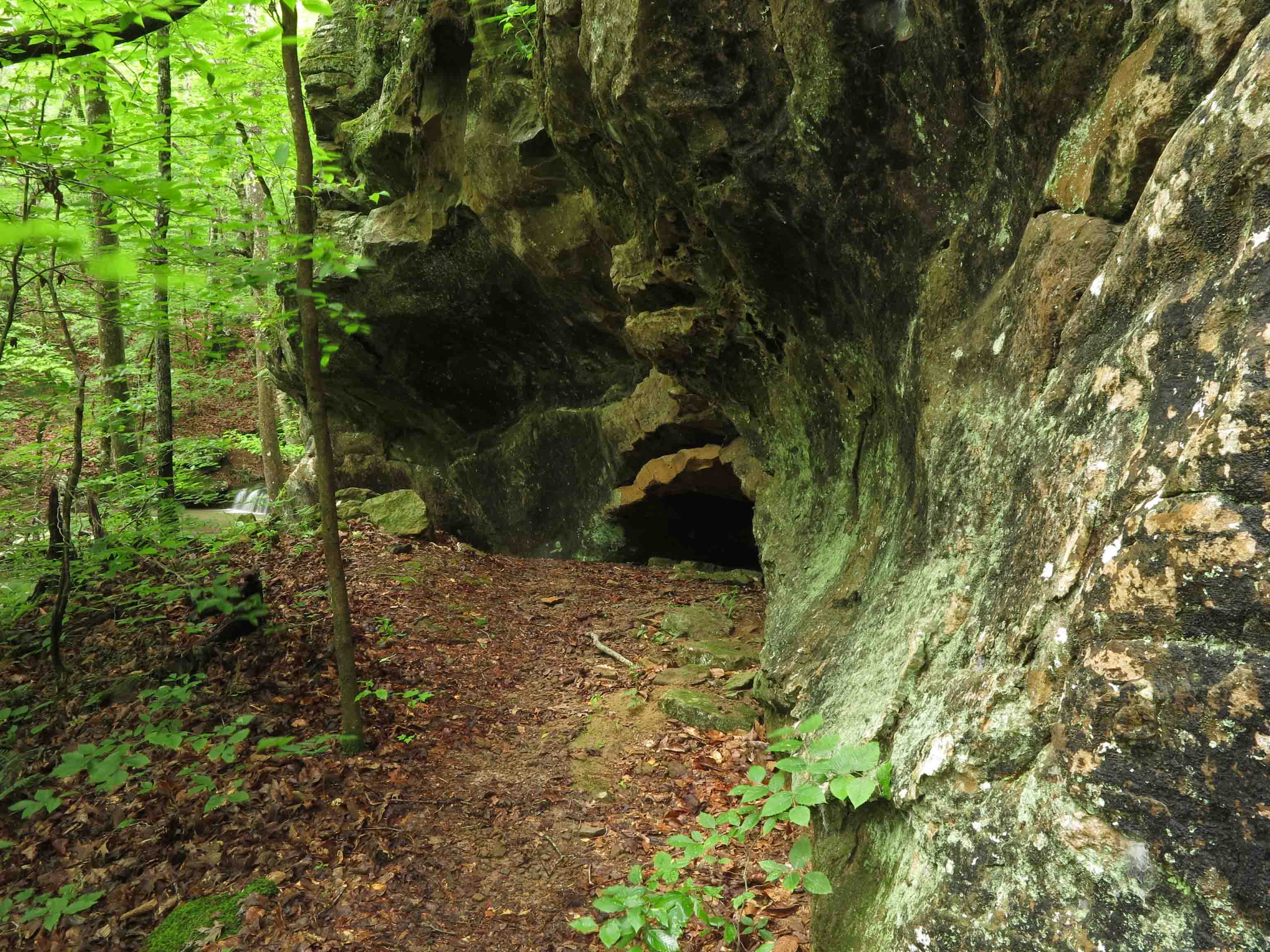
Lindsey Creek disappeared underground for about twenty yards then emerged in the creek bed and a couple of adjacent “springs.” They appeared as springs, but the water was similar to the creek water, so I doubt that the underground flow was long. Still, they were intriguing.

IMG_4677rr

“Spring” next to Lindsey Creek

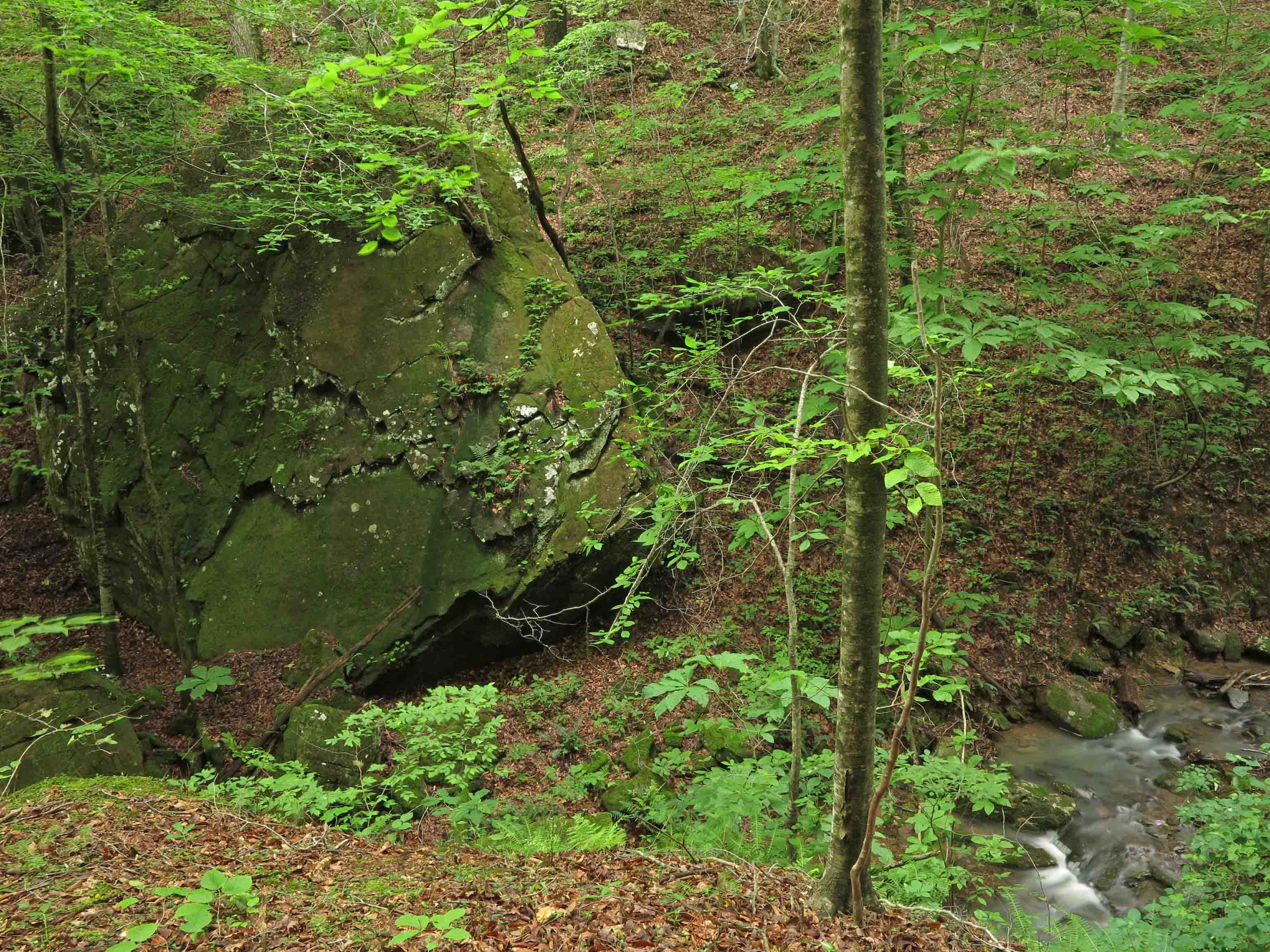
A massive rock wall ran alongside the creek. We didn’t see structure footings nearby as would be expected. We might find footings away from the creek to avoid flooding. That exploration would have to wait for another day.

IMG_4655rr

This piece of a wood-burning stove was leaning facedown against a flat rock in the creek bed. After taking photos, I placed the heavy piece of cast iron back where I found it.

IMG_4696rr

Piece of a stove with my shoe for scale.

I wondered if I might learn when it was made by the ornate patterns in the iron. Did it belong to those who built the rock wall next to this creek? Did it belong to another family upstream? This artifact left me with fun questions to ponder while huffing and puffing out of this hollow.

IMG_4709rr

Thanks for coming along on this Lindsey Hollow walk. If you have an idea about the date of that stove, please contact me, and I’ll update this post.

IMG_4715rr

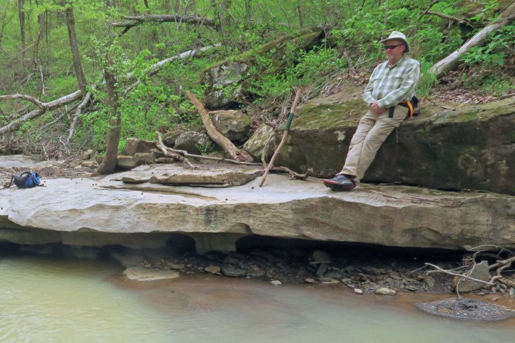
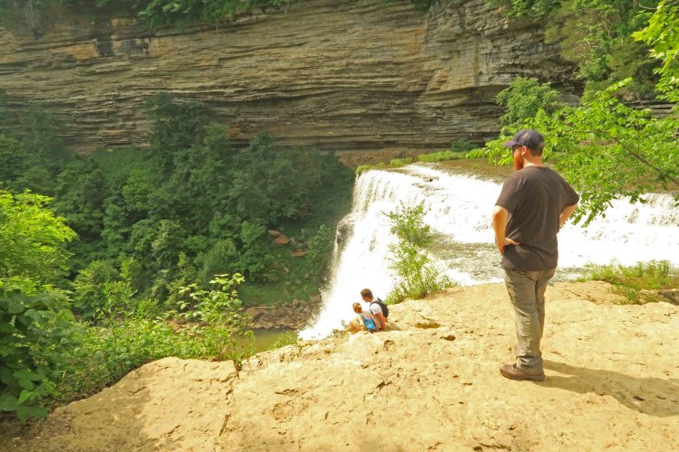
Steve enjoying the view before the hike out.

Little Taste of Tennessee

IMG_8910rr

Taylor taking in the view next to Falling Water River

On our first visit to my daughter and her husband’s new home in Cookeville, Tennessee, my son-in-law offered to take me on a short hike along Falling Water River.  I jumped at the chance, knowing the next day would be filled by a 500-mile drive back to the Ozarks.

IMG_8942rr

I liked the sound of the river’s name, and Taylor said waterfalls were on the menu. After a 20-minute drive, we were walking along the river’s edge wading out on the pitted Mississippian limestone shore.

IMG_8847rr

A “smaller” set of falls located upriver from Big Falls

The water flow was greater than I anticipated on this popular stretch of river. Several waterfalls were formed as the main riverbed eroded and fell away over time.

The trail comes to Big Falls Overlook before switching back down to the upper deck of Big Falls. Metal stairs leading to the base of the falls were closed due to past flood damage. My only regret on this beautiful day was that we didn’t have more time to explore. 

IMG_8916rr

Two of many hikers next to “Big Falls” on this sunny day.

IMG_8863rr

The appropriately named “Big Falls” where a powerhouse was once located down below.

IMG_8955rr

Fern growing in the moist rocky bluffs above the river.

Here’s a link to the Burgess Falls State Park Brochure

IMG_8952rr

One lost “soul” along the trail.

On the Way and a Change of Plans: Hiking a Wet Marinoni Scenic Area

Stream flowing over the top of Marinoni Falls

Stream flowing over the top of Marinoni Falls

Hiking the Marinoni was my plan B today. Plan A was to check on my adopted section of the Ozark Highlands Trail. I got eleven miles east of Hwy 71 on Old Locke Road when I came upon a downed oak across the road. At first I thought my handsaw might be used to clear a single lane. After making a couple of cuts, I abandoned that idea. It was a chainsaw job. Hiker was restless and probably wondering what I was doing when we should be hiking. When we got back into cell range, I reported the tree and then headed to the Indian Creek Dawna Robinson Spur Trail east of Cass.

I’ve written about the Marinoni Scenic Area before, but I haven’t hiked it when water was flowing as strong as today. What could have easily been a two to three-hour hike was more like five with all of the photo stops. I felt thankful for that tree that changed my itinerary because the Marinoni was what I needed. Sometimes the best plan is plan B.

View of Marinoni Falls from a short distance.

View of Marinoni Falls from a short distance.

Marinoni Falls

Marinoni Falls

Small falls upstream from Marinoni Falls

Small falls upstream from Marinoni Falls

I spent enough time around these falls that Hiker-dog got impatient. She begins to bark when she thinks I’ve had enough time at the camera. I noticed that she began to pause and glance my way each time we passed any flowing water as if anticipating a photo stop.

Hiker watching the trees for squirrels while waiting patiently.

Hiker watching the trees for squirrels while waiting patiently.

I found it difficult to walk away from the Marinoni Falls. They provided an enjoyable time with my camera.

Small falls upstream from Marinoni Falls

Small falls upstream from Marinoni Falls

The towering walls above Briar Branch seem to envelop you like cathedral walls.

The bluffs above Briar Branch

The bluffs above Briar Branch

Bluffs above Briar Branch

Bluffs above Briar Branch

Edge of bluff with Briar Branch down in the distance

Edge of bluff with Briar Branch in the distance down to the right of the trail

Cascade close to the Marinoni marker

Cascade close to the Marinoni marker

IMG_9976rr

Little cave next to the Marinoni marker

Little cave next to the Marinoni marker

Large boulder across Briar Branch

Large boulder across Briar Branch

I never hike this section without pausing to be amazed at the size of this boulder down next to the creek.

Crossing Briar Branch

Crossing Briar Branch

Stone memorial for Dawna Robinson

Stone memorial for Dawna Robinson close to the trailhead

To read more about the Marinoni:

Making Time for Marinoni (includes driving directions to the trailhead)

Marinoni Revisited (Four Star Treatment) 

Fall in the Marinoni

In response to The Daily Post’s weekly photo challenge: “On the Way.”

Favorite Old Trails With a Favorite New Friend

Had a great day sharing some favorite old trails with my “new” hiking buddy, found on the Ozark Highlands Trail in January of 2014.

IMG_6282rr

Shores Lake to White Rock Mountain Loop Trail is one of my all time favorites in Arkansas. I’ve done it as a day and overnighter many times. Part of the attraction might be its proximity to Alma, but the real attraction for me is the water, scenic valleys, and the visual payoff of passing by White Rock Mountain. It dawned on me that Hiker-dog had never done any of this trail, so we decided to remedy this and drive through the little community of Fern to Shores Lake.

I’m working on a trail guide and decided a few months ago that this entire loop trail would not fit the book’s criteria for a typical day hike. However, the first section of the West Loop fits beautifully. The plan was to get GPS readings from Shores Lake to the White Rock Falls and then drive up to the White Rock Mountain Loop Trail. These two trails together gave us about 8 miles for the day (or maybe 10-12 for Hiker since she does a lot of off-trail sprinting).

Cascade at Bliss Spring

Cascade at Bliss Spring

We met up with a delightful group of Boy Scouts at the Bliss Spring crossing. They were taking care of the environment and obviously had strong adult leadership for their troop.

Little Roaring Falls

Little Roaring Falls

White Rock Creek was flowing. We left Hiker’s pack and my hiking poles on the trail and scrambled down (no trail here) to check out the Little Roaring Falls. “Little Roaring Falls” is my name for this waterfall because you’ll hear a low roar as you approach. Hiker loved this spot and took the opportunity to explore over, under, and around the falls. She also had a good swim below the falls.

Hiker exploring Little Roaring Falls

Hiker exploring Little Roaring Falls

IMG_6266rr

I wished for a cloud cover, but it was a crystal clear day making for less than ideal photography lighting.

White Rock Falls

White Rock Falls

We continued down the trail, arriving at White Rock Falls at 2.8 miles. We returned to Shores Lake for  a roundtrip hike of about 5.6 miles; a perfect day hike!

White Rock Creek

Hiker taking in the view of White Rock Creek as we returned to Shores Lake.

Other than the scout group, we passed by a nice couple from Little Rock and then saw another couple beginning their hike as we finished. I remembered Tim Ernst’s comment during his photo presentations, “The Ozark Highlands Trail is Arkansas’ best-kept secret!”

Great trail maintenance work was done in early fall on this trail. Because of the loss of parts of the tree canopy in areas, maintenance can be challenging, and it’s a tribute to the volunteers of the OHTA who maintain this trail. Check the OHTA website for trail maintenance dates. Good fellowship and good work! ozarkhighlandstrail.com

IMG_6359rr

We drove up to the Top of White Rock Mountain to hike the 2-mile loop trail. It had been several years since I did this loop on a foggy day, so this was like a brand new hike to me.

The sign saying to keep an eye on your children gave me pause. I guess Hiker-dog could be thought of as a child at less than two years old, but between the two of us, I was more likely to fall. In fact, children suffer falls less often than adults. Maybe this sign should read, “Children, keep an eye on your parents.” I decided Hiker would be careful around these high bluffs.

Ice on the east side of White Rock Mountain

Ice on the east side of White Rock Mountain

Some massive ice flows covered portions of bluffs, especially those protected from the sun.  Some snow remained on the east side of the trail but it was now a slush and safe for walking.

West side of White Rock Mountain

West side of White Rock Mountain

It took a while to walk this short loop trail. Found myself gawking at views every step of the way. If you do this hike, glance at the trail often to ensure you don’t go over the edge while being entranced by the views. Thank you to the volunteers in the Ozark Highlands Trail Association for trail maintenance! I saw a lot of evidence of work done last fall.

Hiker-dog and I would like to spend a few days camping on White Rock Mountain and exploring this loop with my camera in different light and at different times of the day. Rustic cabins close to the trailhead are nice options, too, but Hiker is definitely an outside dog!

West side of White Rock Mountain

West side of White Rock Mountain

White Rock Mt.

White Rock Mt.

Shelter on the southwest side of White Rock Mt.

Shelter on the southwest side of White Rock Mt.

Getting there:

Shores Lake Campground – Take Exit 24 from I-40 and drive north on AR 215 for 9 miles to Fern. Follow AR 215 right at 9.4 miles.  At 12.2 miles, drive straight off of AR 215 onto Bliss Ridge Road. Turn right into the Shores Lake Campground at 13.6 miles. The trailhead is at the north side of the campground.

White Rock Mountain Loop – Continue past Shores Lake Campground on Bliss Ridge Road (dirt) for 4 miles then turn left onto White Rock Mountain Road.  After 2.2 miles, turn right and drive the final 1 mile up to White Rock Mountain. Continue past the White Rock Mountain Campground, caretaker’s residence, and cabins. The White Rock Mountain Loop Trailhead is at the end of the road. Total distance from I-40 is approximately 21 miles.

Marinoni Revisited (Four-Star Treatment)

When I first began hiking, I’d check off trails as if that indicated that I’d seen those places.  While it did document that I had been at those locations, I later realized that I’d only grazed the surface.  This is especially true of the Marinoni Scenic Area.

Indian Creek sign

We entered on the Dawna Robinson Spur Trail that begins at the Indian Creek canoe parking area.  Watch for traffic when crossing Hwy 215.  We paused a moment to admire the memorial marker just a few steps up the trail.

Dawna Robinson Memorial Marker

We were immediately impressed with the condition of the trail which is only about two years old, built by volunteers with the Ozark Highlands Trail Association.  The switchbacks climbing up to the base of a bluff line are beautiful and you almost forget you’re climbing because of the steady grade.   When we arrived at the top of the climb we began an easy walk through open woods.  It was unseasonably cold with occasional rain.

Hiking the Marinoni

Our group of three included Robert who was visiting family in Missouri before returning home to Hawaii.  I wondered what his response would be to hiking in the Ozarks.  I was pleasantly surprised because he went on and on about the beauty of our little Ozark Mountains.  He was not the least bit disappointed even though he’d hiked some beautiful areas in Hawaii.

Crew marinoni

This was a short hike designed for novice backpackers with the hope for time to explore after making camp.  With only a three mile hike in this hike definitely did not meet Bob’s miles driving to miles hiking ratio.   The shorter distance did something nice for us though.  It demanded that we slow down and enjoy the passing of scenery. Robert was doing his first backpack trip and Bob’s nights backpacking numbered into the four digits but we all enjoyed learning from each other and sharing tips along the way.

Having hiked through the Marinoni many times, I wanted the chance to camp there.   This little spot looked better than a four-star hotel as we approached and pitched our tents.

Four-star hotel and gourmet coffee next to Briar Creek

Four-star hotel and gourmet coffee next to Briar Creek

The Marinoni never disappoints!  The soothing sounds of Briar Creek accompanied our walk along rocky bluffs and budding wildflowers.  The moist day made it feel like a rain forest with clear water droplets hanging from every leaf.  Cascades and waterfalls were flowing nicely.

bloom

Marinoni waterfall

Briar Creek

Briar Creek

A trip highlight and something even four-star hotels can’t offer was a short afternoon nap in dry leaves under a bluff overhang accompanied by Briar Creek and song birds.  I was worried that it might be difficult to sleep after napping but slept pretty much straight through from 7:00 p.m. to 7:00 a.m.  This was some four-star sleep!

Napping under a bluff overhang.

During our hike out on Sunday morning I was already looking forward to my next visit to the Marinoni Scenic Area.  No reservations required!

For location and more reading about the Marinoni Scenic Area visit the following link:

Making Time for Marinoni