Cameron Bluff on Mount Magazine
Residents of the Ozarks hanker for higher elevations this time of year. I wish Arkansas had an 8,000-foot mountain, but it would be crowded with the whole state huddled at the top through July and August.
Fortunately, there is a place where you can sometimes escape the south’s summer heat and humidity. Mount Magazine, at 2,753 feet, is Arkansas’ island in the sky and offers a wide array of beautifully maintained hiking trails and facilities.
Years ago, I visited Mount Magazine and saw the remaining footprint of the 1940 WPA Lodge that burned in 1971. The huge stone wall that formed the terrace for that earlier lodge now stands below a massive new lodge, completed in 2006. All rooms feature views across the Blue Mountain Lake and valley. To learn more about the history of this area, check out Don Simons’ book, Mount Magazine (Images of America).

Portion of Lodge at Mt. Magazine and Skycrest Restaurant above 1940 WPA stone wall

High point marker

Stone map of Arkansas map at state high point
The lodge and surrounding cabins are beautiful as is the campground, located a short walk from Cameron Bluff. We traveled through driving rains in the River Valley to reach Cameron Bluff Campground, arriving in an eerie cloud atop Mount Magazine. The next day brought temperatures in the low 60s, heaven for the summer dayhiker!

Sunset at Cameron Bluff

Taking in the views from the North Rim Trail
Hiker-dog and I wanted to hike around the “island” and decided to do a longer variation on the hike I described in Fives Star Trails: The Ozarks. We accessed the trail by the High Point Trail and then added the full length of Mossy Bluff Trail, East Benefield, Bear Hollow, and Will Apple’s Road Trail.
 We completed the morning with the North Rim Trail to make a 12-mile loop, arriving back at our campsite ready for lunch and a nap.
Color provided visual highlights along the trail on this summer hike. A lone coneflower called caught my eye as we hiked Mossback Ridge Trail.
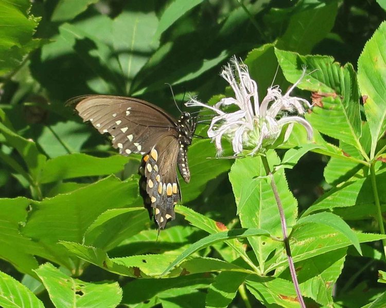
 Butterflies danced from bloom to bloom, sometimes landing long enough for a picture, despite my lack of a long lens. Mount Magazine and the nearby town of Paris hosted their 20th (and last) Butterfly Festival in 2016. Thankfully, the diverse butterfly population didn’t get the news release and still arrives on Mount Magazine to enjoy its unique blooms and cool temperatures.
 A subtle collection of frog calls announced our approach to a small hidden pond located on the historical Benefield homestead. While Hiker-dog grabbed a drink, I captured a short sample of the pond’s soundscape.
Between the flowers, bluffline vistas, cool morning air, and wildlife, we ended our day filled with thankfulness for Mount Magazine, our gorgeous green island in the sky!

The view from Sunrise Rock on the Bear Hollow Trail
A few more glimpses of color and beauty from our hike…

Becca enjoyed our drive around the mountain to see many of the sights from our earlier hike.

Signs clarify routes at trail intersections.

A couple enjoys views from the North Rim Trail


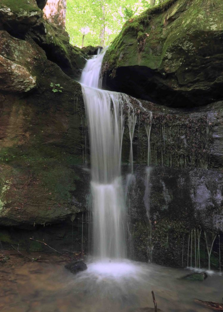 Hiker-dog and I scouted a route into the Marinoni Scenic Area on Monday evening. Hiking late in the day offered views in a new light, but my concern was how long that light would last in this deep Ozark hollow.
 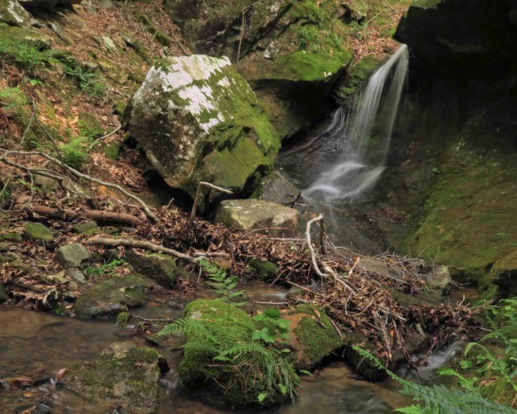 The woods were alive with the sounds of flowing water. Briar Branch and the inlets on each side were flowing nicely. I recorded a few seconds of the waterfall as seen from the trail above.
 A copperhead was enjoying the warmth next to a tall bluff. I wondered if this snake was alright at first because it was in an awkward pose, almost as if smelling the surroundings. It remained in this position while I took photos and then moved on.
 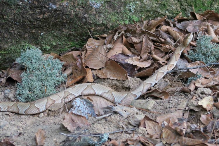 I enjoy seeing snakes in their natural environment, but I will admit that I watched my step a little more carefully after meeting my copperhead friend. Hiker-dog never came close to the snake. I’m sure they smelled each other’s presence. I’ve read that snakes will sometimes “dry bite” to defend themselves against mammals that aren’t a food source. Snakes prefer to save their venom for killing things that are good to eat, not dogs or people.
 I set the camera on a rock in the middle of Briar Branch to record this view upstream as the sun drifted lower in the sky. We then explored the little cave next to the Paul Marinoni sign placed here many years ago by the Ozark Highlands Trail Association.
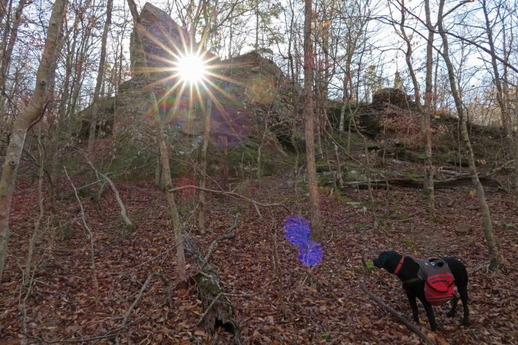
 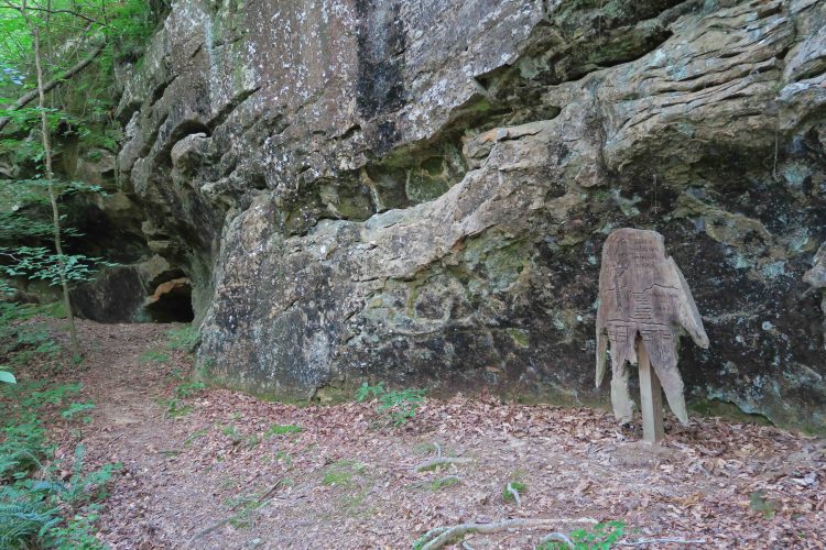 We scrambled uphill to have a close look at the Natural Bridge. During leaf-off, I’ve viewed this rock formation from the trail below, but it wasn’t visible with all of the spring growth. One of my favorite photos from an earlier hike caught the morning sun underneath the bridge. Today I realized the “bridge” was smaller than I thought. A unique little formation at the top of the bluff.