Crystal Prong
Bob and I walked the first 160 miles of the Ouachita (Wash’-i-taw) Trail before and after Christmas, so only the last 63 miles stood between us and completing our thru-hike. Several things occurred to keep us from getting back out there, but May 2-6 was finally determined to be the time.
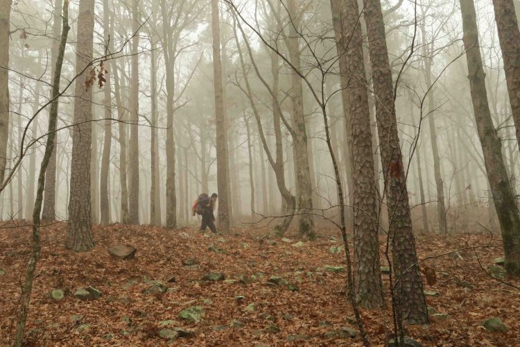
The woods had changed greatly since we came off the trail at mile 160. Now deep greens of spring limited views and warm humidity weighed in as part of the pack load.

 By one mile into the hike, pollen was evident on my pants cuffs as I walked through thick foliage.
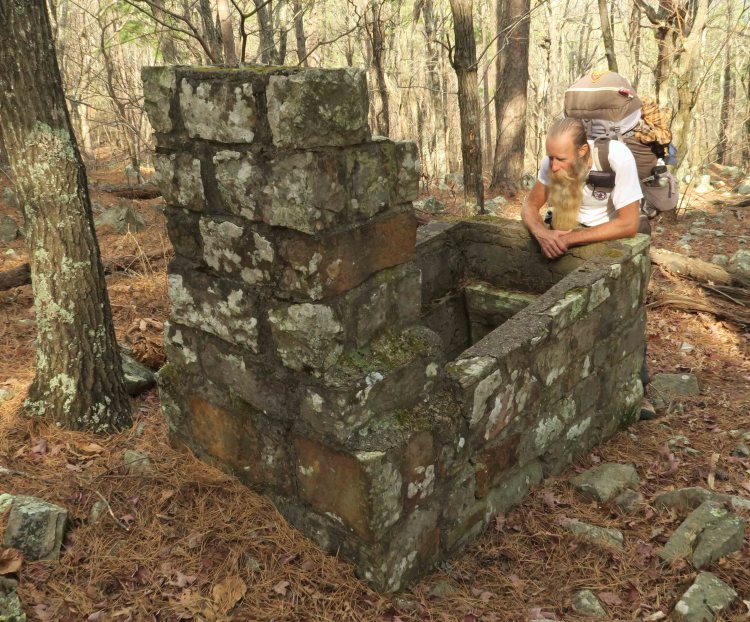
We passed a small broken crag, extra special because of the clear water flowing softly. I topped off my water and snapped a photo.
Later, we filled up for the night at Tom Thumb Spring. It was barely a trickle, so I dipped carefully using my cup.

Watery crag
Wednesday night was spent on White Oak Mountain on a long ridge with many possible sites. We built no fires on this trip since the temperatures were warm, and we wanted to limit our impact. The evening meal was more delicious than I’d expected. A simple Knorr side dish with a dash of olive oil was gourmet surrounded by open woods after a good first day’s walk.

I slept well in the cool winds and light rain that fell on and off through the night.
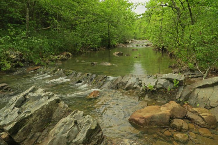
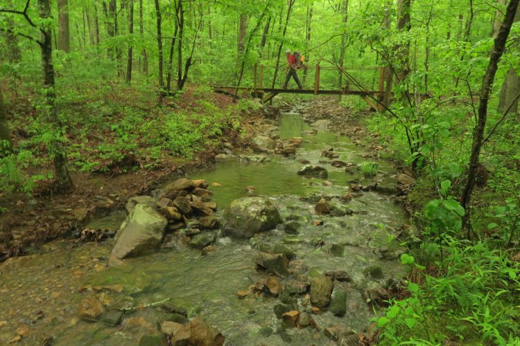
Crystal Prong was the highlight of our second day hiking. It was more beautiful than I remembered. I did a wet crossing to cool my feet and give me a chance to take photos. The opening image on this post is upstream and the following photo is downstream.

Downstream from Crystal Prong crossing
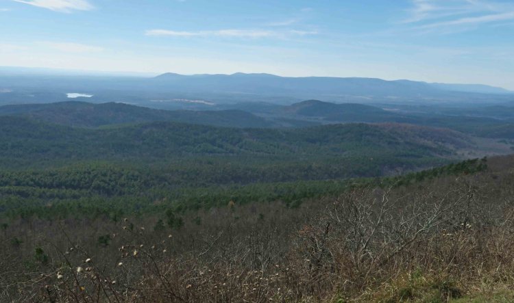
Flatside Pinnacle is always a treat, even with hazy skies in midday light. Strong winds make you concentrate while standing close to the edges. Contrasting greens of early spring popped far below.

Our only planned stay in a shelter was the second night at Brown Creek Shelter. I walked 1/2-mile from the shelter to Brown Creek for water, and an approaching thunder began on my return walk. Hard rains and a wonderful, booming thunderstorm followed while we had supper inside the shelter.

Good water was usually easy to find on the Ouachita at this time of year.
Hiking along Maumelle River, we had the feeling of being in south Louisiana with cypress knees along the water’s edge. For the third night, Bob wisely selected a campsite on a high ridge over a spot where the river was flowing quickly, and mosquitoes were few.

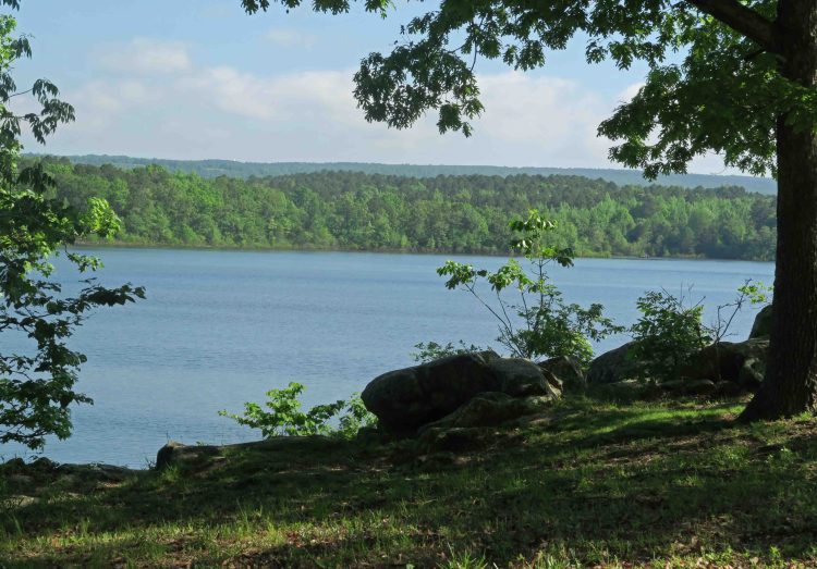
When we arrived at Hwy 10 and Lake Maumelle, we took a break at a roadside park. The remainder of the hike would roughly follow the lake’s north shoreline that we were viewing from the park.
I caught myself thinking of Nimblewill Nomad and his Route 66 trek while walking a section of Hwy 10 just feet from passing vehicles. Drivers were courteous in giving us clearance as they passed.

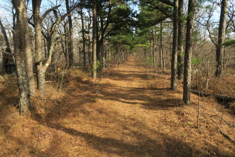
Reentry into the woods was just past the bridge and easy to miss from the highway. A pleasant walk in the woods characterized most of the remaining miles. The trail crossed several small levees that provided excellent footing. Some bordered small ponds and some stood alone making us wonder about their function.


Completely dry insoles and shoes
We finally dried out completely on the last evening, camping well away from the trail. We attempted to follow the trail to Penny Campground but ended up on an old roadbed and stealth camped without leaving a trace.
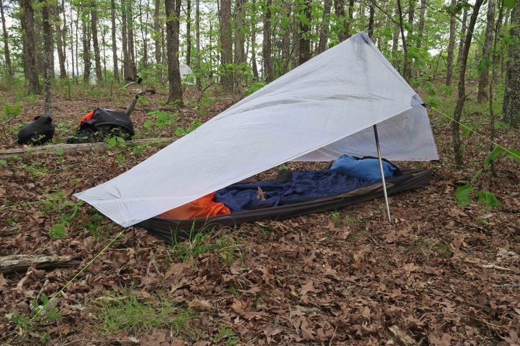
Clear skies prompted me to leave the tarp hanging close by and use only the bivy to keep out the bugs. It was warm enough to make sleep a little difficult, but the miles traveled lured the body into a good night’s rest.
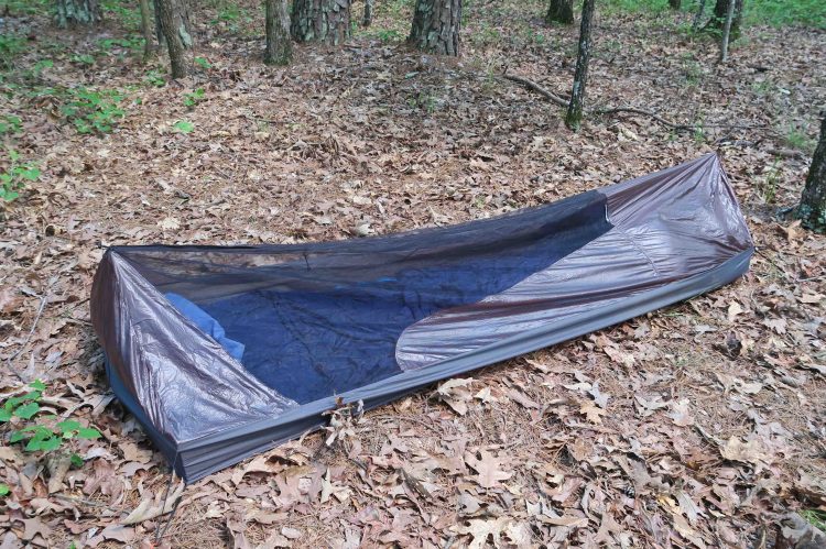
Bivy sack zipped up for bug protection
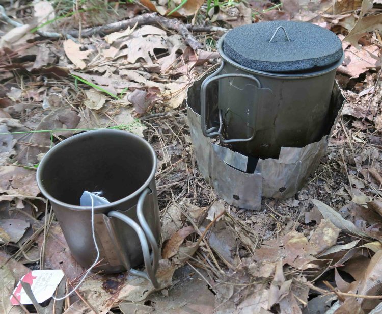
I used my second teabag of the trip that evening and enjoyed sipping while walking and exploring the area.
We got an early start and clipped along at a good pace on the last day, stopping only for water and a quick lunch. Approaching Pinnacle Mountain, we realized our thru-hike was almost complete. We passed our first hikers in five days around mile 119 and then saw several on the Base Trail around Pinnacle Mountain leading to the Visitor Center.

We’d laughed earlier while talking about the obligatory group photos that take time away from walking. Still, we had to stop for a photo before completing our trip.
My oldest daughter was our shuttle, scheduled to meet us at the Visitor Center. She drove up two minutes after we arrived and we began the drive back to the Hwy 7 Trailhead followed by the trip back to Northwest Arkansas.


Last mile marker just under a mile from the trailhead
I’d begun this 63-mile section with feelings of sadness, but the trail did its magic, leaving me physically tired but inwardly strengthened and peaceful. It also left me with memories of the beautiful Ouachita Mountains.
We had the added benefit of feeling a sense of accomplishment that we’d now completed the entire 223-mile Ouachita Trail from Talimena State Park in Oklahoma to Pinnacle Mountain State Park a few miles east of Little Rock, Arkansas.
Below are links to previous posts from our Ouachita Trail thru-hike. We experienced the trail in all types of conditions by contrasting December with May.
Ouachita Trails’s First 51 Miles at the Imperfect Time
The Ouachita Trail: Just Add Water
A fine minute slideshow following the whole route.


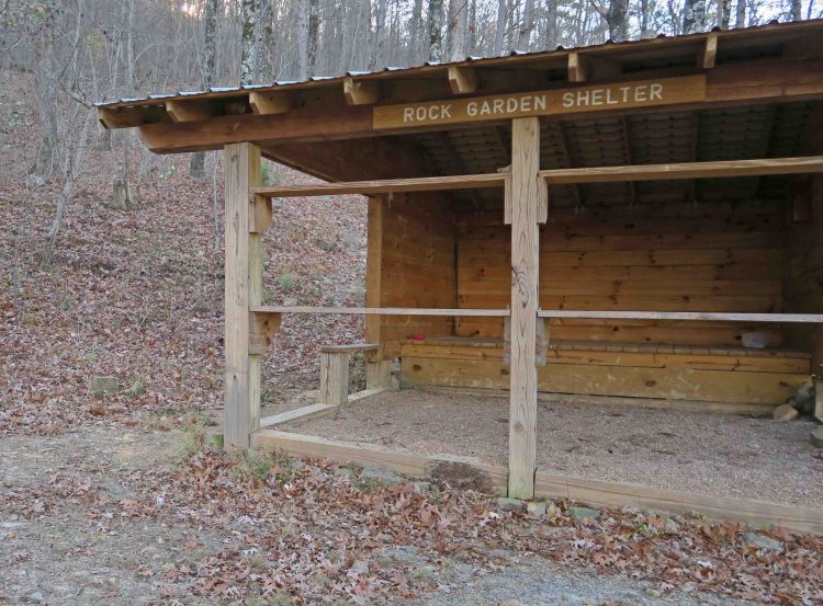
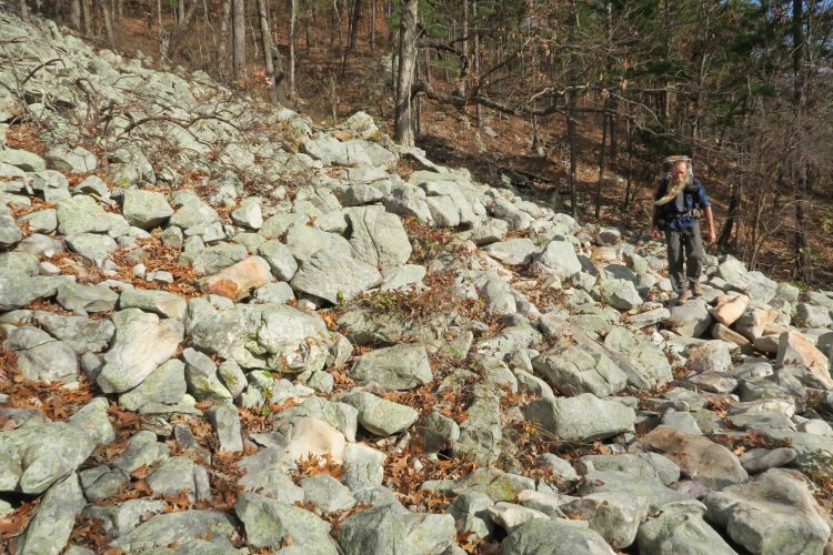
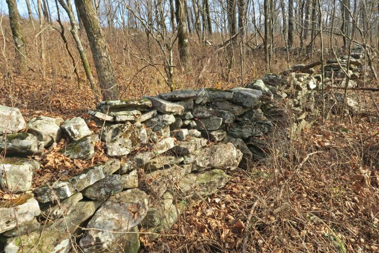
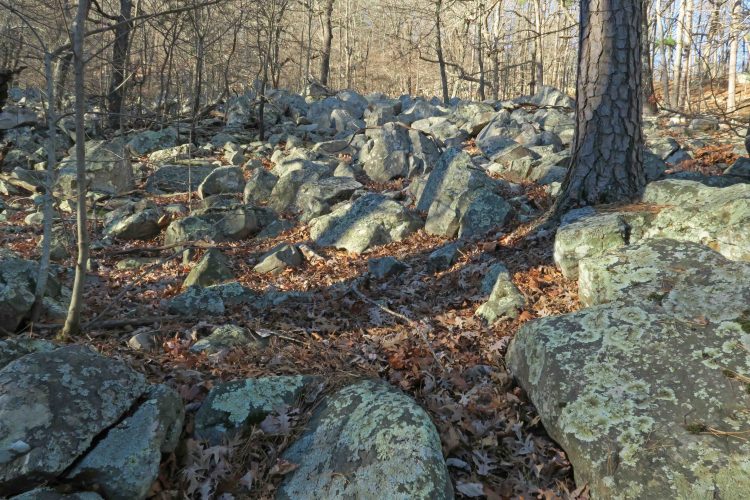 The Rock Garden Shelter got its name honestly. The next several miles involved careful stepping. We were impressed with how different the Ouachitas felt from the Ozarks. Part of it was the increased number of pine trees, but I think the foundations of the differences stemmed from geology. The Ouachitas were formed by the colliding of geological plates while the Ozarks developed from a volcanic uplift, both followed by many years of shaping from erosion.