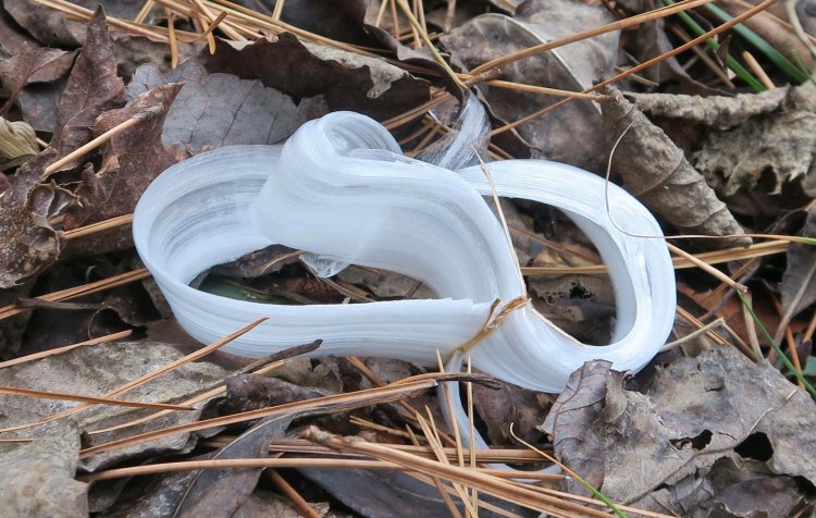
You must rise early with temperatures in the 20s to see frost flowers. That’s what I’ve told friends who express disappointment that they’ve never spotted them. Our second of four days on this 37-mile trek (MM 51-88) provided an unusual opportunity to see frost flowers all day. Skies remained overcast, and temperatures stayed below 30. These little guys slowed my progress on the trail as they called for me to stop to capture images throughout the day.
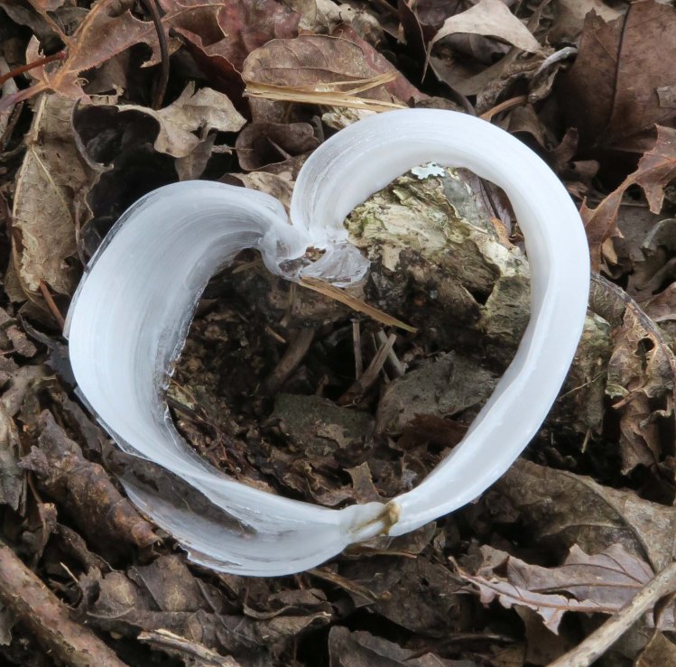
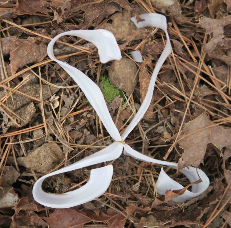
Frost flowers provide endless varieties of asymmetric shapes. Bob noticed the following frost flower which is only the second example of a symmetrical heart-shaped frost flower I’ve seen. I was thankful to capture this image since my wife enjoys finding heart shapes in nature.
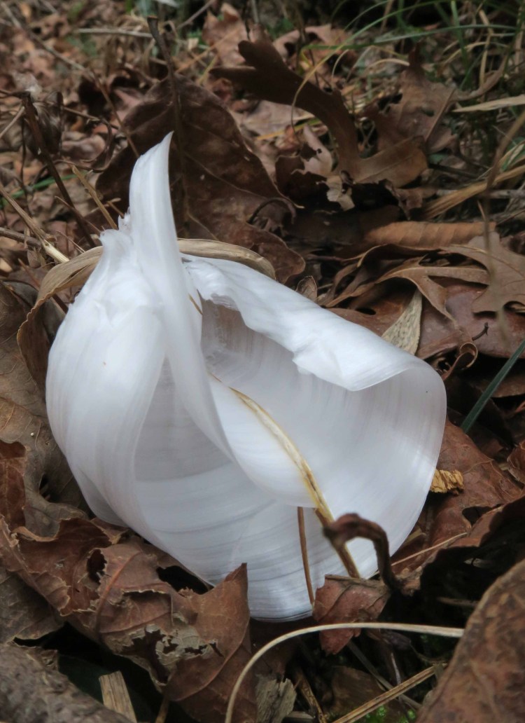
Another almost symmetrical shape was next to the trail. Bob and I were hiking apart at the time but later realized we’d both noticed this one and took photos.
On several north-facing hillsides we saw displays of white that looked almost snow-like but were actually ice crystals that dropped from nearby trees.

The week before Christmas, our wish for rain was granted (“Just Add Water”). This was a “just add ice” week on the trail. I felt anxious during our first day of hiking anticipating temperatures into the 20s with my 20-degree down quilt. Experienced backpackers will say bag ratings just mean you won’t die at that temperature, not that you’ll be comfortable. By wearing a base layer top and down pants, I slept comfortably under my quilt.
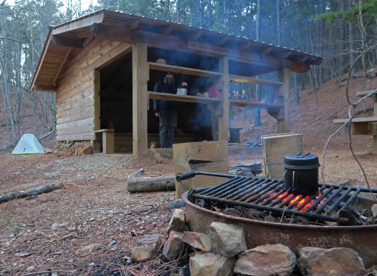
Black Fork Shelter
We stayed at three shelters, Black Fork, Foran Gap, and Turner Creek. Scott, who completed Ozark Highlands Trail over the last couple of years, joined us for an overnighter at Black Fork Shelter. He commented that this was his first shelter camping experience and that it was enjoyable.

With cold temperatures, we thought our water cache at Hwy 71 might be frozen. We’d placed our jugs under a large tree trunk surrounded by leaves and were surprised to find our water was ice-free. Small creeks in the area were flowing so the water jugs weren’t necessary but saved us lost time from filtering.
At Turner Creek, we met only the second backpacker we’ve seen on our first 160 miles of the Ouachita Trail. Kurt, from Oklahoma City, was thru-hiking east to west, so we shared scouting reports with each other. We were able to tell him about Tan-A-Hill Spring (pictured below) where Kurt would be collecting water the next day.


Cold temperatures and lots of available firewood justified nightly fires for warmth and cooking

The Ouachita Trail provided beauty and interest at every turn. Trees sometimes limited vistas but extended horizons reminded us of the expansive country that surrounded us.

One of many rocky outcrops along the trail.

Turner Gap Shelter from the approach spur trail
After shuttling and picking up water jugs, we ended our hike surrounded by an icy-cold cloud at Queen Wilhelmina State Park as we enjoyed a large burger.
Kurt, who we met earlier, had bragged about the Rich Mountain Country Store at the base of the mountain, so I stopped for a cup of coffee to go. I ended up enjoying a visit with the witty and entertaining store owner, Steve Watson. This is a place I’ll come back to in the future!


Other Ouachita Trail Thru-Hike Posts: Ouachita Trail’s First 51 at the (Im)perfect Time / The Ouachita Trail: Just Add Water (Mile 88-160) Due to dryness (at the time) and available days, we did the first 51 miles, then skipped to mile 88-160 the week before Christmas. After Christmas, we did miles 51-88 included in this present post.

Pingback: Photo Challenge: Ending of the Day | Ozarkmountainhiker
Pingback: Ouachita Trail Completed | Ozarkmountainhiker
Pingback: Ouachita Trail’s First 51 at the (Im)perfect Time | Ozarkmountainhiker