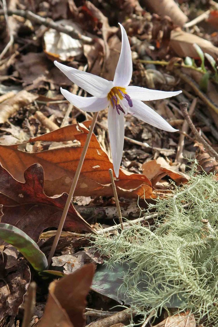
Ushering in Spring on the Ozark Highlands Trail

IMG_1060rr

trout lily

This trout lily peeped up through the leaves and whispered, “Spring is near.” Mike, a fellow hiker, noticed these small wildflowers as we passed. I stopped and spent a few minutes looking and listening to what the subtle blends of color might be saying about the approaching spring.

The open woods revealed a contrast between the trout lily’s tiny voice and the soft roar of wind through the overhanging leafless hardwood canopy.

IMG_1027rr

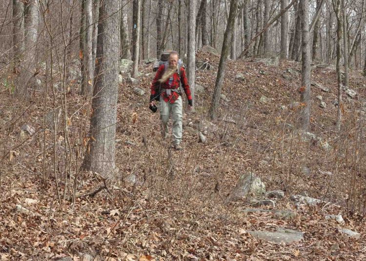
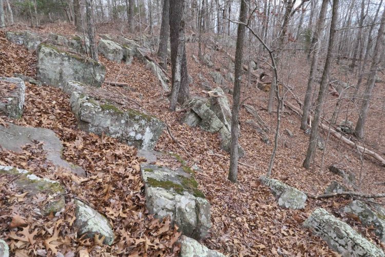
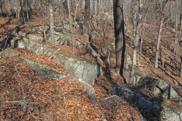
On the OHT southeast of Arbaugh trailhead

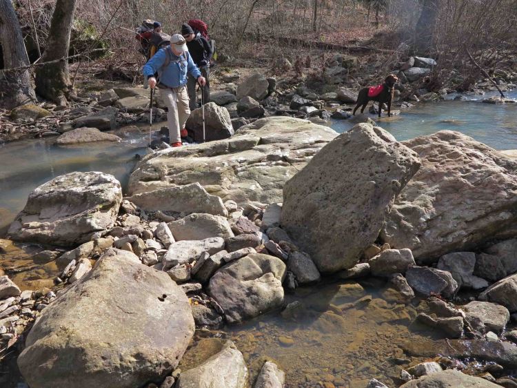
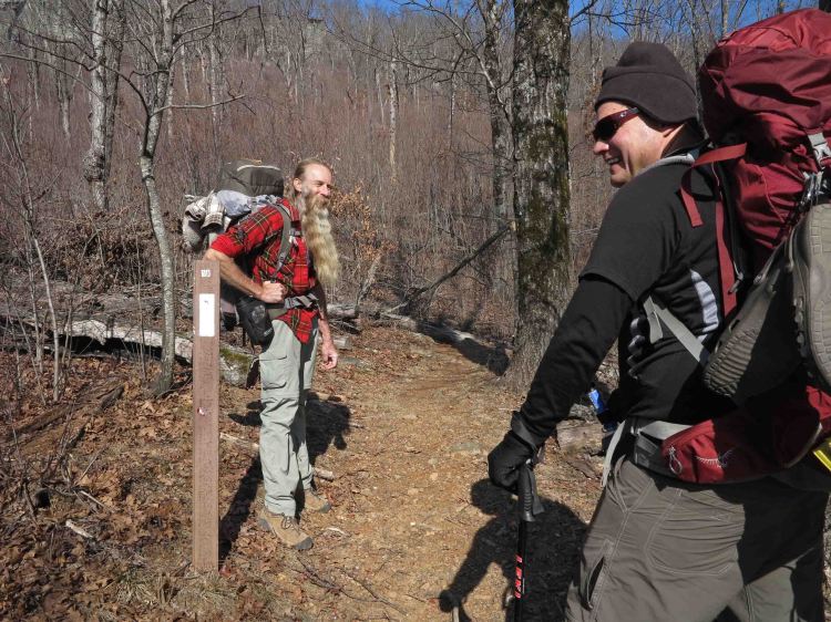
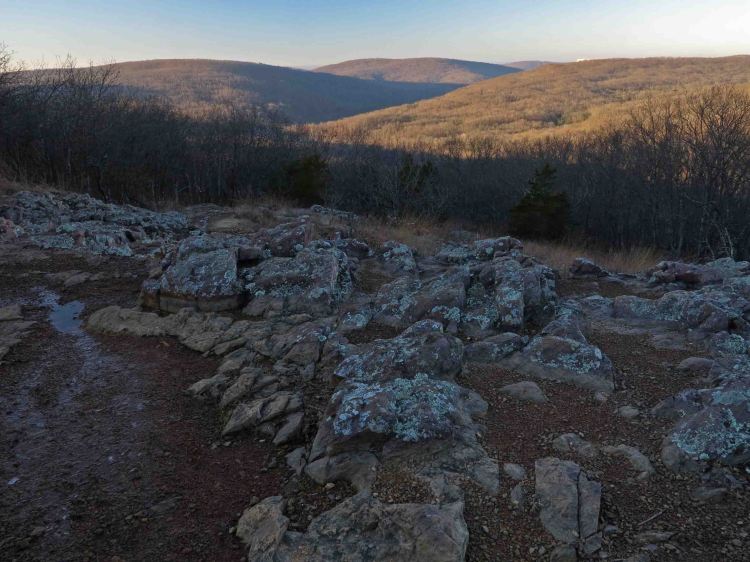
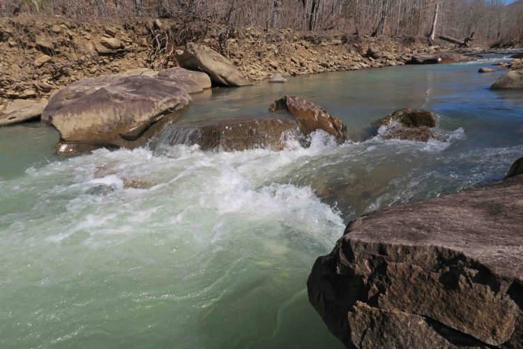
Our route began at Arbaugh Trailhead, north of the little town of Oark, and headed east and south on the Ozark Highlands Trail. Kerry, a strong hiker and mountaineer, led our group of twelve. We enjoyed a short level walk before beginning a long steady downhill toward Lewis Prong, a beautiful stream flowing just enough to require a wet crossing.

IMG_1049rr

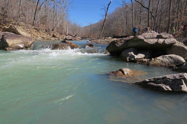
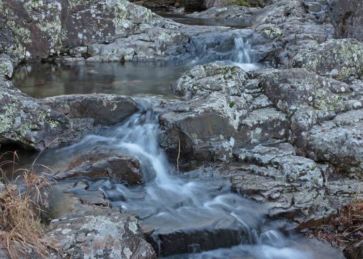
After crossing, I sat to enjoy the flow for a moment before moving on. Maybe recent practice at slowing down was paying off. In the past, I might have hurried on down the trail, but pausing gave me a chance to enjoy Lewis Prong and this rushing cascade downstream from our crossing.

IMG_1055rr

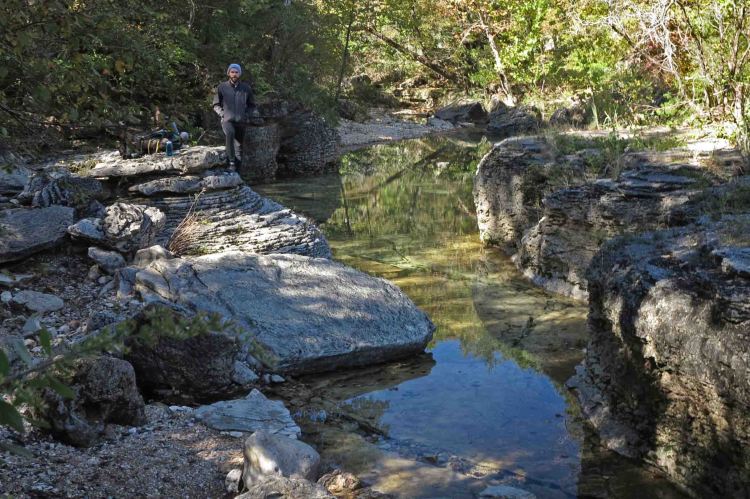
Turner Hollow made a nice lunch stop. Doug found the perfect sitting-rock with a view.

IMG_1066rr

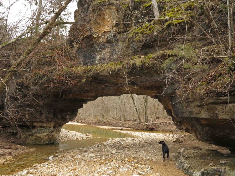
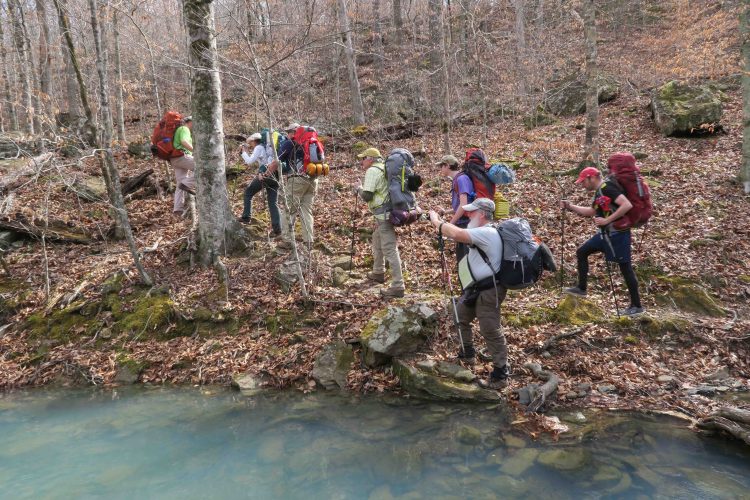
We crossed several creeks that day under Kerry’s watchful eye.

IMG_1069rr.jpg

Waterfall Hollow was littered with downed trees from ice storms of the past. We saw evidence of trail maintenance all along this section. Randy, the adopter of this section, and other volunteers had spent many hours here, and we were thankful.

IMG_1078rr.jpg

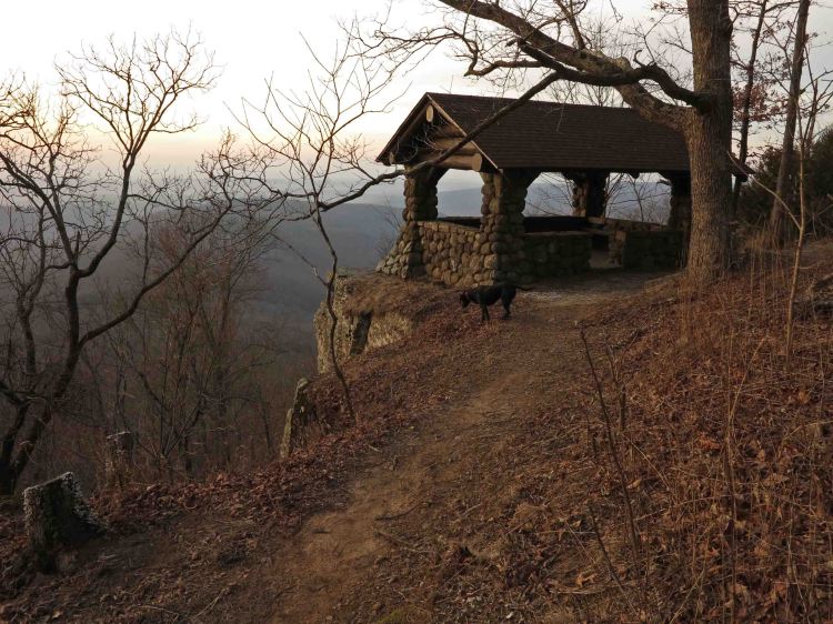
The climb up and over Moonhule Mountain was tough followed by smooth sailing down to Hignite Hollow where we camped.

IMG_1091rr

As the sun went down, we began to enjoy the warmth of a fire as well as conversation and marshmallows. I used the fire to cook my broccoli cheese soup with dehydrated potatoes. The temperature probably dipped down into the upper 30s on this clear, star-filled night.

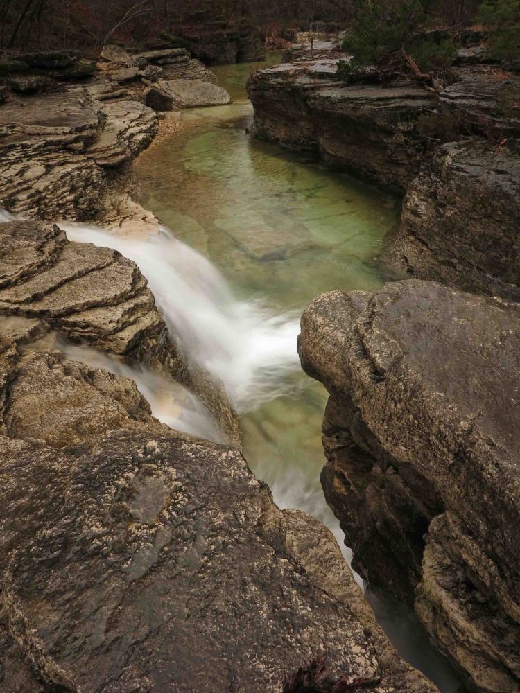
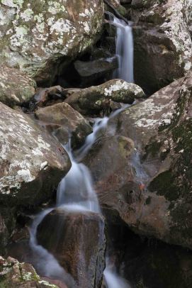
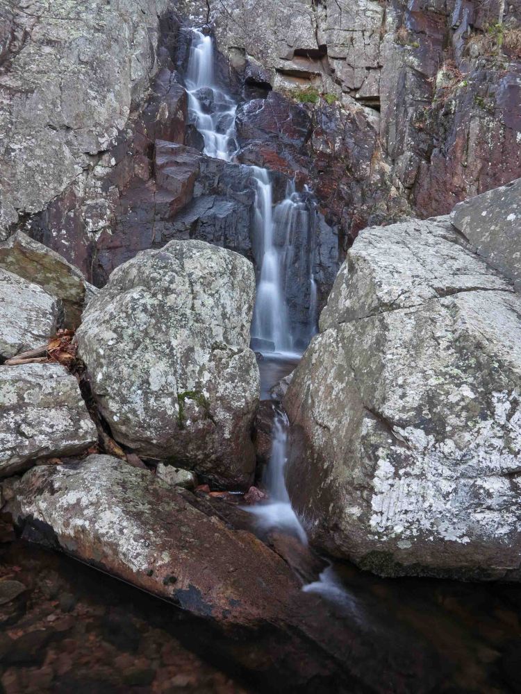
The next morning I was up at first light and headed out for a short hike with camera in hand. I hiked along the trail and then down an old roadbed to a drainage that led back to Hignite Hollow Creek. It was a pleasurable hike, especially where the creek formed small cascades that shimmered in the morning light.

IMG_1115rr

IMG_1149rr

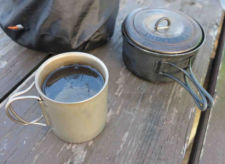
Morning coffee before continuing toward Ozone Campground

IMG_1179rr

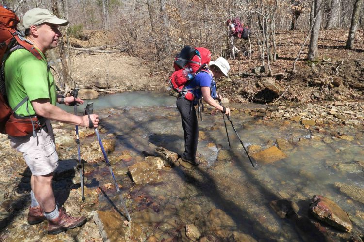
Boomer Branch was a dry crossing though the water was clear and inviting. Once on the other side, the route continued up and away from the creek. Mike stopped for a photo as the group headed out.

IMG_1183rr

After a short climb, we followed a beautiful ridge walk before descending to, and crossing, the Mulberry River. At my feet’s request, I remained standing in the creek a few extra seconds. The cold water felt good on tired feet and legs.

Some tough climbs awaited us as we moved away from the Mulberry and eventually to Ozone. A familiar looking trout lily stood silently as I passed. It seemed to be saying, “Hope you enjoyed your springtime hike. Think of this cool morning next July!”

I thought about how much this little stretch of trail had given me during my two-day trek. Gifts from the trail are often more than expected, and this hike was no exception.

IMG_1191rr

Back to Morgan Mountain and Lessons in Slowing Down

IMG_0697rr

Hiker at a potential wet-season waterfall after our climb.

It had been 20 days since I resolved to slow down and do some exploring on Morgan Mountain. Hiker-dog and I decided to use the Redding Loop as a jumping off point. Several rocky drains asked to be explored, so I answered by using the rocky routes to see some new landscape and get in some good climbs.

As I was climbing pretty hard, I looked up to see Hiker-dog in the distance already at the top. She seemed to be looking down and wondering what was taking so long. Then she flew down the hill, arriving at my side within a few seconds. I was envious.

IMG_0706rr

From the lower falls on Redding Loop, we climbed up the drainage, finally reaching the dome of this small mountain. After a break, I looked at the map and decided to follow the next drain down, thinking it would probably take us down to the upper falls. After reaching those falls (all pretty dry), we followed the loop around and back to Redding Camp Ground.

Along the way, Hiker did some serious dog-work looking for moles. She came up empty today but had a dirty nose to prove her work.

IMG_0714rr

Digging for moles

IMG_0723rr

A recent controlled burn gave the woods that familiar campfire smell. Hiker leashed up when we got close to Hwy 215 and the campground.

IMG_0732rr

IMG_0756rr

We stopped off to view the Mulberry River before heading toTurner Bend for lunch. Today was a good blend of covering some miles, but taking time to explore and sit still for a while. I still need more training in slowing down and letting my routes be flexible, but today was a nice beginning.

IMG_0761rr

Turner Bend’s “Almost Famous” ham sandwich is awesome! 

Random Walking with John Muir in the Ozarks

IMG_0082rr

Detail of ice formations at the base of a bluff

I drove up AR 23 (AKA Pigtrail) to collect GPS waypoints for an article I’m working on with photographer and hiking friend, Eric Scowden. My only traveling partner today was Hiker-dog. It was a cold morning, but the sun warmed the air quickly. I enjoyed the “popcorn” ice formations that formed on roots and rock along wet bluff lines.

This morning was like many others over the last eighteen months. I have places to go and data to collect. Working on a trail guide to the Ozarks has been a wonderful experience, but every outing’s purpose has been to hike and collect information about specific trails. I had my to-do list for today though it was shorter than usual.

After hitting the required locations, I picked a random pullout spot on Morgan Mountain Road that I’d driven past many times. On impulse, I walked down an old jeep road just to see what was there. I didn’t jump over a fence but thought of John Muir’s statement that he would often “throw bread and tea in an old sack and jump over the back fence” to begin an exploration of nature.

IMG_0111rr

Large boulders at the edge of an open field

I was surprised at how much I enjoyed the randomness of this walk. I formed my route by following what looked interesting to me. I arrived at an open, level field lined with large boulders along the eastern ridge. They bowed to the forces of gravity, drifting down toward the next bench fifty feet below.

IMG_0116rr

Hiker exploring the field on the eastern side of Morgan Mountain

I walked past a hollow filled with jagged boulders that begged me to enter, but they’ll have to wait for another day when I return with a dry loaf of bread, tea, and hours to spend. I’d like to apply Muir’s “method of study” and his ultra-light packing techniques to my next hike on Morgan Mountain.

“My method of study was to drift from rock to rock and grove to grove. I’d sit for hours watching the birds or squirrels, or looking into the faces of flowers. When I discovered a new plant, I sat beside it for a minute or a day, to make its acquaintance and try to hear what it had to tell me. I asked the boulders where they came from and where they were going. And when I discovered a mountain, I climbed about it and compared it with its neighbors. It’s astonishing how high and far we can climb in the mountains we love, and how little we require for food and clothing.” – John Muir

I look forward to spending an entire day meandering my way down that rugged hollow on Morgan Mountain. I look forward to simply sitting still to listen, watch, and learn. Maybe I’ll even ask a boulder or two where they came from and where they’re going. I think even Hiker-dog might enjoy a little less goal-oriented travel in the Ozarks.

IMG_0132rr

Ozark Morning at Natural Dam

IMG_5765r

Early morning sun began to touch the tips of trees upstream.

I expressed embarrassment to local photographer Eric Scowden that I’d lived in the Ozarks for fifteen years without driving the short distance to see Natural Dam Falls. He’d photographed Natural Dam before, so we headed up AR 59 north of Van Buren to have a look before sunup. Typical of cold mornings, we had the place to ourselves.

We kept our ears open for approaching traffic while placing tripods on the nearby road. Natural Dam Road has led a hard life here in the path of the Mountain Fork of Lee Creek. We saw evidence of recent repairs from last month’s winter floods. When the creek reaches flood stage, the road and dam can literally disappear.

IMG_5720rr

Eric composing shots from Natural Dam Road

Eric is an outstanding photographer so watching him move around for different compositions and angles inspired me to experiment more than usual. He changed lens from zoom to wide-angle which wasn’t an option for me with my non-SLR camera. We both had our heavy tripods, essential pieces of equipment for scenic photography.

IMG_5740rr
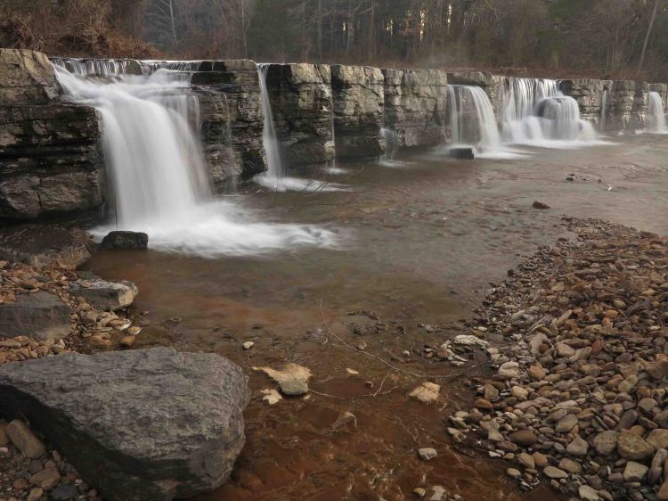
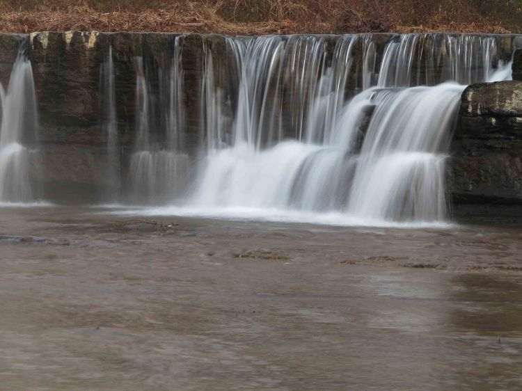
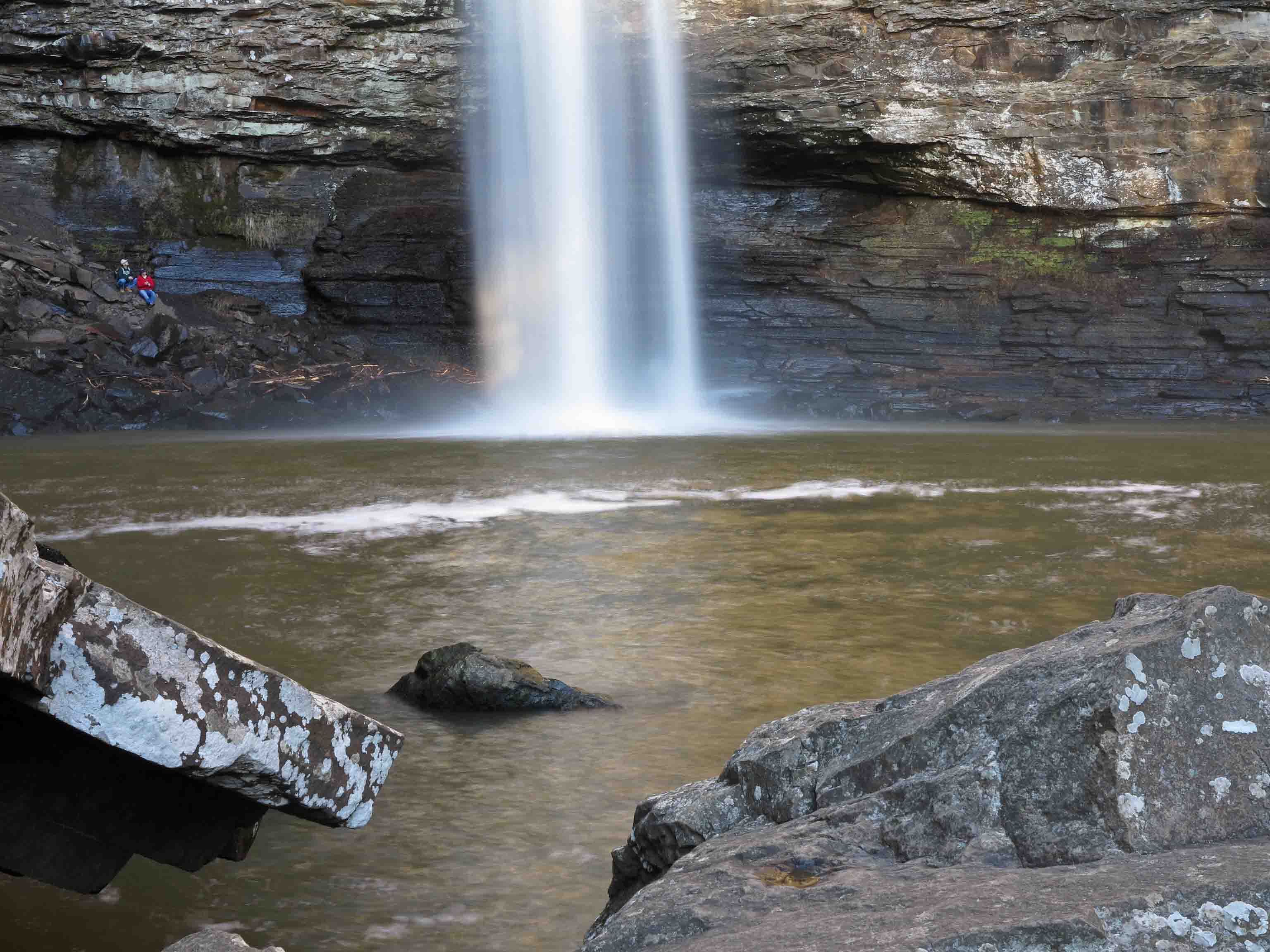
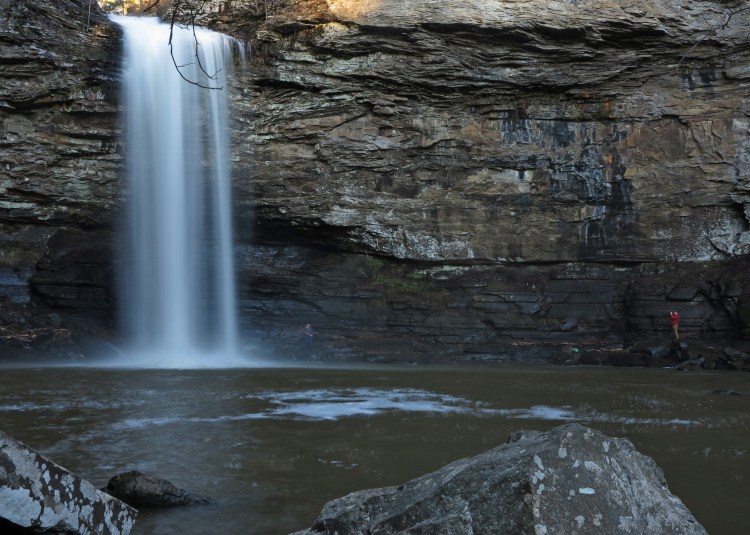
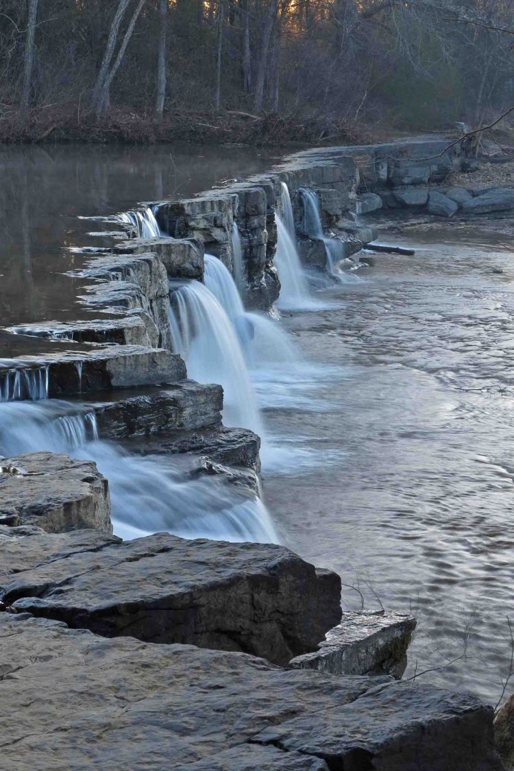
William Larrimore came across this wide stone ledge while hunting in 1819. He built a small gristmill on the left (northwest) side of the ledge. Large rectangular rocks that formed the foundation still sit next to the creek. Natural Dam became one of the earliest settlements in Crawford County and by 1838, a post office and store were located in the town of Natural Dam.

IMG_5712rr

Eventually, we walked upstream to check out a small cascade across the creek. We agreed that this will be a great photo location in the spring and fall when colorful foliage is reflecting on the water. On this morning, the white bark of leaning sycamore trees sparkled nicely on the glassy surface of Mountain Fork Creek.

IMG_5780r

Eric focusing on reflecting light

IMG_5728rr

We could have spent the whole morning at Natural Dam, but another trail was on the itinerary, so we finally pulled ourselves away as sunshine warmed the air and locals began to arrive.

Waterfalls are never the same twice. I look forward to future visits to Natural Dam.


Overdue visit to White Rock Mt.

IMG_5478rr

Sunrise from the top of White Rock Mt.

White Rock Mountain is a special place. You can drive up using gravel roads, but the best way to visit is by trail. We began at Shores Lake on the west side of the loop leading to White Rock Mountain. Parker led the hike. He and Bob camped the night before at Shores Lake. Rick and I joined the group Saturday morning. With the two labs, Hiker and Henry, our group of six started out.

My last trip to White Rock Mountain was in March of 2015. Hiker-dog and I were overdue for a White Rock visit and way overdue for a backpacking trip. I spent the last year writing about day hikes in the Ozarks of Arkansas and Missouri for a Five-Star trail guide to be published in September. Now that the text, photos, and GPS files are submitted, it’s time to do some multi-day trips and get into backpacking condition.

IMG_5428rr

The flow in White Rock Creek was moderate, which made for dry crossings. The White Rock Cascade is pretty at all water levels.

IMG_5451rr

Clothing layers came off during the climb up the mountain. It was a cold but sunny day, perfect conditions for walking uphill.

IMG_5460rr

Bob and Rick paused at the 18-mile marker on the short portion of trail that follows the Ozark Highlands Trail. That 18 is indicating how many miles it is on the OHT to Lake Fort Smith State Park Trailhead. At this point, we’re about a mile from the top of White Rock Mountain. You might be able to see one of the overlooks on the edge of the bluff directly above Bob.

Backpacking provides some of the best exercise, but also the best rest. I was in the bag by 7:30 p.m. The next morning, I watched for my cue in the eastern sky. As the sky began to glow, I headed to the rim of the mountain with my camera (and my dog). We took the sunrise photo shown at the beginning of this post and then walked around the rim to the southern and southwest overlooks in the ever-changing light.

IMG_5493rr

Southern overlook

IMG_5494rr

Southern overlook looking toward Shores Lake a few minutes after sunrise

IMG_5504rr

Southwest overlook with arrows pointing toward various locations in the distance

IMG_5517rr

Arriving back at camp warmed from the sun and the walk, I measured a cup of water for coffee. Ice formed immediately reminding me that it was a cold morning.

Our housing – three tents and one hammock

IMG_5531r

Many frost flowers popped out along the roadside and trail.

IMG_5533rr

In addition to being our hike leader for this outing, Parker is the trail maintenance coordinator for the OHT. As we paused at the White Rock Mt. trail register, Parker wondered whether cards or notebooks would be better for recording use of the trails.

IMG_5550rr

The trail on Sunday was mostly downhill except for the last couple of miles. This is where the trail makes you earn the distance. There are several PUDs (pointless ups and downs) in this section. They really are not pointless but tend to come at the numerous drainages and creek crossings. I was feeling pleased with this overdue backpacking trip, knowing these little hills are investments in conditioning that will pay off on future trips.

IMG_5567rr

One of several small creek crossings in the last couple of miles.

Shores Lake / White Rock Mountain Loop is one of the classic hikes in Arkansas for a reason. It’s just the right challenge for many backpackers and can be done as a 13-mile strenuous day hike.

If you do this loop trail, you’ll get some great health benefits and see some beautiful sights. You’ll also want to visit again. White Rock Mountain never loses its attraction and has a way of drawing you back in every season.

For driving directions, you might check out this previous post, Favorite Old Trails with  a Favorite New Friend.

Rock House on the Ozark Highlands Trail Revisited

IMG_5349rr

We began at Cherry Bend Trailhead on AR 23 hiking the Ozark Highlands Trail to the west and stopped at the Rock House before continuing toward Fane Creek. Today I remembered the cold and rainy day when Bob and I sought refuge here on our thru-hike of the OHT. Later in that trip we found Hiker-dog. I should probably plan a camping trip at the Rock House for her in the future.

Today, Bob and his wife, Dana along with Mary, Mike, and his granddaughter took a few minutes to pause and have a look. Below are a few photos from today’s visit that you might enjoy. For a little history of the Rock House, visit my earlier post, Rock House on the OHT.

IMG_5367rr

Hiker investigating the Rock House 

IMG_5352rr

IMG_5373rr

Spring in the back corner

IMG_5382rr

Wondering how much longer this stone will stay in place. 

IMG_5384rr

Hiker seemed to be saying it was time to go. 

Natural Arch on Clifty Creek: The weight of beauty

WordPress Daily Post: Weight(less)

IMG_5229rr

Natural Arch on Clifty Creek in the Missouri Ozarks

Northwest of Rolla, Missouri, Little Clifty Creek merges with the main channel of Clifty Creek by way of this Natural Arch. With rock weighing approximately 170 pounds per cubic foot, I was a bit nervous and awed when walking underneath this massive arch. Though solid and standing in its present form for several human lifetimes, it was carved by the relentless force of water (62.5 lbs. per cubic foot) over time. Its form is still subject to change today.

IMG_5261rr

Hiker-dog and the Natural Arch

I appreciated Hiker-dog posing to provide a sense of scale as I took a picture from the other side of the arch.  She weighs as much as one cubic foot of water, and I’m just under the weight of one cubic foot of stone. As impressive as the Natural Arch is due to its size and weight, I was even more awed by a quality that has no weight by the cubic foot; its beauty!

Solitude on Missouri Trails: Hercules Glades


IMG_5129rr

Long Creek Falls viewed from downstream on January 7th hike.

On our last visit to the Hercules Glades Wilderness Area, we crossed paths with at least ten hikers on the trail and another twenty members of a Boy Scout troop at the Coy Bald Trailhead. The hiking was excellent, and it was a pleasure to see others on the trail, but the creeks were mostly dry, so I looked forward to a second visit in wetter conditions with a little more solitude.

IMG_3245rr

Long Creek Falls during dryer and busier times. One of the few pools on the creek. Five more hikers are close by.

IMG_5170rr

A similar view to the one above looking downstream in different light and conditions.

I’ve found that if you hike on a rainy day in January, you’ll probably have the trail to yourself. Your chances for solitude are enhanced if snow is in the forecast. I didn’t see another person on the trail all day.

IMG_5205rr

Long Creek runs under an overhanging bluff where we stood in the dry on our last visit.

Hiker-dog and I walked from Hercules Tower Trailhead to Long Creek then downstream to the falls. No concerns for drinking water on this trip! I would filter it, but Hiker enjoyed having a drink or a bath whenever it suited her.

IMG_5175rr

Hiker-dog taking in the view after taking a dip in the falls.

There are several creek crossings on this trail and the temperature was around 40-degrees and dropping. To save time, I opted to do the crossings in my regular hiking shoes, so I got a little chilled while standing still to take photos at the waterfall.

I was thankful for the warming effects of the the uphill climb back to the trailhead. It was a solitary, chilly, and beautiful time in the Hercules Glades Wilderness Area!

Welcoming 2016 at Cedar Falls

I was a little surprised by the number of people hiking up and out of Cedar Falls Valley as I was hiking in. Many were carrying cameras, and one said I was too late for the prism shots they’d gotten. I wasn’t disappointed. His comment let me know the sun was still striking the falls, so I stopped to take a few photos of a little stream next to the trail.

IMG_4932rr

Small cascade next to Cedar Falls Trail

I was wanting to arrive as the shadow of the valley covered the falls and made it possible to get even light.

Pausing at this little cascade reminded me of many childhood hikes down this trail while listening to the water work its way toward Cedar Creek.

IMG_4933rr


I thought it was interesting to see this sign at Cedar Creek Bridge. I noticed some bowing in the bridge’s shape toward the downstream side, probably a result of recent high creek levels. This little bridge is pretty tough.

When I arrived at the falls, crowds had thinned, and I was able to select a spot to hang out for a while. Since sunshine was still hitting the upper parts of the valley wall, I focused on the base of the falls and was pleased with these two hikers for adding a sense of scale.

The base of Cedar Falls

The base of Cedar Falls

As the valley walls increasingly blocked the sun, I was able to enlarge the frame.

I asked a young man who was rock hopping if he’d already been to the base of the falls. I mentioned that having someone there would add scale to my photos. He got excited about doing this, and I feared I was going to see him fall in the creek.

A few minutes later he and a buddy were at the base. He didn’t realize I was using long shutter speeds. He never stood still, but that was reflective of his energy and enthusiasm.

Petit_Jean_Cedar_Falls12

Energetic young man tossing limbs at the base of the falls as his buddy takes a picture.

A few minutes later, he showed up at my camera and I was relieved to see he was still in one piece. I gave him my email, hoping to share a few of the waterfall photos with him.

I enjoyed spending over an hour there at Cedar Falls and recommend a waterfall hike as a good way to welcome the new year.

Petit_Jean_Cedar_Fall10

Notice the hikers to the left of the falls. This is a big place!

IMG_5060rr

Hiked up to a higher viewpoint for this shot before hiking out.

Couldn’t resist taking a short video clip of Cedar Falls before heading out. Please forgive the jerky camera movement. I used my still camera and tripod for the shot.

Taum Sauk Mountain: Missouri’s high point and home to Mina Sauk Falls

IMG_4112rr

Hiker-dog seemed to appreciate the beauty of rocky cascades above Mina Sauk Falls.

Hiker-dog and I camped on top of Taum Sauk Mountain with the plan to hike the Mina Sauk Falls Trail early. It was a cool night at 27-degrees. We rose early, excited to hike a loop trail that includes the high-point of Missouri.

IMG_4146rr

The section of trail to the high point of Missouri is paved and handicapped accessible. Beyond that, the trail turns to dirt and rocky paths.

IMG_4096rr

The Missouri high point at 1,772 feet reminded me of Arkansas’ high point on Mount Magazine (2,753 feet). Hardwood forests surround both high points rather than expansive vistas. The impressive views from these mountains are closer to the mountain ridges at lower elevations.

You’ll see a commemorative plaque and a trail register to document your visit. Be sure to step up onto the boulder so you’re officially at the highest point possible.

IMG_4101rr

Rocky overlook 

There are several nice overlooks along this loop trail. Paths through lichen-covered rocky sections are marked with trail posts and orange arrows.

IMG_4119rr

Water twists its way down toward Mina Sauk Falls. As you begin to hear the water flowing, the trail intersects with the Ozark Trail. Hiking down the rocky Ozark Trail about a tenth of a mile takes you to the base of the Mina Sauk Falls. It’s worth the side-trip!

A Native American legend tells how the Mina Sauk Falls were named. The version linked here was printed in the Southeast Missourian in 1935. It could be called a Missouri Ozarks version of the Romeo and Juliet story.

IMG_4137rr

Junction to the Ozark Trail and the base of Mina Sauk Falls 

IMG_4135rr

Mina Sauk Falls

Spend some time at the base of Mina Sauk Falls, beautiful even when water flow is subdued. Imagine Mina Sauk of the Sauk-ton-qua tribe leaping to her death over these falls, enraged over the unfair death of her Osage warrior love.

After enjoying the falls, we climbed back up to the junction and continued along the creek on this loop trail. We couldn’t resist a second look at Missouri’s high point as we neared the trailhead.

On the last section of this loop, we encountered the same two hikers we’d met the day before at Maramec Spring. I thanked them for recommending the walk down Maramec Branch to the bridge. We’d only met two other hikers on the trail on this cold morning, so I chalked this up as another “small world” experience.

As we walked to the Jeep passed the sheltered trailhead, I thought about the crowds that must flock to this location during the warmer months. We like Taum Sauk Mountain in winter!

Taum Sauk Mountain Mina Sauk Falls Trailhead

Taum Sauk Mountain Mina Sauk Falls Trailhead