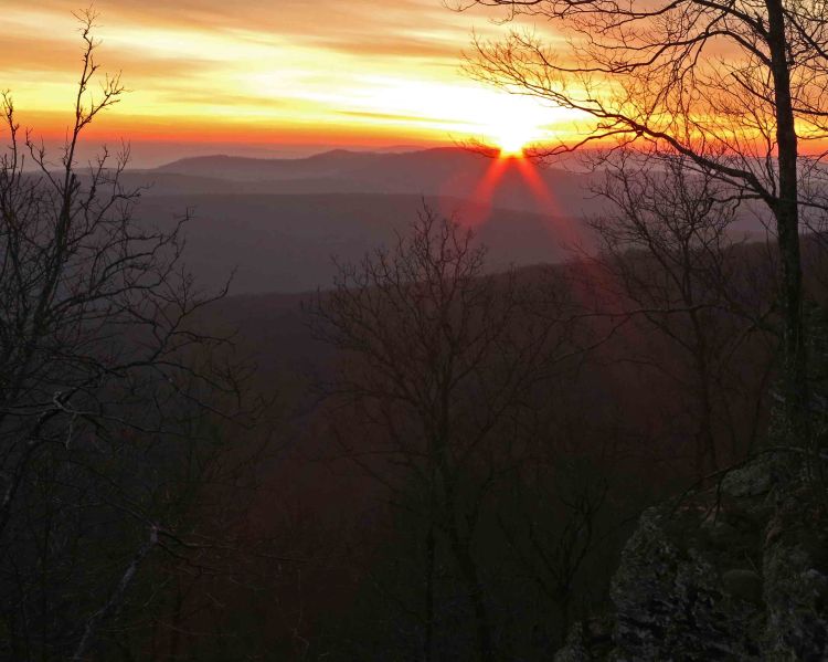
Sunrise from the top of White Rock Mt.
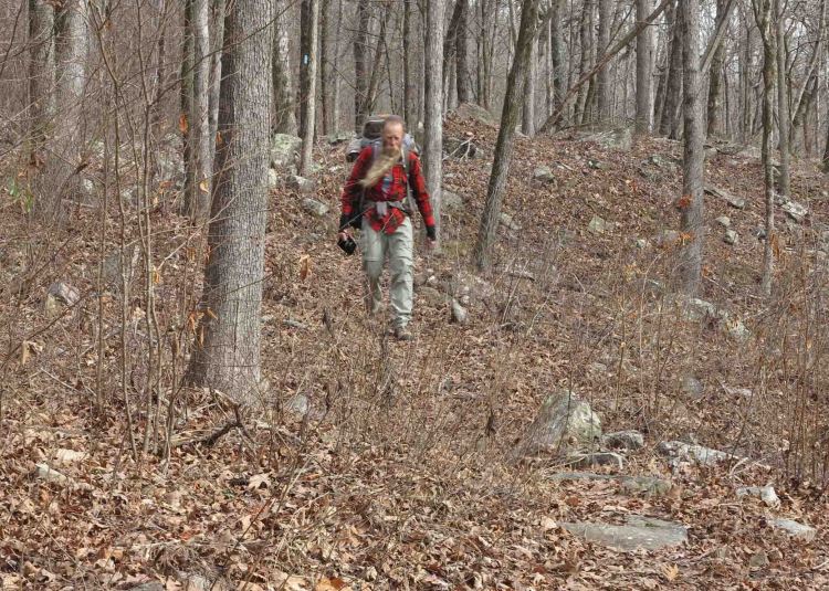
White Rock Mountain is a special place. You can drive up using gravel roads, but the best way to visit is by trail. We began at Shores Lake on the west side of the loop leading to White Rock Mountain. Parker led the hike. He and Bob camped the night before at Shores Lake. Rick and I joined the group Saturday morning. With the two labs, Hiker and Henry, our group of six started out.
My last trip to White Rock Mountain was in March of 2015. Hiker-dog and I were overdue for a White Rock visit and way overdue for a backpacking trip. I spent the last year writing about day hikes in the Ozarks of Arkansas and Missouri for a Five-Star trail guide to be published in September. Now that the text, photos, and GPS files are submitted, it’s time to do some multi-day trips and get into backpacking condition.

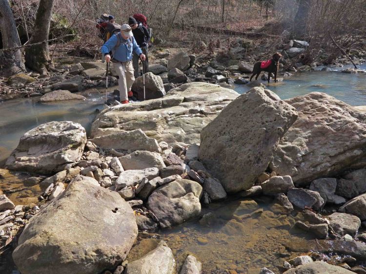
The flow in White Rock Creek was moderate, which made for dry crossings. The White Rock Cascade is pretty at all water levels.
Clothing layers came off during the climb up the mountain. It was a cold but sunny day, perfect conditions for walking uphill.
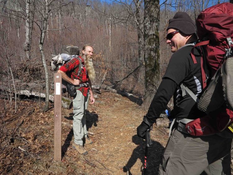
Bob and Rick paused at the 18-mile marker on the short portion of trail that follows the Ozark Highlands Trail. That 18 is indicating how many miles it is on the OHT to Lake Fort Smith State Park Trailhead. At this point, we’re about a mile from the top of White Rock Mountain. You might be able to see one of the overlooks on the edge of the bluff directly above Bob.
Backpacking provides some of the best exercise, but also the best rest. I was in the bag by 7:30 p.m. The next morning, I watched for my cue in the eastern sky. As the sky began to glow, I headed to the rim of the mountain with my camera (and my dog). We took the sunrise photo shown at the beginning of this post and then walked around the rim to the southern and southwest overlooks in the ever-changing light.
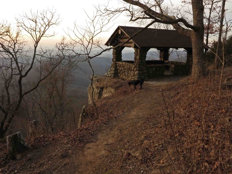
Southern overlook

Southern overlook looking toward Shores Lake a few minutes after sunrise

Southwest overlook with arrows pointing toward various locations in the distance
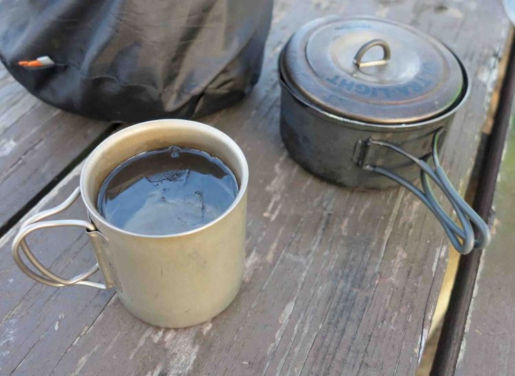
Arriving back at camp warmed from the sun and the walk, I measured a cup of water for coffee. Ice formed immediately reminding me that it was a cold morning.


Our housing – three tents and one hammock

Many frost flowers popped out along the roadside and trail.

In addition to being our hike leader for this outing, Parker is the trail maintenance coordinator for the OHT. As we paused at the White Rock Mt. trail register, Parker wondered whether cards or notebooks would be better for recording use of the trails.
The trail on Sunday was mostly downhill except for the last couple of miles. This is where the trail makes you earn the distance. There are several PUDs (pointless ups and downs) in this section. They really are not pointless but tend to come at the numerous drainages and creek crossings. I was feeling pleased with this overdue backpacking trip, knowing these little hills are investments in conditioning that will pay off on future trips.

One of several small creek crossings in the last couple of miles.
Shores Lake / White Rock Mountain Loop is one of the classic hikes in Arkansas for a reason. It’s just the right challenge for many backpackers and can be done as a 13-mile strenuous day hike.
If you do this loop trail, you’ll get some great health benefits and see some beautiful sights. You’ll also want to visit again. White Rock Mountain never loses its attraction and has a way of drawing you back in every season.
For driving directions, you might check out this previous post, Favorite Old Trails with a Favorite New Friend.

I wonder how the area has recovered from the tornado damage from 15+ years ago. The west loop was the worst I recall, but it was like a messy clearcut in many places.
The whole loop is in good shape thanks to trail adopters and maintainers.