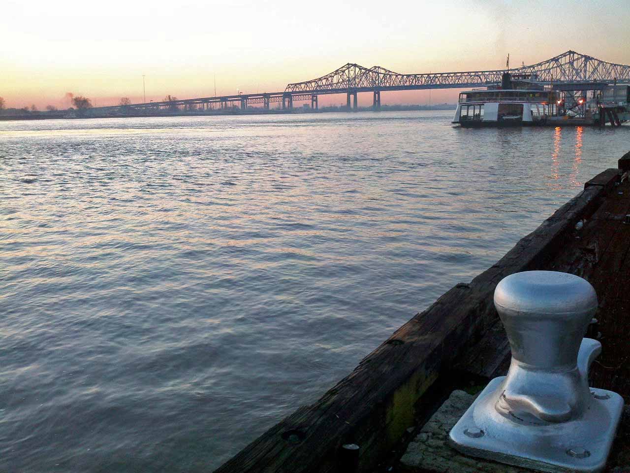
There’s nothing like a little “urban hiking” to make you appreciate the Ozark Mountains. But, there are interesting and sometimes beautiful things to explore even in an urban setting. Early morning is my favorite time in big cities, especially New Orleans. It’s one of the few times you can walk around without bumping into hordes of people (many inebriated). I rose before dawn on the final day of a professional educator’s conference looking forward to an easy run/walk along the Mississippi River.
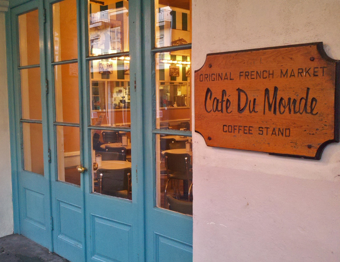
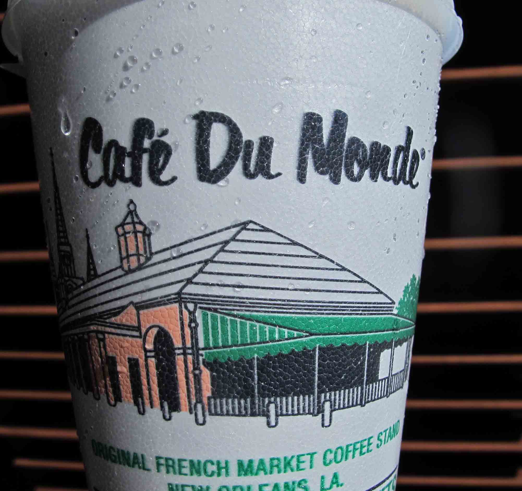
My targeted stop was Café Du Monde’ on Decatur Street. The friendly manner of the staff was refreshing, especially in a city where everyone has their hat out waiting for a tip. I gladly tipped the pleasant gentleman who retrieved my Beignets and STRONG coffee. Anyone working at 5:00 a.m. deserves extra consideration.
Entrance to Cafe’ Du Monde’
Local artists were setting up for an exhibit in the Jackson Square area even before daylight. The motivation might have been to get prime locations. Even in the dim light I could make out some of the things that were already on display. I admire those who can create visual art. Some art really grabs me and some leaves me wondering if any skill was required to produce the piece. Looked like both types were going to be represented in this exhibit.
Stopped to take a picture of the cathedral at Jackson Square before following the street sweepers and pressure washers on down Decatur toward the hotel. Ready to begin the day, refreshed by the cool morning air, some good exercise, and a STRONG cup of coffee.
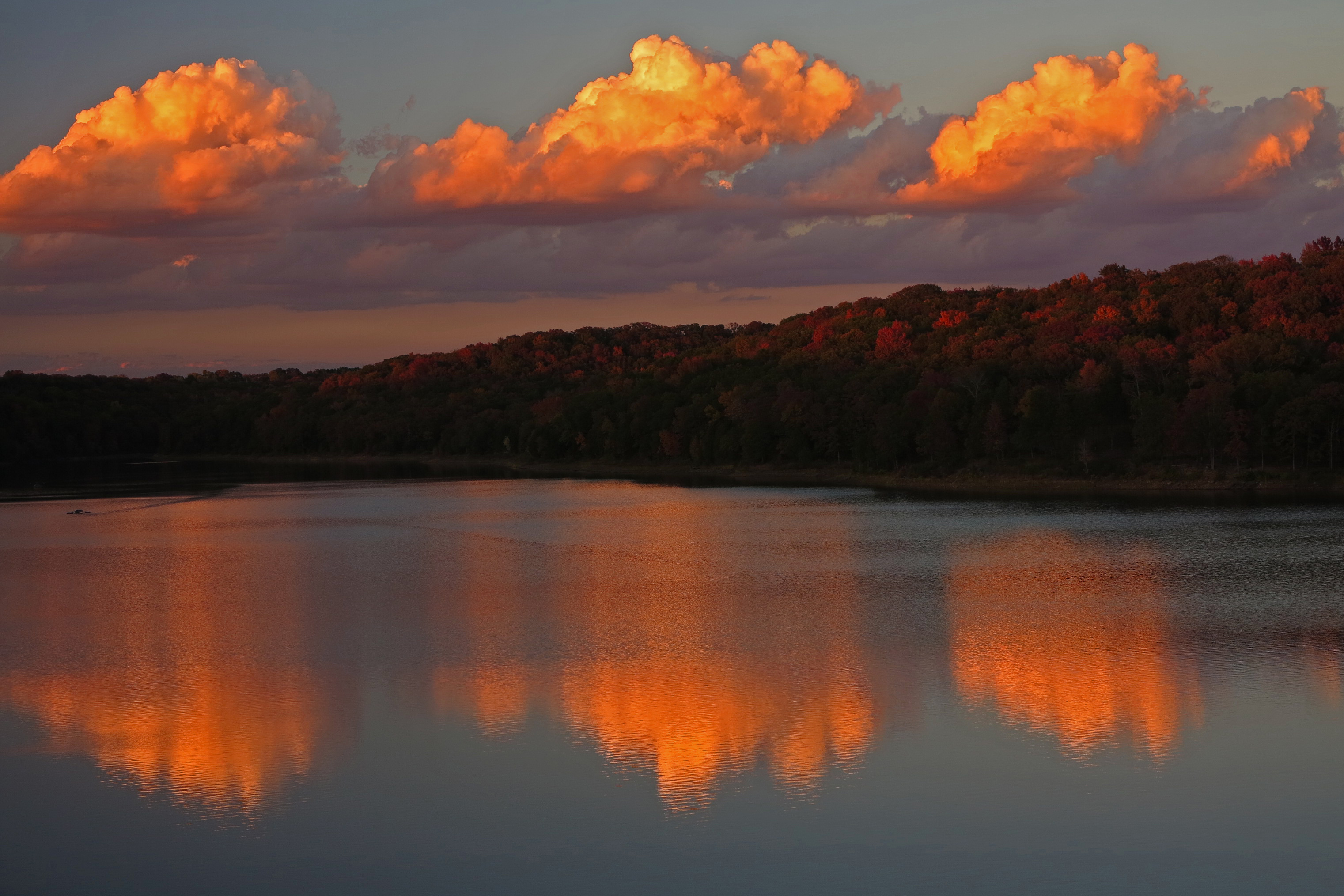
View at dusk the evening we arrived at the South Rim.
The perfect antidote…
Need a remedy for that lethargic feeling you get during the winter months? Here’s an antidote that works for me. The plan? Assemble a group of good friends and hike one of the natural wonders of the world: The Grand Canyon.
The Grand Canyon Crew
Our crew included father/son duo, Scott and Boone Hardy, Bob Cable, Steve Cattaneo, and Dale Fudge. We came from a variety of career backgrounds but were united in our love for the beauty of the outdoors. We’d backpacked the Ozark Mountains together but this would be a more involved outing. A trip of this type is only as good as each participant. By the time you’ve spent a few days backpacking with someone, you know if there are major character flaws. I could vouch for each of these guys and knew they would work well together.
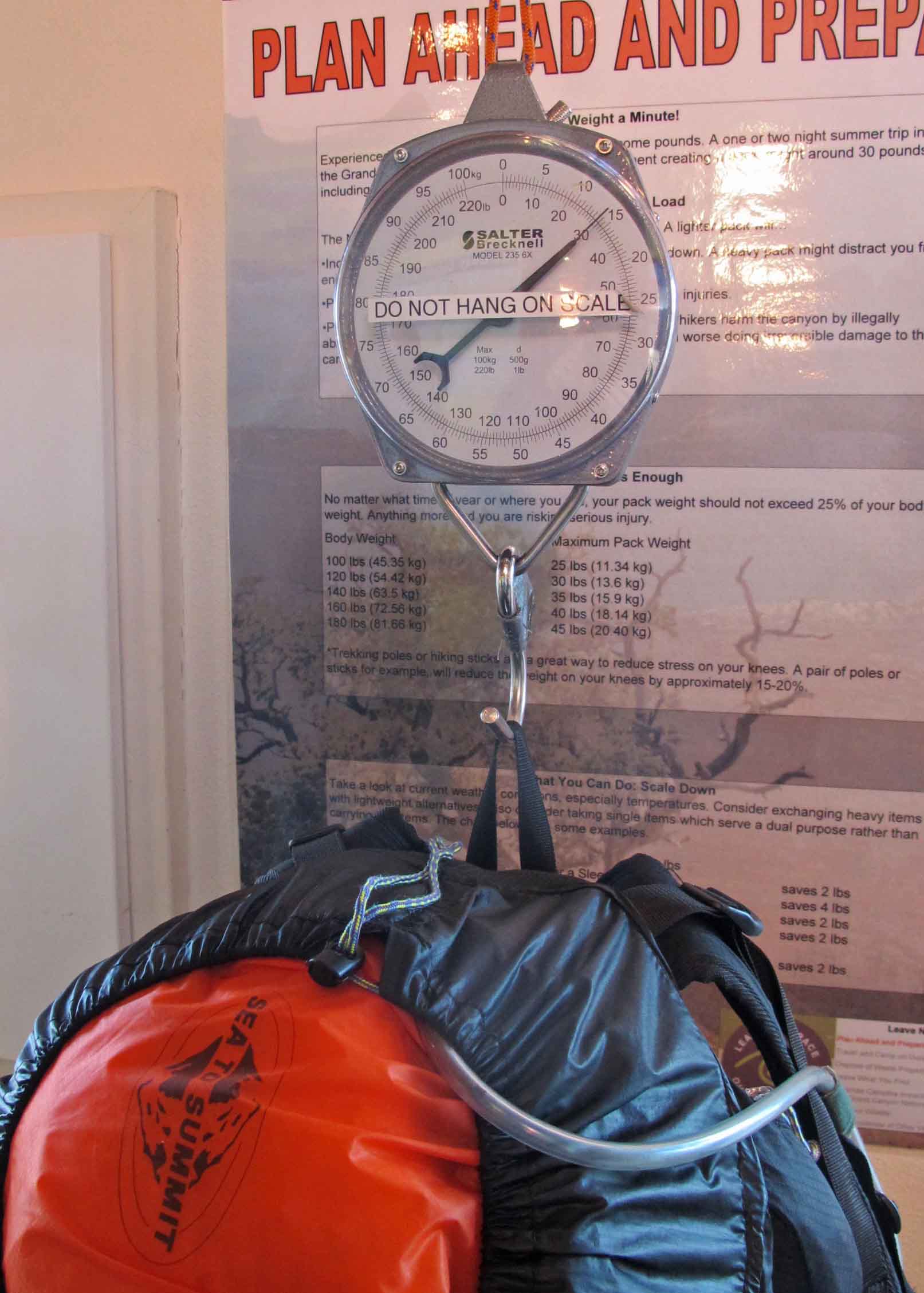
Directions for getting to the canyon are easy; drive west to Williams, Arizona then north. Directions for being ready to enterthe Grand Canyon are a little more complicated. We completed training hikes and runs for conditioning. We requested backcountry permits four months in advance and waited nervously until approved. We combed through piles of backpacking gear in repeated attempts to eliminate all but the most essential items. I felt a great sense of accomplishment after packing four days of food, clothing, and shelter in under thirty pounds.
Weighing packs at the Back Country Office
Too much weight could be a trip-ender while attempting to hike up the nearly 5,000-foot elevation gain from river to rim, the equivalent of climbing more than 500 office building floors while covering miles of uneven terrain and ever-changing conditions in winter. As Bob said, “There’s no such thing as bad weather… just the wrong clothes. Pack wisely.” A small percentage of the nearly five million visitors who see the Grand Canyon each year hike below the rim and several hundred of those are rescued inside the canyon. Lack of preparation is commonly cited in trips that end badly.
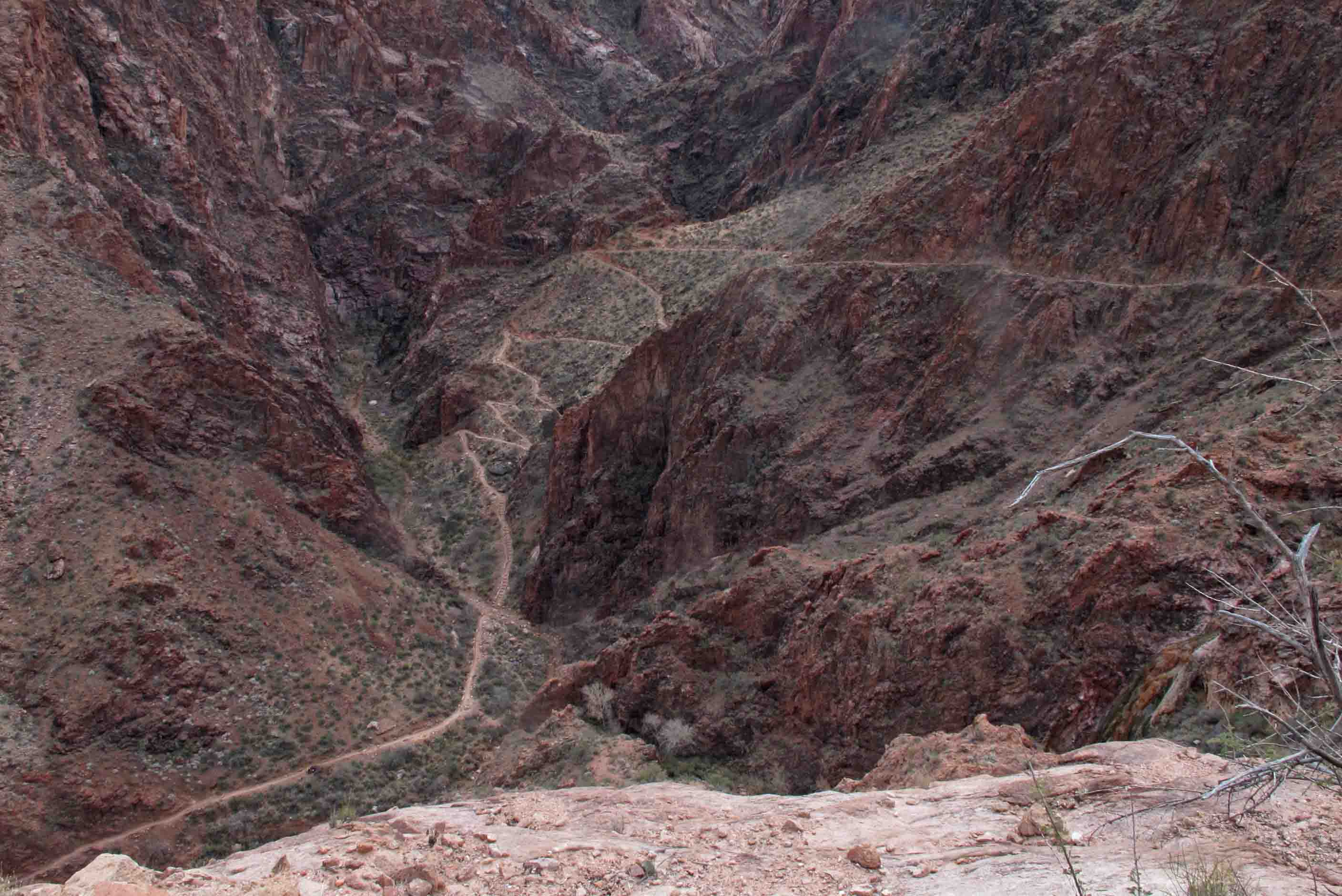
South Kaibab Trail
We entered the Grand Canyon on December 28, 2012, on the South Kaibab Trail. Temperatures ranged from the teens on the rim to the forties at the bottom of the canyon. We spent two nights at the Bright Angel Camp Ground, allowing time to explore the Clear Creek Trail on the north side of the Colorado River. Then came a strenuous climb up to Indian Gardens Camp Ground. At the top of a series of brutal switchbacks called “Devil’s Corkscrew,” Boone said, “That section of trail definitely lived up to its name!” The final day would include about 3,500 feet of elevation gain during the hike up to the South Rim.
Devil’s Corkscrew on Bright Angel Trail
A visual feast…
Having dined on holiday food during the previous weeks, we were now enjoying a wide menu of visual feasts. That first night Scott was full of energy and wanted to explore the silver bridge since we’d crossed the more historic black bridge earlier on our hike into the campground. This turned into three miles of night hiking but was well worth the effort. While standing at the Colorado River, we watched a full moon rise over the canyon rim. Reflections of moonlight softly painted inner canyon walls and reflected on the churning river’s surface.
Moon rise from the Colorado River
On day two we hiked Clear Creek Trail, filled with remarkable rock formations every step of the way. The trail seemed to pull us along sweeping views of the river and inner canyon. Scenes continuously opened up and changed with the steady passing of the sun. While pausing at one overlook, Dale, who was visiting Grand Canyon for the first time, said, “I’m so thankful that I got to do this trip. I’ve never seen anything like this. It’s just amazing!”
Along side of Clear Creek Trail
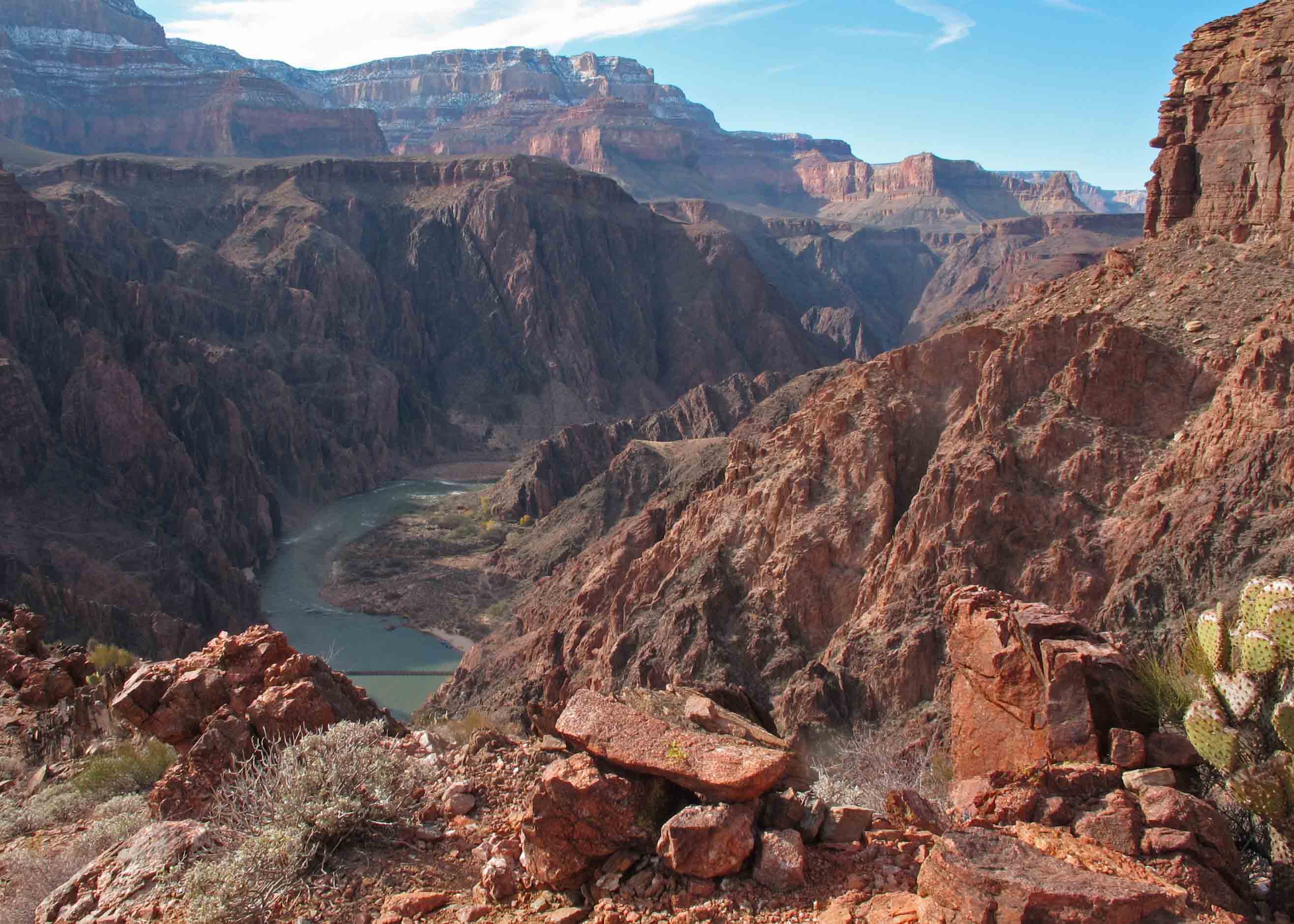
View of the Colorado River from the Clear Creek Trail.
A constant companion while camping at the bottom of the canyon was the soothing sound of Bright Angel Creek, named by John Wesley Powell during his exploration of the area in 1869. It is clean, clear, and cold! I took an hour to explore the creek with my camera, wishing for a longer day as the sunlight faded.
Bright Angel Creek flowing through the campground.
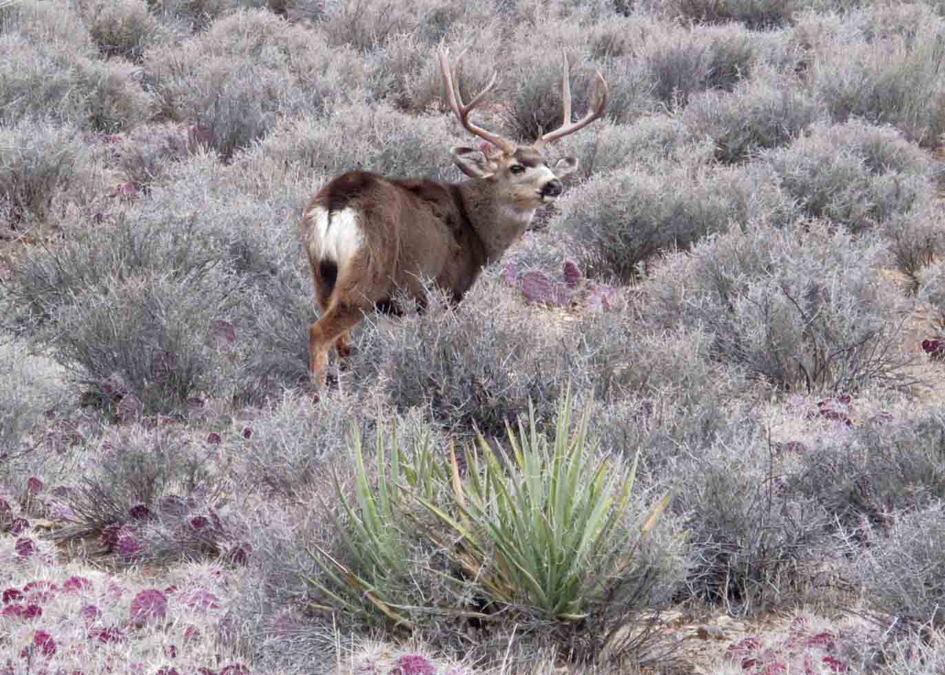
On our third evening in the canyon, a short hike from Indian Gardens Campground turned into a wildlife outing on Plateau Point. A California condor enjoyed showing off his aerial finesse, swooping so close that I heard a deep whoosh from his wings slicing through the air. The introduction of condors into the park appears to have had some success and this condor exemplified confidence in his new canyon home. Several mule deer were grazing close to the trail. They gave me a dismissive glance as if stoically accepting my visitor status in the canyon.
Condor at Plateau Point
Mule Deer
A winter wonderland…
After a dinner of homemade dehydrated pasta at Indian Gardens, a light snow began to fall as darkness came over the canyon. All sounds were muted except the gentle crackle of icy snow against the roof of my tent. The next morning we woke up to a winter wonderland. Several of us softy sang the song by that name as Steve, the early riser, fired up his stove for coffee and oatmeal. Then it was time for the final push up Bright Angel Trail to the South Rim. This would be a personal test for me physically and I felt some nagging anxiety about the severe elevation gain on a snowy route.
Breaking camp at Indian Gardens for the for the hike up the Bright Angel Trail.
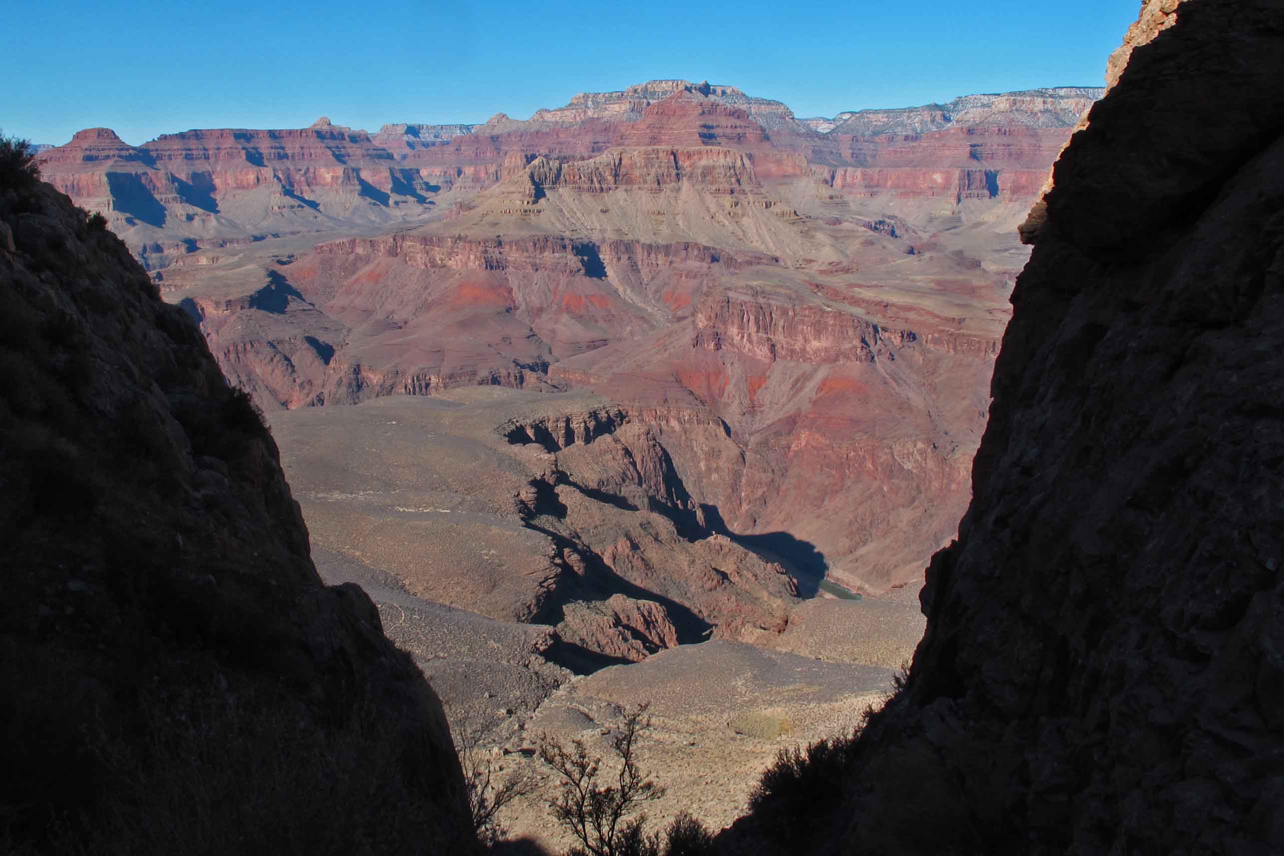
As we progressed up the trail I found myself walking slower and slower, not from the climb, but from a desire to make the experience last longer; I didn’t want it to end! Every few minutes I’d stop and stare as the sky and light changed our view back into the canyon. One minute the canyon appeared dimly through a frame of clouds. Moments later, clouds would dance gracefully as they roamed freely through the upper canyon, sunlight slicing through and settling along the face of fire-red walls trimmed with snow.
View while hiking up Bright Angel Trail
One elderly dayhiker said in passing, “I ran out of adjectives a long time ago!” Pictures and words fail in the presence of the Grand Canyon. Reaching the rim I continued to gaze into the chasm for a few last visual morsels from the beauty below. I paused and bowed slightly toward the canyon whispering, “Thank you.” Then I turned to walk away from the edge, carrying images that will nourish my spirit and fill my memories for years to come.
View from close to the top of Bright Angel Trail
To learn more:
Grand Canyon National Park web site: nps.gov/grca
Ozarkmountainhiker.wordpress.com
Published in the February, 2013 issue of Urban Magazine, Fort Smith, Arkansas
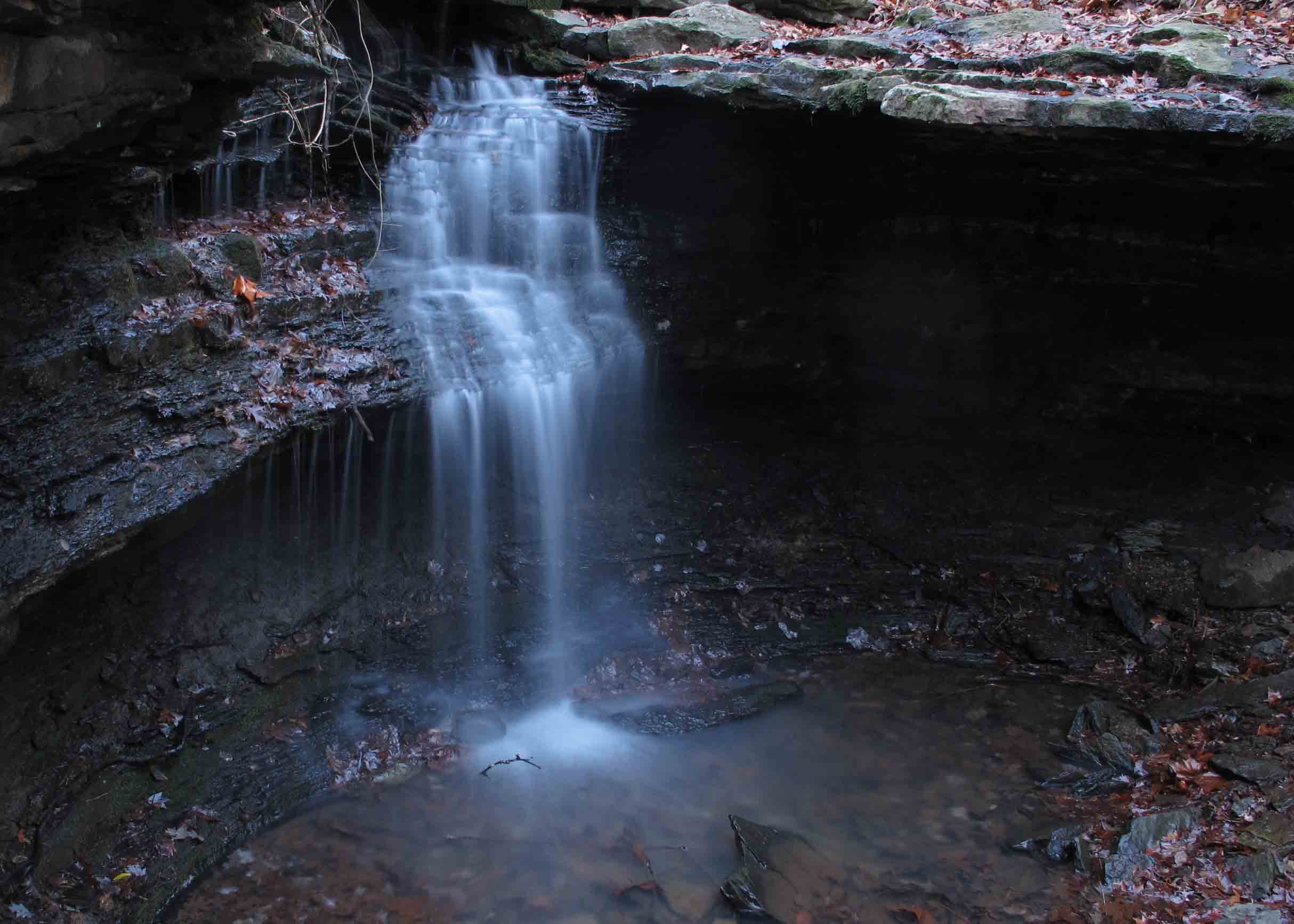
Every little lake should have its own little waterfall and so it is that we have Lake Alma Waterfall, a short distance from the trailhead of Lake Alma Trail. We’ve been longing for some rain, not only because water levels are low, but because the creeks around Lake Alma and the Ozarks have been pretty dry. With recent rain, we’re finally able to see the Lake Alma Waterfall (Update as of April, 2013: The Alma City Council designated McWater Falls in recognition of Harry McWater who was instrumental in the construction of the Lake Alma Trail).
At approximately 12-feet tall this is definitely worth checking out. The shape, location, and pretty little drainage make this a great place to spend some time. Give yourself an hour or more so you can sit and enjoy the sight and sound.
Read my blog about the Lake Alma Trail for directions on how to get there. The spur trail to this waterfall is only a 25-minute walk from the trailhead. The spur is about one tenth of a mile long.
Get out and enjoy!
McWater Falls as viewed from underneath its bluff.
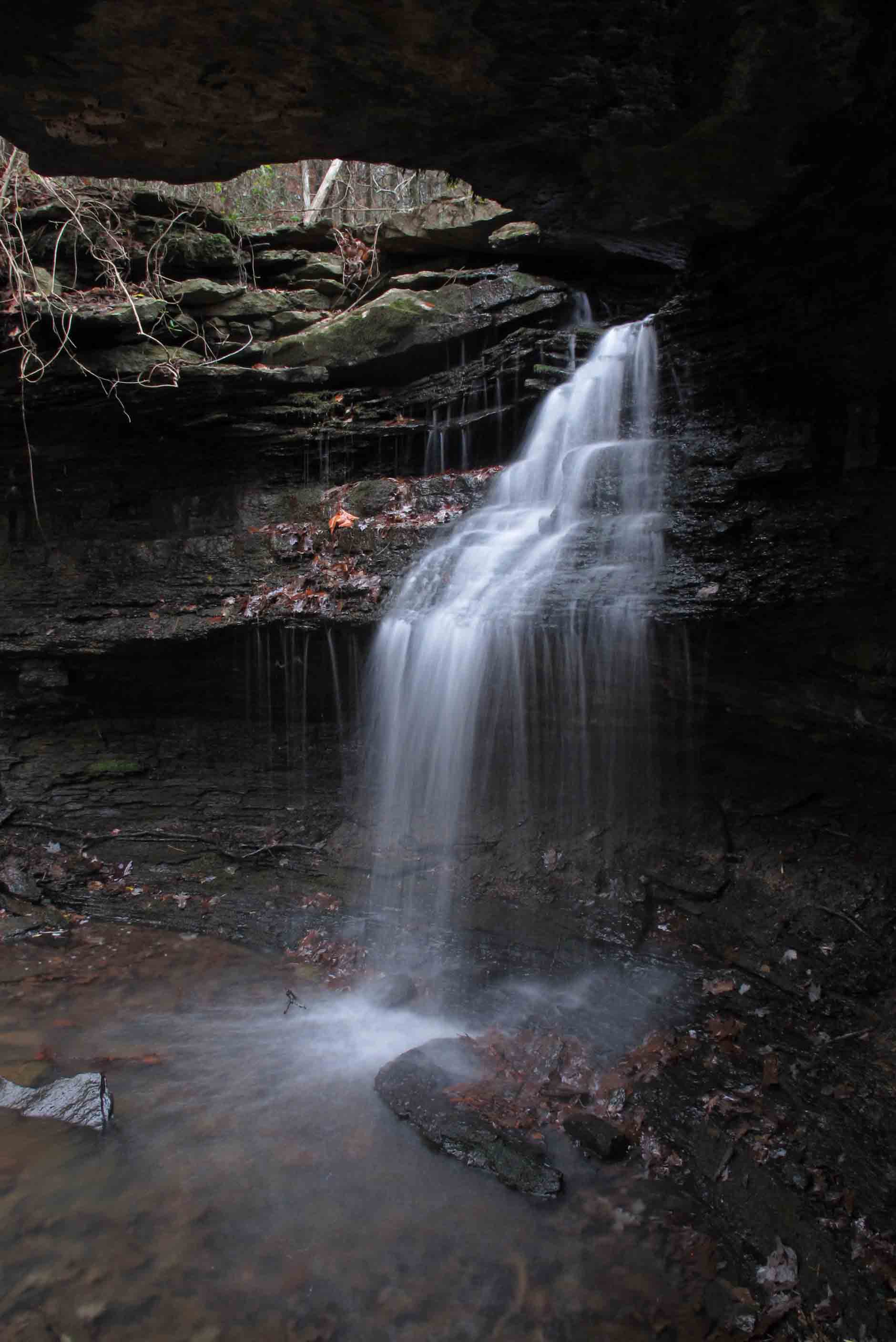
McWater Falls is located in a beautiful drainage .1 of a mile off the main trail.
This next picture is of poor quality but it gives a perspective on the size of the waterfall.
Always feel a sense of accomplishment after packing 4-days of food, clothing, and housing. Our group of six had mostly clear sailing on I-40 past Oklahoma City and on to the Grand Canyon in spite of recent snow. We were ready to burn some Christmas calories!
My pack weighed in at 27 lbs. without water. Anything below 30 pounds is where I like it. I was afraid my Equinox backpack wouldn’t hold up when I purchased it five years ago but it is still going strong which pleases me given its light weight.
This is Dale’s pack which came in at 29 lbs. without water.
We began our hike into the Grand Canyon on the South Kaibab Trail on Dec. 28th. We spent two nights at Bright Angel Camp Ground which allowed some time to explore Clear Creek Trail. Then we hiked to Indian Gardens and camped one night before hiking up Bright Angel Trail on our final day.
Roads were mostly clear from Alma to Gallup, New Mexico. The first falling snow we saw was in Gallup. A highlight of the day was our dinner at WOW Diner in Grants, NM. It had lots of character, good service, and an interesting location sandwiched between a truck stop and federal prison. Our appreciation goes out to Scott for the amazing marathon driving and arranging hotel rooms for us.
The WOW Diner
Backcountry Office scale
After a night at Maswik Lodge on the South Rim, we caught the hiker express shuttle to the South Kaibab Trailhead. We were pleased that all packs came in at about thirty pounds including food for four days and water to get us down South Kaibab Trail.
South Kaibab Trail
The hike down was beautiful. Beginning temps were in the low teens warming up into the 40s by the river.
View toward inner canyon from the South Kaibab Trail
Black bridge tunnel
Moon rise from the Colorado River
It was a thrill to watch the moon rise and reflections of moonlight on the canyon walls. The only picture I could get was this one just prior to the moon peaking over the walls. My tripod was the black bridge. Probably about a 6-8 second exposure.
Along side of Clear Creek Trail
The dayhike on Clear Creek Trail was a joy. Interesting rock formations every step of the way and sweeping views of the river and inner canyon. I hope to return and camp in the Clear Creek area in the future.
The Colorado River and South Rim as viewed from the Clear Creek Trail
Bright Angel Creek
Our constant companion while camping at the bottom of the canyon was the soothing sound from Bright Angel Creek, named by John Wesley Powell. It is clean, clear, and cold.
Wayne Ranney with Scott at Phantom Ranch
Scott was reading a book from the Phantom Ranch lending library when he discovered that the author, Wayne Ranney, was present. Wayne, geology professor in Flagstaff, and his wife were hiking the canyon. Carving the Canyon is a great book for those wanting to better understand how the canyon came into its present form. The writing style is entertaining and makes difficult concepts more easily understood by non-scientists like me.
The hike up Bright Angel Trail was quite a climb. Devil’s Corkscrew was an appropriate name for this series of switchbacks. The overall vertical gain in elevation from the river to the rim of the canyon is over 5,000 feet which we covered in two days of hiking.
Devil’s Corkscrew on Bright Angel Trail
The Grand Canyon is massive and literally overwhelms the eyes, but you’ll find unexpected beauty and interest as you narrow your focus to take in smaller scenes. There were several locations where ice crystals formed over gently flowing water. I like to call them ice puddles.
Ice puddle along the trail
Clear water shimmered over rocks in a small portion of Pipe Creek.
Pipe Creek
From Indian Gardens Campground we hiked out to Plateau point where a condor seemed to enjoy putting on a show for us. A park employee named Shores had told us we might see a condor here but we never imagined we’d get such a performance. His tag number was L4. The introduction of condors into the park seems to be having some success.
Condor at Plateau Point
Condor at Plateau Point
Several deer were grazing close to the trail as we passed on our way back to the Indian Gardens Camp Ground.
Mule Deer
Dusk at Indian Gardens
After dinner I roamed the area and took some relaxing photographs as darkness came over the canyon. Our last night in the canyon we had 1-2 inches of snow.
Bright Angel Trail
Our last morning we hiked up Bright Angel Trail in a winter wonderland. In fact, we sang this tune softly as we came out of our tents.
View while hiking up Bright Angel Trail
I found myself walking slower and slower, not from the climb, from a desire to make the experience last longer; I didn’t want it to end. Every few minutes I’d stop and stare as the clouds and light changed our view back into the canyon. For a few minutes the canyon appeared through a “cloud frame.”
View from close to the top of Bright Angel Trail
We topped out on the South Rim sooner than I’d expected at the end of day four. The hike out didn’t seem as difficult as in the past. Pictures and words fail in the presence of the Grand Canyon. As one day hiker said, “I ran out of adjectives a long time ago.” The sun sparkled as it reached the edges of stone bluffs while clouds seemed to dance and bend gracefully as they roamed freely around the upper canyon. As soon as I reached the Kolb Studio on the rim I began to mentally plan a future trip into the Grand Canyon.
A word about our crew. Couldn’t be a better group to backpack with. We represent a variety of career backgrounds, skills, and I suspect, a variety of political and philosophical views, but we’re united in our love for the outdoors and appreciation of our beautiful planet. I can also provide character references for any of these gentlemen because backpacking tends to reveal character flaws that may not be obvious in day-to-day activities. I can recommend each of these guys without hesitation!
The Grand Canyon Crew
This video includes a humorous discussion of the items Scott ended up not needing in his backpack.
I often walk the Lake Alma Trail before daylight. On a recent morning I was listening to my iPod while focusing on my footing made visible with a headlamp. “Sure on This Shinning Night,” a choral piece by Morten Lauridsen , was playing as my focus narrowed down the trail.
Suddenly I paused to let the music sweep over me. I looked toward the sky through oak limb silhouettes to a silvery new moon. It was a worshipful few moments for me as the beautiful sound accompanied the shining moon and stars. I felt intense thankfulness. Thankful for my senses, especially hearing and sight. Thankful for the burn in my legs and steady pounding in my chest. Thankful for the gift of another day!
I look forward to these early morning hikes and am thankful for the beautiful places of worship to be found in nature.
“Sure on This Shinning Night” by James Agee
Sure on this shining night
Of star-made shadows round
Kindness must watch for me
This side the ground
The late year lies down the north,
All is healed, all is health
High summer holds the earth,
Hearts all whole
Sure on this shining night
I weep for wonder
Wandr’ing far alone
Of shadows on the stars.
The hike from Arbaugh to Ozone on the Ozark Highlands Trail was beautiful! We hike 8.8 miles the first day and camped at Boomer Branch. The surround sound howl of coyotes and an owl in the distance were the only disturbances to the silence of the woods and soft sound of flowing water. The weather was just cool enough to justify a small fire for cooking, warmth and good conversation. During a silent moment one hiker said, “You know where I would like to be?” Another asked, “Where?” “Right here,” he answered. “This is the best place in the world to be right now.” Night brought a few light sprinkles with lightning in the distance.
Sunday morning was cool but pleasant. Coffee made with Boomer Branch’s water was delicious. We hit the trail by 8:00 a.m. and gained a lot of elevation over the 4 miles to Ozone.
Open birch forest.
Highlights included hiking through a forest of beech trees with their deep brown leaves holding on through the winter. There were some smooth-hiking sections of shortleaf pine woods along the way before hiking back into the Mulberry drainage for a nice cool crossing. The final mile was a heart-throbbing, thigh-burning pull up to the Ozone Campground on Highway 21.
As I hiked east from Dockery Gap to check my section of trail a dad and his four sons approached from the opposite direction. They had a haggard and disheveled look as they lumbered up the trail loaded down with one-gallon plastic milk jugs filled with cloudy water and overloaded backpacks. One of the sons carried a rifle presumably for protection from wild bears.
The gun made me nervous, but I relaxed when the dad spoke. He explained that they had camped at Jack Creek with plans to hike to White Rock Mountain, but now they were wondering how to hike out and where they might get cell phone service to call mom to come get them. I took my map out and showed them the road they were approaching and how to walk toward civilization. They explained that their water filter wasn’t working correctly, hence the murky water jugs. They’d not slept well, were overheated and exhausted. As I continued down the trail, I thought they’d made the right decision in exiting the forest.
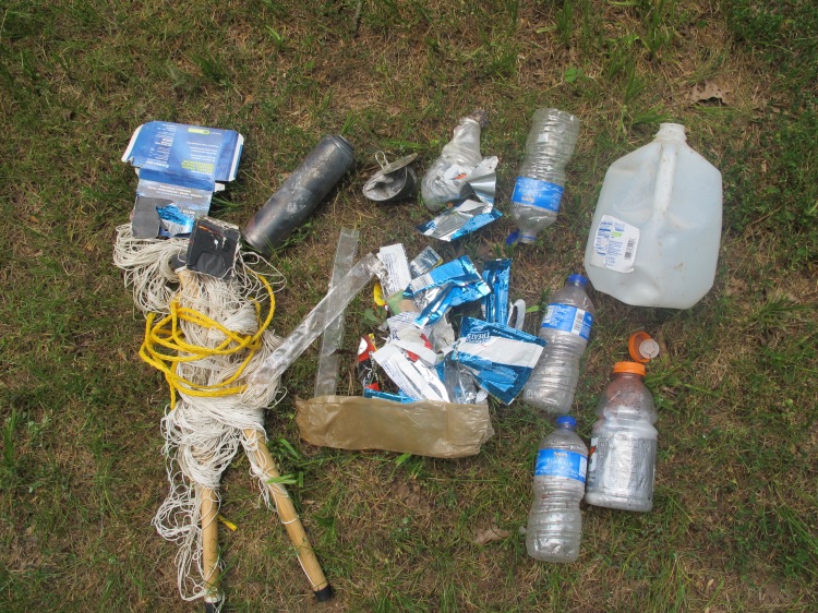
Approaching Jack Creek less than a mile later, I saw smoke and a burning campfire. There was a hammock tied between two trees next to the creek and trash everywhere. Thinking someone must still be occupying the site I called out, but there was no response. It gradually dawned on me that this was the camp left by my exhausted friends who’d just asked for directions. I extinguished the fire, kicking a large aerosol can of insect spray out of the coals and then collected the trash.
I continued down the trail picking up more trash at each creek crossing. It appeared that these young men and their dad deposited trash at every rest stop. After doing a little maintenance I returned to the trashy camp, scattered the now cooled fire ring, and bagged the trash I’d collected earlier. Then I noticed scaring on a tree next to the creek where they had chopped it with an ax for no apparent reason. This began to feel like a crime scene.
Some of the trash collected at the site. Notice the burned aerosol can.
I had visions of driving up on these fellows as they walked along the road and what I would like to say but then considered the rifle and thought a more diplomatic approach might be best. As I hiked up the trail away from the scene of the crime, I rehearsed the discussion I would have about the beauty of the Ozark National Forest and how important it is that we care for it and pass it on to our children. I wished for words to help these men discover a better way to treat the wilderness but, in reality, it seemed futile to try to convert remorseless criminals who enter the forest for recreation and harm it by their very presence.
As it turned out, by the time I arrived at the trailhead to throw my bag of trash in the Jeep, the father and his sons were nowhere to be seen. I do wish I could have that conversation, but I take comfort in the knowledge that I probably witnessed the conclusion of their first and last backpacking trip on the Ozark Highlands Trail. If I just had some assurance that they don’t have access to four-wheelers I’d feel a whole lot better.
Recently I encountered a dad, mom, and their three children, younger than 7 years old, hiking the Lake Alma Trail. It was a warm afternoon and we were close to mile 2 on the 3.6-mile trail. The dad asked how much farther it was around the loop. Seeing no evidence that they were carrying water I offered an extra bottle I carry just for such occasions along with a banana I had in my pack.
I later saw them wearily crossing the dam and was relieved that they would make it back to their car. As we passed I thought it strange that I didn’t see the water bottle but figured it was in the dad’s pocket. After they passed I wished I’d asked for it so I could use it again.
Most of my walks around the lake are early mornings with a flashlight but later during that same week I was hiking during the daylight hours while picking up trash. Most of the trash had obviously been there for years. No “new” trash was to be found along the trail, showing that our hikers are being considerate of this area.
Then I saw it. The same water bottle I’d given that dad earlier in the week. I was sure it was the same bottle because of the unusual shape and the location being just a little farther down the trail from where I’d met them the week before. I wondered what my reaction might have been if I’d asked for the bottle and he’d told me he dropped it on the trail. As it was I had the luxury of making a few comments to myself as I picked up the bottle.
This experience reminded me of “Leave No Trace” principles, one of which is that preparation is an essential part of protecting nature. Hikers who are unprepared end up in bad situations (like having a thirsty family). They make mistakes and demonstrate poor judgment. Still, I wonder what the thought process is when a person takes a bottle of water given by a fellow hiker and then tosses it on the trail after using the much-needed water.
By Jim Warnock – Published in the @Urban Magazine (now Do South Magazine) of Fort Smith in October, 2012
Lake Alma Trail at sunset.
Whether you’re a parent looking for an easy day hike to introduce your children to the gentle pleasures of nature or a trail runner looking for a heart-throbbing, rock-hopping, scrambling good time, Lake Alma Trail is for you!
Chuck Dovish, of Exploring Arkansas with AETN, said, “It’s amazing that so much variety and diversity of scenery is found right inside the town of Alma.”
Step onto this little 4-mile trail and your eyes are in for a treat. You’ll see bluff lines and moss-covered boulder fields up close. You’ll walk beside clear streams, rocky cascades and small waterfalls. Situated within a diverse mixed hardwood forest, you may spot deer, rabbit, fox, great blue heron, and a variety of songbirds. Watch your step and give right-of-way to the many terrapin turtles that call Lake Alma home.
On any given day you’ll find families out for a stroll or a nature walk and picnic lunch at McWater Falls, just twenty-minutes into the trail. Said one father, “I want my kids to know how beautiful and fragile our environment is. When they see Little Frog Bayou and realize this is the source of our drinking water, they’ll become caretakers and protectors of places like this.” History buffs will enjoy exploring rock structures located just past mile one. Mystery surrounds the “when” and “why” of these structures which include a small hexagon rock house with fireplace.
Old homesite hexagon house
Continue down the trail and you’re likely to encounter trail runners soaring up “little bluff scramble” and churning around the whole loop in preparation for competition. “I love this trail! It allows for an intense workout in a short amount of time and the scenery makes even the hills enjoyable!” said Tommy Griffin, a local runner. Hike early and you’ll see locals trotting slowly and carefully along the rockier paths preparing for future marathons or just enjoying a morning workout and quick dose of nature.
Trail runners
Harry visiting with Chuck Dovish at Lake Alma as trail volunteer,Laura Seal, looks on.
The beginnings of Lake Alma Trail can be traced to longtime resident, Harry McWater. The idea of a trail around the lake occurred to him during the late 1990s as a member of the Alma City Council. He mentioned the possibility several times only to be told that money for such a project wasn’t available.
Then, about a year ago during a conversation with the mayor he asked, “What if I find volunteers to get that hiking trail built?” Mayor John Ballentine said, “Go for it!” With that, Harry sought expertise and labor from the Arkansas Master Naturalists, Ozark Highlands Trail Association and local volunteers, including Alma School District student organizations and scout troops. Students were enthusiastic about the project. Nathanael Mickelson, then a senior Student Council member said, “I can’t believe I have a hiking trail three minutes from my house!”
McWater Falls (approx. 12-feet)
The actual work began in March of 2012 and the forward momentum that followed was undeniable. Since that time well over one-hundred pairs of helping hands have spent time making this trail a reality. Volunteers blazed and cleared the route. There was side-hilling, raking, and general cleanup to be done. With each workday, a deeper beauty was revealed. As the route became established, hikers’ feet helped firm up the tread and keep it open. One volunteer said, “It’s like remodeling your kitchen. You use it before it’s finished. Maybe it’s never really finished.” The work continues as constant improvements are made.
The best trail maintenance is use! Give your concrete-weary feet a break or drop the cumbersome baggage of civilization for a few hours. Relax beside a clear, cool stream or let your mind wonder about the early inhabitants of the “hexagon house.” Whatever your reason, Lake Alma Trail is ready to greet you in all its beauty and variety.
Logo design, Ashley Campbell
Getting There Take Alma Exit 13 off I-40, then drive north on Hwy 71 to the first light. Turn right onto Collum Lane East then left onto Mountain Grove Road. Go north past the Alma water tanks on the left then a quick left into a picnic area. The trail begins at the fishing dock. Walk the paved Nature Trail north with the lake to your left. The Lake Alma Trailhead is at the north end of the paved trail where it turns sharply back toward the picnic area. Read the information sign built and installed by volunteers with some help from the City of Alma. If you hike the whole 4-mile trail, you’ll come back to the fishing dock from across the dam. A shorter family-friendly hike is the forty-minute walk to the waterfall and back. To get more information about Lake Alma Trail and volunteer opportunities, follow updates from the Lake Alma Trail Facebook page.
Springtime reflections on Little Frog Bayou
Bridge over west creek built by volunteers, Joe and Laura