Rock House
The Rock House is one of my favorite landmarks on the Ozark Highlands Trail (OHT). It’s easily accessed, but most drive Highway 23 unaware of the history perched under a bluff a mere quarter mile walk from the road. As the crow flies, the distance is much closer and during the winter it’s easy to see the highway down below. Don’t let the roundtrip 0.5-mile by trail deceive you. It’s a steep climb on the Ozark Highlands Trail and a short spur trail to the structure. If you walk to see Rock House, wear sturdy walking shoes and carry some water.
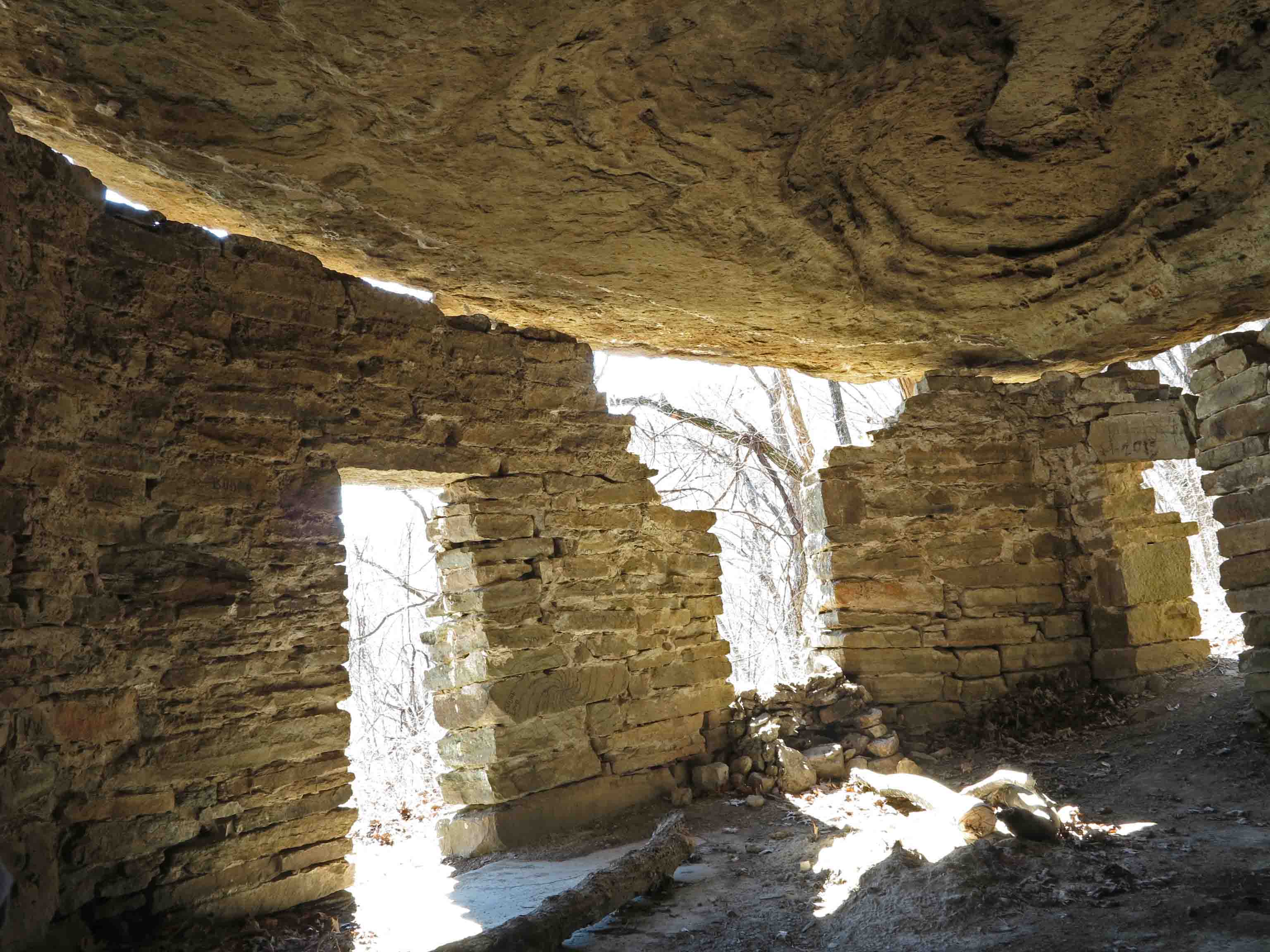
The Rock House was probably built as a shelter for loggers sometime during the 1890s to 1920s when the area was heavily logged for white oak, in high demand because of the expansion of railroads across the country. By the 1930s, the old-growth forests were pretty much exhausted. It still makes a good shelter today in spite of some shifting of the ground that has caused a separation between the wall and bluff. It has a rough concrete floor, and a small spring located in the back of the single room.

The short hike to Rock House begins at Cherry Bend Trail Head, located approximately five miles north of Cass on AR 23 (AKA Pig Trail). This is a popular trailhead for accessing the OHT. Watch for fast traffic when crossing the highway as you begin your walk.
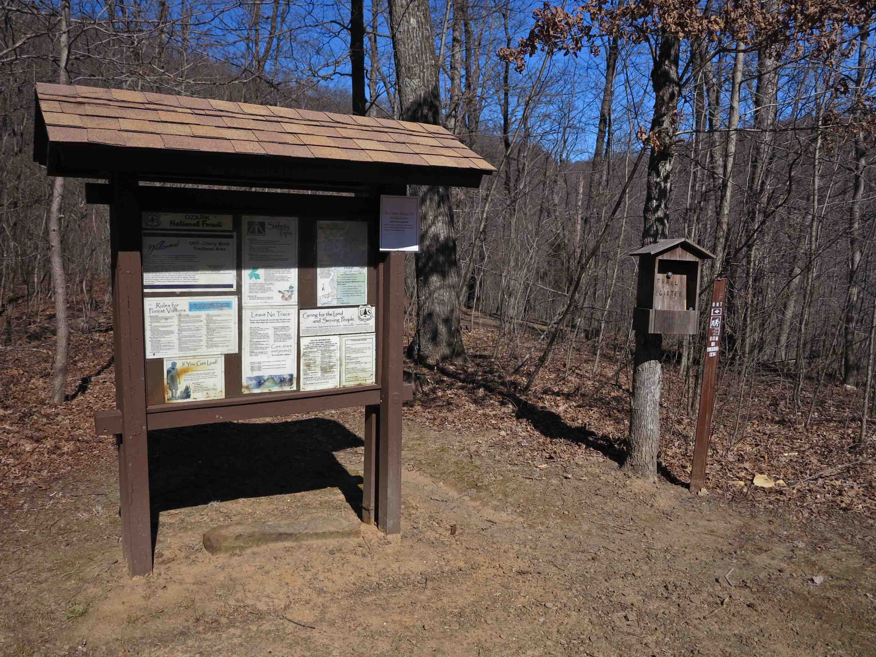
Cherry Bend Trail Head
A spur trail leads to a nice view behind the trailhead sign, but to access the OHT and Rock House, you’ll cross the highway on a short trail marked with blue blazes.

Lost sole…
There is a thru-hike trail register at the intersection with the OHT. We’re going to turn left onto the OHT and head sharply uphill following white blazes. I only saw one “lost sole” on my hike up to Rock House. You’ll often have the OHT all to yourself, but you might encounter thru-hikers and enjoy a short visit about their time on the trail.

Sign indicating spur trail to Rock House blue blazes marking the spur and white blazes marking the OHT
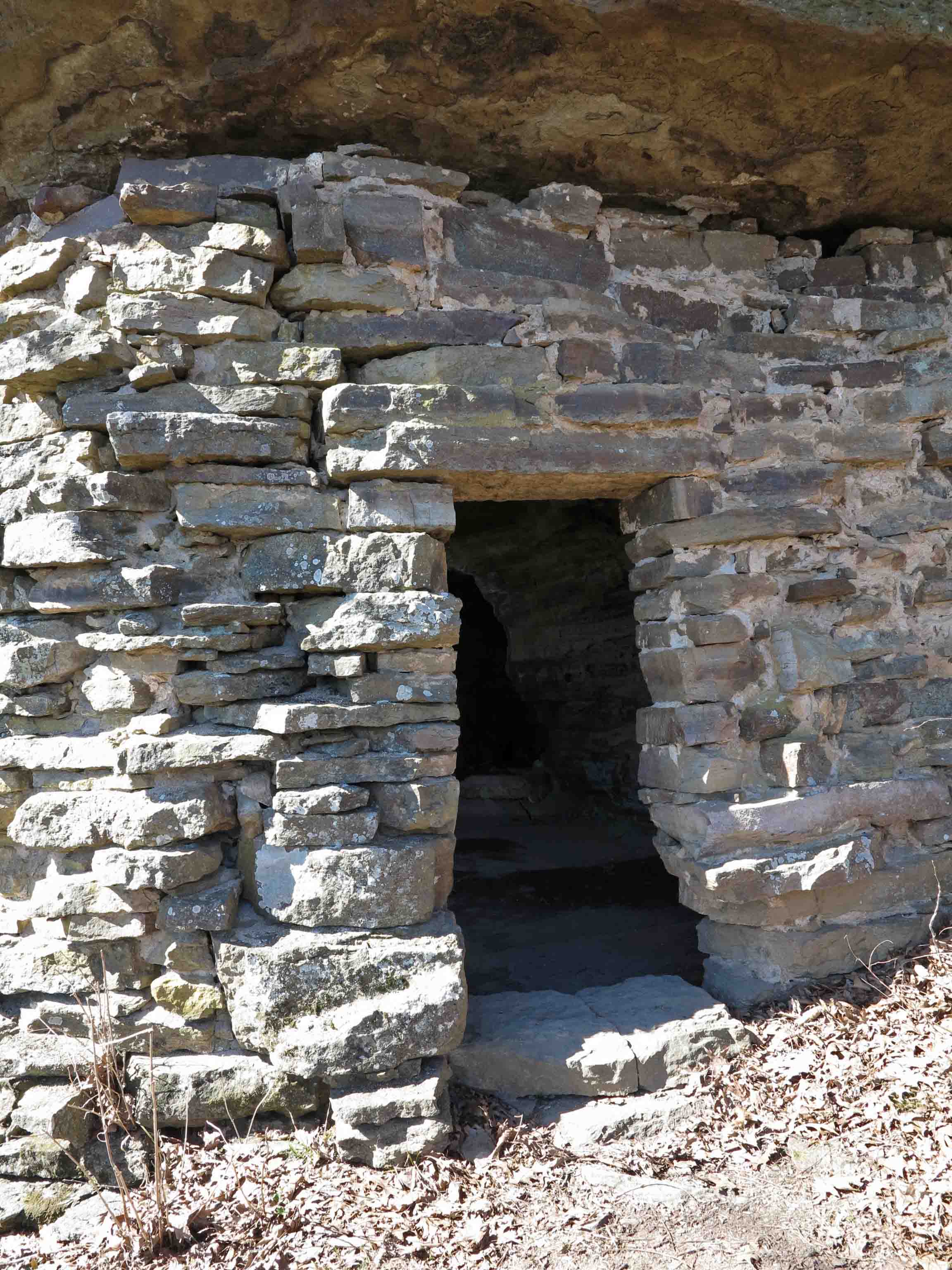
Front door facing the approaching spur trail
On a thru-hike of the Ozark Highlands Trail in December of 2013, a hiking buddy and I spent a cold night in the Rock House sheltered from the rain. Seeing car lights below made me want to rush down and beg someone to bring pizza from Clarksville, but staying warm in my sleeping bag won that short mental argument.
Today as I revisit the Rock House, it’s sunny and mild for February. The views of the Ozark Mountains to the east are enticing. I feel the desire to load my pack and head out for a multi-day hike over Hare Mountain and through the Marinoni Scenic Area to Lick Branch.
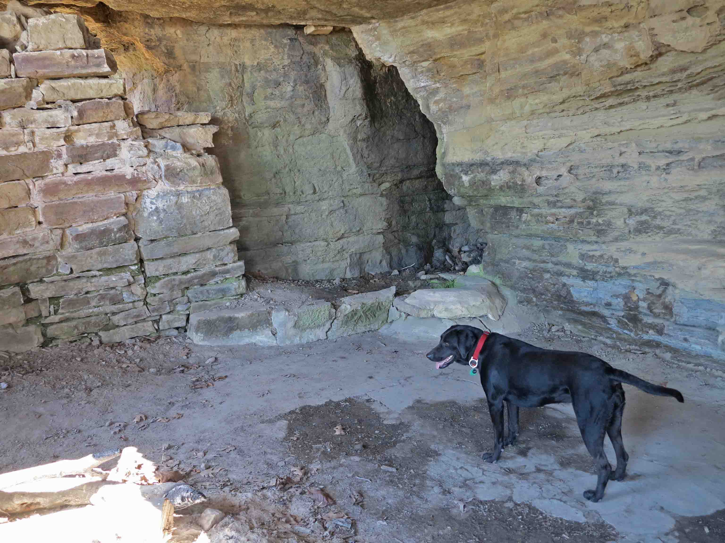
Hiker and spring in the back of the Rock House
Hiker attempted to drink from the spring in the back corner but the water was a couple of feet below the edge, and she didn’t couldn’t reach it. The water from this spring needs to be filtered. The single time I filtered water here, it wasn’t the best. It would be good water if you’re in a bind or have time to filter it through cloth before using your water filter.
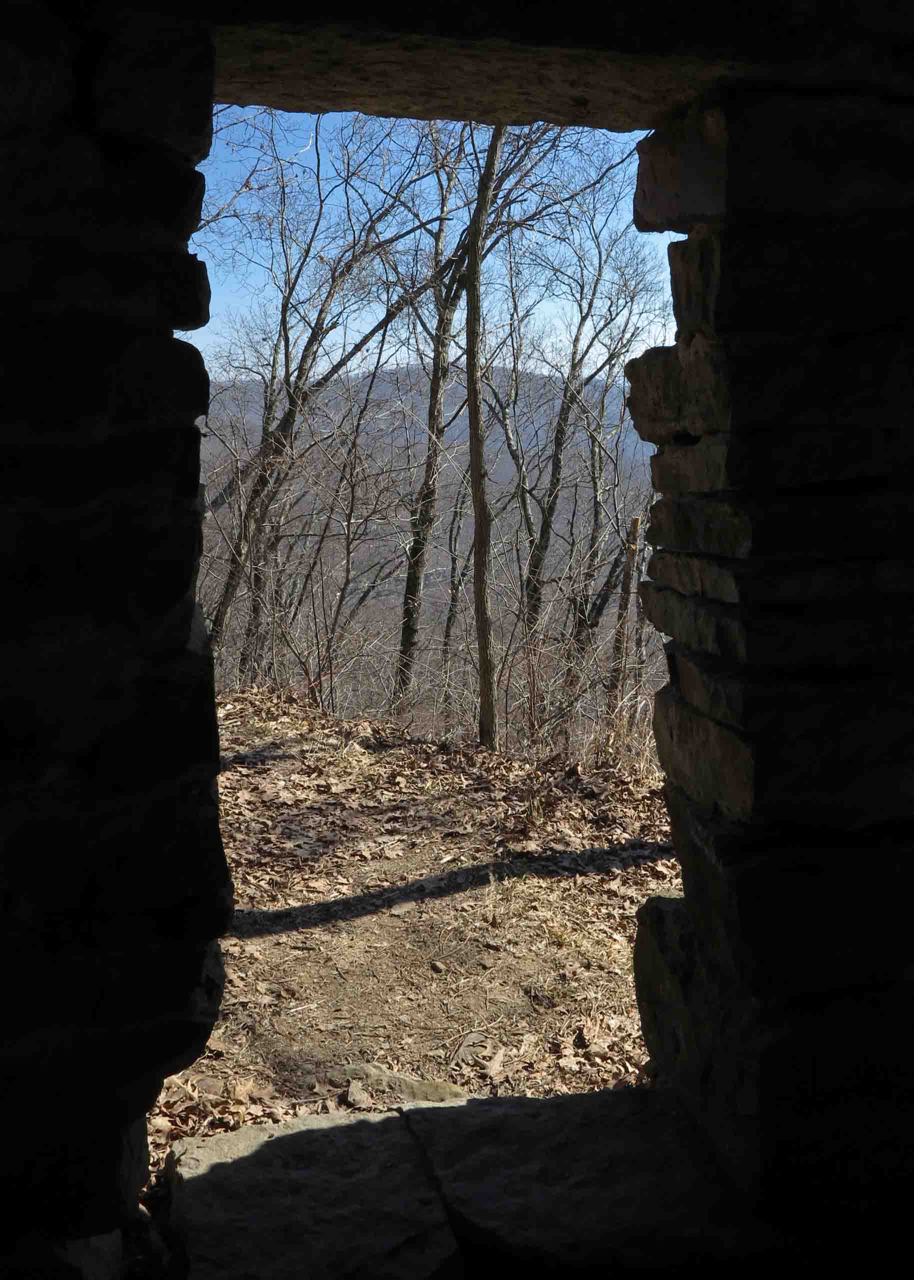
Inside the Rock House
You can see the toll that time has taken. The separation of the rock walls from the bluff ceiling are evident as well as the loose rocks around doors and windows. Please leave this fragile structure as you find it. The Rock House is a little historic treasure we’ll want our children and grandchildren to see for years to come!
Note: I’ve enjoyed sharing a glimpse of the rich history surrounding the Ozark Highlands Trail. If you know of other structures in the Arkansas or Missouri Ozarks, please share them with me on my feedback page or comment on this post.

Route from Hwy 23 to Rock House
Cherry Bend Trail Head GPS: N35 44.554 W93 48.799
Cherry Bend Trailhead is located approximately 5 miles north of Cass on Arkansas Highway 23. The second waypoint on the above map is the intersection with the OHT. The OHT route showing on this web map is an approximation. The last waypoint on the east side of Highway 23 is the Rock House.

Back door of the Rock House