In response to The Daily Post’s weekly photo challenge: “Rule of Thirds.”
I looked at photos from a hike into Lynn Hollow last Saturday for evidence of the “Rule of Thirds” and found it in use for the following photos among others.
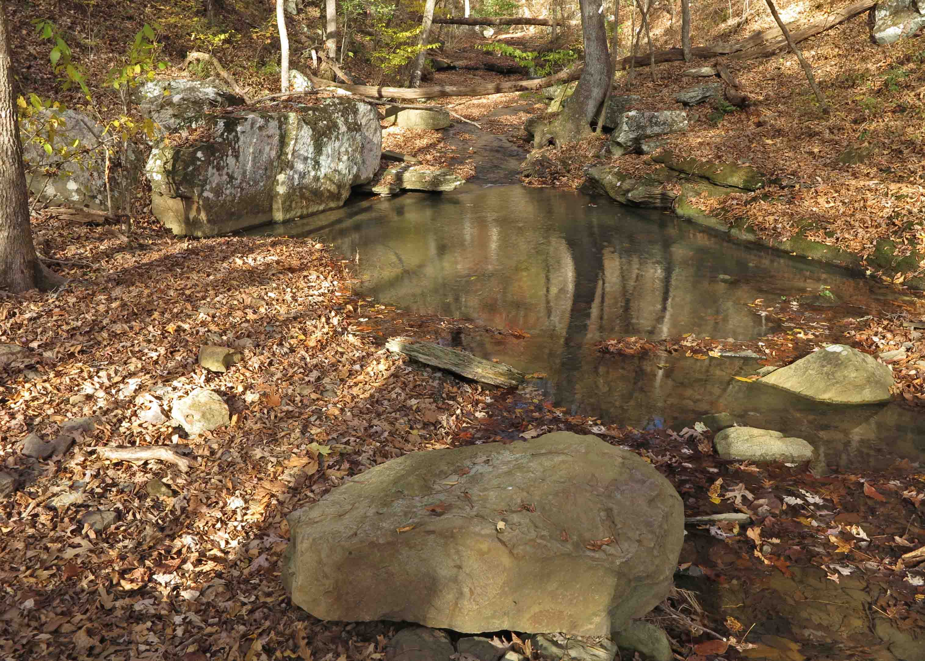
Blue-green swimming hole in Lynn Hollow.
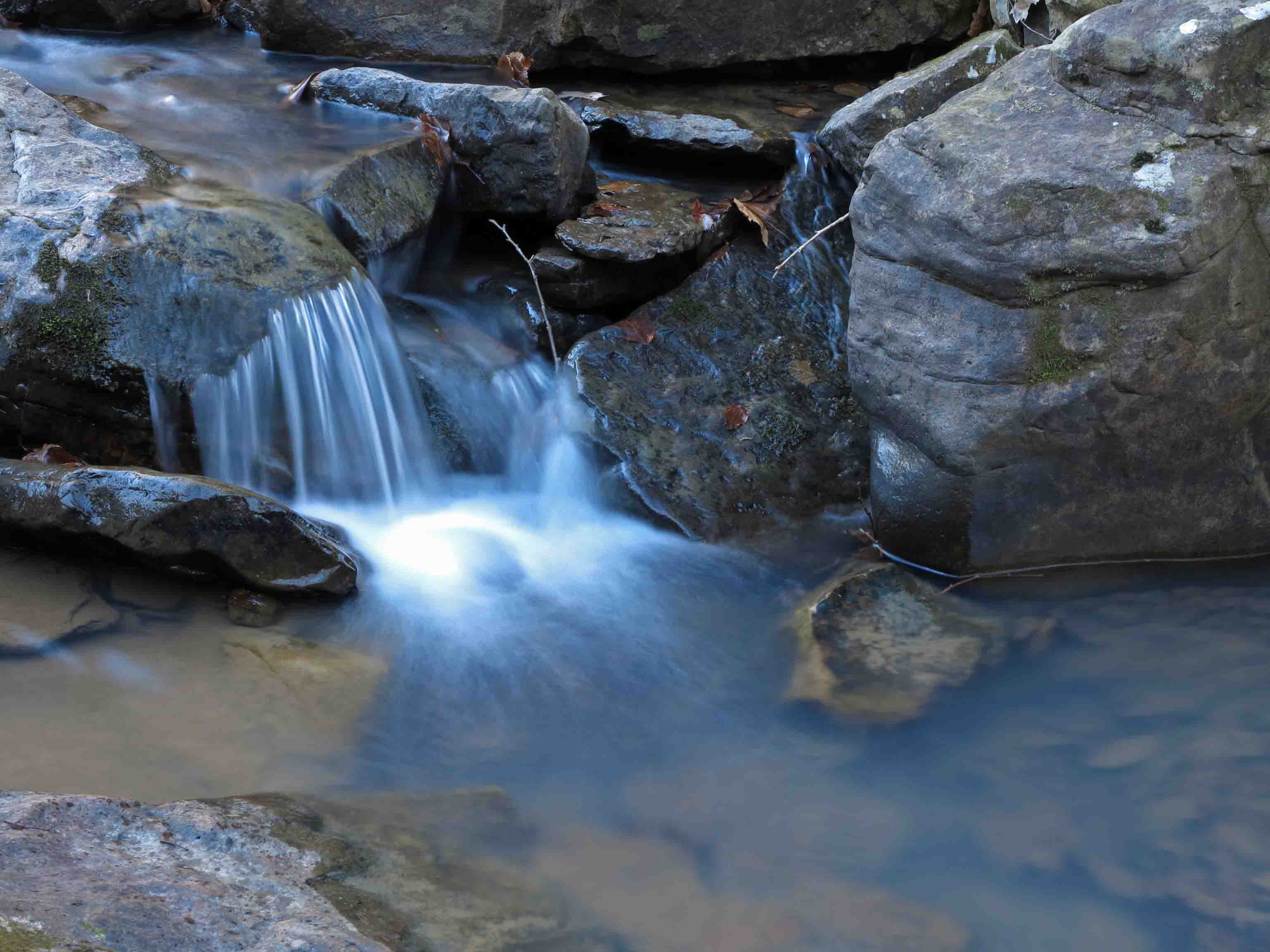
Placing the active movement of water using the rule of thirds is a useful tool.
Small cascade in Lynn Hollow, Ozark Highlands Trail
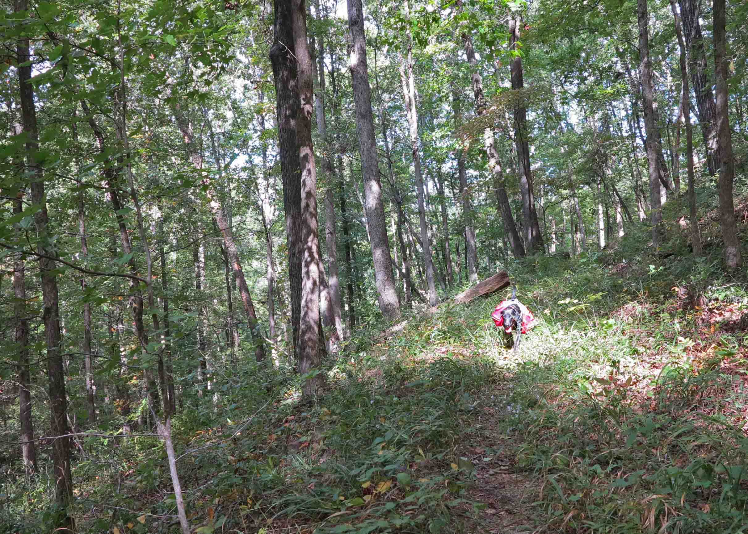
Hiker-dog heard something in this dead tree that she wanted desperately. The last photo shows the use of “Rule of Thirds” to place Hiker-dog’s rear for a balanced, and humorous depiction of typical K-9 behavior.
Hiker pausing from her digging into the trunk of this dead tree.
Hiker-dog doing what dogs do.
Tag Archives: Ozark Highlands Trail


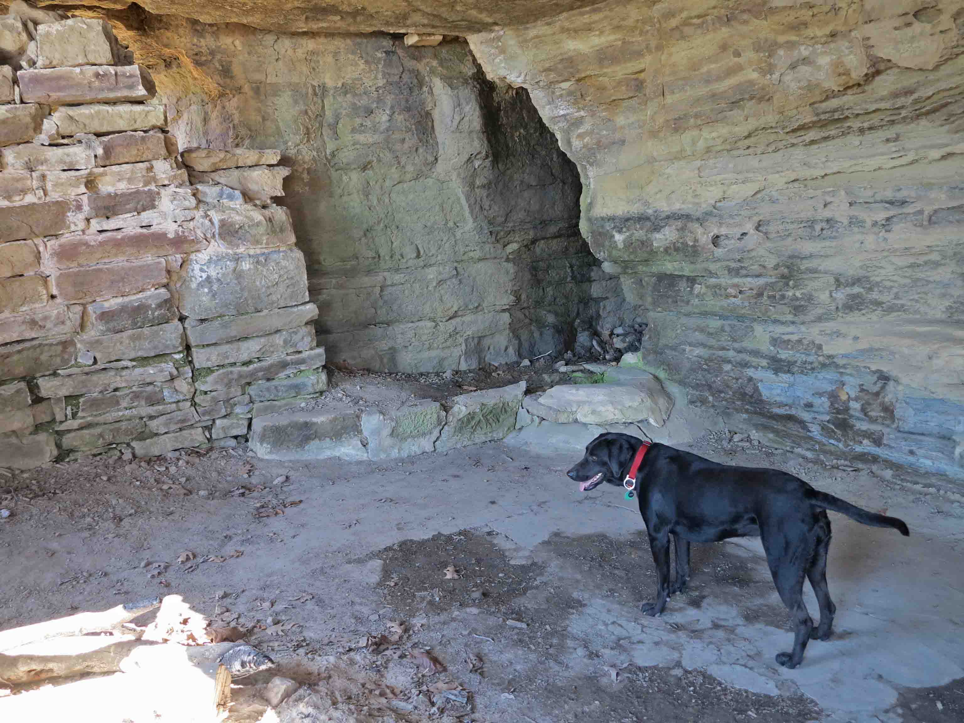
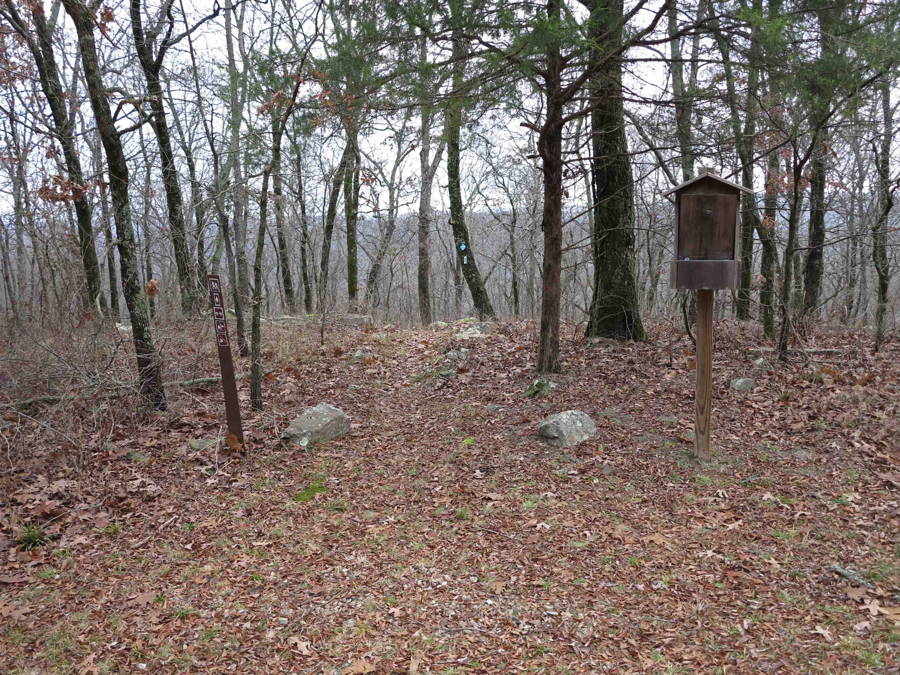
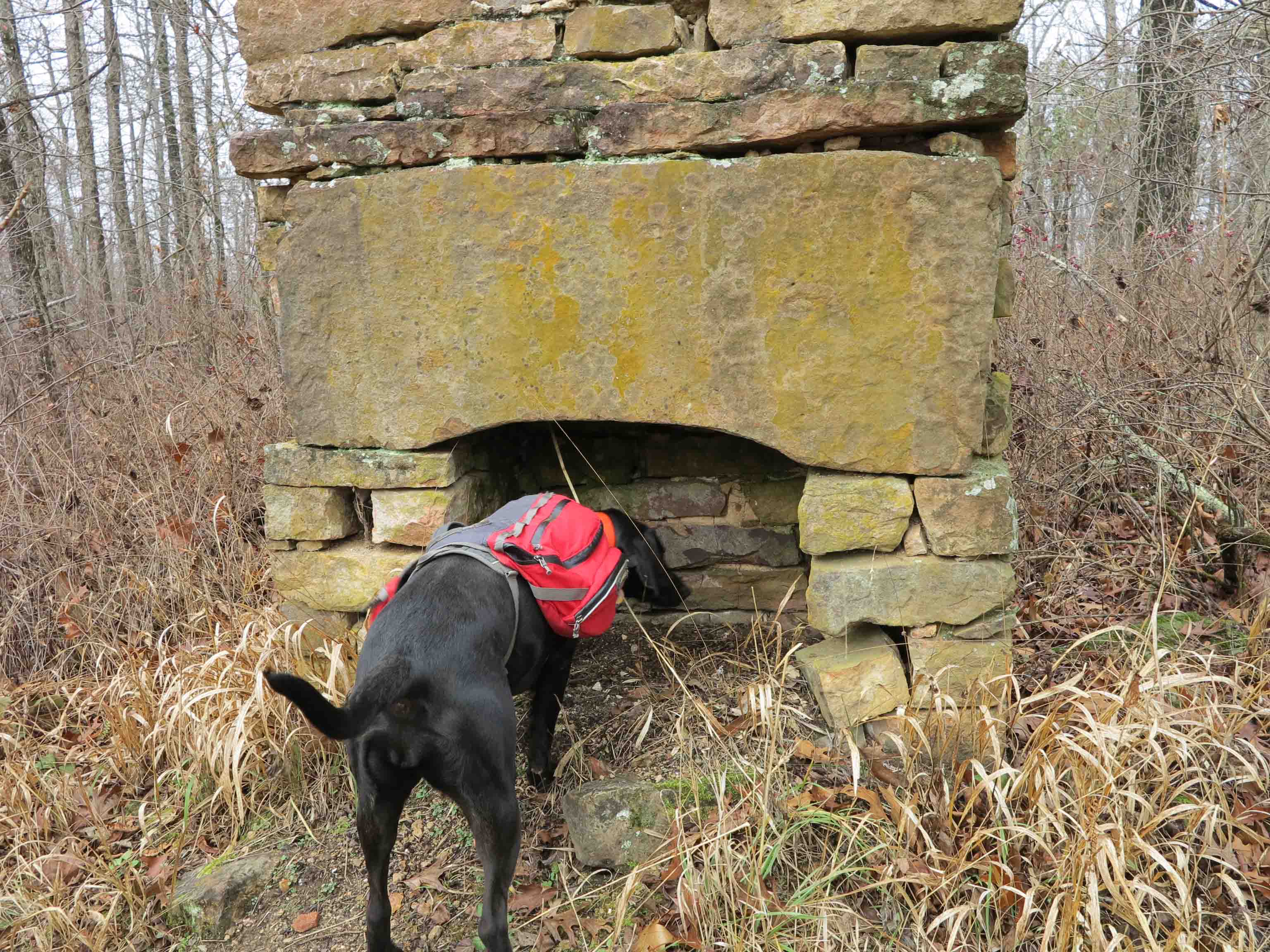
Rock House on the Ozark Highlands Trail

Rock House
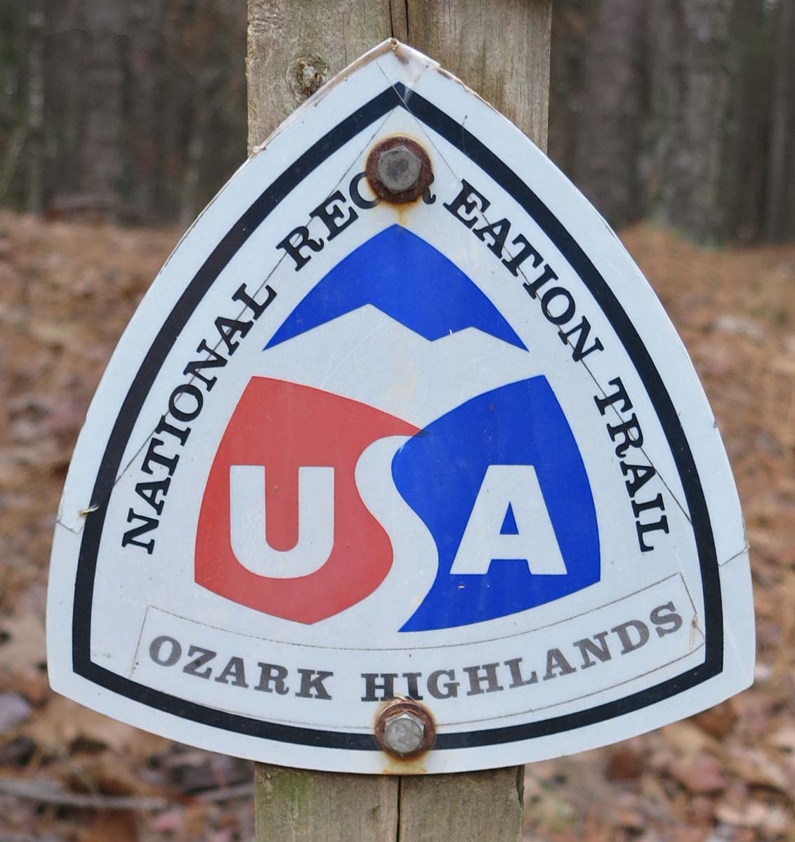
The Rock House is one of my favorite landmarks on the Ozark Highlands Trail (OHT). It’s easily accessed, but most drive Highway 23 unaware of the history perched under a bluff a mere quarter mile walk from the road. As the crow flies, the distance is much closer and during the winter it’s easy to see the highway down below. Don’t let the roundtrip 0.5-mile by trail deceive you. It’s a steep climb on the Ozark Highlands Trail and a short spur trail to the structure. If you walk to see Rock House, wear sturdy walking shoes and carry some water.
The Rock House was probably built as a shelter for loggers sometime during the 1890s to 1920s when the area was heavily logged for white oak, in high demand because of the expansion of railroads across the country. By the 1930s, the old-growth forests were pretty much exhausted. It still makes a good shelter today in spite of some shifting of the ground that has caused a separation between the wall and bluff. It has a rough concrete floor, and a small spring located in the back of the single room.

The short hike to Rock House begins at Cherry Bend Trail Head, located approximately five miles north of Cass on AR 23 (AKA Pig Trail). This is a popular trailhead for accessing the OHT. Watch for fast traffic when crossing the highway as you begin your walk.
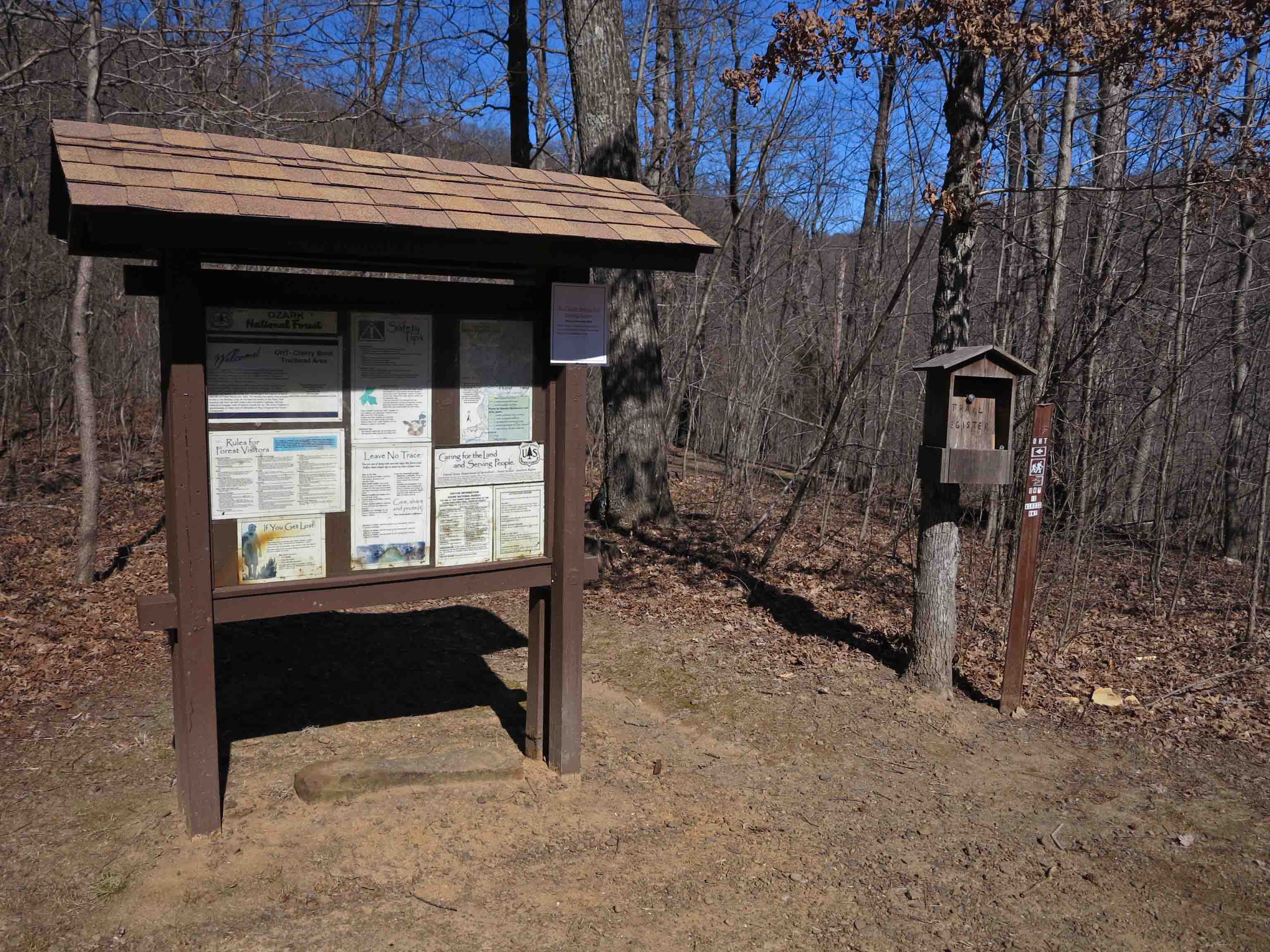
Cherry Bend Trail Head
A spur trail leads to a nice view behind the trailhead sign, but to access the OHT and Rock House, you’ll cross the highway on a short trail marked with blue blazes.

Lost sole…
There is a thru-hike trail register at the intersection with the OHT. We’re going to turn left onto the OHT and head sharply uphill following white blazes. I only saw one “lost sole” on my hike up to Rock House. You’ll often have the OHT all to yourself, but you might encounter thru-hikers and enjoy a short visit about their time on the trail.

Sign indicating spur trail to Rock House blue blazes marking the spur and white blazes marking the OHT
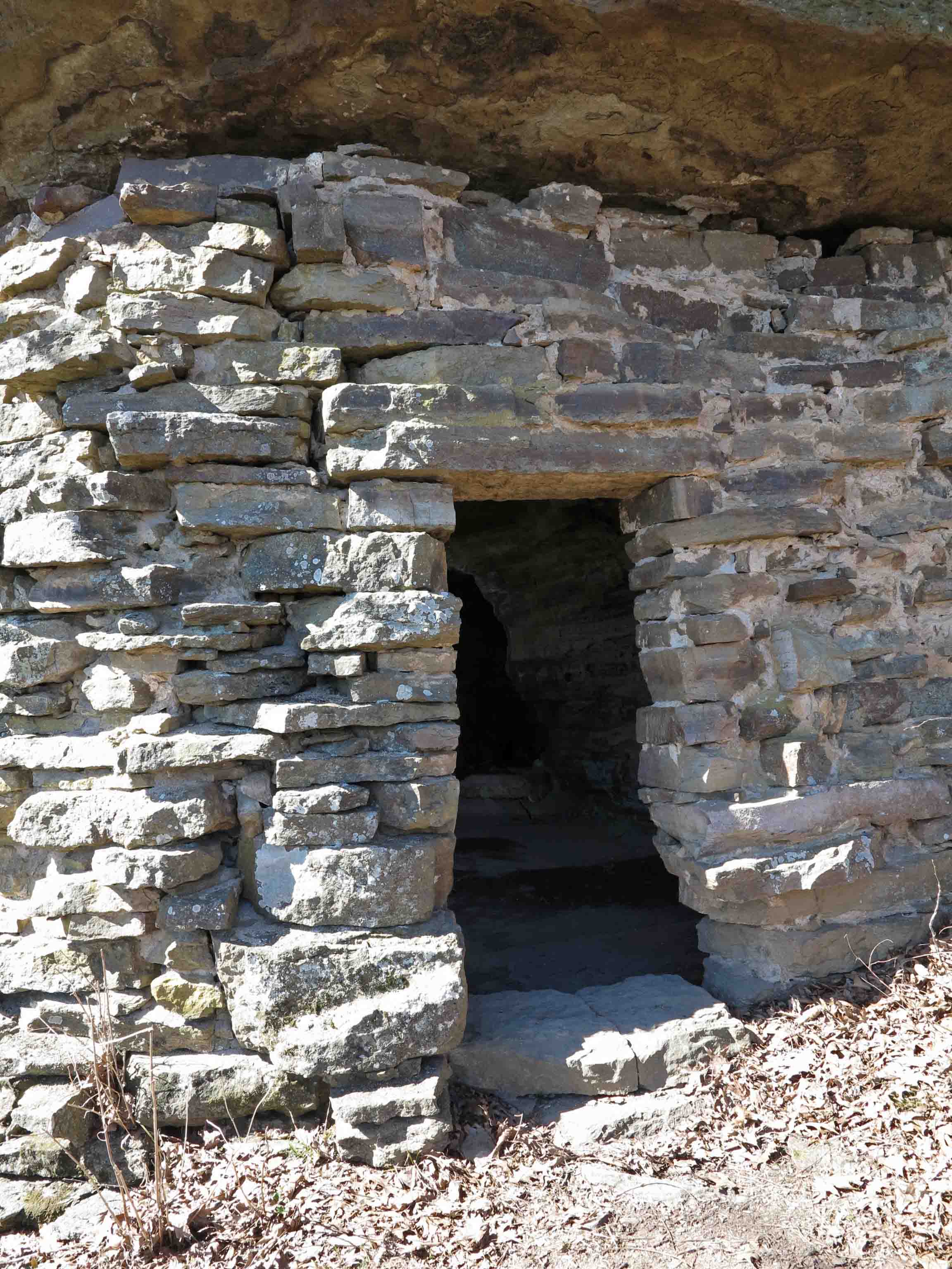
Front door facing the approaching spur trail
On a thru-hike of the Ozark Highlands Trail in December of 2013, a hiking buddy and I spent a cold night in the Rock House sheltered from the rain. Seeing car lights below made me want to rush down and beg someone to bring pizza from Clarksville, but staying warm in my sleeping bag won that short mental argument.
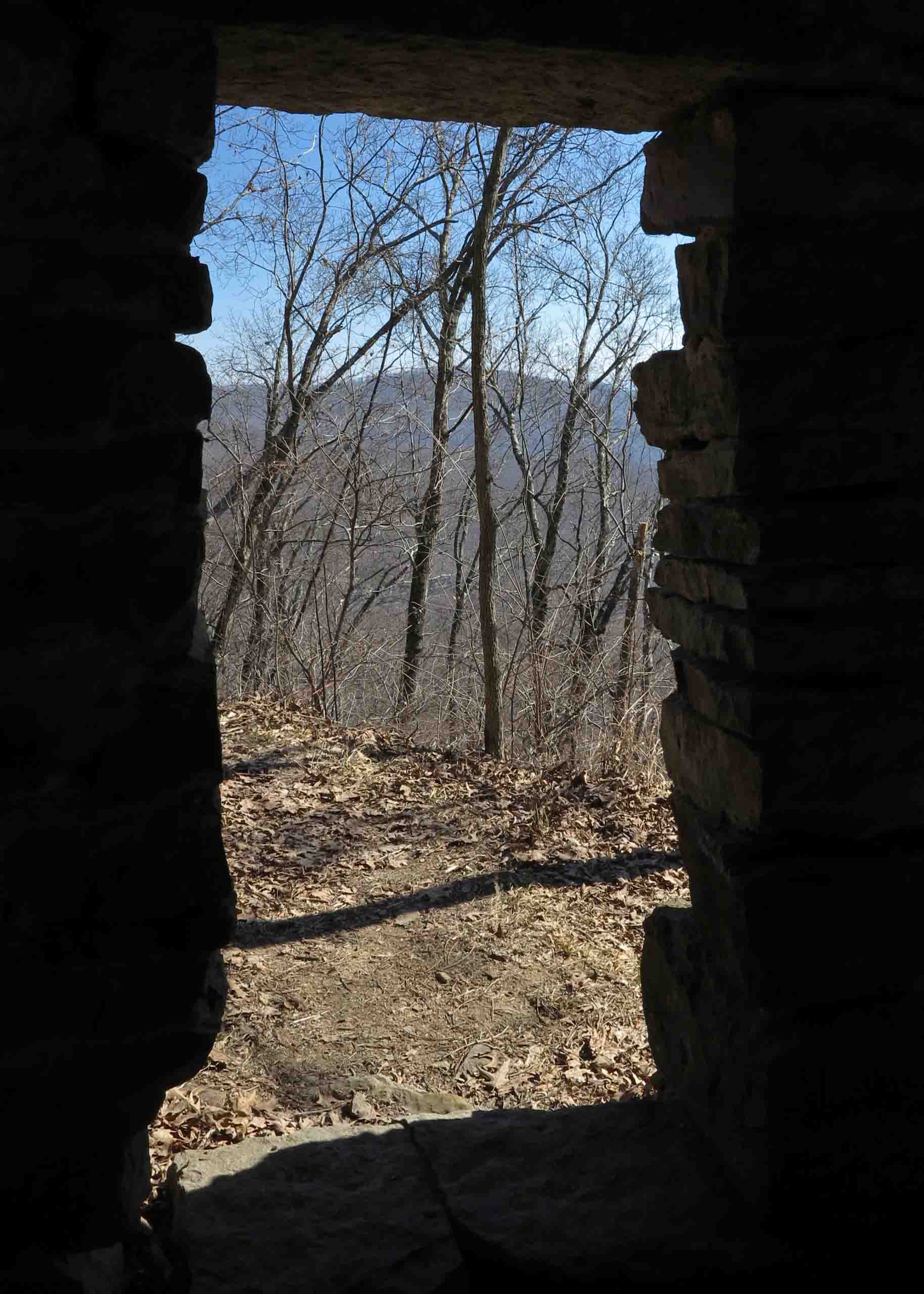
Today as I revisit the Rock House, it’s sunny and mild for February. The views of the Ozark Mountains to the east are enticing. I feel the desire to load my pack and head out for a multi-day hike over Hare Mountain and through the Marinoni Scenic Area to Lick Branch.
Hiker and spring in the back of the Rock House
Hiker attempted to drink from the spring in the back corner but the water was a couple of feet below the edge, and she didn’t couldn’t reach it. The water from this spring needs to be filtered. The single time I filtered water here, it wasn’t the best. It would be good water if you’re in a bind or have time to filter it through cloth before using your water filter.
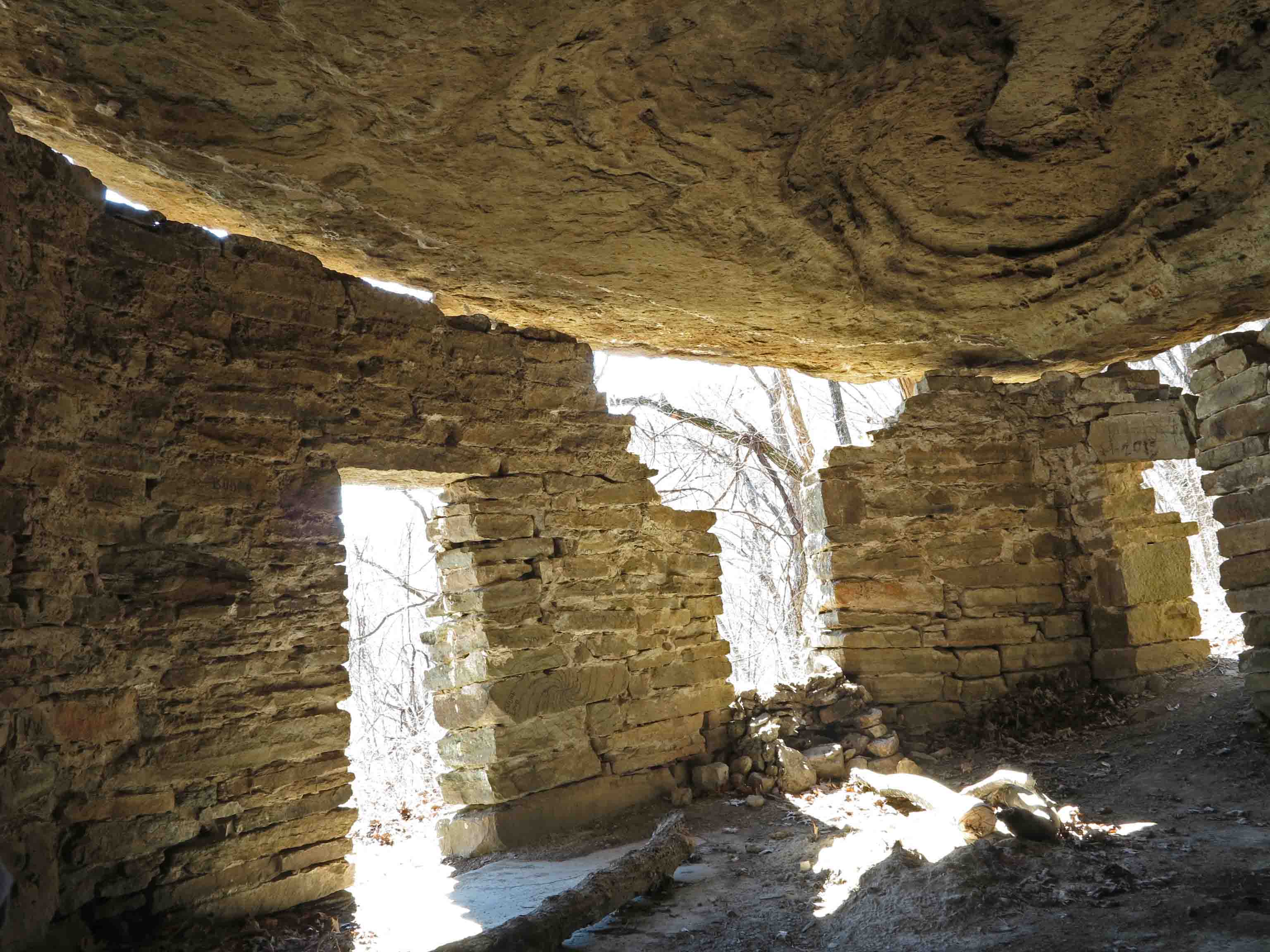
Inside the Rock House
You can see the toll that time has taken. The separation of the rock walls from the bluff ceiling are evident as well as the loose rocks around doors and windows. Please leave this fragile structure as you find it. The Rock House is a little historic treasure we’ll want our children and grandchildren to see for years to come!
Note: I’ve enjoyed sharing a glimpse of the rich history surrounding the Ozark Highlands Trail. If you know of other structures in the Arkansas or Missouri Ozarks, please share them with me on my feedback page or comment on this post.

Route from Hwy 23 to Rock House
Cherry Bend Trail Head GPS: N35 44.554 W93 48.799
Cherry Bend Trailhead is located approximately 5 miles north of Cass on Arkansas Highway 23. The second waypoint on the above map is the intersection with the OHT. The OHT route showing on this web map is an approximation. The last waypoint on the east side of Highway 23 is the Rock House.

Back door of the Rock House
On the Road in the Ozarks

Vacant cabins at the old Lake Fort Smith turnoff in Mountainburg.
Part of the pleasure of hiking is the drive to the trailhead. Here are just a few of my favorite places along side of Ozark roads. I drive through Mountainburg in route to many trailheads, but only recently noticed these little cabins. They are a short distance off of AR 71 at the turnoff that led to the original Lake Fort Smith State Park, closed in 2002 when the lake was expanded.

Dairy Dream in Mountainburg.
The Dairy Dream is on the east side of AR 71 in Mountainburg. I noticed their “Mountainburger” is priced at $2.50 according to the menu in the window. The Dairy Dream was closed for the winter. I’ve never stopped there but hope to try the Mountainburger someday.
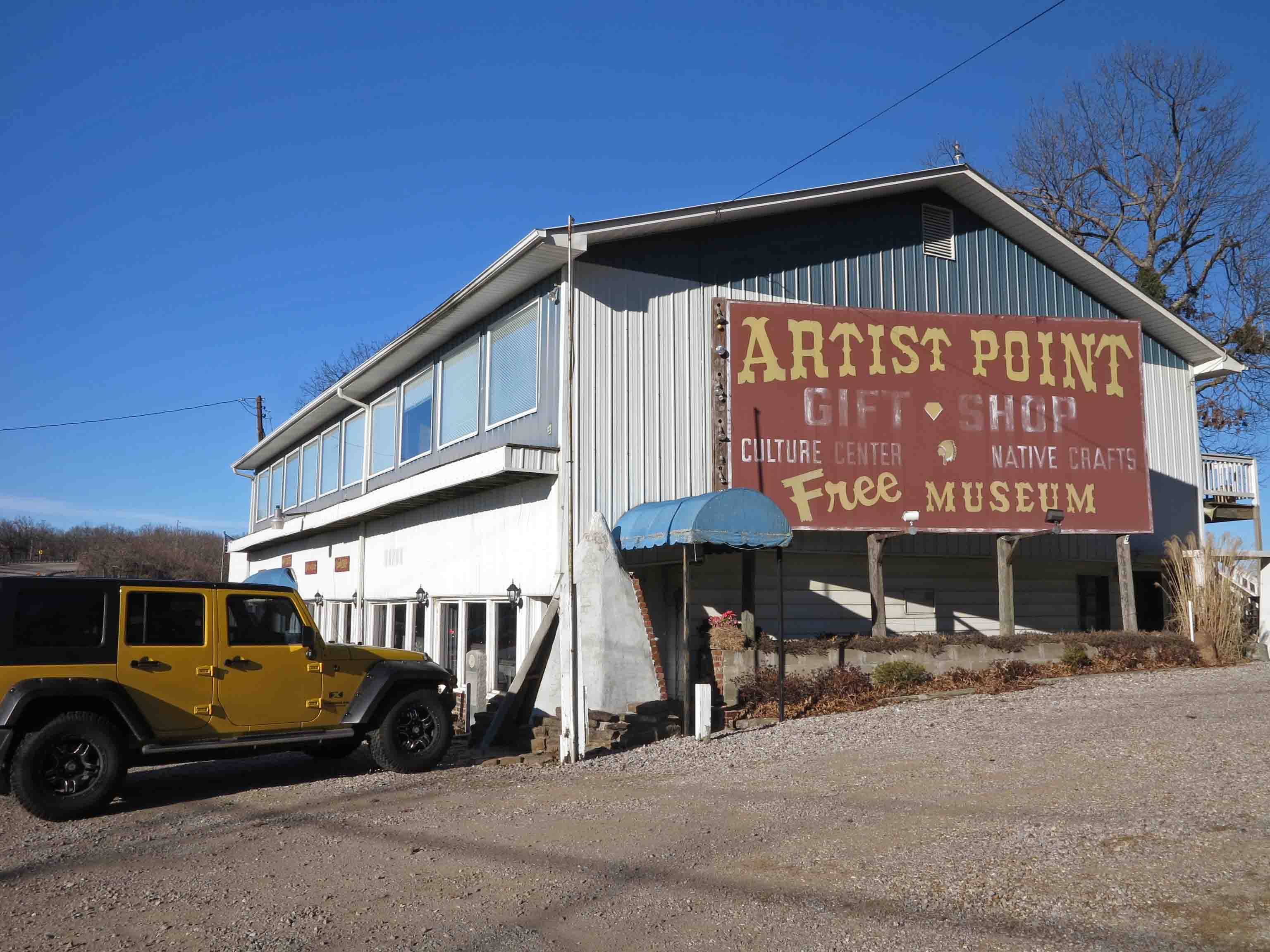
Artist Point on AR 71
Artist Point, north of Mountainburg, is one of my favorite places on AR 71. In 2001, when we were thinking about moving to Alma, we stopped in at Artist Point. A helpful young lady was working behind the counter as her grandparents looked on. I asked where she attended school, and she said, “Alma.” Both she and her younger brother were my students, and I enjoyed watching them grow up.
I became friends with Mr. and Mrs. Blaylock, owners of Artist Point. There was a steep trail behind the store. Mr. Blaylock wasn’t able to hike the trail down to the waterfall anymore, but enjoyed hearing reports and seeing photos of the area. Sadly, Mr. Blaylock has been gone for several years, but his store remains and is definitely worth a stop if you’re in the area.

Abandoned house on Highway 23
Old structures along the roads sometimes demand that my Jeep hit the shoulder. Even though I’m rushing to the trail, I’ll pull out the camera for a few pics.
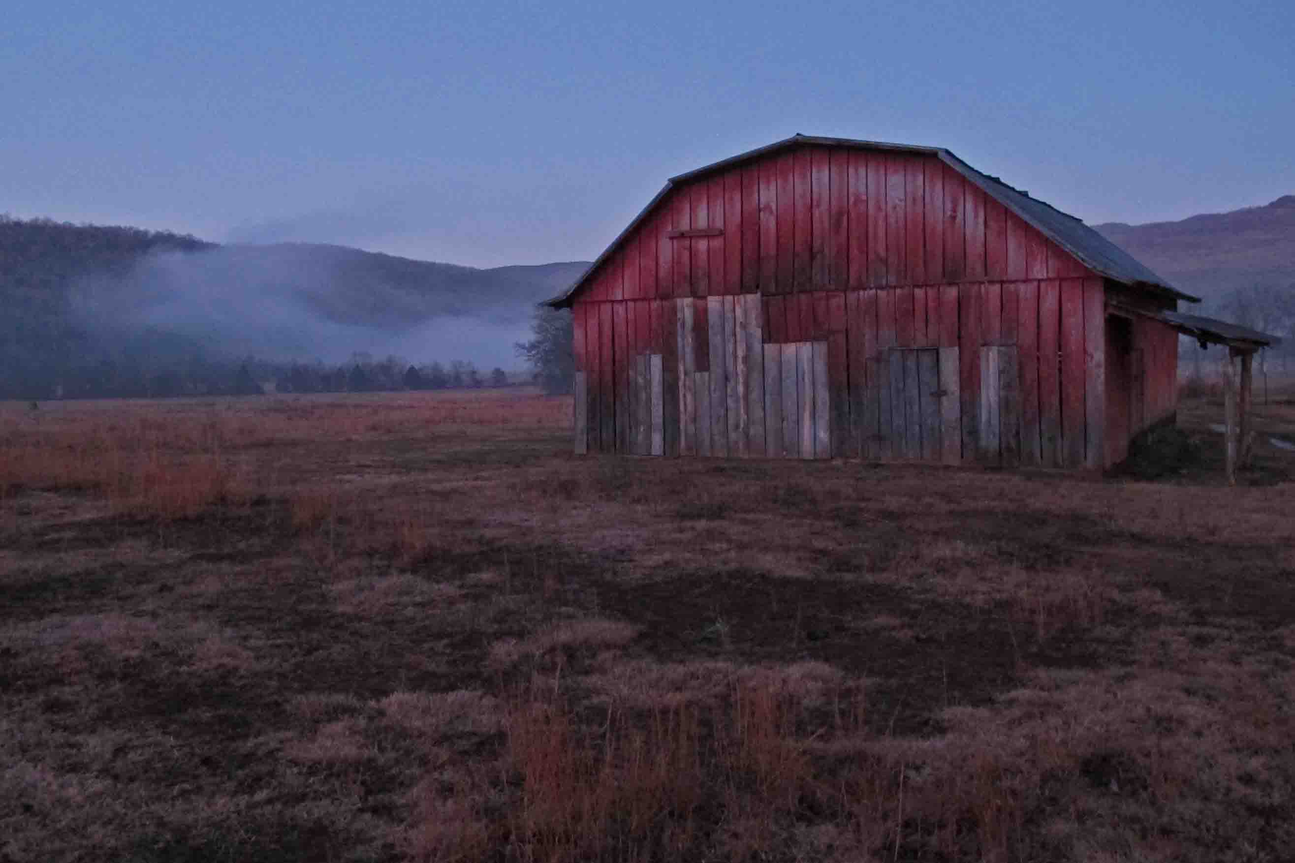
Barn on Highway 23
Sometimes food is the motivator. Such is the case with the Turner Bend Store, located on Highway 23 close to Cass. Great sandwiches and good people! Stopping there is always a treat!
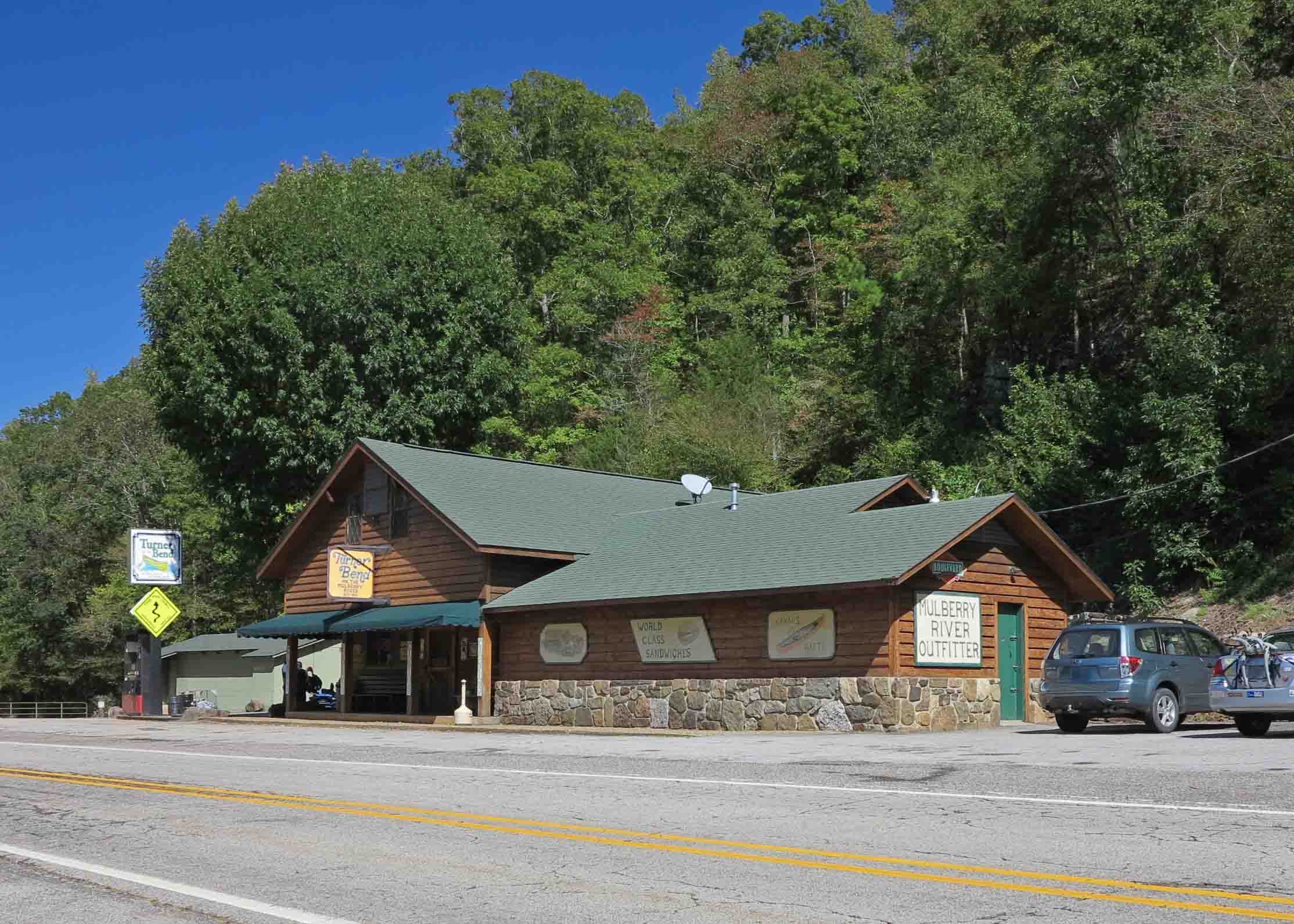
Turner Bend Store
The Oark General Store serves up a good breakfast, lunch, and dinner. They are known for being Arkansas’ oldest continuously open restaurant. A necessary stop if you’re hitting the western part of the Ozark Highlands Trail. It’s a short drive from Arbaugh Trailhead.

Oark General Store

Oark General Store
The Hagarville Country Store on Highway 215 north of Clarksville is a great little stop. The owner also runs shuttles for hikers when needed and usually has some good trail stories to share.

Hagarville Country Store

Hankins Country Store
Another favorite stop on the road to the trails is Hankins Country Store, located at the intersection of AR Scenic Highway 7 and AR 215. An old post office and several interesting old items are inside. There’s even a barber’s chair that is used from time to time if someone needs a haircut. The wood burning stove feels great after a winter hike through the Hurricane Wilderness Area. They make a good sandwich….especially good after a hike.

Pelsor Post Office inside the Hankins Country Store
If you’re up in the Buffalo River region, a stop in at the Ozark Cafe is a must. Lots of good food and history!

Ozark Cafe in Jasper

The Arkansas House Cafe
Another great place to eat in Jasper is the Arkansas House Cafe, connected to the Arkansas House, an old, but clean establishment. The Elk Chili was a treat!

Buffalo Outdoor Center
The Buffalo Outdoor Center is a long-established business that began when Mike Mills started running river shuttles about forty years ago. The staff loves to talk trails, and they give good directions to some beautiful spots close by. They also have good food, books, and run shuttles. I’ve used them several times to shuttle my Jeep over to Highway 7 when I hike the Buffalo River Trail.


Inside the Buffalo Outdoor Center
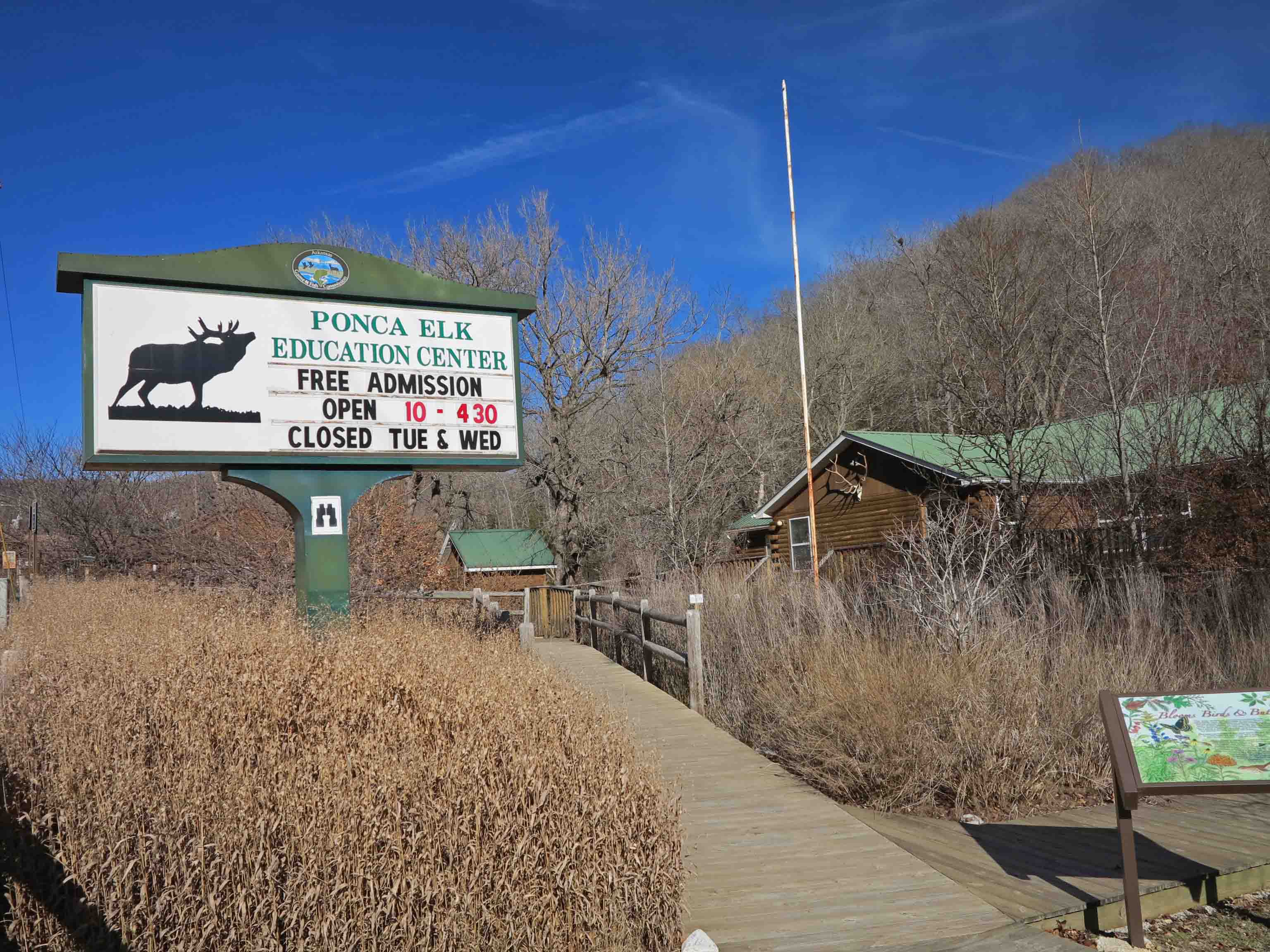
Across the street from the Buffalo Outdoor Center, you’ll find the Ponca Elk Education Center. This is a great place for all ages. I enjoyed spending a little time looking at the nature displays inside.
The closest I’ve come to an Arkansas Black Bear.
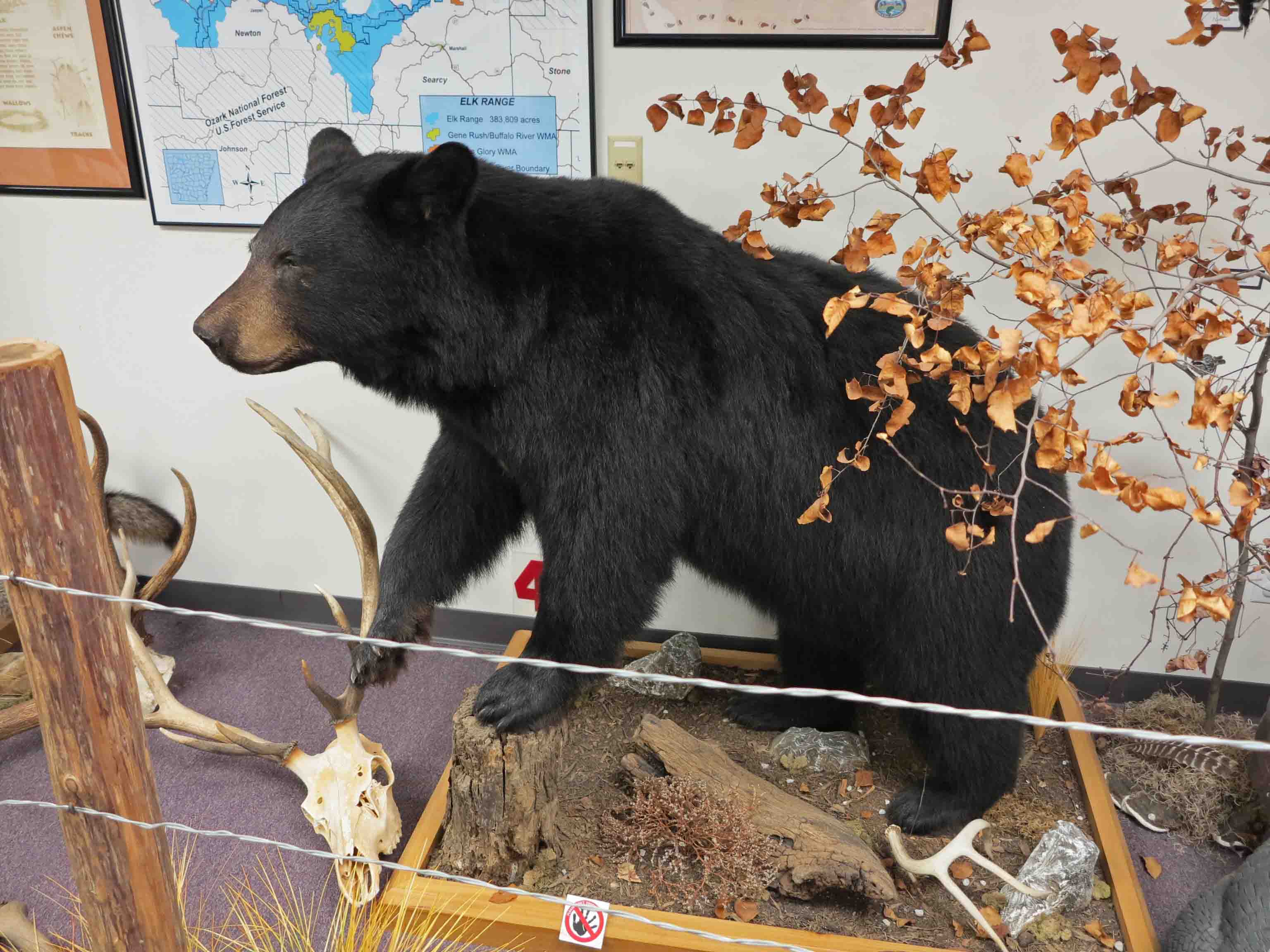
Display at the Elk Education Center
The Boxley Baptist Church is a highlight just a few minutes from Ponca.

Boxley Valley, Arkansas
Many old structures can be found on the roads to the trail. This little house is located on the dirt road to the Lost Valley Trail.

Close to Lost Valley

Inside the two room structure.
To be continued…. So many roads to so many trails.

“Fixer-upper” on the road to Lick Branch Trailhead of the Ozark Highlands Trail
Ozark Mountain Frost Flower – Gone, But Not Forgotten
In response to The Daily Post’s weekly photo challenge: “Gone, But Not Forgotten.”
Frost flower next to the Ozark Highlands Trail in Arkansas, USA
This cold morning discovery while thru-hiking the Ozark Highlands Trail was a special little gift. My wife enjoys looking for heart shapes in nature, and now I’ve picked up the habit. This frost flower would disappear shortly after being touched by sunlight, but it would never be forgotten.

Just another day on the trail…
Abandoned house on Highway 23
Part of the fun of hiking is driving to the trailhead. I just had to stop when this abandoned house caught my eye.

I was looking forward to hiking with Mike LeMaster. He is a “heavy hitter” when it comes to trail maintenance, but today he hiked without his chainsaw. We had a good visit while on the trail. He is shown here with his famous Toyota go-anywhere truck. This little truck has slid into a couple of ditches and a barbed wire fence, but just keeps going and going.

We decided to avoid running a shuttle and did the Redding Loop. We passed this “would be” waterfall. I thought about a kayaker who often said, “If there were water, we could float this.” I thought to myself, “If there were water, this would be a waterfall,” but it was just a trickle today. The little valley was a pleasure to see as the trail followed around its edge.
Spy Rock
We didn’t make the spur to Spy Rock but enjoyed seeing it from a distance. Below is a picture taken from the bluff a couple of months ago. Sean is cutting up (carefully) on the edge of Spy Rock.

After completing Redding Loop, Mike headed back to Fayetteville to catch a football game. Hiker-dog and I had one more hike in mind. We drove up to Morgan Fields Trailhead with the idea of doing an out-and-back to Hare Mountain, the highest point on the OHT.
Trail entrance from Morgan Fields Trailhead
This out-and-back hike was on the Ozark Highlands Trail, passing mile marker 43, and 44. I’m always pleased to see these little trail signs at road crossings. I must associate them with good experiences on the trail.
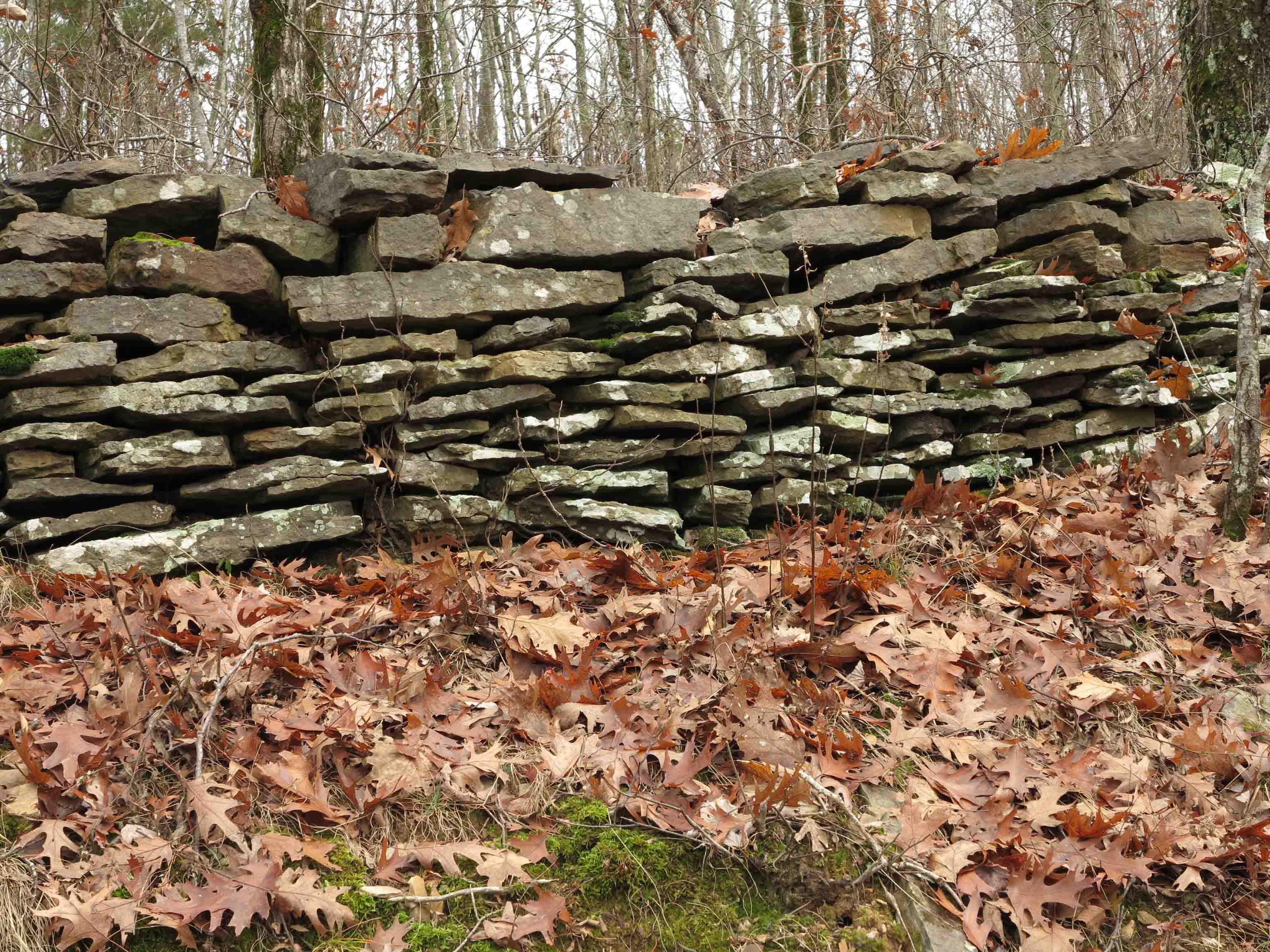
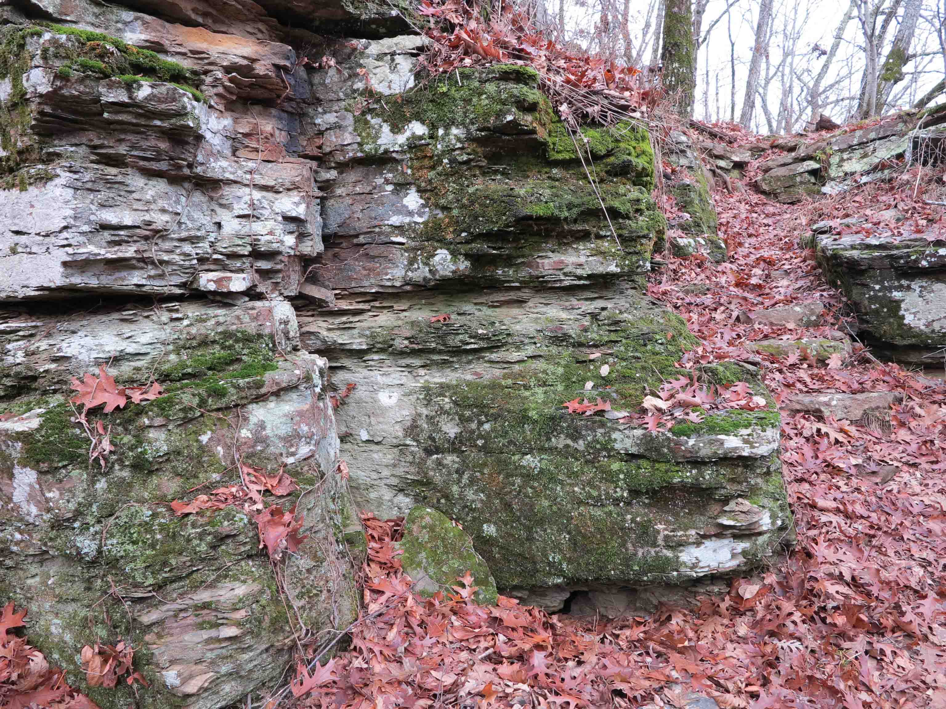
The trail passes a rock wall. I wish these walls could tell stories of the people who built them. Below is a picture of a small portion of rockwork that forms the base of a section of historic roadbed. The trail follows this road for a short distance. Over the years, some of the stone retaining wall has been torn up by falling trees but much of it has stood the test of time. I can’t imagine how much physical labor went into building this little section of road.
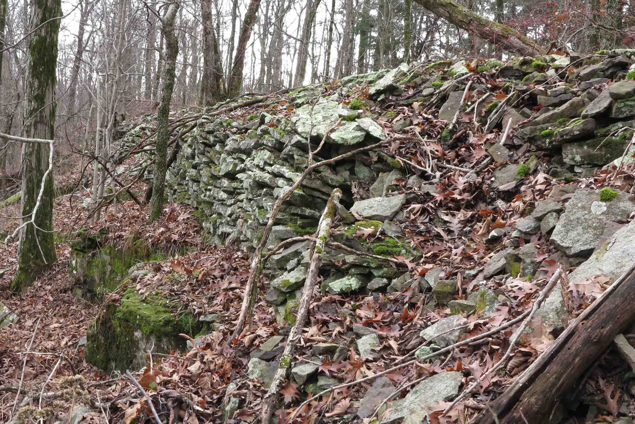
Rock base of historic roadbed
The trail climbs steadily and cuts through a couple of rocky crags. It’s December 6, and I’m hiking in a t-shirt. I was chilly but avoided breaking a sweat on the climb.
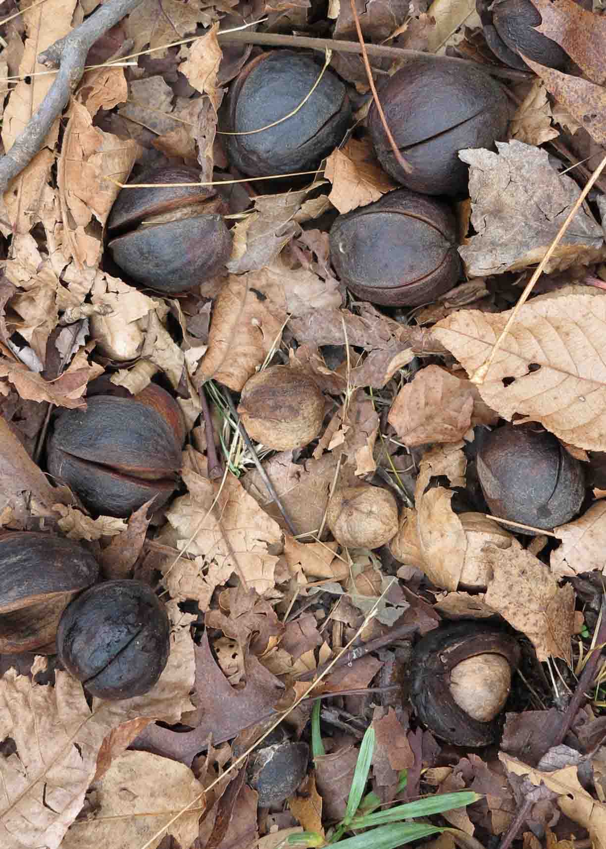
Hickory nuts were plentiful on top of Hare Mountain. I picked one up and tossed it for Hiker to chase. To my surprise, she began to crack it with her teeth. Half fell out on the ground, and she chewed up the other half. I dug out some of the nut and tried it. Pretty good but a lot of work.
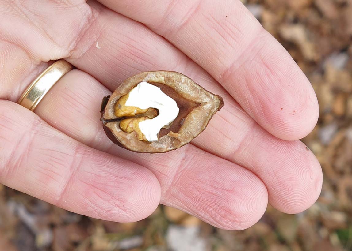
The hickory nut Hiker cracked for me.
Hiker chewing a hickory nut.
Hiker inspected the homestead chimney and well. I’m always impressed with the mantel stone on this fireplace. It appears that some mortar may have been used, but there are no firebricks. I would like to know the date of construction.
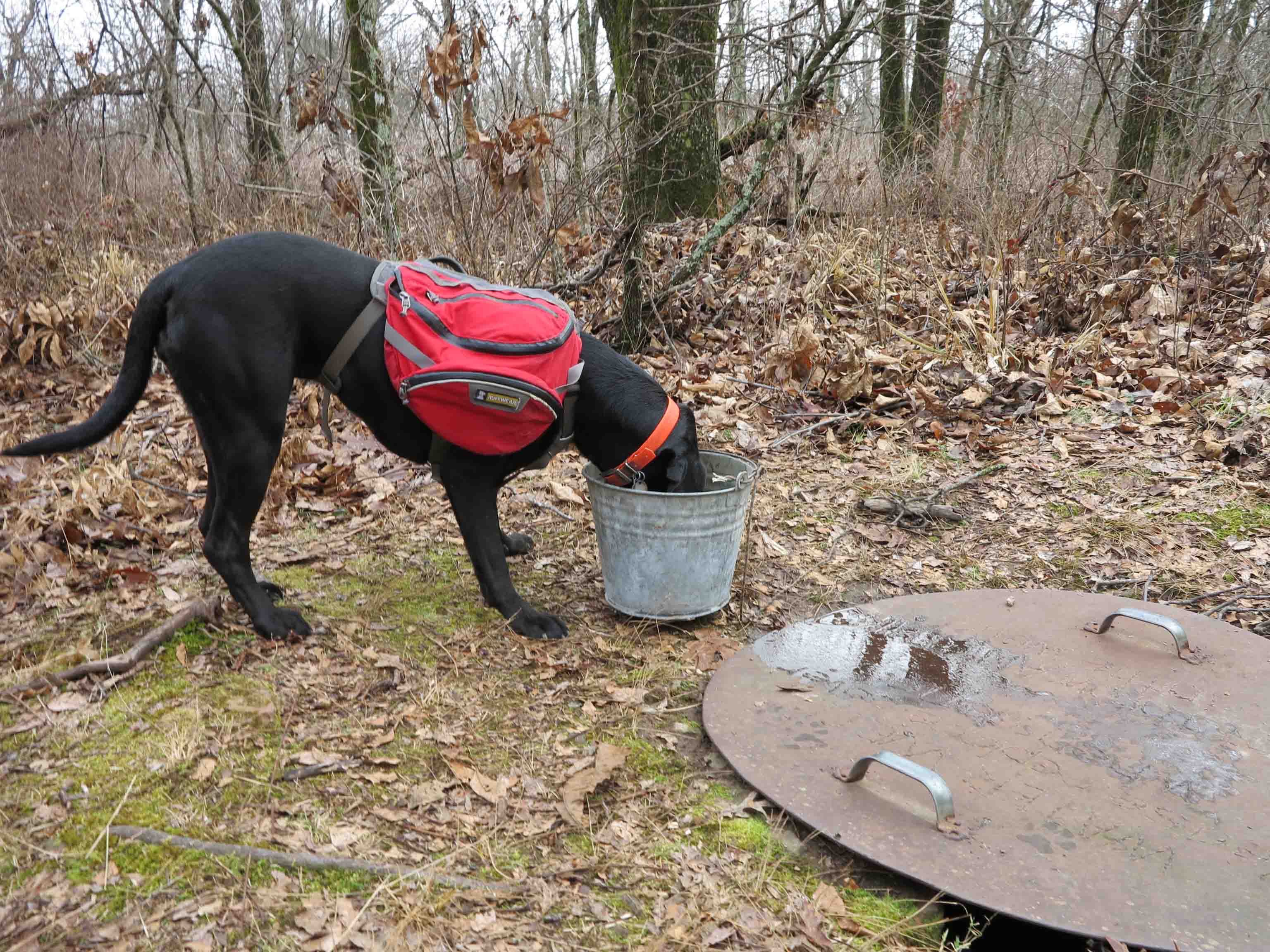
Hare Mountain Well
I peeked under the well lid to check the water level. It was about two feet from the top and pretty cloudy as usual. Rain water had collected in the bucket.
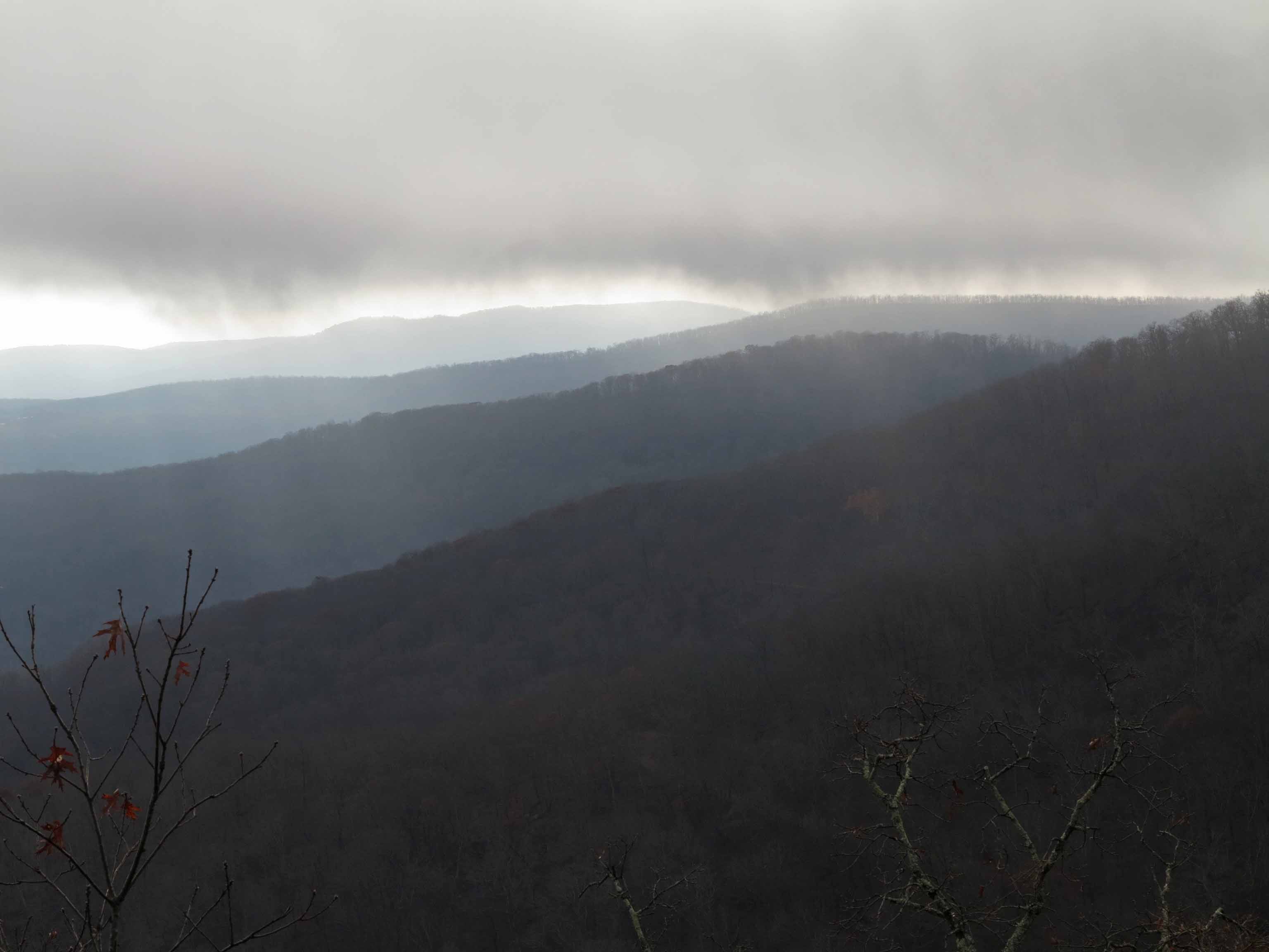
Even on foggy days, the view from Hare Mountain is a joy to see. A quick hike down the mountain and we called it a day, another very good day on the trail!
If you’d like to see more of the Ozark Highlands Trail, here’s a slideshow from my thru-hike last winter.
Gone But Not Forgotten: Shimmer of Color
Wet crossing on the Ozark Highlands Trail in the Hurricane Creek Wilderness
I long to hold onto fall, wishing I could stop the progressive changes in color. The sunny day, when gusts of wind begin to deliver spent brown leaves to the ground, is always a day of mixed emotions.
I love fall, but only the extremes of winter seem to connect with childhood memories. In south Arkansas, there were the rare snow days. We called them “free days” to miss school and play. More often, there were ice storms and the cannon booms of pines snapping like pencils in the woods behind our house. Memories connected with winter are easy, but those surrounding fall are vague.
Much is forgotten as the concerns of adulthood pile high over the seasons of childhood. Now, I sometimes pause to own a moment, hoping it will stay. Two falls ago I stopped beside a small stream to celebrate a shimmer of color, soon to be washed from its rocky perch. The leaf is gone, but the joys of that day are not forgotten. I should pause more often.
In response to The Daily Post’s weekly photo challenge: “Gone, But Not Forgotten.”

Trail Maintenance – A High Paying Job
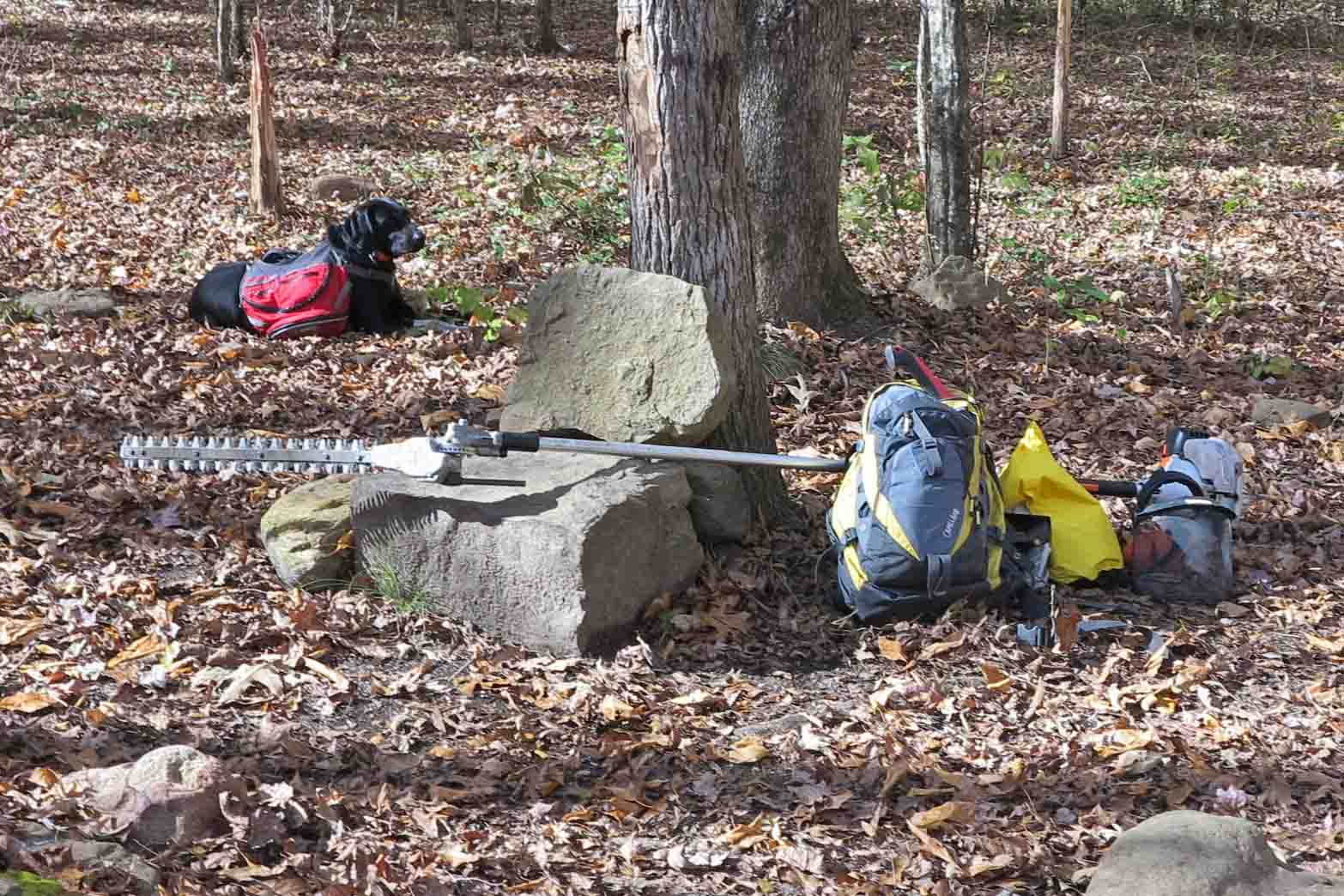
We took a break and refilled our water at the Jack Creek west camp site.
This Stihl hedge trimmer pictured above works well with small woody growth encroaching on the trail. I checked it out from the Ozark Highlands Trail Association to use on my adopted four-mile section. The Stihl website shows this being used to trim hedges, hence the name. I wonder if Stihl realizes this is a favorite tool for trail work in Arkansas.
Hiker wasn’t impressed with the tool. After about five hours, she began to pause and bark as if to say, “Why don’t you quit playing with that and pick up your pace.” We covered four miles out-and-back for a total of eight. That would typically be a four-hour walk. We got started at 8:00 a.m. and finished at 4:20 p.m.

Practice “Leave no Trace” so I don’t have to pack out your trash.
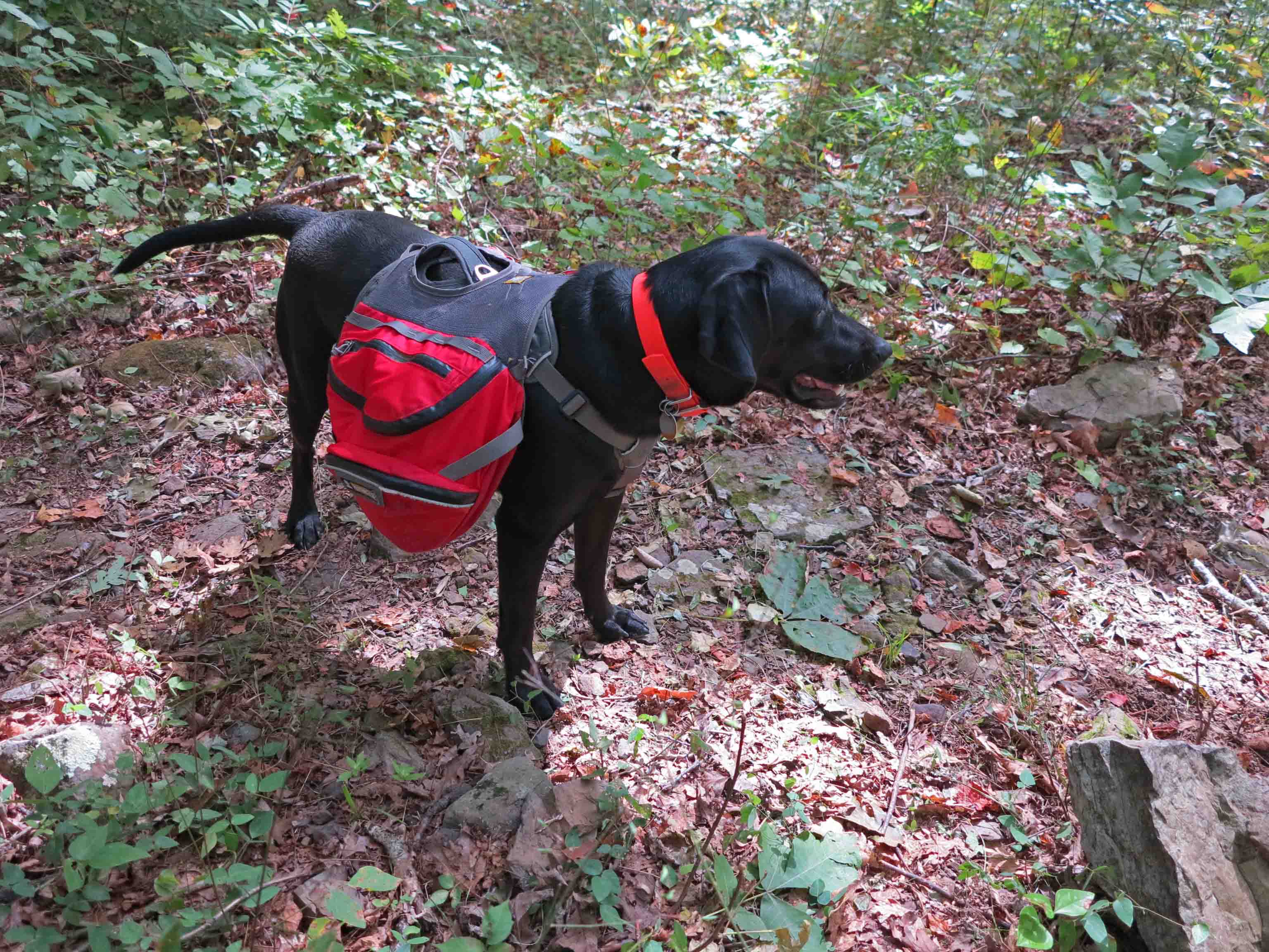
Hiker carries some food in her pack. She packs out any trash we find. She ended the day with an empty plastic bottle, a tin can, and a few candy wrappers. I wonder how litterbugs would feel, knowing that a sweet dog like Hiker is cleaning up after them.
I feel a sense of pride when “my section” of the Ozark Highlands Trail is in good shape. I would recommend trail adoption to all hikers. It’s satisfying work and a way to ensure that trails will be available for future hikers. It’s also a good workout. I always end a maintenance day feeling like I’ve been highly paid for my work. To see some of those who make the OHT possible, read In Praise of Trail Maintainers/Volunteers.
Bear Creek at the trail crossing.
Just being here is a cause for thanksgiving. Another cause for thanksgiving is the meal my creative wife prepares. Good food and company after trail maintenance is the best!

Hiking Through the Pawpaw Patch – Fanes Creek to Spirits Creek and Back
The plan? Meet at a favorite Ozark landmark, Turner Bend Store on Highway 23 (AKA The Pig Trail). Then drive a short distance to Fanes Creek Trail Head, near mile 31 of the Ozark Highlands Trail.
Turner Bend Store
Hiker-dog was bouncing and hyper Saturday morning, celebrating cooler fall temperatures; Sunny and 41 degrees! She was beside herself as I loaded the Jeep. When I finally said, “up,” she jumped into position, ready for a road trip to whichever trail it might lead.

Hiker heading toward the trail head.
We’ll have to call this the “pawpaw hike.” Fanes Creek west to Spirits Creek treks through several pawpaw patches. I was unfamiliar with this little fruit, but Dana, one of our hikers, pointed them out as we passed. The first ones we saw were overripe and a little bitter.

These two pawpaws were overripe.

Pawpaw
Later we passed some that were just right. I eagerly cut the skin off of this pawpaw and tried a bite. The taste is described as a blend of banana, mango, pineapple and papaya. I thought this was an accurate description. I ended up eating several before I stopped to think maybe I should proceed with caution because of my lack of experience with pawpaws.
Pawpaws are an understory tree and do not self-pollinate so they need other trees in the vicinity. The upper canopy of oak and sweet gum shaded the tinder looking pawpaw trees. There seemed to be limited numbers of fruit on each tree and great variation in the maturity of the different trees.

Pawpaw showing the meat and seeds of the fruit.
If I find pawpaws growing close to the road, I would like to try mixing in some lemon juice and dehydrating a pawpaw “leather” as a backpacking treat. I saved the seeds from the fruit I ate to see if I can grow a few pawpaw trees underneath some oaks behind our house.

Pawpaw tree with fruit.
This section of trail contains a lot of history. A couple of miles follow an old railroad bed dating to the early 1900s when trees were harvested and transported on a narrow gauge railroad. During the winter, it is easier to see evidence of the work done here. Old bridge footings where the rail line crossed drainages can be seen. Making this railroad must have been a major ordeal, but evidently the line worked for several years.
Hiking the old railroad bed.

Boulders sliding down the sides of the old excavation for the railroad bed.
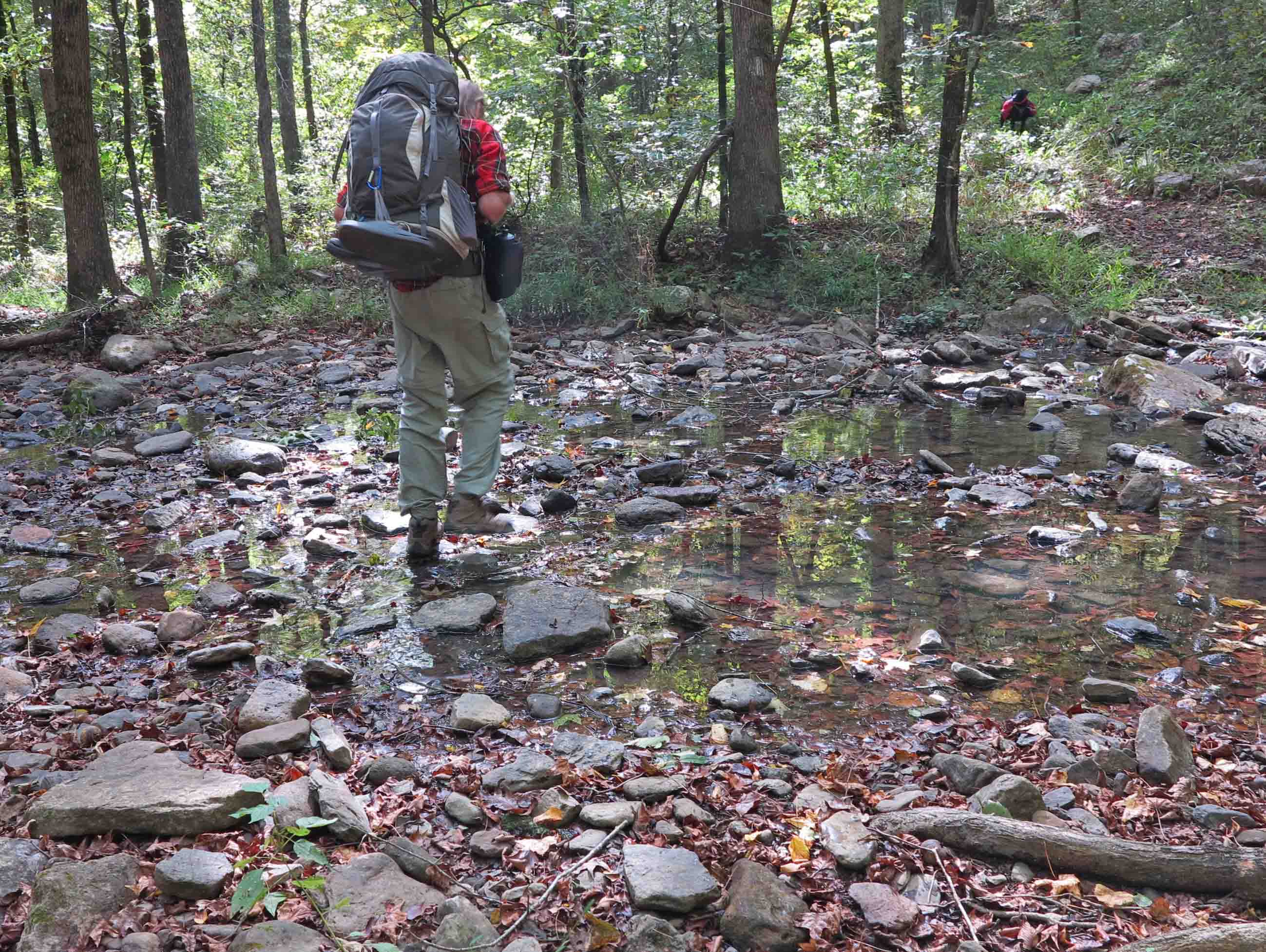
Water in the creeks was just right for drinking but low enough for dry crossings. The lower water levels gave an opportunity for Hiker-dog and I to spend a little time after dinner walking down Spirits Creek.
Bob stepping across Spirits Creek.
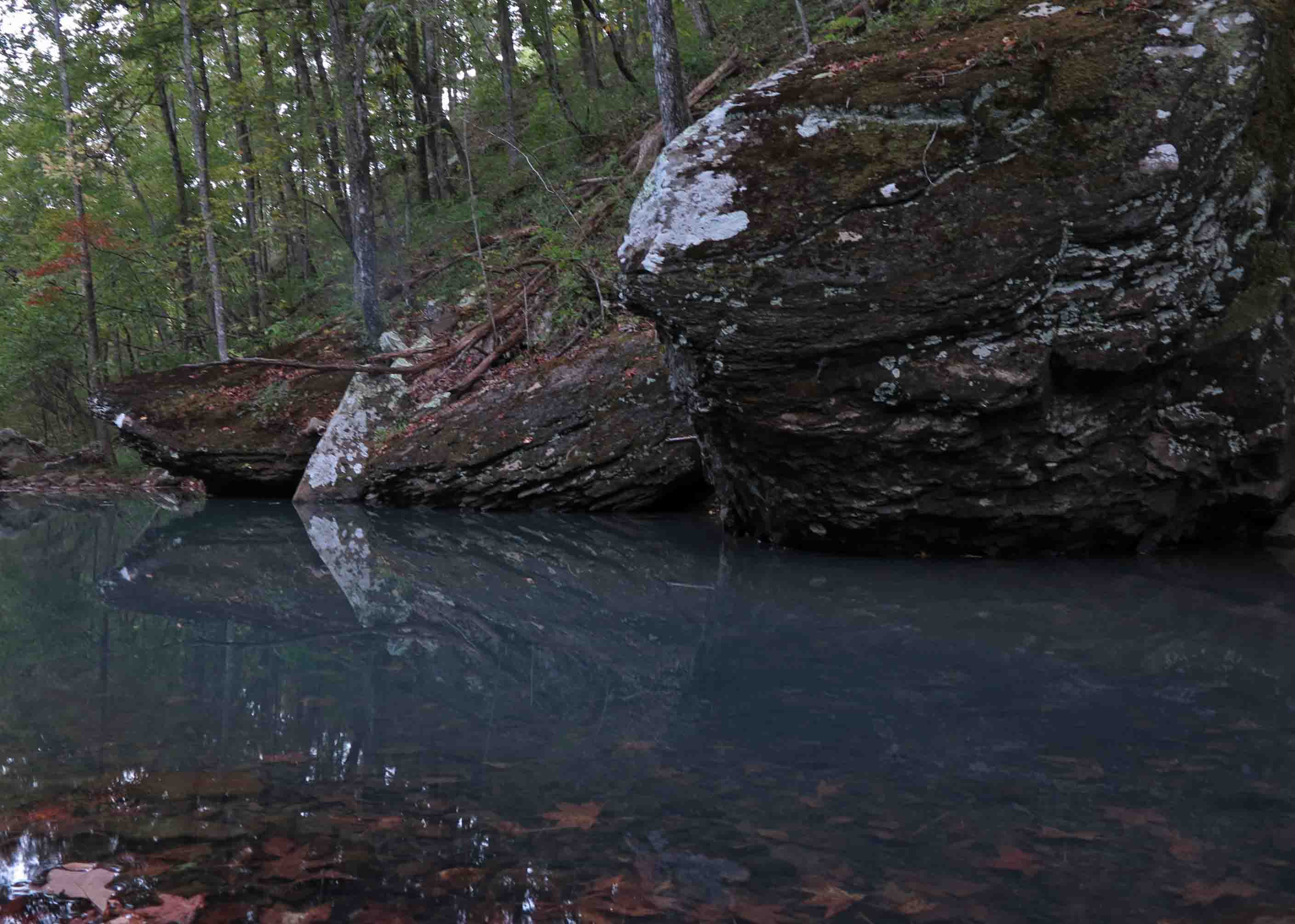
Small pool on Spirits Creek
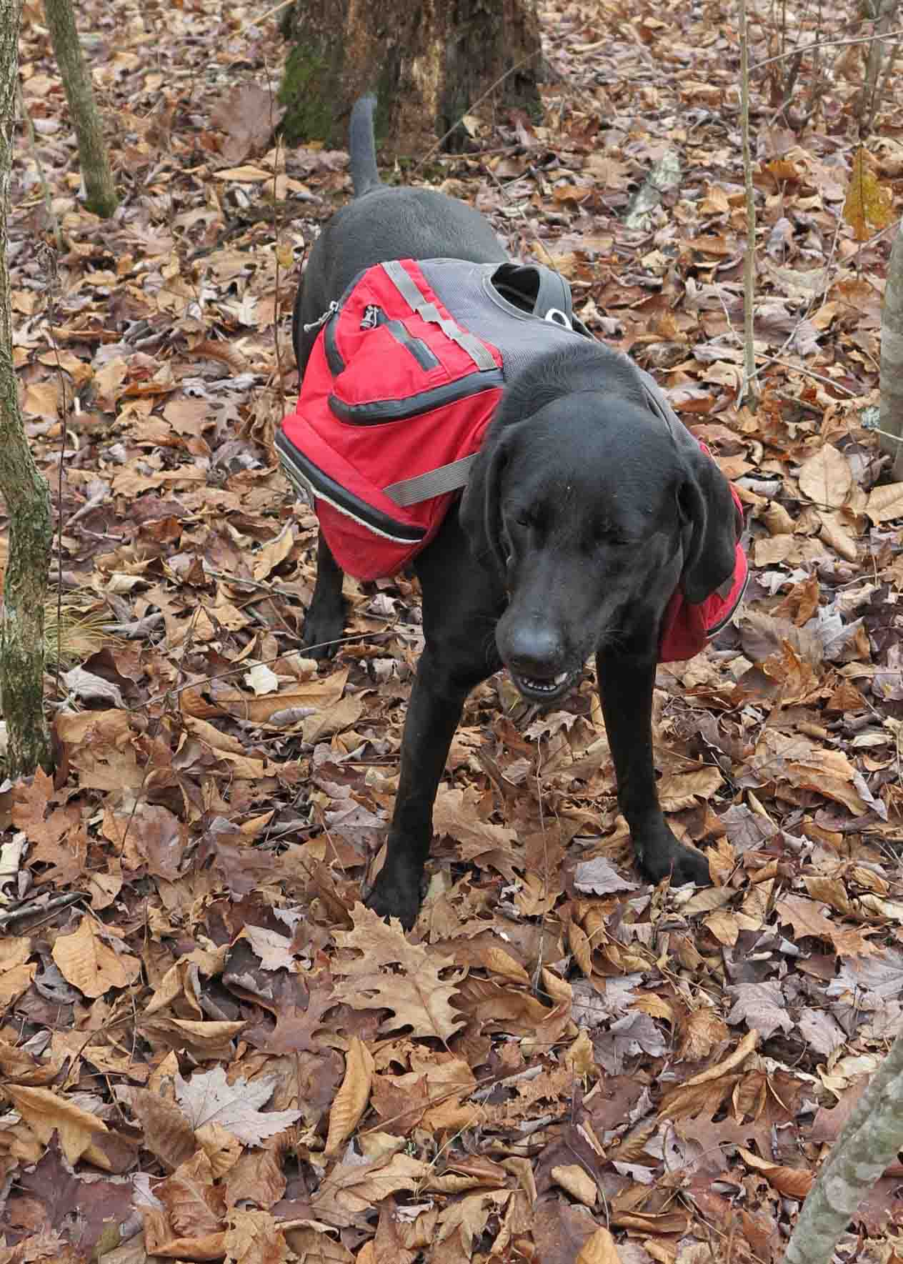
Hiker with her food supply for two days.
Hiker is in her element when walking the trail. She is poised and confident as she struts along. One exception to this was on the first day. She got turned upside down in some brush and spent several seconds frantically trying to right herself. She looked like a big turtle with a red shell. Finally, she was able to gain a hand…paw hold and flip herself over. We told her we were laughing with her, not at her. Unfortunately, I do not have a picture.
Seeing Hiker with others in camp was interesting. She has a habit of being a little too friendly when people are trying to operate stoves and prepare meals. I’m thankful that she does not chew on tents or other pieces of equipment. However, I do wish that she would be a little less affectionate in camp.
I’ve noticed that Hiker does much better in camp after walking ten or more miles for the day. We only hiked seven so she ended the day with lots of energy. To divert her attention, we played fetch with sticks and black walnuts. Finally she bedded down for the night.

Bedding down for the evening.
Water was easy to filter at Spirits Creek. It was clear and looked good enough to drink without filtering, though I wouldn’t recommend it.
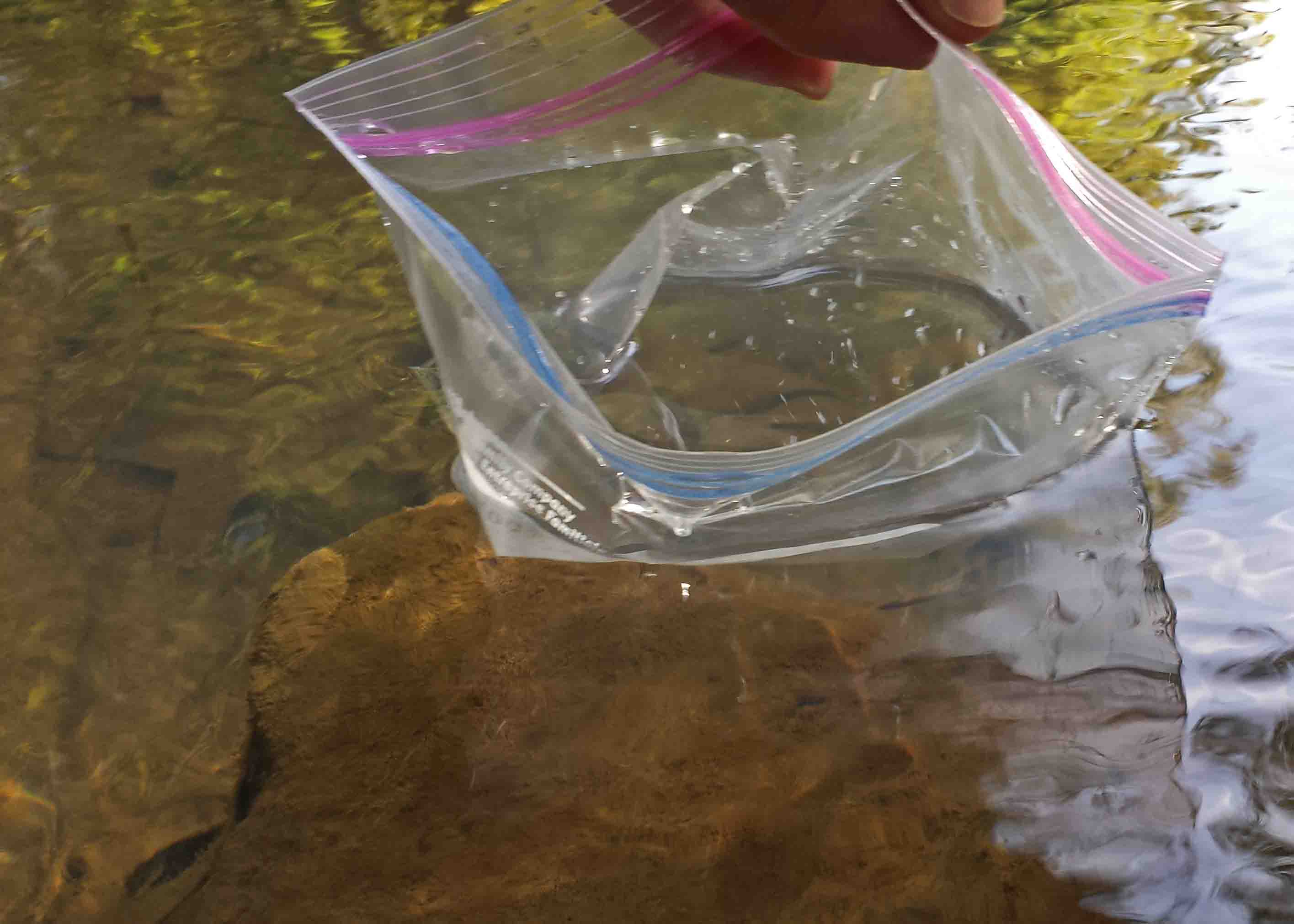
Collecting drinking water using a ziplock freezer bag.
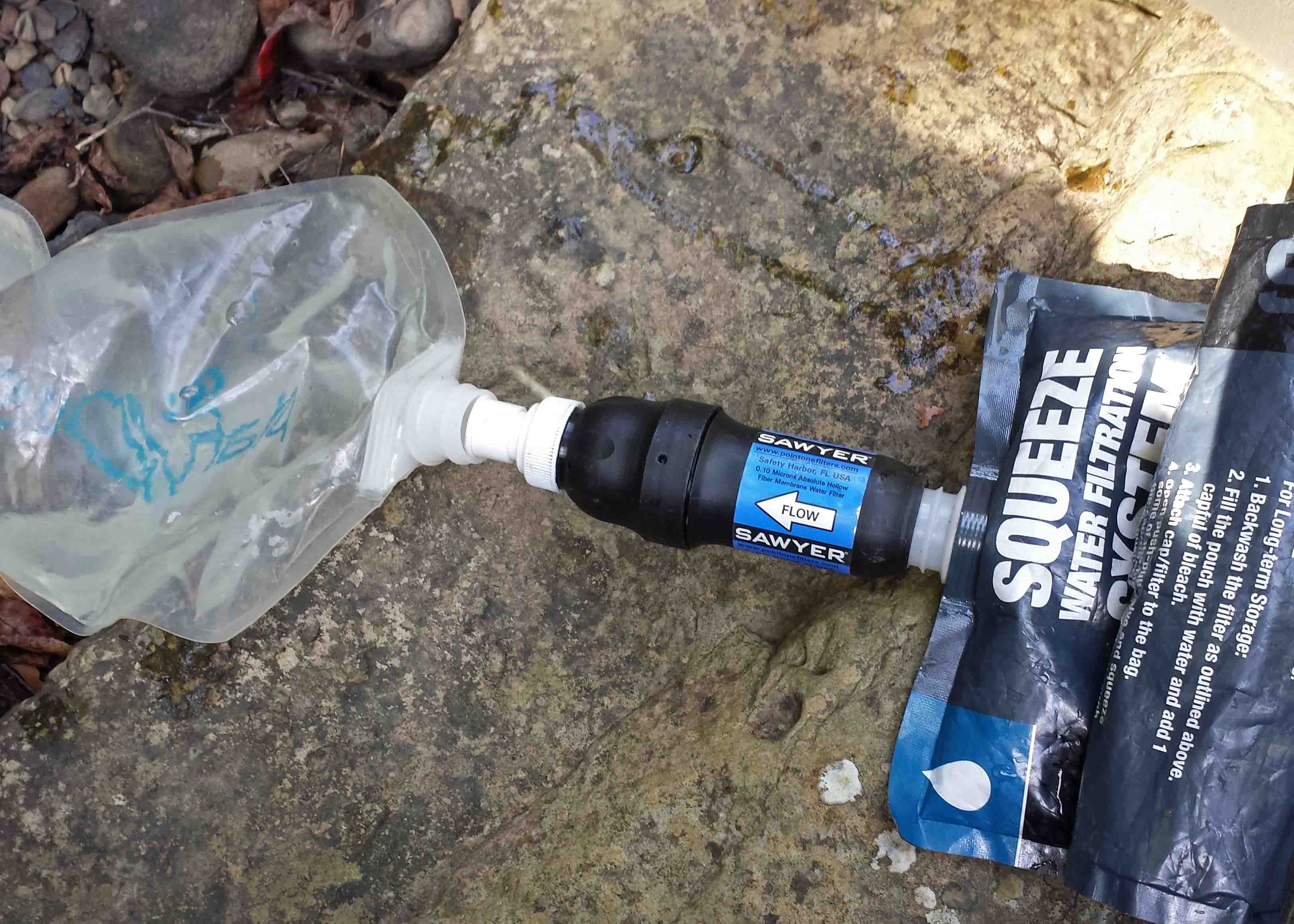
Filtering water from Spirits Creek.
I brought plenty of food for this overnighter. I had a couple of red potatoes in the bottom of my pack (hence, my trail name, Tater). I cut up the largest and began to boil it adding dehydrated vegetables from the Huntsville Pantry that were a gift from a friend. Then I added Bear Creek Creamy Potato Soup Mix and let it simmer. This was a healthy and delicious feast with all of those vegetables! After a cup of hot tea, I slept soundly.
The next morning I had two cups of coffee which tasted like a gourmet brew on a cool morning in the Ozarks. I boiled water with dehydrated apples and then added oatmeal. Outstanding! Next, I put several slices of pre-cooked bacon in boiling water with the smaller red potato remaining in my pack. I couldn’t stand the idea of hiking out with that “heavy” potato in my pack. I was well nourished and ready to hike.

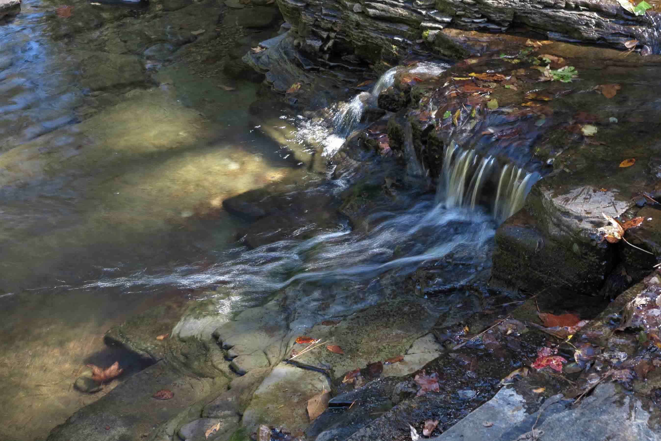
Fane Creek
Fane Creek was flowing slowly. We were unable to cross this creek on our winter thru-hike due to high water, so this was a different view of this beautiful creek. Knowing my trip was drawing to an end, I paused and spent a couple of minutes at the crossing. I’m thankful for the beauty of the Ozark Mountains and the privilege of hiking them.
A Rich Man’s Shoes

A rich man’s shoes.
“Put your money where your feet are.” I’m not sure where I first heard this, but it has been good advice. I hear of many hiking trips coming to a painful end due to foot injuries or blisters. I have found that good fitting shoes and wool blend socks make it possible to hike many pain-free miles.
Besides comfort, a good reason to purchase good equipment is that manufacturers will tend to back their product if there is a problem. The well-used pair pictured above have covered many miles including a trip through the Grand Canyon. I liked these shoes so much that I purchased a second pair to use on my thru-hike of the Ozark Highlands Trail last winter. That second pair of shoes made the trip beautifully.
I was set with two identical pairs of Oboz Firebrand shoes which allowed me to alternate and keep a dry pair ready to go on my daily morning hikes.
Many miles later, sections of the sole began to come loose on one of the newer shoes. The shoes pictured here are my first pair still in use every day. After submitting a warranty claim and picture to Oboz online, I was contacted by phone. I’d entered my email incorrectly so they were calling to ensure they could send a package slip for me to ship my shoes with the loose soles to them. I was impressed!
Today my new Oboz shoes arrived. I’m glad to have two pairs of these shoes again and look forward to many more mostly-comfort-filled miles.
Looking closely at the well-worn soles of my original pair of Oboz, I was reminded of Emerson’s statement, “He is the richest man who pays the largest debt to his shoemaker.” Investing in your feet is money well spent!

When you have worn out your shoes, the strength of the sole leather has passed into the fibre of your body. I measure your health by the number of shoes and hats and clothes you have worn out. He is the richest man who pays the largest debt to his shoemaker. ~Ralph Waldo Emerson, 1851
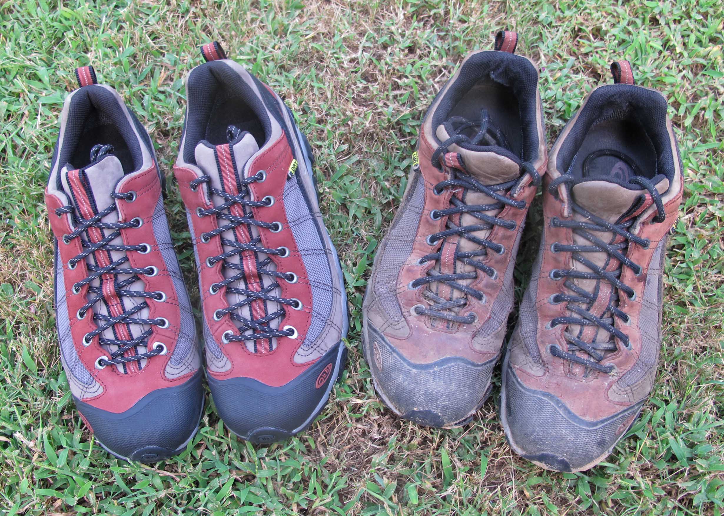
New Oboz Firebrand shoes sitting next to my first pair that are still going strong.
Update on Hiker, My Trail Partner

Hiker waiting for Dr. Green
Hiker paid a visit to the Alma Animal Clinic recently for a checkup and to look at some gunk in her ears. As we turned into the parking lot, she began to jump and shake, positioning herself next to the passenger door. When I opened her door, she ran excitedly to the front of the clinic, tail wagging non-stop. I decided she must like the undivided attention she receives from Dr. Green, his daughter, and other staff. Or, maybe she associates this location with good things that have happened to her in the past. When someone comments on how pretty she looks on the trail I sometimes say, “She’s a tribute to veterinary medicine.”
Turns out the ear infection is a minor issue that should clear up with ten days using an ear wash for a few days. With her daily dips into Lake Alma during her four-mile morning hike, I’m sure moisture in the ears is a contributing factor.
Toward the end of January, Hiker weighed about 46 pounds which was up several from when we first met at mile 138 on the Ozark Highlands Trail. Now she weighs right at 66 lbs. The following links tell more about Hiker’s story as well as the pictures below.
Walk, Eat, Sleep, Repeat, Fairview to Tyler Bend and A New Trail Partner
What Makes Hiker a Good Trail Partner?

Hiker on the last day of her 40+ mile hike for survival.

Hiker on January 20th after completing 40+ miles on the OHT with limited rations.

Hiker playing in the back yard on August 18th. She hikes the Lake Alma Trail at least six days out of seven.

Playtime

Hiker on her morning walk on the Lake Alma Trail.
