Hiker-dog can do leashed trails, too!

Walking toward the CCC Lodge at Roaring River

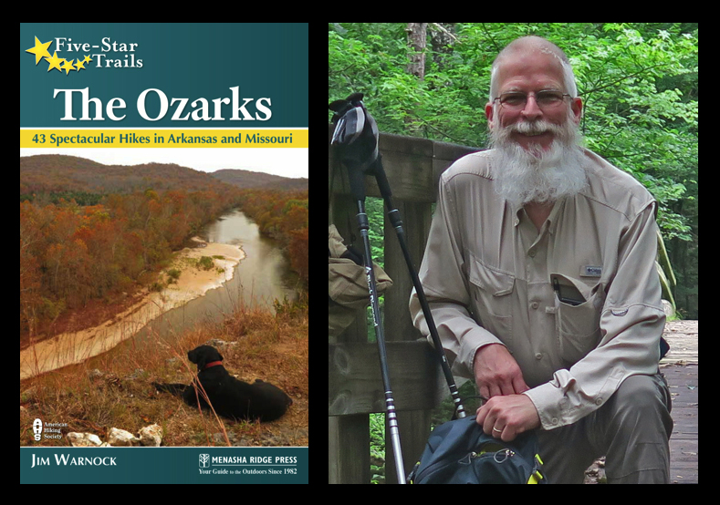
Part of the pleasure of having written Five Star Trails: The Ozarks is revisiting the trails to look for changes and needed updates. The book currently has a rating of 4.8 stars out of five!

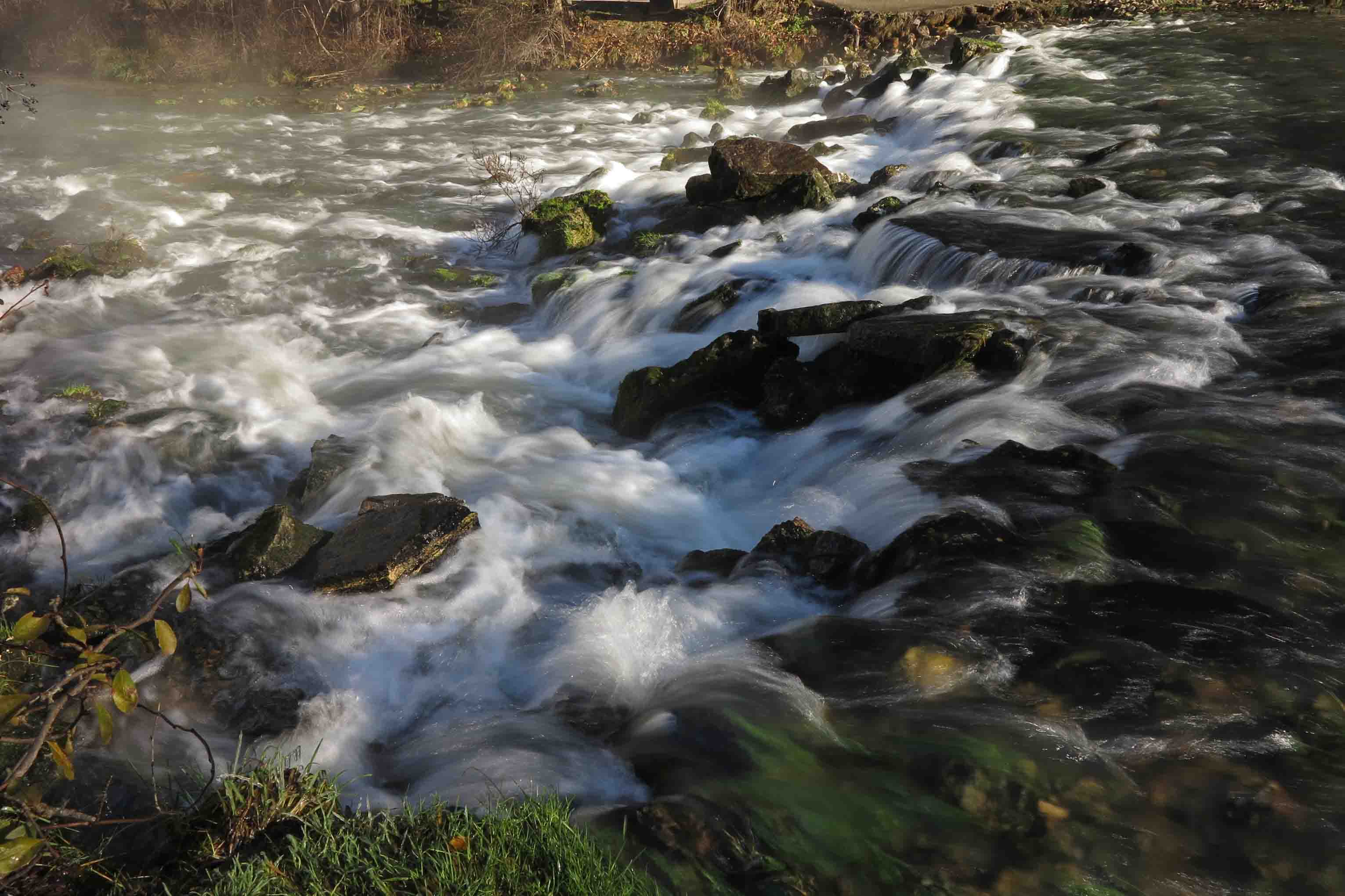
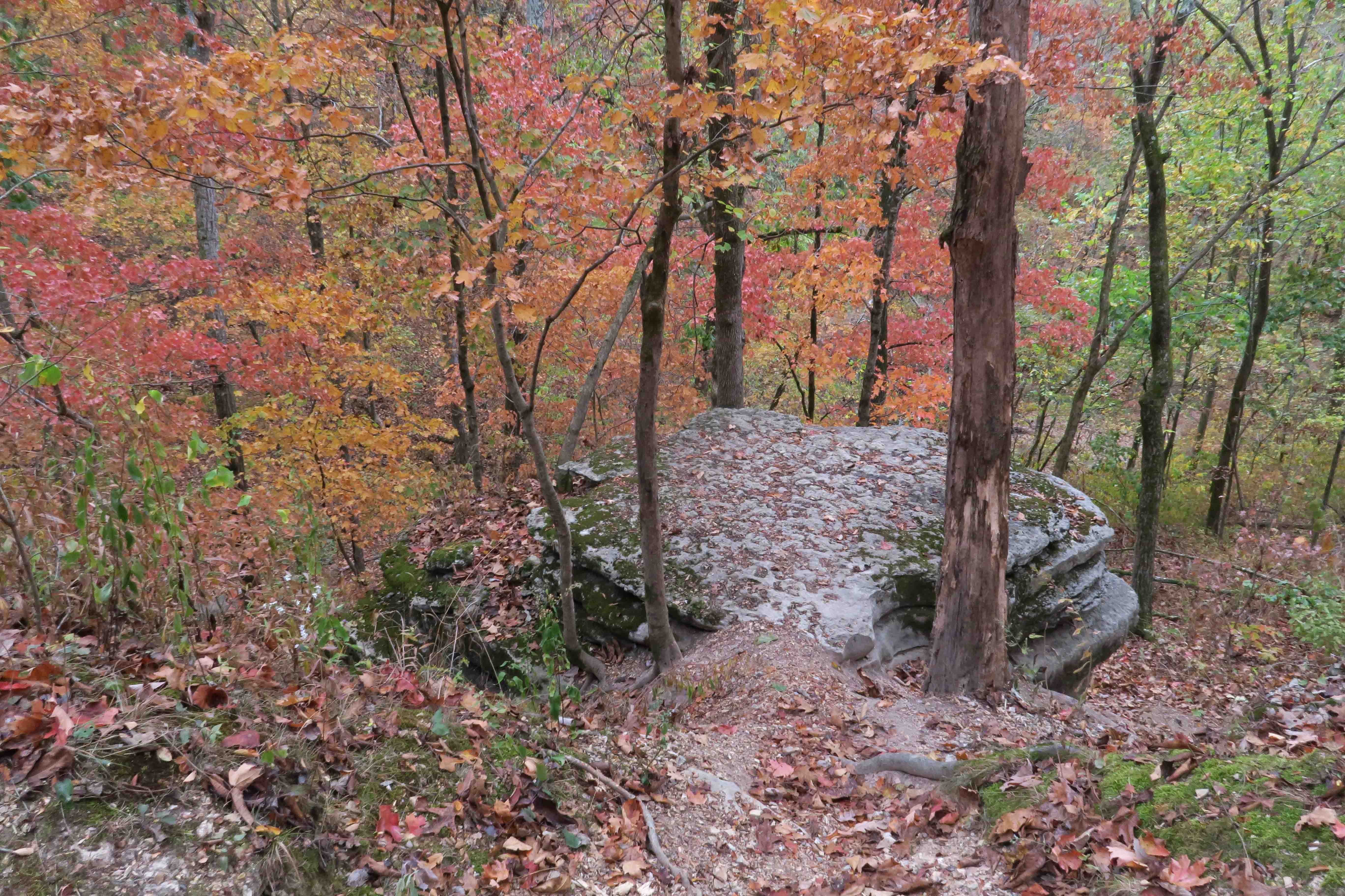
Since there will eventually be a second edition, we visited Roaring River State Park for a couple of nights in the campground and some good day hiking. The fall colors were beginning to pop in this southern Missouri location.

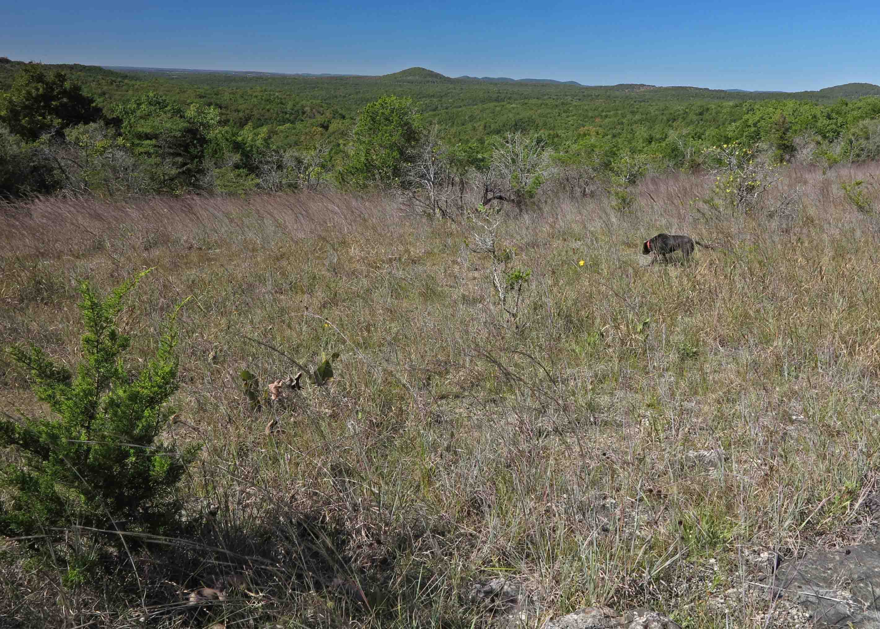
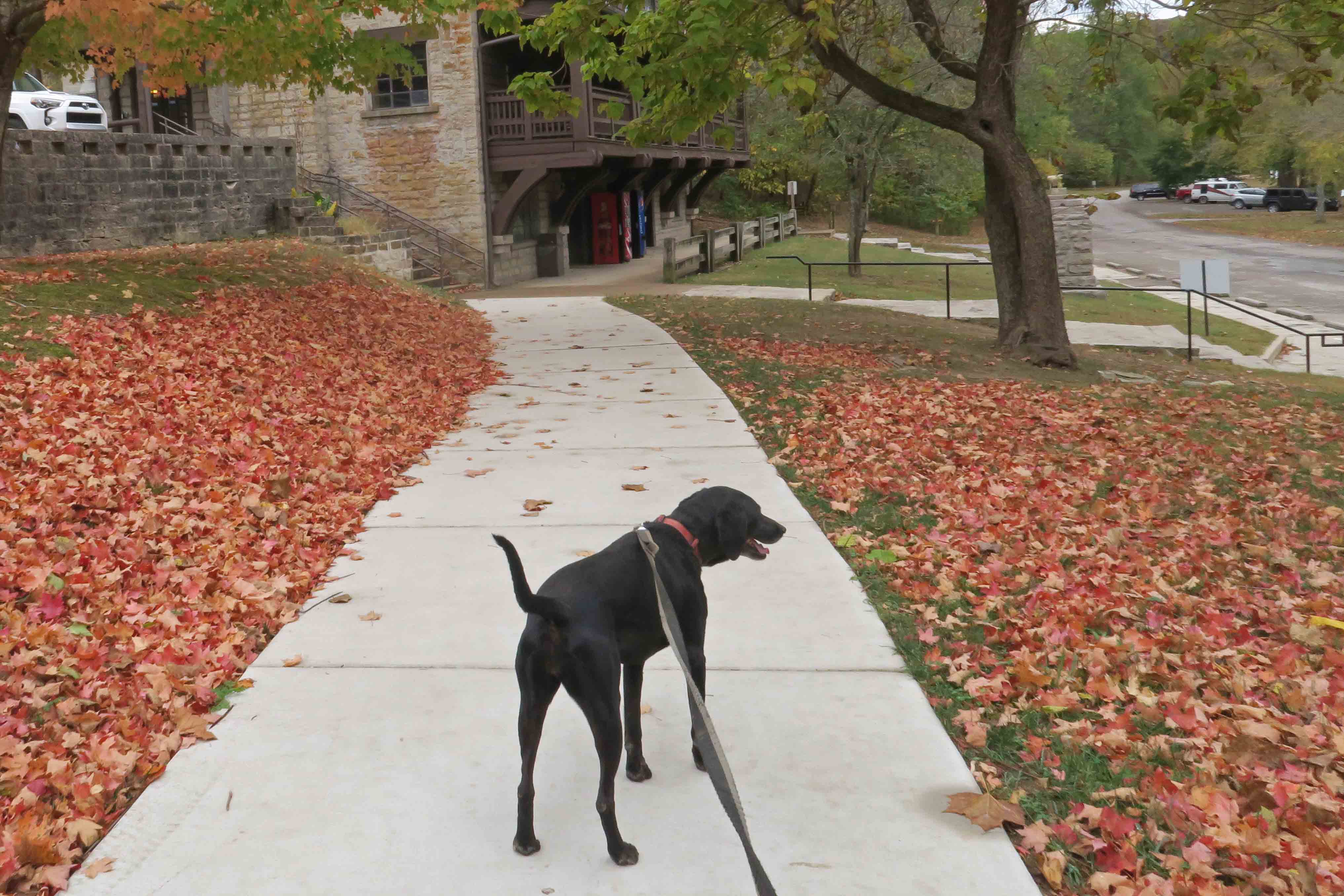
For these trails, Hiker-dog had to wear a leash, but she handled it beautifully as long as I gave her the chance to run off-trail before starting our “formal hiking.”

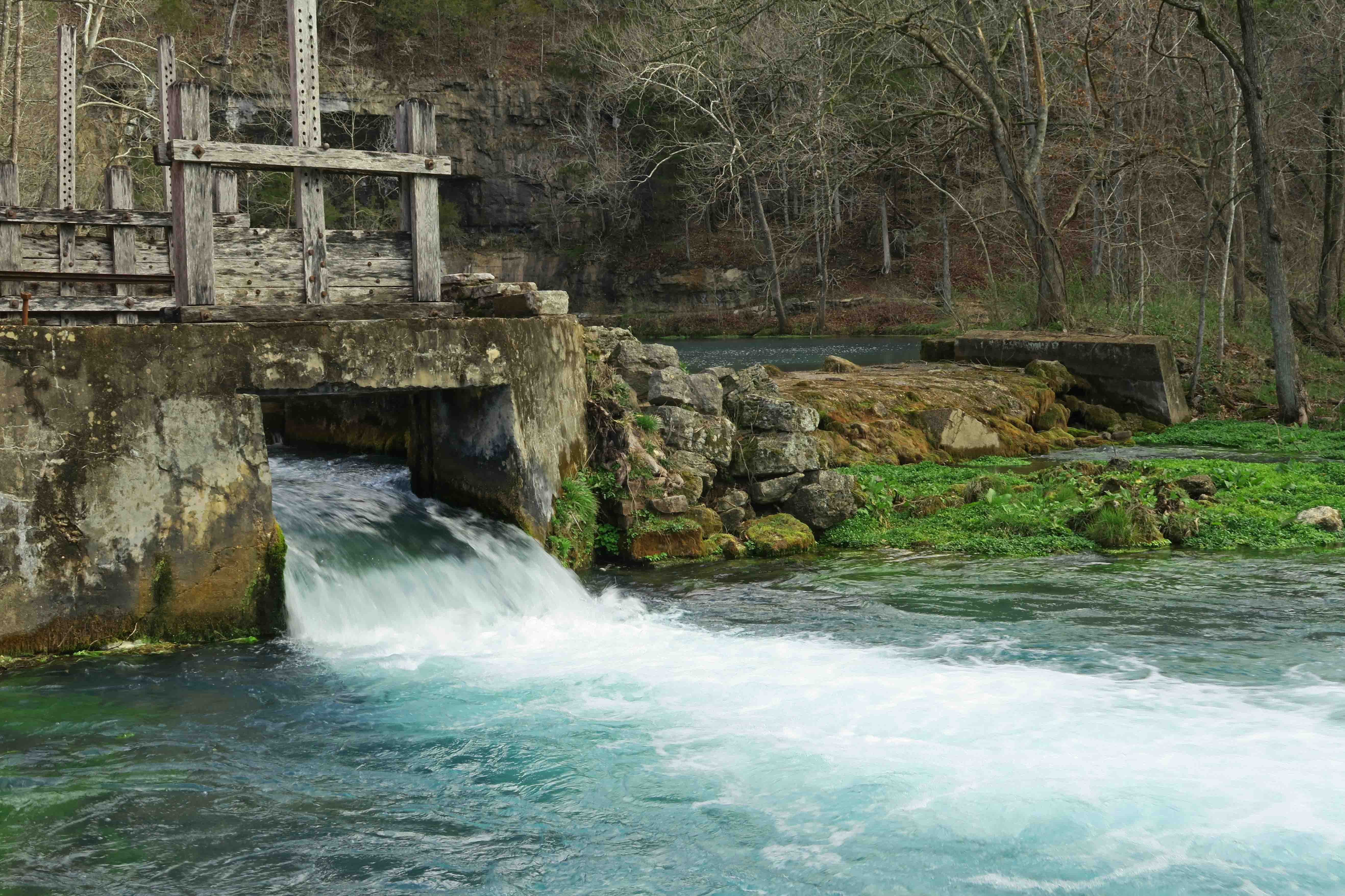
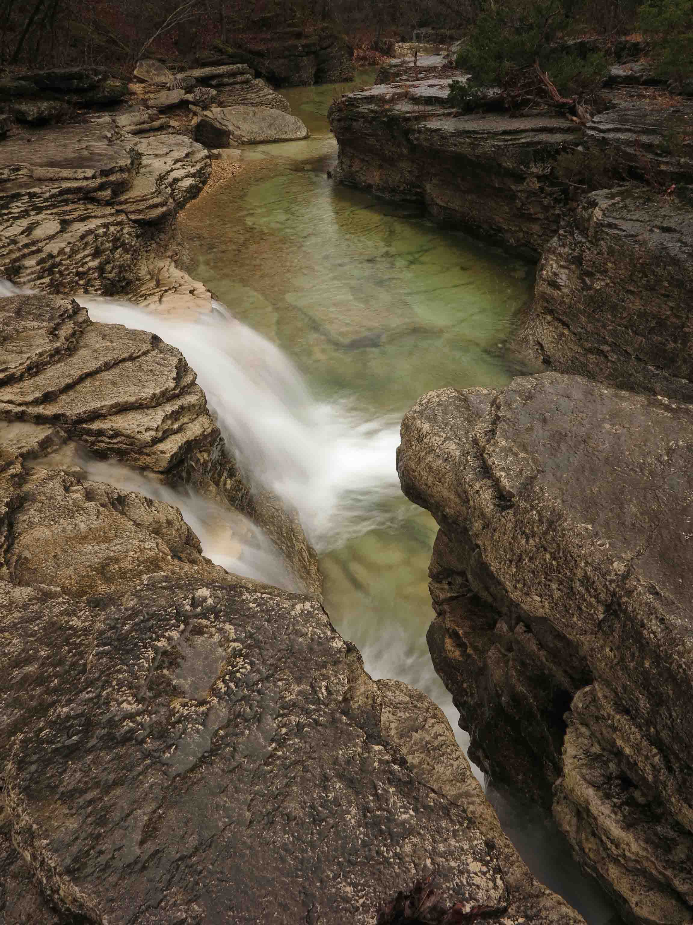
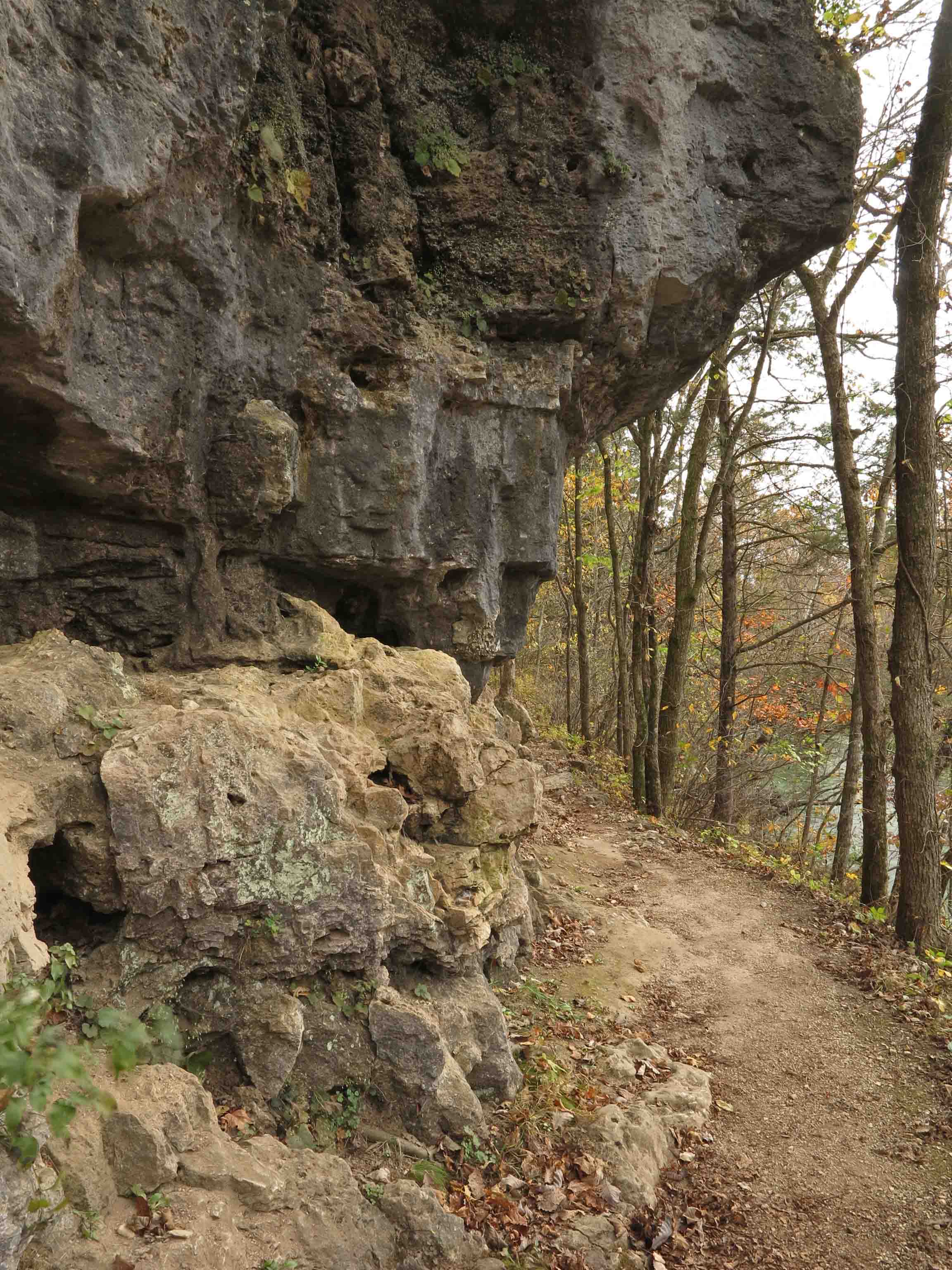
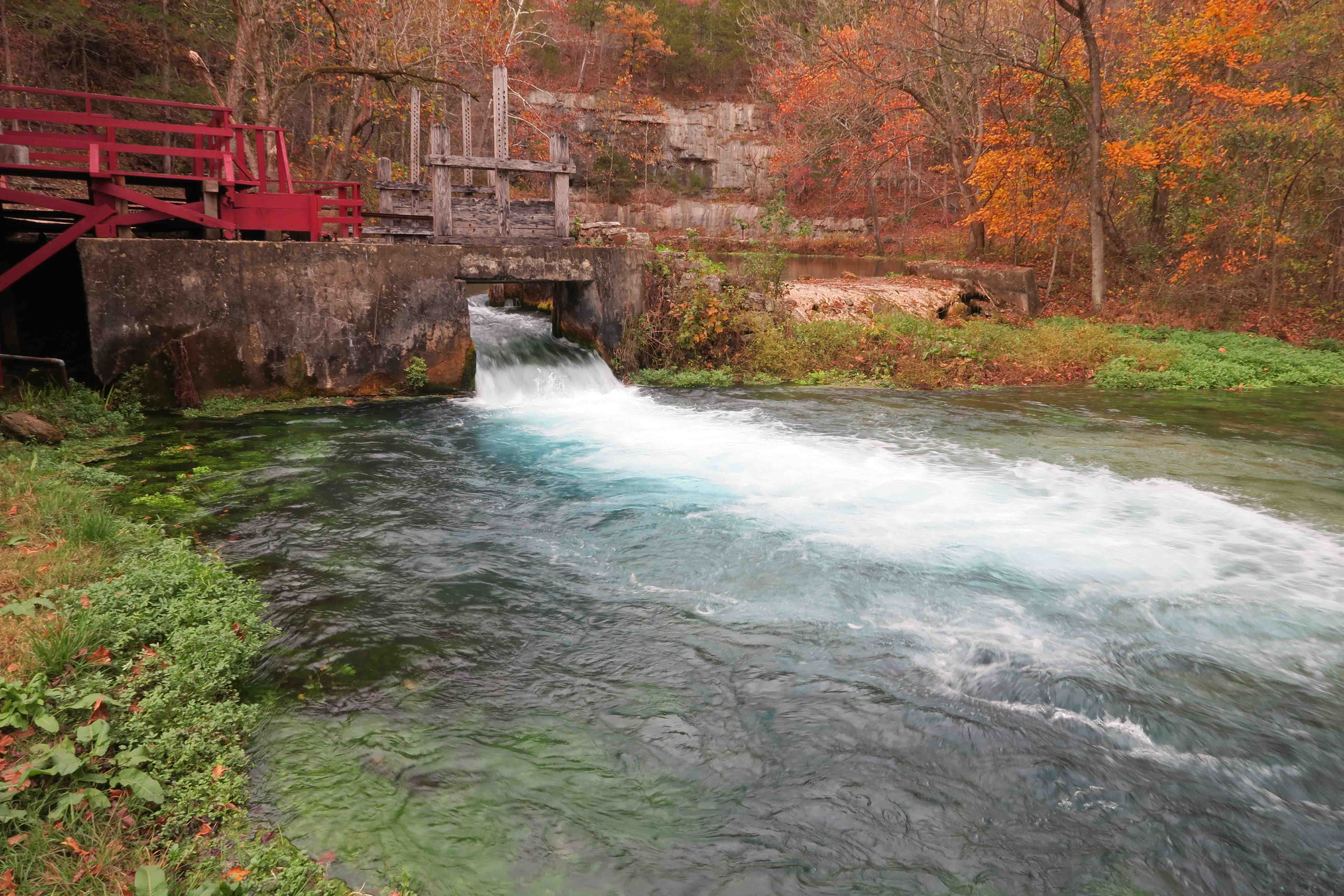
We walked the Tower Trail, Deer Leap, Devil’s Kitchen, and River Trails that combine to make an out-and-back figure-eight. We found it necessary to walk a different part of the Deer Leap Trail because of construction around the vent of the spring that feeds Roaring River. This was an easy adjustment and construction is a temporary thing, which was a relief.

View of fish hatchery, part of the area closed due to construction

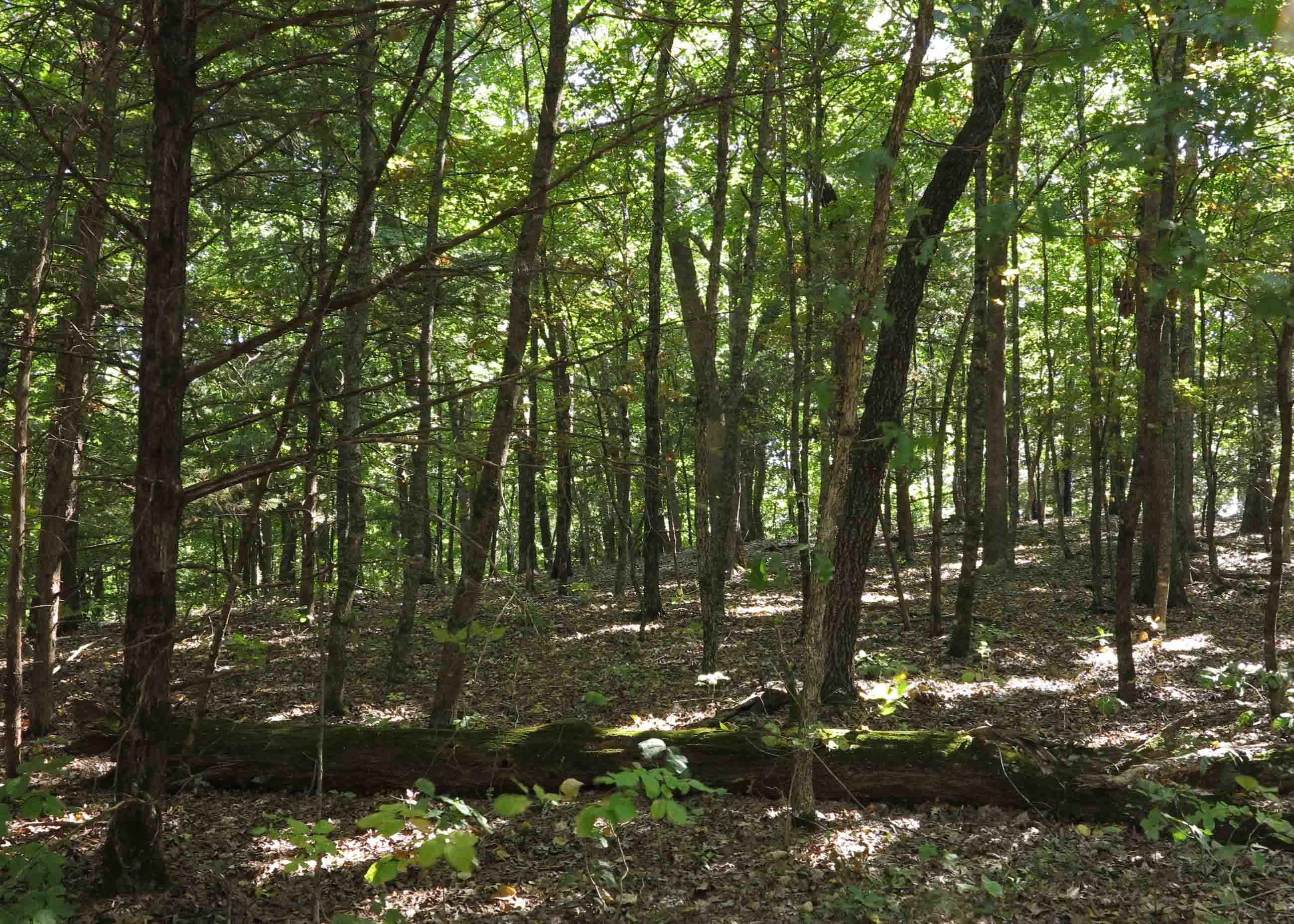
I was impressed all over again by these trails, and it was a treat to see them in early fall colors.

Small overlook on Deer Leap Trail

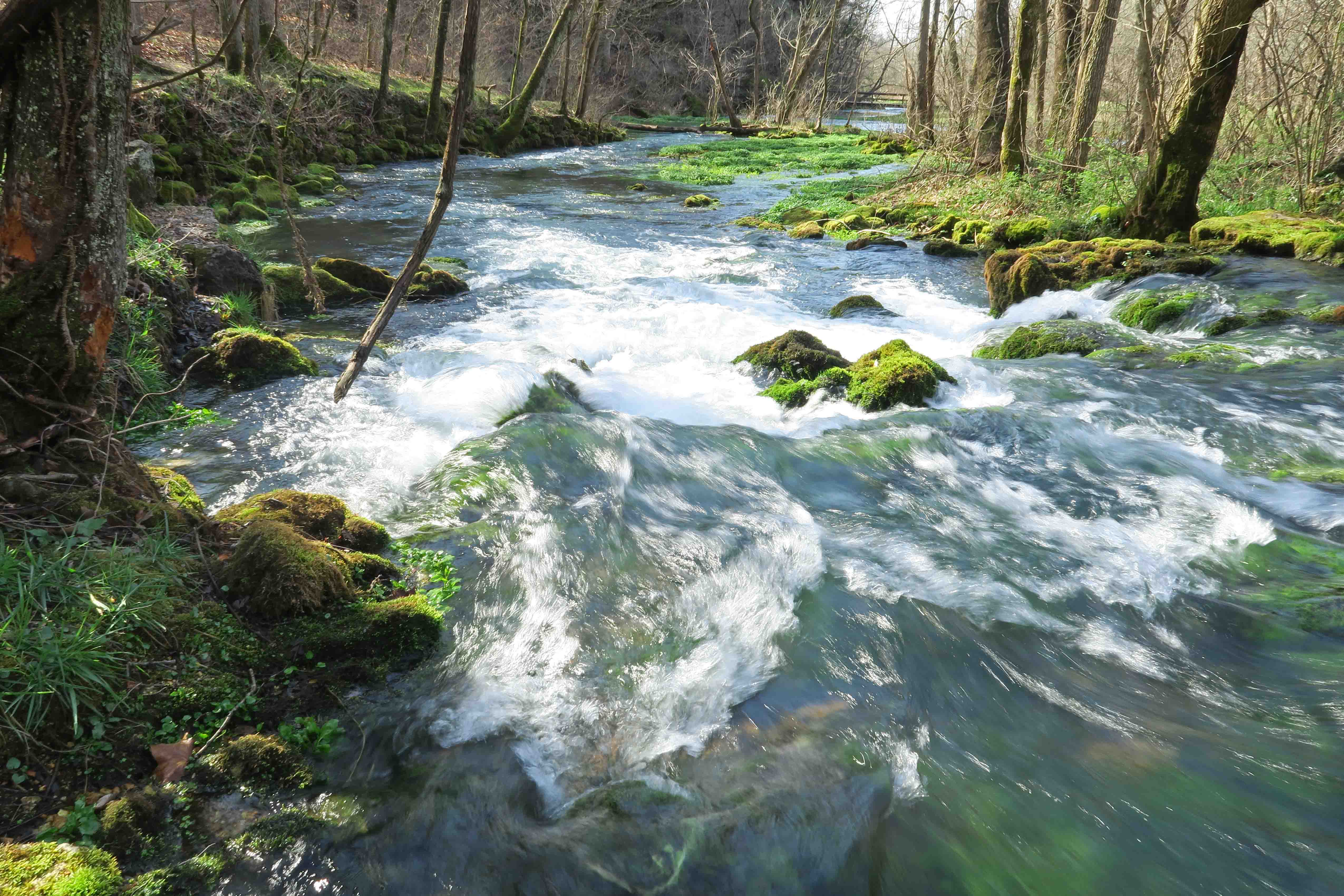
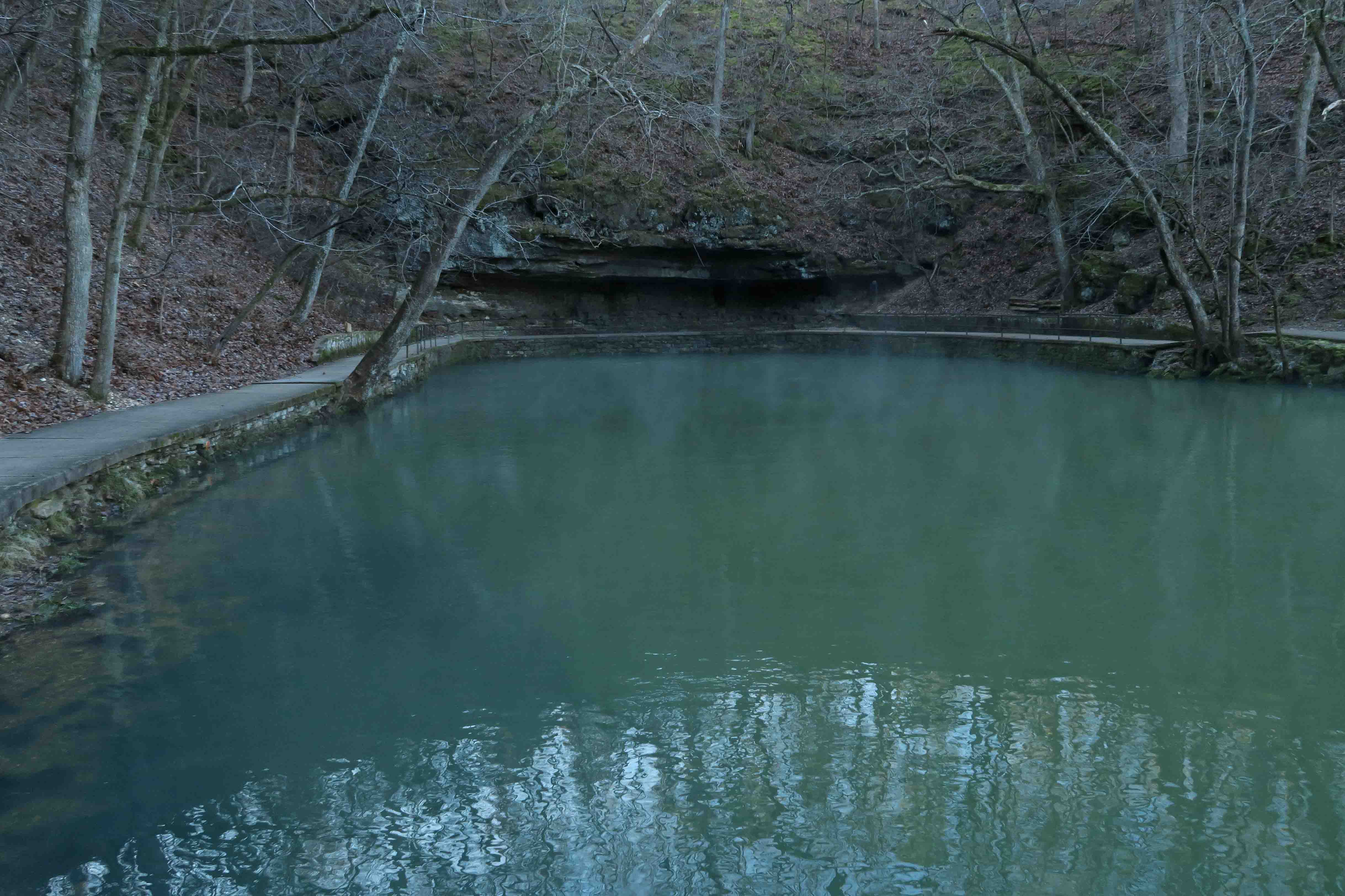
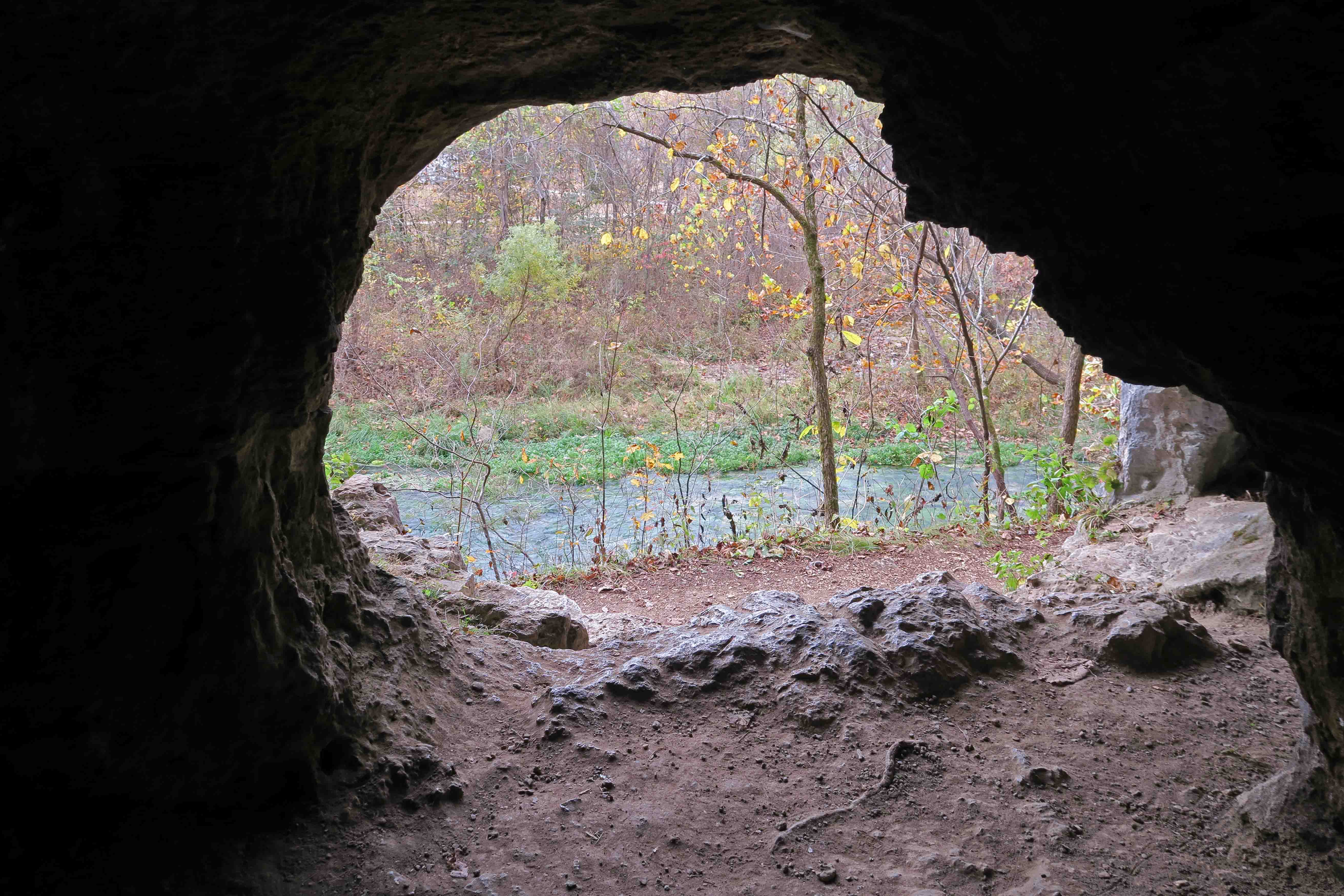
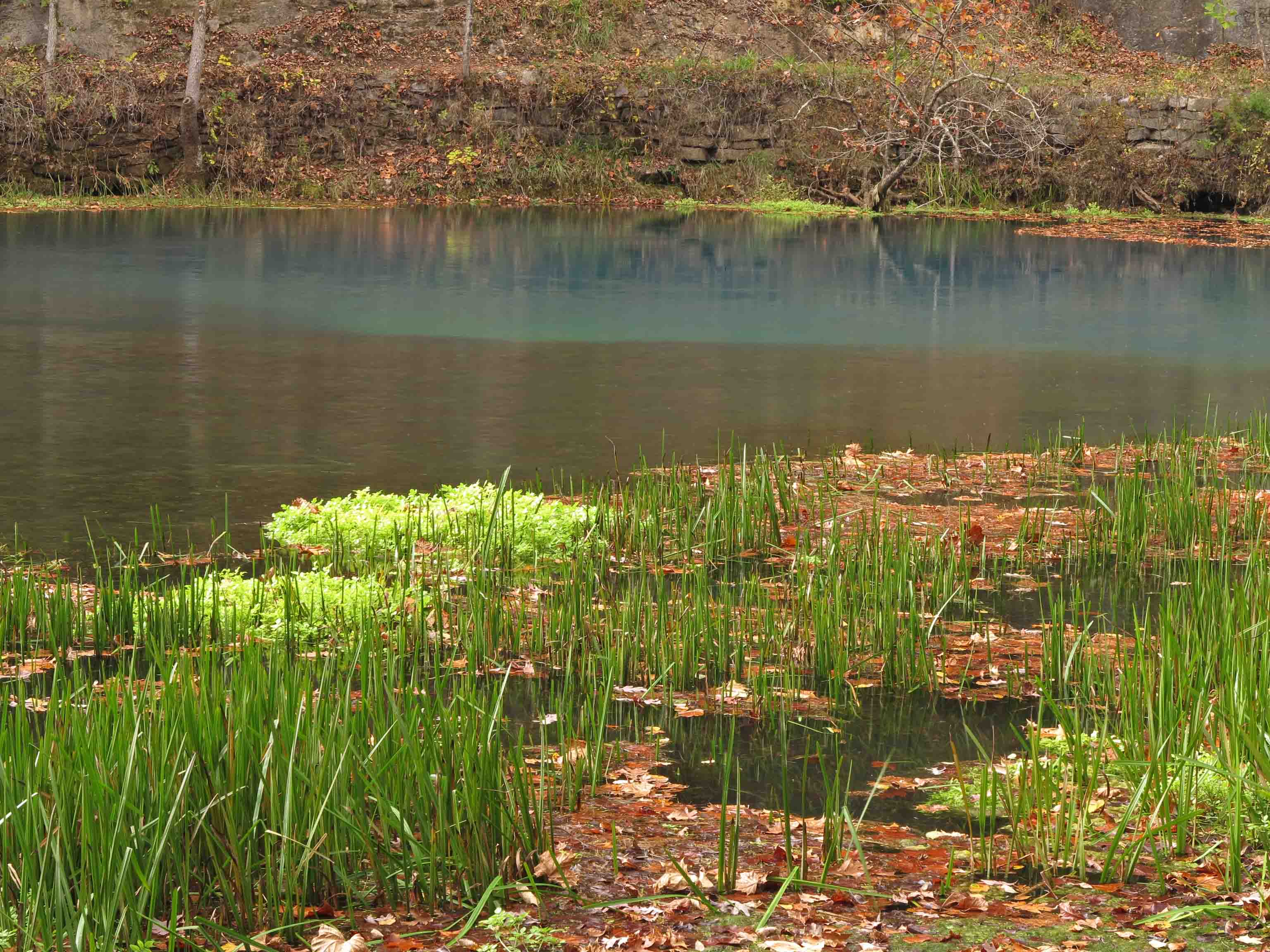
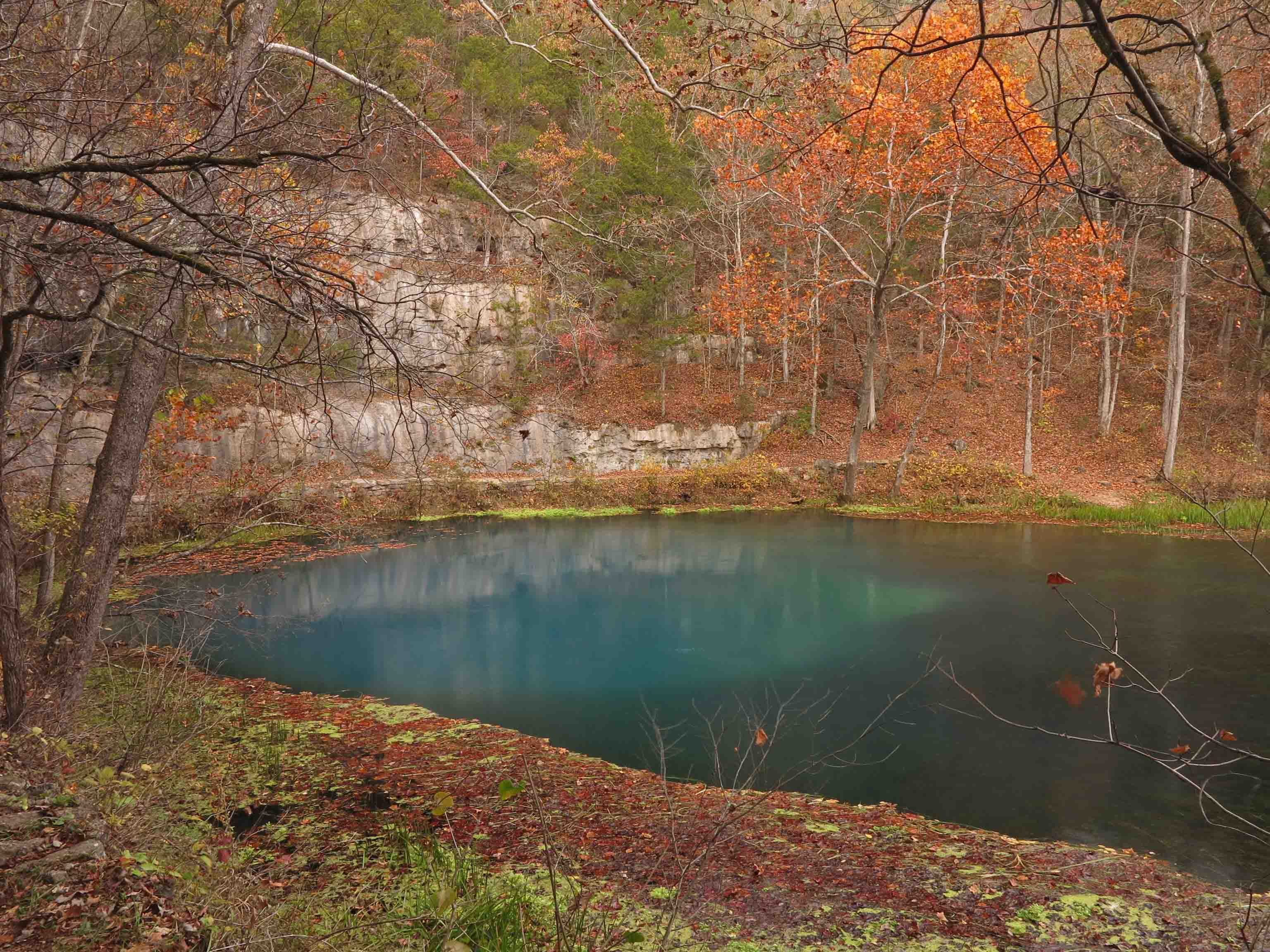
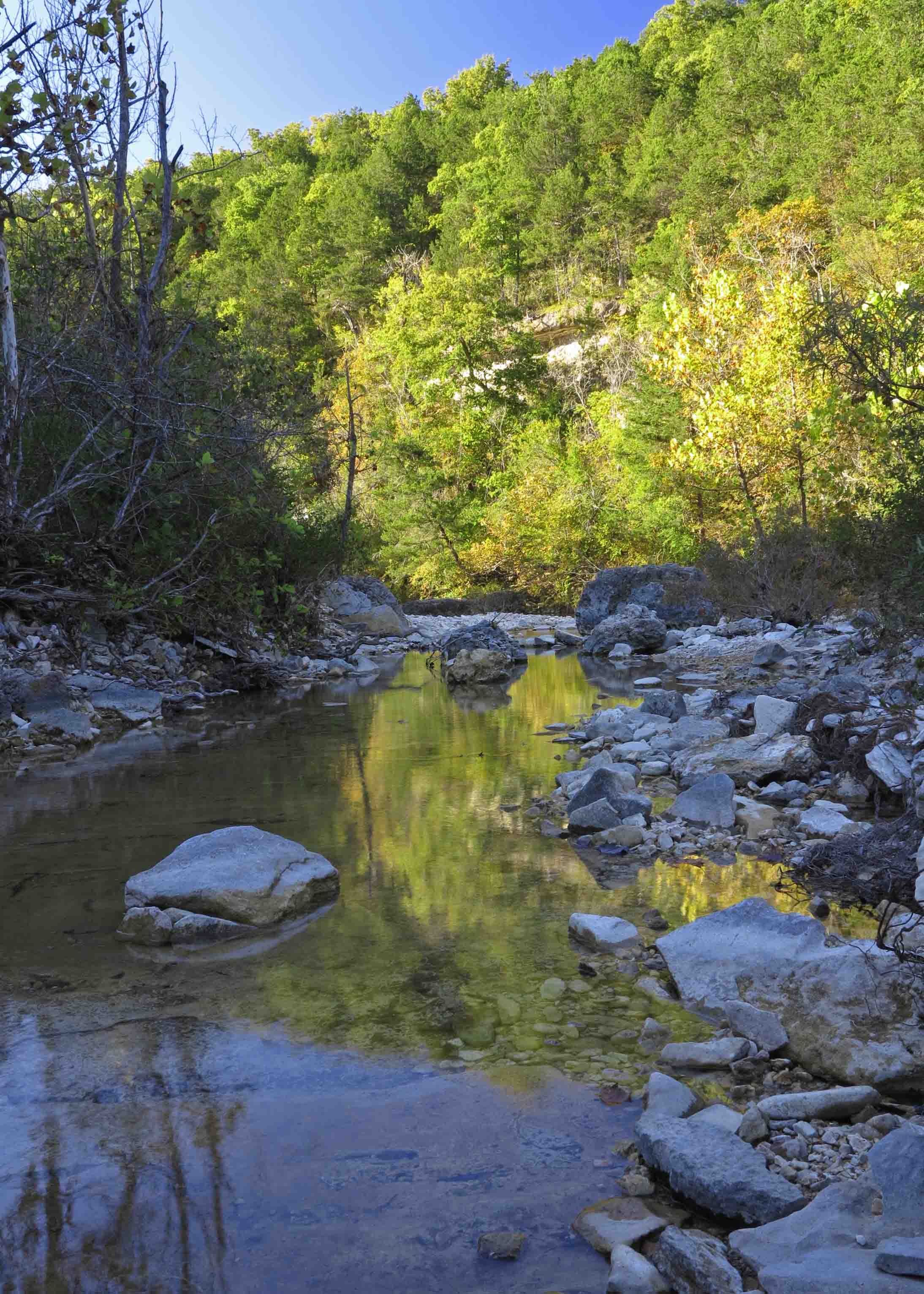
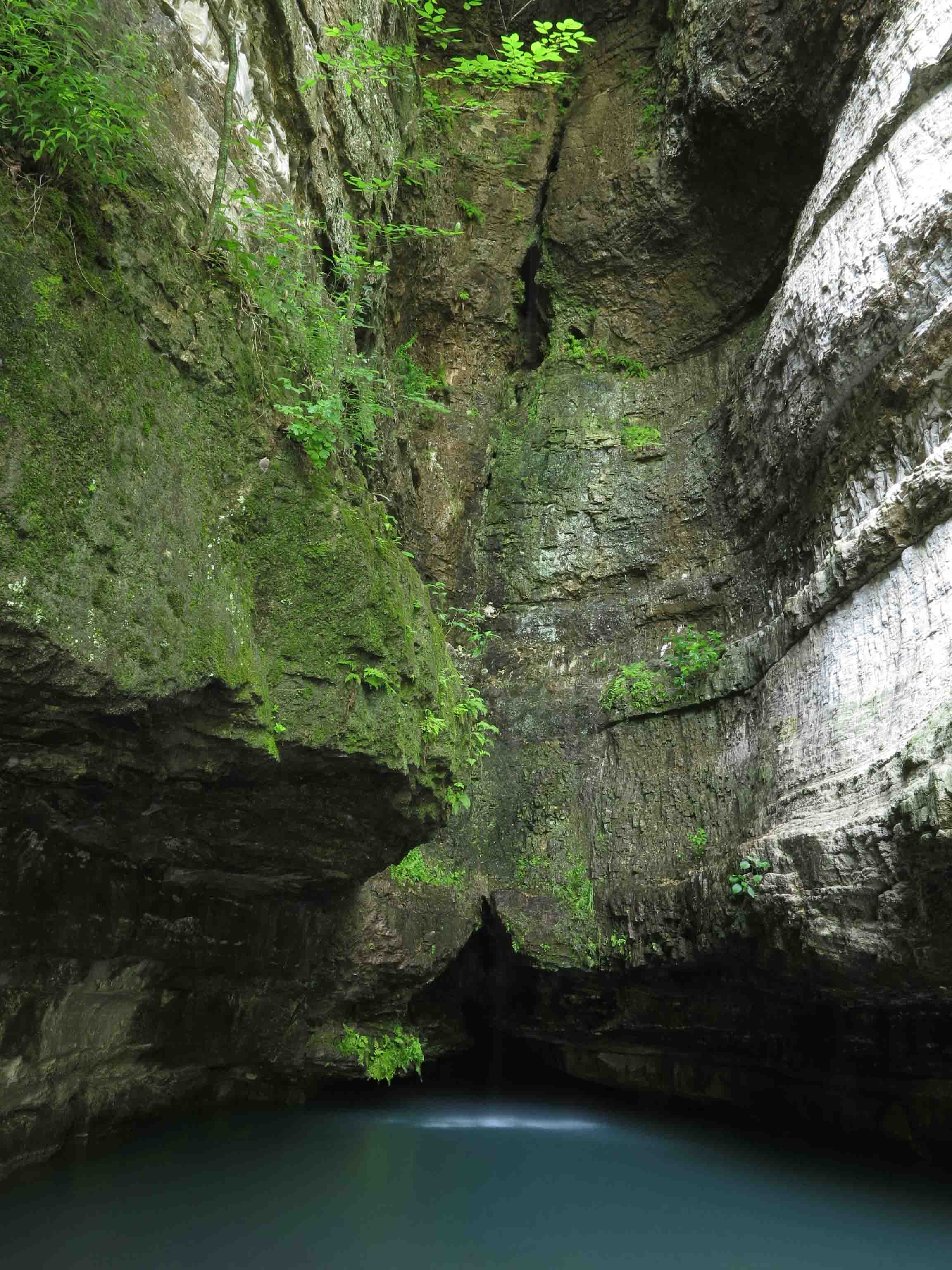
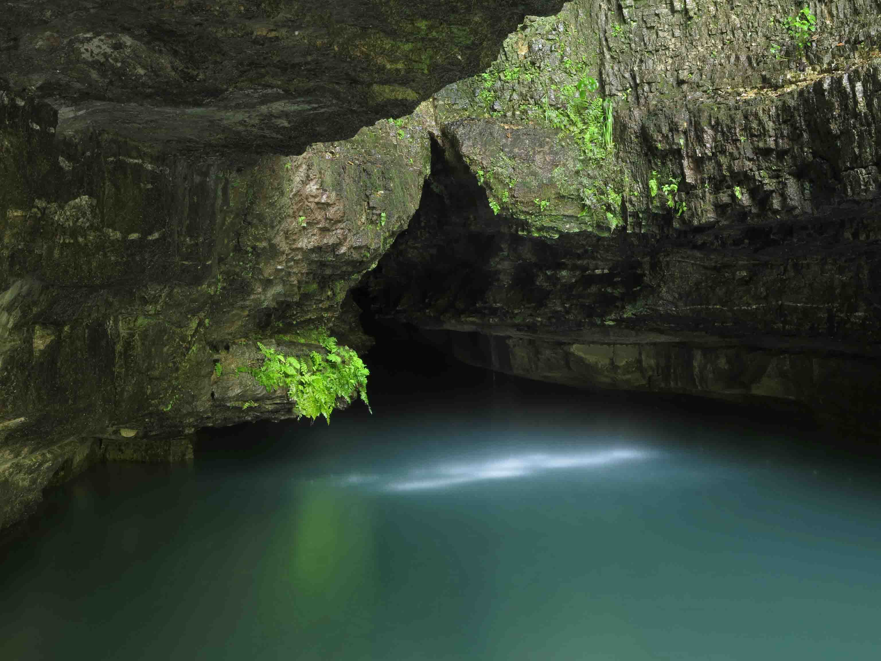
I poured out water for Hiker-dog on a couple of flat rocks as we walked. Though the trails surround Roaring River, drains were pretty dry. We were pleased to arrive at a small spring. The water seeps from under the rock ledge above and is crystal clear.

Hiker-dog quenching her thirst

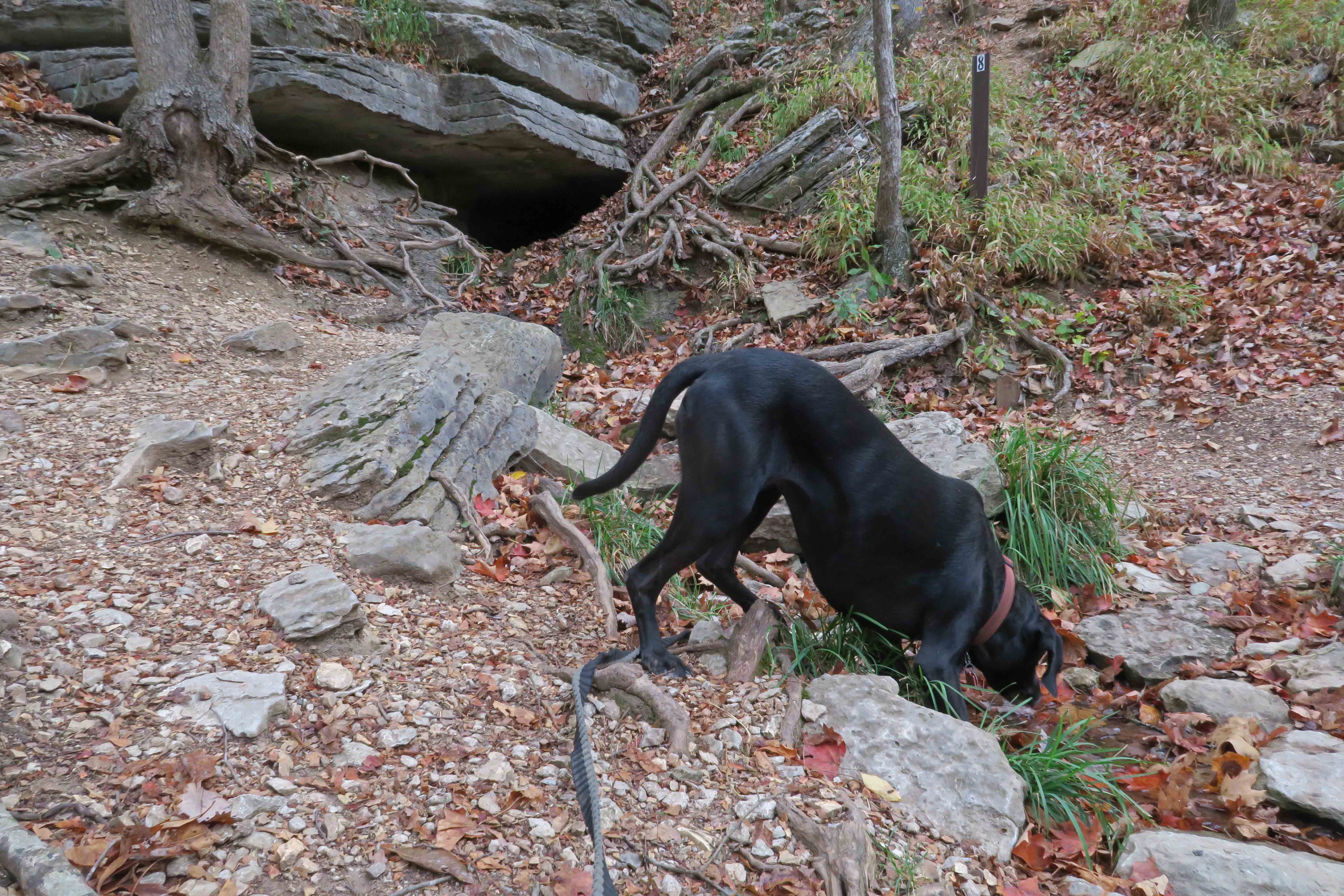
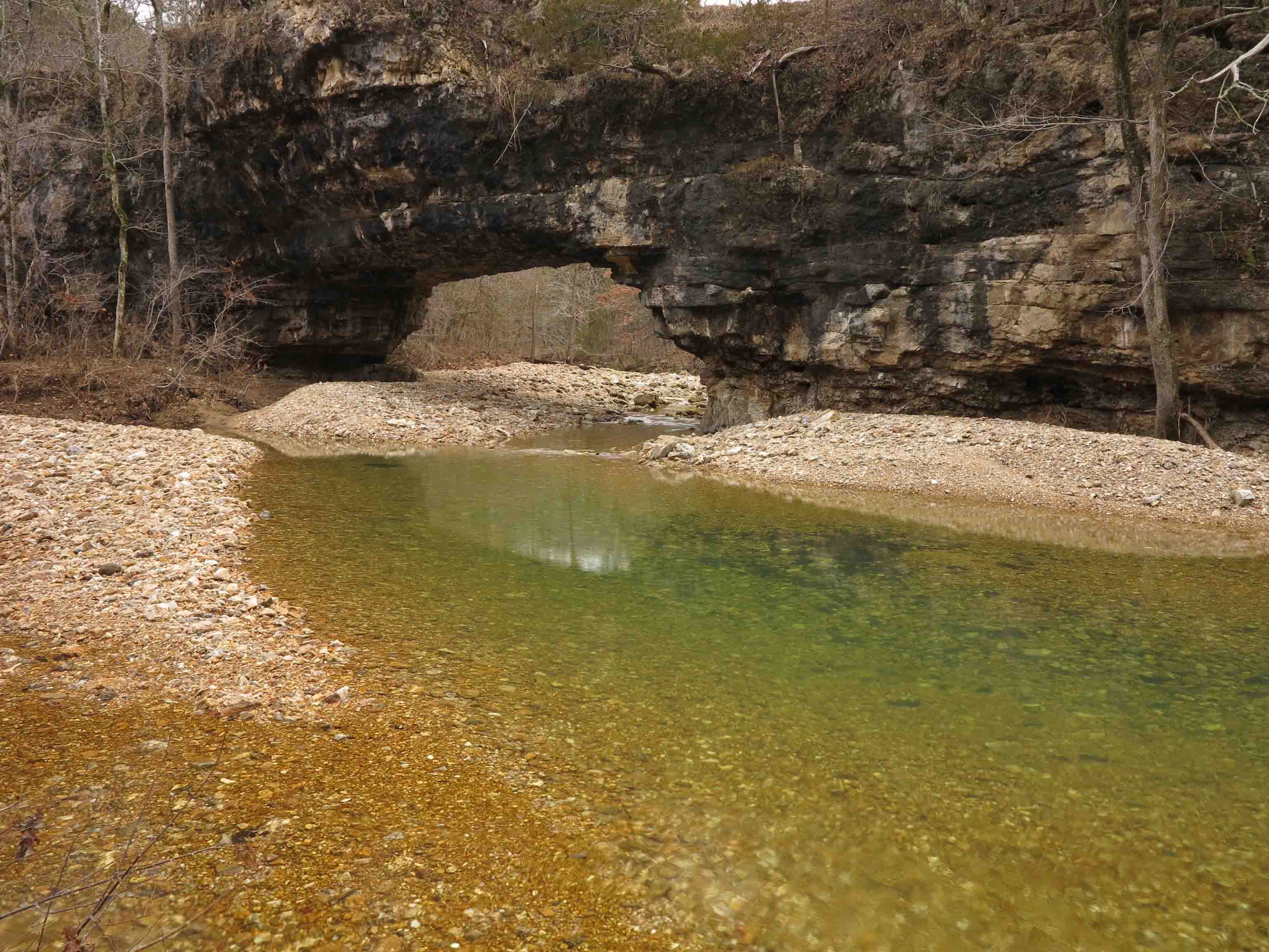
The area labeled as Devil’s Kitchen is a gnarly bluff area.

Devil’s Kitchen

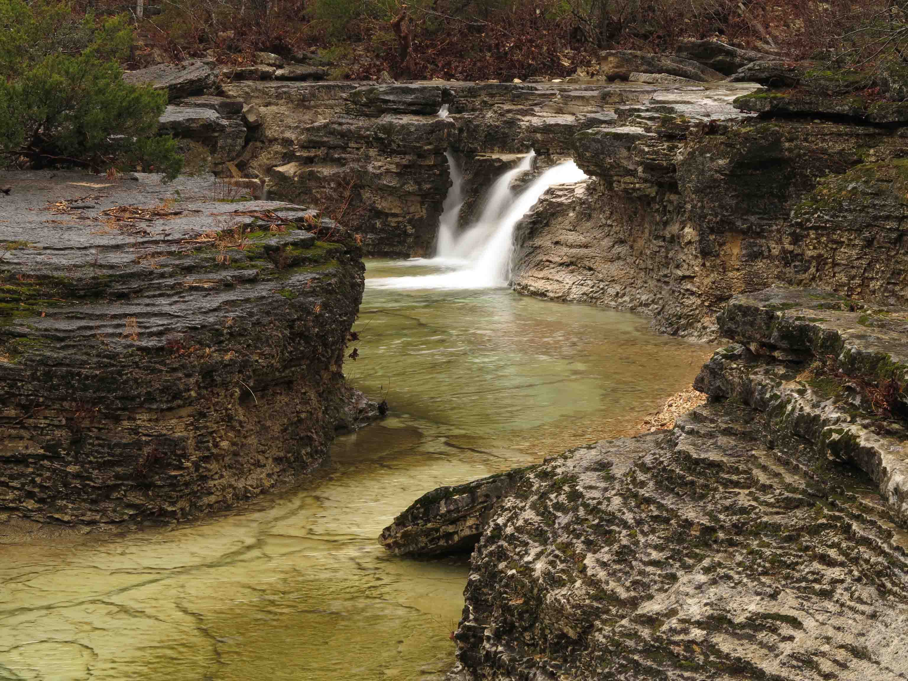
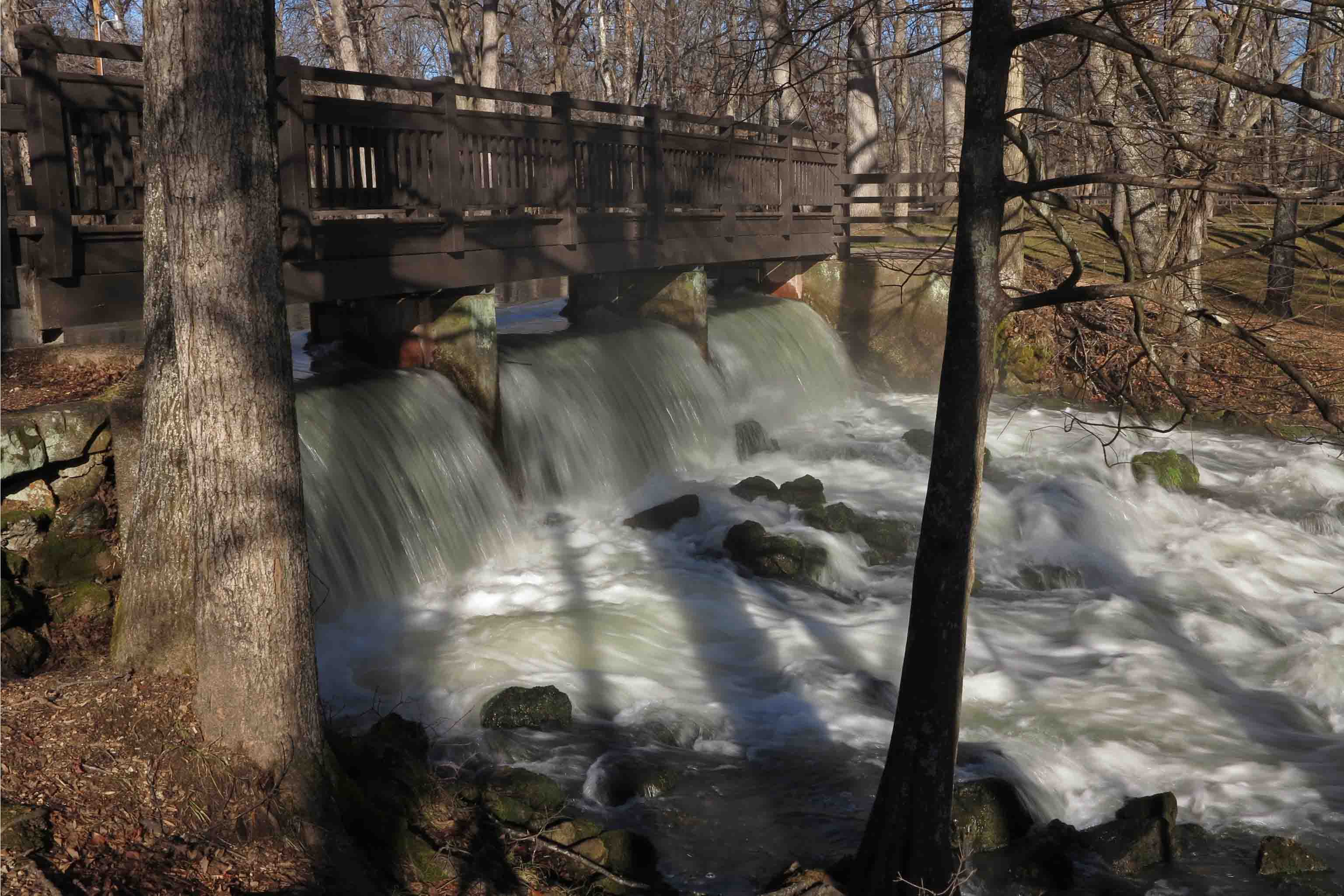
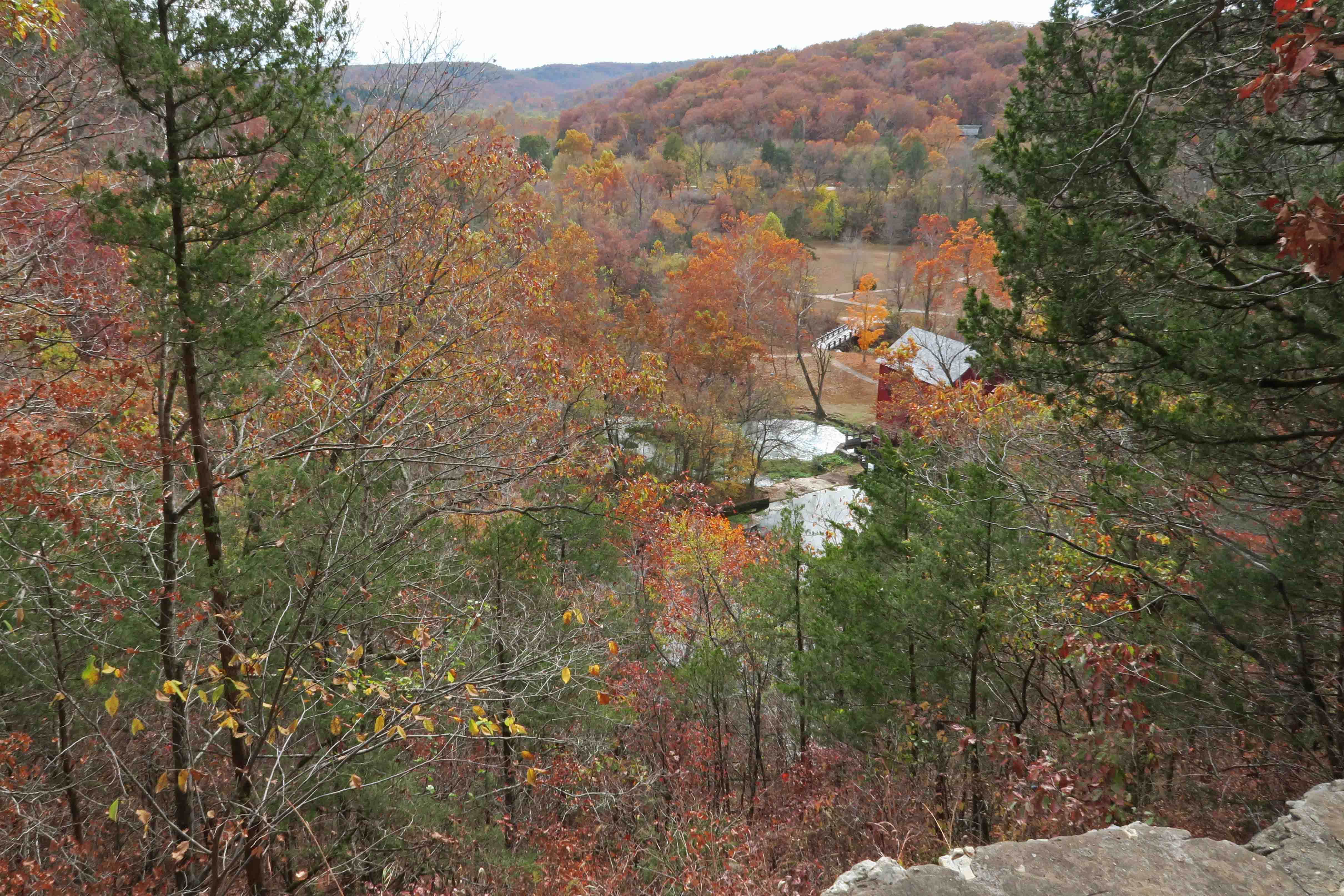
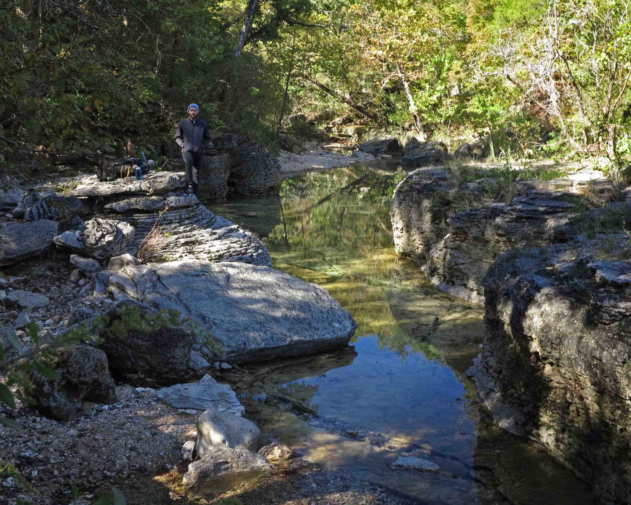
Our hike’s last stretch included the River Trail and a walk along a beautiful bluff before arriving back at the end of this trail at the Ozark Chinquapin Nature Center.

After making the guidebook trail, I investigated Eagle’s Nest Trail to see if it might make a bid for inclusion in the next edition of my guidebook. It was a nice hike but included more road walking than I would expect to see in what would qualify as a most scenic trail in Missouri.

Eagle’s Nest Trail
Great location for a homesite

This trail’s destination is an old homesite location, but doesn’t include cabin footings or historic artifacts to explore. What I found was a beautiful location for a homesite. This is a great little trail just under three miles, but it won’t make the guidebook list. One of the hardest things about writing a guidebook to the Ozarks’ best trails is determining which trails make the cut.

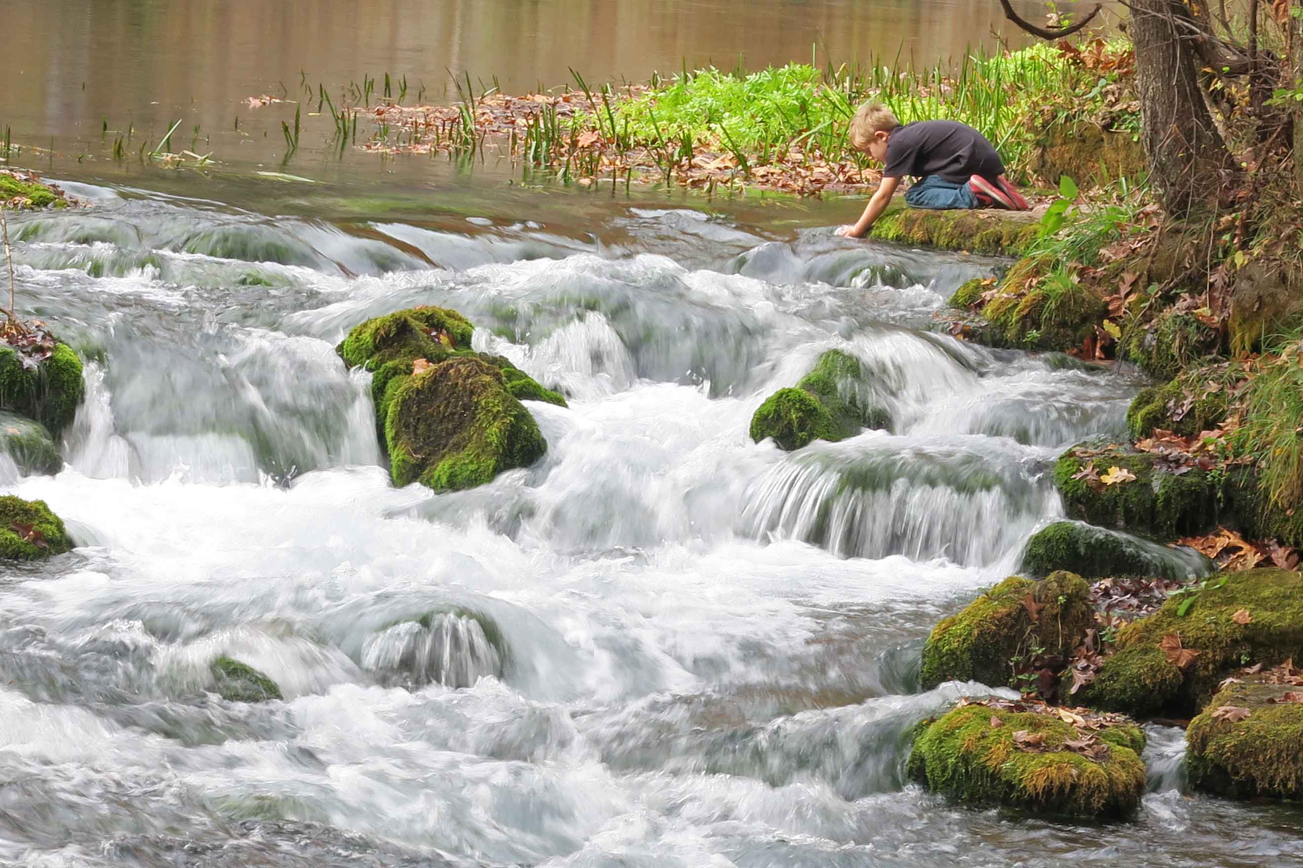
While we hiked the trails, Becca enjoyed exploring along the Roaring River and reading.

Becca was a truck camper pro on this trip, having prepared food without need for refrigeration. Our Four Wheel Popup Camper gave us flexibility on accommodations and a light load. Ours is a shell model that is light and simple. The awning is essential and gives us a protected outdoor space for meals, reading, and resting.

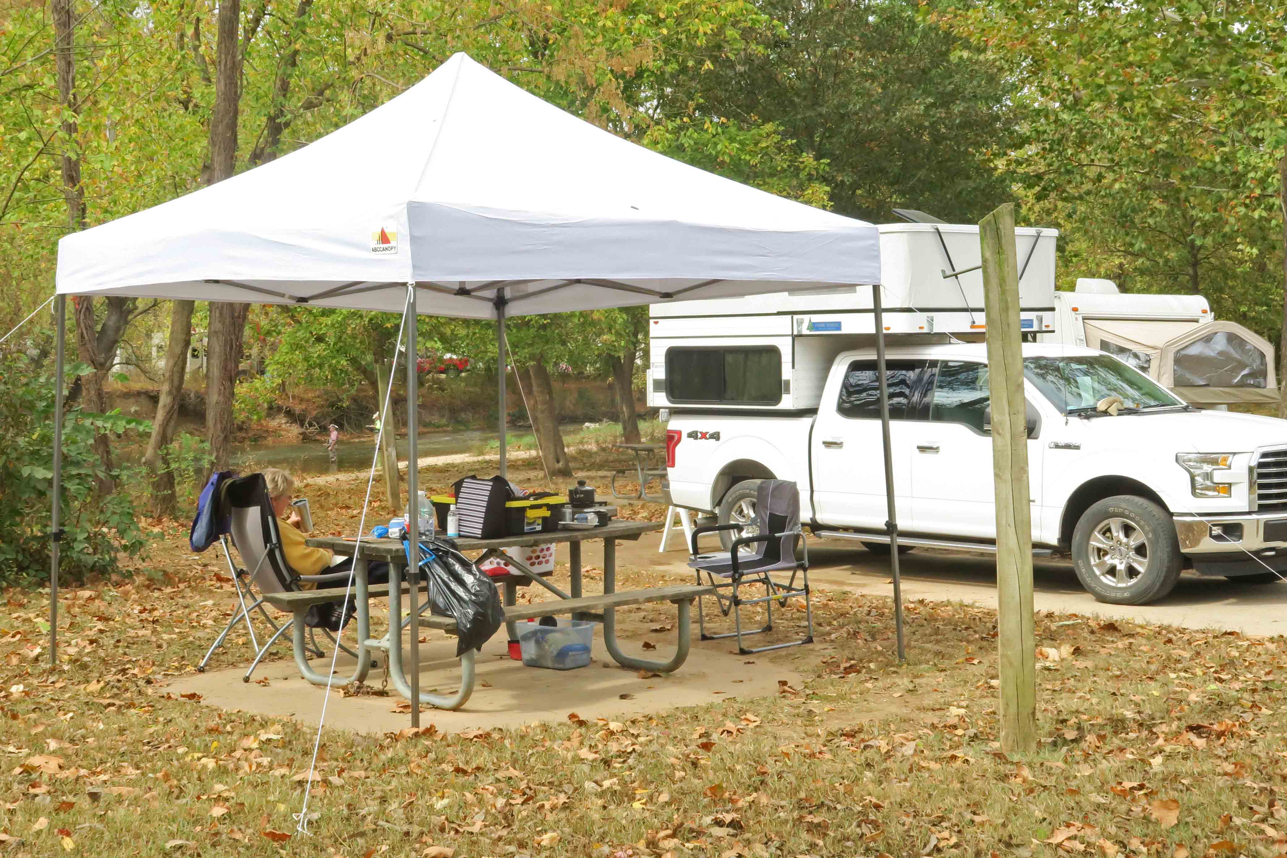
We enjoyed camping and found our neighbors to be friendly and welcoming. We wished for more space between sites and found the highway noise unfortunate for such a beautiful river location.

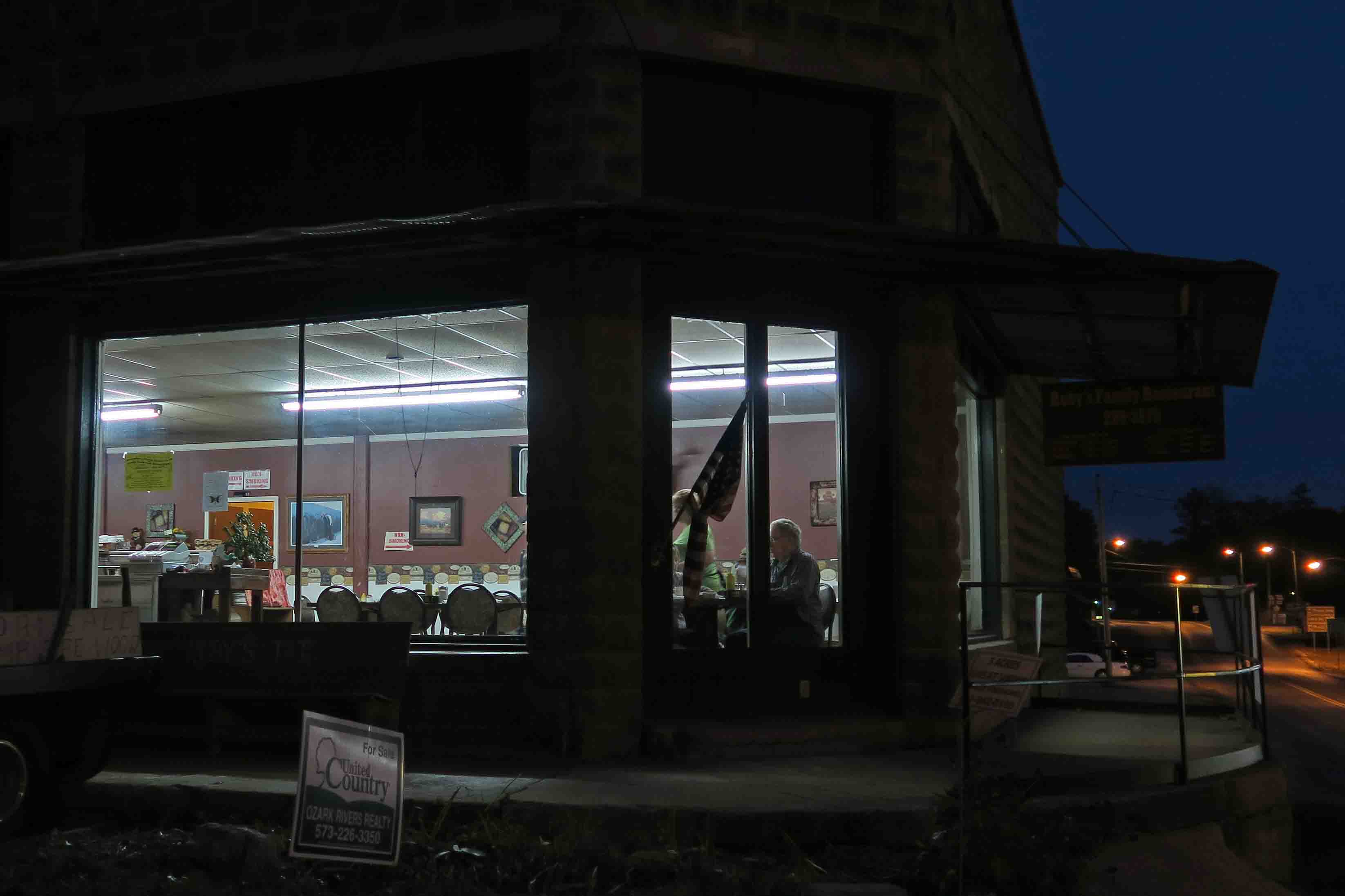
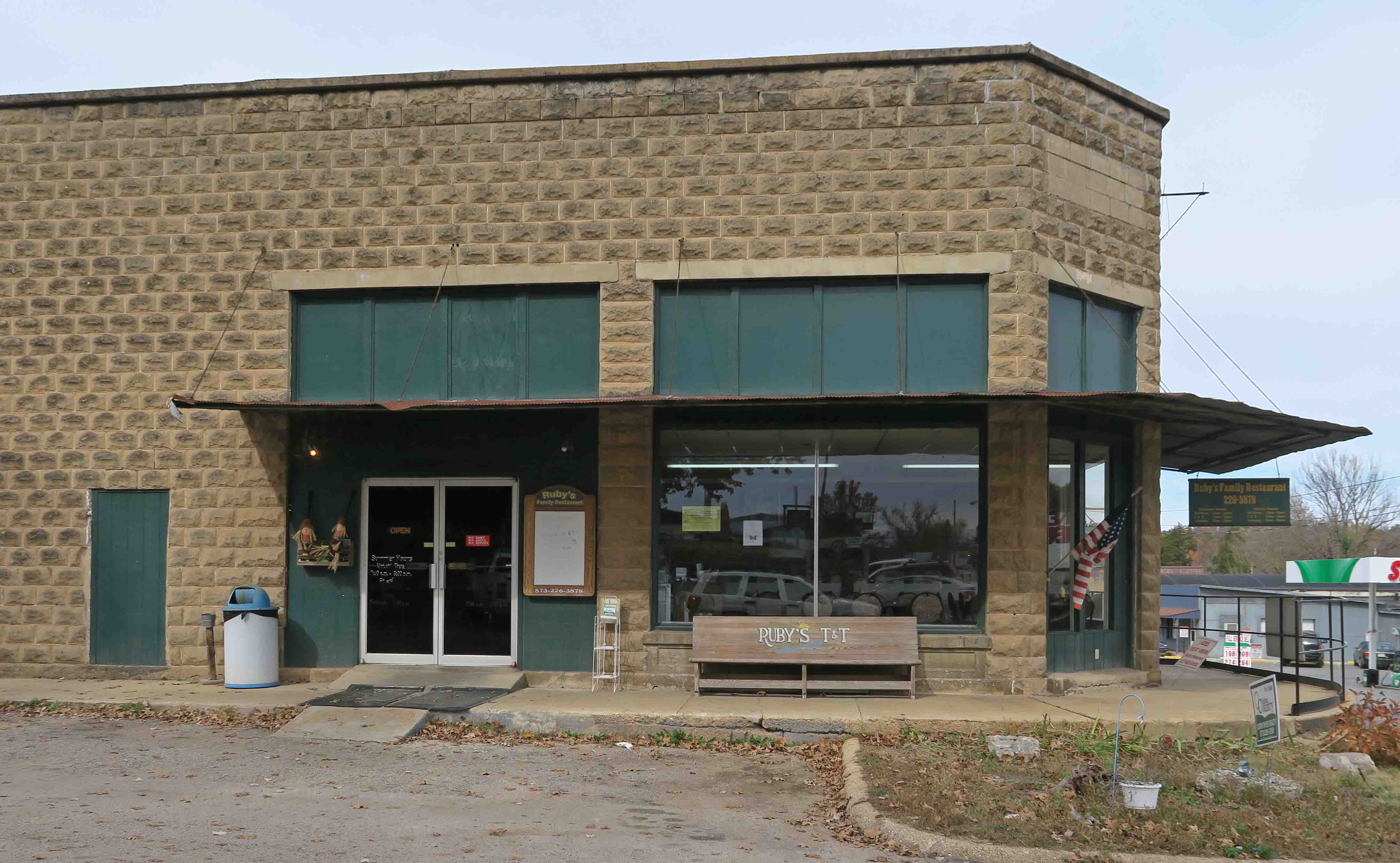
If you want to hike some beautiful trails and or do some trout fishing with like-minded folks, Roaring River State Park is the place!

If you want to pick up a copy of Five Star Trails: The Ozarks, you can get it from Amazon, but if it’s available at your favorite independent bookstore, get it there. Chapters on Main in Van Buren, Arkansas, and Bookish in Fort Smith, always keeps copies on hand. While you’re there, have a cup of coffee and browse.

Deep Greens and a Healing Spring

Photo Challenge: It IS Easy Being Green

IMG_9938rr

Alley Mill, Missouri

My wife and I spent three days exploring springs in the Ozarks of Missouri. Alley Mill Spring was one of my first springs to visit two falls ago*. Revisiting this week reminded me of the rich grays of limestone and wood mixed with blues and deep greens.

The unifying and ever-present element that connects each scene for me is the color green. Sitting still to drink in the greens on mossy rocks and swirling under the water heals my soul and quiets my spirit.

IMG_9965rr

Cascades below Alley Spring

IMG_9985rr

Looking across the deep spring vent toward Alley Mill

After my first visit to Alley Mill, I immediately changed my travel plans and camped close by so I could visit the next morning and avoid the crowds. Hiker-dog and I walked the trails and included a description in Five Star Trails: The Ozarks, (my two-year labor of love).

Why Visit the Ozarks?

img_1521rr

I’m proud to share posts written this month for Menasha Ridge Press. Below are links to each of these fall-focused posts. Come enjoy the beauty of fall in the Ozarks. I’d be honored to guide you on the trails with my new book, Five Star Trails: The Ozarks.

Part I: Top Reasons to Visit the Ozarks This Fall

Part II: Why Visit the Ozark Mountains? All the Fall Colors! 

Part III: Why Visit the Ozarks? The Rich History of the People of the Ozark Mountains 


When in Doubt

Thank you to the award winning author, Marla Cantrell, for sharing my story in the October issue of Do South Magazine.

“When in doubt, take a step.” – Jim Warnock’s mom

Jim Warnock has worn down the soles of hiking shoes until they are as smooth as a pair of loafers. The erosion takes place over months, as he walks across hills, through valleys, beside waterfalls that catch the sun’s rays, throwing diamonds of light across an already breathtaking landscape.

When he thinks about what it means to hike… Continue reading

http://dosouthmagazine.com/when-in-doubt/

Natural Arch on Clifty Creek: The weight of beauty

WordPress Daily Post: Weight(less)

IMG_5229rr

Natural Arch on Clifty Creek in the Missouri Ozarks

Northwest of Rolla, Missouri, Little Clifty Creek merges with the main channel of Clifty Creek by way of this Natural Arch. With rock weighing approximately 170 pounds per cubic foot, I was a bit nervous and awed when walking underneath this massive arch. Though solid and standing in its present form for several human lifetimes, it was carved by the relentless force of water (62.5 lbs. per cubic foot) over time. Its form is still subject to change today.

IMG_5261rr

Hiker-dog and the Natural Arch

I appreciated Hiker-dog posing to provide a sense of scale as I took a picture from the other side of the arch.  She weighs as much as one cubic foot of water, and I’m just under the weight of one cubic foot of stone. As impressive as the Natural Arch is due to its size and weight, I was even more awed by a quality that has no weight by the cubic foot; its beauty!

Solitude on Missouri Trails: Hercules Glades


IMG_5129rr

Long Creek Falls viewed from downstream on January 7th hike.

On our last visit to the Hercules Glades Wilderness Area, we crossed paths with at least ten hikers on the trail and another twenty members of a Boy Scout troop at the Coy Bald Trailhead. The hiking was excellent, and it was a pleasure to see others on the trail, but the creeks were mostly dry, so I looked forward to a second visit in wetter conditions with a little more solitude.

IMG_3245rr

Long Creek Falls during dryer and busier times. One of the few pools on the creek. Five more hikers are close by.

IMG_5170rr

A similar view to the one above looking downstream in different light and conditions.

I’ve found that if you hike on a rainy day in January, you’ll probably have the trail to yourself. Your chances for solitude are enhanced if snow is in the forecast. I didn’t see another person on the trail all day.

IMG_5205rr

Long Creek runs under an overhanging bluff where we stood in the dry on our last visit.

Hiker-dog and I walked from Hercules Tower Trailhead to Long Creek then downstream to the falls. No concerns for drinking water on this trip! I would filter it, but Hiker enjoyed having a drink or a bath whenever it suited her.

IMG_5175rr

Hiker-dog taking in the view after taking a dip in the falls.

There are several creek crossings on this trail and the temperature was around 40-degrees and dropping. To save time, I opted to do the crossings in my regular hiking shoes, so I got a little chilled while standing still to take photos at the waterfall.

I was thankful for the warming effects of the the uphill climb back to the trailhead. It was a solitary, chilly, and beautiful time in the Hercules Glades Wilderness Area!

Maramec Spring: A Missouri Ozarks Surprise

IMG_9534rr

Cascade below the Maramec Spring in early morning light

While driving Missouri Highway 8 toward another hiking location, a quick stop for a few photos turned into several hours of exploration, rich with beauty and history. Maramec Spring was a delightful surprise!

I had read of no trails in the area, and hiking wasn’t listed as an available activity on the Maramec Spring website, so I was puzzled to see two ladies beginning their morning walk. They said they enjoyed the paths around the spring and walking down Maramec Creek with cameras in hand. I quickly scanned the area and started my GPS, hoping to record a pleasant route.

IMG_9516rr

Maramec Spring

My walk led directly to the Maramec Spring, a gentle and broad spring whose strength isn’t realized until a nearby cascade demonstrates the volume of water flowing from the ground. Park literature indicates this is Missouri’s fifth-largest spring with an average daily output of 100 million gallons. Another source listed the volume as 90 million gallons and the sixth or seventh largest spring in the state. Regardless of size, its beauty is top of the line.

IMG_3968rr

Cascade below Maramec Spring

Another demonstration of flow-rate is on display at a bridged spillway downstream. This water will travel about 165 river miles to where the Maramec River empties into the Mississippi.

IMG_3973rr

IMG_3986rr

Cypress knees border  Maramec Creek where fly fishing begins

The flow from Maramec Spring eventually widens into a creek channel where fly fishermen enjoy their pursuit of trout, visible just below the clear cold currents.

Where the paved paths end, dirt trails begin, bordering both sides of the creek and crossing a bridge several tenths of a mile downstream. Conditions were right for the formation of early morning frost flowers, a visual treat for early morning winter hikers.

This slideshow requires JavaScript.


IMG_4019rr

Maramec Spring’s natural beauty is complemented by a fascinating history. Portions of the paved paths take you through an outdoor museum of the Maramec Ironworks. Thomas James, an Ohio businessman, began construction in 1826 by. In 1843, Thomas sent his son, William James, to operate the ironworks.

The Civil War increased the demand for iron from the plant in spite of the transportation challenges of this remote location. At its peak, the plant town was reported to have close to 500 residents. The Maramec Ironworks ceased operation in 1876.

IMG_4016rr

Maramec Ironworks casting arch


IMG_3964rr

Powerhouse with Maramec Spring in the background


IMG_3958rr

Maramec Ironworks Museum

While hiking the Maramec Spring in winter is a pleasure, you’ll miss out on visiting the Ironworks Museum, closed at the end of October and reopening in the spring.

I felt a tinge of sadness as I drove away from Maramec Spring, but hope to visit again someday. I’m thankful that William James’ granddaughter, Lucy Wortham James, chose to protect this area for us to see today.

IMG_9535rr

“As this is considered to be the most beautiful spot in Missouri, it is my great hope that you will arrange that it may ever be in private, considerate control, and ever open to the enjoyment of the people.”

~Lucy Wortham James


Alley Spring Mill in the Missouri Ozarks

Alley Spring from downstream

Alley Spring Mill from downstream

While researching possible trails in the Jacks Fork and Current River area of Missouri, I almost dismissed Alley Spring because of its shortness at only 1.9 miles. As I stepped onto the trail beginning behind the mill, I realized what a mistake that would have been. The trail is well built and scenic every step of the way.

View of Alley Springs Mill from the trail

View of Alley Spring Mill from the trail

The trail takes you to an overlook on a ridge behind the mill. You can see the spring, mill, and foot bridge approaching the mill. After switchbacking down to the mill’s level, a section of the trail follows a narrow dirt road shared by a horse trail. The trail passes between two horse hitching posts before beginning to follow Alley Branch upstream.

Alley Spring Trail

Alley Spring Trail

The trail then follows Alley Branch upstream next passing a couple of interesting little bluffs populated with indentions and caves, suitable homes for everything from cliff swallows to small mammals. I found one about the size of a tent and crawled inside for a look.

Trail next to Alley Branch

Trail next to Alley Branch

Shallow cave in Alley Branch bluff

Shallow cave in Alley Branch bluff

Story Creek fed by Alley Spring

Alley Branch fed by Alley Spring

Alley Branch flows away from Alley Spring. The water is clear and cold. A young man walking the trail with his grandmother stooped over and took a drink of the clear water. I was a little envious of his lack of caution and still regret not scooping up a sip myself.

Alley Branch

Alley Branch

Shortly after passing the small cascade, the trail wraps around the deep, blue spring that pours out over 80-million gallons of water per day.

Alley Spring

Alley Spring

Alley Spring

Alley Spring

The trail then comes back to the mill house, passing water gates that adjusted the flow of water. These gates in front of the turbine pit allowed some control over the speed of the mill, making turbine mills superior to waterwheel mills.

Flow gates

Flow gates next to the mill

Alley Springs Mill

Alley Spring Mill

Before heading back to the parking lot, I spent some time just looking back on the mill and relaxing in the cool October air. Alley Spring would a great place to spend a whole day. A picnic area and restrooms are located close to the parking lot. A campground next to Jacks Fork River is located close by. Hiker-dog and I slept there under a tarp to rest for the next day and more trails.

Alley Spring mill

Alley Spring mill

The following morning, after hiking the Alley Spring trail a second time before dawn, Hiker-dog and I drove six miles east to the little town of Eminence. I was surprised to find a restaurant open at 6:15 a.m. and stopped for some breakfast. Turned out to be a real find! Ruby’s Family Restaurant served up a real breakfast and kept the coffee topped off.

I struck up a conversation with the only other customer. The elderly man had grown up in Alley Spring and was a delight to visit with. He attended school in a one-room schoolhouse located right next to Alley Spring and walked just over a mile to school each day.

After hiking the Rocky Falls area that morning, I returned to Ruby’s for lunch and met Ruby, the owner. I mentioned my conversation with the gentlemen that morning.  Without hesitation she told me his name and said he could share a lot of history about Eminence and Alley Spring.

I look forward to eating at Ruby’s and seeing Alley Spring Mill again someday. I might even run into Pete Ward, the resident historian again.

Ruby's Restaurant

Ruby’s Family Restaurant on my first visit.

Ruby's Cafe

Ruby’s Family Restaurant after a late lunch.

Hiker-dog enjoyed exploring small caves in the bluffs next to Alley Branch.

Hiker-dog enjoyed exploring small caves in the bluffs next to Alley Branch.


Exploring the Hercules Glades of Missouri

I enjoyed exploring the Ozarks of Missouri this weekend. The plan was to hike two trails in the Hercules Glades Wilderness Area. The Missouri Ozarks provided an excellent time on the trail, exceeding my expectations.

Hercules Glades

Hercules Glades

Friday afternoon, I hiked a 6.6-mile loop in the Hercules Glades. This wilderness area doesn’t use blazes, so I walked off of the trail following rocky glades on two occasions, but my mistake was caught before going more than a few steps. Hiker-dog loved the grassy glades and leaped with pleasure as she chased anything that moved.

A low water bridge is always a good sign when you’re looking to get out into a wilderness area. The clarity of the water was also a good sign.

Low water bridge on FR 544

Low water bridge on FR 544

Looking upstream from the low water bridge

Looking upstream from the low water bridge

In the Hercules Glades, deep woods alternate with open glades, punctuated with thick cedar groves. The contrast of temperatures and environments were surprising. The warmth of the glades wasn’t as surprising to me as the coolness of the wooded sections. The woods were also nice and open due to the heavily shaded canopy.

Hercules Glades wooded section

Hercules Glades wooded section

Crossing Long Creek late in the hike provided some much needed clear drinking water for Hiker-dog. The sun was getting lower in the sky, so I took a few minutes to enjoy the foliage reflecting on the surface.

Hiker having a drink.

Hiker having a drink.

Evening light

Evening light on Long Creek

Long Creek

Long Creek

Once back at the trailhead, I was preparing a for a quiet dinner, having seen only one small group and a solo hiker on the entire loop. As I was sitting there with Hiker, the parking lot began to fill up. By sundown, I had seen two groups of fifteen Boy Scouts enter the trail. I opted to sleep in my Jeep so I wouldn’t be sleeping in a tent when more vehicles arrived.

The scouts and the leaders were nice and seemed well organized. When one of the group of fifteen called out, “Who has the compass?” it gave me pause. Later one of the adults mentioned a young man who had loaded his pack with three extra pairs of pants and a double-D battery lantern, but only one small bottle of water. I’m sure some good learning occurred this weekend among those young men.

Fire tower at the trailhead off of Hwy 125

Fire tower at the trailhead off of Hwy 125

On day two, we drove to the east side of Hercules Glades Wilderness and hiked around Pole Hollow and down Long Creek to the falls. The trailhead includes a nice pit toilet, picnic tables and tent pads. There is also an abandoned fire tower.

This six-mile out-and-back was a pleasure every step of the way. When we arrived at the falls, a young man and his wife who entered the day before were looking for a campsite. He later reported that they camped that night with a large group of Boy Scouts. Not the solitude they’d envisioned, but still a good evening in the woods.

Hiking down Long Creek made me resolve to return during a wet season. This area is beautiful now, but must be several notches up on the “amazement scale” when the water is flowing.

Long Creek Falls

Long Creek below the falls

The depth of this overhanging bluff surprised me. The overhang must have been at least fifteen feet deep.

Overhanging creek bluff

Overhanging creek bluff

The hike back toward the trailhead was enjoyable because we could relax and enjoy the views having walked this route before. I let Hiker off the leash since we had this section of the trail to ourselves. She likes to run ahead and dart off-trail to explore. I’m a little envious that she sees so much more than I do with my two wobbly legs. Both Hiker-dog and I are looking forward to exploring more of the Missouri Ozarks.

Hiker-dog on the trail

Hiker-dog on the trail

Vivid Roaring River Spring

Roaring River in Missouri

Roaring River

This morning while hiking at Roaring River State Park in southern Missouri, I was fascinated by vivid greens and browns as they blended in fast flowing and trout-filled water.

Roaring River

Roaring River

Roaring River Spring

Roaring River Spring

Roaring River Spring drew me in with it’s subtle beauty and strength. The surface of this spring, which flows up from a canyon-like cave far below the bluff, seems to hide the average flow of 20 million gallons of water each day. This cold spring produces the rapids downstream, filled with color and life.

Roaring River Spring

Roaring River Spring

In response to The Daily Post’s weekly photo challenge: “Vivid.”