
The view over a landslide site next to Richland Creek Wilderness Area.

In January of 2014, Bob and I met a black Lab close to mile 138 on the Ozark Highlands Trail (OHT). If you want to know that story, skim this little book I wrote for children at my school, Gift From the Ozarks.
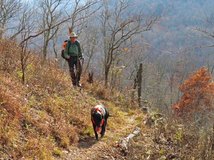
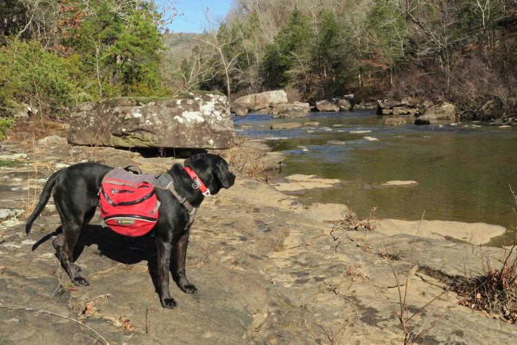
Since joining our family, Hiker-dog has covered most of the OHT but still lacked the miles from Fairview Trailhead on Hwy 7, east to where we found her. Hiking buddy, Eric, is working his way through the OHT and needed this section. Bob completed our group, being the first to meet Hiker-dog a few years ago.

Eric and I drove to Richland Creek Campground to leave my truck, then shuttle back to Fairview to meet Bob. Hiker-dog enjoyed the ride and seemed to anticipate some good hiking as we drove next to the Richland Creek Wilderness Area.
We laughed at how hyper she was in camp. I took her on a short out-and-back walk in an attempt to calm her down but she needed more, and there hadn’t been time that day with all the shuttle driving. Since others were camping nearby, I put Hiker-dog’s mat inside the tent and was thankful when she curled up and slept all night.
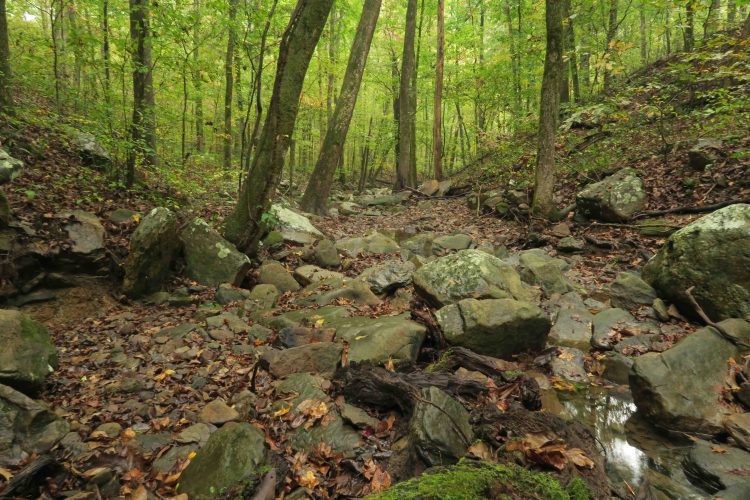
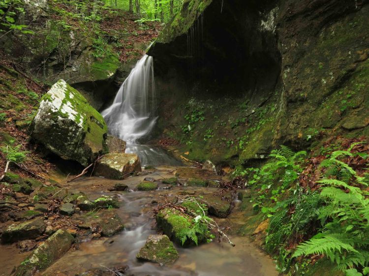
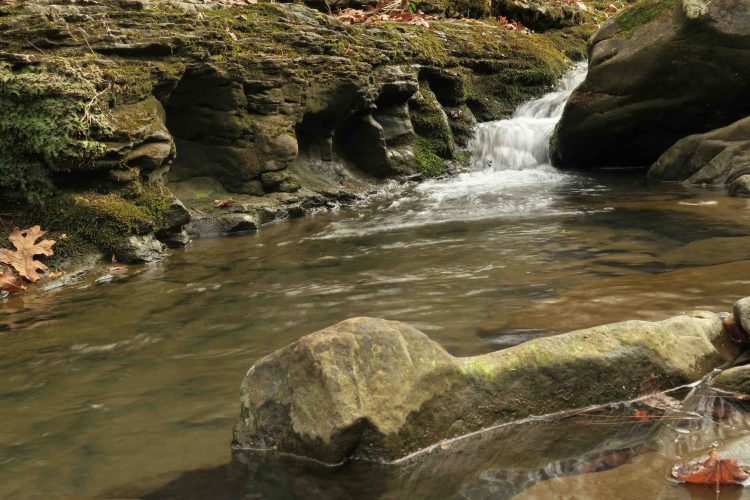
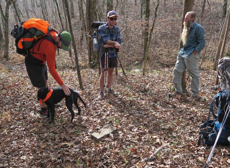 Saturday’s hike was pleasant as we crossed old oak bore and ice damage saying a word of thanks for trail volunteers who keep this section passable. The canopy improves after a couple of miles, and the beauty of the Ozarks is revealed as you pass several creeks. As we stopped for lunch, two of the only other backpackers we would meet stopped for a short visit.
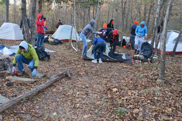
 I’ve hiked through the remnants of the CCC Camp before but never spent the night. This was a treat, and water access was easy. We enjoyed exploring before selecting tent sites.

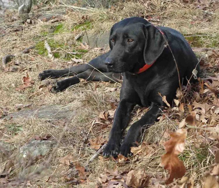
Someone was impatient with tent setup and curled up for a short nap.
After supper, we played with our cameras while warming by a fast burning cedar wood fire. Popping cinders left orange streaks and sometimes caused alarm when they landed on a leg or foot.  We experimented with some light painting to bring out the foreground and trees.
 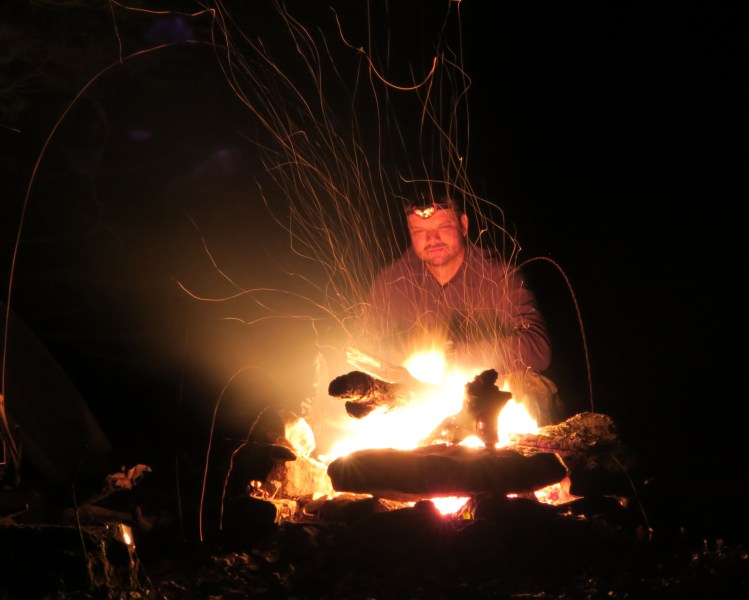 Lots of cinder streamers fly during 15-second exposures. Perhaps the ghostly remnants from the CCC structures made us wish for visitors from the past. Looks like some spirits stopped by as we sat by the fire.
 Eric experimented with some light writing. Who would think three grown men could be so entertained by a couple of small cameras and headlamps!
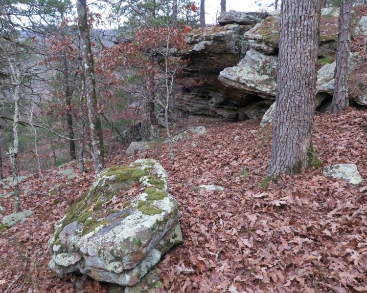
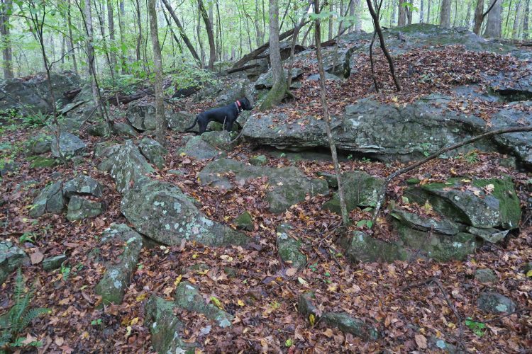
 The next morning, we explored a bluff area next to the camp. The open woods surrounding the CCC Camp were a joy for a well-rested Hiker-dog.


We came to the place we first met Hiker-dog close to mile 138 (now near 137 with route changes on the OHT). A deer from the previous day’s hunt was lying about fifty yards away, and Hiker-dog quickly found what the hunter could not. I thought about Hiker-dog’s condition just under four years ago and what rich meals this deer would have provided.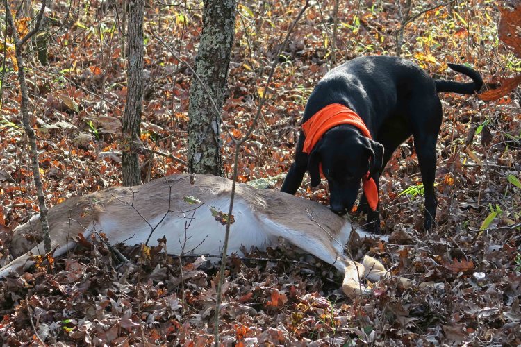
 We came across our backpacking friends from the previous day and had a nice lunch as Hiker-dog fought the desire for a nap in the warm sunshine.
 Hiking along Falling Water Creek was a pleasure until we came to an arrow indicating the bypass up and over the site of an old landslide. We huffed and puffed along the steep hillside, but the bluff above provided scenic views into the Richland Creek Wilderness Area. From our thru-hike a few years ago, I didn’t remember this section’s steepness. It was probably blocked from my memory because of the pain.
Thanks to Eric for catching Hiker-dog and me on the reroute

One of many views from the bluff.
As we arrived at Richland Creek Campground to complete our 20-mile trek, Hiker-dog was nowhere to be seen. I heard children’s voices next to the creek and thought she might have been drawn to the sound, but she popped out of the woods a few minutes later, still strong and ready for more. I thought about how fortunate we both were to cross paths at mile 137 of what would become our adoption trail on that cold January day.
Hiker taking a break on Spy Rock, Hare Mountain.

Enjoying fall colors on the Lake Alma Trail.


 A drizzling rain wouldn’t interfere with maintenance plans since I was only doing light hand sawing and clearing. Almost every creek had pockets of water and about the time I was thinking this would be a great weekend for camping, I came upon a hammock. John, a thru-hiker I’d meet on my hike out in a few hours, was sleeping in during the light rain. I was proud that Hiker-dog ignored the hammock and continued across Jack Creek on the trail.
 I purposefully stopped every few minutes to look and enjoy these woods I’ve passed through many times. This was my nod to Mr. Muir in my effort to “saunter.” Slowing down and pausing occasionally allowed me to notice things I’d typically miss like small fungi on a decaying log.
 After scouting the trail and beginning my return trip, I came across muscadines hanging right over the trail I hadn’t noticed my first time through. I picked a few and enjoyed their sweet centers and tart chewy skins as I walked along remembering my mother’s muscadine jelly on toast. The rain had stopped and I was now sauntering along with a hand full of muscadines and blueberry cookies. A wonderful feast!
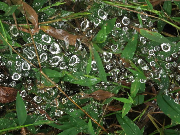


 I was surprised to see a brand new trailhead kiosk. At some time in the past, I emailed a request for a kiosk here since the Dockery Gap Trailhead served as the main entrance point during construction of the Lake Fort Smith State Park. I hope it lasts and is left alone.


 The always-reliable, “Rusty Spring” was flowing as usual. Hiker-dog passed it by, so I followed her example and fought the urge to take a sip.
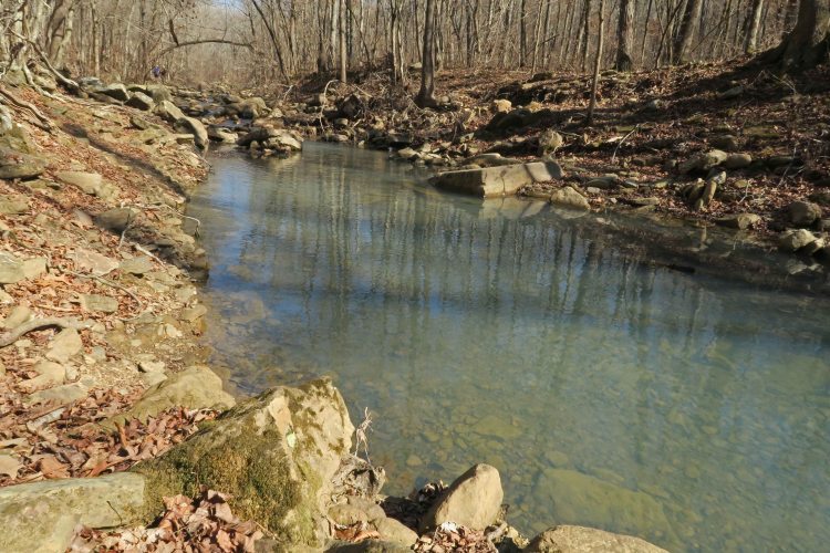


 December 29: This trek through the Hurricane Creek Wilderness Area would bring Hiker-dog closer to completing the Ozark Highlands Trail. It was also the final section needed for one of our group to finish the traditional 165-miles of the OHT.
  One vehicle approached the bridge as we crossed, but the driver stopped and gave us a friendly wave as we continued across the one-lane bridge.
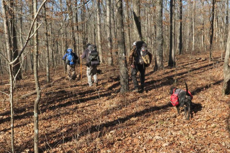 The winter woods were open and clear under sunny skies.
 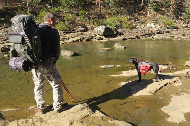 Eric and Hiker-dog paused to take in the views at the slow running Hurricane Creek. The water was as clear and the bottom of the creek was as slippery as I remembered. Even Hiker-dog’s four paws slipped a time or two.
  Bob and Eric did some rock hopping to cross dry. Scott, Hiker-dog, and I all chose to wade the creek.
 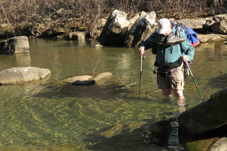 It looked like Scott found a deep spot in the creek, but we all made it across dry and ready to move on up the trail.
  Winter leaf-off is a good time to view Natural Bridge perched at the top of bluffs on the west side of Hurricane Creek.
 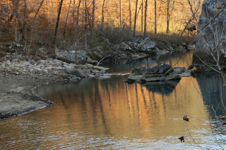 Thanks to Eric for noticing the color reflecting upstream. We took turns photographing the scene with my camera since Eric’s camera batteries were drained.
  Hiker seemed to enjoy showing off by hopping rocks as the sun continued to move lower in the sky.
 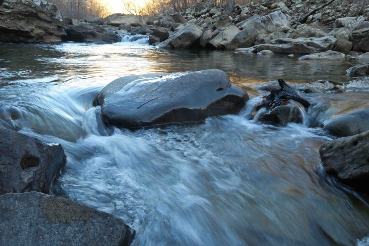 We were in our tents by 7 p.m., lulled to sleep by the gentle sounds of Hurricane Creek below our campsite. Coyotes let loose a chorus of howls late in the night, but I find their distant cries relaxing and part of the beauty of nighttime in the Ozarks. Temperatures got down to the mid-20s.
 Around midnight, I answered nature’s call and enjoyed looking at the starry sky for a moment before returning to my tent. I discovered Hiker-dog curled up on my down blanket rather than her Thermarest sleeping pad. When she felt my feet under the quilt, she moved back to her bed, sorry that I didn’t see the need for her to have a down bed.
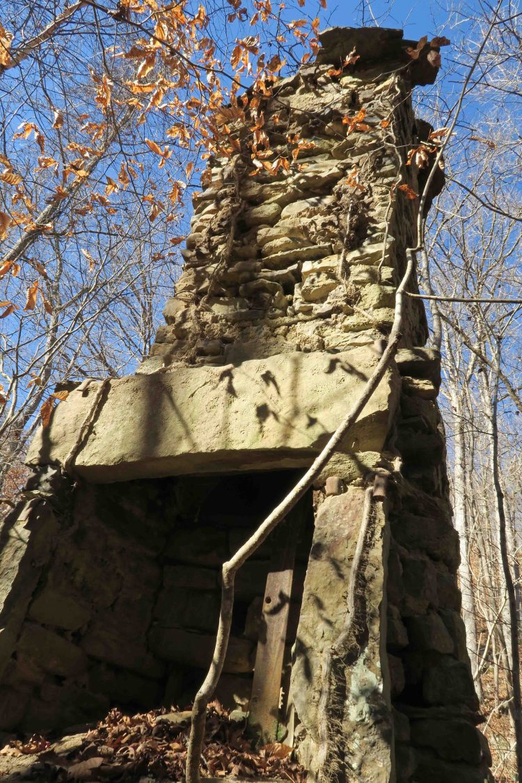 After the east crossing of Hurricane Creek, we passed the Highwater Bypass and continued toward Chancel and our campsite at a small creek that eventually feeds into Buck Brn Creek.


 Bob reminded me of the arched shape of the bridge below Forest Road 1209A. I dropped down for a few pictures before rejoining the group on the trail and the big climb toward Fairview.
 After lots of huffing and puffing, we arrived at the trip’s end. Celebrations were in order as this was the last section Scott needed to complete 165-mile of the OHT. We were proud of his accomplishment.
