Video Slideshow of OHT Thru-Hike
To see how that scrawny lost dog from the slideshow is doing today: What Makes Hiker a Good Trail Partner?
To read the story of this thru-hike go to Walk, Eat, Sleep, Repeat.
Video Slideshow of OHT Thru-Hike
To see how that scrawny lost dog from the slideshow is doing today: What Makes Hiker a Good Trail Partner?
To read the story of this thru-hike go to Walk, Eat, Sleep, Repeat.
We did not want to lose momentum and conditioning from our first two outings and were anxious to get back on the trail. We selected January 16-20 to finish our third leg of the trail to complete the whole 180 miles of the Ozark Highlands Trail. To read about our eleven days of hiking the first 125 miles go to Walk, Eat Sleep, Repeat.
Packing was much easier for this outing because my third supply bag was still together and ready to go. My gear arrangements from the previous two legs of the hike were still fresh on my mind. One new addition was a zero-degree sleeping bag. I would find that this bag worked well as a blanket until temperatures got down into the mid-twenties. Then it was time to crawl in and zip up!
We were anticipating some of the best hiking weather yet and wouldn’t be disappointed. We had temperatures from the mid twenties to the 60s. The following layers and a dry bag with base layers have kept me comfortable and safe in any conditions I’ve faced here in Arkansas.

Warm layers

L to R top: Food bag, cook pot, Esbit stove, cup
L to R bottom: sleeping bag, mattress, tent poles and tent.
We arranged a shuttle with Mark at Haggarsville Grocery and planned to come off of the trail between 2:00 and 3:00 p.m. on Monday, January 20th.
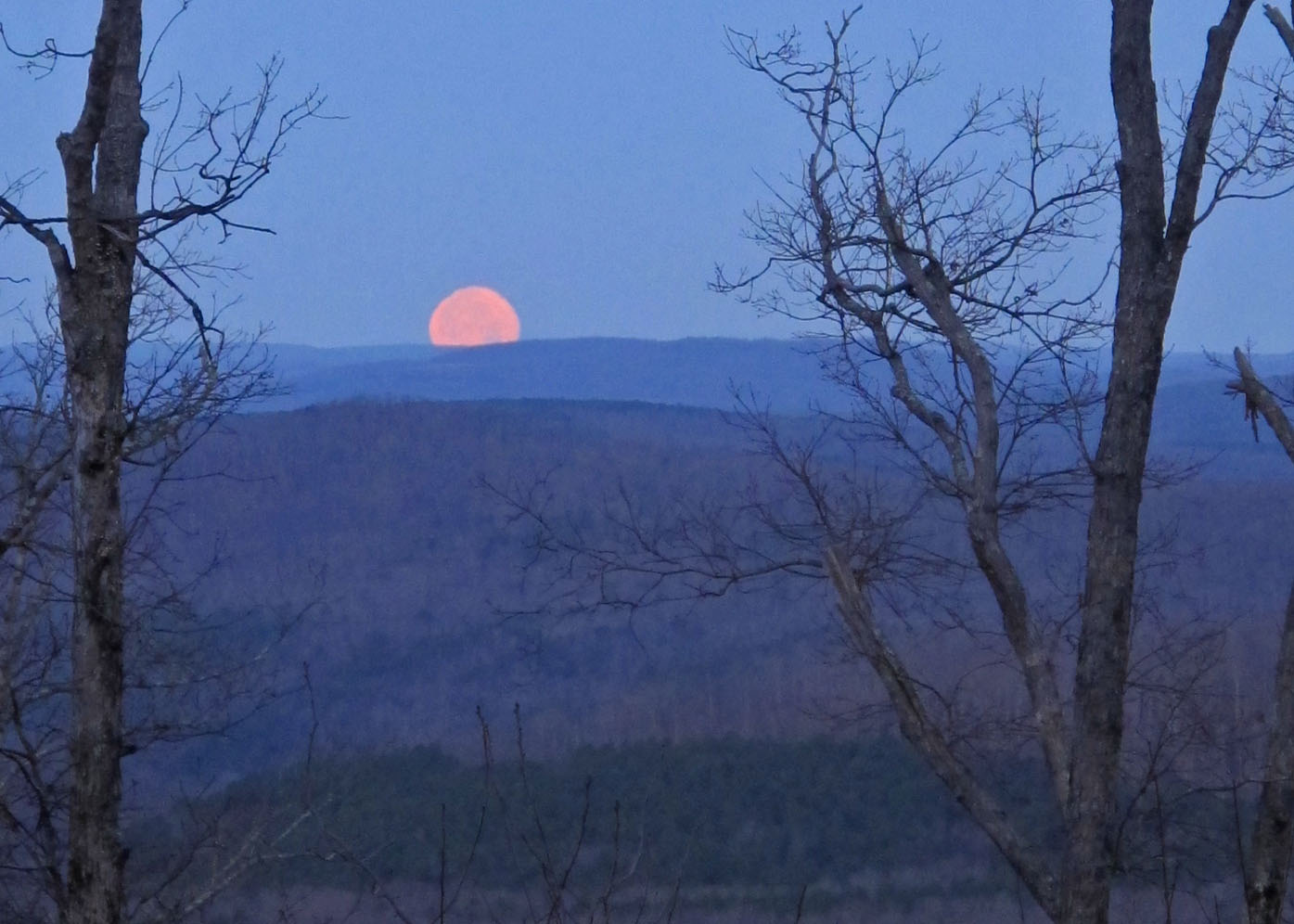
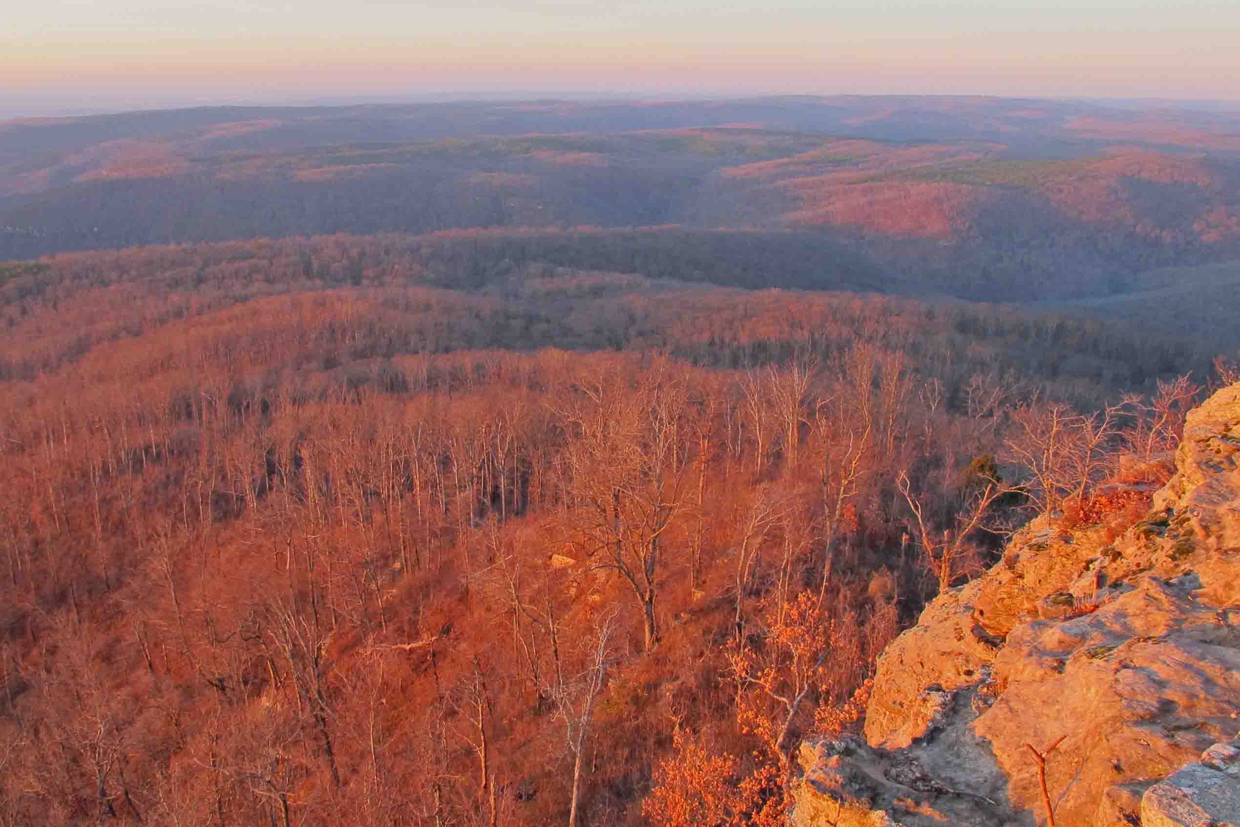
Moonset from Fairview Campground.
We camped at Fairview Campground so we could get an early start the next morning. This moonset seemed to promise good travels. I slept in the back of my Jeep in my 20-degree bag so my backpack would be undisturbed and organized for the trip. It felt good to cross Highway 7 the next morning heading east. This would be the last paved road we crossed for the next fifty miles.
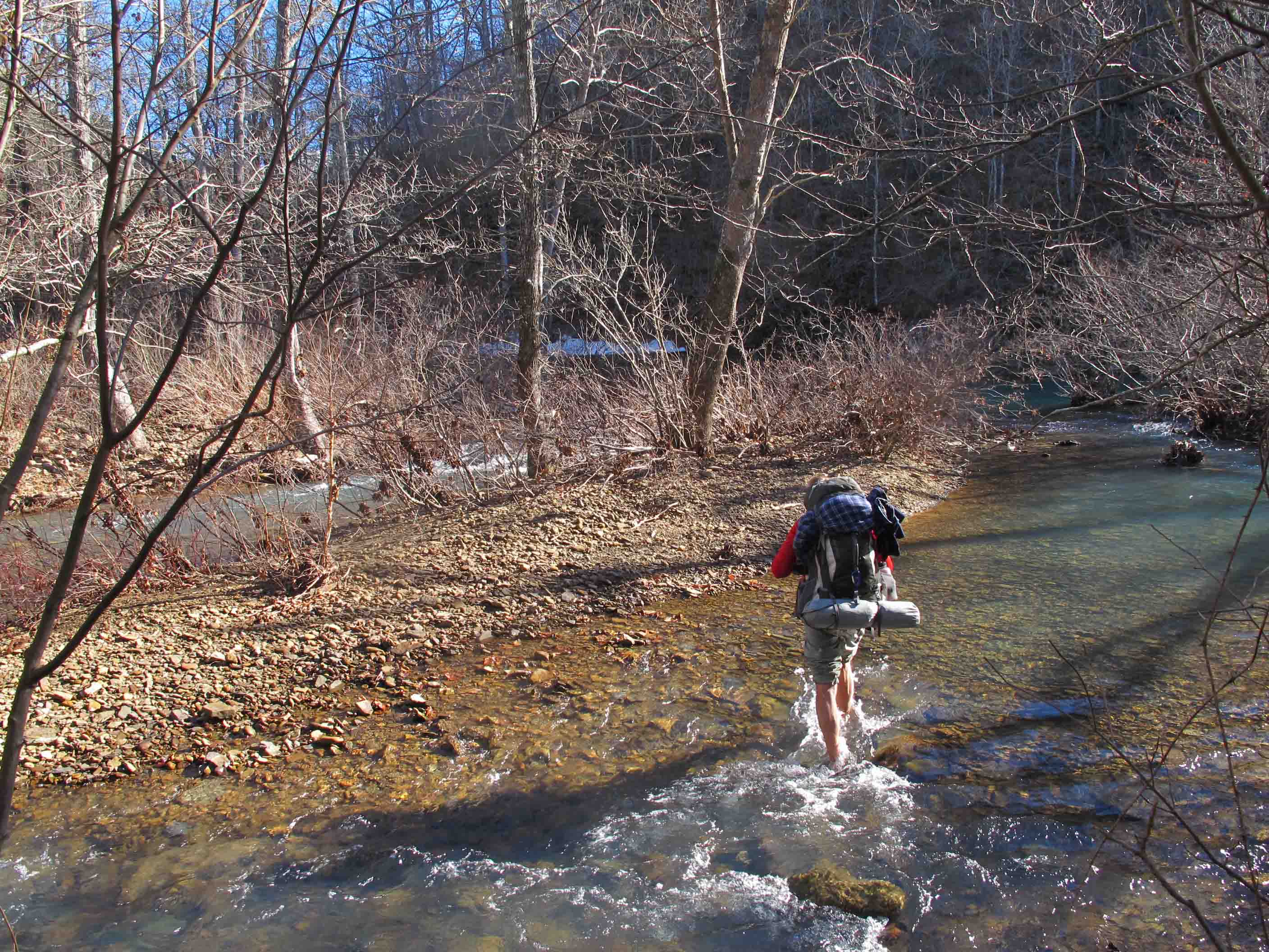
Crossing Richland Creek at the CCC Camp
Richland Creek drainage next to the CCC Campground.
Creek crossings were easy but looking at remnants of earlier snow while standing in a cold mountain creek will numb your feet within seconds.
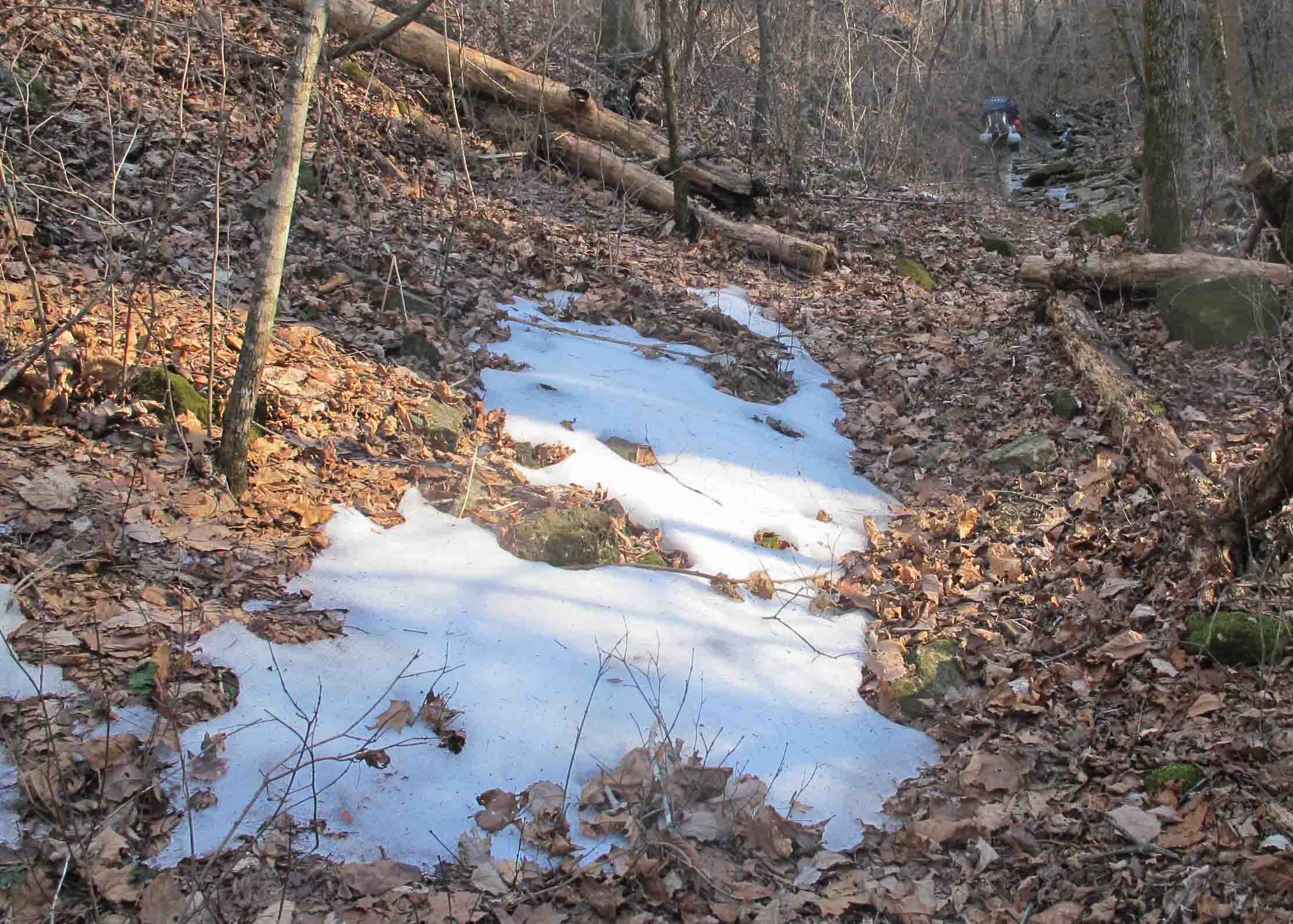
We were beginning to fear that water and a campsite would not appear on our second night but this spot didn’t disappoint. We enjoyed a nice view and one of our coldest nights of the trip. I found that by slipping my water pouches under the edge of my tent floor I could avoid having frozen water the next morning.
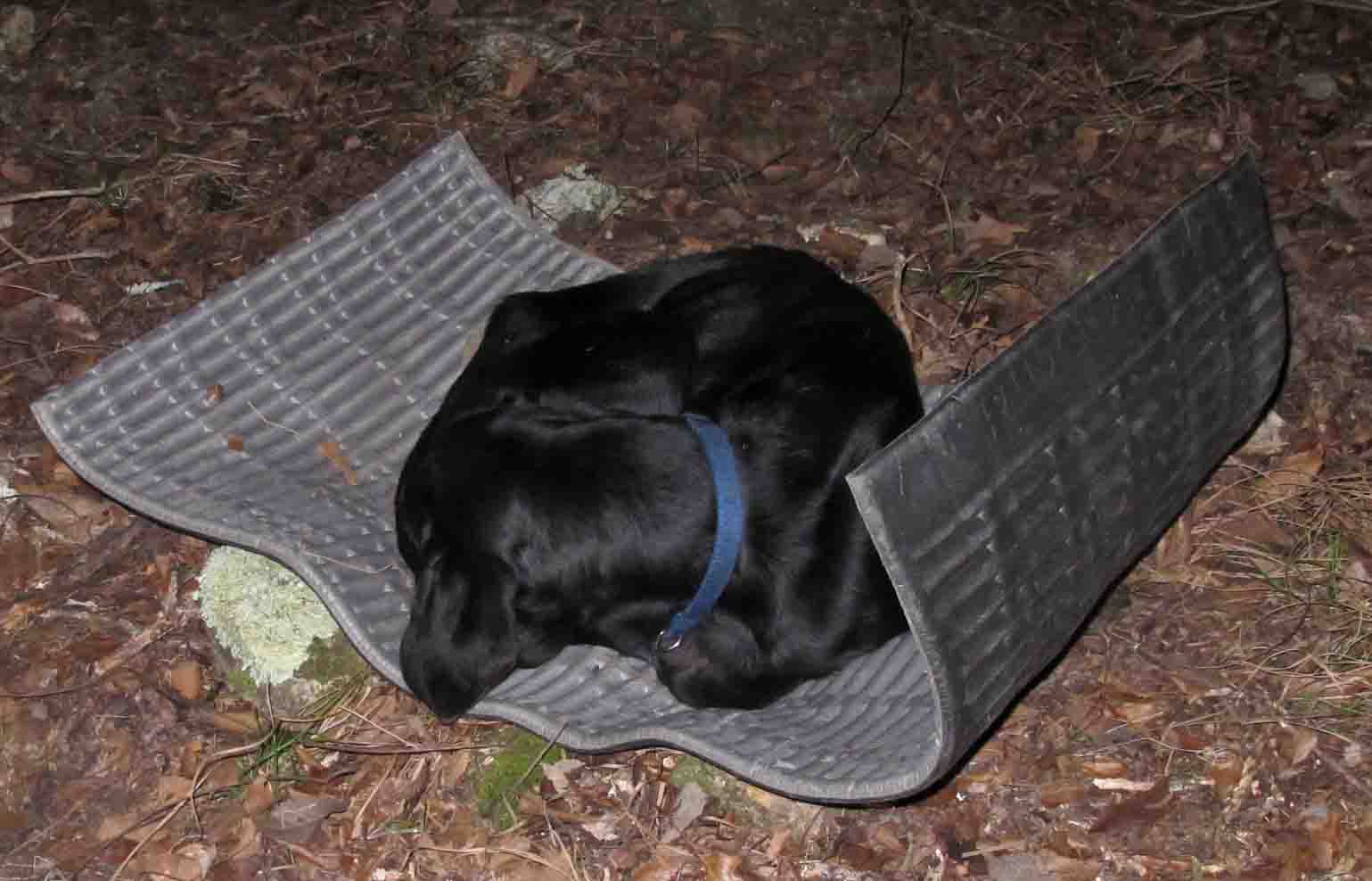
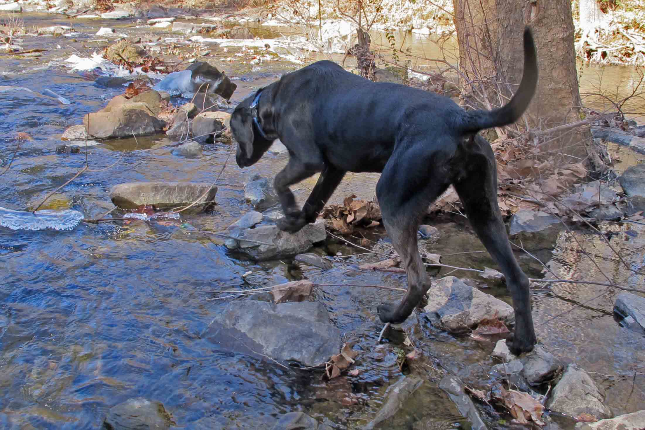
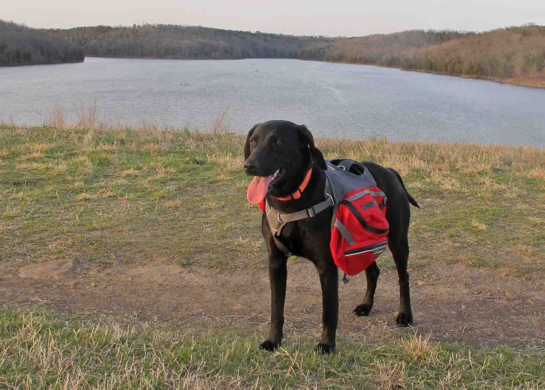
New Hiking Partner: A third hiking partner joined us on our first night out. We were setting up camp at mile 138 when an emaciated black lab appeared. We ignored her in hopes that she would reunite with her owners but the next day she quietly followed us for fourteen miles. At the end of that day we gave in and shared some of our beef and turkey jerky. These were limited rations because neither of us packed much extra food. Bob said, “If we’d known we’d have a dog, we would have packed some Alpo.”
This black lab demonstrated good outdoor skills as she curled up in a nest of leaves next to a log. The following morning we feared we were going to witness the death of this dog but she persevered and continued mile after mile with only limited rations from our small surplus of food.

Later in our trip our junior hiking partner discovered the joys of avoiding cold conduction from the ground by sleeping on a foam sleeping pad. Though she was skin and bones, we witnessed an improvement in her energy even with limited food. We were amazed by her persistence on the trail and at creek crossings. She was committed to following us for the 40+ miles to Tyler Bend! We wondered if she would last.

Historic structures along the Buffalo River
A number of historic structures can be found along the trail in the Buffalo River section of the OHT. These can be so much fun to explore that it is sometimes difficult to maintain forward progress in hiking.

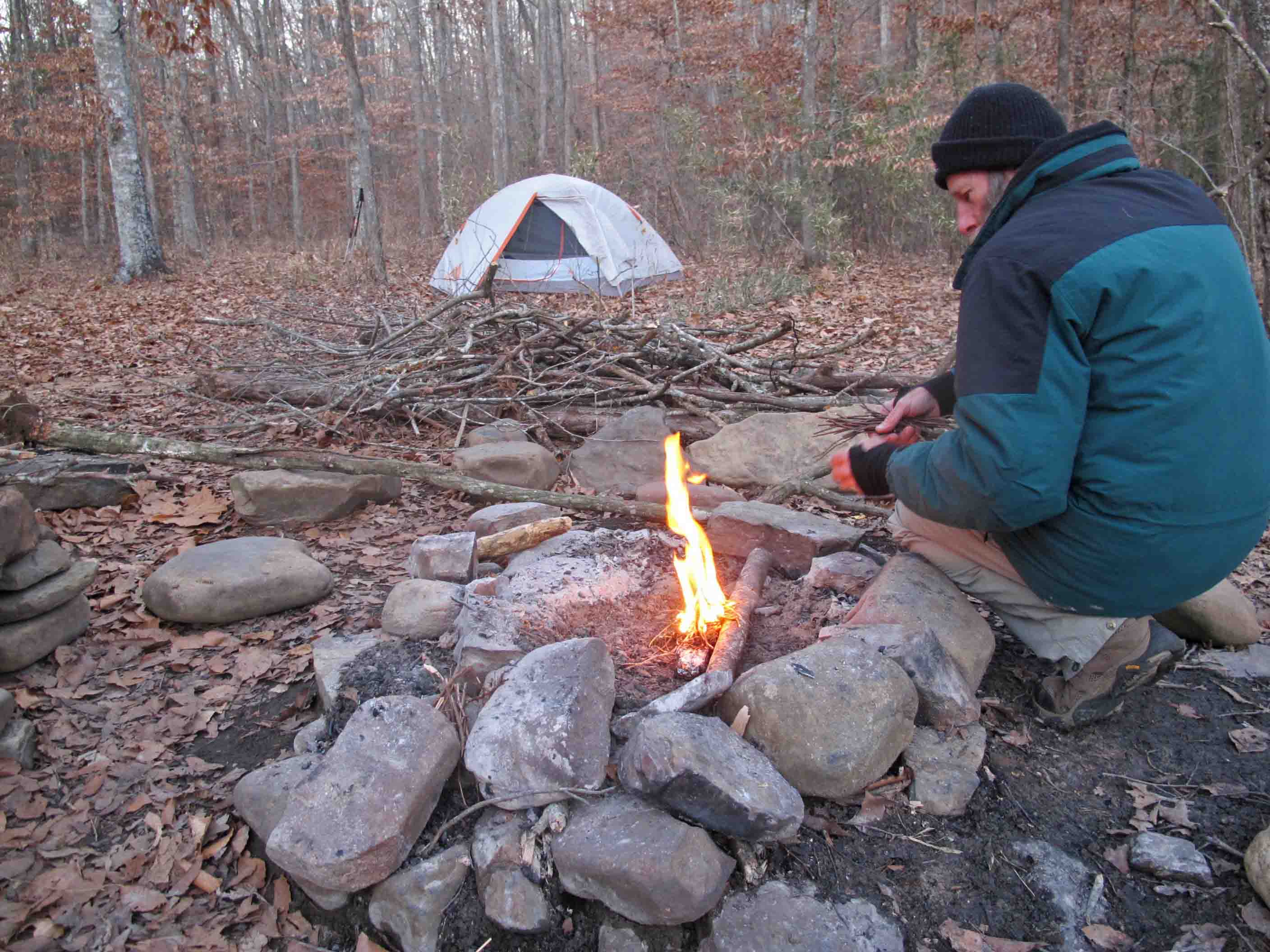
Breakfast and coffee in bed.
I chose to prepare my oatmeal and coffee in bed on this coldest morning of our trip. It is important to set the Esbit stove away from any tent surface to avoid fire hazard. Never burn a stove inside of your tent unless you’re wanting to end your outing early or have a death wish.

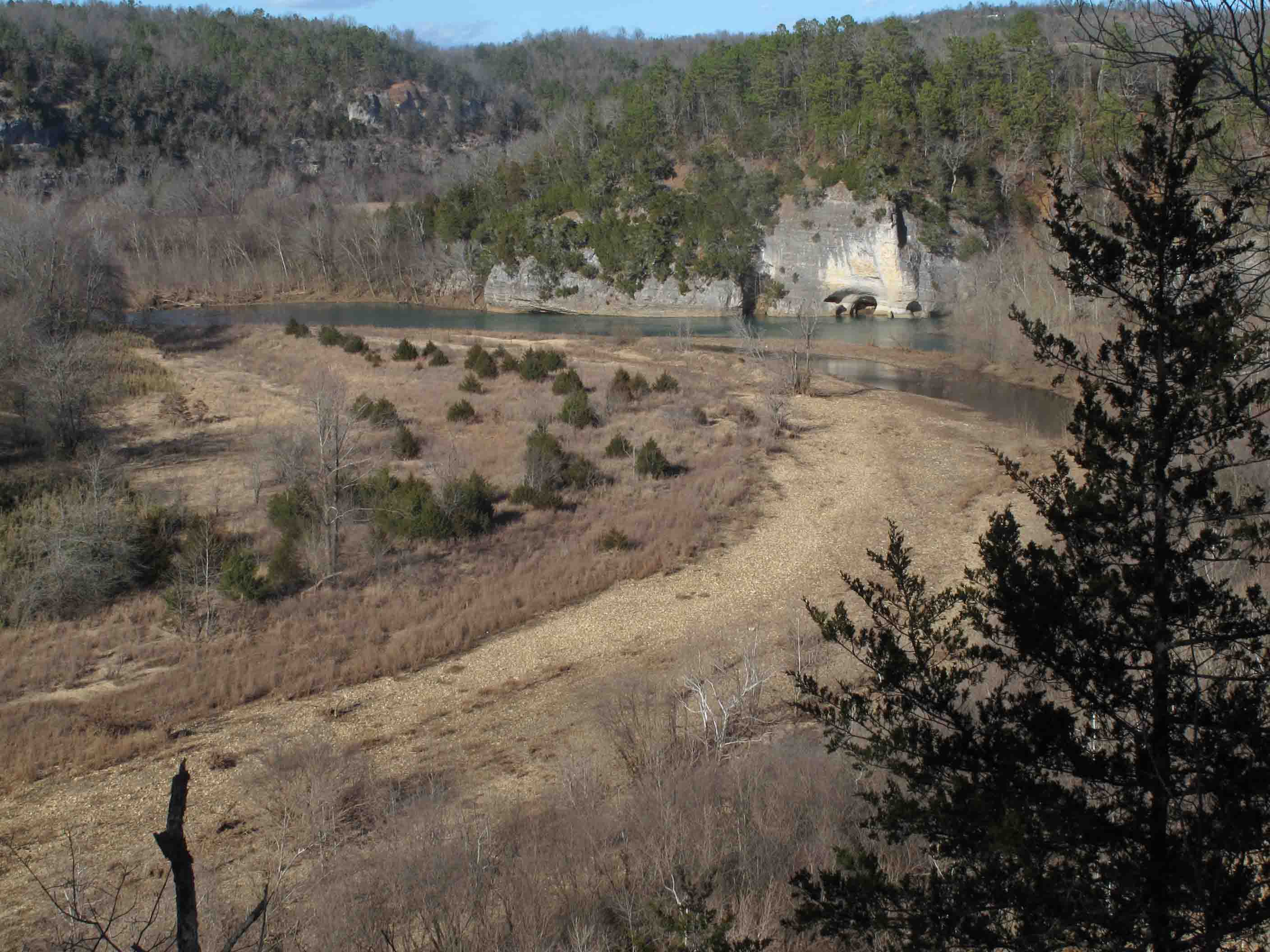
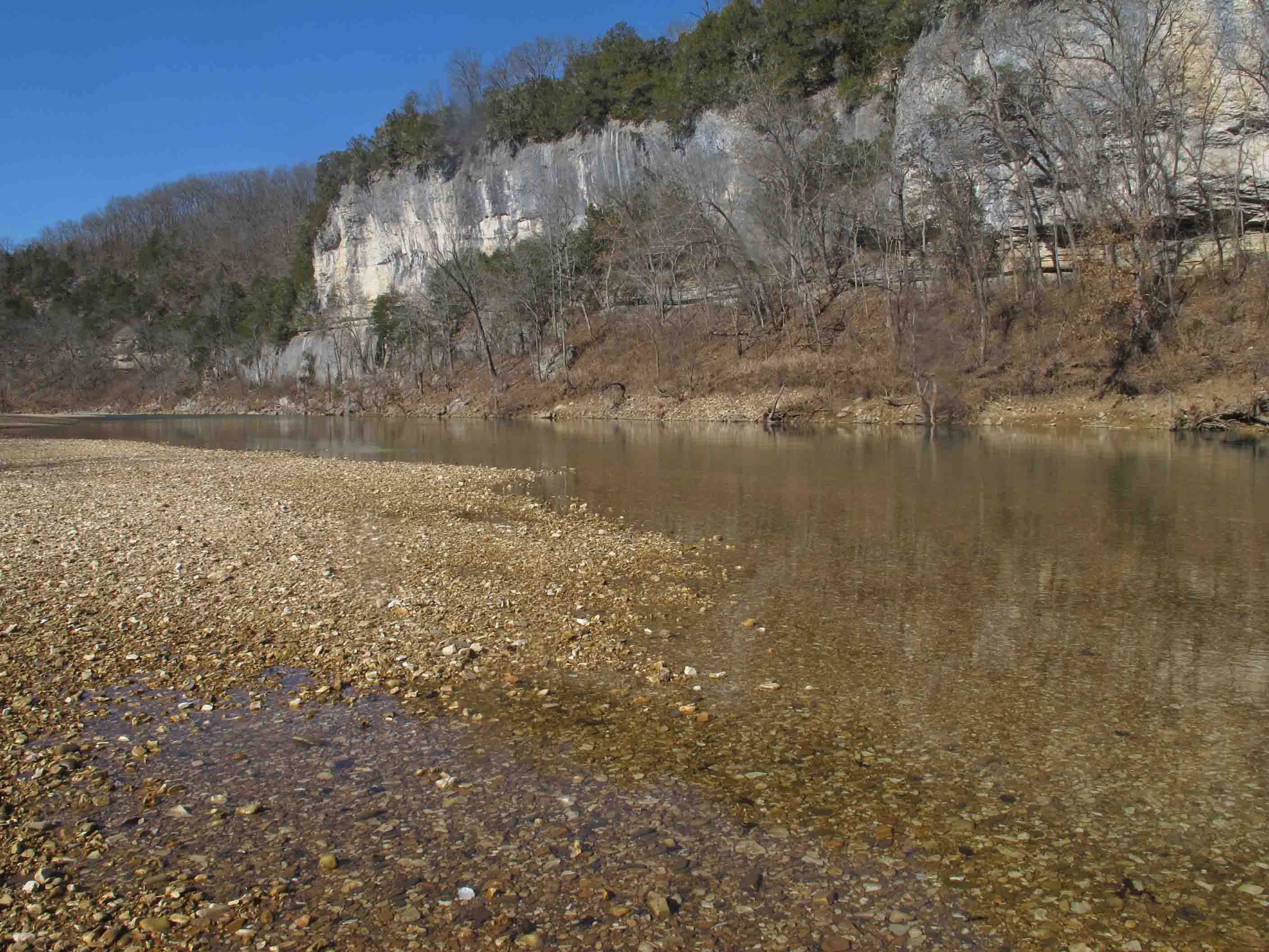
This sign at the beginning of the last four miles of the 165-mile original trail made the distance seem more real. We would complete the 165 miles, cross Richland Creek and continue fifteen more miles to complete the present 180 miles of the OHT on Monday, January 20th. We had to hike upstream for a short distance to find a wide place on Richland to cross since it is pretty deep as it draws closer to the Buffalo River. We were glad not to be crossing the Buffalo because it looked deep as in over our head deep. If we were ending our trip here at Woolum a Buffalo River crossing would have been necessary.
We took turns staying with our new hiking partner while the other hiked up the Narrs (Narrows) next to the Buffalo River. This was my first time to climb up on this sidewalk in the sky. It was a thrill to finally experience this beautiful and unique geological feature of our state.
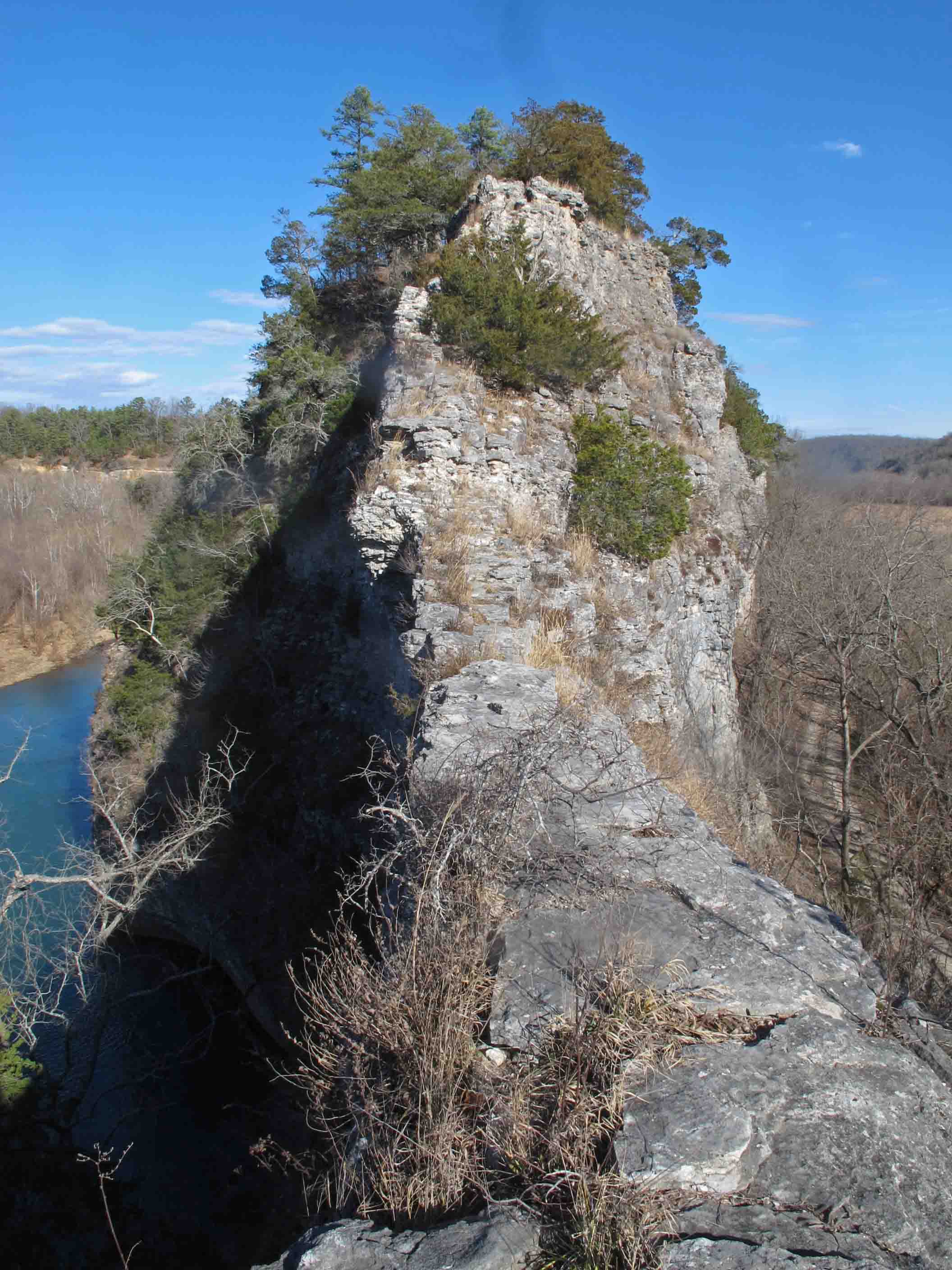
The Narrs, a sidewalk in the sky.

Looking toward the southeast side of the Narrs
Looking down the northwest side of the Narrs toward Skull Bluff.

Moderately confused.
We weren’t lost, just a little confused for an hour or so…
We carefully followed yellow horse trail blazes but when those blazes led us to a river crossing we knew something was wrong. We filtered water and began to backtrack in hopes of correcting our mistake. We started feeling a whole lot better when our revised route led us across Calf Creek and then back into the woods. We were relieved to find this sign indicating we were right where we wanted to be!
A sign was needed on the road where the trail branched off to Grinders Ferry. One white blaze there would have kept us on the OHT route but as it turned out we saw some beautiful open fields and needed to replenish our water anyway.

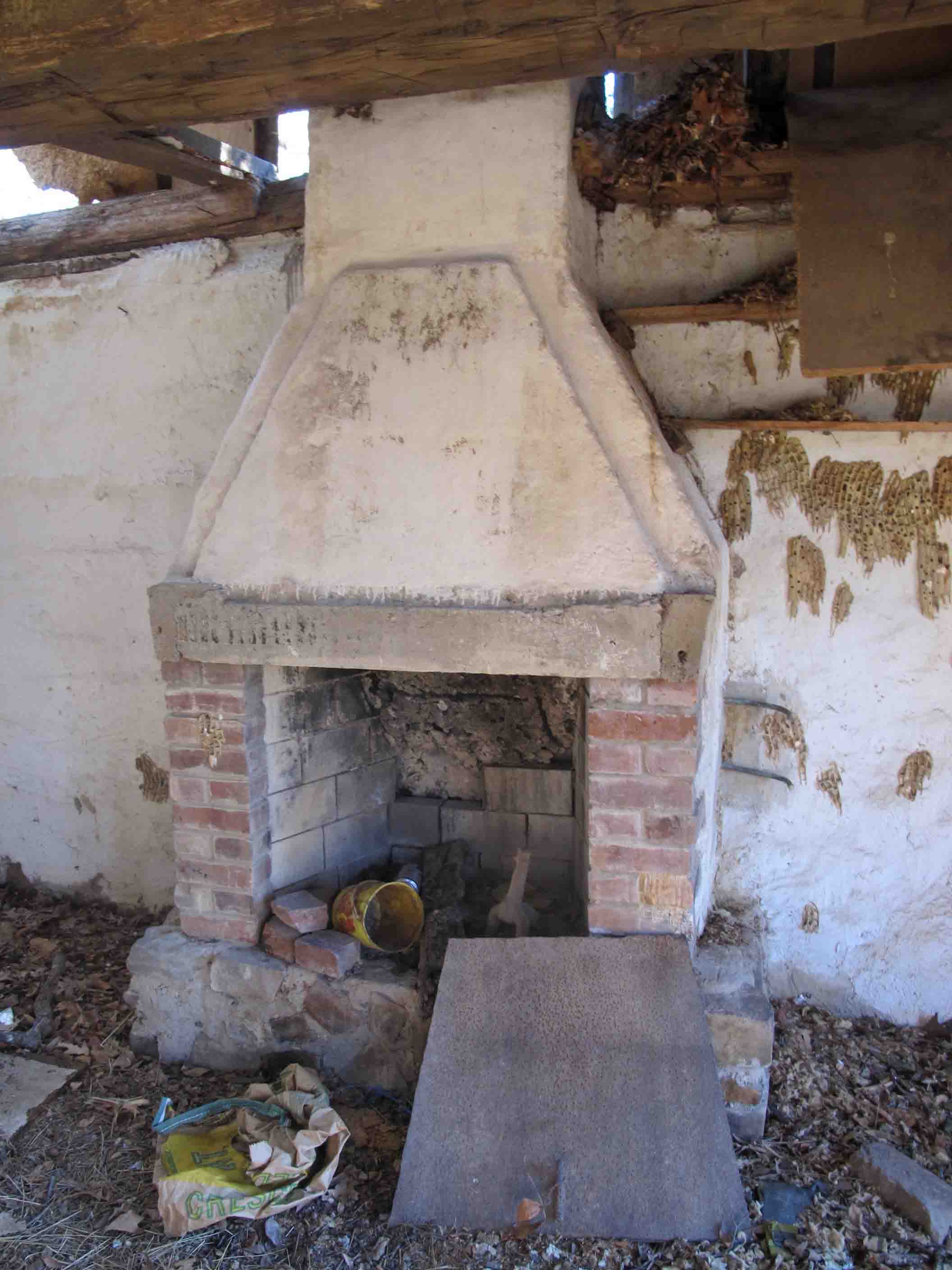
Collier Homestead
On our last night we camped in a cedar grove not far from the Collier Homestead. Mr and Mrs. Collier and their children began to homestead this property in 1928 with 15-cents to their name. They grew a variety of crops, worked as hunting and fishing guides and raised their family off of the land through hard work and grit.
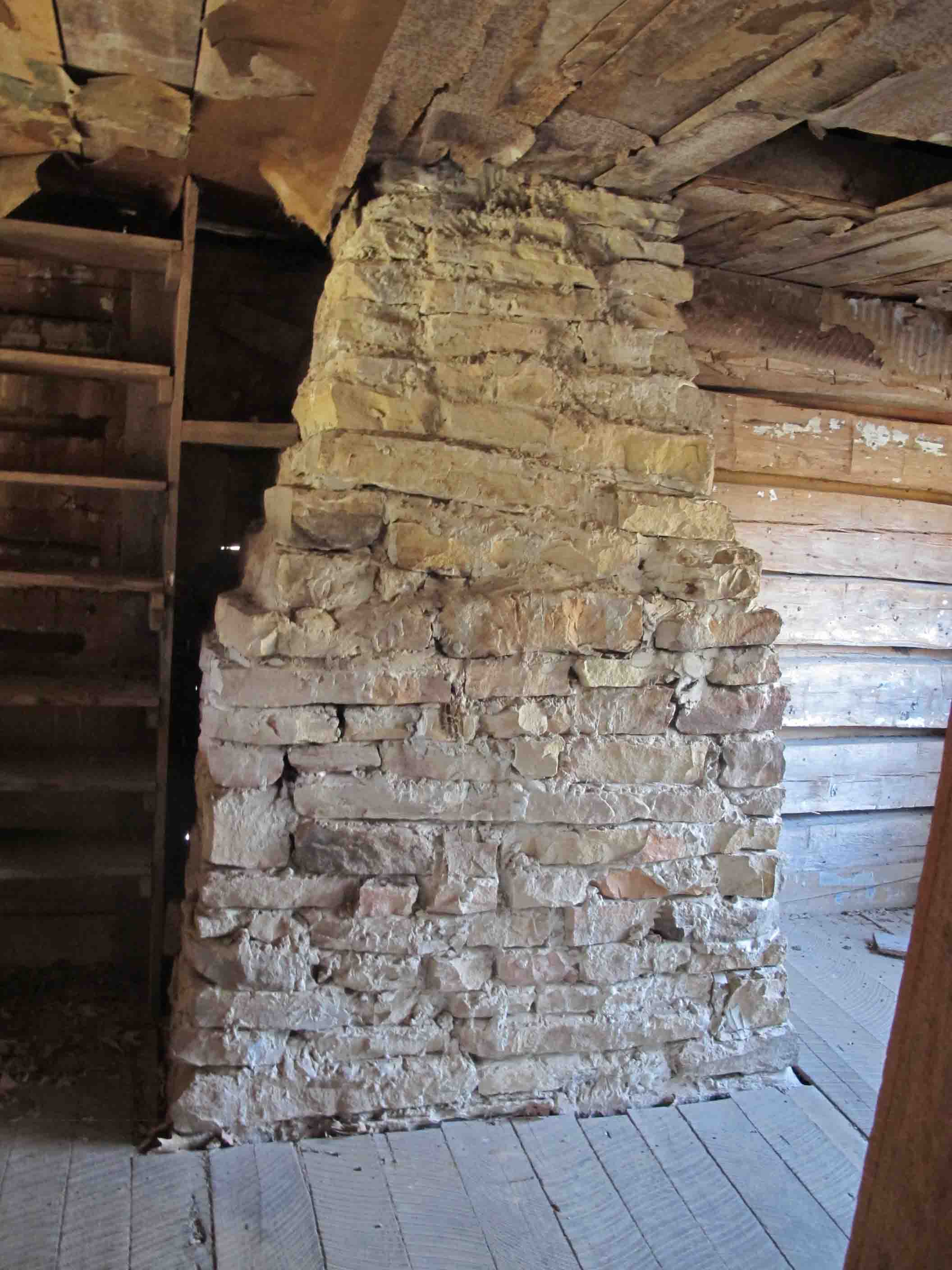
Fireplace in Collier Homestead

Remnants of insulation on a wall of the Collier Homestead.
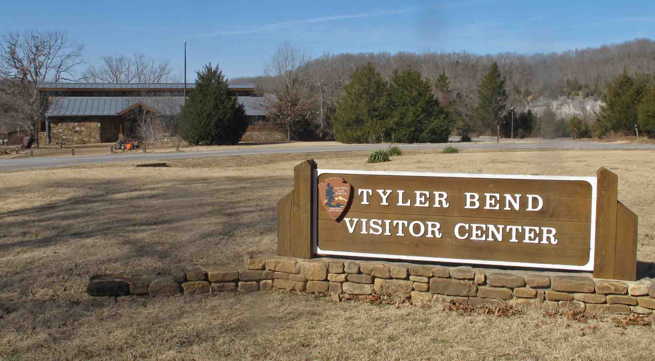
We were disappointed that the visitor center was closed due water damage repairs. We were looking forward to reading more about the area while waiting on our shuttle. A sign on the door said it would be open January 21st. Joey, a UPS driver exercising on his lunch break, shared his cell phone so we could confirm our arrival with our shuttle. We enjoyed sharing the story of our third hiking partner with him.
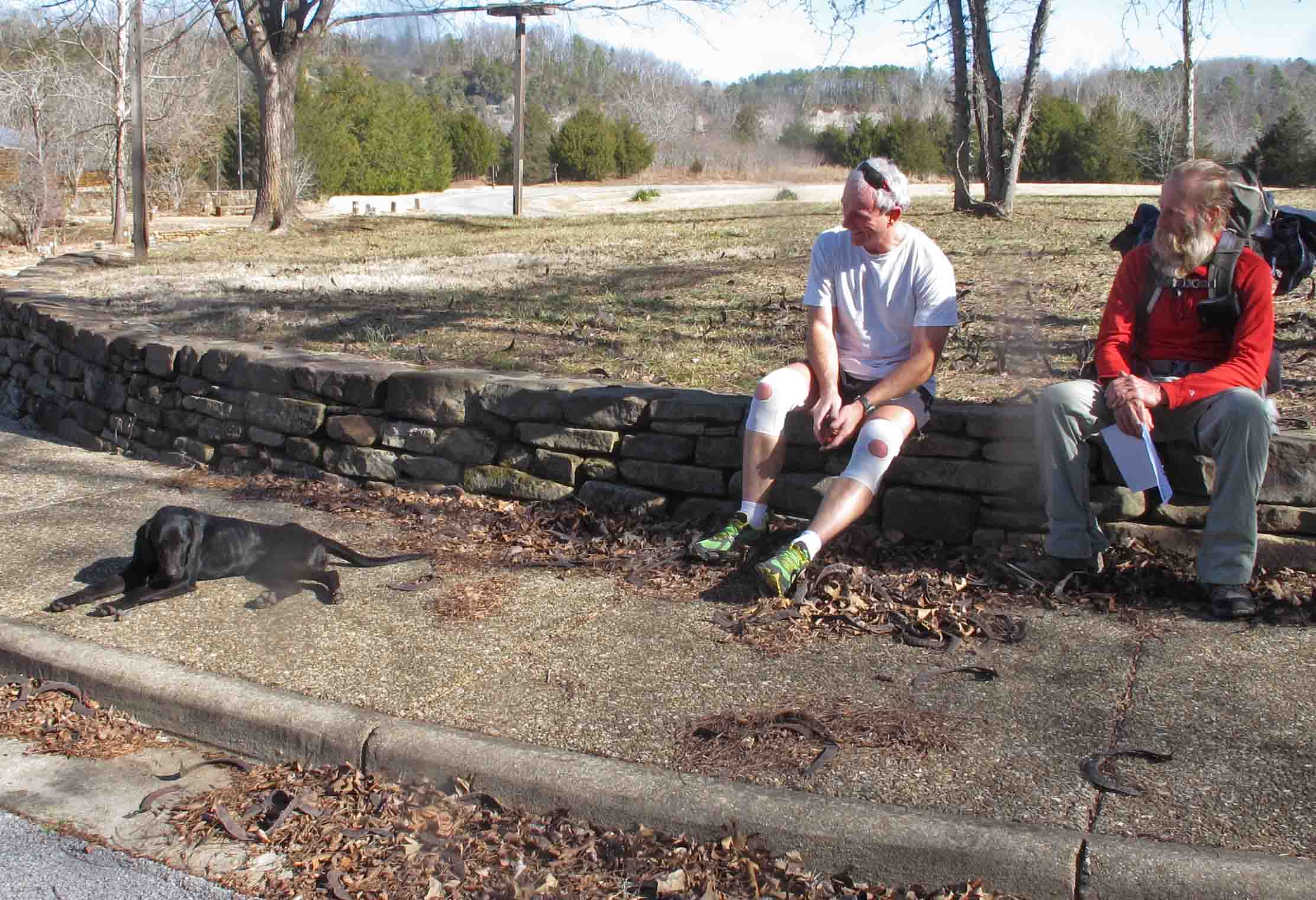
Joey taking a break from his lunch break workout.
Buffalo River at Tyler Bend
It felt good to splash cold Buffalo River water on my face and arms while waiting for our shuttle. Hiking 180 miles of the Ozark Highlands Trail had been everything I’d hoped and more. All expectations were exceeded which is typical of backpacking experiences. I was looking forward to a warm shower and my wife’s wonderful meals but I was also beginning to plot my next long hike. Where to go from here? So many trails and so little time…
Update on Hiker, our third travel partner:
Hiker is currently my guest. I’m enjoying watching her gain strength with some moderate but regular nutrition. She is gentle with young children and has good manners. The only time she appears aggressive is when she glides through the woods at high rates of speed. Here’s a post four months following her adoption after she’s logged some serious miles: What Makes Hiker a Good Trail Partner?
We had several great suggestions for names. I went with Hiker since the sound of this word projects well in the woods and it describes one of her strongest attributes.
The following pictures show Hiker’s progress beginning at Tyler Bend and the end of her OHT hike. She was pretty exhausted.

Hiker on January 20th after completing 40+ miles on the OHT with limited rations.
Hiker exploring Little Frog Bayou on the Lake Alma Trail.
These pictures were taken on Hiker’s first four-mile hike around Lake Alma just five days following her 40+mile trek after being abandoned and near starvation on the Ozark Highlands Trail. She was looking and feeling much better after her visit to Dr. Green at the Alma Animal Clinic.

Hiker picking her route down a bluff portion of the Lake Alma Trail.
Hiker on February 3rd having gained about 7 pounds from January 20th.
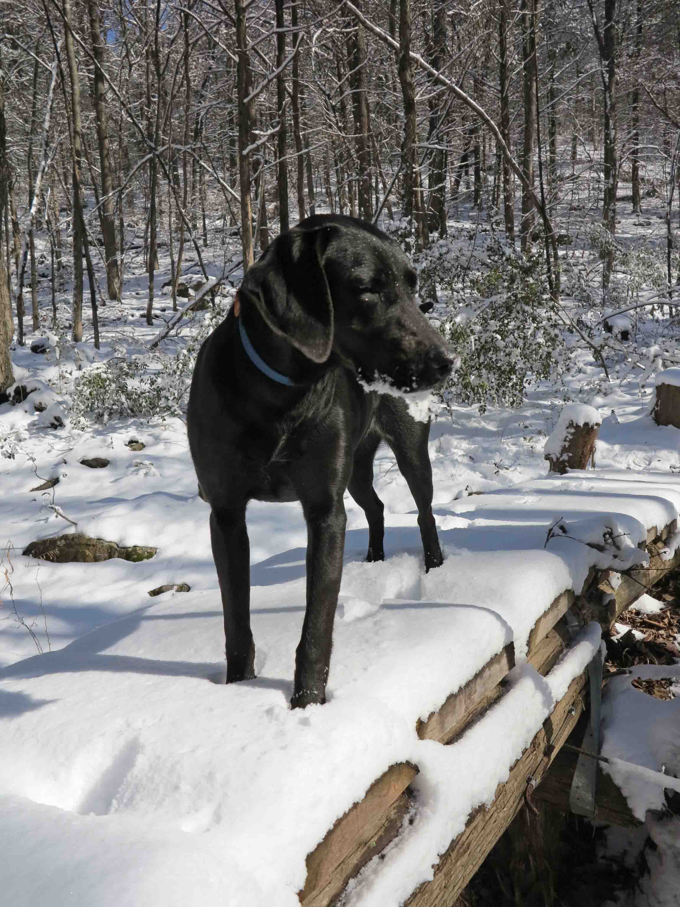
Hiker crossing a bridge on the Lake Alma Trail on February 3rd, fourteen days after her arrival in Alma. She was enjoying the snow and managed to acquire a snow-beard from playing as she hiked.

Hiker on February 22, 2014
Hiker after thirty-two days in Alma. She’s stronger than ever and loves to travel by trail!
Hiker on March 18th, carrying her own food and stronger than ever.

Crossing Little Frog Bayou with two days of dog food in her backpack.

Hiker’s March 24-25 trip on the Shores Lake, White Rock Mountain Loop, and Salt Fork Creek.

Thru Hike patch earned for hiking the first 165-miles of the OHT.
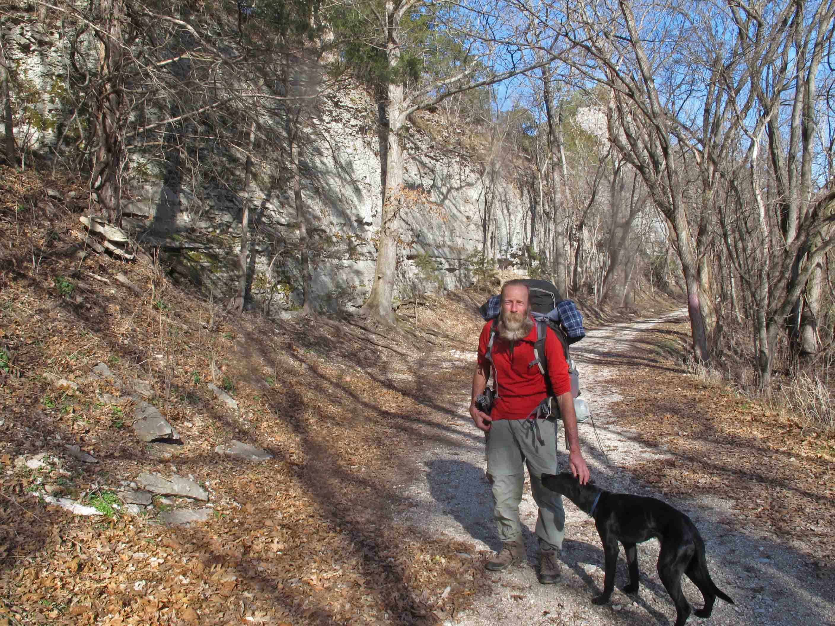
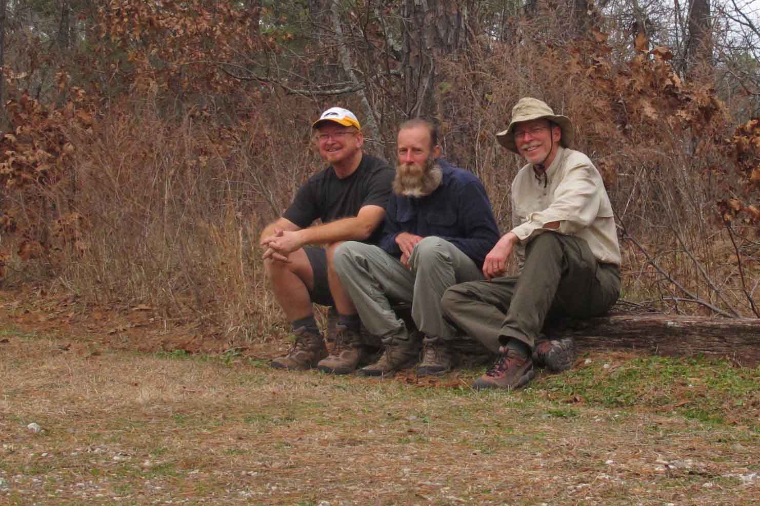
The idea of this hike began with a recurring and nagging thought over a period of months… “I want to hike the Ozark Highlands Trail (OHT) end to end.” I had hiked most of the trail in pieces and random order but never in sequence from beginning to end. I planned to hike it alone but when hiking buddy Bob mentioned that he would like to join me I was pleased. He has great outdoor skills and he’s a strong hiker. As a practical matter, the trip becomes safer with a second person, especially since we have a compatible hiking pace and mutual respect for each other. We were pleased to welcome another fellow hiker and good friend, Steve, into our group for the second leg of the trip. We would have been happy to have him for the whole outing but his work schedule wouldn’t allow this.
We decided to do the OHT in two stages, taking a couple of days off for Christmas. As it turned out, heavy rains changed our itinerary and dictated that our last five days of hiking would occur later in January so we could avoid the Buffalo River crossing at Wollum.
We decided to do the OHT in three legs: Five days followed by two days for Christmas. We would then hike six days, completing the final leg in January with an additional five days.
Planning and packing took lots of time but the anticipation is an important part of the enjoyment. Packing equipment is similar to other shorter trips. The challenge was to prepare food for 5-6 days of hiking at a time. I kept my dehydrator running for a couple of days with the goal of avoiding commercial dehydrated meals and their high salt and funky taste.

Dehydrated gold potatoes
Determining which clothes to pack was a challenge. Winter in Arkansas can bring a range of temperatures. Nighttime temperatures were expected into the twenties with daytime temps anywhere in the forties to sixties. One very important piece of equipment is a waterproof stuff bag. In this I place a base layer to ensure that I have dry clothes at the end of the day when I crawl into my tent. As an added step I place these clothes in a freezer ziplock bag.
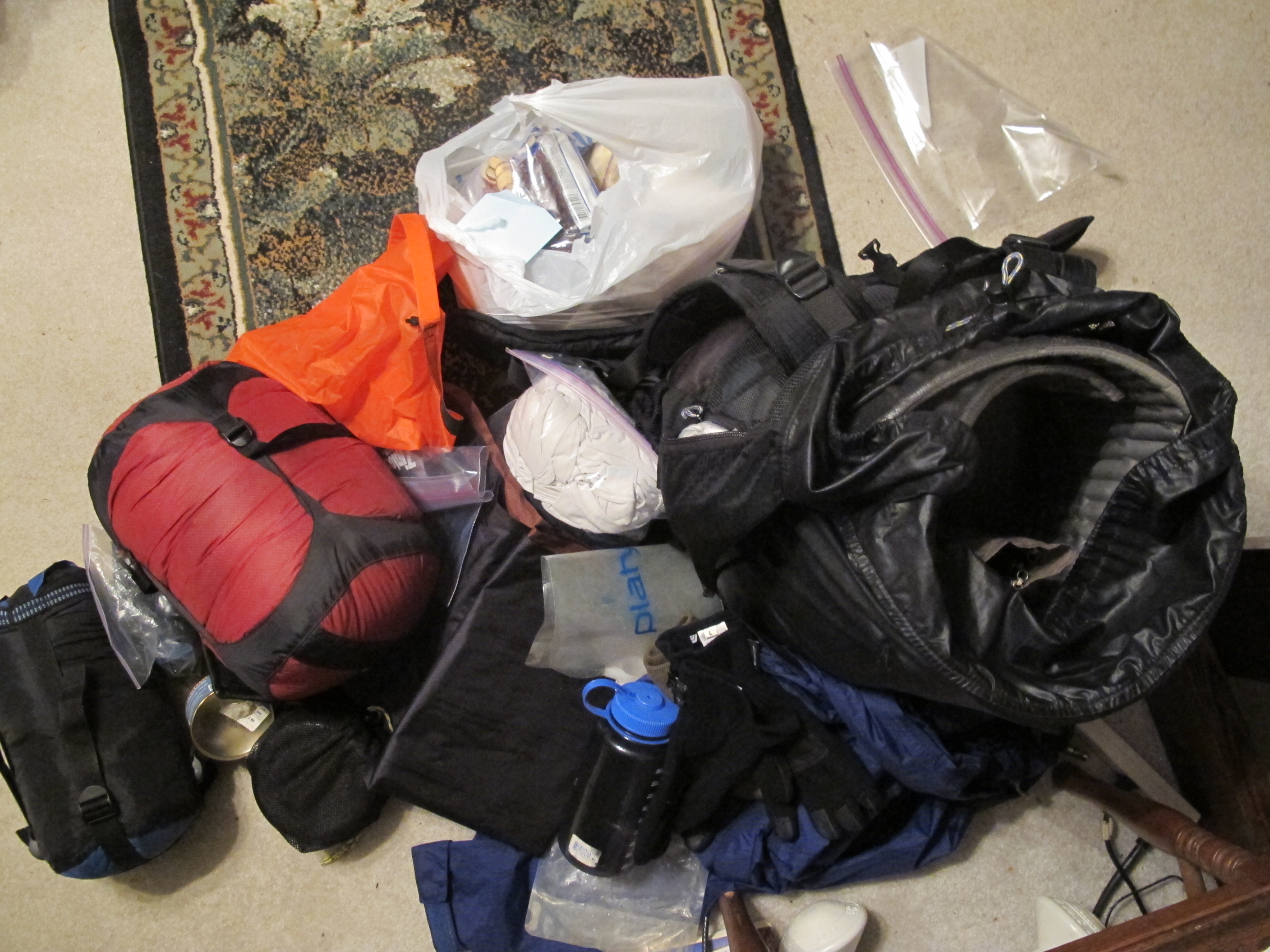
Backpack pile taking form
In the above picture you’ll find my sleeping bag in a waterproof stuff stack, orange waterproof bag for clothes, tent, ziplock with base layer, food bag for one leg of the trip, stove, water, etc. This pile eventually takes shape after going over a checklist several times.
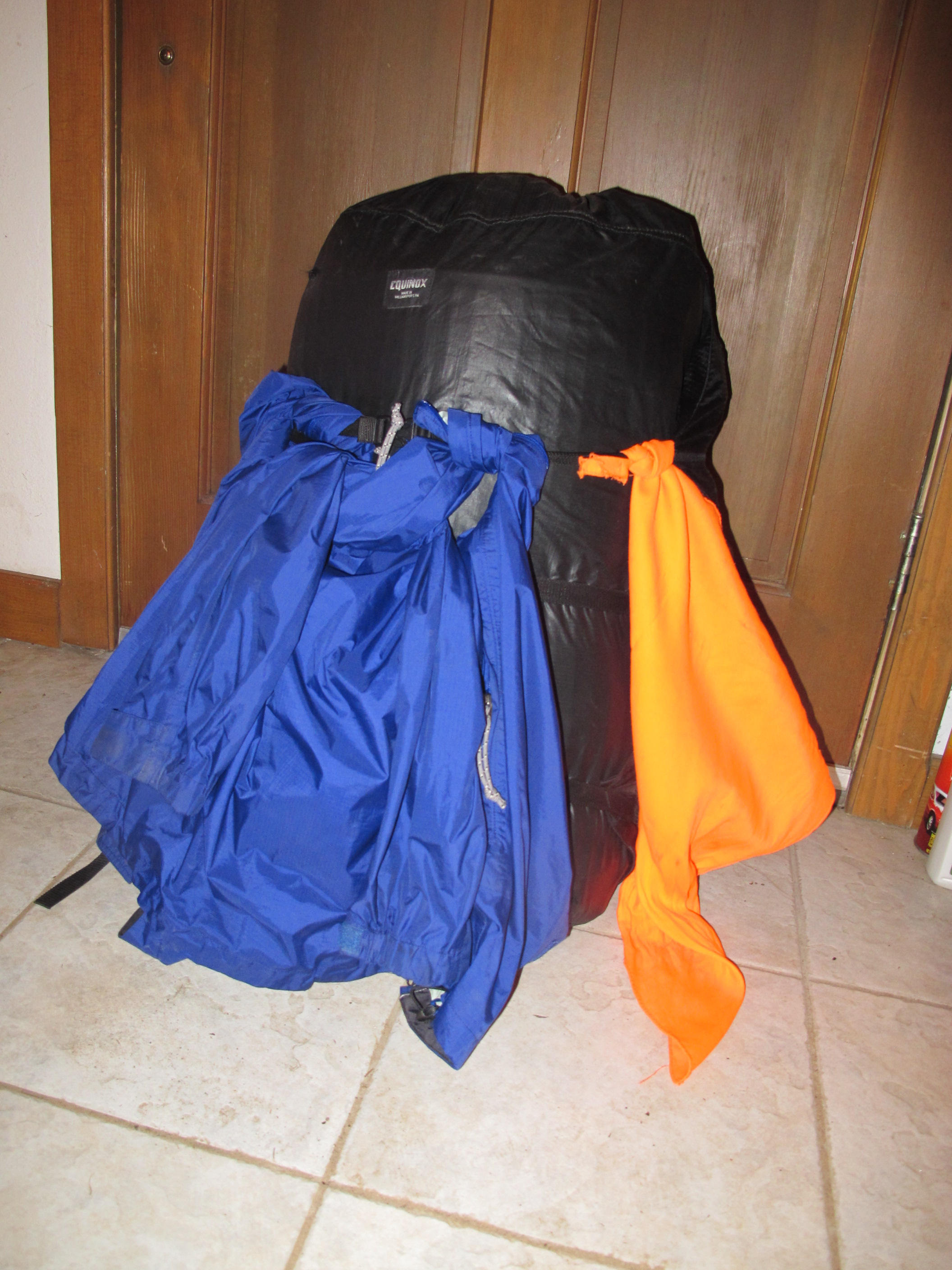
Backpack loaded and ready to go.
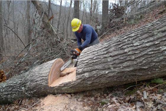
Finally we begin! Bob and I met at Lake Fort Smith State Park and stepped off of the concrete sidewalk leading to the beginning of the OHT. It felt good to be on the trail with only 180 miles to go. During the first few miles we saw three raccoon and a bald eagle.

Beginning
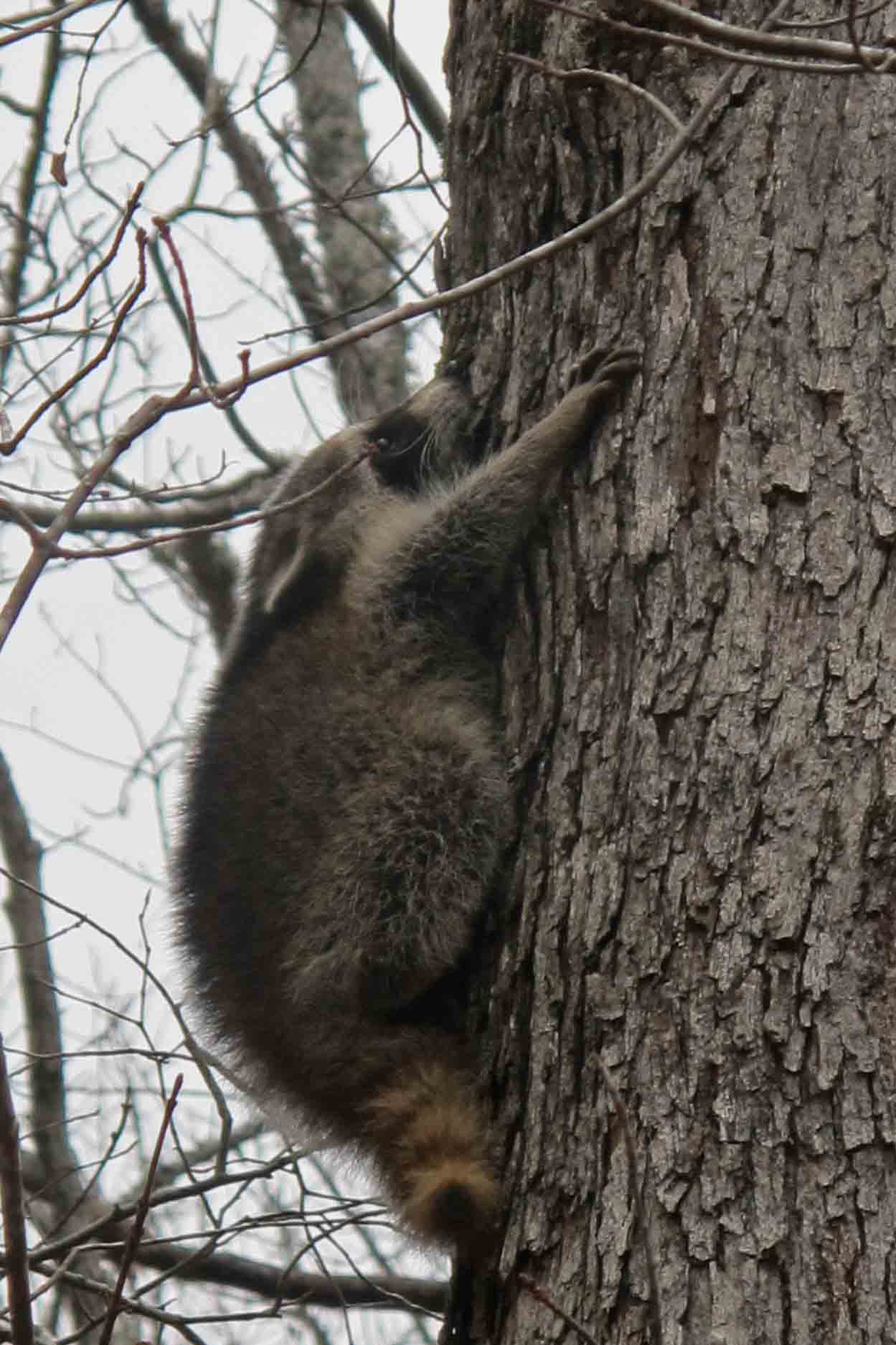
Raccoon next to the OHT.
One of many camping sites we were to see over the course of our hike. There was always an ample supply of water and firewood.

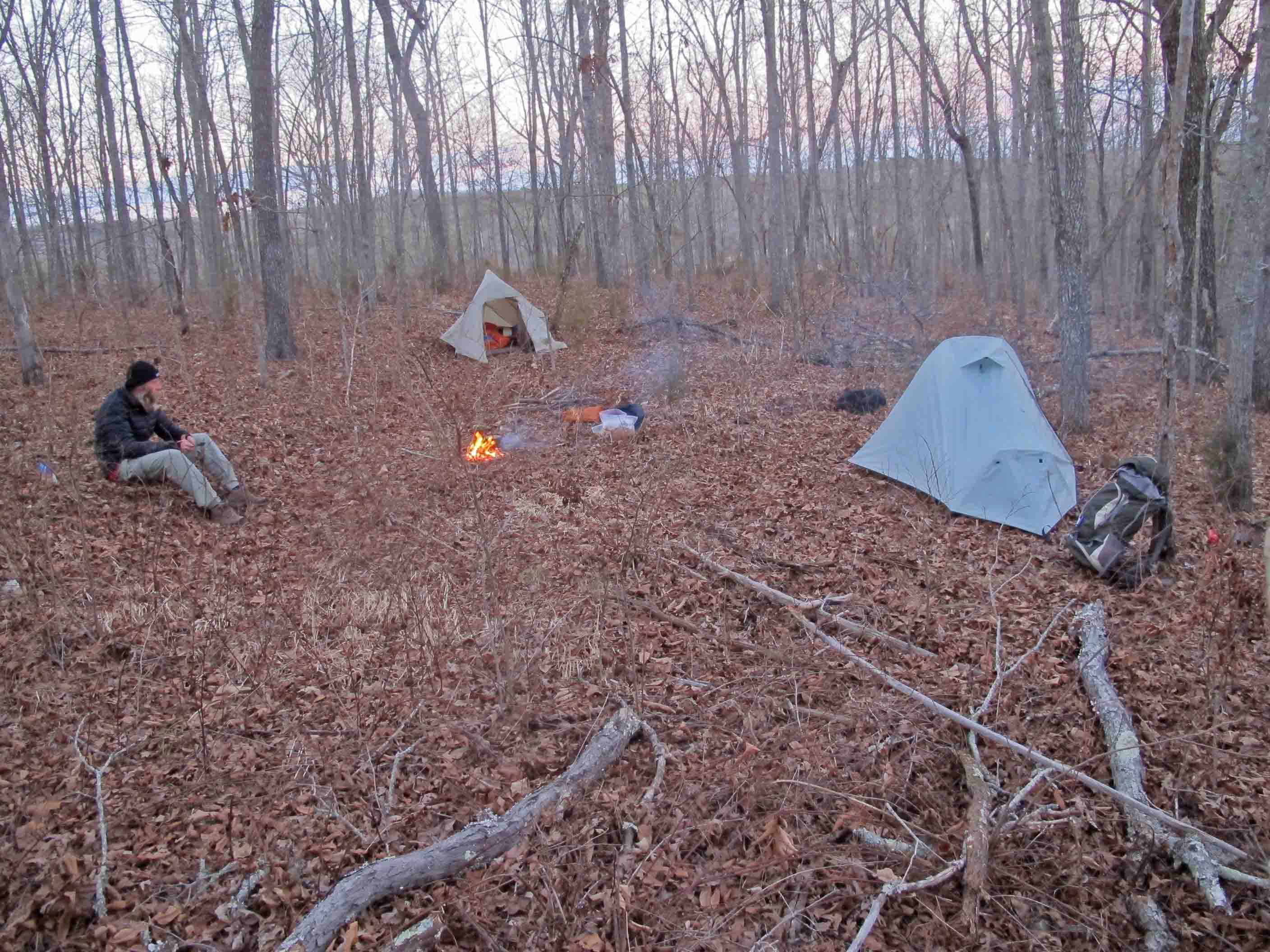
Making camp
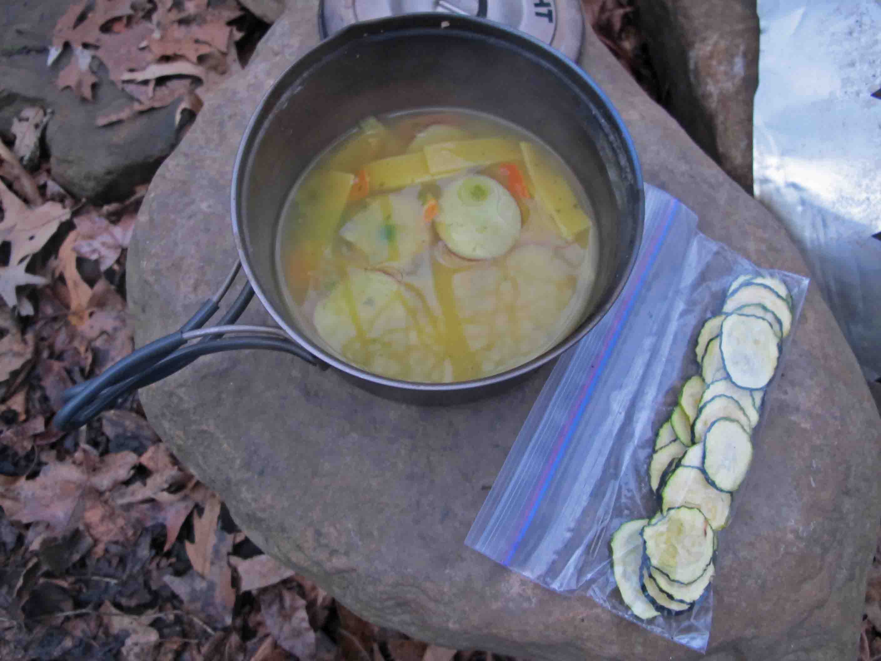
Dehydrated potatoes and squash
Yummy … I did discover that the potatoes are much better if allowed to re-hydrate for an hour or so before cooking. This wasn’t always possible which just resulted in chewy but tasty potatoes.

I carried a notebook and pencil and had great intentions of reflecting on each day and recording my thoughts. By about the second day I realized that this was unlikely. On a long hike, the days have a rhythm and flow to them. My “to do” list became very simple and consisted of doing things that related to meeting basic needs while on the trail. On my third night I wrote what was to be my “to do” list for the next eight days, “walk, eat, sleep, repeat.”
That pretty well summed it up so I put my pencil and notepad away and began focusing on the trail, not my thoughts about the trail. I let my mind fall into the natural rhythm of walking 6-7 hours each day. After making camp, filtering water and preparing the evening meal, I let my mind flow back over the trail and enjoy the scenery once more without any obligation to write about it or learn from it. I began to enjoy the natural silent times around the campfire when no one felt obligated to speak. A story or comment might come out of the silence but there was the luxury of time to really hear and think about what was said.
I commented to Bob and Steve that I was really struggling to get by with only eleven hours of sleep each night. By the time you sit around the campfire until 7:00 p.m. it’s been dark for almost two hours. Your body says, “Hey, I’m getting cold. Why don’t you get in that warm sleeping bag and let me rest!” I found that my body could use this extra time for repair and maintenance. The trail, combined with rest, added a new type of strength unlike what I felt from typical daily workouts.

Falls along Spirits Creek

Crossing a swollen Spirits Creek
Day 2 and 3 brought light rain then heavy rain. I couldn’t resist taking a picture of Bob crossing Spirits Creek. He normally doesn’t use a stick whereas I use two hiking poles to stay erect while crossing creeks. His balance is impressive. On this day however, he used a stick to probe the floor of the normally clear Spirits Creek. Strong rains made all creeks cloudy with sediment. I was delighted to be on the other side.
I turned my camera to a waterfall spilling into Spirits Creek using a tree as a tripod. Then the camera was placed deep within my waterproof stuff bag for the remainder of the day due to rain. My only regret was failing to get a picture of what would have been our next creek crossing.
About five miles later, Fane Creek made Spirits look like a trickle. We ended up bushwhacking down the west side of Fane Creek for a half mile to a bridge and then following the road back to the trail to continue on. Seeing the Rock House was a relief. We were thoroughly wet, somewhat chilled, and hungry.
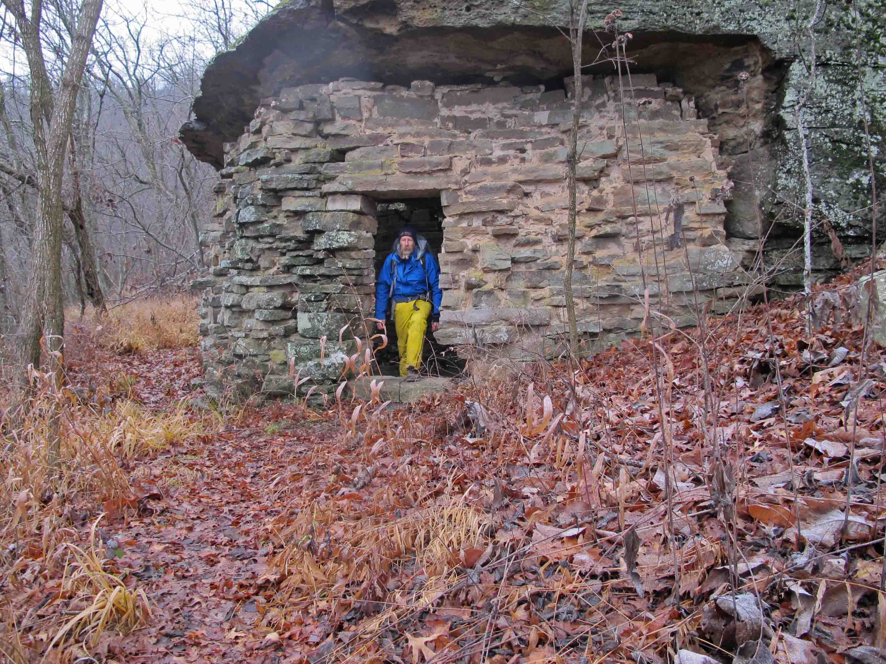
Refuge from the rain in the Rock House
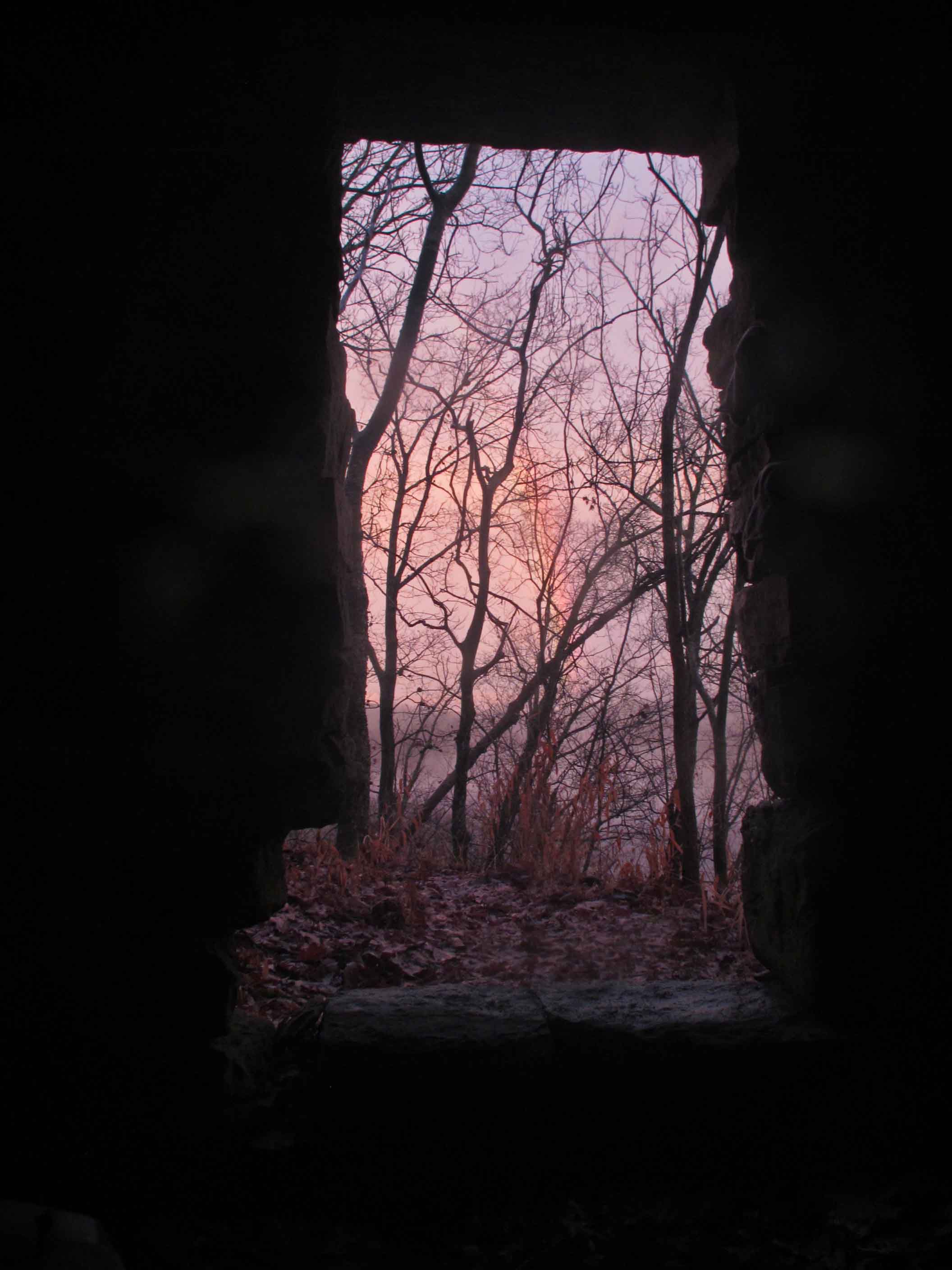
View of a faint rainbow from the Rock House
A rainbow to the east followed through on its promise of better weather to come. We began to dry out while hiking the next day. Hiking over Hare Mountain resulted in some colder temperatures, probably down into the twenties. We wondered what the water levels at Harrods Creek would be like. Nothing like anticipating another bushwhack! What we found was a somewhat swollen Harrods Creek but we crossed without difficulty.
Frosty hiking as temperatures plummet.

One of many waterfalls along the trail.

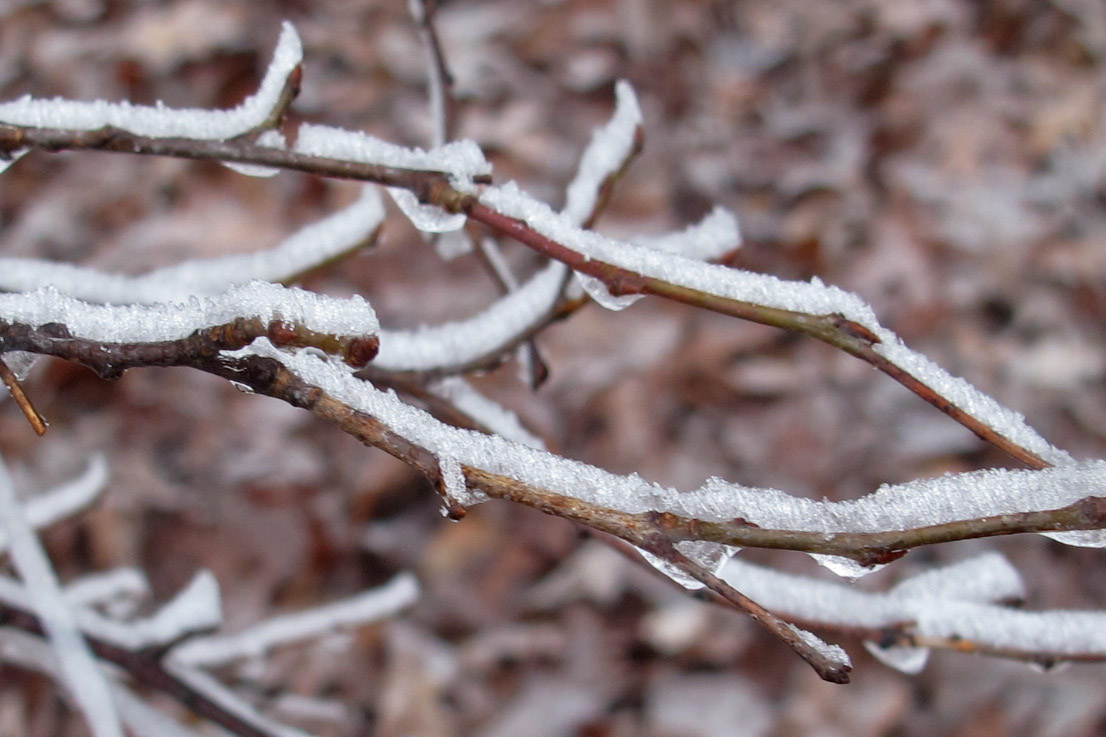
Frost flower
Colder temperatures produced some little rewards along the trail. Frost flowers could often be seen during the morning walks. Once the sun came out they vanished. I enjoyed this little heart-shaped frost flower and took a pic to share with my wife who enjoys finding naturally occurring heart shapes in nature.

Frost Flower

Nice lunch spot overlooking the Mulberry River Valley
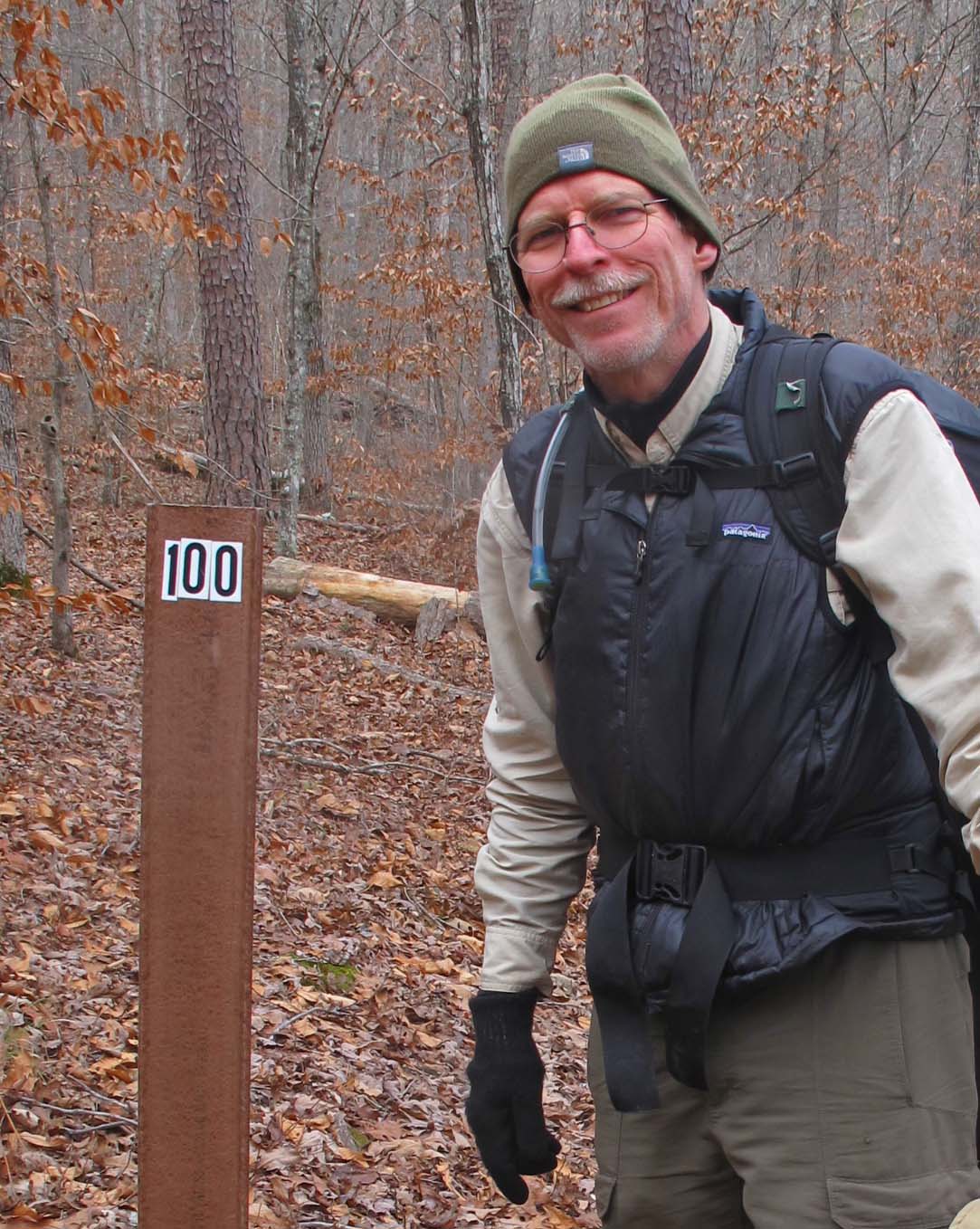
Passing the 100-mile marker.
Making the first 100 miles felt good! This left 25 miles to hike over the next two days and then 55 more miles to hike later in January.


Jerky snack

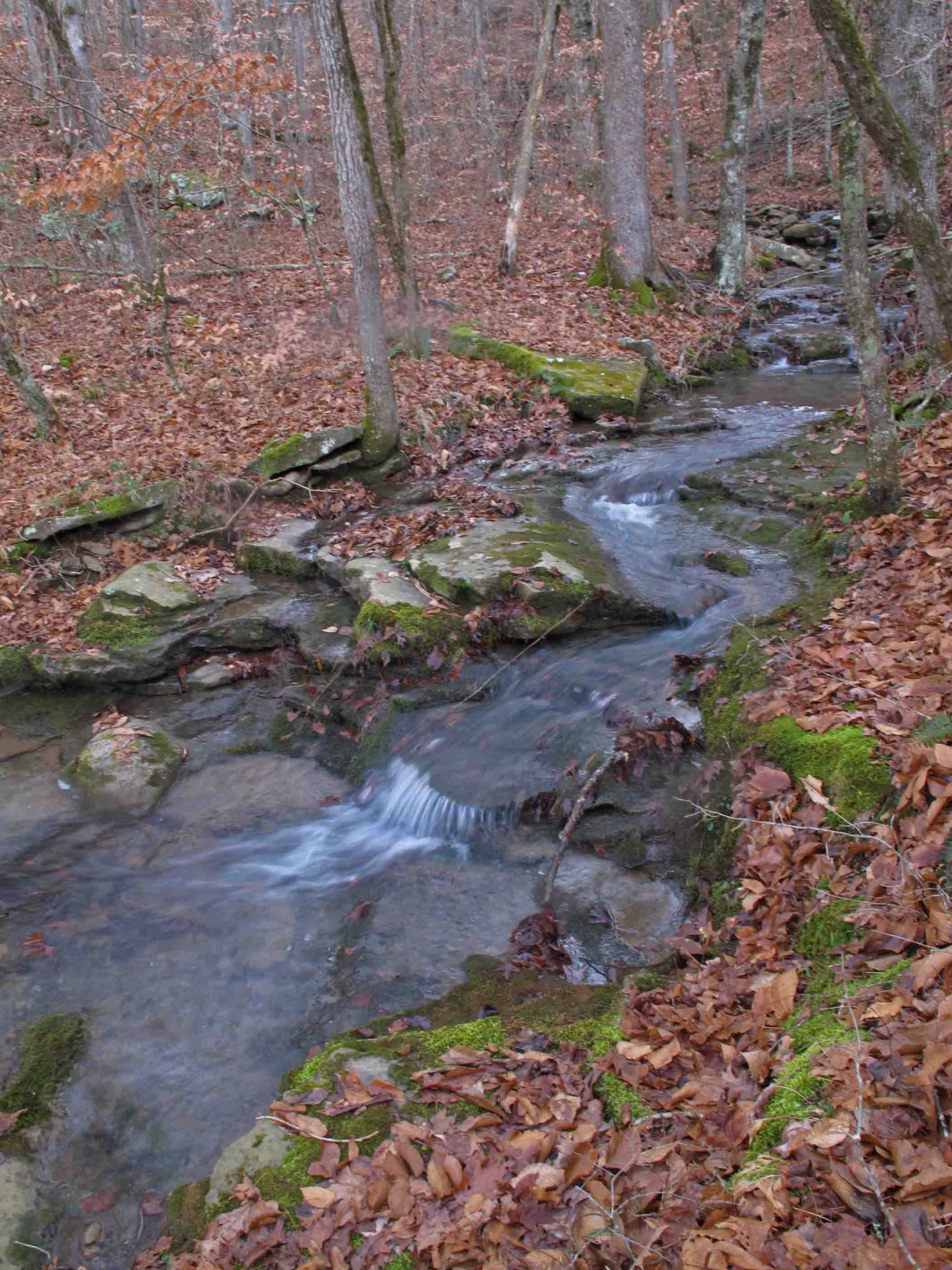
Cedar Creek
Hurricane Creek Wilderness Area

Icy bluffs along the trail.

Hurricane Creek
Hurricane Creek
Bob building a fire.

Sawyer water filter

Waterfall along the trail.

Hurricane Creek area

Hurricane Creek Wilderness Area

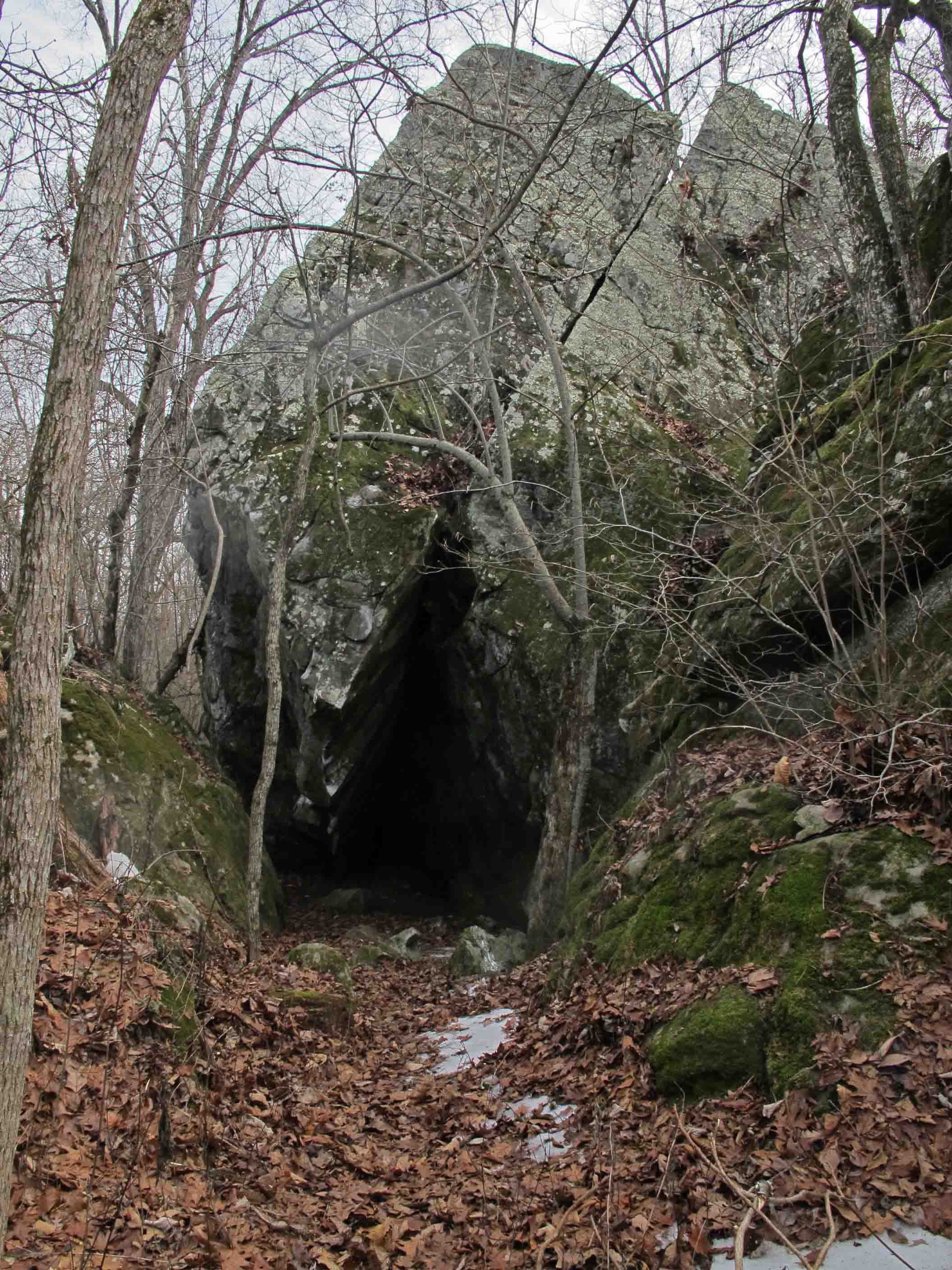
Detail of rock formations in the Hurricane Creek Wilderness Area
The Hurricane Creek Wilderness Area contains a maze of house-size boulders. The work of time, water, and temperature changes could be seen on the face of these boulders. I found it difficult to keep going through this section of the trail. My hand kept spontaneously reaching for my camera.
Finished the first 125 miles at Fairview Camp Ground.
The final climb from Hurricane Creek up to Fairview Camp Ground on Hwy 7 really kicked me good. It was as if the trail was anticipating my departure and wanted to leave me with that good feeling of total exhaustion! Wildman, who hiked many long trails during his long life, used to say he would find himself hiking slower as he approached the end of a long hike. He didn’t want it to end. I now understood what he meant. The climb, combined with my wish that the hike wouldn’t come to an end, made for a slow and reflective pace.
As we finished this leg of the outing I found myself wishing I could just continue on without stopping. I was firmly entrench in the rhythm of the trail….walk…eat…sleep….repeat…
To read the rest of the story go to Walk, Eat, Sleep, Repeat, Continued.
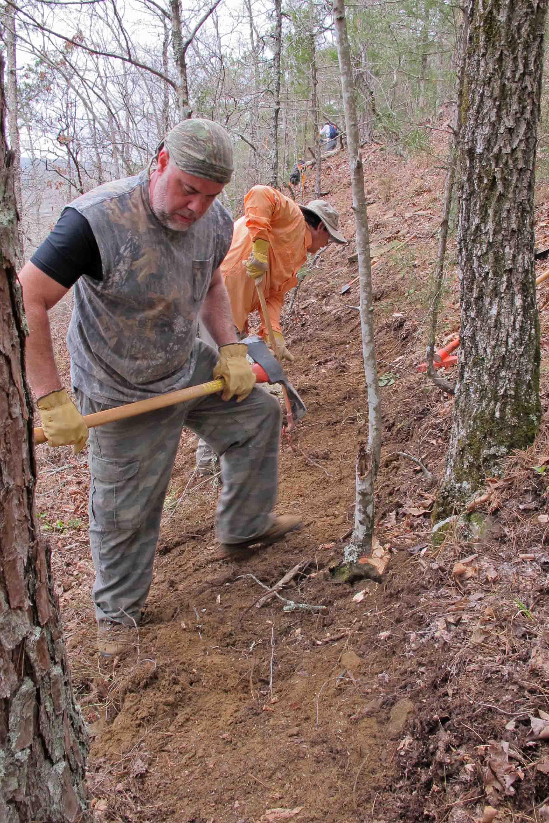
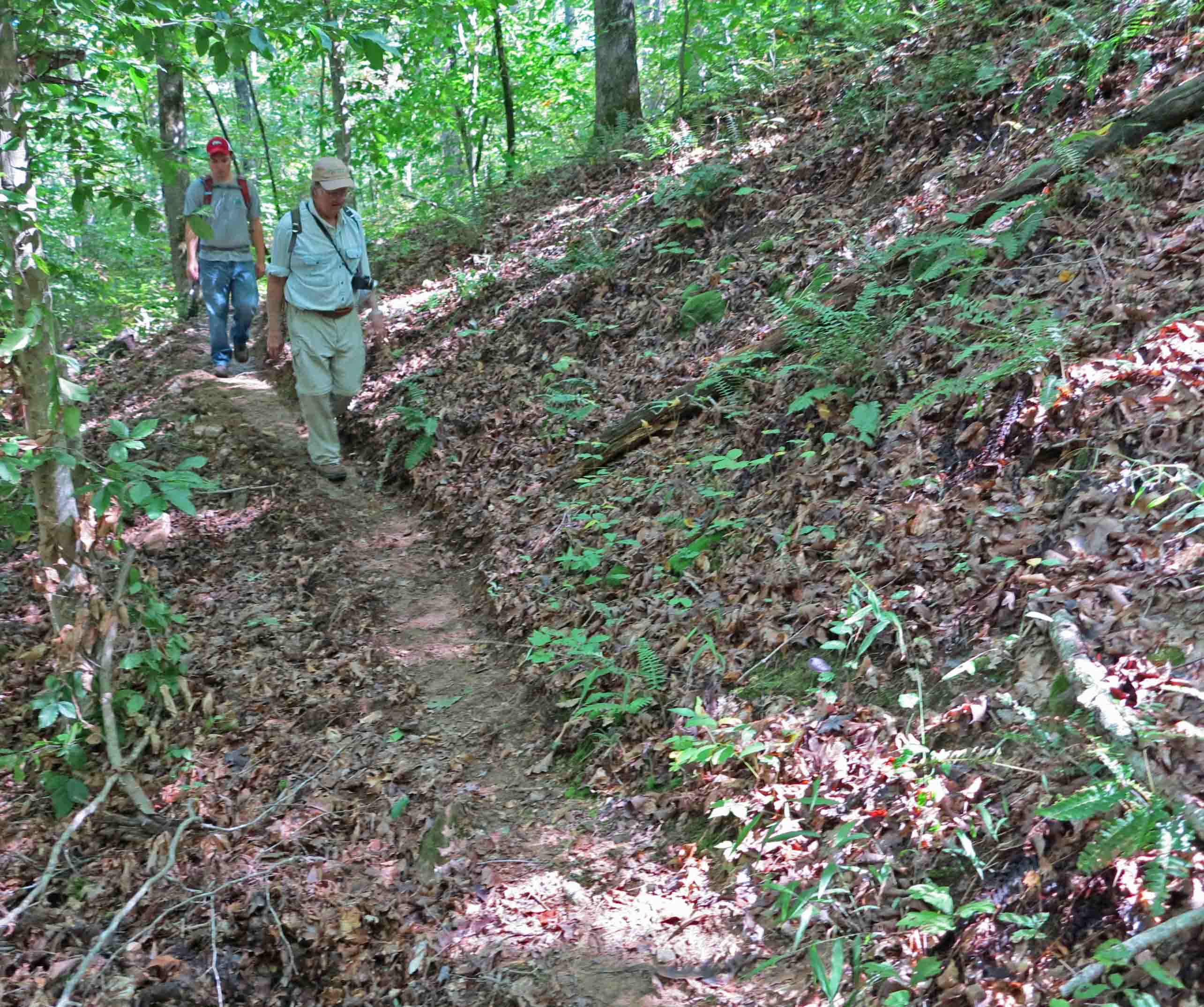
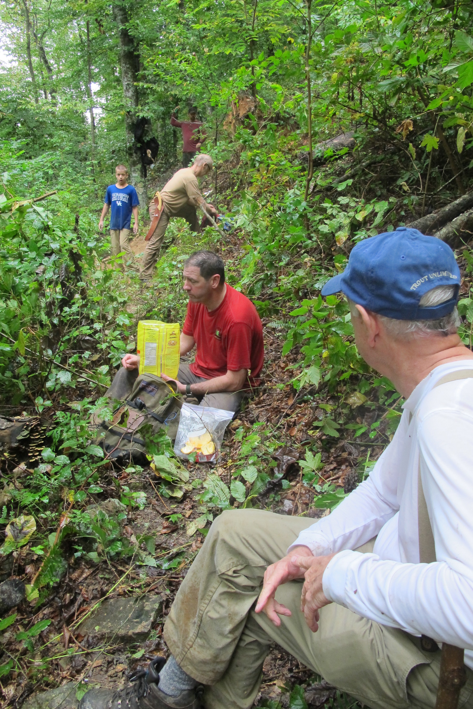
On a recent hike of the first 125 miles of the Ozark Highland Trail I was reminded of the importance of trail maintainers/volunteers. We saw evidence of some great work that has been done over recent months and years.
Then I returned to my “home trail” and what I saw really amazed me. Volunteers had obviously descended on the Lake Alma Trail and done their magic. Following recent ice it was difficult to make it around the four-mile loop but today I enjoyed a relaxing hike, noticing evidence of trail work at every turn.
Volunteers are the reason we’re able to hike the beautiful trails of Arkansas! As a novice hiker I assumed that trails rarely needed attention. A few years ago I tried to hike a small neglected trail and realized the impact of volunteer trail maintainers. Now, as an experienced hiker and occasional trail volunteer myself, I know the value of the work done and the satisfaction derived by doing trail maintenance or trail building.
If you’ve never participated in a trail workday, I would encourage you to try it. You’ll enjoy a good workout and end the day with a deep sense of satisfaction and service to the wilderness and your fellow hikers. Thank you volunteers!

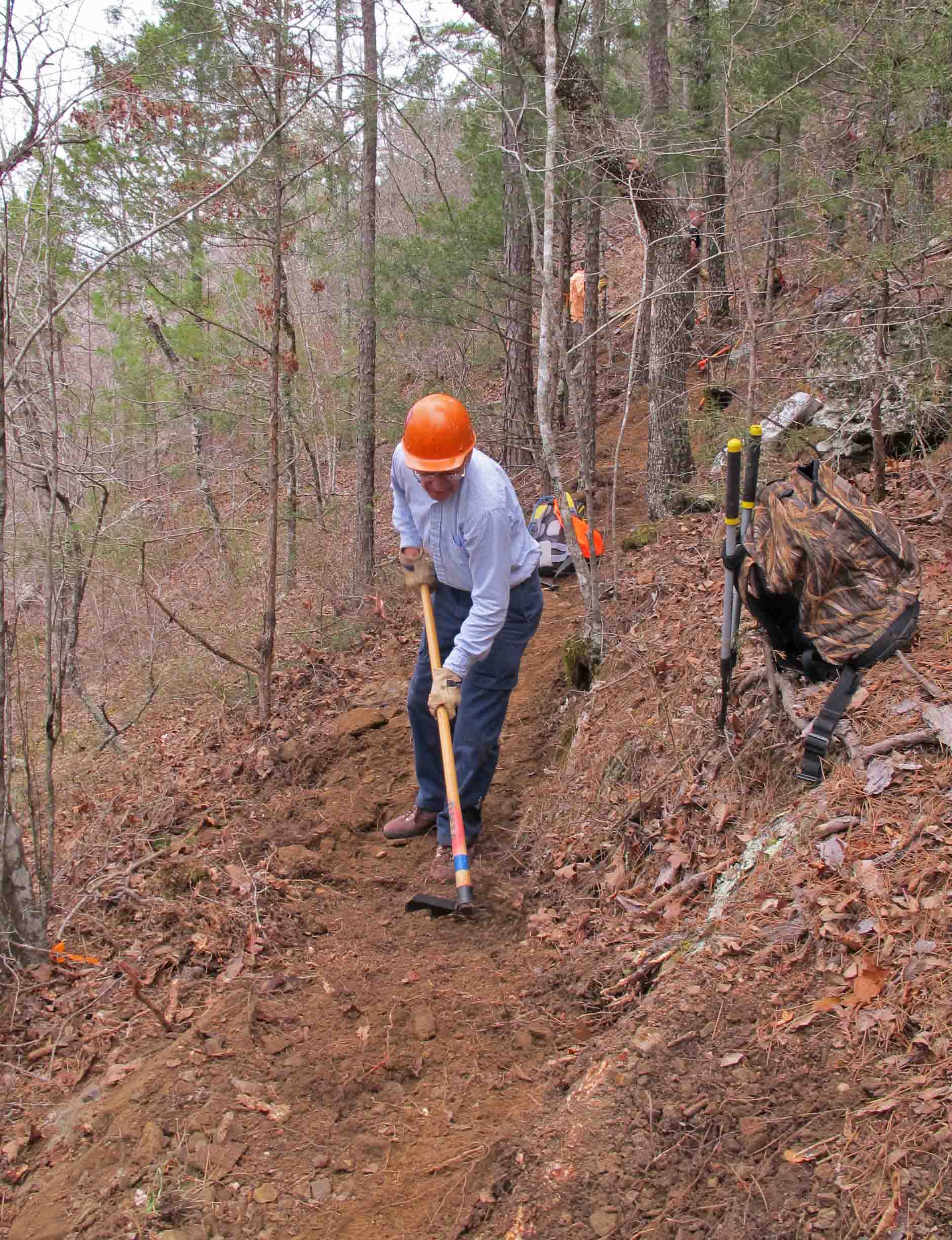
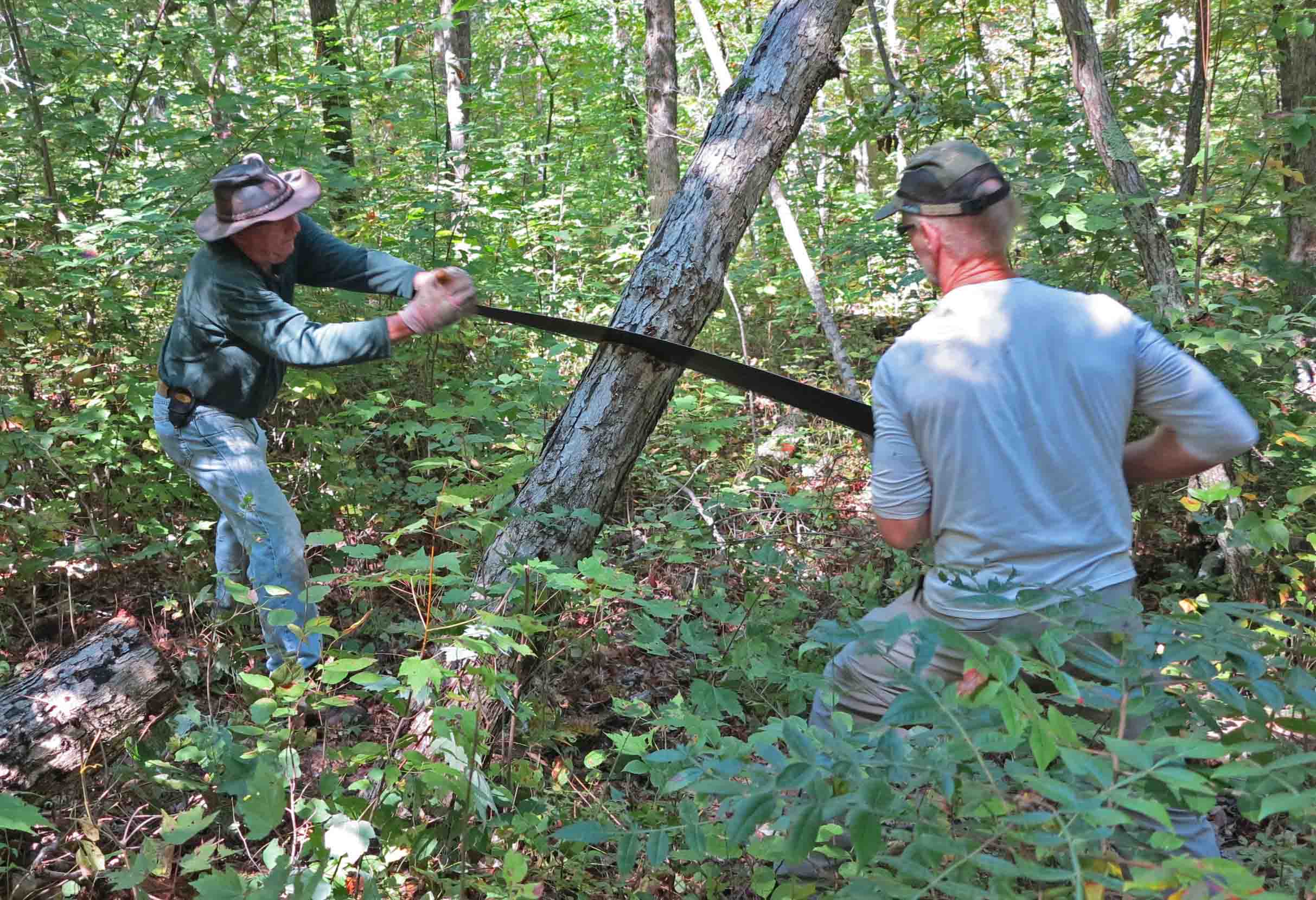
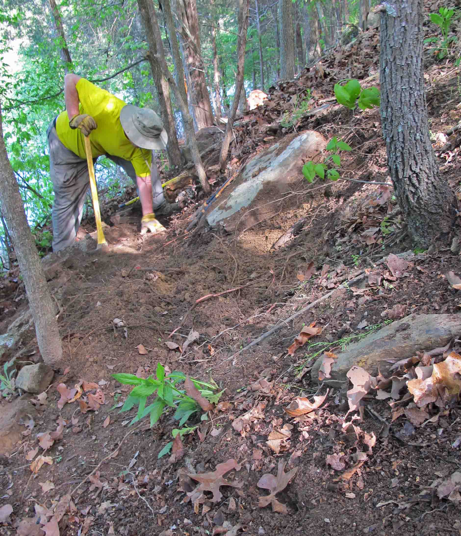
Chopping trail out of the hillside.
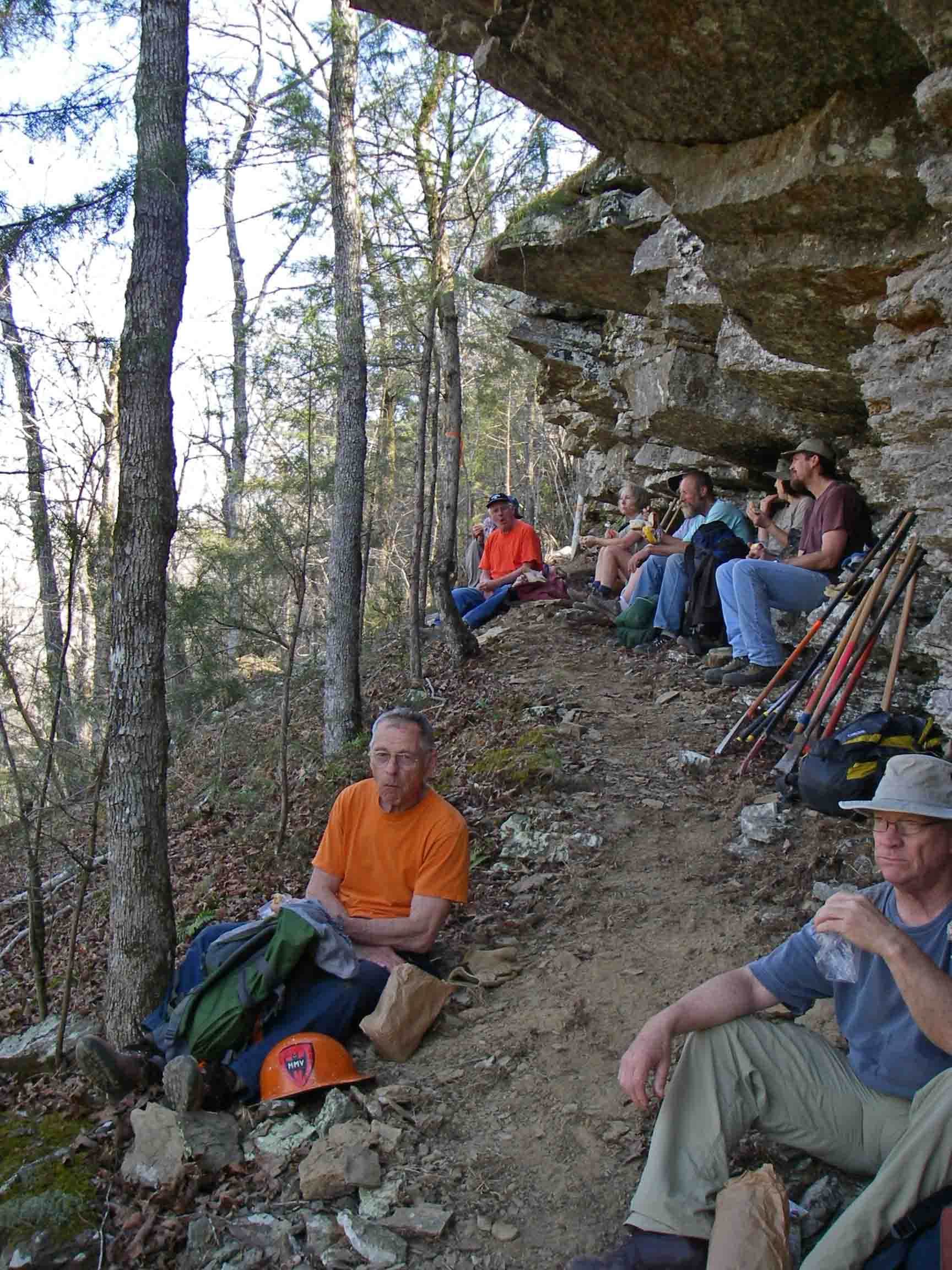
Lunch break under a beautiful bluff overlooking Indian Creek.

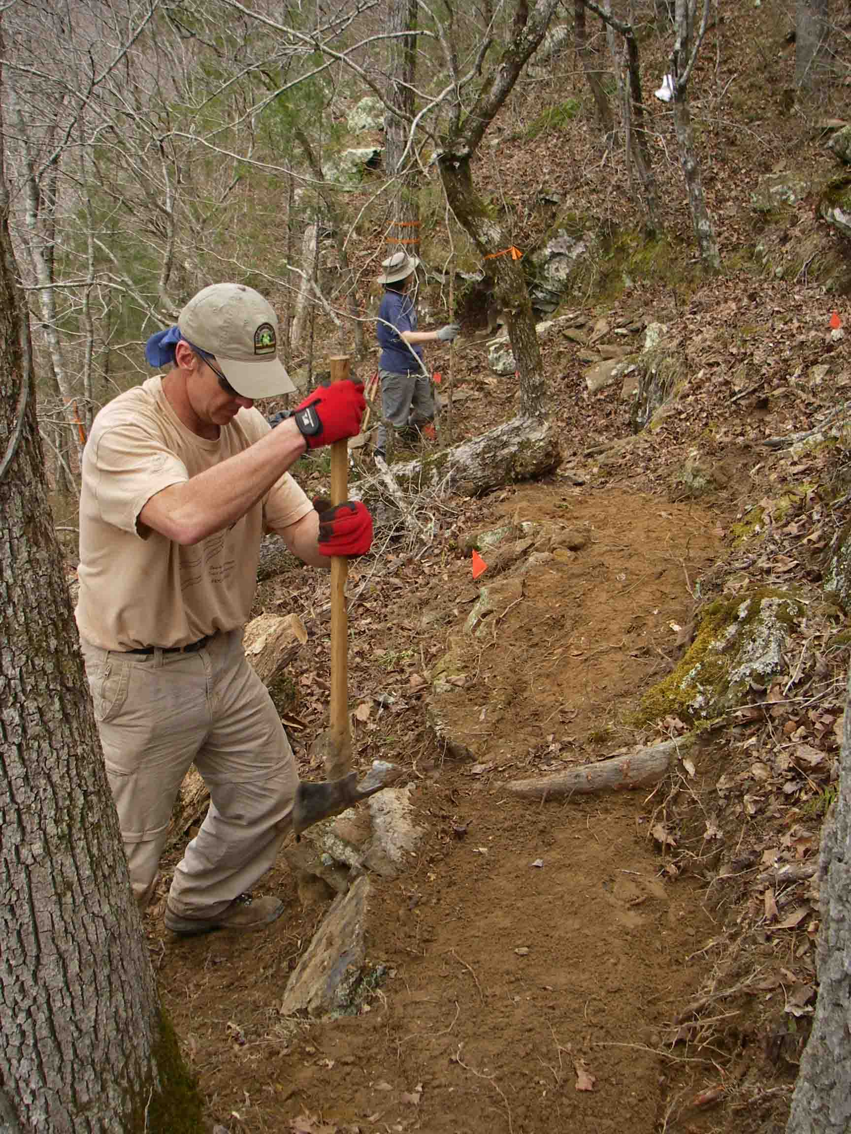
Duane, engineer and volunteer, looking at trail grade.
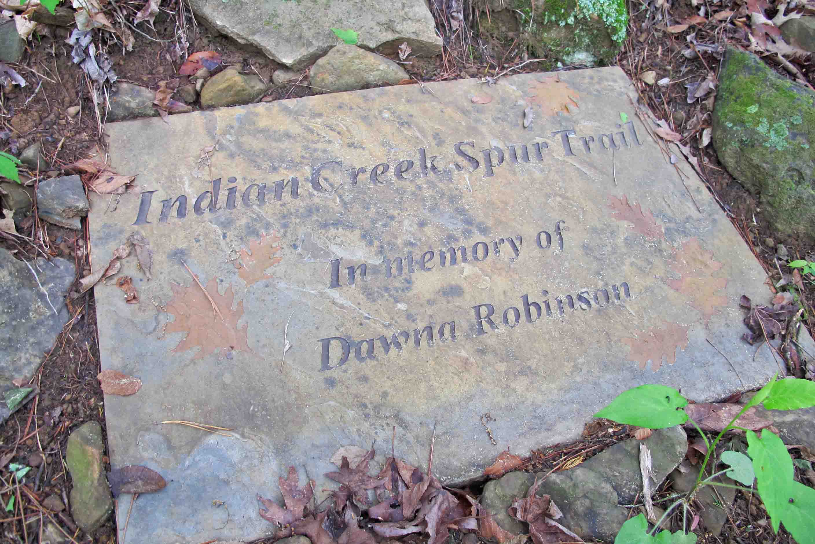
Building the Dawna Robinson Spur Trail.
Dale building a trail he would then adopt to maintain, the Dawna Robinson Indian Creek Spur Trail.

Keeping trail volunteers fed is a big job!

OHTA Crew on Hare Mountain

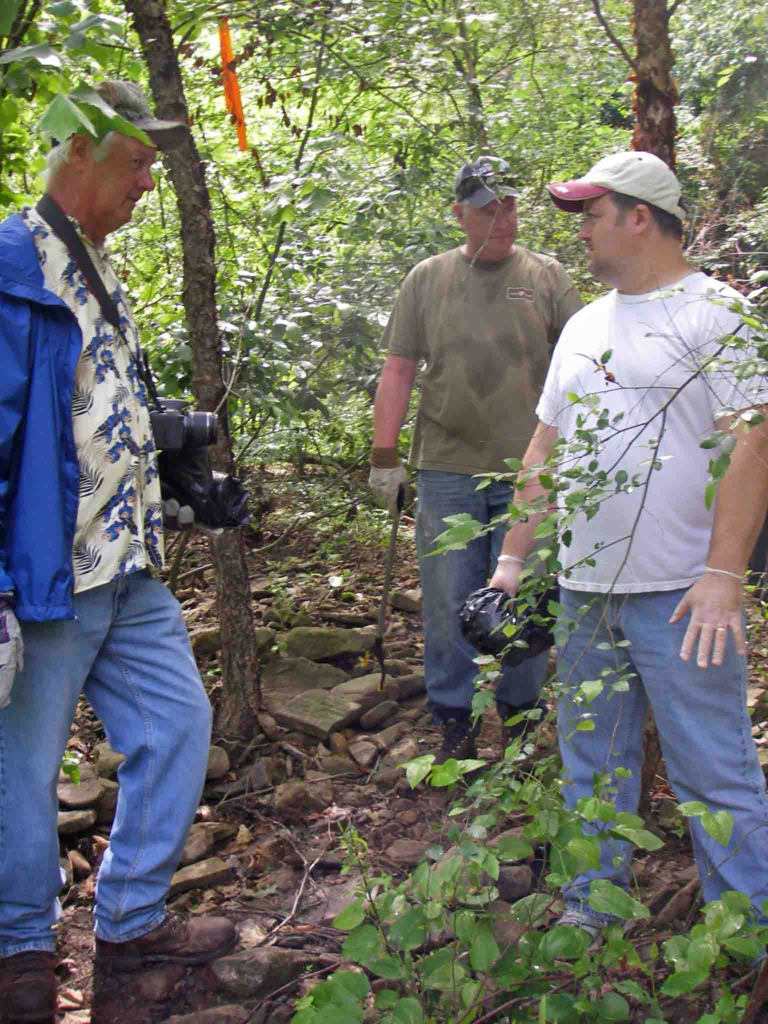
Lunch break

Enjoying fellowship and the satisfaction of a good day’s work in the Hare Mountain area. Left to Right: Mike Lemaster, President of the OHTA, Bob Robinson, Chris Adams, and Roy Senyard, Trail Maintenance Coordinator for the OHTA.

Volunteers picking up trash on the Lake Alma Trail
Harry McWater, the driving force behind building the Lake Alma Trail, visiting with volunteers.

Cleaning up the Lake Alma Trail.

Arkansas Master Naturalists helping with trail building.
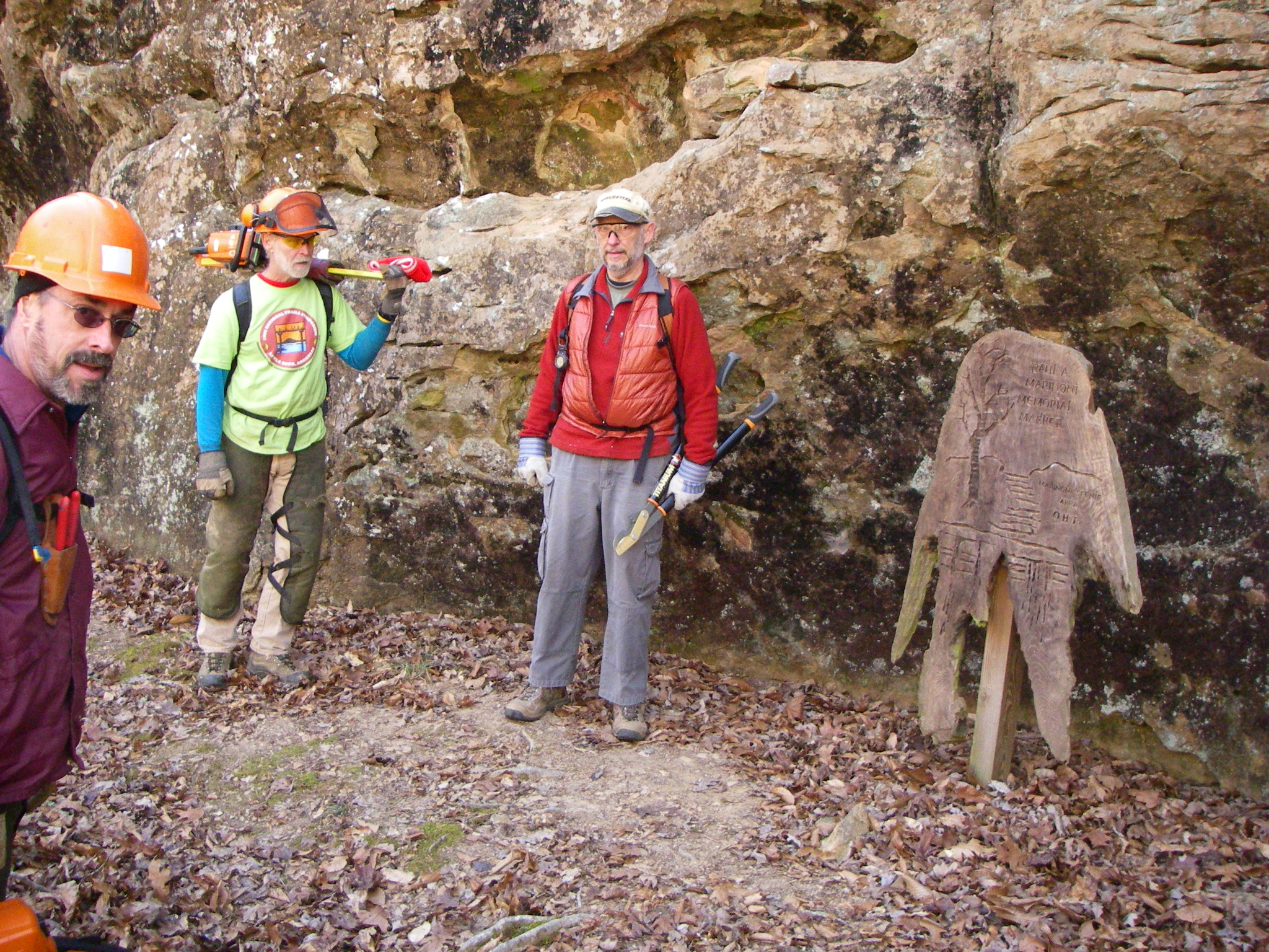
Volunteers in the Marinoni Scenic Area of the Ozark Highlands Trail
Roy Senyard, Trail Maintenance Coordinator for the Ozark Highlands Trail.

Joe, clearing the Lake Alma Trail.

Cliff, building some new trail at Lake Alma.

Volunteers having breakfast before working in the Hurricane Creek Wilderness of the Ozark Highlands Trail.

Mary is one hard worker when it comes to trail maintenance! She is shown here on the back porch of Mirkwood Cabin during a work trip on the OHT.

Using crosscut saws in the Hurricane Creek Wilderness
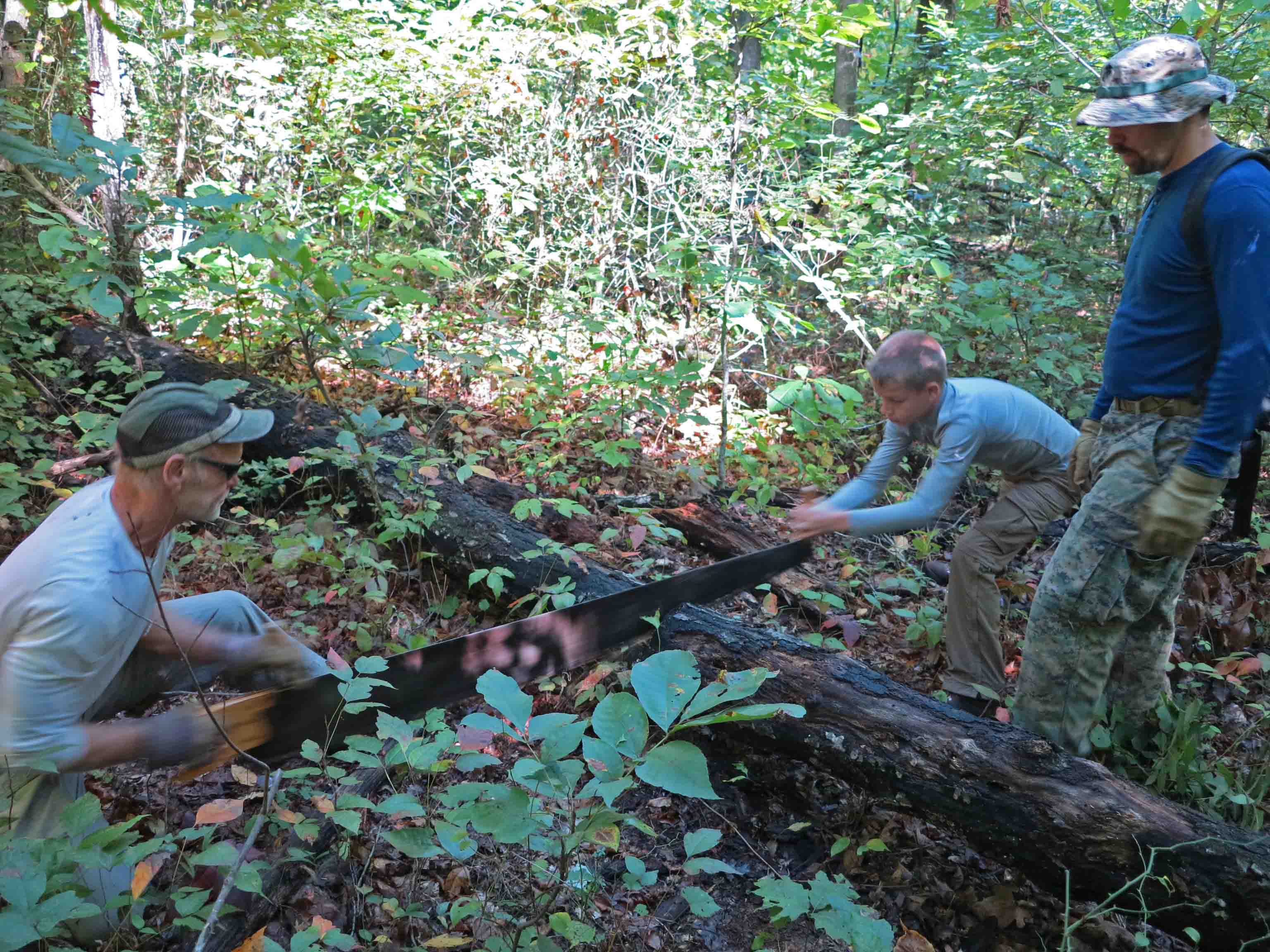
Using crosscut saws in the Hurricane Creek Wilderness

Bob Robinson, a “heavy lifter” when it comes to trail maintenance.
New tread being tested after recent side-hilling work.

Steven Parker, right, became Trail Maintenance Coordinator for the OHTA in 2015.

Lake Alma Trail at sunset.
I love the changes in season. New colors always seem to surprise.

Fall leaves along the Lake Alma Trail.
Season change often brings beauty right under your feet if you’re noticing.

Old roadbed on the Ozark Highlands Trail.
What might be an ordinary roadbed that follows the path of the trail glitters with color.

Sweet gum leaf at a wet crossing on the Ozark Highlands Trail
Little scenes of beauty surround you and are easily overlooked. Following the crossing of this little creek in the Hurricane Creek Wilderness Area, I was captured by the beauty of the path I’d just traveled.
Hurricane Creek
Progress down the trail was slow because my camera kept calling to me to please stop.

Hurricane Creek

Hurricane Creek
Lake Alma Trail
Back home again. We’ll end where we began with the evening sun lighting up the 3.8 mile trail at Lake Alma.
When I first began hiking, I’d check off trails as if that indicated that I’d seen those places. While it did document that I had been at those locations, I later realized that I’d only grazed the surface. This is especially true of the Marinoni Scenic Area.

We entered on the Dawna Robinson Spur Trail that begins at the Indian Creek canoe parking area. Watch for traffic when crossing Hwy 215. We paused a moment to admire the memorial marker just a few steps up the trail.
We were immediately impressed with the condition of the trail which is only about two years old, built by volunteers with the Ozark Highlands Trail Association. The switchbacks climbing up to the base of a bluff line are beautiful and you almost forget you’re climbing because of the steady grade. When we arrived at the top of the climb we began an easy walk through open woods. It was unseasonably cold with occasional rain.

Our group of three included Robert who was visiting family in Missouri before returning home to Hawaii. I wondered what his response would be to hiking in the Ozarks. I was pleasantly surprised because he went on and on about the beauty of our little Ozark Mountains. He was not the least bit disappointed even though he’d hiked some beautiful areas in Hawaii.

This was a short hike designed for novice backpackers with the hope for time to explore after making camp. With only a three mile hike in this hike definitely did not meet Bob’s miles driving to miles hiking ratio. The shorter distance did something nice for us though. It demanded that we slow down and enjoy the passing of scenery. Robert was doing his first backpack trip and Bob’s nights backpacking numbered into the four digits but we all enjoyed learning from each other and sharing tips along the way.
Having hiked through the Marinoni many times, I wanted the chance to camp there. This little spot looked better than a four-star hotel as we approached and pitched our tents.
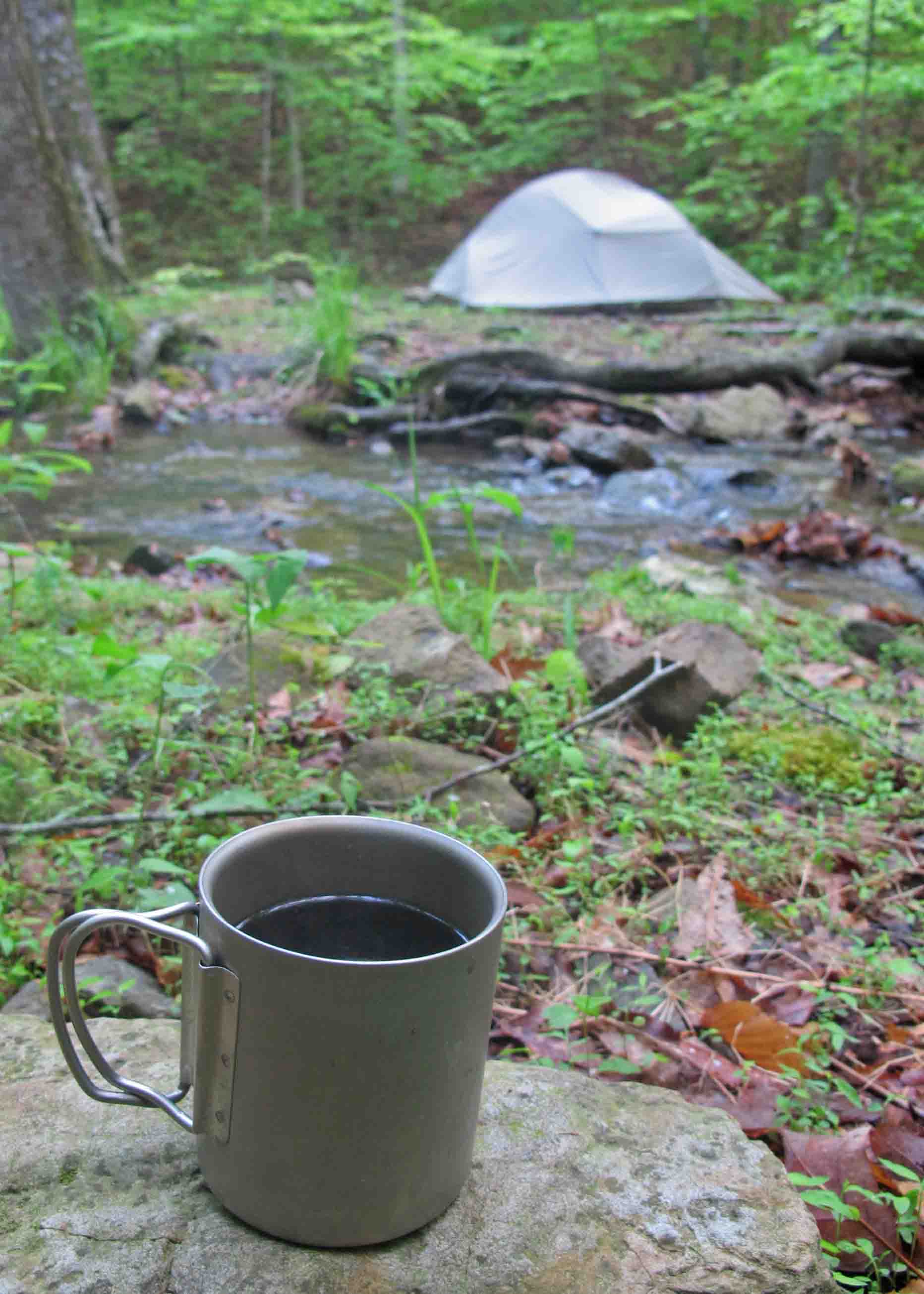
Four-star hotel and gourmet coffee next to Briar Creek
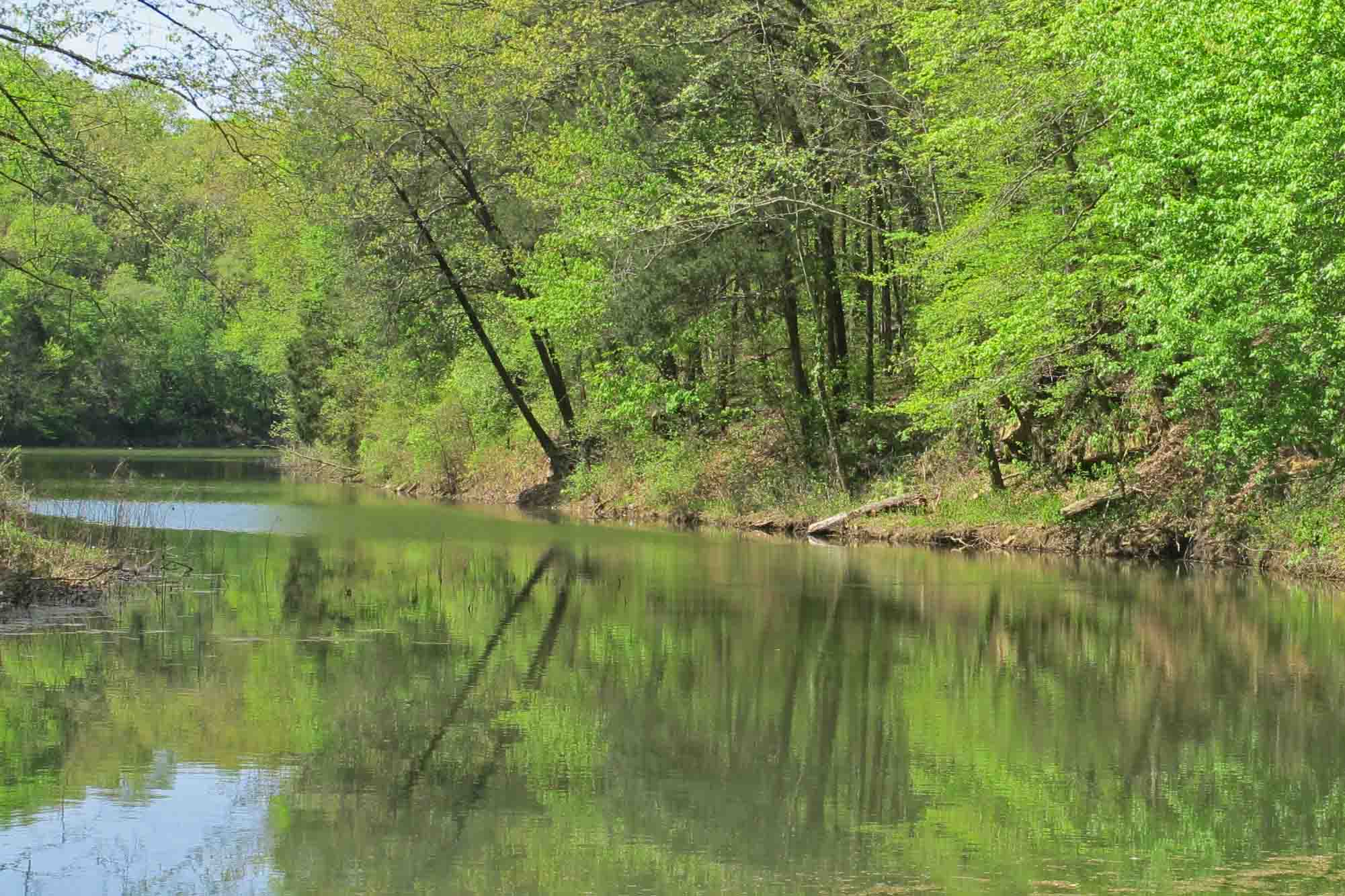
The Marinoni never disappoints! The soothing sounds of Briar Creek accompanied our walk along rocky bluffs and budding wildflowers. The moist day made it feel like a rain forest with clear water droplets hanging from every leaf. Cascades and waterfalls were flowing nicely.


Briar Creek
A trip highlight and something even four-star hotels can’t offer was a short afternoon nap in dry leaves under a bluff overhang accompanied by Briar Creek and song birds. I was worried that it might be difficult to sleep after napping but slept pretty much straight through from 7:00 p.m. to 7:00 a.m. This was some four-star sleep!

During our hike out on Sunday morning I was already looking forward to my next visit to the Marinoni Scenic Area. No reservations required!
For location and more reading about the Marinoni Scenic Area visit the following link:

Lake Alma Trail mile marker 3.5
While working on a local trail this morning, Clifford, a fellow volunteer said, “When I tell people what I’m doing out here, they think I’m crazy! But I love it.” Exercise, fresh air, beautiful surroundings, and good fellowship, all for free. We both agreed it was nice to do yard work in God’s back yard.
Clifford doing some side-hilling on the Lake Alma Trail.
As we continued our work, Clifford stopped, looked at his watch, and commented that he had just met his Arkansas Master Naturalists certification requirement of 40 volunteer hours. About 30-minutes later we reached our stopping point for the day. We walked the short section several times commenting on the difference our work had made.
Little Frog Bayou
I continued around the trail with Pulaski in hand to chop out several little stubs I’d been noticing on my daily walks. As I hiked along thinking of many workdays on this trail since March of 2012, I began to realize what a wonderful treasure we have here.
I experienced a sense of deep gratification and thought of the thousands of steps that have already been taken on this trail. Some of our local hikers, especially children, got their start on this trail. The Lake Alma Trail is having an impact on the health of our community. I know it has benefited my own health and wellbeing.
I began to think of some of the trail volunteers I’ve worked with and how committed they are to making hiking trails available to others. Working with them has given me a new appreciation for every step I take on a trail.
Here’s a short list of reasons to volunteer to do trail building and maintenance.
1. Trail work is good exercise – It is a full body workout for sure. No gym charges and no gym smells.
2. Good fellowship – Great chance to work with good people.
3. Satisfaction – Tangible results from work is rewarding. It is nice to hike a section of trail where you’ve done some work.
4. Trail work blurs the lines between work and recreation. Nice to have an activity that you can frame any way that suits you. If you want others to think you have a strong work ethic, tell them you’re doing trail work. They don’t have to know how much you enjoy it.
5. Building or maintaining trails is a way to express your gratitude for creation and share the beauty with others. A well built trail allows many caring eyes to view an area and increase the likelihood that it will be protected.
If you want to be a trail volunteer, how do you get started?
1. Place a small trash bag in your pack and pick up any trash you see on the trails.
2. Occasionally hike with loppers and cut limbs back that brush against you as you hike. Kick rocks off of the trail or drag small trees off the trail as you hike.
3. Be part of a volunteer work crew on a workday. All you need is lunch, water, and work gloves. You might want your own loppers but most tools are provided.
4. Join a hiking community. If you’re in Arkansas, the Ozark Highlands Trail Association (OHTA) or Friends of the Ouachita Trail (FoOT) are great places to make contact for volunteer opportunities. Membership is inexpensive and your money goes to maintaining trails. Go to the Lake Alma Trail Facebook page to volunteer on a local community trail here in western Arkansas.

Nice place for a break on the Lake Alma Trail.

White Rock Mountain, in the Ozark Mountains of Arkansas
White Rock Mountain is one of my favorite mountains because it is beautiful in every season and especially friendly during winter. The Ozark Highlands Trail passes across White Rock at about mile 18. I like traveling to White Rock because the trailhead is only 45-minutes from home which means more time on the trail and less time in the Jeep.

Campsite with a view on White Rock Mountain
Camping on White Rock is a treat.

This picture of the morning after the previous picture demonstrates just how quickly conditions can change on this relatively low elevation mountain (2,320 feet).
There are overlooks for viewing sunset and sunrise on a 2-mile loop trail on top of White Rock Mountain.
Sunrise from White Rock Mountain
On the Ozark Highlands Trail just east of the spur to the top of White Rock
Visit http://wheresmybackpack.com to get more travel themes and possible locations for your own travels.

White Rock Creek along side the Shores Lake White Rock Loop Trail.

Campfire conversation…
The hike from Arbaugh to Ozone on the Ozark Highlands Trail was beautiful! We hike 8.8 miles the first day and camped at Boomer Branch. The surround sound howl of coyotes and an owl in the distance were the only disturbances to the silence of the woods and soft sound of flowing water. The weather was just cool enough to justify a small fire for cooking, warmth and good conversation. During a silent moment one hiker said, “You know where I would like to be?” Another asked, “Where?” “Right here,” he answered. “This is the best place in the world to be right now.” Night brought a few light sprinkles with lightning in the distance.
Sunday morning was cool but pleasant. Coffee made with Boomer Branch’s water was delicious. We hit the trail by 8:00 a.m. and gained a lot of elevation over the 4 miles to Ozone.

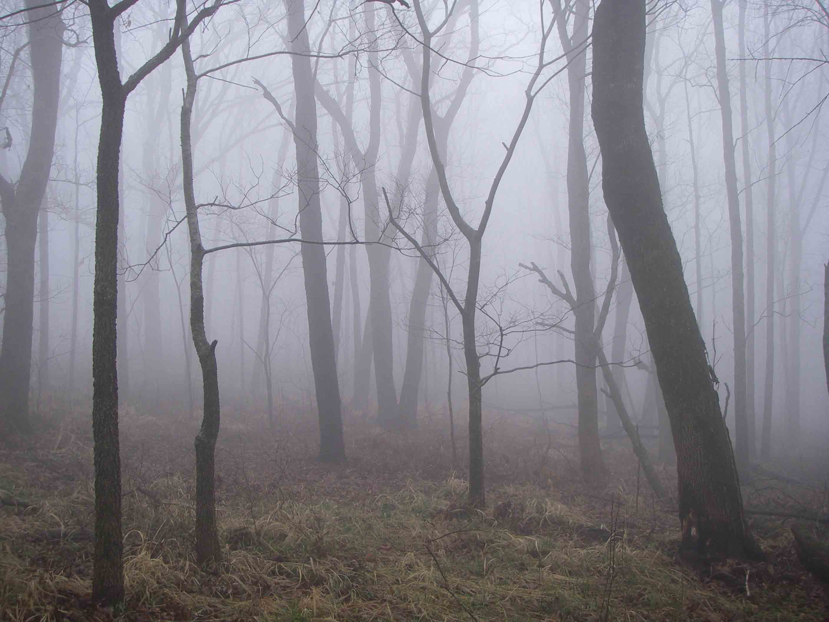
Open birch forest.
Highlights included hiking through a forest of beech trees with their deep brown leaves holding on through the winter. There were some smooth-hiking sections of shortleaf pine woods along the way before hiking back into the Mulberry drainage for a nice cool crossing. The final mile was a heart-throbbing, thigh-burning pull up to the Ozone Campground on Highway 21.

Crossing the Mulberry River.
As I hiked east from Dockery Gap to check my section of trail a dad and his four sons approached from the opposite direction. They had a haggard and disheveled look as they lumbered up the trail loaded down with one-gallon plastic milk jugs filled with cloudy water and overloaded backpacks. One of the sons carried a rifle presumably for protection from wild bears.
The gun made me nervous, but I relaxed when the dad spoke. He explained that they had camped at Jack Creek with plans to hike to White Rock Mountain, but now they were wondering how to hike out and where they might get cell phone service to call mom to come get them. I took my map out and showed them the road they were approaching and how to walk toward civilization. They explained that their water filter wasn’t working correctly, hence the murky water jugs. They’d not slept well, were overheated and exhausted. As I continued down the trail, I thought they’d made the right decision in exiting the forest.
Approaching Jack Creek less than a mile later, I saw smoke and a burning campfire. There was a hammock tied between two trees next to the creek and trash everywhere. Thinking someone must still be occupying the site I called out, but there was no response. It gradually dawned on me that this was the camp left by my exhausted friends who’d just asked for directions. I extinguished the fire, kicking a large aerosol can of insect spray out of the coals and then collected the trash.
I continued down the trail picking up more trash at each creek crossing. It appeared that these young men and their dad deposited trash at every rest stop. After doing a little maintenance I returned to the trashy camp, scattered the now cooled fire ring, and bagged the trash I’d collected earlier. Then I noticed scaring on a tree next to the creek where they had chopped it with an ax for no apparent reason. This began to feel like a crime scene.
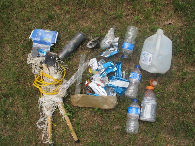
Some of the trash collected at the site. Notice the burned aerosol can.
I had visions of driving up on these fellows as they walked along the road and what I would like to say but then considered the rifle and thought a more diplomatic approach might be best. As I hiked up the trail away from the scene of the crime, I rehearsed the discussion I would have about the beauty of the Ozark National Forest and how important it is that we care for it and pass it on to our children. I wished for words to help these men discover a better way to treat the wilderness but, in reality, it seemed futile to try to convert remorseless criminals who enter the forest for recreation and harm it by their very presence.
As it turned out, by the time I arrived at the trailhead to throw my bag of trash in the Jeep, the father and his sons were nowhere to be seen. I do wish I could have that conversation, but I take comfort in the knowledge that I probably witnessed the conclusion of their first and last backpacking trip on the Ozark Highlands Trail. If I just had some assurance that they don’t have access to four-wheelers I’d feel a whole lot better.
