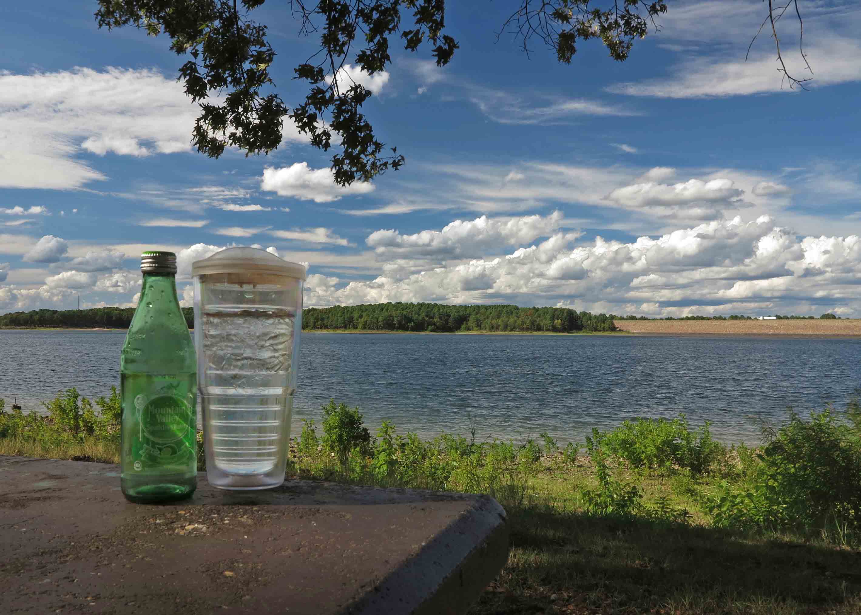
Clear water. Crisp, clean air. Nothing here to take for granted.
Oark General Store
A post-hike meal at the Oark General Store, said to be Arkansas’ oldest continuously operating restaurant. Good food and fellowship. Always a treat.
Oark General Store
In response to The Daily Post’s weekly photo challenge: “Treat.”
Archives


Happy Places Above the Fray
Sylamore Creek Valley
My happy place is on almost any Arkansas ridge overlooking an Arkansas stream. One of my favorites is Sylamore Creek Trail north of Blanchard Springs. After just a few steps onto this trail, I feel tension leaving my shoulders and my steps become lighter. This picture is from a recent hike, Sylamore Trail, Getting Reacquainted.
Another favorite ridge-top hike is overlooking the Buffalo River in the Tyler Bend area. It provides the right mix of adventure, history of place, and sheer beauty. To see more of this area you might enjoy Buffalo River From Boxely to Pruitt in Typical Arkansas Weather.
Buffalo River
My ultimate “happy place” outside of Arkansas also involves a “little stream,” but this stream formed a “little canyon” in Arizona. The Grand Canyon surrounding the Colorado River provides relaxing reflective moments when I pause to remember how it felt to stand in awe of such beauty. To take a quick trip through The Canyon with a few friends of mine, read Seeking Something Grand.
View at dusk the evening we arrived at the South Rim.
I’m thankful for the memories of these happy places and the healing effects they have on my daily life.


In response to The Daily Post’s weekly photo challenge: “Happy Place.”
Grays and Greens in the Ozarks
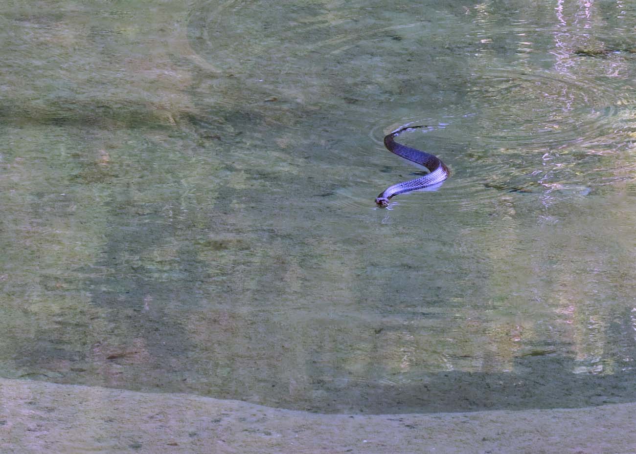
This photo topic interested me, and I realized that several shots from this week’s hike were monochromatic views of nature. In the Ozarks, various tones and hues of a predominant color can be inviting. Having said that, the following photo was not inviting enough to make me want to wade into Sylamore Creek at this specific location.
Happy swimmer in the cool water of the Sylamore Creek on the Ozark Highlands Trail.
The next scene was taken before sunrise. This view from the edge of a bluff communicated distance and size with little variation in color although the indirect light of the sun was beginning to play with the fog.
North Sylamore Creek Valley
Blandard Springs
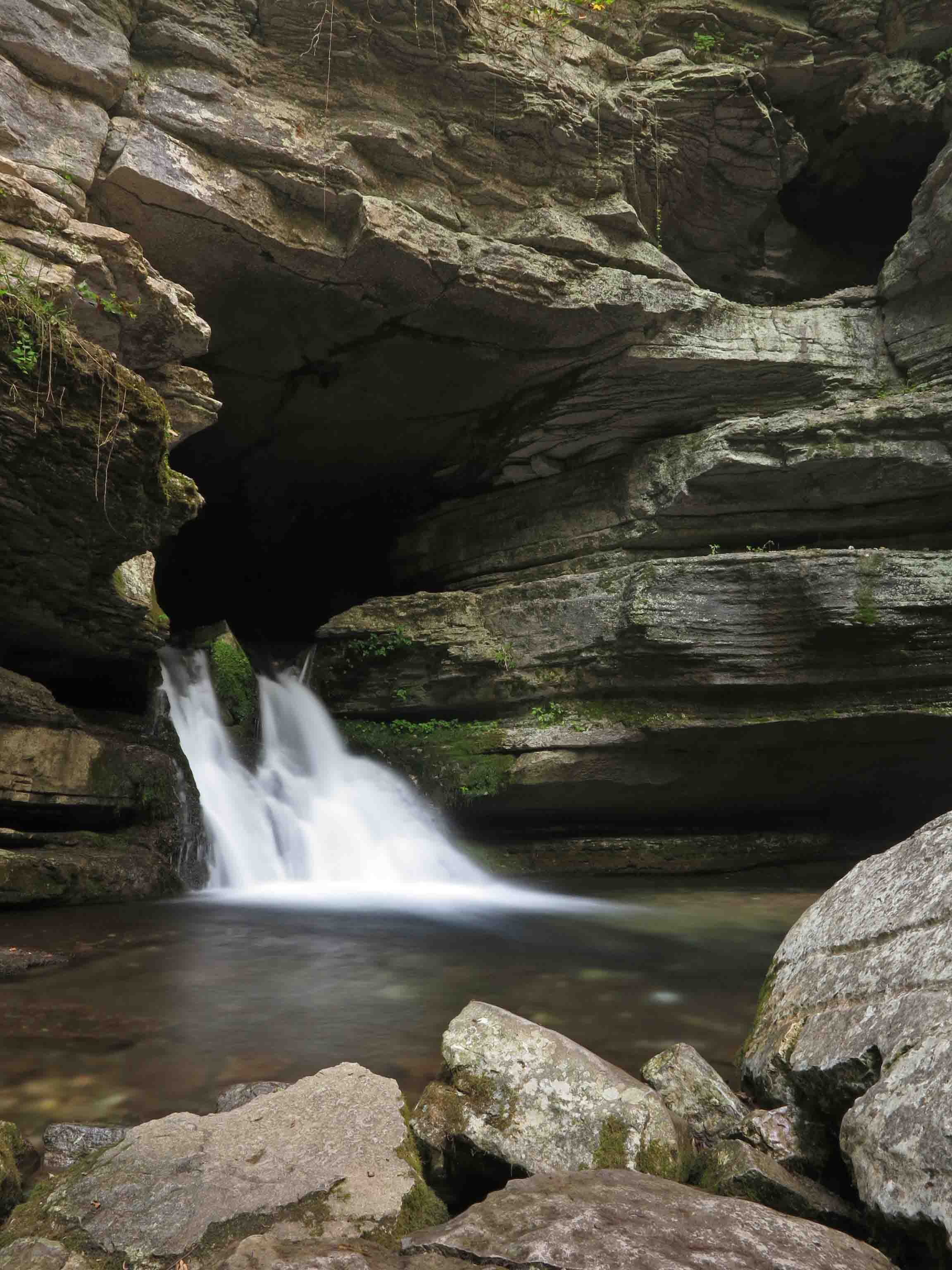
My apologies if this isn’t true to the monochromatic theme, but the predominance of grays and absence of color in the spilling spring seemed to fit. The only hint at another basic color is the green of moss at the mouth of this cold, year round spring. Notice the opening at the upper right-hand corner. This is an earlier exit for spring water before years of erosion formed the scene we see today.
Mirror Lake
Blanchard Springs eventually flows into Mirror Lake, a green on green scene.
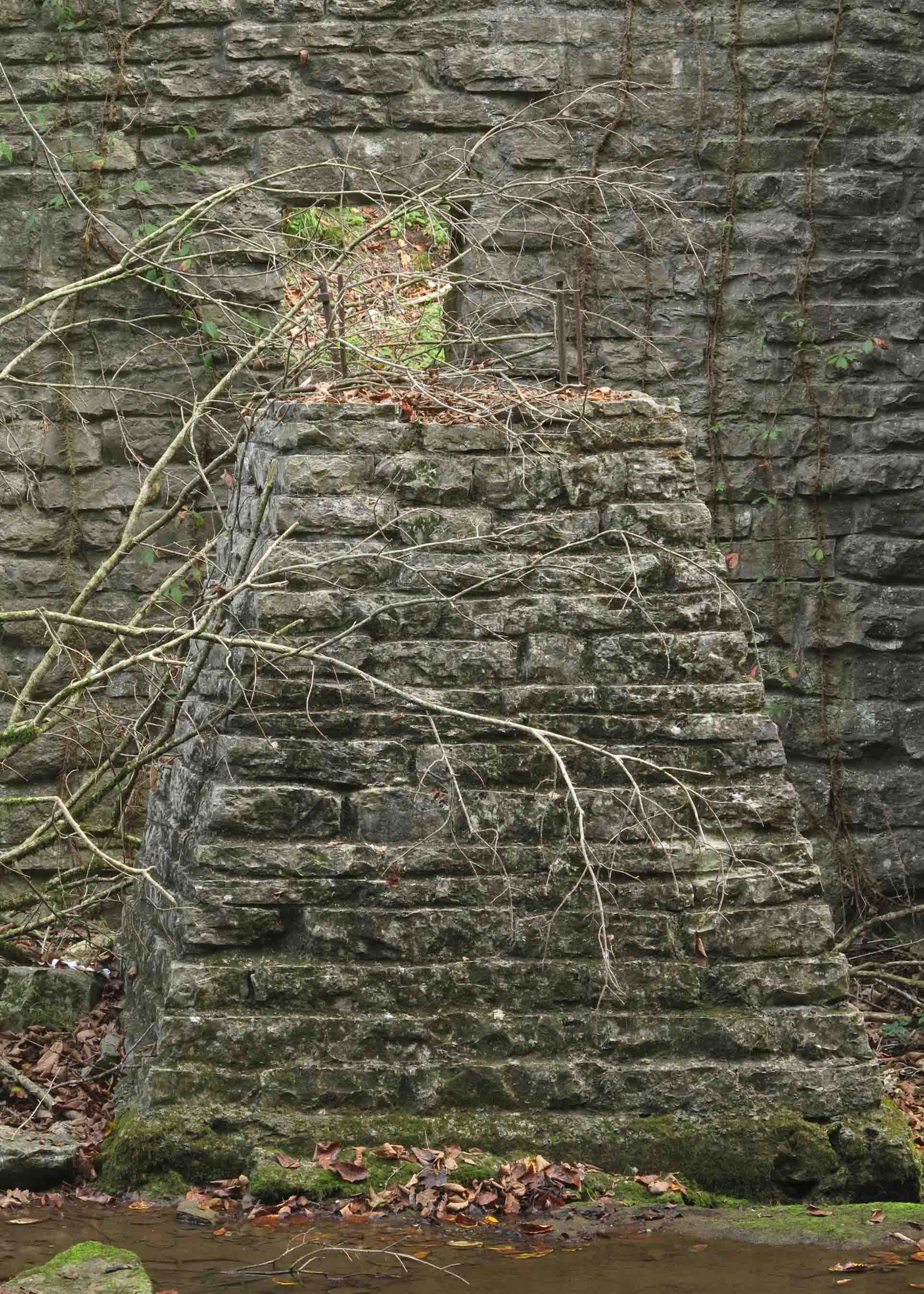
This is the pedestal on which a waterwheel once turned. John Blanchard built this undershot grist mill in the 1880s. It sits downstream from Mirror Lake Dam as testimony to the hard working people who once made their lives in the Ozarks. The CCC restored the dam and part of the mill during the 1940s.
Grist mill
In response to The Daily Post’s weekly photo challenge: “Monochromatic.”

Vivid Roaring River Spring
Roaring River
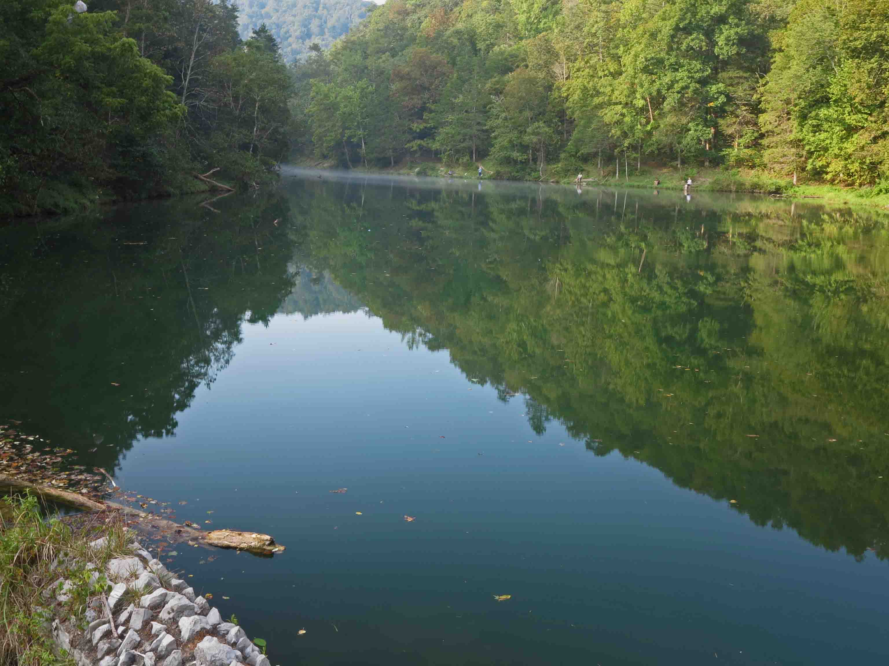
This morning while hiking at Roaring River State Park in southern Missouri, I was fascinated by vivid greens and browns as they blended in fast flowing and trout-filled water.
Roaring River
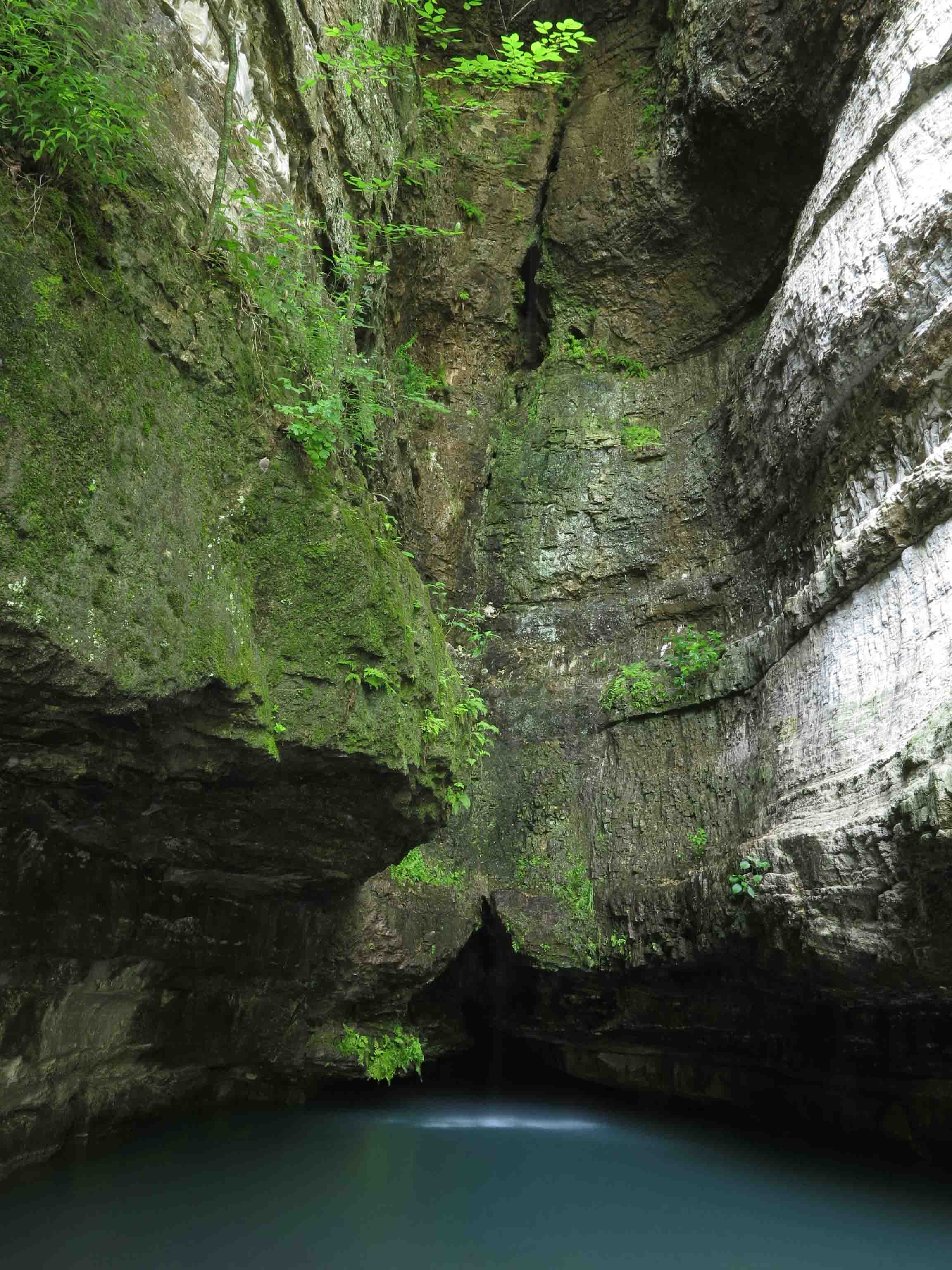
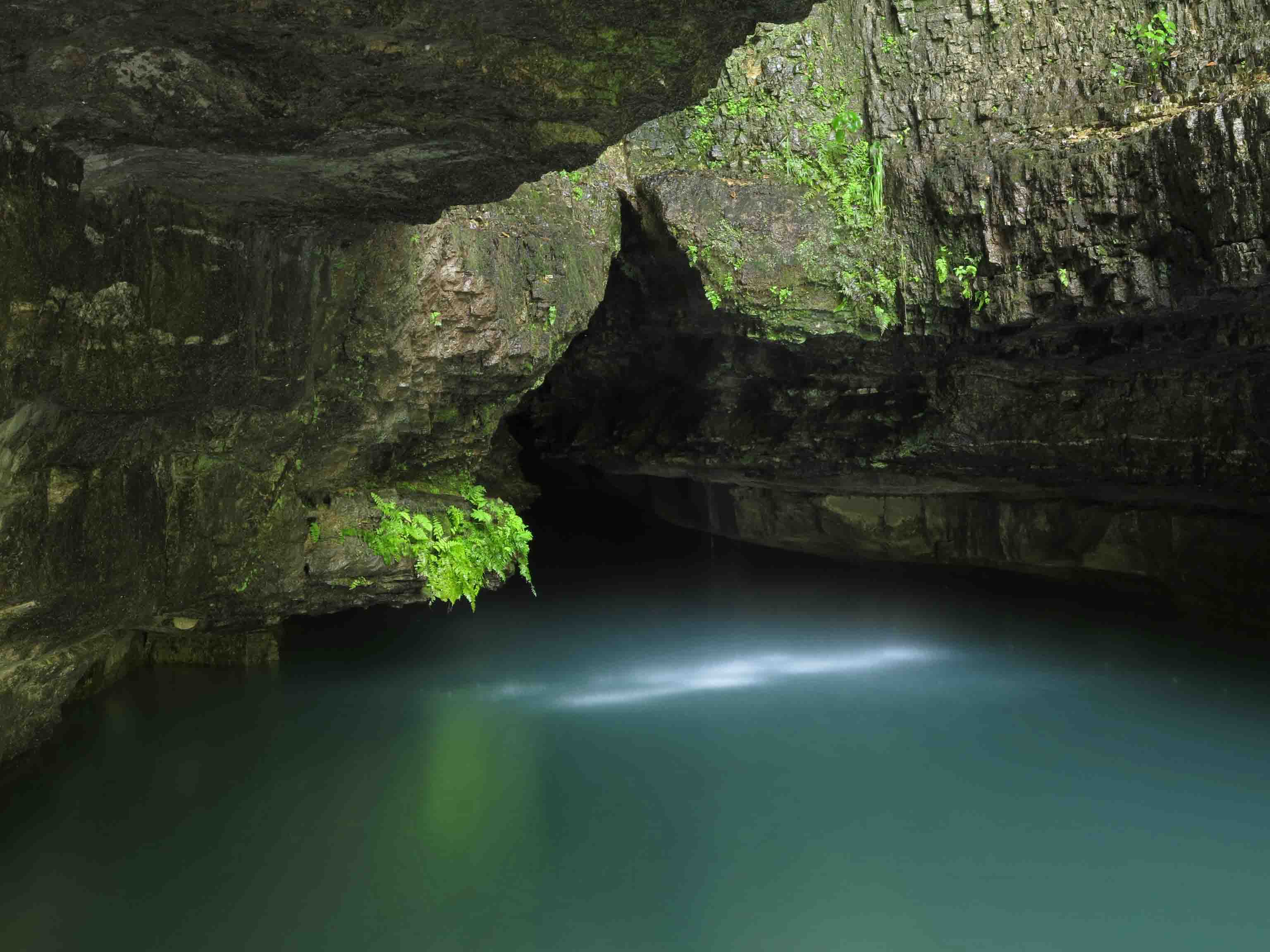
Roaring River Spring
Roaring River Spring drew me in with it’s subtle beauty and strength. The surface of this spring, which flows up from a canyon-like cave far below the bluff, seems to hide the average flow of 20 million gallons of water each day. This cold spring produces the rapids downstream, filled with color and life.
Roaring River Spring
In response to The Daily Post’s weekly photo challenge: “Vivid.”


A Right Wrong Turn
Flat Creek Bridge
My wife and I took a turn too early off of Highway 39 while driving a scenic route in Missouri. After about 100 yards on a small paved road, a sign said, “Pavement Ends.” This was our cue to turn around, but not before exploring the rustic bridge a little farther down the road. What started out as a wrong turn became a pleasant stop and gave us a taste of rural Missouri Ozarks.
As often happens, a wrong turn is really a right turn providing special sights to explore. Sometimes I wonder how many special places we pass each day as we rush to our planned destinations.
Jenkins, MO
GPS 36.775911, -93.685915
Flat Creek Bridge
Flat Creek Bridge
Flat Creek Bridge
Flat Creek Bridge
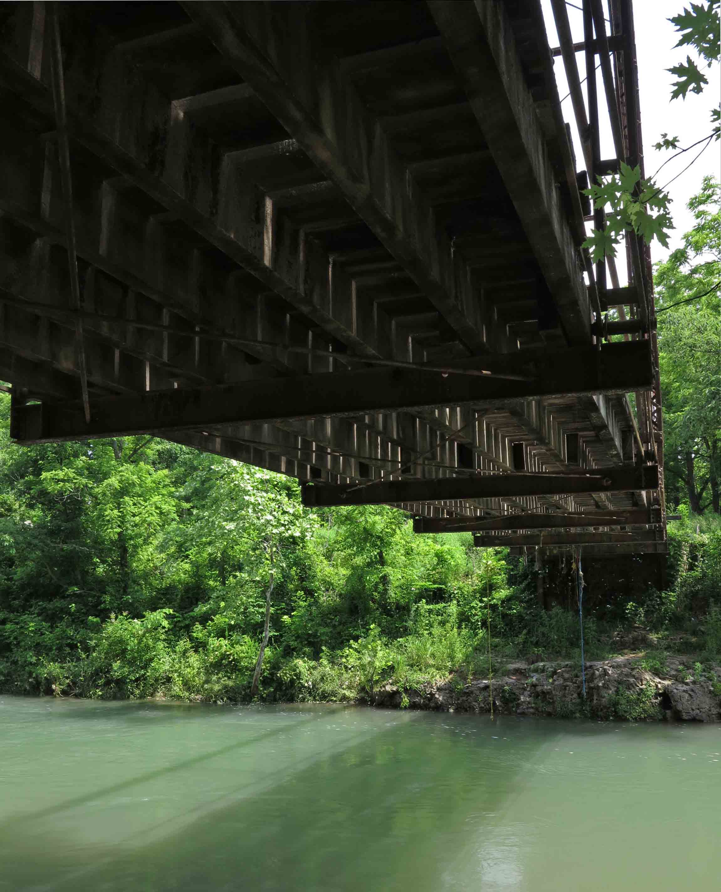
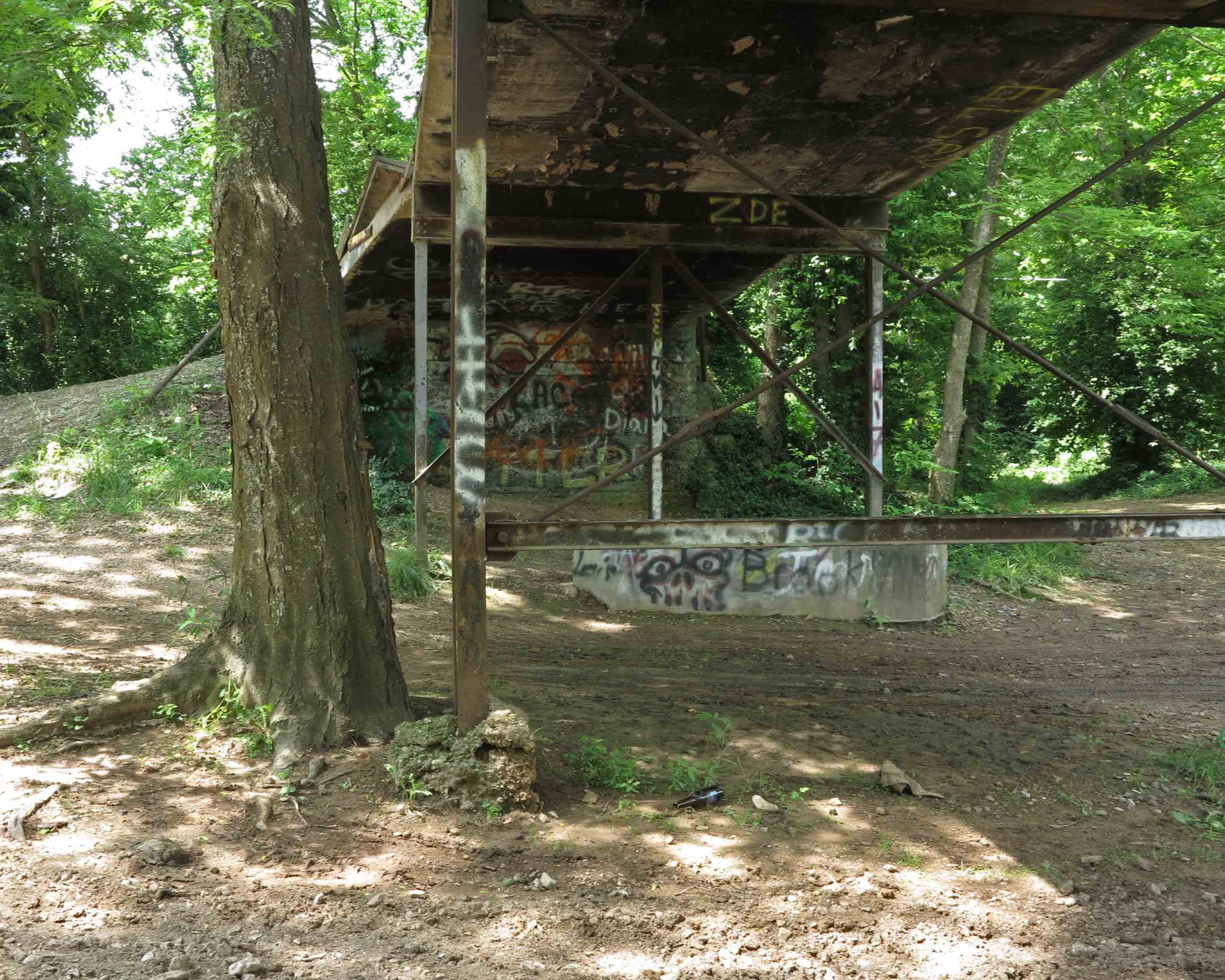
Underneath Flat Creek Bridge
Underneath Flat Creek Bridge
Underneath Flat Creek Bridge – Jenkins party spot
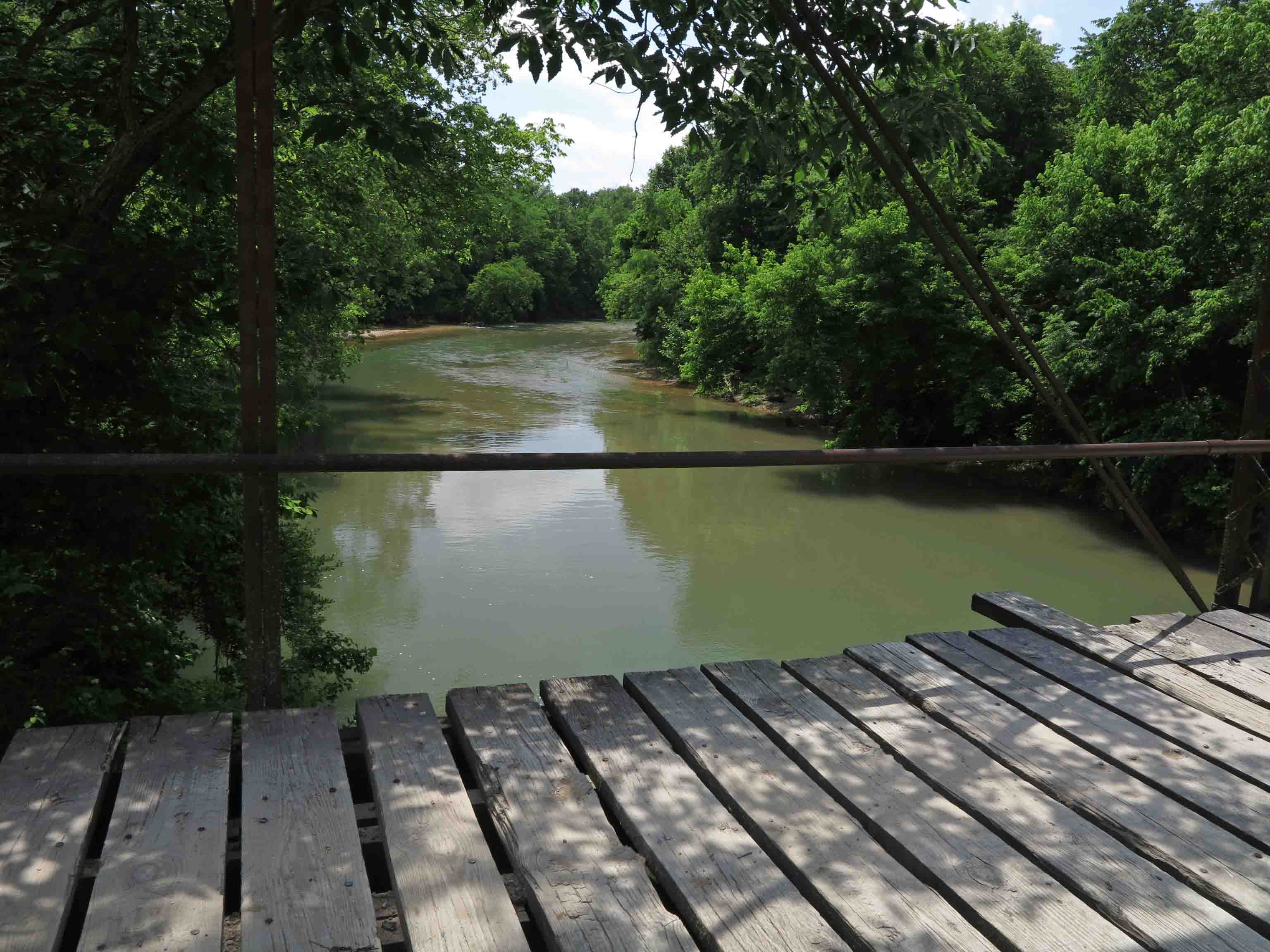
Looking upstream from Flat Creek Bridge
Flat Creek Bridge
In response to The Daily Post’s weekly photo challenge: “On the Way.”


On the Way and a Change of Plans: Hiking a Wet Marinoni Scenic Area
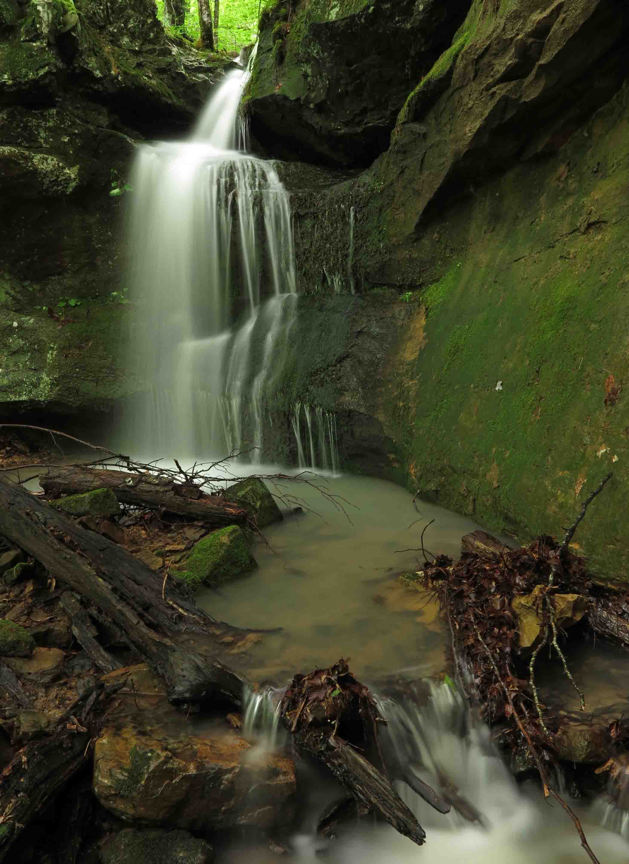
Stream flowing over the top of Marinoni Falls
Hiking the Marinoni was my plan B today. Plan A was to check on my adopted section of the Ozark Highlands Trail. I got eleven miles east of Hwy 71 on Old Locke Road when I came upon a downed oak across the road. At first I thought my handsaw might be used to clear a single lane. After making a couple of cuts, I abandoned that idea. It was a chainsaw job. Hiker was restless and probably wondering what I was doing when we should be hiking. When we got back into cell range, I reported the tree and then headed to the Indian Creek Dawna Robinson Spur Trail east of Cass.
I’ve written about the Marinoni Scenic Area before, but I haven’t hiked it when water was flowing as strong as today. What could have easily been a two to three-hour hike was more like five with all of the photo stops. I felt thankful for that tree that changed my itinerary because the Marinoni was what I needed. Sometimes the best plan is plan B.
View of Marinoni Falls from a short distance.
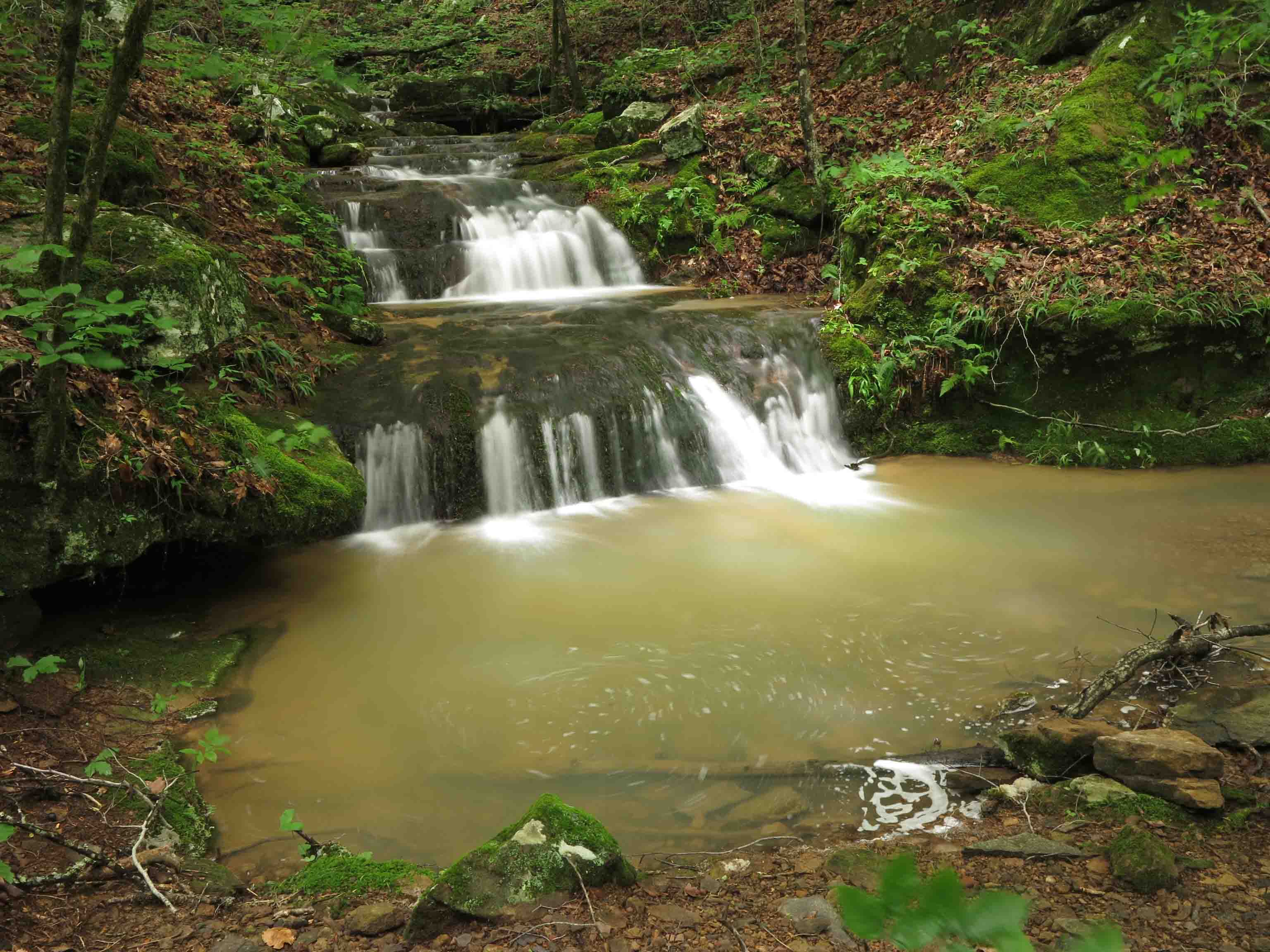
Marinoni Falls
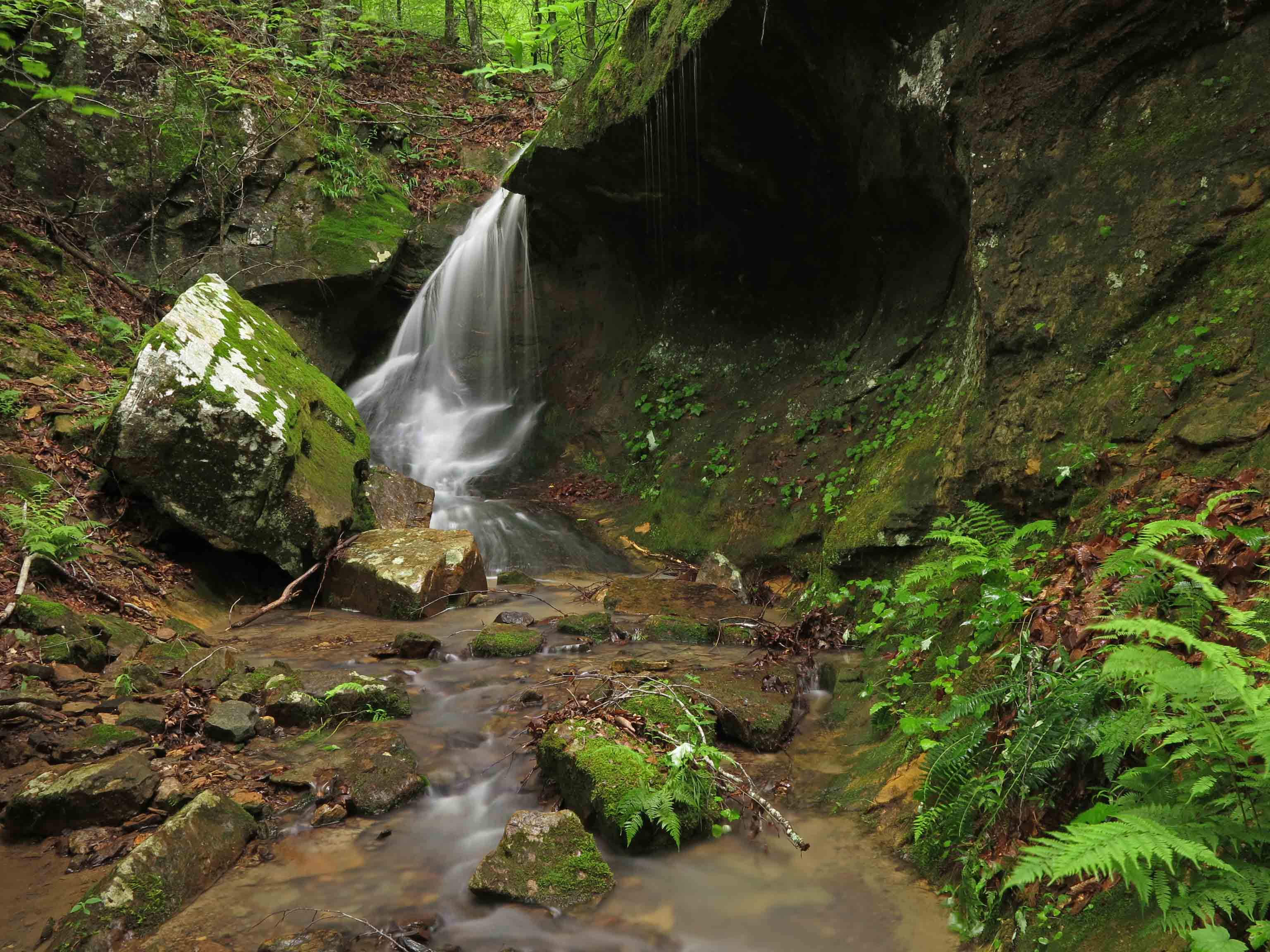
Small falls upstream from Marinoni Falls
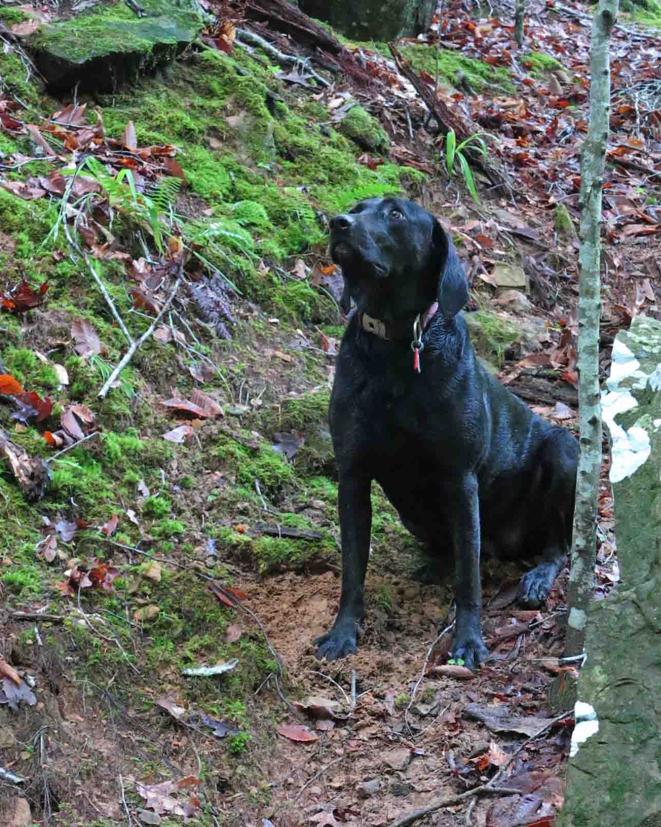
I spent enough time around these falls that Hiker-dog got impatient. She begins to bark when she thinks I’ve had enough time at the camera. I noticed that she began to pause and glance my way each time we passed any flowing water as if anticipating a photo stop.
Hiker watching the trees for squirrels while waiting patiently.
I found it difficult to walk away from the Marinoni Falls. They provided an enjoyable time with my camera.
Small falls upstream from Marinoni Falls
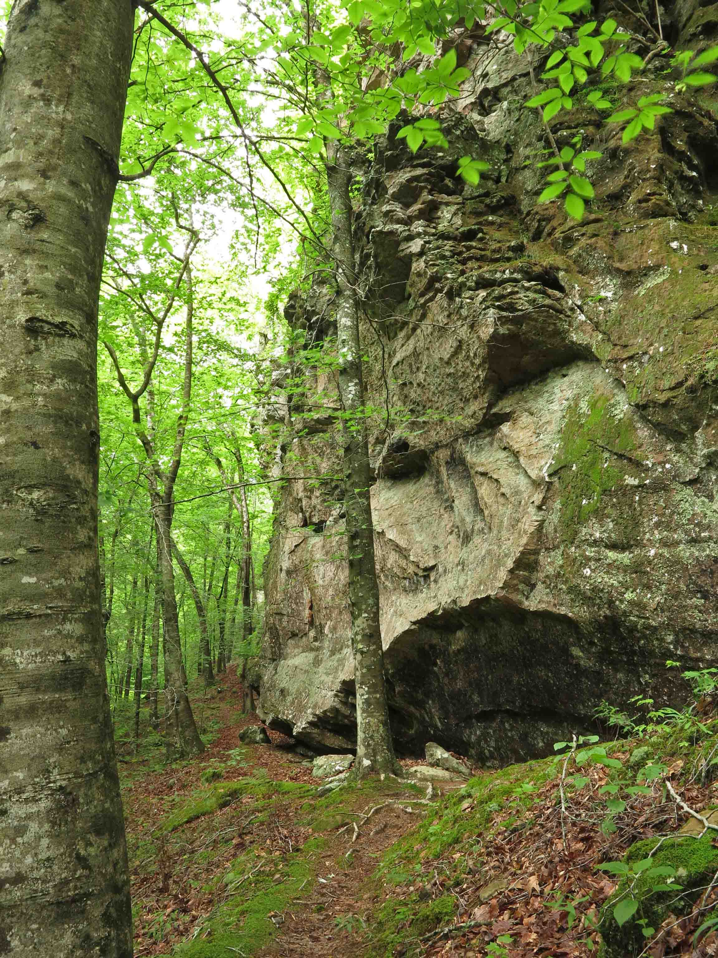
The towering walls above Briar Branch seem to envelop you like cathedral walls.
The bluffs above Briar Branch
Bluffs above Briar Branch
Edge of bluff with Briar Branch in the distance down to the right of the trail
Cascade close to the Marinoni marker
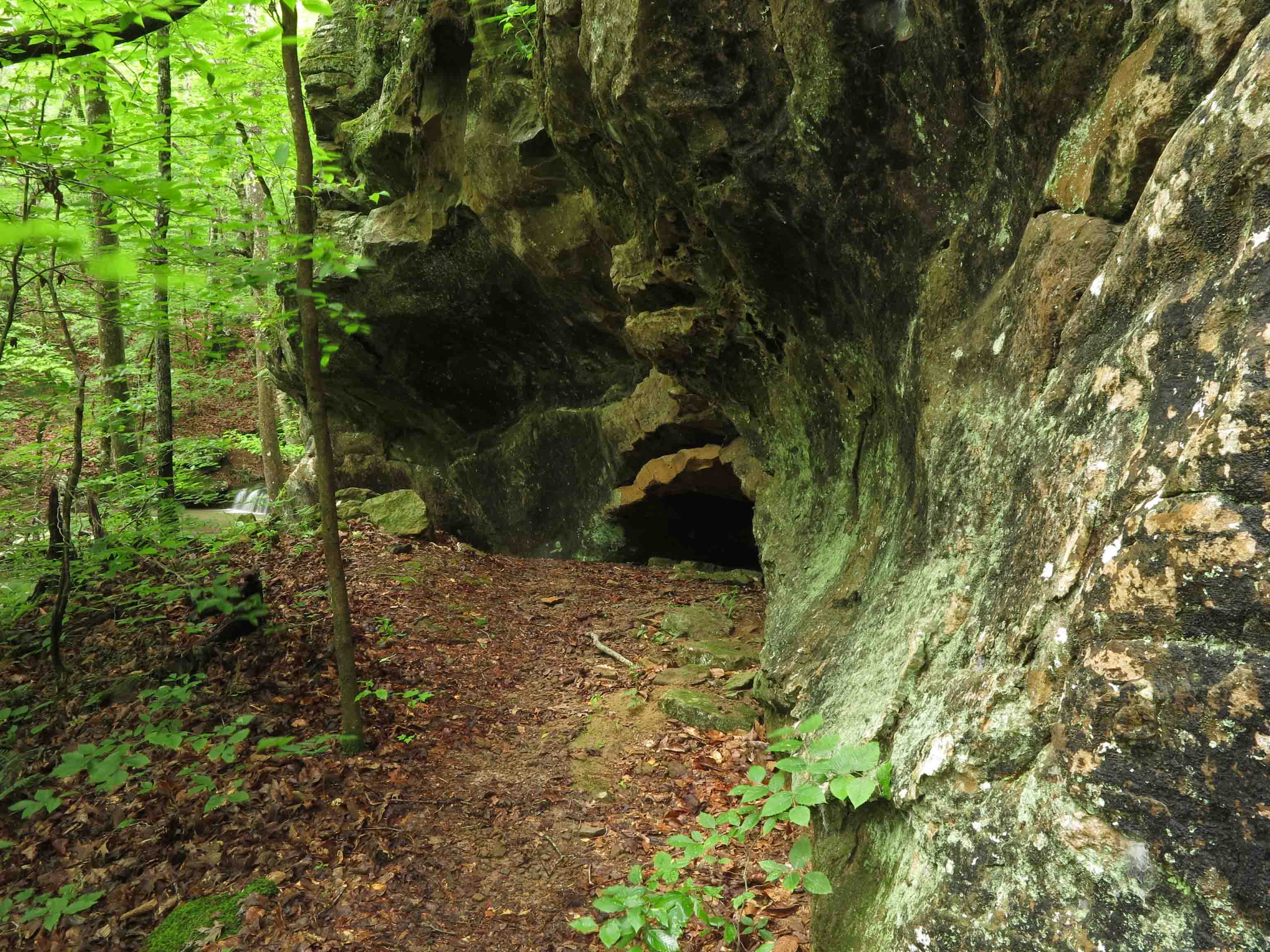
Little cave next to the Marinoni marker
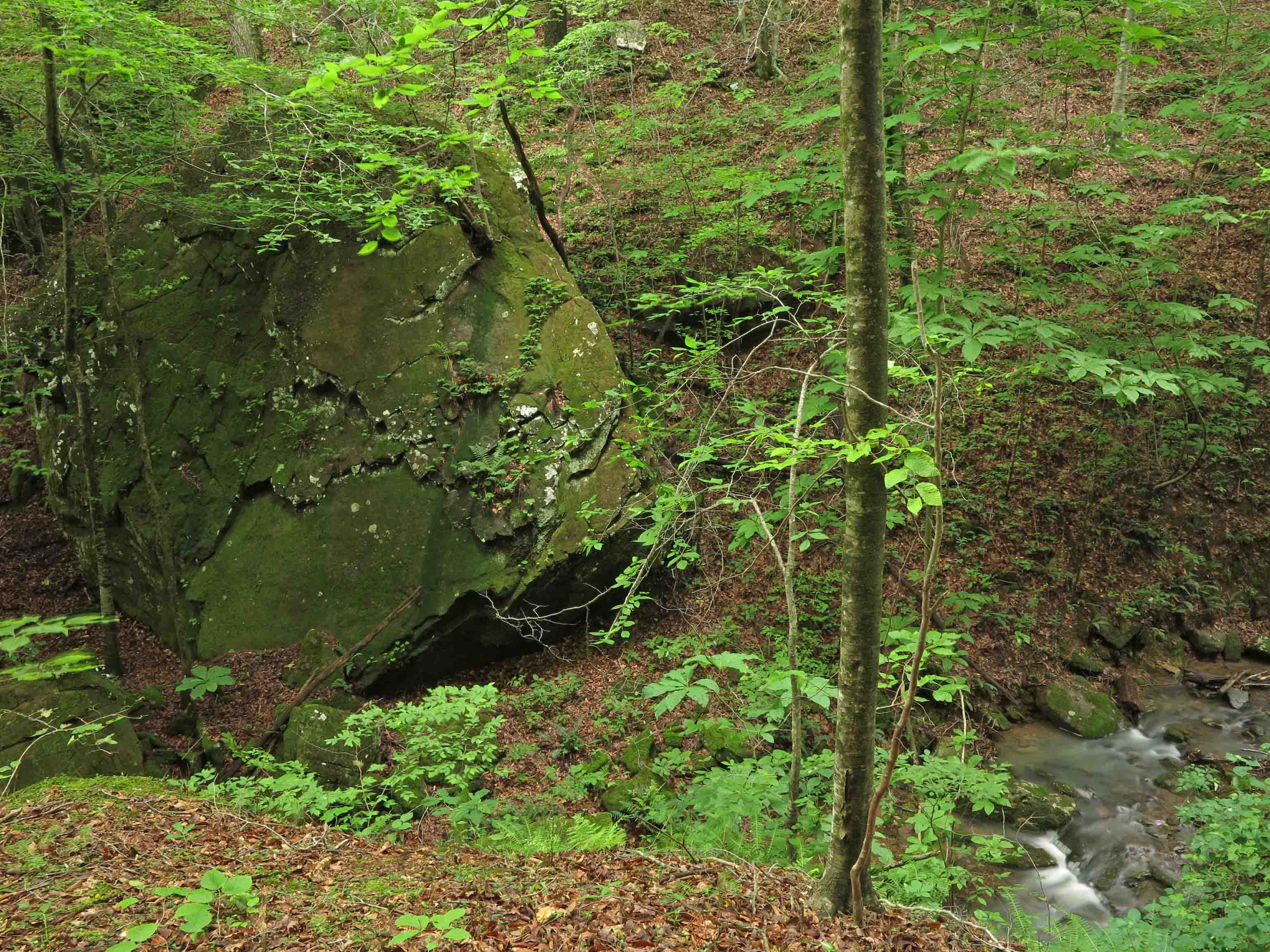
Large boulder across Briar Branch
I never hike this section without pausing to be amazed at the size of this boulder down next to the creek.
Crossing Briar Branch
Stone memorial for Dawna Robinson close to the trailhead
To read more about the Marinoni:
Making Time for Marinoni (includes driving directions to the trailhead)
Marinoni Revisited (Four Star Treatment)
In response to The Daily Post’s weekly photo challenge: “On the Way.”


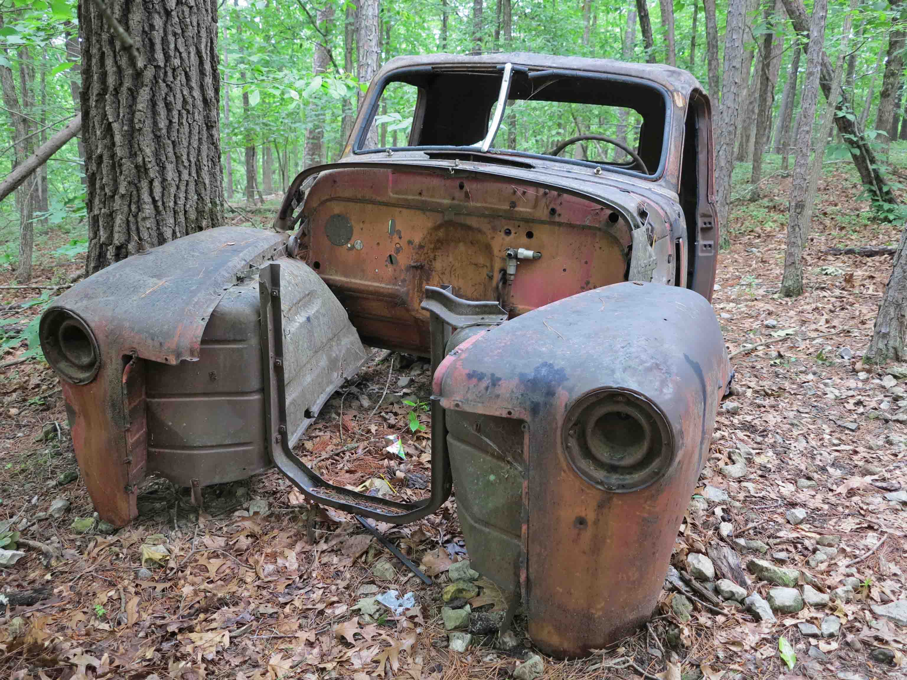
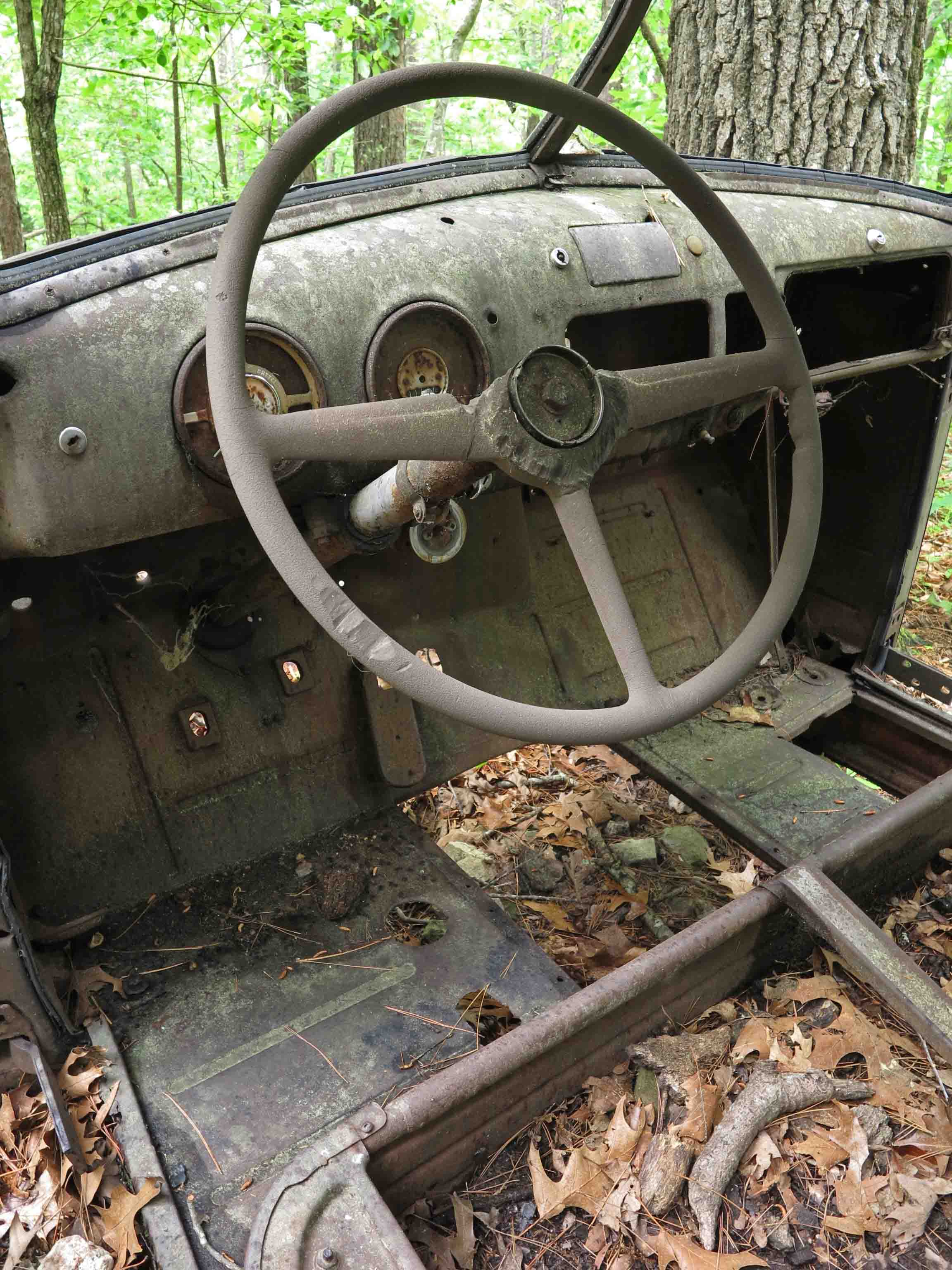
Broken Down in the Ozarks
I came across the remains of this old truck this morning. It was on a ridge trail leading to Beaver Lake in Northwest Arkansas. I’d like to hear the stories this broken down piece of history could tell.

In response to The Daily Post’s weekly photo challenge: “Broken.”

Weekly Photo Challenge: “Intricate” in the Ozarks
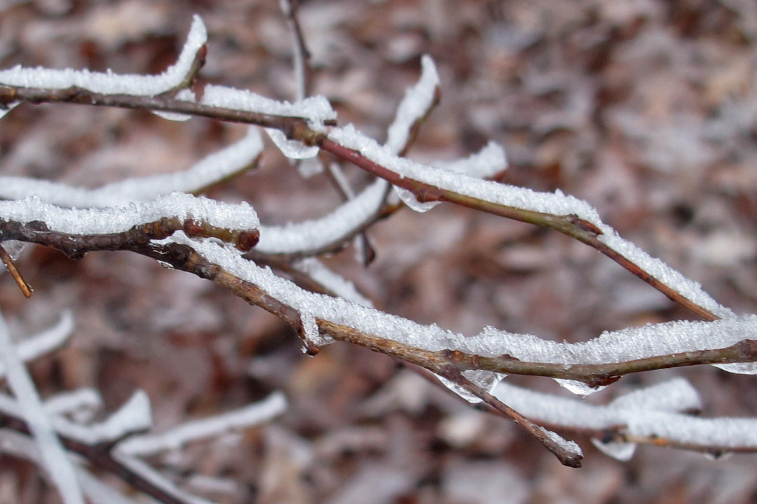
In response to The Daily Post’s weekly photo challenge: “Intricate.”
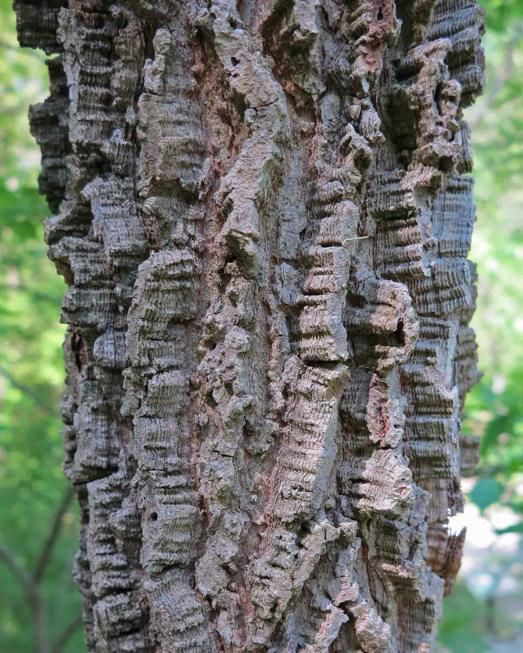
Tree bark
These intricate patterns caught my eye while hiking Saturday morning. I’m not sure of the tree name, but it’s located in the Ozarks close to Hobbs State Park in Arkansas. I snapped the picture and hurried on down the trail without trying to identify the tree by its leaves. Maybe someone with more tree identification skills can help.
Several photos from the past came to mind when I read the word ‘intricate.” Intricate patterns or designs in plants, rock, and water reveal themselves along the trails if I’m paying attention. Makes me wonder about the microscopic patterns I’m walking past without a thought.
Detail of rock formations in the Hurricane Creek Wilderness Area
Frosty intricate pattern on branches on Hare Mountain.
One of the visual gems so easily missed along the Buffalo River Trail.
The lip of White Rock Mountain Falls showing intricate patterns in the flow.


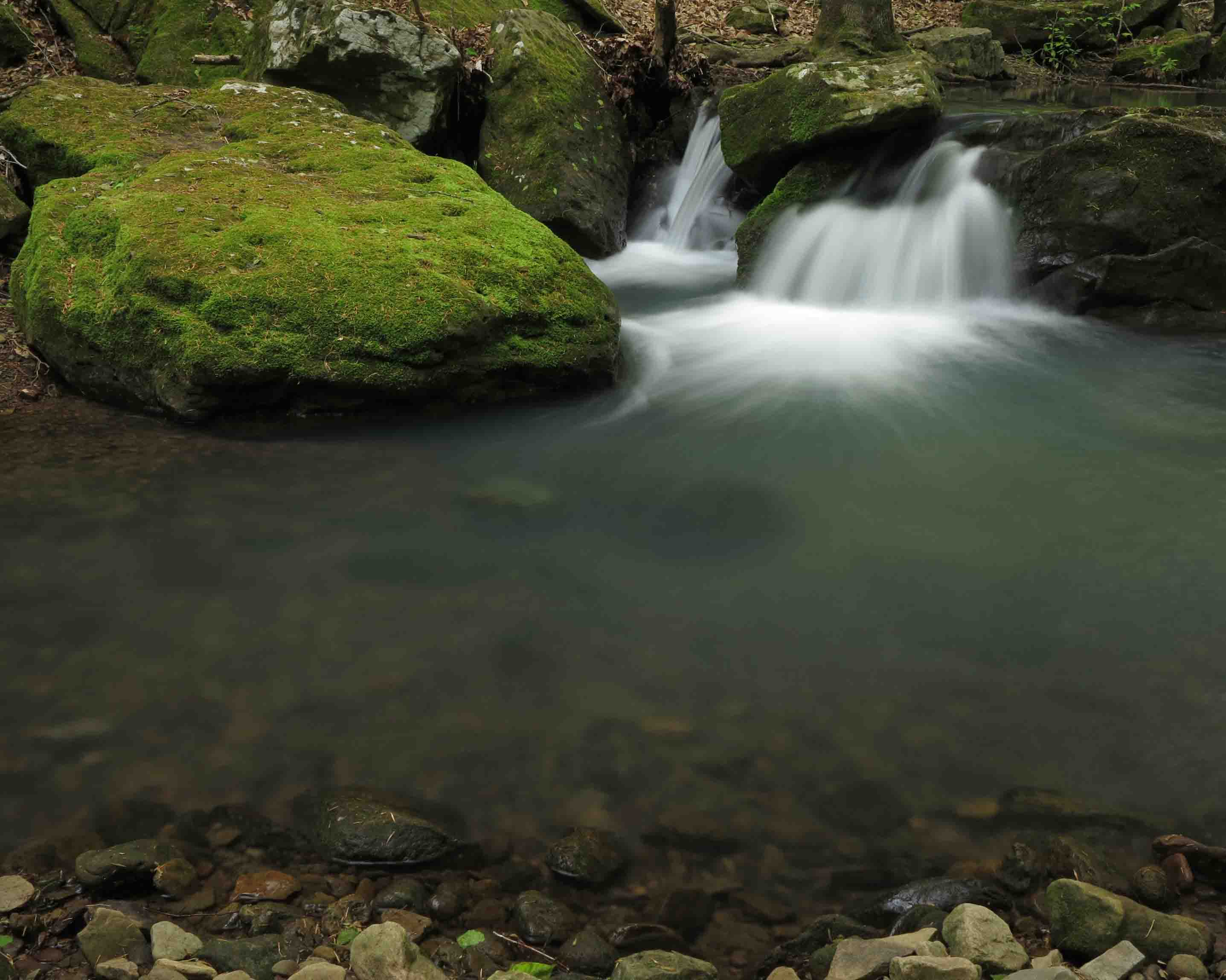
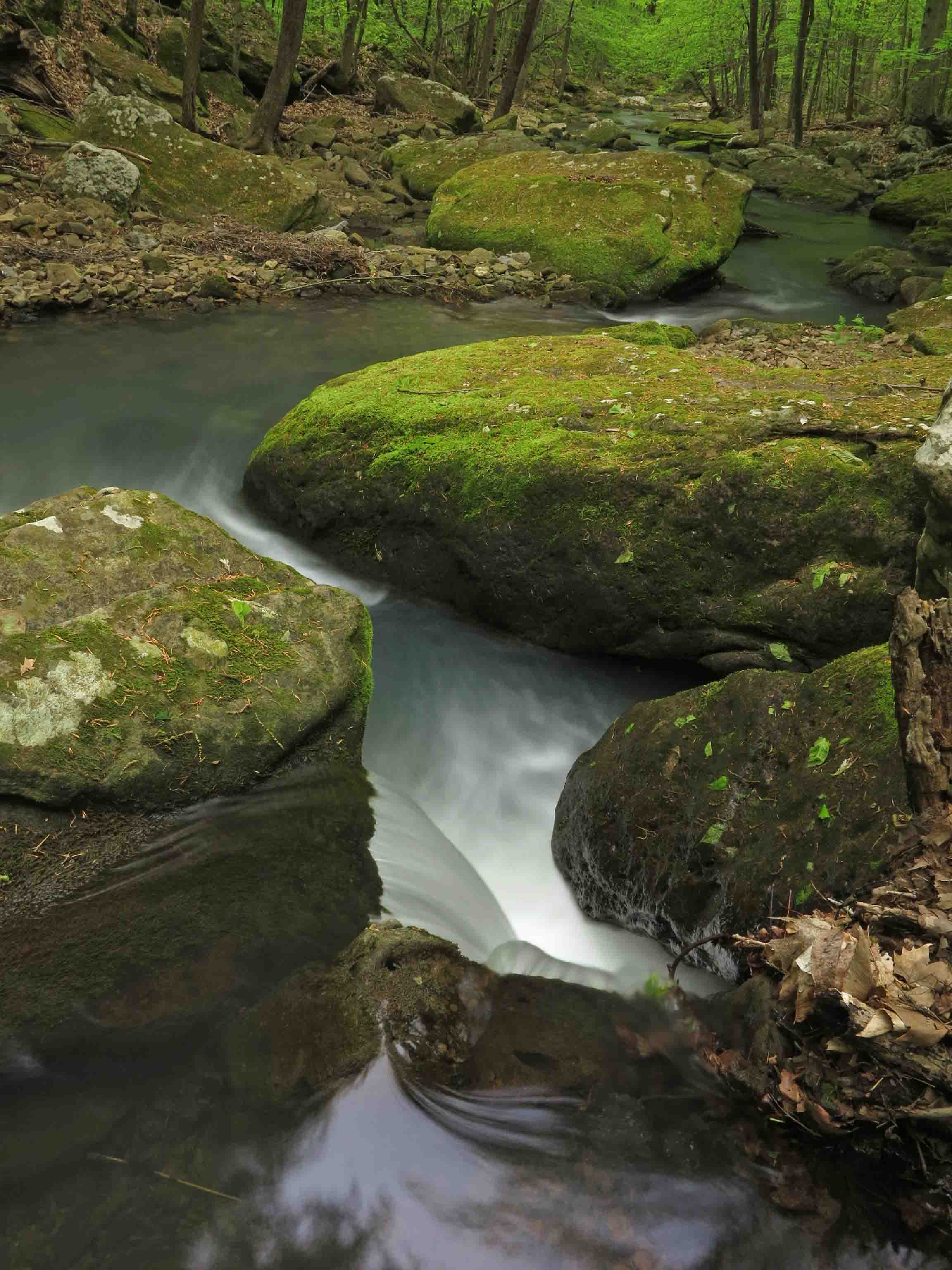
Movement of Water: Divine Brushstrokes
Elise Falls
The movement of water fascinates me. I feel like I’m recording the movement of divine brushstrokes across stone and air. These photos are from yesterday’s early morning 5-mile hike in the Smith Creek Preserve. Smith Creek flows into the Buffalo River, America’s first National River.
View downstream from a little cascade.
Smith Creek
Even in the stillness of this pool there is movement below and lightly dancing reflections on the surface.
In response to The Daily Post’s weekly photo challenge: “Motion.”


Early Bird Waterfall Watcher
Glory Hole Falls
Up at 5:00 a.m. so I could get to the Buffalo River region early last Saturday. I had the short trail to Glory Hole Falls all to myself. It was a special time since this trail is usually covered up with people on the weekends.
As I hiked away from the falls, I passed twenty hikers heading down the trail. I was thankful for my early morning time with this special little spot in the Ozarks.
Glory Hole Falls up close.
Hiker on Goat Bluff looking down on the Buffalo River
Later in the day I enjoyed some larger views. This wonderful fourteen-mile day was only possible because I chose to be an early bird hiker and waterfall watcher.
In response to The Daily Post’s weekly photo challenge: “Early Bird.”


