Ouachita Trail: Just Add Ice (160 miles completed)

IMG_5160rr

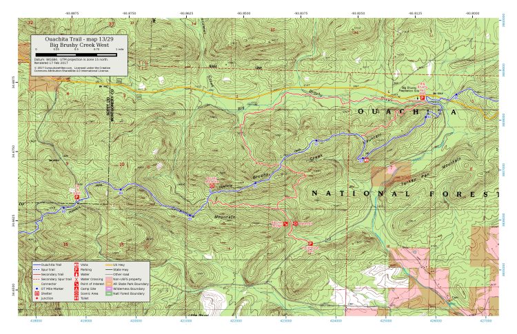
You must rise early with temperatures in the 20s to see frost flowers. That’s what I’ve told friends who express disappointment that they’ve never spotted them. Our second of four days on this 37-mile trek (MM 51-88) provided an unusual opportunity to see frost flowers all day. Skies remained overcast, and temperatures stayed below 30. These little guys slowed my progress on the trail as they called for me to stop to capture images throughout the day.

IMG_5171rr

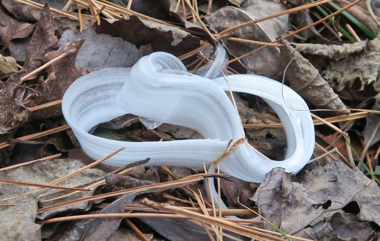
Frost flowers provide endless varieties of asymmetric shapes. Bob noticed the following frost flower which is only the second example of a symmetrical heart-shaped frost flower I’ve seen. I was thankful to capture this image since my wife enjoys finding heart shapes in nature.

IMG_5193rr

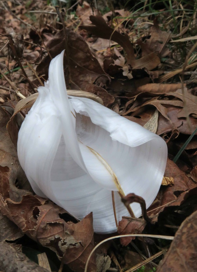
Another almost symmetrical shape was next to the trail. Bob and I were hiking apart at the time but later realized we’d both noticed this one and took photos.

IMG_5181rr

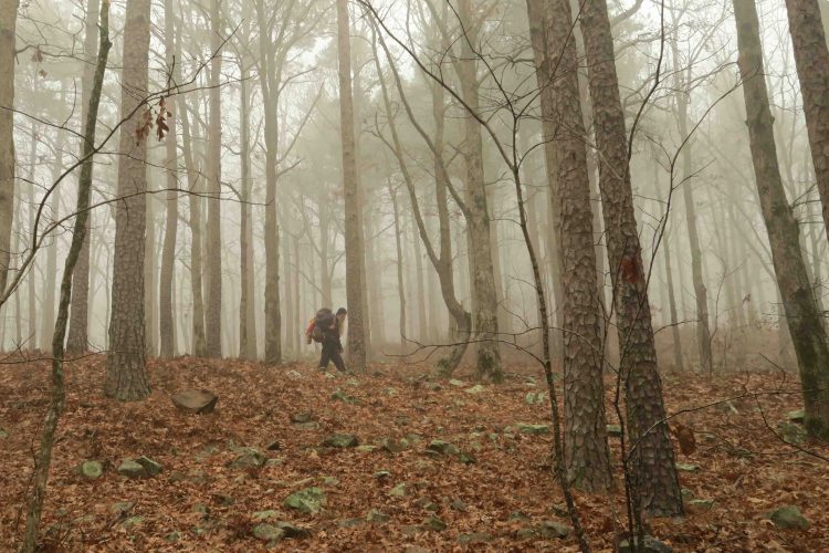
On several north-facing hillsides we saw displays of white that looked almost snow-like but were actually ice crystals that dropped from nearby trees.

IMG_5186rr

The week before Christmas, our wish for rain was granted (“Just Add Water”). This was a “just add ice” week on the trail. I felt anxious during our first day of hiking anticipating temperatures into the 20s with my 20-degree down quilt. Experienced backpackers will say bag ratings just mean you won’t die at that temperature, not that you’ll be comfortable. By wearing a base layer top and down pants, I slept comfortably under my quilt.
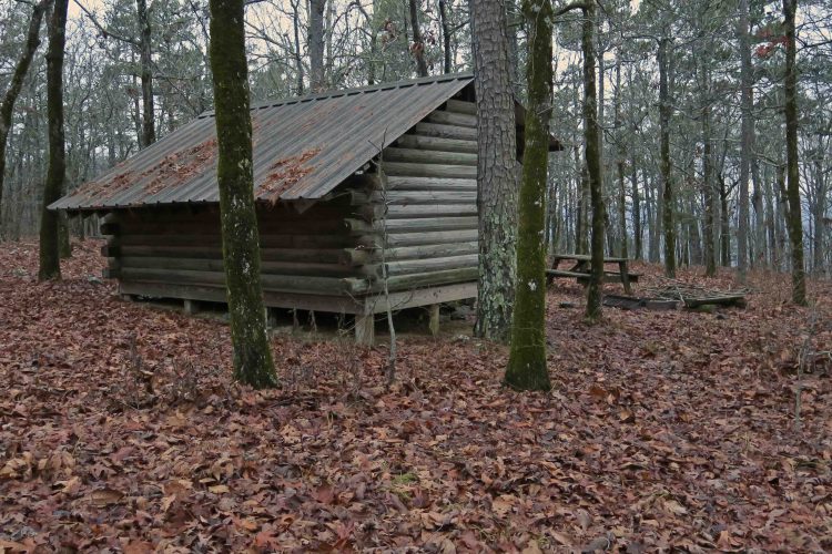
IMG_5148rr

Black Fork Shelter

We stayed at three shelters, Black Fork, Foran Gap, and Turner Creek. Scott, who completed Ozark Highlands Trail over the last couple of years, joined us for an overnighter at Black Fork Shelter. He commented that this was his first shelter camping experience and that it was enjoyable.

IMG_5207rr

With cold temperatures, we thought our water cache at Hwy 71 might be frozen. We’d placed our jugs under a large tree trunk surrounded by leaves and were surprised to find our water was ice-free. Small creeks in the area were flowing so the water jugs weren’t necessary but saved us lost time from filtering.

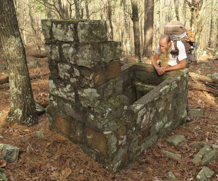
At Turner Creek, we met only the second backpacker we’ve seen on our first 160 miles of the Ouachita Trail. Kurt, from Oklahoma City, was thru-hiking east to west, so we shared scouting reports with each other. We were able to tell him about Tan-A-Hill Spring (pictured below) where Kurt would be collecting water the next day.


IMG_5153rr

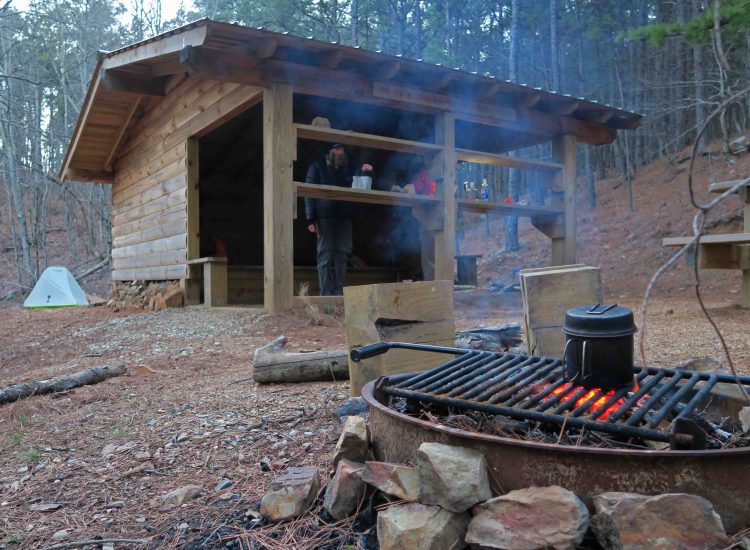
Cold temperatures and lots of available firewood justified nightly fires for warmth and cooking

IMG_5273rr.jpg

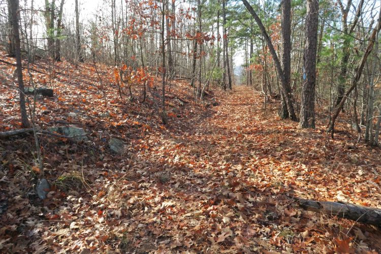
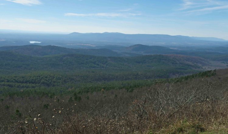
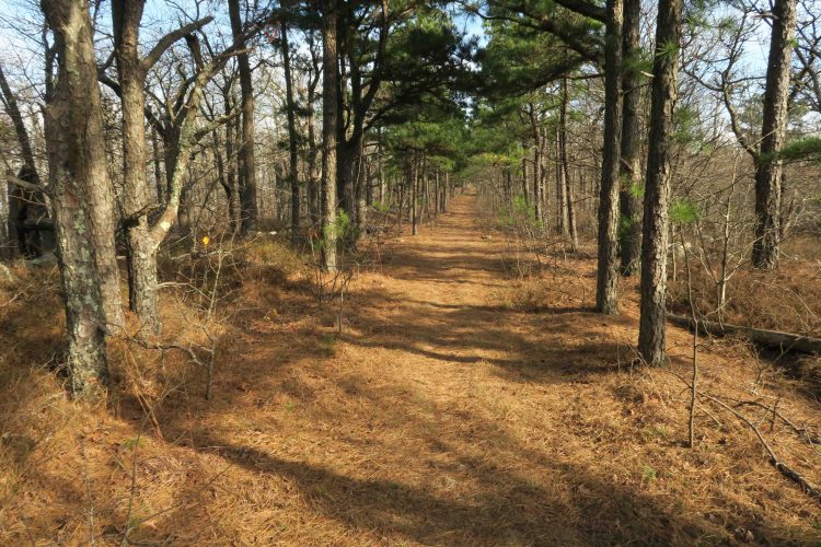
The Ouachita Trail provided beauty and interest at every turn. Trees sometimes limited vistas but extended horizons reminded us of the expansive country that surrounded us.

IMG_5302rr

One of many rocky outcrops along the trail.

IMG_5280rr

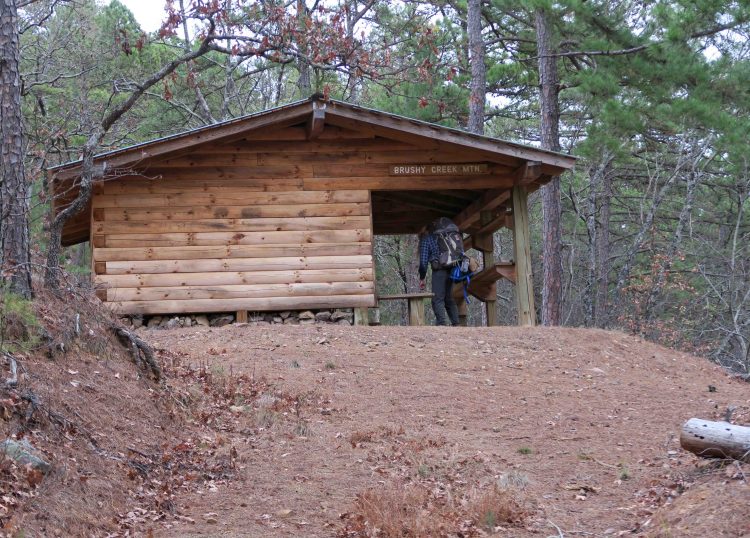
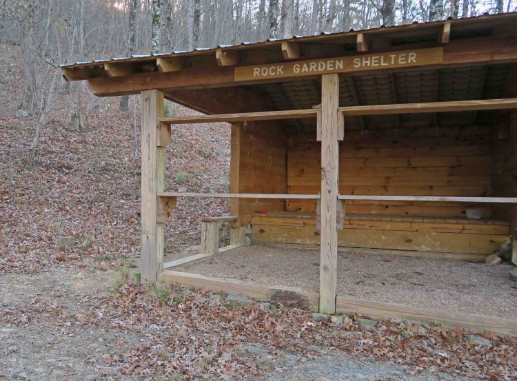
Turner Gap Shelter from the approach spur trail

After shuttling and picking up water jugs, we ended our hike surrounded by an icy-cold cloud at Queen Wilhelmina State Park as we enjoyed a large burger.

Kurt, who we met earlier, had bragged about the Rich Mountain Country Store at the base of the mountain, so I stopped for a cup of coffee to go. I ended up enjoying a visit with the witty and entertaining store owner, Steve Watson.  This is a place I’ll come back to in the future!

Other Ouachita Trail Thru-Hike Posts: Ouachita Trail’s First 51 at the (Im)perfect Time / The Ouachita Trail: Just Add Water (Mile 88-160) Due to dryness (at the time) and available days, we did the first 51 miles, then skipped to mile 88-160 the week before Christmas. After Christmas, we did miles 51-88 included in this present post.

The Ouachita Trail: Just Add Water

IMG_4910rr

Early morning vista from the trail

Ouachita (Wash’-i-taw) is a word I’ve heard all my life. As a child, I knew “Ouachita” as the name of my parents’ college. The Ouachita was also a large river that flowed through Arkansas and close to my home. It was imprinted in my memory due to a very cold dunking I took during a winter float trip.

With this hike of 70+miles, Ouachita’s Native American translation as “happy hunting grounds,” resonates with me. I would add “VERY BIG hunting grounds.” Again and again, I found myself pausing in awe of these massive woods.

IMG_4704rr

Bob approaching one of many large pines in the Ouachitas.

After completing a very dry 51 miles of the Ouachita Trail using several pre-planted water caches, we decided to skip 37 typically dry miles and begin at the Buck Knob Trailhead close to mile 88. We had wished for rain during our last hike in hopes that creeks would collect water for our next outing. On this hike, our wish was more than granted!

IMG_4671rr

Day 1 (Dec. 16) We placed one water cache with our names and dates of travel written on the side of the plastic jugs. Then we hiked from Buck Knob Trailhead to Big Brushy Shelter as the sun went down. I’d tossed an Arby’s sandwich in my pack for a quick supper. I threw the meat on the grill and toasted the buns. A fast food sandwich never tasted better. There was a light sprinkling of rain that night.

IMG_4734rr

Gage fixing breakfast

Day 2 – 3 (Dec. 17-18) Woke to a soft fog and hiked to Fiddler’s Creek Shelter with occasional light rain and drizzle. Temperatures were warm, so wetness wasn’t a concern. As the evening fell, Gage joined us at the shelter. He was thru-hiking from east to west, and we enjoyed visiting around a warm fire. He would be the only backpacker we saw during our eight days on the trail.

The next day was a short distance to Suck Mountain Shelter. We arrived at 1:30 p.m. after walking an extended ascending roadbed.

IMG_4775rr

The Suck Mountain Shelter completed the series of structures covering the length of the Ouachita Trail. The newer shelters include extended front covers and shelves as well as gravel surface in the porch area. We marveled at the amount of work and funding it must take to prepare sites, transport materials and complete the construction. The final structure is solid and meant to last!

IMG_4776

IMG_4784rr

We considered ourselves visitors to the shelters. Permanent residents included mice, dirt daubers, and barn swallows. We saw evidence of wasps from warmer seasons. During the night stereophonic coyote calls bounced around in the valleys below.

IMG_4778rr

Barn swallow nest

IMG_4788rr

Sunset at the Suck Mountain Shelter

Day 4 (Dec. 19) We had a rainy 14-mile walk to the John Archer Shelter. It was one of the earlier designs and perched unobtrusively on a hillside away from the trail. Dry clothes felt good when we arrived, and it didn’t take long to eat and crawl under my down quilt. It rained all night with periodic rounds of hard rain.

IMG_4823rr

Ranger John Archer Shelter

Day 5 (Dec. 20) We began our walk in a drizzling cloud wearing our wet clothes from the day before. Later in the day, we caught some of the only sun we’d seen in three days.

A concrete walkway across Irons Fort allowed us to cross high and dry. We spent a few minutes enjoying the views upstream and down. I later learned that in 1981, John Archer and a group of Ouachita Mountain Hikers came to this concrete bridge that had recently been built by two men from Mount Ida.

Archer wondered if the bridge withstood recent flooding of Irons Fork. He wrote, “When they came to the bridge the first comment I heard was, ‘Isn’t this a beautiful place!’ The hikers were looking up and down the creek. That made my day.” Read more in John Archer’s concise History of the Ouachita Trail 1970-1997.

Following Irons Fork crossing, we came alongside a tributary with small cascades that called for more exploration. I could have spent a whole day walking up that stream with camera and tripod, but we had trail miles to walk.

IMG_4839rr

Irons Fork concrete bridge built in 1980

IMG_4849rr

The view up Irons Fork

IMG_4867rr

Tributary to Irons Fork

After covering 12 miles, we arrived at the long downhill spur trail to Big Branch Shelter. We were relieved to find good water, though I had to backwash my Sawyer Filter between every filtering session. During the night, we listened to distant coyote calls, but our thrill came from the howls within our very own Big Branch valley. Amazing sound!

IMG_4958rr

Big Branch

IMG_4964rr

Glancing skyward while huffing and puffing my way up Blue Mountain.

Day 6 (Dec. 21) We had good weather for our hike from Big Branch to Blue Mountain, passing through great open woods. I was smitten with nostalgia during the climb as I thought back to hiking this section as a four-mile out-and-back over twenty years ago. I was surprised and a little disappointed in how difficult today’s climb felt. I chalked it up to carrying a loaded pack and the fact that I’m twenty years older than the last time I walked this trail. I looked forward to seeing the shelter that I visited then and was relieved that, unlike my body, it didn’t show its 20-years of wear.

IMG_4994rr

Blue Mountain Shelter

Day 7 (Dec. 22) It rained all day with only one pause as we got our water cache close to the Ouachita Pinnacle. It was a cold walk but only 8 miles to Big Bear Shelter, next to a small seasonal stream labeled as having “fairly reliable water.” After the rain of the past four days, it was flowing nicely, but we were glad to have our water cache and avoid lost time filtering. I privately plotted another hike to this area in the future to explore rock outcrops in this valley and to place a new journal in the shelter.

IMG_5010rr

Rock outcrops across the seasonal stream at Big Bear Shelter

During the night temperatures dropped, and rain raged strong. We were thankful to be inside the Big Bear Shelter! I slept warm under my down quilt with slight feelings of dread as I anticipated having to put wet clothes on the next morning.

IMG_5048rr

One of several vistas from the last day

Day 8 (Dec. 23) We enjoyed a 9-mile walk to the Highway 7 Trailhead. It was cold, and my feet were wet, but the big woods of the Ouachitas were beautiful every step of the way. The miles clicked off steadily as images of a big post-hike meal filled my thoughts. A hot, crispy catfish dinner from The Shack in Jessieville filled the bill as we planned our next excursion on the Ouachita Trail!

the-shack-jessieville

Trip Advisor image

Equipment fail but high praise for True Grit Running Company: I’m sorry to report a shoe fail. I had high hopes for my Altra Timp trail running shoes, but with only 125 miles of the Ouachita Trail completed, they must be retired. I’ve liked the wide toe box, sticky soles, and platform, but they’re not built for dirt and rock trail hiking.

When I returned these shoes to True Grit Running Company, owner Melissa exchanged them without hesitation and set me up with another pair of shoes that will meet my needs. I’m thankful for locally owned businesses like True Grit, and helpful service-oriented people like Melissa!

IMG_5102rr

Altra Timp Trail Runners with holes worn through the upper fabric.

IMG_5504rr

Replacement shoes from True Grit Running Company

Best of 2017 OzarkMountainHiker

IMG_9778r

Here are my top five posts in no particular order based on views for 2017. Following these five are my personal favorites for 2017, posts that were particularly rewarding to write or that reflect on an experience I enjoyed on the trail. 

In 2012 when I first started this blog, I had no idea that it would provide such enjoyment and learning. Thank you for reading and letting me share my love of the trails! Pass OzarkMountainHiker.com along to others who love the outdoors. 

Ouachita Trail’s First 51 at the (Im)Perfect Time

Walking Toward Authenticity: Nimblewill Nomad

Hiker-Dog’s Adoption Trail 

Exploring Arkansas Features the Marinoni Scenic Area

Completing Our Goals in the Ozarks

Personal Favorites 

When in Doubt, Write 

A Special Guest on My Home Trail

New Strings

Evening Walk in the Marinoni

Hiker-Dog’s Resume 

Walking Toward Authenticity: Nimblewill Nomad

IMG_4585rrr

It’s startling when you come across a human being who is authentic, demonstrating a congruence between thoughts, actions, and beliefs. Nimblewill is such a person. I’ve visited with him and heard two presentations, one after his Pony Express Historic Trail and the second time after he walked Historic Route 66 from Chicago, IL to Santa Monica, CA.

IMG_4595rr

As he shared honestly and emotionally from the joy he experienced on Route 66, I pictured him walking mile after mile as little pieces of pretense and imitation fell to the ground. Finally, there was only the core person walking on, completely real, alive, and true. This is the person we see now, but he has been years and many miles in the making.

IMG_1919rr

On long walks, I’ve sometimes felt little flakes of my inauthentic self fall away. There might be a tinge of  pain or a gentle sense of loss, followed by a lightness of mind and spirit. Sometimes it’s a chunk of fakeness I’ve projected to others in seeking their approval. This dropping away can be a relief, even if I’m barely conscious of the change as it occurs.

Nimblewill in CA

It will take many miles before I experience even a small measure of the trueness that Nimblewill has accomplished and maintains within himself.

Regardless of the distance, it is good that we walk. Step by step, the trail will perform her sanding and buffing as we approach our more genuine selves.

Walk on Nimblewill, and we will follow you toward authenticity.

Ouachita Trail’s First 51 at the (Im)perfect Time

IMG_4042rr

It’s too dry, too warm, and a busy time with the job. It’s the im-perfect time for hiking the first 51 miles of the Ouachita Trail (pronounced: Wash’-i-taw). But, wait too long, and I’ll hear Jimmy Buffett in my head singing, “someday I will.” So, thru-hiking the Ouachita Trail has been on my to-do list long enough. Perfect time or not, now’s the time to do this!

Bob Cable completed the Ozark Highlands Trail thru-hike with me, so I contacted him about doing this. He was ready to go, and we hoped others might join us for some of the sections.

The plan developed to do the first very dry 51 miles over a week in late November, planting water caches where needed. We’d continue our hike over Christmas break.

IMG_4057rr

Our first steps on the trail at Talimena State Park were met with a cool, sunny morning, and a pine needle carpeted forest floor. Early on, we passed through a glade-like area that reminded me of the Missouri Ozarks.

IMG_4079rr

IMG_4092rr

Sometimes, mile markers were missing but usually shown with placards. Less often, we’d see USGS metal markers. 

Thanks to Michael Reed for his Ouachita Trail Map linked from his blog, The Compulsive Hiker. A portion is shown on the heading of this post.

We were surprised to see water pockets in a small creek as we approached Dead Man’s Gap where we’d stashed couple of gallon jugs the day before. I didn’t schedule Hiker-dog for this trip due to water concerns and my lack of familiarity with the trail. She was missed, but will join us on later sections.

IMG_4097rr

Small water pocket covered in leaves.

IMG_4109rr

I hadn’t planned to use the shelters regularly, but the modest distance between and the reputation of a rugged Winding Stair Mountain led me to schedule the first 51 miles around their locations. The novelty of experiencing these shelters was also a factor. It turned out to be a good plan because miles were just right and allowed some exploring time upon arrival each afternoon.

IMG_4136rr
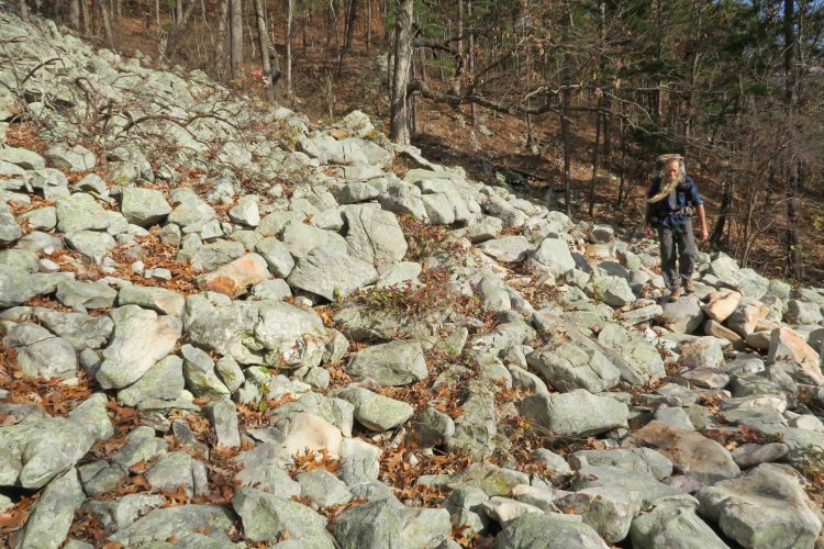
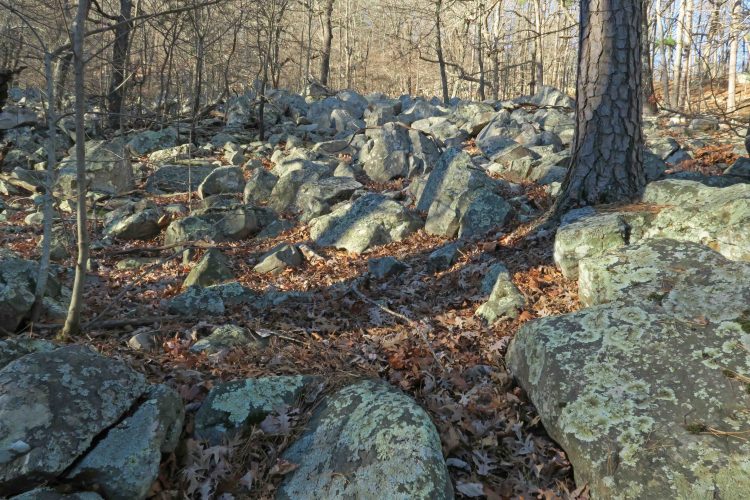
The Rock Garden Shelter got its name honestly. The next several miles involved careful stepping. We were impressed with how different the Ouachitas felt from the Ozarks. Part of it was the increased number of pine trees, but I think the foundations of the differences stemmed from geology. The Ouachitas were formed by the colliding of geological plates while the Ozarks developed from a volcanic uplift, both followed by many years of shaping from erosion.

IMG_4121rr

IMG_4381rr

The shelters included a fire ring and picnic table, luxuries by our standards. The fire ring grill and plenty of dry wood made cooking easy. I used instant potatoes as a base for each dinner. The biggest challenge was getting those handles without burnt fingers.

On a couple of mornings, I used my fuel tab stove for oatmeal and coffee since no simmering was needed.

We arrived at the Holson Valley Shelter in the early afternoon and watched the view into Holson Valley as darkness fell. Beautiful coyote howls and owl calls filled the cool night.

IMG_4206rr

We were puzzled by this lone rock structure a few yards from the trail. It appeared to be a smoker or grill, but there were no other indications of civilization in the area.

IMG_4267rr

IMG_4284rr

It was smooth sailing on this old abandoned roadbed leading up Winding Stairs Mountain toward the shelter by the same name, placed close to the footings from a now absent fire tower. We enjoyed reading through shelter journals. What follows is one of the more artistic entries from this mountain peak journal with a popular quote by Shanti Devi.

IMG_4285rr

I woke during the night and could barely see the picnic table through the thick cloud that enveloped Winding Stair Mountain. The next morning we began our hike with soft lighting provided by a gently lifting fog.

IMG_4295rr

IMG_4301rr

Red Spring got its name honest. The red of iron tainted water puddled around the PVC pipe. A covered concrete cylinder captured the spring water that trickled steadily from the end of the pipe.

IMG_4317rr

Rock gardens greeted us occasionally but less frequently than the miles earlier in the trail.

IMG_4327rr

We scouted Big Cedar Creek before beginning our hike and determined that no water stash was needed. The water was clear and easily filtered. We filled all containers and enjoyed lunch next to this beautiful creek’s rocky shore.

IMG_4340rr

Big Cedar Creek

Both signage and maintenance are impressive on the Ouachita Trail. We saw signs at important junctions and examples of recent work to keep the trail clear of trees. Thank you FoOT (Friends of the Ouachita Trail). The stone footings for this sign appeared to have been there for many years.

IMG_4427rr

IMG_4468rr

IMG_4476rr

The State Line Shelter was perched just below the trail shortly after crossing into Arkansas. There was just enough space behind the shelter for Bob’s tent. Powerful winds blew through the night.

The next morning we enjoyed stopping at the Pioneer Cemetery. Bill Hefley’s stone was the only granite marker.  All others were native stone with illegible lettering. We were interested in the coins and small rocks placed on many of the headstones. I later learned that it’s common for veterans to leave coins paying tribute to the deceased.

A sign at the entrance shares the legend that during the Civil War a young girl was collecting firewood for her family (other sources say water from a nearby spring). She never returned. Her frozen body was found in a tree where she sought refuge from wolves. It is said that her spirit continues to haunt Rich Mountain, evidenced by strange lights seen in the trees. I thought of the previous nights’ coyote howls and starlight peeking through stunted oaks on the high ridges of Rich Mountain. It’s easy to see how the story of haunting continues today.

IMG_4495rr

As we approached Queen Wilhelmina State Park, we passed several impressive rock walls on this fast level section of trail, hindered only by occasional green briers that arched across our path.

IMG_4510rr

Walking through the campground at Queen Wilhelmina State Park with the Lodge uphill in the distance was a joy, knowing a high calorie meal was in our immediate future.

IMG_4531rr

Queen Wilhelmina State Park Lodge

Our next steps will continue following the trail toward the east. This first dose of the Ouachita was a treat, so we’re looking forward more Ouachita Trail miles to come!

Links to other sections of this the Ouachita Trail project:

Ouachita Trail: Just Add Water

Ouachita Trail: Just Add Ice

Ouachita Trail Completed 

map-ouachitatrail-v5a-13r

An excerpt from Michael Reed’s map #13 east of Queen Wilhelmina State Park, our next section.

My Sometimes “Cheeky” Hiker-Dog

WordPress Photo Challenge: CheekyIMG_5175rr
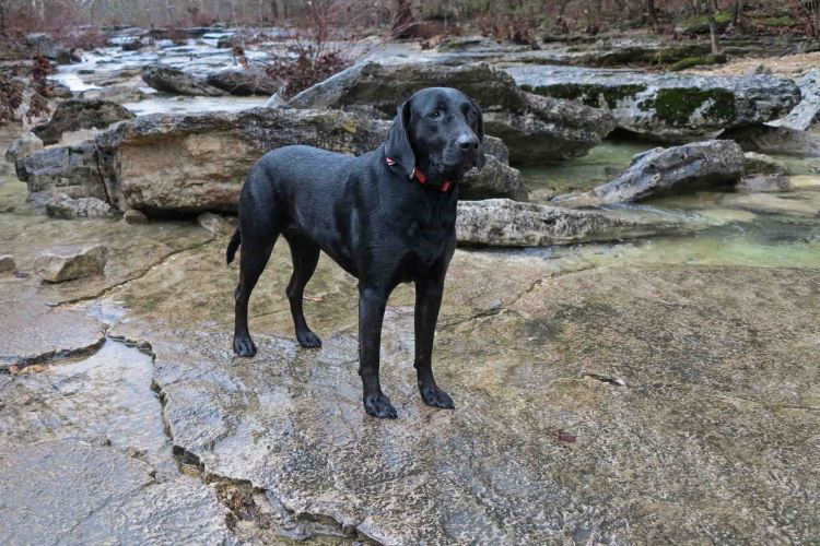
Hiker-dog gave me this scoffing look on a rainy day in the Hercules Wilderness Area in Missouri. She gave me this same look moments earlier after I fell on a muddy trail.

On a sunnier day and trail closer to home, Hiker-dog looked back as if to say, “Are you coming or not?” This is a “cheeky” look I often get when she pauses to see if I’m still progressing down the trail. IMG_2542 Hiker’s curiosity is entertaining. img_8381rrBelow is a little resume I share at slideshows. I offer it here if you’d like to know a little of her story.

Hiker-dog resume 072217