Maramec Spring: A Missouri Ozarks Surprise

IMG_9534rr

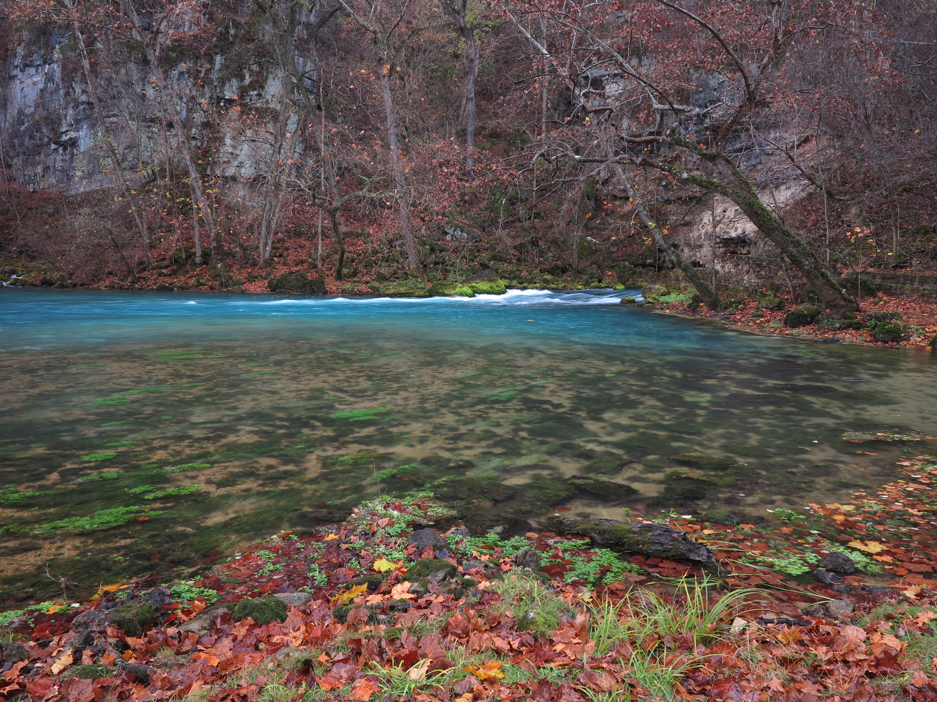
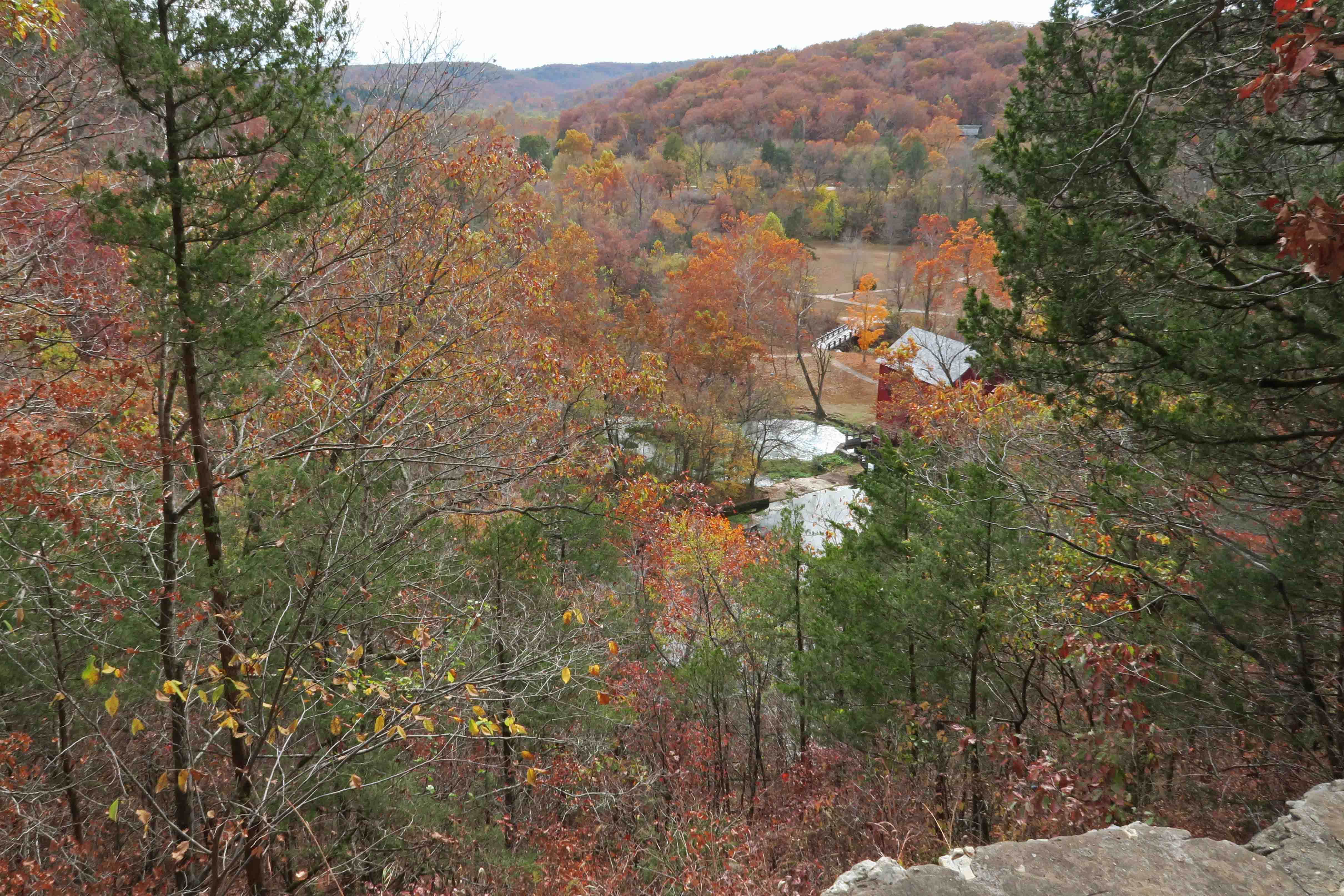
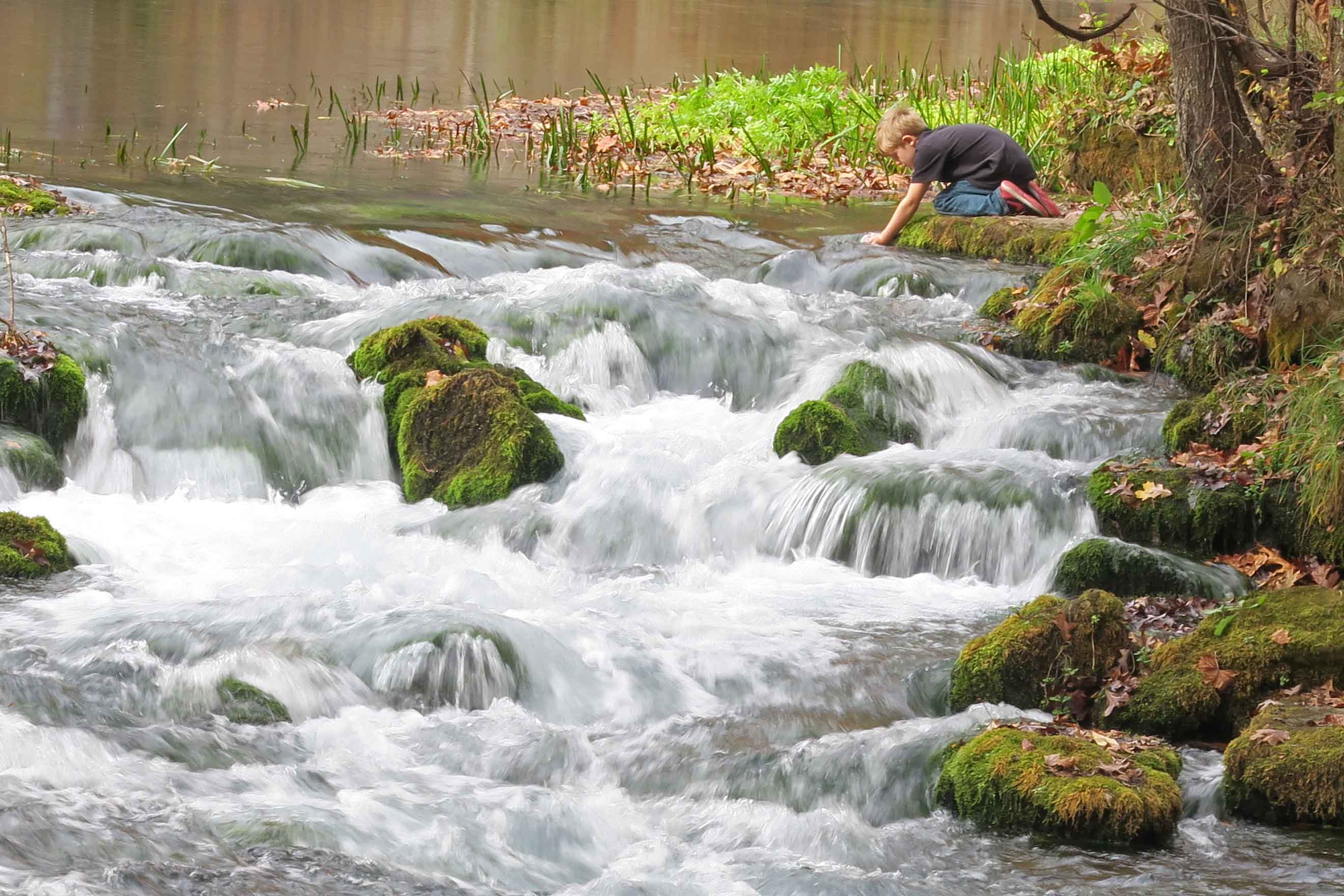
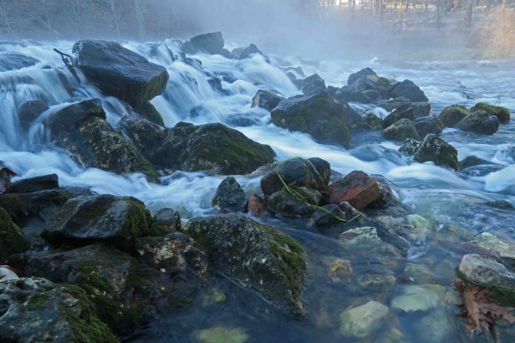
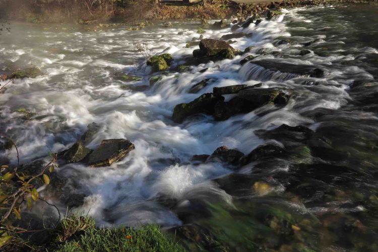
Cascade below the Maramec Spring in early morning light

While driving Missouri Highway 8 toward another hiking location, a quick stop for a few photos turned into several hours of exploration, rich with beauty and history. Maramec Spring was a delightful surprise!

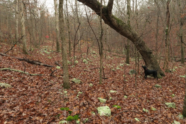
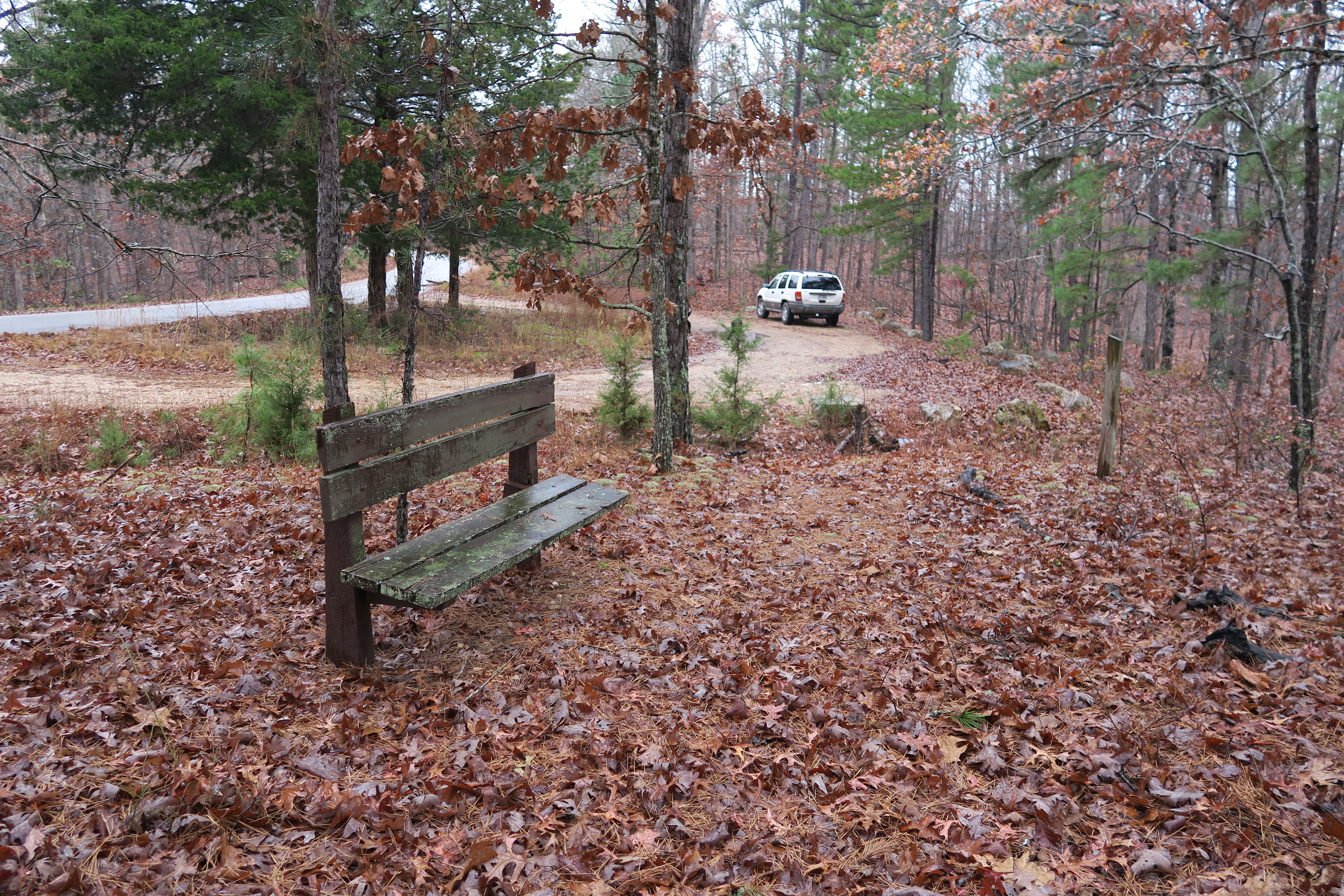
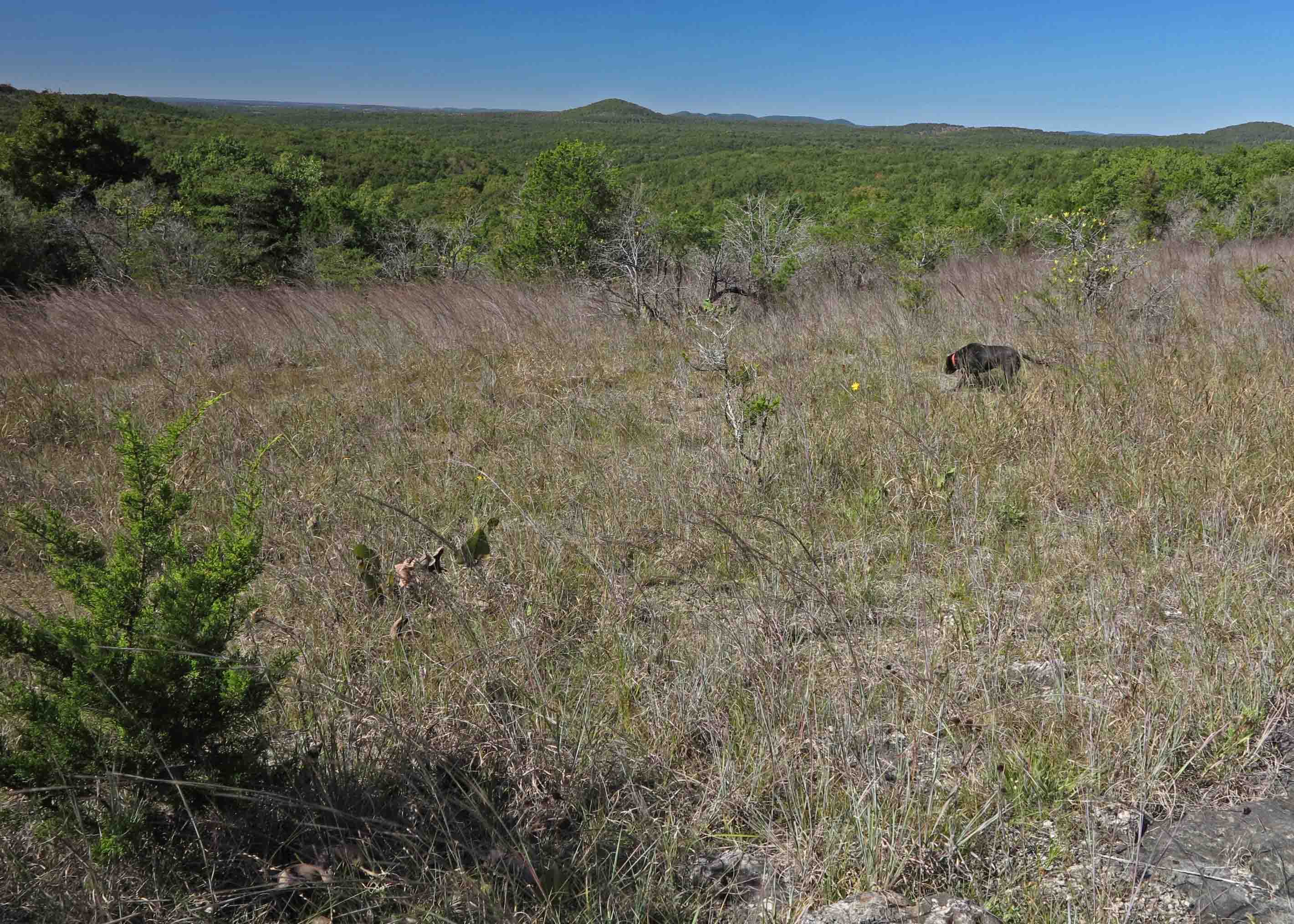
I had read of no trails in the area, and hiking wasn’t listed as an available activity on the Maramec Spring website, so I was puzzled to see two ladies beginning their morning walk. They said they enjoyed the paths around the spring and walking down Maramec Creek with cameras in hand. I quickly scanned the area and started my GPS, hoping to record a pleasant route.
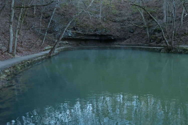
IMG_9516rr

Maramec Spring

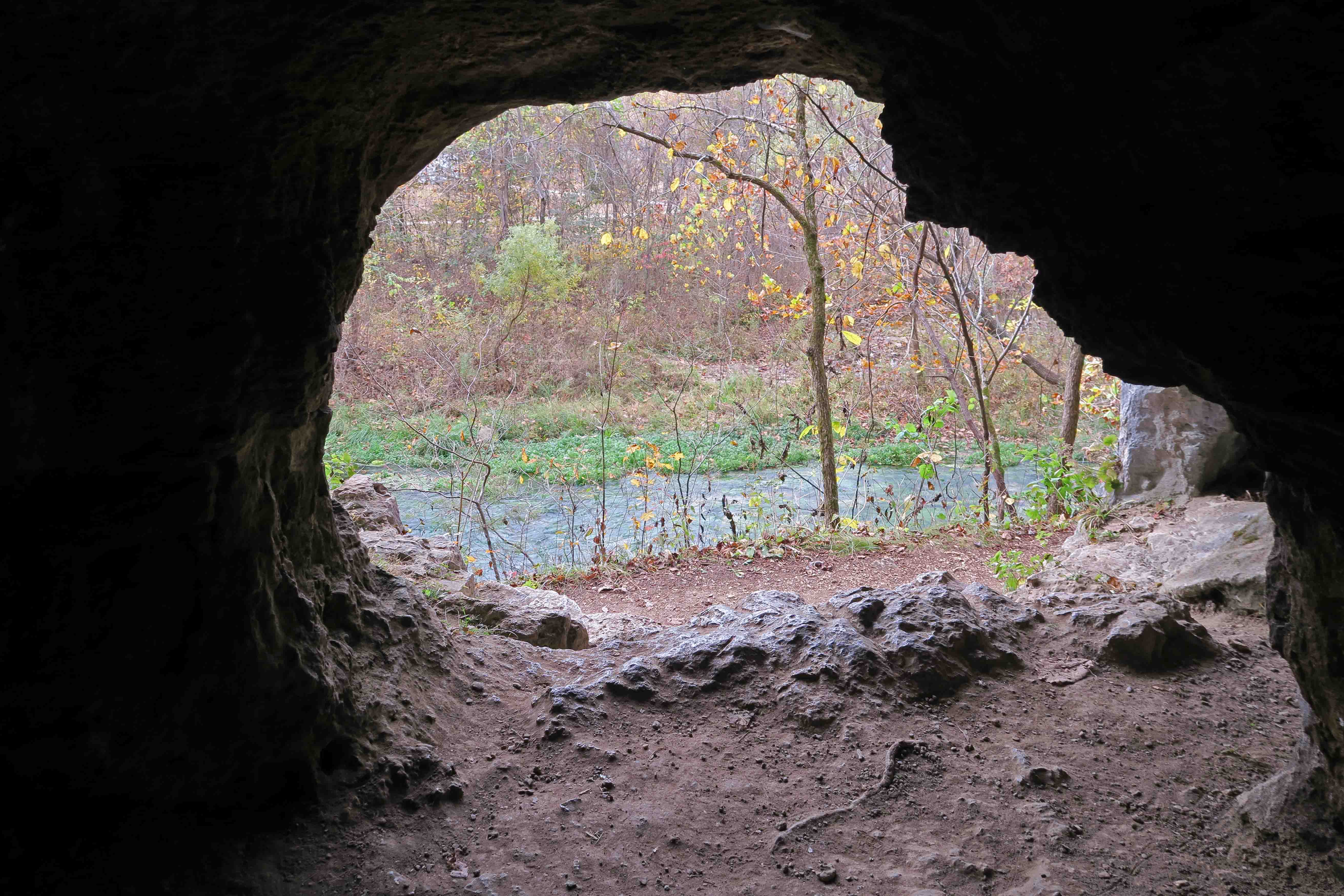
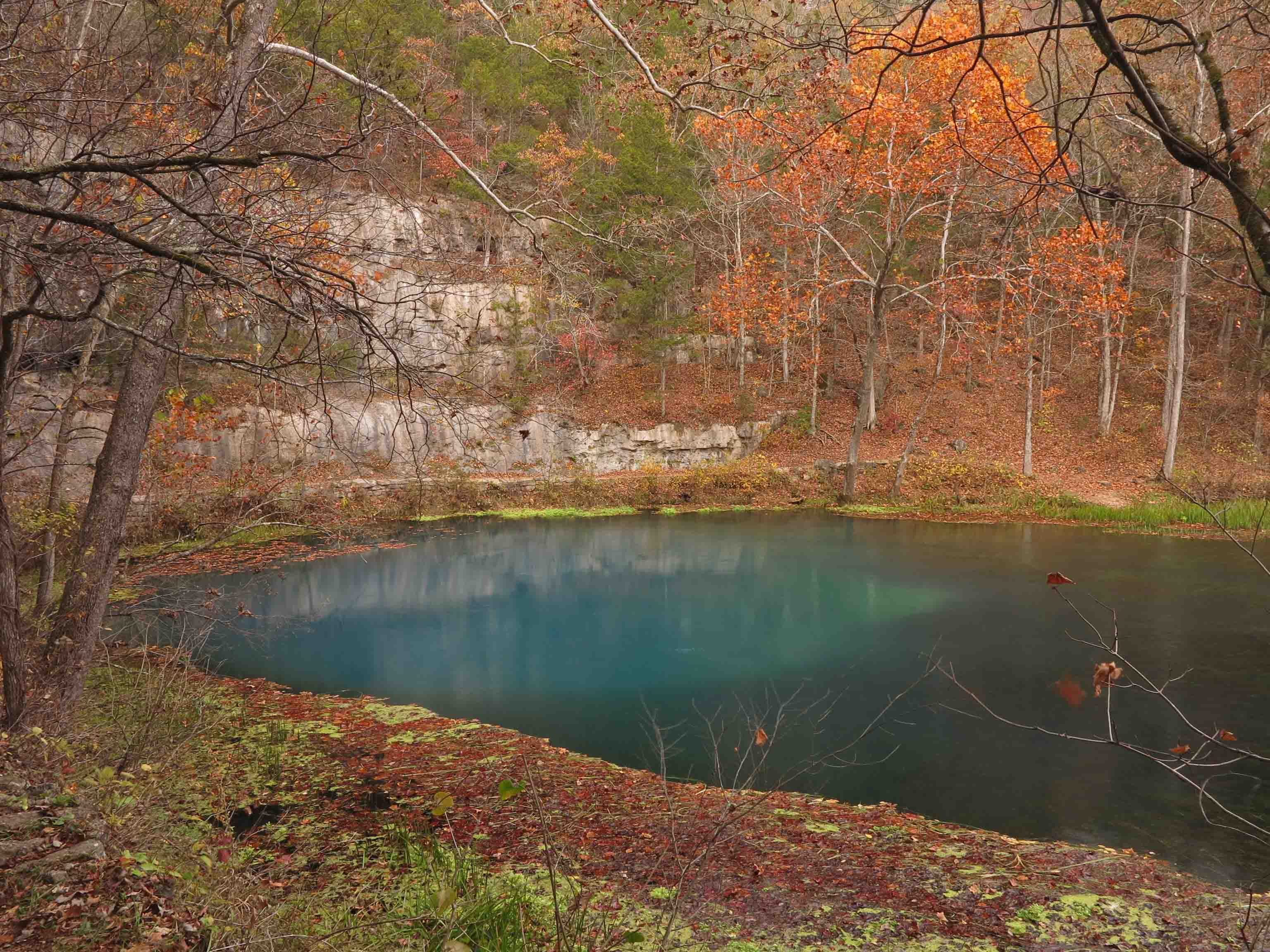
My walk led directly to the Maramec Spring, a gentle and broad spring whose strength isn’t realized until a nearby cascade demonstrates the volume of water flowing from the ground. Park literature indicates this is Missouri’s fifth-largest spring with an average daily output of 100 million gallons. Another source listed the volume as 90 million gallons and the sixth or seventh largest spring in the state. Regardless of size, its beauty is top of the line.

IMG_3968rr

Cascade below Maramec Spring

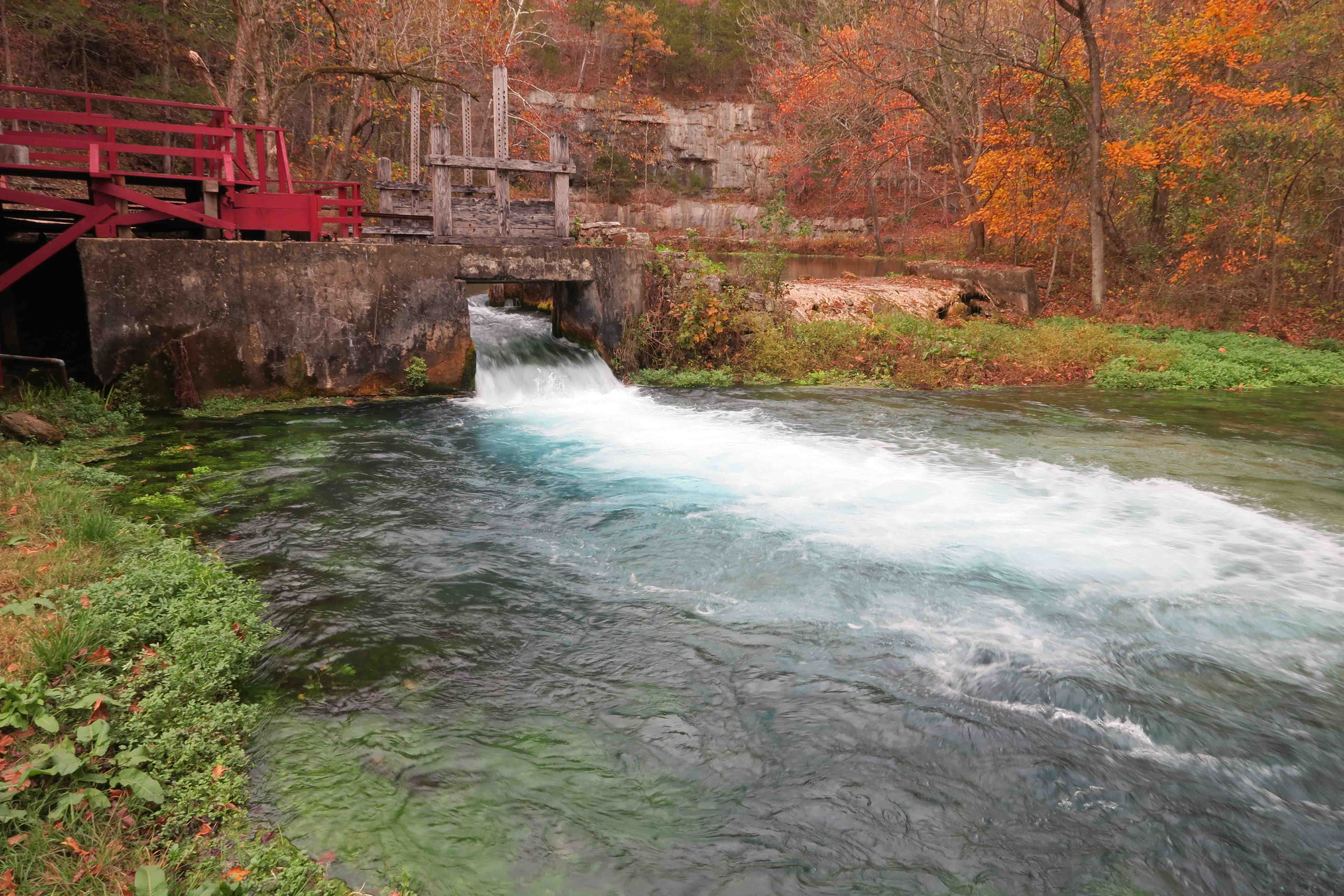
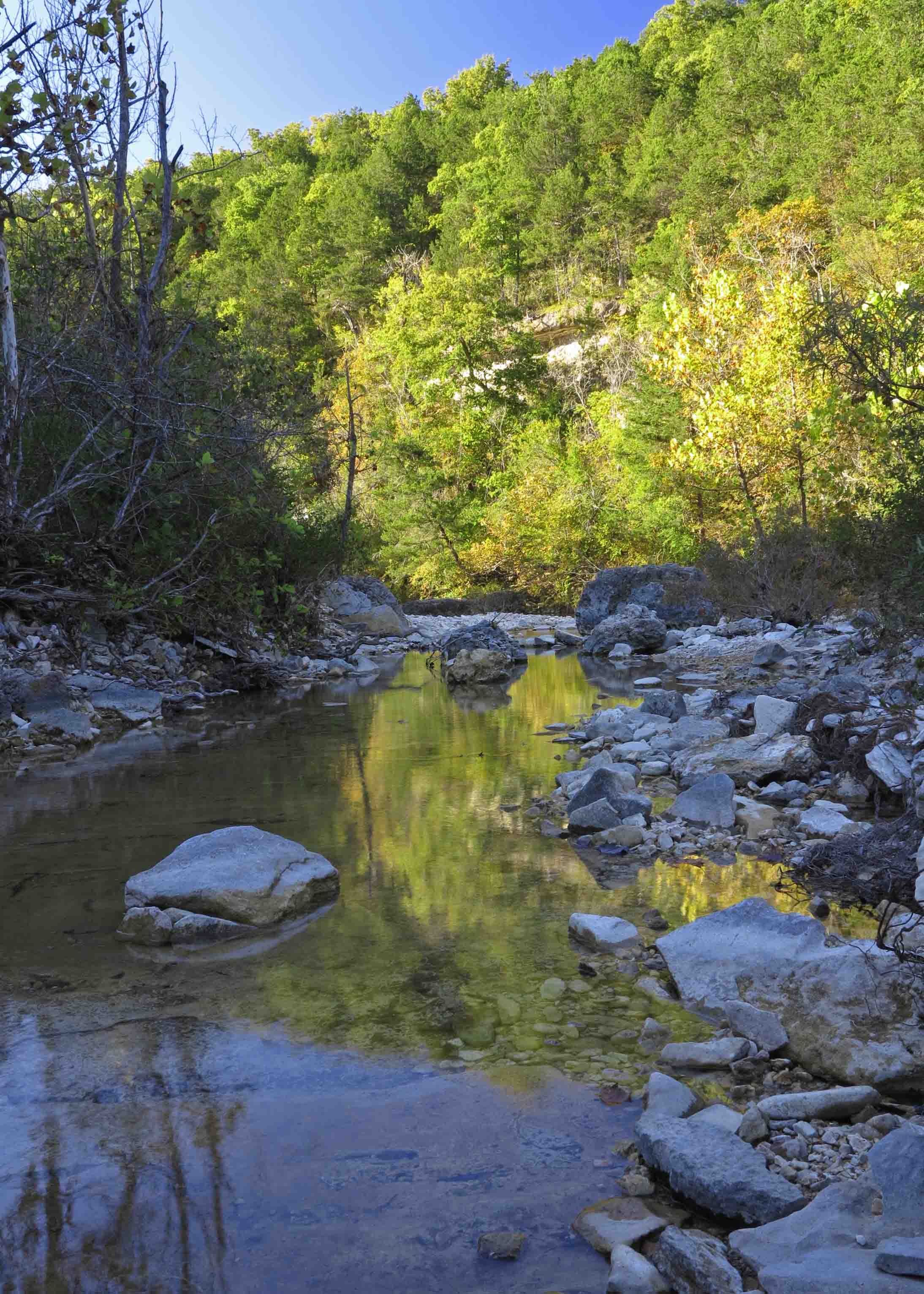
Another demonstration of flow-rate is on display at a bridged spillway downstream. This water will travel about 165 river miles to where the Maramec River empties into the Mississippi.

IMG_3973rr

IMG_3986rr

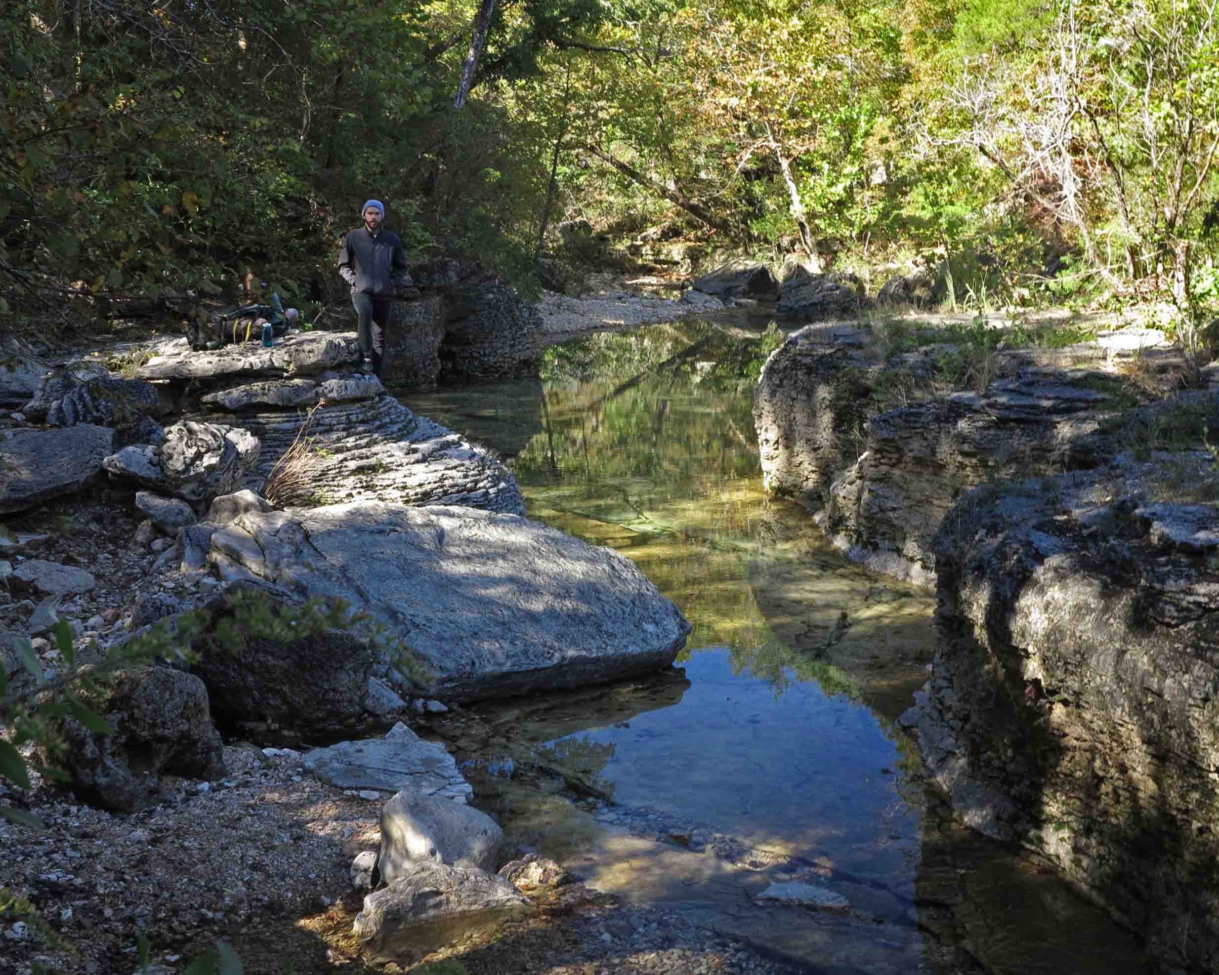
Cypress knees border  Maramec Creek where fly fishing begins

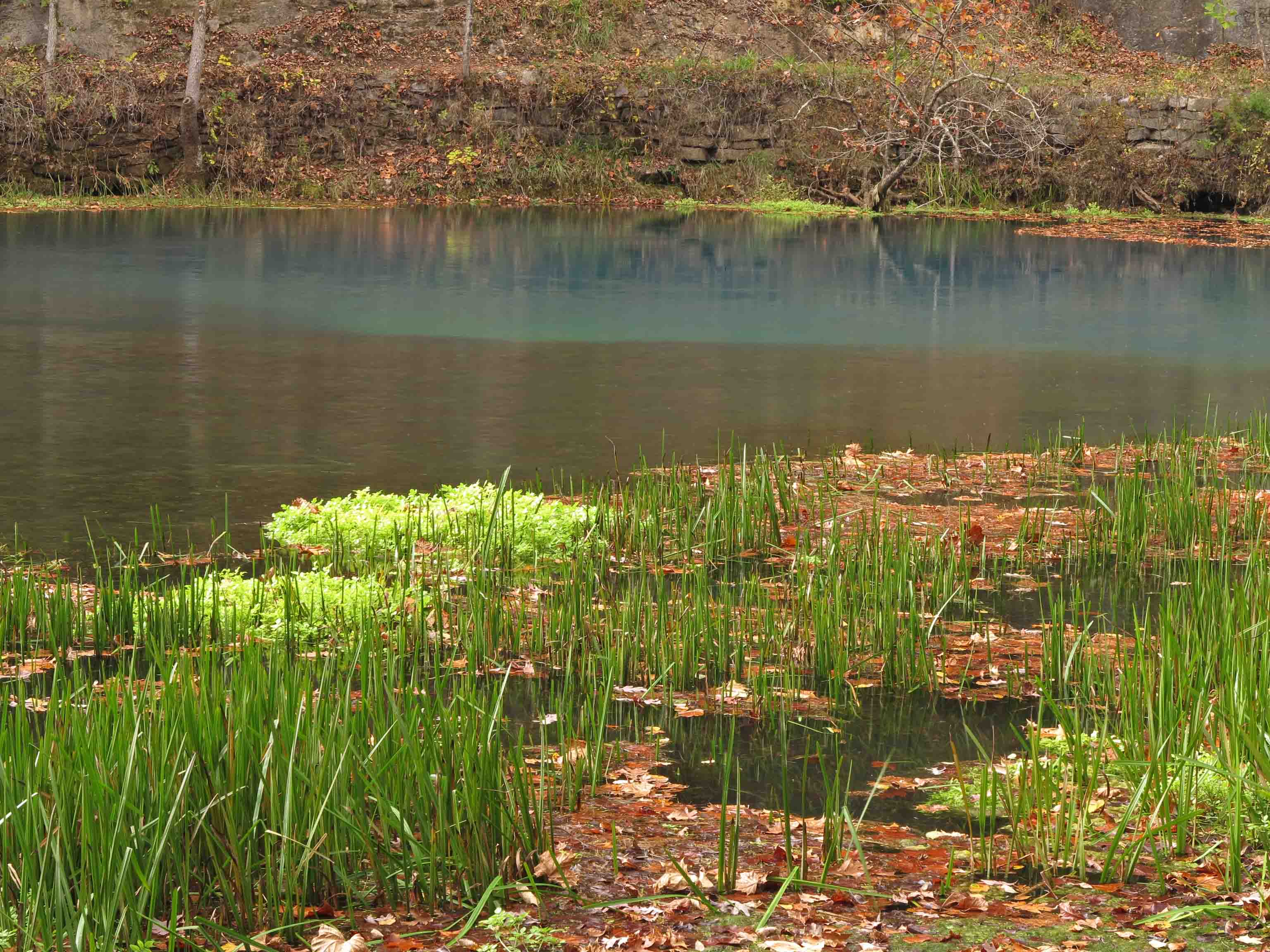
The flow from Maramec Spring eventually widens into a creek channel where fly fishermen enjoy their pursuit of trout, visible just below the clear cold currents.

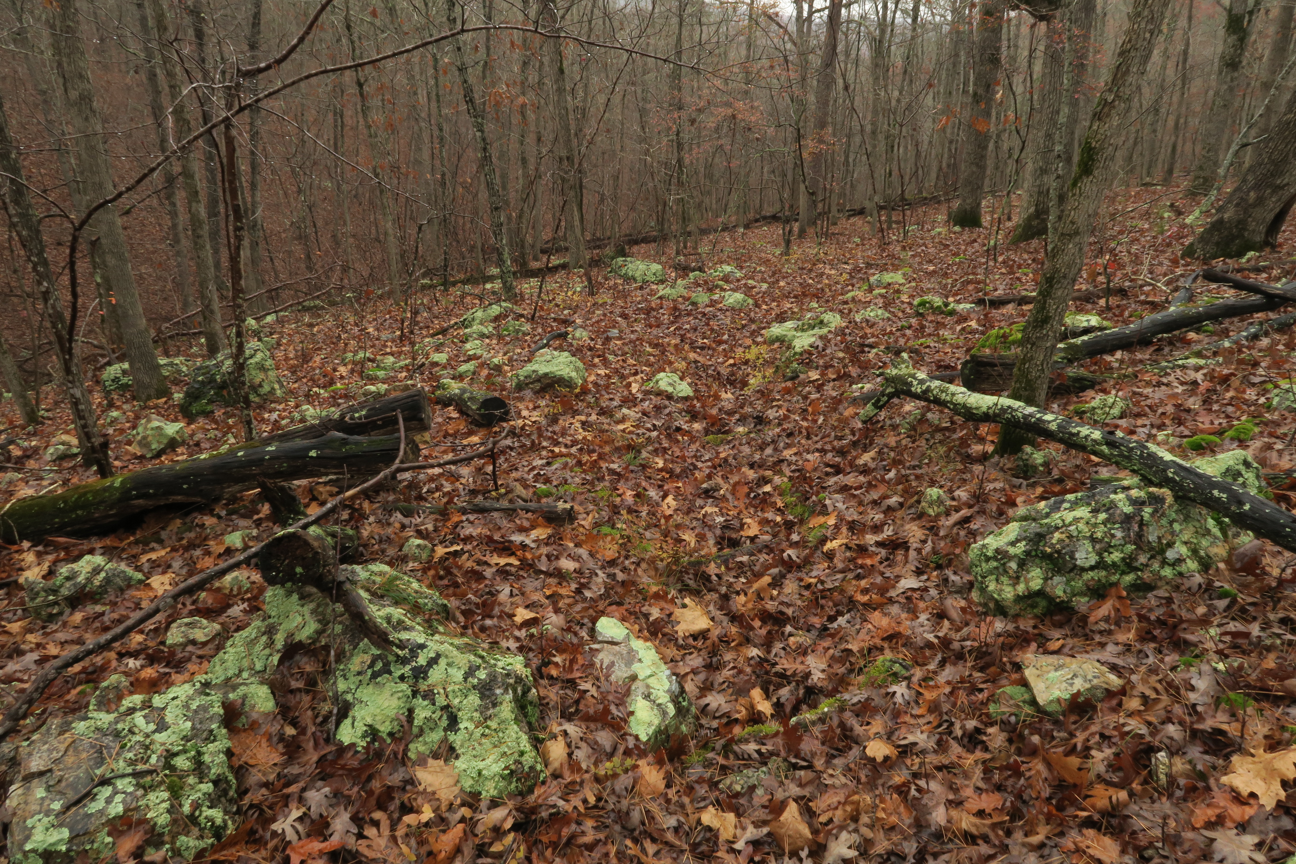
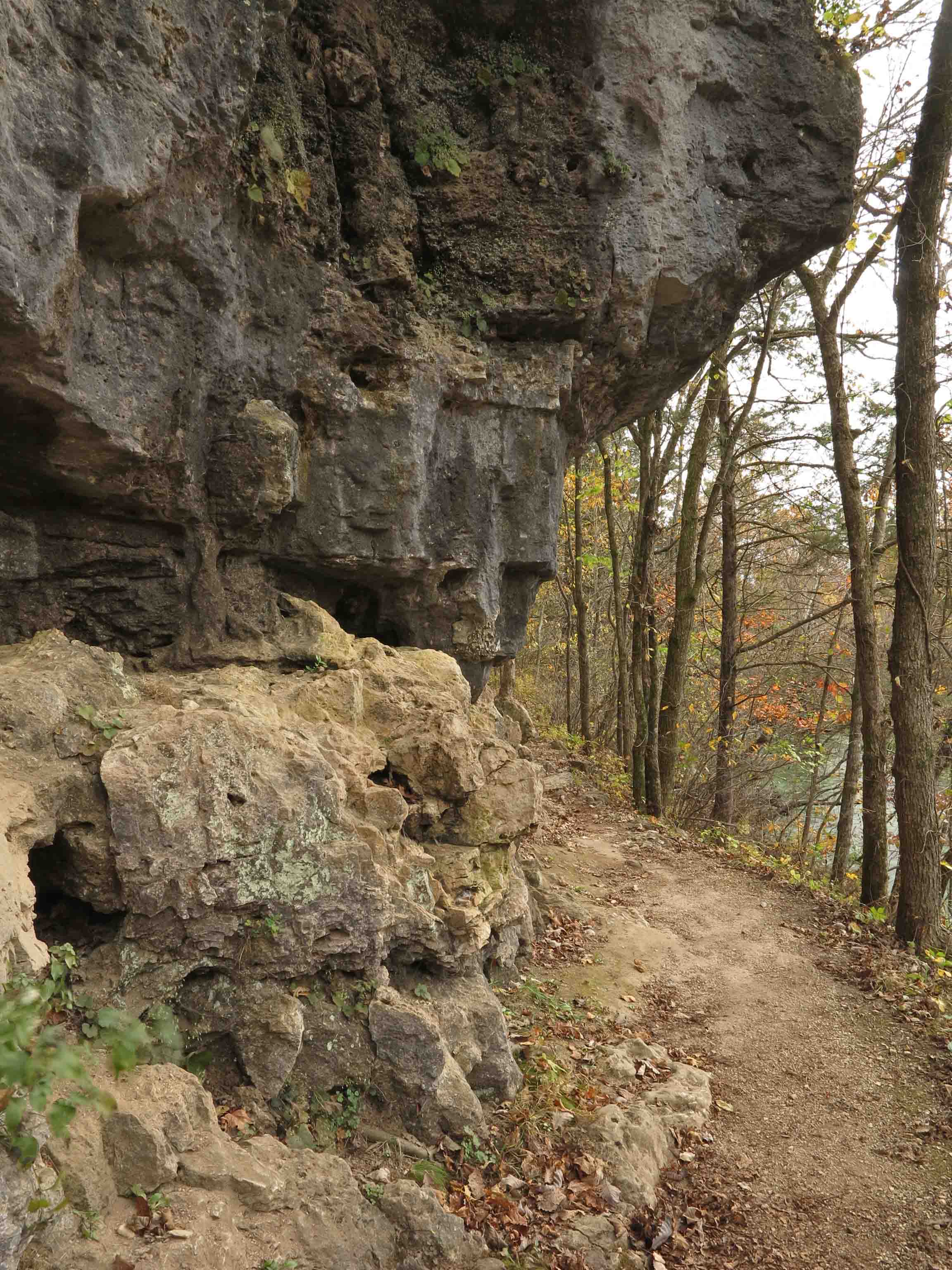
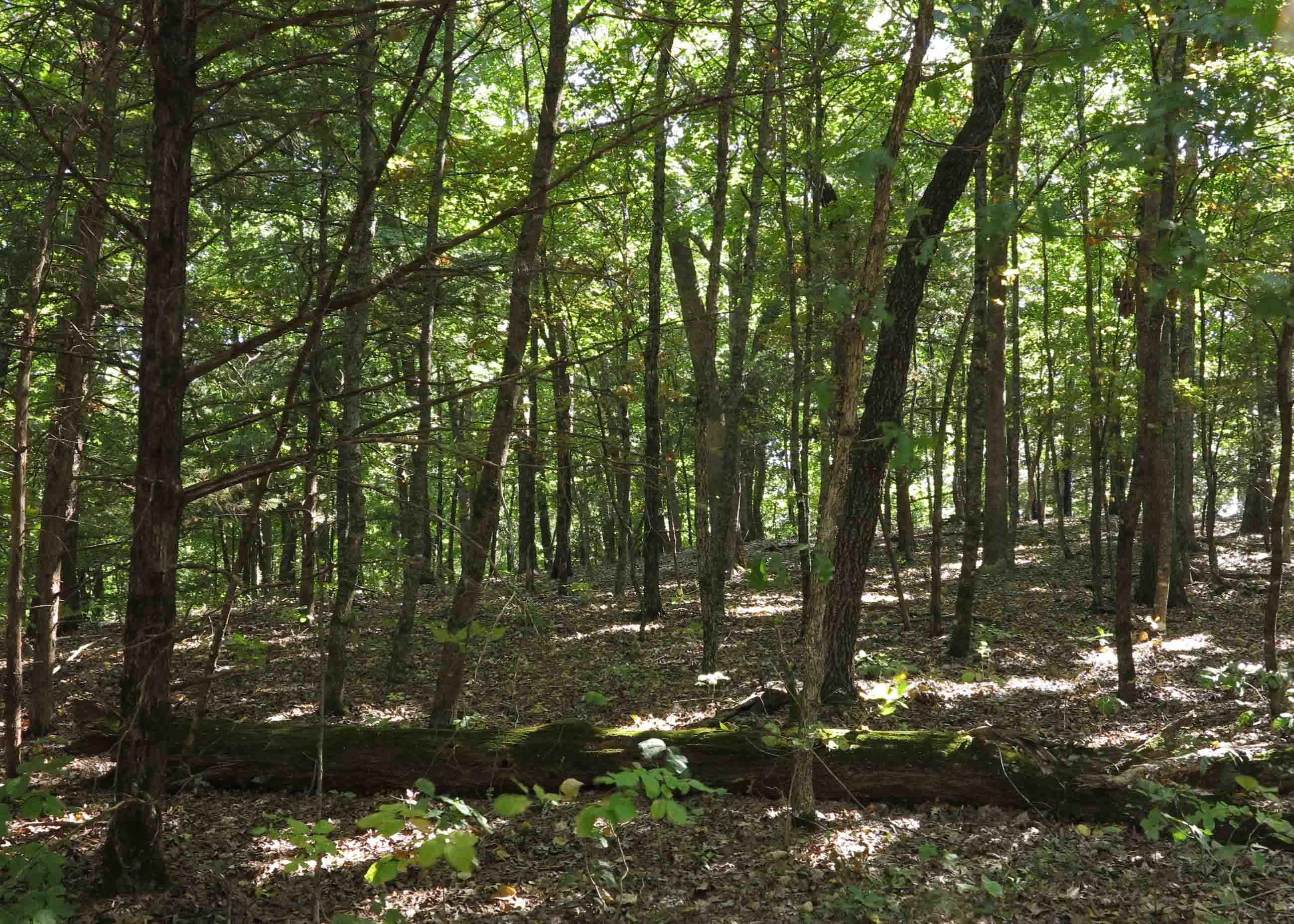
Where the paved paths end, dirt trails begin, bordering both sides of the creek and crossing a bridge several tenths of a mile downstream. Conditions were right for the formation of early morning frost flowers, a visual treat for early morning winter hikers.

This slideshow requires JavaScript.


IMG_4019rr

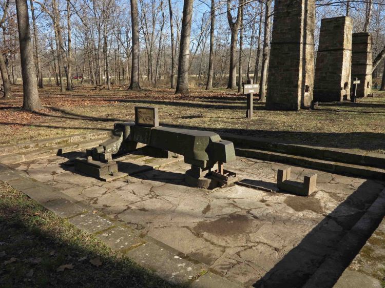
Maramec Spring’s natural beauty is complemented by a fascinating history. Portions of the paved paths take you through an outdoor museum of the Maramec Ironworks. Thomas James, an Ohio businessman, began construction in 1826 by. In 1843, Thomas sent his son, William James, to operate the ironworks.

The Civil War increased the demand for iron from the plant in spite of the transportation challenges of this remote location. At its peak, the plant town was reported to have close to 500 residents. The Maramec Ironworks ceased operation in 1876.

IMG_4016rr

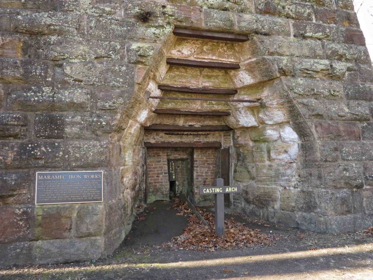
Maramec Ironworks casting arch


IMG_3964rr

Powerhouse with Maramec Spring in the background


IMG_3958rr

Maramec Ironworks Museum

While hiking the Maramec Spring in winter is a pleasure, you’ll miss out on visiting the Ironworks Museum, closed at the end of October and reopening in the spring.

I felt a tinge of sadness as I drove away from Maramec Spring, but hope to visit again someday. I’m thankful that William James’ granddaughter, Lucy Wortham James, chose to protect this area for us to see today.

IMG_9535rr

“As this is considered to be the most beautiful spot in Missouri, it is my great hope that you will arrange that it may ever be in private, considerate control, and ever open to the enjoyment of the people.”

~Lucy Wortham James


Trail Freestyling in Van Buren, Missouri


IMG_1898

Rusty gold – An unexpected jewel of a trail just outside of Van Buren, MO

I enjoy watching Mike Wolfe and Frank Fritz cruise the country in search of “rusty gold.” In mid-November, I experienced something of what the American Pickers must feel when “freestying.”

My scheduled hikes were completed. All that remained was a short visit to Big Spring in Van Buren, and then we’d make the drive back to Arkansas. My plan was to include Big Spring as a nearby attraction related to other trails since Big Spring was a tourist attraction rather than hiking destination.

As an afterthought, I decided to check on a trail I’d noticed in an old guide book to see if it was still in existence. The book indicated the trail hadn’t been maintained since 1994, so I wasn’t expecting to find it. The trail was on our way, so there we were, Hiker-dog and me driving Skyline Drive in a light rain a couple of miles south of Van Buren, looking for any sign of a trailhead.

We saw a pullout and a bench a short distance into the woods, but after having a look, I decided the trail had been abandoned and drove on, still eyeing the woods for signs of the other end of the trail.

Skyline Trailhead

Skyline Trailhead

When I saw another pullout and bench, I decided to take a short walk with GPS and my recorder in hand. I was delighted with what I found. Like Mike finding some antique signs, or Frank finding a vintage oil can, I slowly realized that this trail was a diamond in the rough.

The out-and-back was exactly three miles and followed a good grade, perfect for an early morning day hike.

Lichen-covered boulders littered the forest floor.

Lichen-covered boulders covered the forest floor.

Next, it was to be a quick stop at Big Spring for a few photos and then back to Arkansas. What we found at Big Spring captivated our attention. We stood in awe next to the power of Big Spring’s 288 million gallons of water a day.

Looking down on Big Spring from the trail

Looking down on Big Spring from the trail

We did the little trail at the spring for photos. Along the way, I noticed a set of stone steps that led up above the bluff line of Big Spring. Steps going up must be followed, so we ended up at a high point above the bluff with beautiful views to the east and west. The old roadbed with treated timber water bars circled back down the mountain to the entrance road not far from Big Spring Lodge. It gradually dawned on me that this was a “5-Star” hike.

Steps built by the CCC. Made to last!

Steps built by the CCC. Made to last!

Big Spring Lodge became the trailhead for this hike.

Big Spring Lodge became the trailhead for this hike.

Once back to the lodge, I determined a course and set out with GPS and recorder. This became a 3-mile figure-eight hike. It included views of Big Spring and Current River confluence, Big Spring itself, the woodsy mountain above and behind the spring, and some historic structures along the way. Every step was a delight!

Confluence of Big Spring with Eleven Points River

Confluence of Big Spring with Current River

Big Spring

Big Spring

Mike and Frank would be proud of the hidden and not-so-hidden treasures we found this day. What started out as a no-trail day resulted in two beautiful trails and about nine miles of walking since I hiked the Big Spring trail twice while experimenting with routes. Now for a long drive back to Arkansas for two happy hikers. Just wish I could split the driving with Hiker-dog.


Crystal Bridges:Bachman-Wilson House by Frank Lloyd Wright

IMG_2447

An affordable Frank Lloyd Wright home? That was the goal of the “Usonian home,” a design concept born during the Great Depression. Wright chose Usonian as an abbreviation of “United States of North America” and he envisioned these homes as a way to make good design available to the American middle class.

Between 1936 and 1959 about 60 Usonian homes were built by Wright or his apprentices. Usonian homes were delivered in shipping containers to be assembled by third party contractors. Detailed blueprints provided guidance in the construction.

Below is a copy of the letter requesting the commission of this house. I like its directness, beginning with “Would you build a home for us?” and concluding, “Please say ‘yes’ Mr. Wright.”

IMG_2459

IMG_2422

The back of the home and living areas face southwest and open to the outdoors by way of extensive glass walls and doors. This side of the home would have faced the Millstone River in its original New Jersey location. At Crystal Bridges, it faces Crystal Spring hollow.

IMG_2388

From a nearby hiking trail you get this view looking down on the front of the home.

IMG_2464

Students in the Fay Jones School of Architecture and Design built the Interpretive Pavilion that serves as a transitional and informational entrance to the Bachman-Wilson House. A Crystal Bridges blog post and video provides an overview on how this was done.

IMG_2506

Notice the unobtrusive front door and limited windows on the front side of the home. Wright used limited openings on the front to increase privacy.

IMG_2451

The mahogany and glass clerestory windows increase natural light. These windows break up the cinderblock walls and form a band around the house below the ceiling. Clerestory windows and two narrow front entrance windows were the only openings to the front of the house. Wright modeled this window design on wing-shaped sycamore tree seeds.

IMG_2415

Crystal Spring is in the hollow just downhill from the back side of the Bachman-Wilson House. The spring flows from the base of a rock just behind the rock bridge above this cascade. Nice backyard!

IMG_2519

Our self-guided tour of the Bachman-Wilson House was at 5:30 p.m. Tickets were required to limit the number of visitors. Ordering free tickets online was easy.

It was a treat to see 1950s appliances, the fireplace, and living areas. I was impressed by a very narrow hallway that connected the living area to a work area next to the carport. The space saved from the hallway was added space for the kitchen.

Disassembling, labeling, shipping, and reassembling this house on its new site is another story. On my last visit to Crystal Bridges, the house was under construction. I can’t comprehend the complexity of this project. The builders had the original blueprints available but had to compensate for minor adjustments the original contractors made in construction.

Several times during our tour I reached compulsively for the camera on my belt, but I followed the rules and resisted indoor photos. As I walked through this structure, I felt thankful that it now stands in this Arkansas location where it will be maintained and protected for future generations.

IMG_2524

After our self-guided tour inside of the Bachman-Wilson House, we paused on the trail for one last view of Chrystal Bridges Museum of American Art. Already a wonderful place, Crystal Bridges is now even more special with the addition of the Bachman-Wilson House designed by Frank Lloyd Wright.

My wife, oldest daughter, and I made the short walk back to the parking lot and then began the easy task of finding a nearby restaurant before making the drive back to Alma.

If you want to see more about the trails of Crystal Springs, have a look at this post from last April.

The Art Trail

The Art Trail

Ornate Skies

Ornate

IMG_2203

As I crossed Lake Alma’s earthen dam yesterday evening, light and clouds began to do their magic and the words from last week’s photo challenge came to mind.

What I saw was “breathtakingly extravagant” and it was clear that “the creator pulled no stop and went all out.” I was thankful to witness these ornate skies.

IMG_2230

Alley Spring Mill in the Missouri Ozarks

Alley Spring from downstream

Alley Spring Mill from downstream

While researching possible trails in the Jacks Fork and Current River area of Missouri, I almost dismissed Alley Spring because of its shortness at only 1.9 miles. As I stepped onto the trail beginning behind the mill, I realized what a mistake that would have been. The trail is well built and scenic every step of the way.

View of Alley Springs Mill from the trail

View of Alley Spring Mill from the trail

The trail takes you to an overlook on a ridge behind the mill. You can see the spring, mill, and foot bridge approaching the mill. After switchbacking down to the mill’s level, a section of the trail follows a narrow dirt road shared by a horse trail. The trail passes between two horse hitching posts before beginning to follow Alley Branch upstream.

Alley Spring Trail

Alley Spring Trail

The trail then follows Alley Branch upstream next passing a couple of interesting little bluffs populated with indentions and caves, suitable homes for everything from cliff swallows to small mammals. I found one about the size of a tent and crawled inside for a look.

Trail next to Alley Branch

Trail next to Alley Branch

Shallow cave in Alley Branch bluff

Shallow cave in Alley Branch bluff

Story Creek fed by Alley Spring

Alley Branch fed by Alley Spring

Alley Branch flows away from Alley Spring. The water is clear and cold. A young man walking the trail with his grandmother stooped over and took a drink of the clear water. I was a little envious of his lack of caution and still regret not scooping up a sip myself.

Alley Branch

Alley Branch

Shortly after passing the small cascade, the trail wraps around the deep, blue spring that pours out over 80-million gallons of water per day.

Alley Spring

Alley Spring

Alley Spring

Alley Spring

The trail then comes back to the mill house, passing water gates that adjusted the flow of water. These gates in front of the turbine pit allowed some control over the speed of the mill, making turbine mills superior to waterwheel mills.

Flow gates

Flow gates next to the mill

Alley Springs Mill

Alley Spring Mill

Before heading back to the parking lot, I spent some time just looking back on the mill and relaxing in the cool October air. Alley Spring would a great place to spend a whole day. A picnic area and restrooms are located close to the parking lot. A campground next to Jacks Fork River is located close by. Hiker-dog and I slept there under a tarp to rest for the next day and more trails.

Alley Spring mill

Alley Spring mill

The following morning, after hiking the Alley Spring trail a second time before dawn, Hiker-dog and I drove six miles east to the little town of Eminence. I was surprised to find a restaurant open at 6:15 a.m. and stopped for some breakfast. Turned out to be a real find! Ruby’s Family Restaurant served up a real breakfast and kept the coffee topped off.

I struck up a conversation with the only other customer. The elderly man had grown up in Alley Spring and was a delight to visit with. He attended school in a one-room schoolhouse located right next to Alley Spring and walked just over a mile to school each day.

After hiking the Rocky Falls area that morning, I returned to Ruby’s for lunch and met Ruby, the owner. I mentioned my conversation with the gentlemen that morning.  Without hesitation she told me his name and said he could share a lot of history about Eminence and Alley Spring.

I look forward to eating at Ruby’s and seeing Alley Spring Mill again someday. I might even run into Pete Ward, the resident historian again.

Ruby's Restaurant

Ruby’s Family Restaurant on my first visit.

Ruby's Cafe

Ruby’s Family Restaurant after a late lunch.

Hiker-dog enjoyed exploring small caves in the bluffs next to Alley Branch.

Hiker-dog enjoyed exploring small caves in the bluffs next to Alley Branch.


Daily Post weekly photo challenge: Post-Hike Treats – Food and Drink

Clear water. Crisp, clean air. Nothing here to take for granted.

Oark General Store

Oark General Store

A post-hike meal at the Oark General Store, said to be Arkansas’ oldest continuously operating restaurant. Good food and fellowship. Always a treat.

Oark General Store

Oark General Store

In response to The Daily Post’s weekly photo challenge: “Treat.”

Hiker-dog’s Sunset Photo

Reflections from sunset over Lake Alma

Reflections from sunset over Lake Alma

Credit for this photo over Lake Alma last week belongs to Hiker-dog. It was early evening, and I was tired…too tired for a short walk. Not Hiker-dog! She was beside herself, running back and forth from me to the Jeep and staring at the door as if she could will it open.  I knew she needed to get out, so we loaded up and drove four minutes to Lake Alma.

Hiker ran with joy, bouncing around and chasing every bird or butterfly in sight. While watching her and walking along the trail, I noticed the changing sky. I decided to set up my tripod and watch. Below is the skyline about six minutes before the photo above, showing just how quickly light and clouds sometimes change. This is why photographers sometimes refer to the beginning and ending of days as the “magic hour.”

A big thank you to Hiker-dog for pushing me to get outside when I wanted a lazy evening. I think she knew there were things that needed to be seen out there…and butterflies to chase.

The scene six minutes earlier.

The scene six minutes earlier.


Hiker-dog celebrating the evening

Hiker-dog celebrating the evening in the fading light.

Happy Places Above the Fray

Sylamore Creek Valley

Sylamore Creek Valley

My happy place is on almost any Arkansas ridge overlooking an Arkansas stream. One of my favorites is Sylamore Creek Trail north of Blanchard Springs. After just a few steps onto this trail, I feel tension leaving my shoulders and my steps become lighter. This picture is from a recent hike, Sylamore Trail, Getting Reacquainted.

Another favorite ridge-top hike is overlooking the Buffalo River in the Tyler Bend area. It provides the right mix of adventure, history of place, and sheer beauty. To see more of this area you might enjoy Buffalo River From Boxely to Pruitt in Typical Arkansas Weather.

Buffalo River

Buffalo River

My ultimate “happy place” outside of Arkansas also involves a “little stream,” but this stream formed a “little canyon” in Arizona. The Grand Canyon surrounding the Colorado River provides relaxing reflective moments when I pause to remember how it felt to stand in awe of such beauty. To take a quick trip through The Canyon with a few friends of mine, read Seeking Something Grand.

View at dusk the evening we arrived at the South Rim.

View at dusk the evening we arrived at the South Rim.

I’m thankful for the memories of these happy places and the healing effects they have on my daily life.

In response to The Daily Post’s weekly photo challenge: “Happy Place.”

A Missouri Trail We Owe to the Beverly Hillbillies

IMG_3341rr

How is it that I’m hiking through deep woods after a 15-minute drive from the touristy city of Branson, Missouri? Along side of a beautiful creek and 14-foot waterfall, the speed of driving through development on Hwy 65 gives way to a peaceful walking pace.

It was dark, and we had the trail all to ourselves. As I walked with my headlamp, I found myself humming the theme song from The Beverly Hillbillies, but I’ll explain that association later.

I have felt guilty for living in Western Arkansas fourteen years without visiting Branson, so I contacted one of my Missouri hiking buddies and asked about trails in the area. He said he avoided tourist traps and hadn’t hiked the Ruth and Paul Henning Conservation Area. I felt less guilt, but more concern that this area might not be worth visiting. Thankfully, I was wrong.

IMG_3354rr

Leashed pets are allowed, so Hiker enjoyed this trail. Since we were alone, I let her run a few times as we made our way around the 3.6-mile trail.

Historic well

Historic well

On the Homesteader’s Trail, you’ll see evidence of early inhabitants of the area. The trail passes abandoned wells, rock walls, and ponds used by early homesteaders. One of the wells had a good level of water which was surprising since the creeks were dry. Another well was pretty dry, so I lowered my camera through the grill to take a picture. I wrapped the strap around my wrist to be sure I didn’t add another historic artifact to the well.

IMG_3349rr

The trail passes through a glade area. You’ll climb through this area. We warmed up quickly before returning to the woods.

Glade on the Homesteader's Trail

Glade on the Homesteader’s Trail

Now that I know about this area, I might return to hear some live music and enjoy area restaurants with my wife. There are lots of things to do in Branson, but one of my favorites will be to hike this trail. We’ll watch the weather and return to the Ruth and Paul Henning Conservation Area during wetter times with camera and tripod. That waterfall will be calling me back.

Ruth and Paul Henning provided the land that is now a Conservation Area just north of Branson, Missouri. Paul Henning was a writer and producer, responsible for several television classics like the Beverly Hillbillies, Green Acres, and Petticoat Junction.   I enjoyed hearing his discussion of the creation of the Beverly Hillbillies in the following clip. He seemed like a down-to-earth person, just the type of fellow who would think to preserve an area like this. He died in 2005, but would be pleased to know his gift is being enjoyed and protected.

Exploring the Hercules Glades of Missouri

I enjoyed exploring the Ozarks of Missouri this weekend. The plan was to hike two trails in the Hercules Glades Wilderness Area. The Missouri Ozarks provided an excellent time on the trail, exceeding my expectations.

Hercules Glades

Hercules Glades

Friday afternoon, I hiked a 6.6-mile loop in the Hercules Glades. This wilderness area doesn’t use blazes, so I walked off of the trail following rocky glades on two occasions, but my mistake was caught before going more than a few steps. Hiker-dog loved the grassy glades and leaped with pleasure as she chased anything that moved.

A low water bridge is always a good sign when you’re looking to get out into a wilderness area. The clarity of the water was also a good sign.

Low water bridge on FR 544

Low water bridge on FR 544

Looking upstream from the low water bridge

Looking upstream from the low water bridge

In the Hercules Glades, deep woods alternate with open glades, punctuated with thick cedar groves. The contrast of temperatures and environments were surprising. The warmth of the glades wasn’t as surprising to me as the coolness of the wooded sections. The woods were also nice and open due to the heavily shaded canopy.

Hercules Glades wooded section

Hercules Glades wooded section

Crossing Long Creek late in the hike provided some much needed clear drinking water for Hiker-dog. The sun was getting lower in the sky, so I took a few minutes to enjoy the foliage reflecting on the surface.

Hiker having a drink.

Hiker having a drink.

Evening light

Evening light on Long Creek

Long Creek

Long Creek

Once back at the trailhead, I was preparing a for a quiet dinner, having seen only one small group and a solo hiker on the entire loop. As I was sitting there with Hiker, the parking lot began to fill up. By sundown, I had seen two groups of fifteen Boy Scouts enter the trail. I opted to sleep in my Jeep so I wouldn’t be sleeping in a tent when more vehicles arrived.

The scouts and the leaders were nice and seemed well organized. When one of the group of fifteen called out, “Who has the compass?” it gave me pause. Later one of the adults mentioned a young man who had loaded his pack with three extra pairs of pants and a double-D battery lantern, but only one small bottle of water. I’m sure some good learning occurred this weekend among those young men.

Fire tower at the trailhead off of Hwy 125

Fire tower at the trailhead off of Hwy 125

On day two, we drove to the east side of Hercules Glades Wilderness and hiked around Pole Hollow and down Long Creek to the falls. The trailhead includes a nice pit toilet, picnic tables and tent pads. There is also an abandoned fire tower.

This six-mile out-and-back was a pleasure every step of the way. When we arrived at the falls, a young man and his wife who entered the day before were looking for a campsite. He later reported that they camped that night with a large group of Boy Scouts. Not the solitude they’d envisioned, but still a good evening in the woods.

Hiking down Long Creek made me resolve to return during a wet season. This area is beautiful now, but must be several notches up on the “amazement scale” when the water is flowing.

Long Creek Falls

Long Creek below the falls

The depth of this overhanging bluff surprised me. The overhang must have been at least fifteen feet deep.

Overhanging creek bluff

Overhanging creek bluff

The hike back toward the trailhead was enjoyable because we could relax and enjoy the views having walked this route before. I let Hiker off the leash since we had this section of the trail to ourselves. She likes to run ahead and dart off-trail to explore. I’m a little envious that she sees so much more than I do with my two wobbly legs. Both Hiker-dog and I are looking forward to exploring more of the Missouri Ozarks.

Hiker-dog on the trail

Hiker-dog on the trail