When in Doubt

Thank you to the award winning author, Marla Cantrell, for sharing my story in the October issue of Do South Magazine.

“When in doubt, take a step.” – Jim Warnock’s mom

Jim Warnock has worn down the soles of hiking shoes until they are as smooth as a pair of loafers. The erosion takes place over months, as he walks across hills, through valleys, beside waterfalls that catch the sun’s rays, throwing diamonds of light across an already breathtaking landscape.

When he thinks about what it means to hike… Continue reading

http://dosouthmagazine.com/when-in-doubt/

Lake Alma Trail With Hiker-dog

hiker-1016-1rr

Yesterday afternoon was warm, and I felt lazy. Hiker-dog, my personal trainer, forcefully said, “Let’s go!,” and so we went. Following her lead is usually wise where trails are concerned.

As we descended toward Lake Alma shaded by the bluffs, temperatures dropped, and a slight breeze danced across our path. I felt renewed and looked forward to the climb on the other side of Little Clear Creek.

The photo above was just prior to our arrival beside “Little Snake Bluff.” When Hiker-dog first joined our family, this was the spot where I remember thinking, “She really is a good dog.”

This is one of the few places I’ve named. When the Lake Alma Trail was new, I passed this short bluff with several shelves that almost grazed my ear. Curled on one shelf was a large snakeskin. This caught my attention. I like seeing snakes in the woods but don’t expect to view them, or their leftover skin, right next to my ear. When writing the trail description, “Little Snake Bluff” seemed like the right name.

hiker-1016-2rr After dropping back down to lake level, I led my buddy to the water’s edge so she could take a cooling dip. Hiker lowered herself ceremoniously into the water and drank from the surface before rising and looking toward the west. She helps me recognize gifts from the trail I might otherwise miss. I stood and looked to the west for a moment, thankful for this renewing walk.

A Stroll Through History on the Arkansas River

Stroll

IMG_1174rr

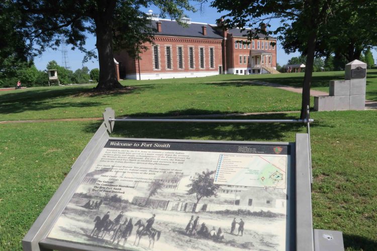
View of the Fort Smith Courthouse as you approach the trailhead

I typically like hiking in the deep woods of the Ozark Mountains, but this little urban path is a fun hike for kids and history buffs. It’s also a great place for runners and cyclists visiting the city of Fort Smith.

Driving Directions: To get to the trailhead, turn southwest off of Garrison Ave (AR 64) onto 4th Street. Then turn right (northwest) onto Garland and drive one block to 3rd street and the entrance to a parking area. A covered pavilion is at the north end of the parking area, and this is where we’ll begin our walk.

GPS  Trailhead Coordinates: N35° 23.260’  W94° 25.851’

Distance and Additional Information:  4.6-mile out-and-back with a small loop. This route is wheelchair accessible throughout. Leashed pets are allowed.

IMG_1170rr

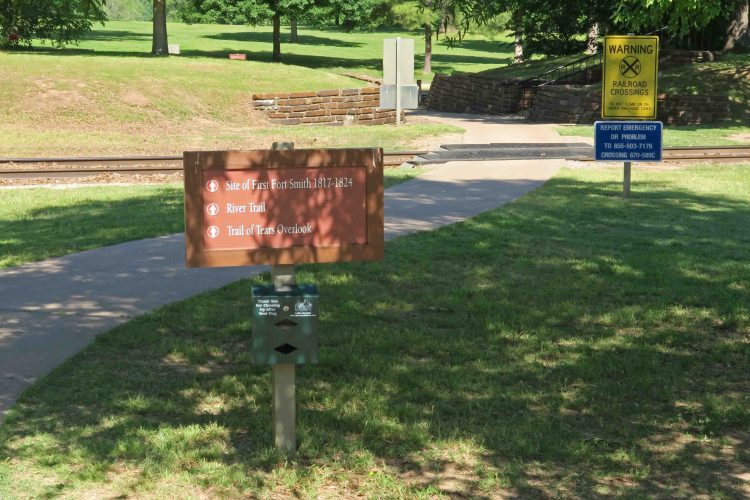
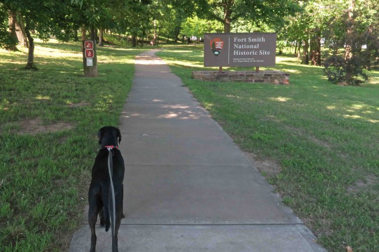
This is one of the few (maybe only) trails I’ve walked that begins by crossing a railroad track, but train traffic is limited (or non-existent). The entire trail described here is handicapped accessible. There are restrooms at the Historic Site Visitor Center just to the northeast of the trailhead. There are also restrooms at the River Park Events Center about 1 mile into the hike. Be sure to carry water even. There are water fountains at the River Park, but they were not on when I visited.

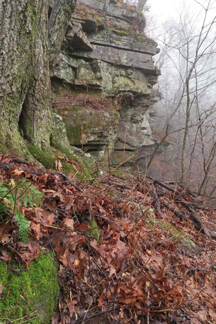
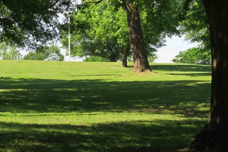
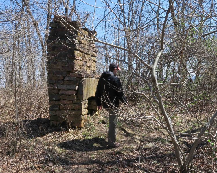
The trail climbs slightly to a small loop around the site of the First Fort Smith, 1817-1824. Stone footings are still visible where the fort stood overlooking the Arkansas River.

IMG_1041rr

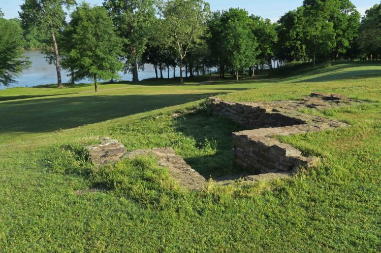
One section of footings at the site of the original Fort Smith

IMG_1044rr

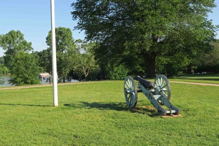
Site of the original Fort Smith

The trail backtracks a short distance to where you’ll take a right and circle around until the Arkansas River is on your left side. You’ll come to the Trail of Tears Overlook with interpretative markers and a bench. A set of stairs invites you to walk down by the riverside where you might see geese and other wildlife.

IMG_1048rr

IMG_0839rr

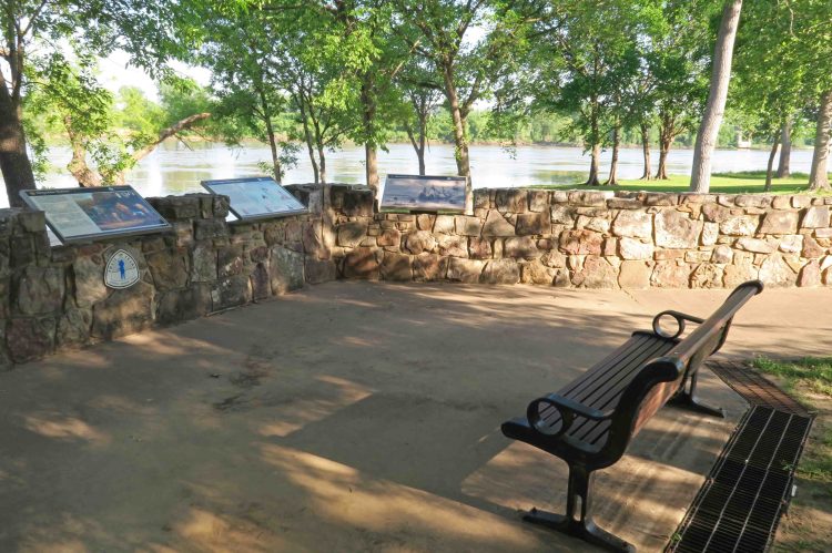
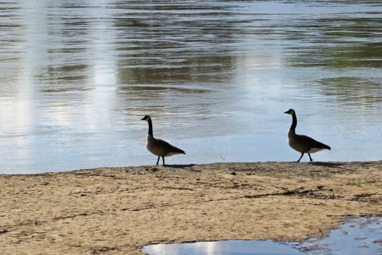
The shoreline below the Trail of Tears Overlook

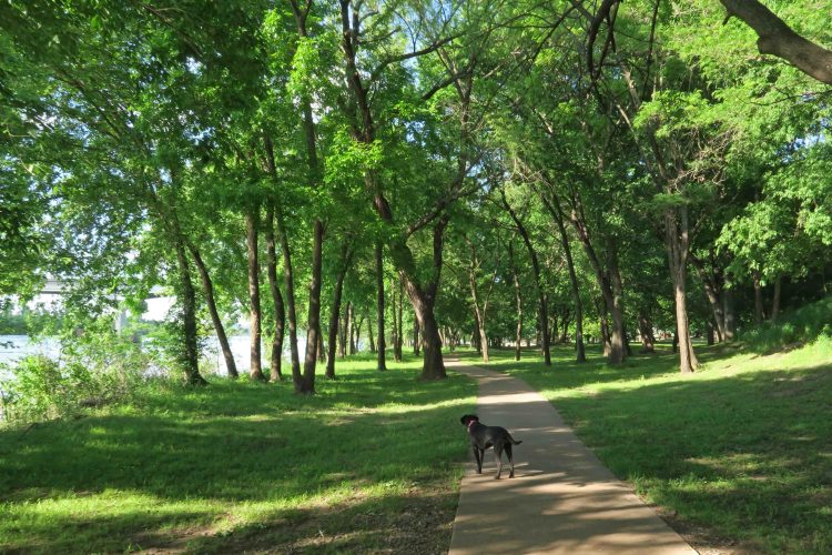
After leaving the overlook, continue down the paved path into a wooded area with a high shaded canopy. Some of the larger trees are cottonwood with a few sycamore close to the riverside. I looked around to be sure we were alone and then let Hiker-dog take a quick run through these woods. She returned and let me leash her back up before any other walkers were in the area.

IMG_0850rr

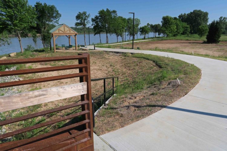
The trail passes a spur to the right that takes you back to the trailhead if you want a short walk. We’ll use this spur later when we return from our out-and-back. Continue under Garrison Bridge at 0.7 mile and to the River Park stage. Turn left (southwest) and walk under the bridge a short distance then turn right (southeast), walking downstream with the river on your left. You’ll come to stone steps that outline the Riverfront Amphitheater seating area. Handicapped accessible switchbacks lead up the seating area to the Events Center.

IMG_1150rr

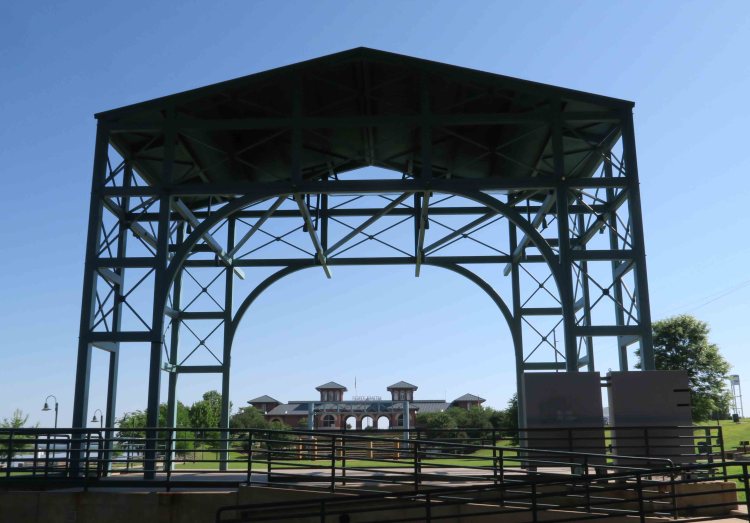
Looking through the Riverfront Amphitheater toward the River Park Events Center

IMG_1144rr

After walking past the River Park Events Center, you’ll come to a pavilion with a bronze statue of a girl carrying flowers and a basket. This is where the River Trail officially begins as it follows the Arkansas River downstream.  IMG_1055rrIMG_1142rr

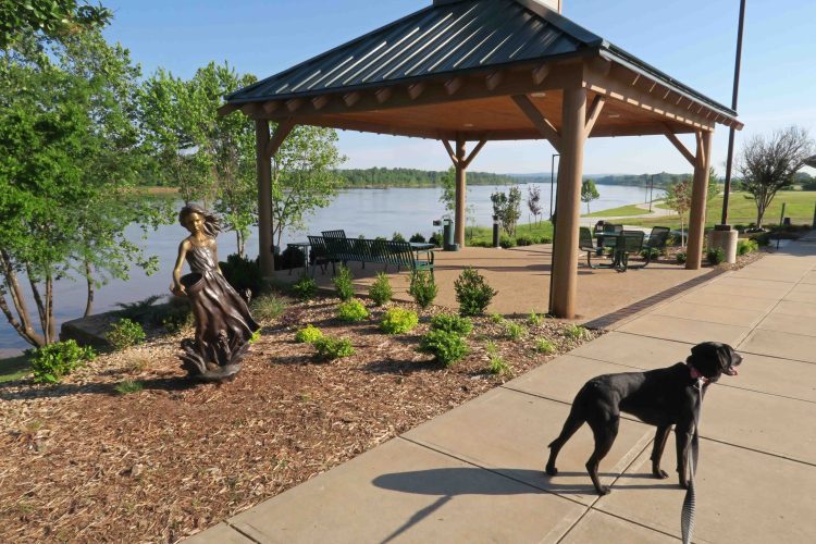
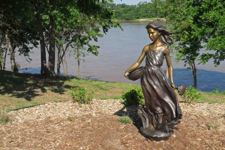
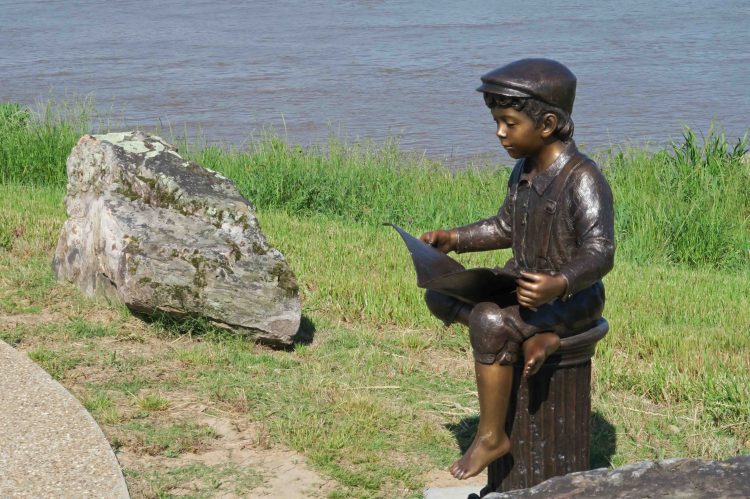
A short distance down the 12-foot wide path leads you to an overlook with two beautiful bronze sculptures. This is a nice destination if you want a shorter walk.

IMG_1058rr

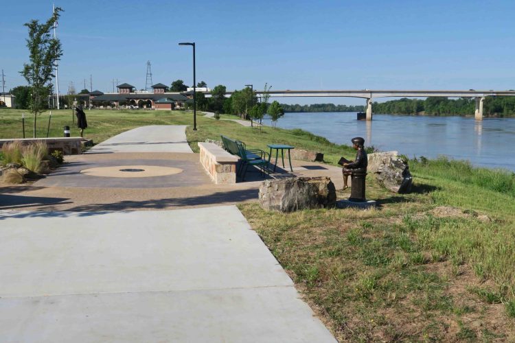
Looking back upriver toward the River Park from the River Trail

IMG_1134rr

This statue seems to celebrate the river and land to the west.

IMG_1131rr

From the overlook, continue down the river and come to the River Trail Bridge at 2-miles into the walk. Just before the bridge is a spur trail left to the riverside. This is a great place for fishing, but Hiker-dog saw it as an opportunity for a quick dip. A small pavilion is on the other side of the bridge. The bridge is another possible destination and turnaround point.IMG_1112rr

IMG_1098rr

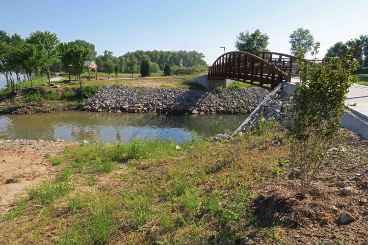
View of the pavilion and Arkansas River from the River Trail Bridge

IMG_1101rr

Looking upriver toward the Garrison River Bridge

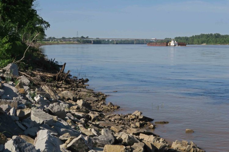
Standing at the edge of the Arkansas River, you realize the strength of its flow. It might appear tranquil from a distance, but there is a firmness in the water as it speeds along. This barge churned its way upstream on the morning of our walk.

The paved trail continues and then comes alongside private property before ending at Riverfront Drive. A dirt path continues from there along the top of a levy. A ranger told me there are plans to eventually extend this trail to all the way to Van Buren. For today’s walk, we’ll turn around here and head back the way we came.

IMG_1080rr

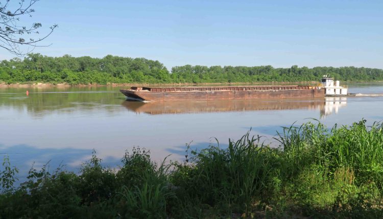
Barge working its way up river

After a nice out-and-back on the River Trail, we return to the Fort Smith Historic Site and take a left at 4.2 miles into our walk. This is the spur we passed earlier and it takes us back to the trailhead. Going straight would take you back around to the Trail of Tears Overlook and would give a little more distance to your hike. This route gives you a total of 4.6 miles, the perfect distance for a walk or run right in the center of downtown Fort Smith.

For solitude, go early in the morning, because this urban trail is getting some heavy use from residents and tourists. It should have a positive impact on the community for years to come.

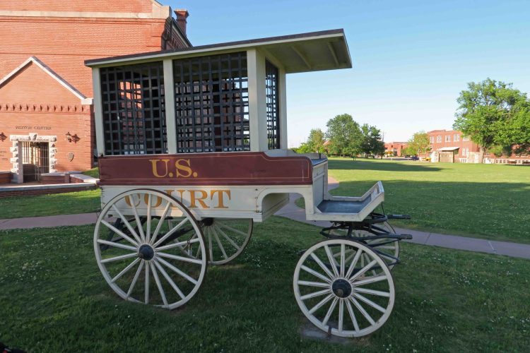
If you have time, check out the gift shop in the Historic Site Visitors Center. You’ll find a variety of books related to the region and National Park Service programs that children and adults will enjoy.  You can take a tour of the Fort Smith Courthouse and decide for yourself if Judge Parker’s reputation as the “hanging judge” was justified. You’ll also learn about Bass Reeves, the first black U.S. Deputy Marshal west of the Mississippi River. Continue your stroll through history on the grounds around the Courthouse and let the kids get a close look at historic artifacts.

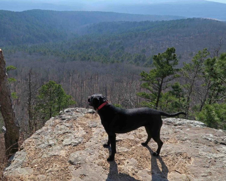
Hiker-dog says, “Thanks for coming along.” IMG_9875Hikerpaw23


IMG_1153rr

Reentering the Fort Smith Historic Site after walking past the River Park on our out-and-back.

IMG_1161rr

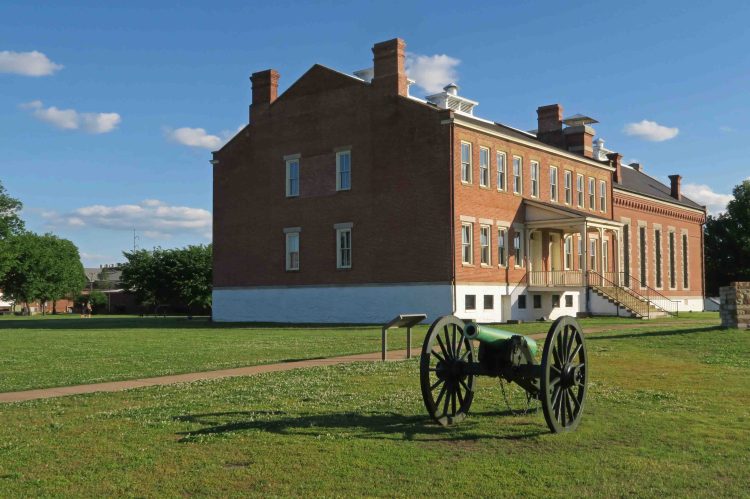
View of the First Fort Smith as you return from the River Trail

IMG_1180rr

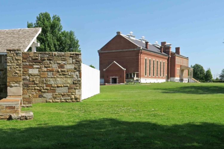
Judge Parker’s gallows are in the foreground with the Fort Smith Courthouse and Visitor Center in the background.

IMG_1176rr

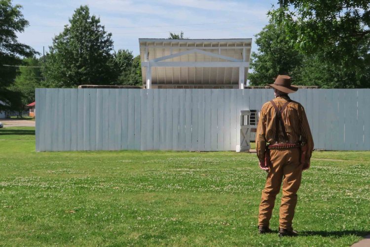
Someone in period costume arriving to participate in one of the children’s programs.
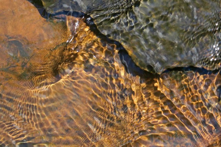
IMG_0914rr

IMG_0898rr


World of Beauty Down a Small Ozark Hollow

IMG_0592rr

I’ve read about the waterfall in Devil’s Canyon, but today was not a waterfall hunting day. We were merely scouting the driving directions and having a look around so that when the water is flowing strongly in the future, we can get to the area quickly. I made it to the first drain and ended up spending all of my available time exploring a small hollow as I followed the water downhill.

Continuing a short distance downstream, we came to this little grotto and waterfall. The large waterfall this area is known for is in another section of Devil’s Canyon (close by air, but distant by foot).

IMG_0475rr

At this point, I thought I’d seen the scenic features of this little side-valley, but the randomly placed car-sized boulders drew me ever downward. I quickly came to a reflective pool and realized little beauty-surprises were hidden around every boulder.

IMG_0481rr

IMG_0559rr

Below is a wider view of the same area showing boulders stacked above.

IMG_0492rr

Massive stacked boulders

Continuing downstream, I heard flowing water but couldn’t see where the cascade was until I arrived next to an A-shaped opening.

IMG_0551rr

A young man who I’d seen running the jeep road on the edge of the canyon reappeared and exclaimed at how beautiful this little area was. I introduced myself and discovered that he worked for the US Forest Service. He’d been helping with a fire in Tennessee and was now headed back home to Oregon. After our short visit, I thought how easy it is to meet fascinating people on the trails of Arkansas.

While taking a photograph of the little cascade through the leaning A-shaped rocks, I heard a commotion close by and instinctively covered my head. Hiker’s 65-pound frame had dislodged some small rocks causing her to glissade down a slope, bringing rocks and dirt with her. She ran over next to me and stayed close by for a few minutes.

IMG_0562rr

A surprised Hiker-dog stayed close by for a few minutes after her slide down a hillside.

I needed to watch my time to allow for the uphill climb out of this little valley. The way these boulders caught my attention, it would be easy to remain until after dark.

IMG_0569rr

We spent some more time at the little grotto on our way back upstream. I ate some dry bread I’d packed as a nod to John Muir, who’s birthday was a few days before on April 21st. Born in 1883, he continues to influence thinking about the outdoors and conservation today. He was known to toss a dry loaf of bread in a sack and explore the mountains for several days…the original ultra-light backpacker.

As we continued upstream, I noticed this scene I walked past earlier. Its beauty wasn’t lost on Hiker because she hopped right in after I took this photo.

IMG_0574rr.jpg

As we crossed the creek that feeds into the hollow, I noticed the abstract patterns created by shallow water and sunlight. I couldn’t resist capturing the intricate dancing lines that flowed at my feet.

IMG_0582rr

Shallow creek crossing

It had been a beautiful hike down this small stream and back up. Today I learned again that you can’t predict the beauty you might find in the eroded valleys of the Ozark Mountains. I was already missing this place as we passed the overlooks on the edge of the canyon. We will return another day!

IMG_0585rr

Hiker seemed to enjoy the view as we hiked away from Devil’s Canyon.

One Good Trail is Enough

IMG_0108rr

It had been several months since I checked my little adopted section of the Ozark Highlands Trail. My last two visits were in July and then again in September. Mike LeMaster cut a number of trees off of the trail in July and then Steven Parker did some more chainsaw work recently. I’ve had some expert help in maintaining this trail!

IMG_0084rr

Mile marker close to Dockery’s Gap

This little piece of the OHT has become special to me. It runs from Old Locke Road (FR 1007) at the Dockery’s Gap Trailhead, west to a campsite next to Jack Creek at mile-5 of the OHT.

When the new Lake Fort Smith State Park was being built, this piece of trail was abandoned, and the beginning of the OHT was at Dockery’s Gap. I liked hiking the closed trail and marked sections with survey tape to make the route easier to follow. Sometimes I’d saw small trees off the trail to keep it passable. When this section of trail reopened around 2008 after the completion of the new state park, I adopted the 4-mile section.

IMG_0184rr

Jack Creek

About three years ago, I realized just how strong my sense of ownership was when I discovered that some campers had trashed a special spot on the trail. I cleaned it up while cursing under my breath. I describe this incident in Jack Creek Criminals. It felt like a personal attack that someone would have so little respect for “my” section of the OHT!

IMG_0141rr.jpg

Hiker enjoyed the trail and cool air.

Today, Hiker-dog and I walked from Dockery’s Gap to Lake Fort Smith State Park where my wife, Becca, would meet us. Wildflowers were popping, creeks were flowing, and the sun was shining through cool, crisp air. It was a magical day and every step held beauty. I felt like I barely knew this trail as if hiking it for the first time.

Sometimes I’ll say, “I’ve done the OHT,” meaning I’ve hiked the 180 miles from Lake Fort Smith to Tyler Bend. I’ve “done” the section from Dockery’s Gap to Lake Fort Smith many times. What I can’t say is “I know this trail.” Today taught me that I never “know” a trail. Each mile has something new to offer every time I walk it. My life would be plenty full with just this little stretch of Ozarks landscape. One good trail is enough! 

…..

As I approached Lake Fort Smith, I met a hiker from Joplin. It was his first time on the OHT, and he was pleased with his new map. I enjoyed telling him that he was standing on the section adopted by Kristian Underwood, the cartographer responsible for the OHT maps.

IMG_0242rrr

Map by Underwood Geographics

Below are a few photos from today’s hike.

IMG_0135rr

Hiker unsuccessfully seeking a mole.

IMG_0175rr

Hiker-dog inspecting a very clean campsite at Jack Creek. The group was from Kansas City, MO.

IMG_9875Hikerpaw23

I enjoyed giving out a couple of bookmarks with Hiker-dog’s “signature.”

IMG_0150rr

Wild iris on the trail

IMG_0145rr

Looking into Jack Creek drainage and the mountain ridge on the other side with new leaves on the hardwoods

IMG_0156rr

Boulders broken by time and the elements

IMG_0222rr

Crossing Frog Bayou that feeds Lake Fort Smith

I’ll end with a few photos of history along the trail approaching Lake Fort Smith and next to the lake.

Diverse group on a 20-mile stretch of the OHT

IMG_9545rr

How often do you plan a trip for five 10th-graders, one college student, four older adults, and a dog? Two of the youngsters had never been backpacking while several of the group had done many nights in Arizona, New Mexico, and Colorado as well as Arkansas. A diverse team for sure!

I was a little hesitant about our itinerary, especially the long first day from Cherry Bend Trailhead to Harrod’s Creek, but everyone was packed and ready to go on Saturday morning. The boys spent Friday night in the Rock House just west of Cherry Bend Trailhead, so they began the trip with an experience few others their age have had.

IMG_9544rr

The group minus Bob’s wife, Dana who joined in at Fly Gap Trailhead.

IMG_9583rr

Pausing to take in the view from Hare Mountain

While hiking over Hare Mountain, the highest point on the OHT, we wondered how anyone could eke out a living on such a rocky terrain. A rock wall, fireplace, and still usable well are the only remnants from the early settlers.

IMG_9596rr

IMG_9618rr

Creeks were flowing, so water options were plentiful.

IMG_9633rr

Crossing Harrod’s Creek after an 11-mile day.

IMG_9635rr

Cedar grove campground at Harrod’s Creek

Several of us packed our bear canisters in preparation for a future trip. We enjoyed the convenience of keeping all food enclosed in a secure container rather than suspending food from tree limbs. I had my traditional tater soup with a few slices of dehydrated sweet potatoes added.

Day 2

Hiking toward Indian Creek brought us alongside a beautiful stream with water features and cascades. I’d passed this small waterfall in the past, but since day two was a shorter mileage day, I took time to scramble down for a few photos.

IMG_9657rr

IMG_9695rr

The group enjoyed an early lunch after crossing Indian Creek.

The trail holds beauty with every step. In places, the moss-covered trail surface glistened green in the distance despite foot traffic.

IMG_9696rr

The younger hikers in our group showed no indication of discomfort. They kept on trucking down the trail.

IMG_9702rr

IMG_9716rr

Bob at the Marinoni Scenic Area campground next to Briar Branch

We enjoyed referring to the new OHT map during our trip to see the lay of the land and forest roads surrounding the trail. Bob scrambled up above the area for a look at the top of the natural bridge.

IMG_9738rr

Briar Branch has clear water most of the year. I enjoyed exploring upstream during the lazy afternoon.

IMG_9763rr

Hiker-dog ate something that didn’t agree with her system and took an extended siesta. I was a little worried about her, but she bounced back to her hyper self the next morning.

IMG_9775rr

Day 3 

IMG_9819rr

Coffee is best next to an early morning fire.

Hiking through the Marinoni is always a treat! The modest Briar Branch flows next to massive boulders brought down by years of erosion. Within a week or so, the place will be alive with wild iris and many other floral displays.

IMG_9828rr

IMG_9846rr

Natural Bridge in the morning sun.

IMG_9855rr

Bob and Dana passing through a rocky maze about one mile from Lick Branch

After arriving at Lick Branch, we drove away with hamburgers on our minds. As we approached Oark, we slowed down while sharing the road with horses. They stopped in at the Oark General Store, and we had a full house for lunch.

IMG_9866rr

IMG_9867rr

Nick heading in for lunch.

IMG_9872rr

Good food and fellowship.

By the end of the trip, I couldn’t tell you which two of our younger hikers had never done a backpacking trip. There was no whining, and they handled themselves like veteran backpackers. I enjoyed seeing their energy and enthusiasm, and I’m sure they enjoyed the comic relief we older hikers provided during our three days on the trail.

If you want to learn more or get driving directions to the Marinoni Scenic Area, go to Making Time for Marinoni.

Here’s a link to the Rock House where the boys spent their first night on the OHT.

There’s always a plan-B in the Ozarks

IMG_1460rr

Senyard Falls

I’d planned to hike Hare Mountain today. As I began climbing a muddy East Fly Gap Road with my two-wheel drive vehicle,  I imagined my wife riding along with Hiker and me. At the moment I could imagine her getting concerned, I decided to turn around.

In the Ozarks, a plan-B is always available. I decided to visit the nearby Senyard Falls, named for Roy Senyard who maintains this section of the OHT and has been involved in trail maintenance for years. Roy is a strong guy, so it’s appropriate that the paths leading to his waterfall involve some tough scrambling, especially when conditions are wet.

There was a light rain, so I avoided having my camera out except for a few quick photos. I look forward to returning to this waterfall and seeing it from below. I couldn’t resist trying to capture a spider web next to the trail above the falls. It was easy to see why a camera could become wet quickly in this morning drizzle.

IMG_1464rr

As Hiker-dog and I headed back upstream, we stopped for a break at a crossing.

IMG_1466rr

While sitting beside the stream, I noticed Hiker looking quite pensive. I began to watch her, wondering what was going on in that little head of hers. I don’t know if dogs are capable of prayer, but I’m pretty sure Hiker was demonstrating a sense of gratitude for what she was seeing and experiencing on this drizzly morning. Or, maybe she was just spotting a squirrel in the distance.

IMG_1499rr
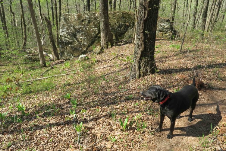
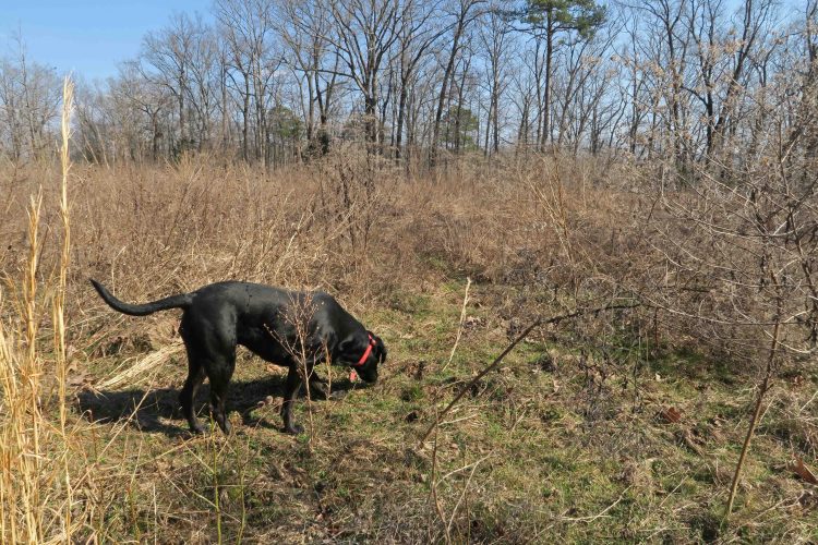
I wonder if Hiker remembers her time of starvation and being alone in the woods before she joined our family. She does seem to appreciate everything about her life now, and she’s wildly excited when we go hiking.

IMG_1502rr

I paused to appreciate the bluff below the Cherry Bend Trailhead as we climbed back toward Hwy 23.

After driving south on Hwy 23, then east on 215, we did some hiking on the Redding Loop. While taking photos of the lower falls that were not running strongly, I noticed these fungi on a limb at my feet.

IMG_1543rr

IMG_1571rr

Hiker and I both enjoyed walking through the pine and cedar groves on the Redding Loop.

I’ve admired a long rock wall close to the trailhead. Today we decided to go off the trail for a closer look. The craftsmanship was obvious from a distance and confirmed on closer inspection.

IMG_1584rr

Rock wall close to the Redding Loop Trailhead

We made a quick stop at Turner Bend for a turkey sandwich. The ladies behind the counter always try to guess my order. I usually fake them out with my ham or turkey decision, but they know I’m going to ask for the “whole garden.” Love those veggies!

IMG_1611rr

Turner Bend Waterfall

We were driving away when I noticed that the falls next to Turner Bend were still flowing. Had to stop for a photo before heading home. Hiker slept in her crate, content and happy after her morning in the woods.

Back to Morgan Mountain and Lessons in Slowing Down

IMG_0697rr

Hiker at a potential wet-season waterfall after our climb.

It had been 20 days since I resolved to slow down and do some exploring on Morgan Mountain. Hiker-dog and I decided to use the Redding Loop as a jumping off point. Several rocky drains asked to be explored, so I answered by using the rocky routes to see some new landscape and get in some good climbs.

As I was climbing pretty hard, I looked up to see Hiker-dog in the distance already at the top. She seemed to be looking down and wondering what was taking so long. Then she flew down the hill, arriving at my side within a few seconds. I was envious.

IMG_0706rr

From the lower falls on Redding Loop, we climbed up the drainage, finally reaching the dome of this small mountain. After a break, I looked at the map and decided to follow the next drain down, thinking it would probably take us down to the upper falls. After reaching those falls (all pretty dry), we followed the loop around and back to Redding Camp Ground.

Along the way, Hiker did some serious dog-work looking for moles. She came up empty today but had a dirty nose to prove her work.

IMG_0714rr

Digging for moles

IMG_0723rr

A recent controlled burn gave the woods that familiar campfire smell. Hiker leashed up when we got close to Hwy 215 and the campground.

IMG_0732rr

IMG_0756rr

We stopped off to view the Mulberry River before heading toTurner Bend for lunch. Today was a good blend of covering some miles, but taking time to explore and sit still for a while. I still need more training in slowing down and letting my routes be flexible, but today was a nice beginning.

IMG_0761rr

Turner Bend’s “Almost Famous” ham sandwich is awesome! 

Random Walking with John Muir in the Ozarks

IMG_0082rr

Detail of ice formations at the base of a bluff

I drove up AR 23 (AKA Pigtrail) to collect GPS waypoints for an article I’m working on with photographer and hiking friend, Eric Scowden. My only traveling partner today was Hiker-dog. It was a cold morning, but the sun warmed the air quickly. I enjoyed the “popcorn” ice formations that formed on roots and rock along wet bluff lines.

This morning was like many others over the last eighteen months. I have places to go and data to collect. Working on a trail guide to the Ozarks has been a wonderful experience, but every outing’s purpose has been to hike and collect information about specific trails. I had my to-do list for today though it was shorter than usual.

After hitting the required locations, I picked a random pullout spot on Morgan Mountain Road that I’d driven past many times. On impulse, I walked down an old jeep road just to see what was there. I didn’t jump over a fence but thought of John Muir’s statement that he would often “throw bread and tea in an old sack and jump over the back fence” to begin an exploration of nature.

IMG_0111rr

Large boulders at the edge of an open field

I was surprised at how much I enjoyed the randomness of this walk. I formed my route by following what looked interesting to me. I arrived at an open, level field lined with large boulders along the eastern ridge. They bowed to the forces of gravity, drifting down toward the next bench fifty feet below.

IMG_0116rr

Hiker exploring the field on the eastern side of Morgan Mountain

I walked past a hollow filled with jagged boulders that begged me to enter, but they’ll have to wait for another day when I return with a dry loaf of bread, tea, and hours to spend. I’d like to apply Muir’s “method of study” and his ultra-light packing techniques to my next hike on Morgan Mountain.

“My method of study was to drift from rock to rock and grove to grove. I’d sit for hours watching the birds or squirrels, or looking into the faces of flowers. When I discovered a new plant, I sat beside it for a minute or a day, to make its acquaintance and try to hear what it had to tell me. I asked the boulders where they came from and where they were going. And when I discovered a mountain, I climbed about it and compared it with its neighbors. It’s astonishing how high and far we can climb in the mountains we love, and how little we require for food and clothing.” – John Muir

I look forward to spending an entire day meandering my way down that rugged hollow on Morgan Mountain. I look forward to simply sitting still to listen, watch, and learn. Maybe I’ll even ask a boulder or two where they came from and where they’re going. I think even Hiker-dog might enjoy a little less goal-oriented travel in the Ozarks.

IMG_0132rr

Rock House on the Ozark Highlands Trail Revisited

IMG_5349rr

We began at Cherry Bend Trailhead on AR 23 hiking the Ozark Highlands Trail to the west and stopped at the Rock House before continuing toward Fane Creek. Today I remembered the cold and rainy day when Bob and I sought refuge here on our thru-hike of the OHT. Later in that trip we found Hiker-dog. I should probably plan a camping trip at the Rock House for her in the future.

Today, Bob and his wife, Dana along with Mary, Mike, and his granddaughter took a few minutes to pause and have a look. Below are a few photos from today’s visit that you might enjoy. For a little history of the Rock House, visit my earlier post, Rock House on the OHT.

IMG_5367rr

Hiker investigating the Rock House 

IMG_5352rr

IMG_5373rr

Spring in the back corner

IMG_5382rr

Wondering how much longer this stone will stay in place. 

IMG_5384rr

Hiker seemed to be saying it was time to go.