I’m pleased to share an inspiring accounting of an Ozark Highlands Trail thru-hike. Hiker-dog and I were out for an overnighter from Cherry Bend to Lick Branch. We met exactly one backpacker over those two days, but he was a special encounter.
After my short visit with Ethan Gehl AKA Sochi, I was several minutes down the trail before it dawned on me what he meant by yoyo on the OHT. He had already been to Woolum at mile 164 and was returning to his beginning point at Lake Fort Smith State Park. I would later learn that he finished his hike that day with fifty-five miles. To my old fella knees, fifteen miles is a long day and fifty-five unimaginable.
Below, he begins by telling of an earlier OHT attempt that didn’t accomplish what he intended, but he returned strong in October of 2020. Some great photos accompany his post. We’ll look forward to seeing Sochi in the Ozarks again in the future. Sounds like he’s smitten by the same beauty that attracts us to this region.
That one time back in 2016 when I tried to set an FKT (Fastest Known Time) with literally no physical training or logistical plan. “That sounds like fun,” I thought. And it (sorta) was. Finished 126 (of 164) miles in 53 hours before the chafe, blisters, and sheer exhaustion bested me. Not what I’d hoped, but still a personal best. Then I came back a couple times in the following months to close out my section hike and do a little scouting for my next speed attempt. Somewhere during that process, I fell in love with this trail. I’ve since completed a 2020 yoyo hike and still have plans to speed hike it in its entirety at some point. Something about it keeps drawing me back in. Continue reading… Sochi OHT 2020 YoYo
After doing our first 88 miles of the Ozark Trail during a week in November, I was hooked and wanted to hike every mile of trail built so far. The Ozark Trail Association website has a trip planner that helped determine the first leg of our journey. For this trip, we started from the last hike’s ending point and continued north. In the process, we’d complete the Blair Creek, Karkaghne, and Middle Fork Sections of the Ozark Trail, traveling south to north from Powder Mill to the Hwy DD Trailhead.
On Friday evening, we camped near the DD Trailhead so we’d be ready for a Saturday morning shuttle to Powder Mill. We were impressed with the John Roth Memorial and read about his life and his hope that the Ozark Trail would eventually connect to Arkansas’ Ozark Highlands Trail making one continuous walk from Lake Fort Smith State Park in Arkansas to Saint Louis, Missouri. Sadly, his life was cut short in an accident, but his vision for the trail continues.
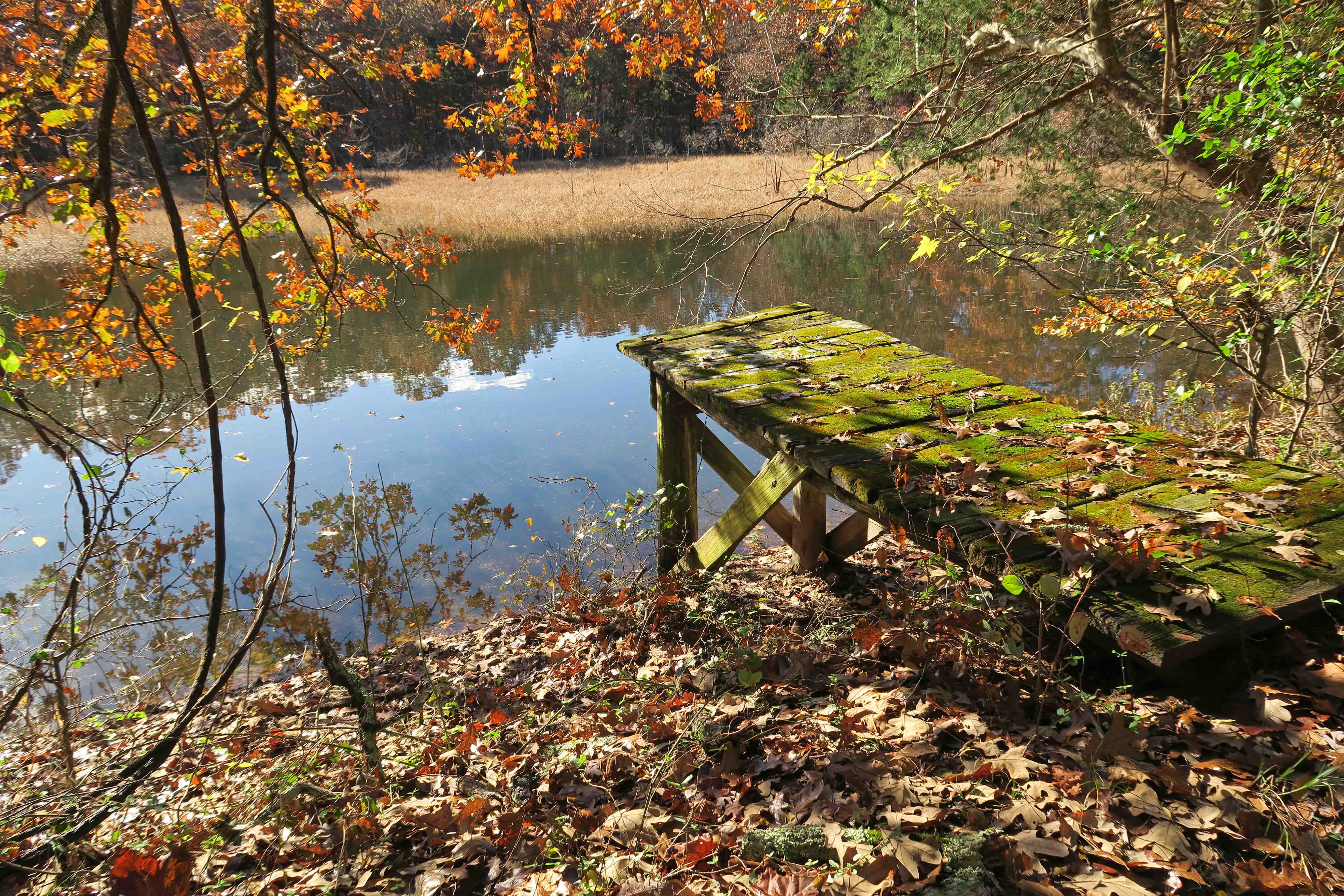
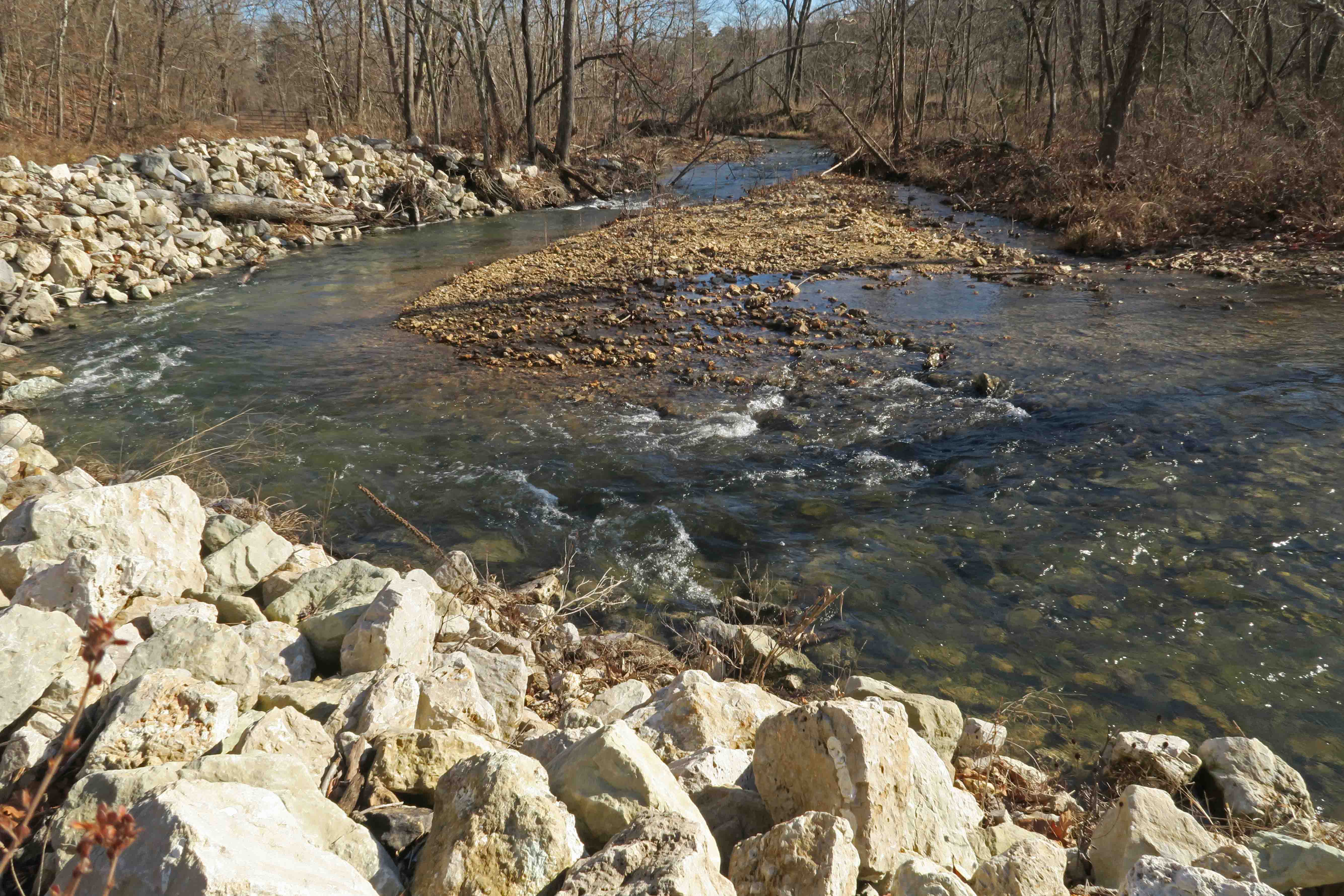
Day 1 (Saturday, December 29) The morning began with a cool 27-degrees. Shortly into our walk north of Powder Mill, we came to a special location high above the Current River. I couldn’t resist asking Bob to take a photo of me on this same bluff where Hiker-dog and I once paused while working on Five Star Trails: The Ozarks. The photo I took of her on this bluff became the book cover as you can see below. We laughed that Hiker-dog would be upset if she saw the picture and realized she missed a trip, but carrying seven-days of dog food wasn’t possible for this outing.
Bluff over Current River
Hiker-dog’s book cover
After walking just over eleven miles, we made camp north of Harper Spring and remnants of an old springhouse. Water was never a concern during our week as we followed creek drainages and crossed many lesser streams over the route.
springhouse
My chicken and rice Knorr meal with added veggies and chicken hit the spot. The broccoli was especially good! We were off to a good beginning.
Day 2 (Sunday, December 30) Good walking day! We passed an old root cellar that had held up well against the elements and time.
root cellar
interior walls of root cellar
Rain was in the forecast for Sunday night so we were hoping to make camp before it started. It was dark by 6 p.m., so I got under my quilt wondering how I was going to get by on just 12-hours of sleep! My body uses the time of rest and recovery since most of the daylight hours are spent walking. I’m always surprised at how well I sleep while camping.
Small stream flowing toward Blair Creek
Day 3 (Monday, December 31) I woke to mild temperatures and constant rain. We hoped to begin hiking when the rain stopped because the next day was supposed to be very cold and we wanted to avoid having wet clothing and shoes, but the rain continued so we decided to take a zero-day.
The luxury of time… After a few hours of nothing but think-time, where do your thoughts go? I found that they drifted toward those I love. I thought of my wife’s care and commitment and our beautiful daughters and their many gifts. I thought of my new grandson and how we look forward to watching his growth and learning. I thought of my aging parents and their positive influence and life-long love for each other.
I then turned my phone on (in airplane mode) and read a portion of Ron Carlson Writes a Short Story and drafted some notes. After a day filled with intermittent naps, I still slept through the ushering in of 2019 without any fireworks.
View of the last 2018 sunset from my front door
Day 4 (Tuesday, January 1, 2019) The morning was warmer than the expected teens, probably in the upper 30s. We had light rain and occasional snow and sleet during the day, so we just walked! As Bob said, “What else are you gonna do?”
We were fired up about being back on the trail and made 18 miles before camping. My typical day with a loaded pack is 12 so this was quite a pull but made easier by the relatively flat route that followed a historic railroad bed once used in logging operations.
Historic rail line bed that now functions as part of the Ozark Trail
Day 5 (Wednesday, January 2)
At the end of our long walk on Tuesday, darkness dictated that we camp near Bee Fork, so we woke at a low elevation with damp tents. Our first task was to cross the cold and slightly swollen Bee Fork followed by 11 miles before camping at 3 p.m.
Bee Fork
Day 6 (Thursday, January 3)
We passed through Sutton Bluff recreation area which included a low water bridge across the Black River. The campground was closed but included RV hookups and attractive facilities.
Small bluffs close to Sutton Bluff Trailhead
We hiked 12.5 miles through some beautiful and open woods before making camp at 3:15 p.m.
I paused in the middle of Brushy Creek for the following photo to capture the clear rushing water. I used only Aquamira water treatment drops for the duration of the trip.
Brushy Creek
As we approached Strother Creek, we noticed an odd sulfur smell. Water from this creek runs through lead mine tailings and hikers are advised not to use this as a water source. It looked pretty but smelled funky.
Strother Creek
A word about campsites: Our final campsite was on a low bench near the Barton Fen Trailhead, an excellent site! We passed several fire rings over the seven days of hiking but chose to avoid those few high-use spots. We didn’t build fires and left nothing more than a small tent-shaped impression in leaves where we camped.
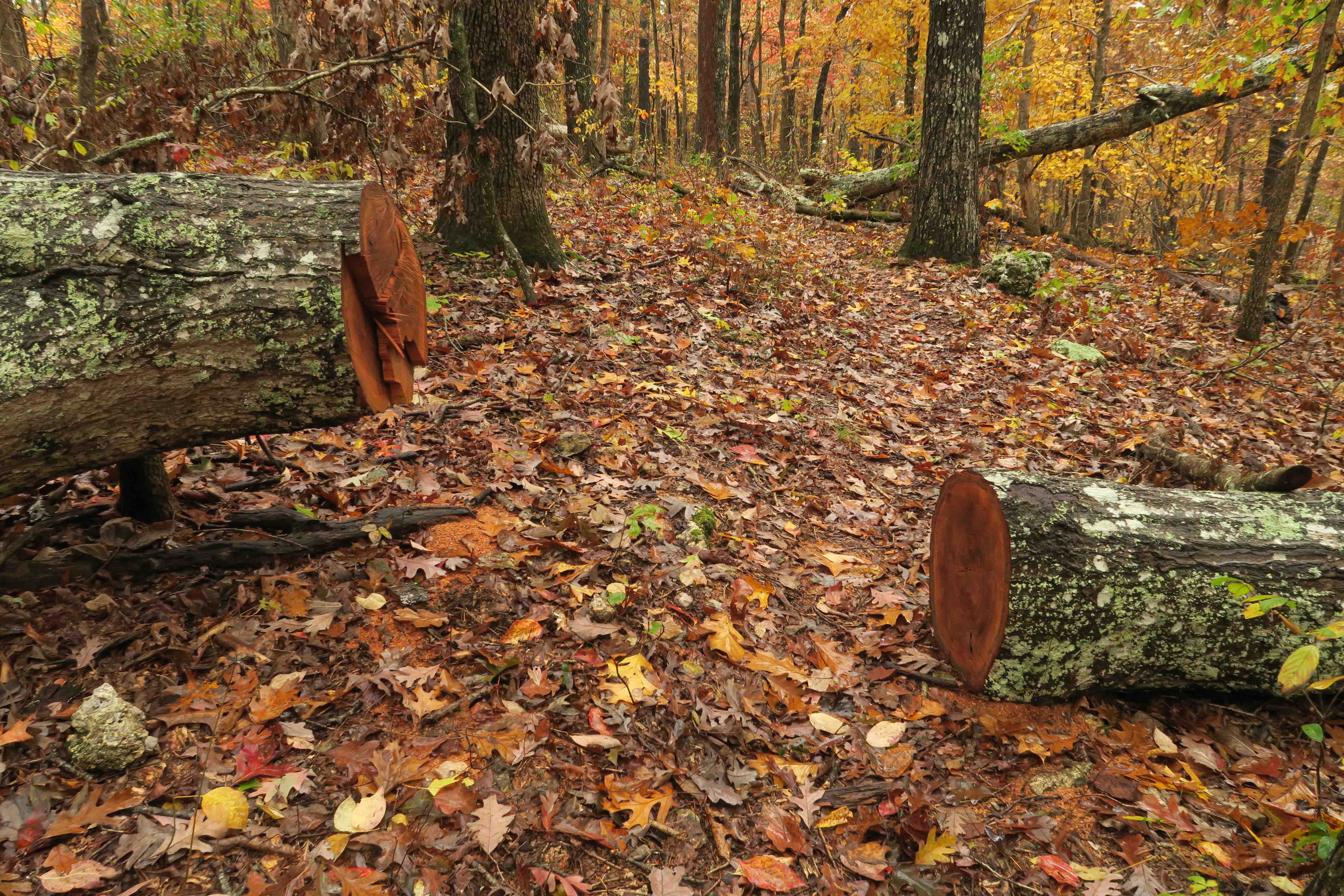
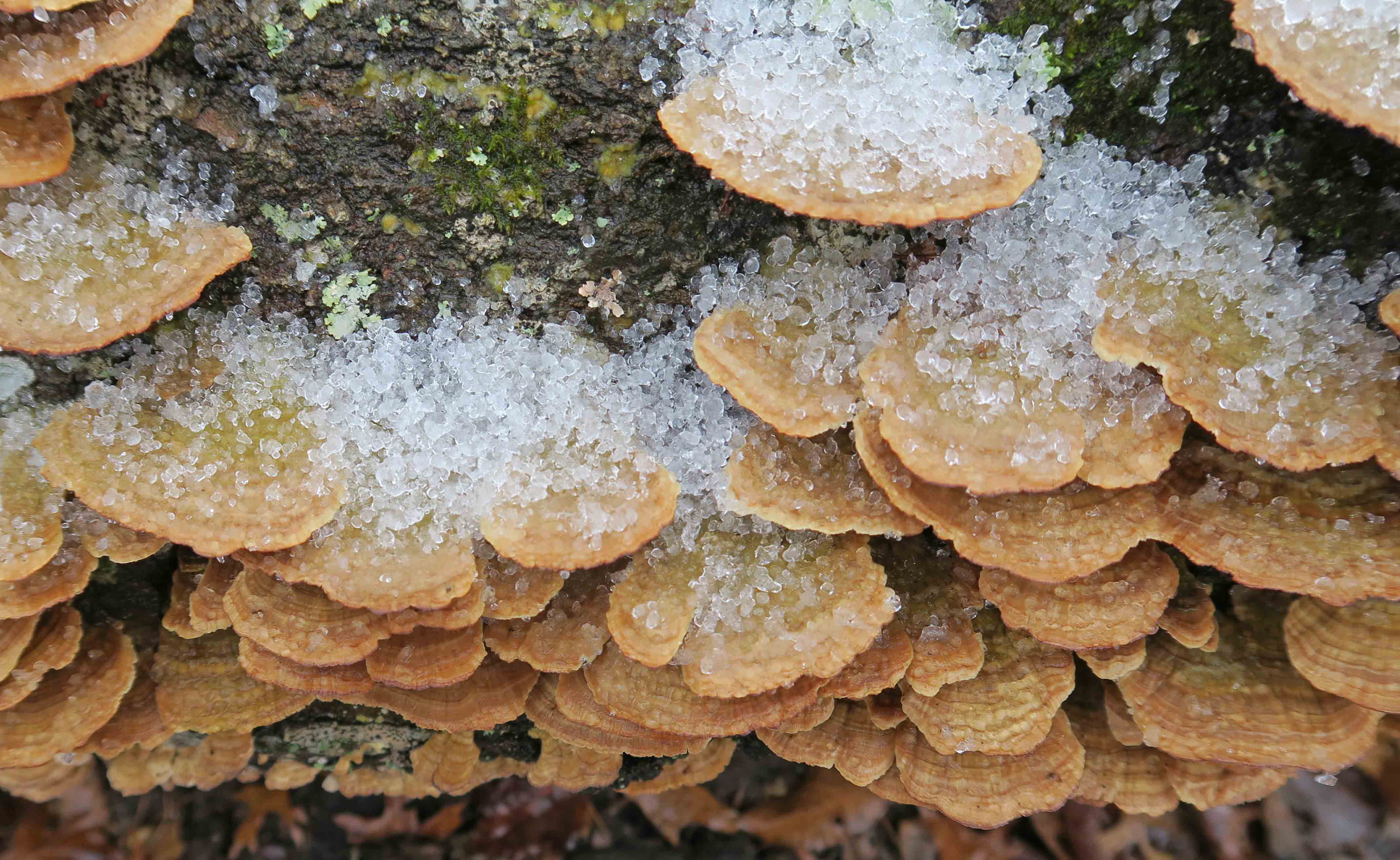
Psychological resources in the Ozarks: We passed several log cuts that reminded us of inkblots. The Rorschach inkblot test was developed in 1921…Funny what you’re motivated to look up after a long hike. Bob took a photo of the star and I got another one that was more random. I thought some of the fungi we saw could also fit with psychological testing…maybe “Ozarks Fungi Assessment of Psychological Associations (OFAPA).”
Bob’s photo of the star pattern
Saprophytic fungi
“inkblot” log cut
Saprophytic fungi
Day 7 (Friday, January 4)
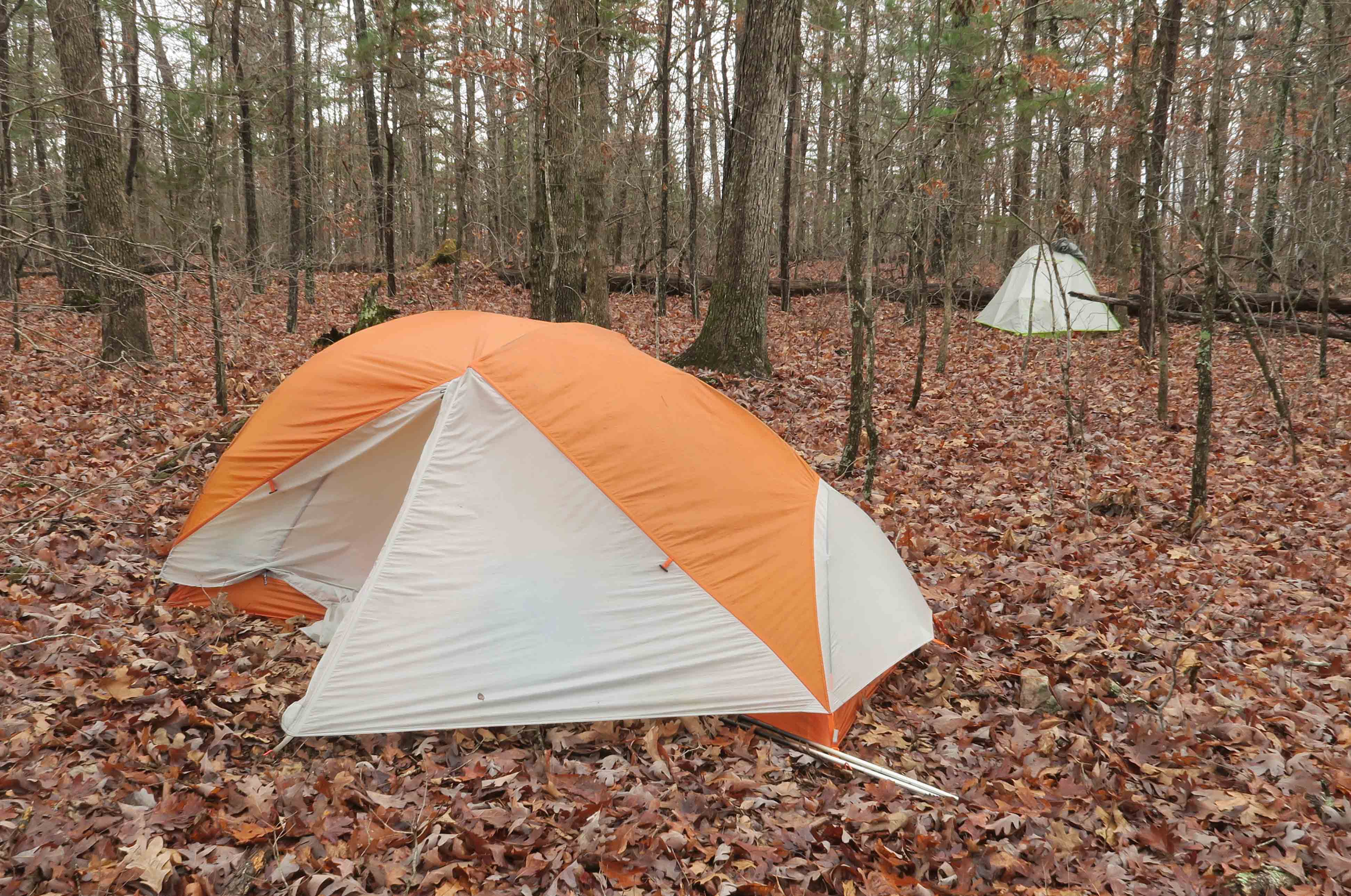
Packed and ready to go except for rainfly
Woke to a light rain that must have begun around 4 a.m. Loading the pack under my rainfly went well.
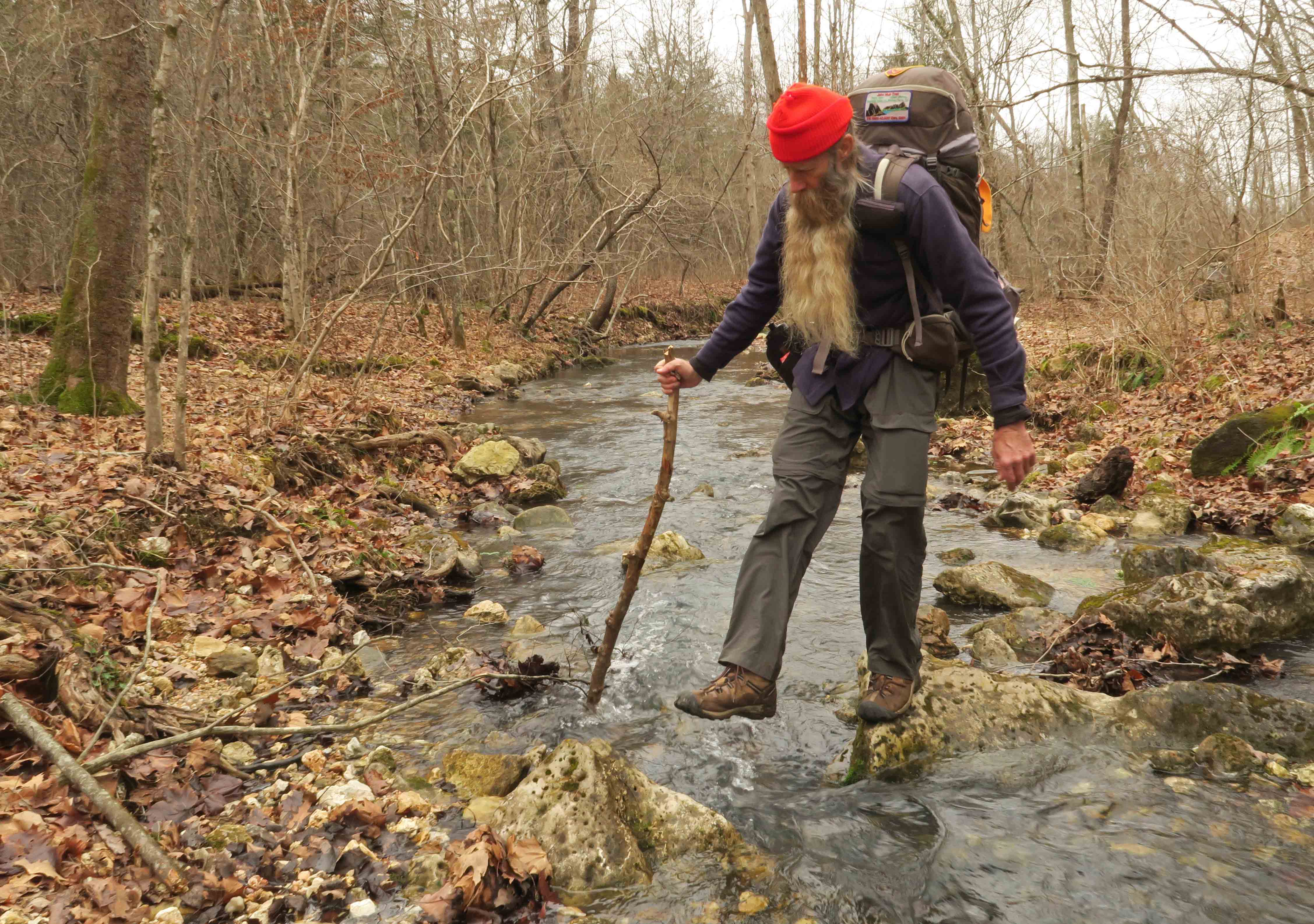
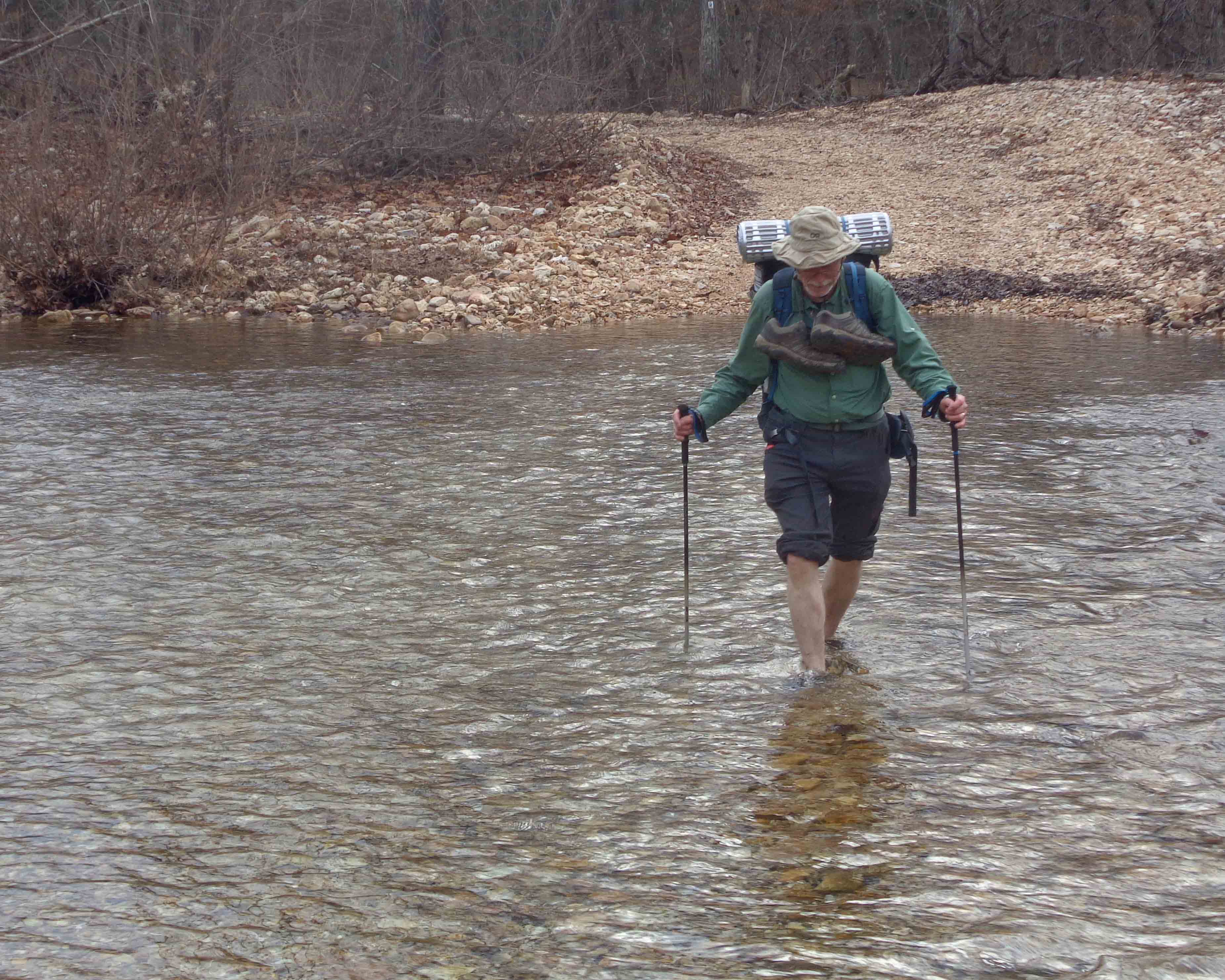
Light rain began to be mixed with sleet and then became fairly strong sleet. With the high humidity, temperatures probably felt colder than they measured, but we were trucking across a series of small creek crossings at a pretty good pace.
Bob crossing one of many intersecting streams
Wet creek crossing and refreshed feet. (photo: Bob Cable)
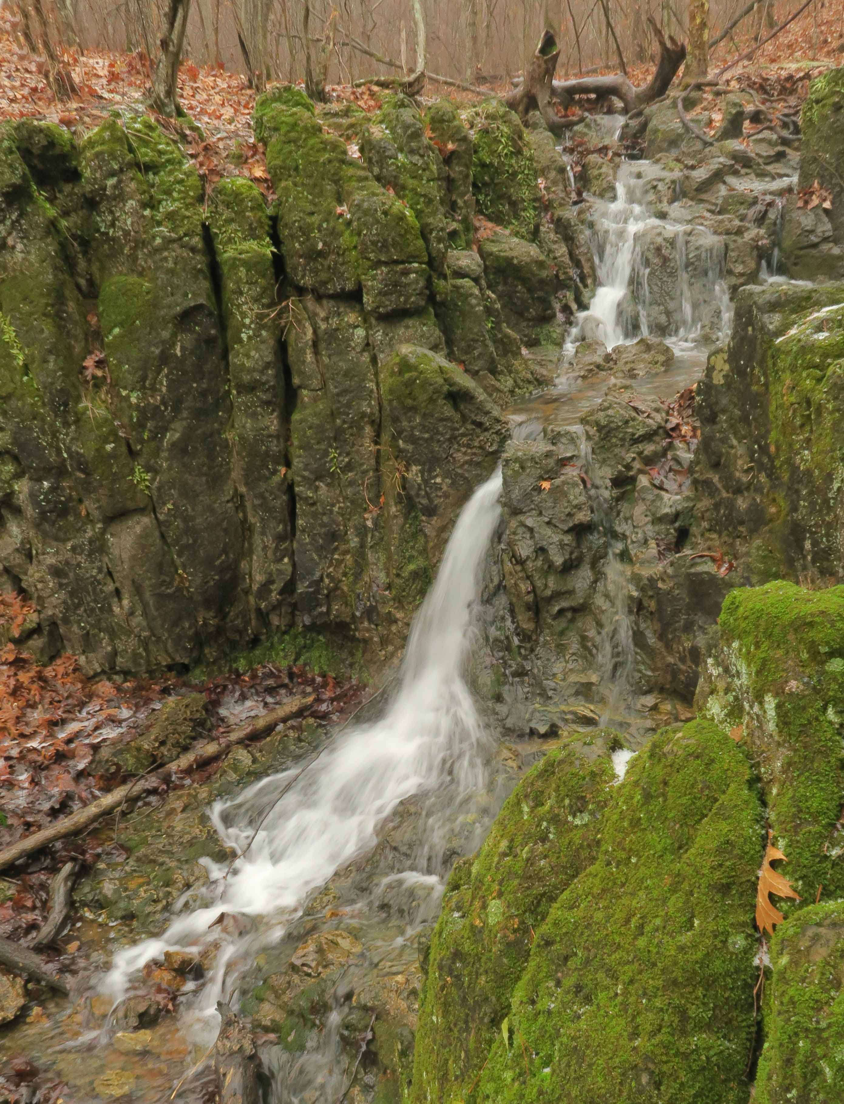
Wolf Pen Hollow Waterfall
I thought it was probably noon and was surprised when we arrived at the Hwy DD Trailhead to learn it was almost 2 p.m. Time flies when you’re having fun! We paused to pay respects to John Roth and the many volunteers who make this trail possible.
It felt great to now have approximately 160 miles of the Ozark Trail completed, and we’re looking forward to more!
A reader emailed several good questions while preparing for a backpacking trip on the Ozark Highlands Trail. I enjoy responding to these type of inquiries and decided to write this post.
Many trip failures can be traced to the planning process or something overlooked in preparation. Even on the best of trips, I usually learn of things I should have done differently, often related to travel distance, packing, or food.
What follows is not intended as an all-inclusive guide, and there’s no “right way” to prepare and pack, but some of the lessons I’ve learned and resources shared here might inform your preparation. I include links to some items mentioned, but am not endorsing products or sources. I prefer to use my local outfitters, suppliers, and bookstores for most backpacking purchases.
Planning the route: Since a good friend, Bob, and I recently completed 88 miles on the Ozark Trail and we’re presently planning our second outing on the trail, I’ll use it as an example. After determining an overview of the route, usually looking at online resources, I order or print maps. The Ozark Trail Association website is very useful for this. Most long trails have associated websites that are helpful in planning.
Online overview map of the Ozark Trail
I printed Ozark Trail maps but purchased section maps because of ease of use and durability. To be sure I ordered the right maps I used this map that labels the sections.
Since portions of the Ozark Trail haven’t been built yet, our goal is to walk the finished sections. We began working our way from south to north with the Eleven Point, Between the Rivers, and Current River sections. For this hike, we’ll continue north on the Blair Creek, Karkaghen, and Middle Fork John Roth sections.
Portion of Ozark Trail Association map
For me, planning campsites involves guesswork and looking at topographical maps. I cut post-it notes into strips and stick them to the map where I think we might camp. I move them around while planning, sometimes even after changes are made while on the trail. I sometimes enjoy not knowing exactly where we’ll stop to spend the night.
Determining when and where water will be available is part of route planning. Sometimes you have to make informed guesses. Monitoring rain in the area you’re going to hike and contacting locals can help you determine if smaller creeks might act as water sources. Last fall when hiking dry sections of the Ouachita Trail, we planted water caches for insurance, but this involved driving to pick up empty jugs after the trip.
How many miles to travel each day is a common question. When in doubt, go short and enjoy the views. It’s easy to bite off too many miles and end up injured and having to leave the trail. With a pack between 18 and 26 pounds, 10-12 miles is a good distance for me, but there’s nothing wrong with a 6-mile day. I occasionally do 14 and might go longer after I correct my foot issue (see the next topic). Update: The foot-fix worked making 15-20 mile days a possibility.
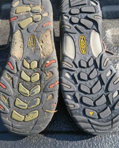
The feet: The most common saboteurs of multi-day trips are down at the end of our legs. Feet are so far away that it’s easy to ignore them. Things we hardly notice on dayhikes, become serious problems when walking day after day with 18-35 pounds on our backs.
On our first 88-mile section of the Ozark Trail, the third toe on my left foot was a problem that reared its ugly head beginning about day four of eight. This same toe was a problem earlier on the Ouachita Trail, but I tolerated the discomfort on both trips.
After the Ozark Trail experience, I found a good podiatrist. He used a spacer and small lifting device to correct this wayward toe’s position, the result of a childhood injury. If something hurts, check it out. It might be an easy fix.
Comparing worn and new shoes
When hiking, doing gentle stretches each morning and evening can avoid problems. Using some lotion on the feet each night after cleaning also helps prevent blisters. Pack a file for smoothing the toenails during your trip.
Wool blend socks help prevent blisters. I use Darn Tough Socks. They last! Comfortable shoes are also essential, and I go light as possible with footwear as in low cut hiking or trail running shoes. No need for heavy boots!
Resource: My favorite (and only) book about this subject is Fixing Your Feet by John Vonhof
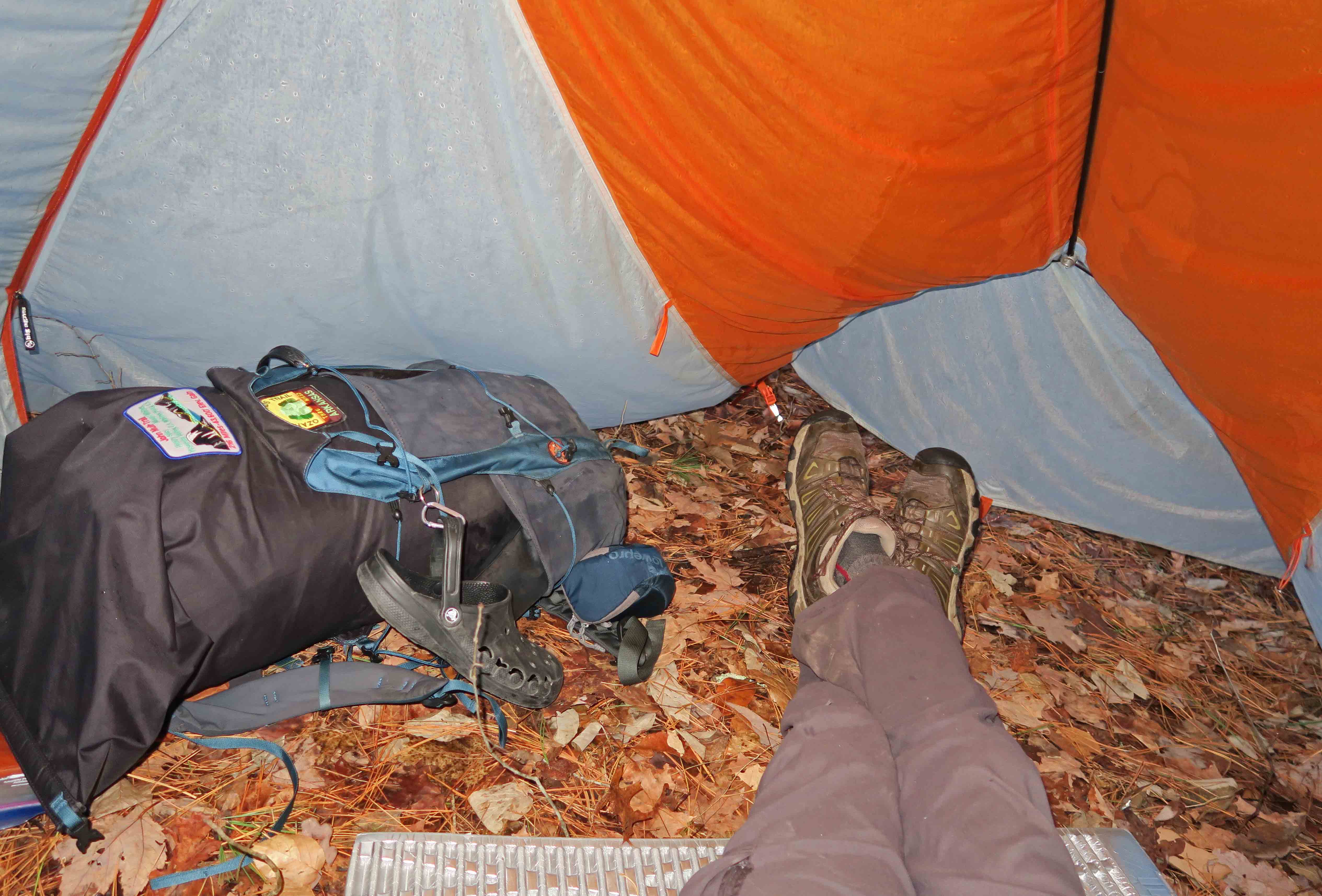
Packed for the John Muir Trail
Packing light: Pack weight is a challenge, especially for multi-day trips when the addition of food increases weight. Looking at the “big three” has helped me. Shelter, sleep system and the pack itself – These three are the big weight items. If you swap a 4-pound tent for a 1-pound tarp, that’s huge! Sometimes I’ll use a tarp, but I have a 2-pound tent I also use depending on anticipated conditions. Moving from a heavy sleeping bag to a down quilt and silk bag liner has reduced weight for me.
Many never think about the actual weight of the pack, but some are close to 5-pounds. Having a fancy suspension system doesn’t reduce the weight your feet and knees are feeling so go as light as possible with the pack. Most ultra-light packs do fine with loads of 15-30 pounds.
Next, I go through the pack to see what I can leave at home. Example: toothpast and toothbrush – I don’t need them. I take floss and use a green twig to clean my teeth as I walk in the morning. I’m veering into the “too much information” category here, but this was the first example that came to mind. I consider Wet Wipes a luxury item but worth carrying. Cleaning up before getting in the bag liner reduces the stink and makes sleep easier.
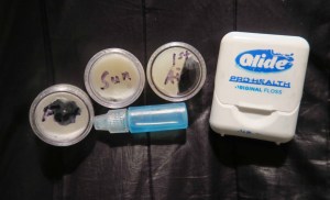
I pack needed items in small containers when possible to save weight. No need for a tube of foot cream or sunscreen, so I estimate what might be needed and pack that amount. As you can see from the photo, I still had foot cream, sunscreen, first aid cream, and Dawn Soap at the end of eight days. The floss is for size reference, but I’m looking for smaller floss containers. I despise plastic floss picks when I see them in the woods. Whatever you use should be placed in your trash bag and carried out. I use an empty coffee bag for trash because it’s light and can be folded down to the size needed. At the end of the trip, the bag goes into the trash.
Clothing: I wear one outfit for the duration of the trip. Layers are added depending on the expected weather. I use a silk weight base layer for cold hiking and an even lighter layer for sleeping. I like to carry a down vest and, if temperatures in the low 20s are forecasted, I’ll add my down pants for sleeping if the quilt needs extra help. A hat for the sun is essential. For a warm hat, I use a stretch-fabric tube (brand isn’t important). Beanie hats work well too, but they tend to be heavier and aren’t as multi-use.
Deciding what needs to remain dry is essential. I pack my clothes and personal items in a waterproof stuff sack, then place that along with my down quilt inside a trash compactor bag. The compactor bag fills cracks and crevices in the pack to utilize space and has kept items dry on rainy days.
When I expect rain, I pack an ultra-light umbrella. This is a personal choice because I’d rather have some wetness on my lower body and not be sweating and cold all over. I sweat under the best of rain shells when hiking hard in moderately cold temps. The umbrella gives me a little roof to walk under, but it’s not for everybody. I’ve also used a poncho which kept my upper body dry, but I still get clammy.
Esbit stove, windscreen, cup and pot
Fire, Food & Water: Like most backpackers, I have a varied collection of stoves. My hiking buddy carries an MSR WhisperLite. It’s great, but I need something simpler. I’ve used a PocketRocket when at higher elevations (like the John Muir Trail) but for the Ozarks, I like my Esbit Stove that uses two Esbit fuel tabs per day. Sometimes I’ll build a fire for cooking if there is an existing fire ring.
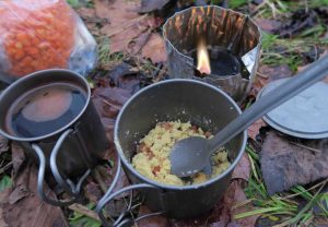
Meal in homemade cozy
Food can get heavy! I avoid freeze dried meals because of their saltiness, expense, and packaging. I prefer using powdered soup mixes, instant potatoes, and Knorr side dishes as a base with my own dehydrated vegetables and meat added. I purchase dried chicken from Mountain House and add it to most meals. I repackage all in ziplock bags. Results are best if I place the chicken and vegetables in water when I first arrive at camp to increase their hydrating time.
In the Ozarks, bears aren’t usually a concern. I never carry bear spray and only used a bear canister once in the High Sierras of California where it was required. I use a bag for food and tie it in a tree, but mainly to keep the little critters out.
Water is heavy! One liter is just over two pounds. Its storage and treatment can add even more weight. I avoid Nalgene bottles because they’re heavy and bulky. I use a Platypus 70 oz. pouch for water storage and it doubles as a pillow filled with air and wrapped in fabric. I use one-liter Vapur collapsible bottles while walking. They’re light and fold up when not in use.
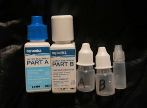
I typically use Aquamira drops for water treatment but carry it in smaller bottles with a tiny bottle for mixing.
Sawyer filters are light and effective. They’re cheap, so I usually carry one in my daypack even though I rarely use it on multi-day backpacking trips.
I must interject a note about coffee here as I consider it essential! I sometimes use Mount Hagen instant, but you end up with a small wrapper to carry out. My tastiest morning brew involves using espresso grind coffee and leaves no trash to carry out.
Here is a link to my Backpacking List. It’s a working document that I update from time to time.
Resource: Ultra-Light Backpackin’ Tips by Mike McClelland – I love this book!
home gym (and music room)
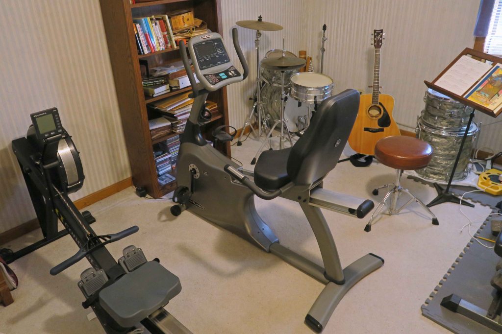
Physical preparation: The best way to prepare for backpacking is to walk with a backpack. I put magazines in my bear canister and place it in an extra pack for this purpose. I love my rowing machine, but biking, running, or any similar exercise will be helpful in preparing for backpacking. Update: In August of 2020, I added a stationary bike (pictured above) to my regular workout and love it! Lunges, squats and toe raises are going to be helpful but don’t start a new activity in the weeks before a long trip because an injury will interfere with preparations. Rest, nutrition and safe stretching are all important to general health and in helping you avoid illness prior to your trip.
Resource: The Stark Reality on Stretching by Dr. Steven D. Stark – This book shows safe stretching techniques and points out the dangers of some common stretches.
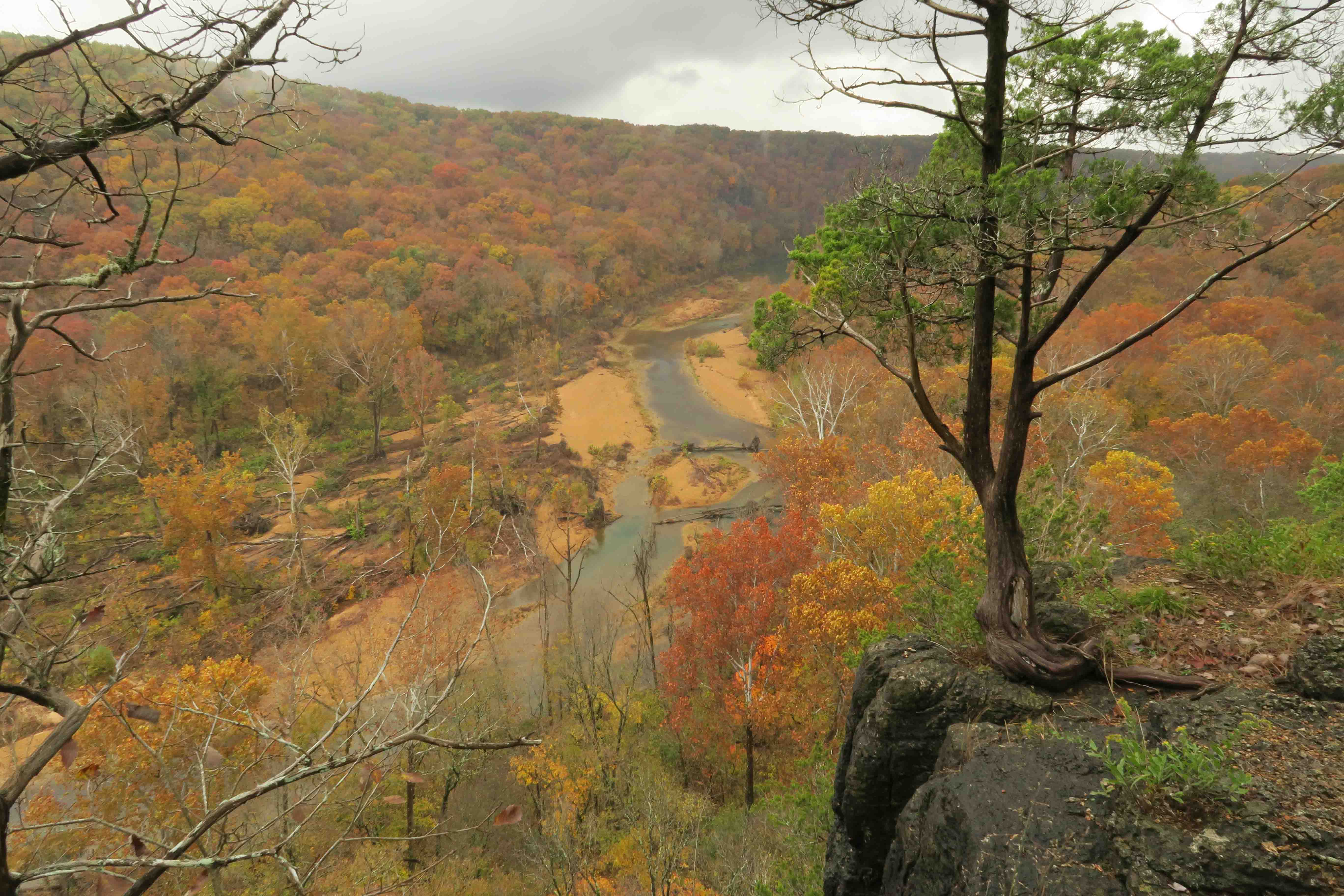
Eleven Point River in Missouri
I’ve shared what I think are important things to remember when preparing for a multi-day backpacking trip. I’ll update this post as questions reveal other areas to include.
Enjoy your planning! If things go well, you’ll gain lifelong memories of indescribable beauty and the satisfying sense of personal accomplishment. If things don’t go as planned, you still might have great memories of your time in the wilderness, but with the addition of new learning to apply on your next trip.
Five Star Trails: The Ozarks in REI, Dallas
While I love the long trails, I enjoy a good dayhike! If you need a great guidebook for the Ozarks of Arkansas and Missouri, check out my book, Five Star Trails: The Ozarks.
While working on Five Star Trails: The Ozarks, I scouted several trails that followed portions of Missouri’s Ozark Trail. Those experiences left me wanting more.
Using the Ozark Trail Association website trip planner, I entered how many days were available for the outing and decided on a south-to-north trek following the Eleven Point, Between the Rivers, and Current River sections for a total of 87.6 miles. I rounded our total trip mileage up to 88 since we poked around in the woods a couple of times where the trail became difficult to follow, mostly around the Peck Ranch section.
On Friday, November 2, I drove up to Fayetteville and picked up Bob, then drove about 5 hours to Powder Mill, east of Eminence, Missouri. Jerry Richard (Richard’s Canoe Rental) met us promptly the next morning and shuttled us to the Western Terminus of the Eleven Point River section close to Thomasville. Our itinerary was simple from there. Just walk 88-miles back to my truck at Powder Mill (AKA Owls Bend on the Current River).
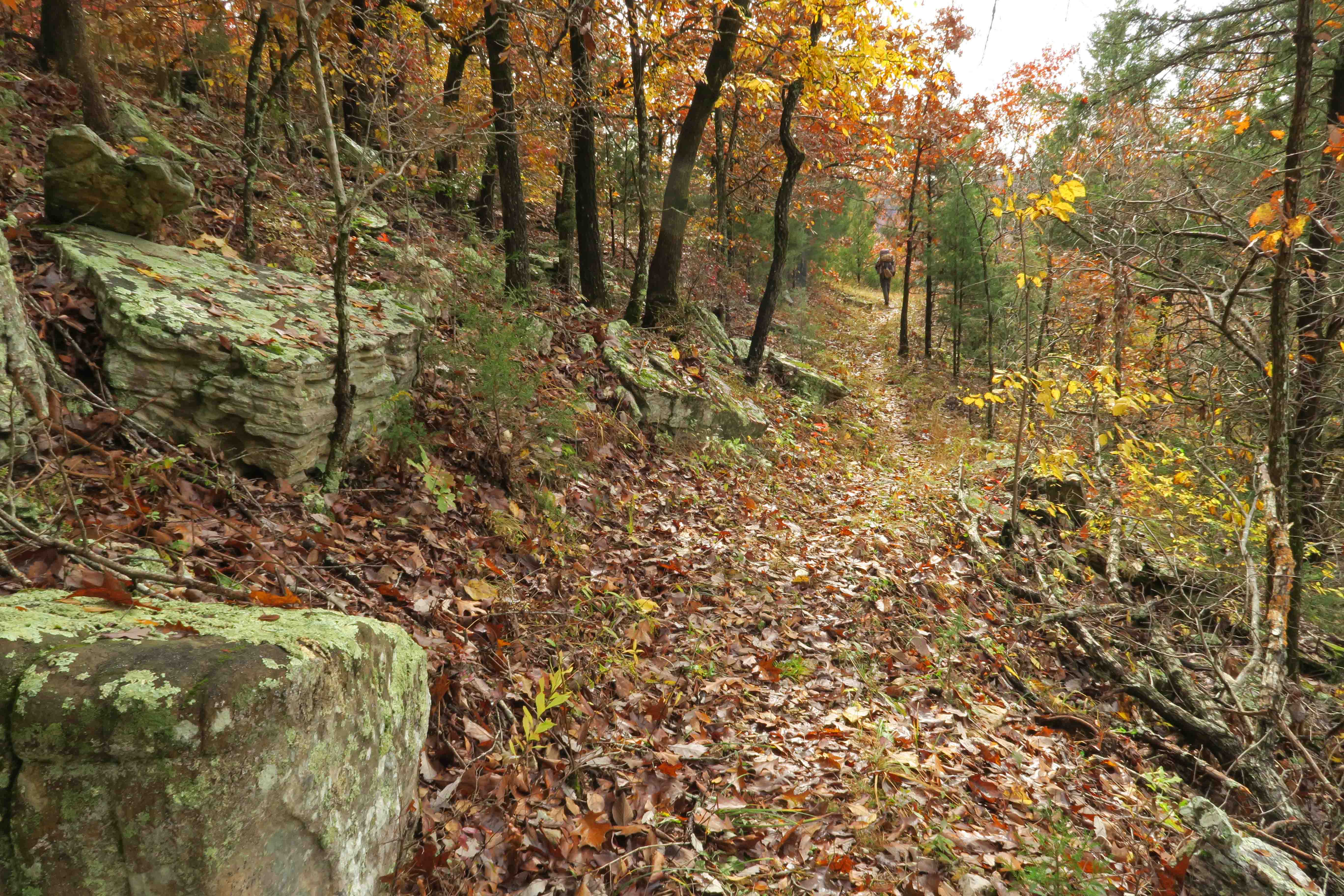
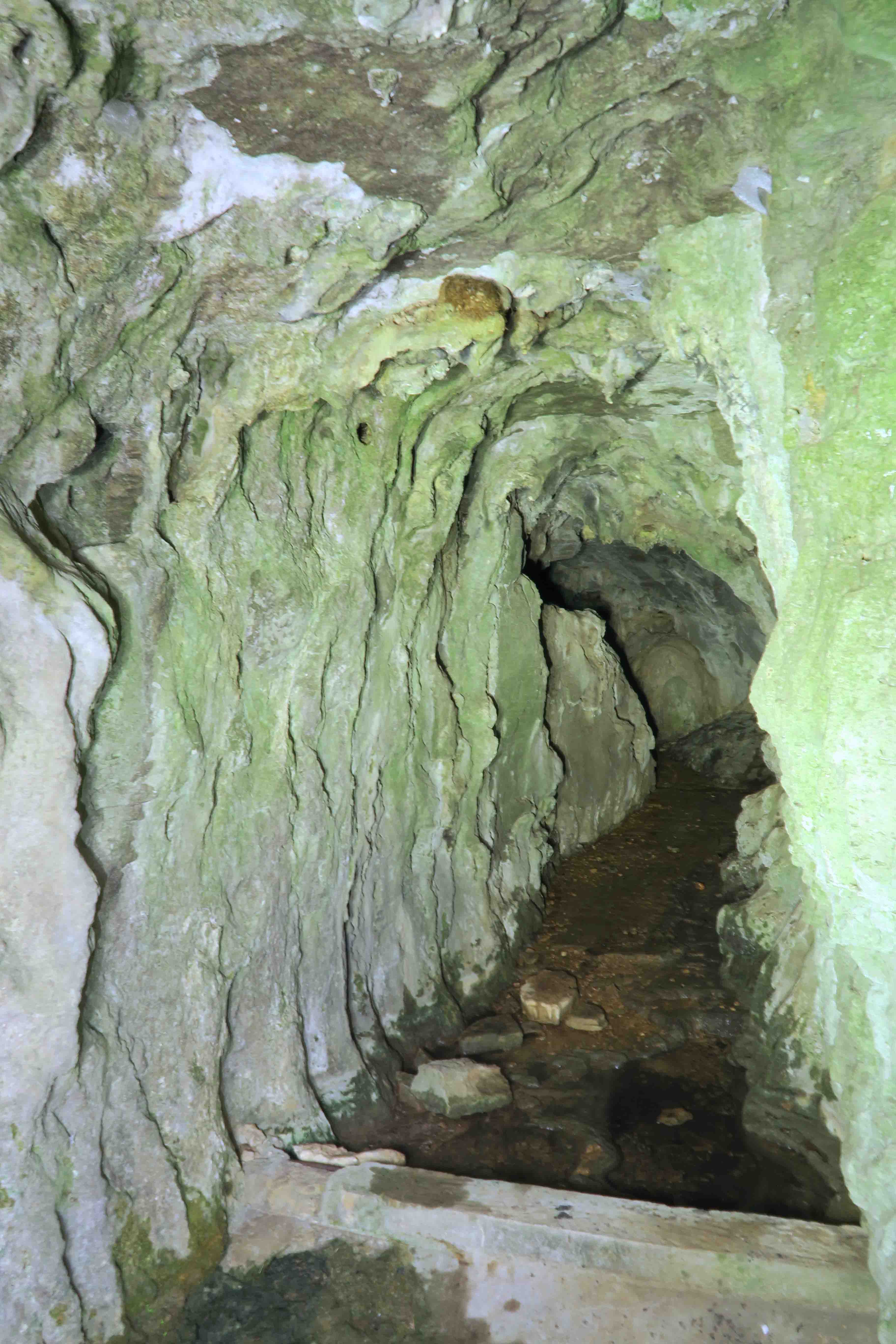
As we set foot on the trail Saturday morning, we were immediately captured by the fall colors. The first day flew by, and we arrived at Bockman Spring early in the afternoon.
Bockman Spring
The cave is closed, but a photo could be taken from the door frame to the bluff built by earlier inhabitants. I used my headlamp to “light-paint” the cave’s walls during a 15-second exposure. We filtered our water from the PVC pipe that carried water from the cave to a metal catch basin in front of the spring.
Bockman Spring
While preparing our evening meals, several friendly locals on four-wheelers drove up, and we visited about our itinerary. They had many questions about the trail and the distance we would travel over the next few days. The first day for gun hunting would be November 10, but we had hunter orange for the final days of our trek.
Coffee, eggs and bacon bits
After a rainy night, I woke to the silhouette of trees against a dull morning light. Drops of water falling from nearby trees sounded like hundreds of little animal steps. I prepared egg crystals and bacon bits with coffee while warming under my quilt.
Packing lightweight food that would satisfy and provide fuel for the miles took some planning, but I was pleased with the results.
Chicken, rice, and veggies
Mountain House dehydrated chicken combined with Knorr meals or instant potatoes made excellent dinners! The addition of selected dehydrated veggies added flavor and balance. I’m looking forward to including examples (and samples) from my backpacking menu during my March 3rd, 2019 presentation for the Friends of Hobbs State Park.
My small umbrella was put to good use as drizzling rain fell on and off the next day. I began to walk a familiar trail included in my guidebook as we passed the McCormack Lake spur. We stopped for a break at a view of the Eleven Point River I’d looked forward to seeing again.
After passing Greer Recreation Area, we followed the upland route. We toured the well maintained Bristol Cemetery that contained grave sites from the 1800s and early 1900s.
After thirteen hilly miles, we made camp four miles into the Between the Rivers Section. As the sun went down, coyote howls echoed through the surrounding woods with a stereo-like high fidelity purity.
The tarp combined with bivy sack as a groundcloth, air mattress, and down quilt kept me dry and warm. I like the closeness I feel with surroundings when using a tarp. If strong thunderstorms had been in the forecast, I might have carried my tent instead.
Monday began cold! Rain started around 11 a.m. and continued throughout the day, slacking up around 6 p.m. My camera was safely stowed inside my waterproof stuffsack so no photos from that day.
Cotham Pond
Tuesday treated us to more water than we’d expected on this typically dry section of trail. We found good water and sunshine at Cotham Pond. A starry night and strong coyote songs followed that evening.
The next few days sailed by as we covered miles and found water plentiful along the trail. Mint Spring was a special place with its soft green color.
Mint Spring
Mint Spring stream
We didn’t see any elk in the Pike Ranch Conservation Area, but saw more deer than we could count. The trail got sketchy at a burned out area, but we found our way. Trail markers were sometimes plentiful but more often spaced so that they reassured us we were on the right path. As part of our planning, we passed through Peck Ranch a couple of days before the route would close for hunting season.
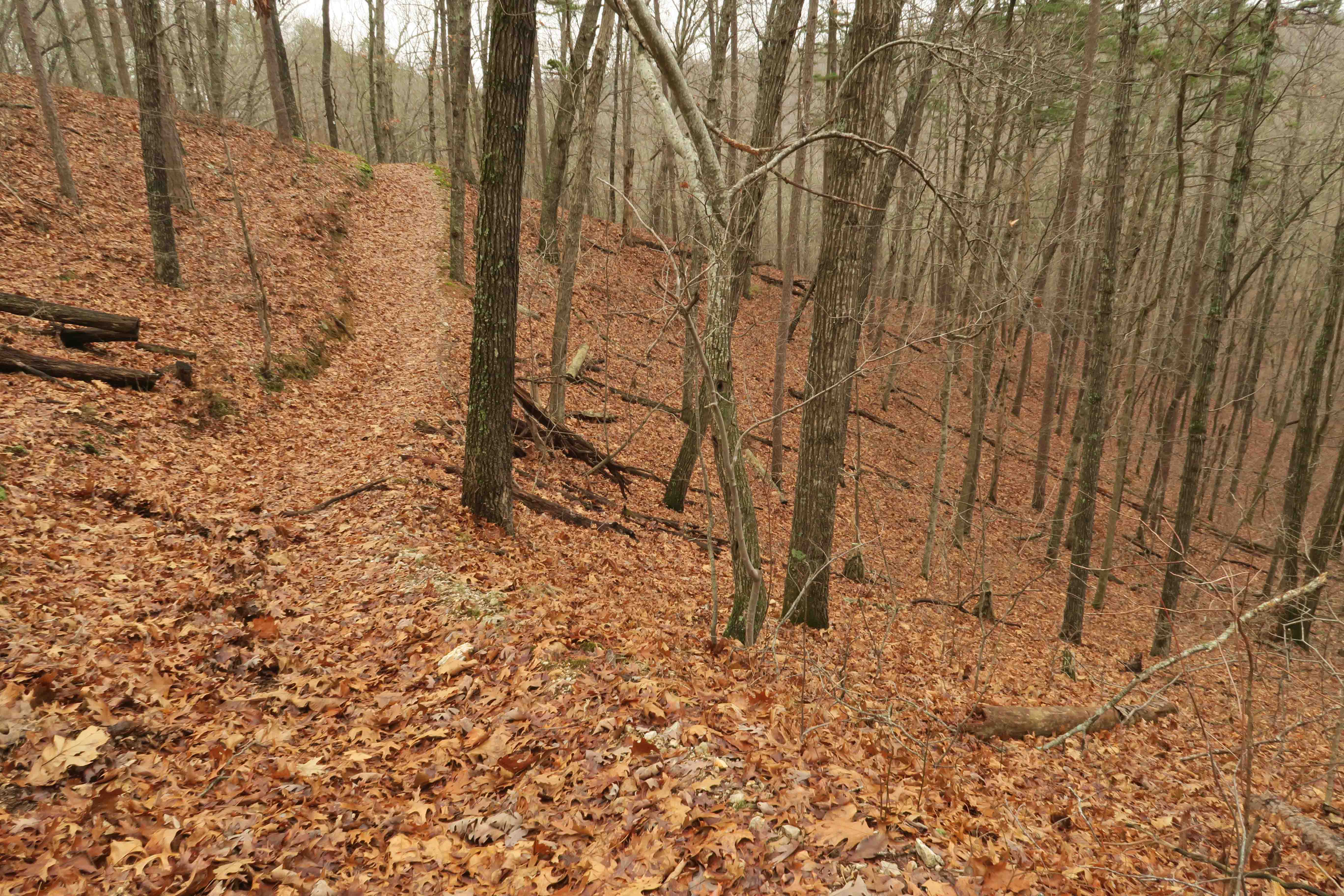
The trail became easier to follow once we got north of Peck Ranch. Climbing up Stegall Mountain was exciting as distant views revealed themselves while we walked through stunted, windblown oaks. We spent a few minutes on the glade mountaintop taking in the beauty then continued toward the Rocky Creek section.
Rocky Creek held wonderful water. I treated it lightly with some Aquamira drops. Our seventh and last night on the trail was our coldest yet. The next morning was a delightful chilly walk to Klepzig Mill followed by several cold creek crossings. Bob said, “The cleanest parts of our bodies are definitely our feet!”
Klepzig Mill
Klepzig Mill
The water of Rocky Creek and adjacent creeks was clear and cold! I enjoyed watching this small leaf dance on the surface of the water and follow its shadow on the rock below.
We walked across a field of frost flowers on this sunny morning. I couldn’t resist the temptation to take a bite from one of the large ice formations.
My first taste of a frost flower
As we approached our final Current River crossing over the Hwy 60 Bridge, a pickup truck pulled up and one of our deer hunter friends from day one at Bockman Spring greeted us. We enjoyed a short visit before continuing to Powder Mill Trailhead and our trip’s end. The only backpacker we met in eight days was Joe B. going the opposite direction early in our hike.
Current River from the Hwy 60 Bridge
We looked forward to a good meal but drove east for a while before stopping at Mountain Grove to have a delicious dinner at Grove Family Restaurant. Great service! Great food!
Bob and Jim
We were thankful to conclude our colorful trek on the Ozark Trail still feeling healthy and strong. Maybe we’ll return and explore more miles of this beautiful trail in the future. Like my dayhikes from three years ago, this first longer walk on the Ozark Trail left me wanting more. Check out the links at the end of this post to read of our other long hikes.
A note of thanks: We passed hundreds of cuts, old and new, that cleared our way on the trail. We saw areas recently maintained and the white tree blazes were essential to following the trail. Bob and I have adopted sections of the Ozark Highlands Trail in Arkansas, so we appreciate the work it takes to keep a trail open. Thank you to the Ozark Trail Association (OTA) and the many volunteers who give their time to Missouri’s Ozark Trail!


 Using the Ozark Trail Association website
  As we set foot on the trail Saturday morning, we were immediately captured by the fall colors. The first day flew by, and we arrived at Bockman Spring early in the afternoon.
 After passing Greer Recreation Area, we followed the upland route. We toured the well maintained Bristol Cemetery that contained grave sites from the 1800s and early 1900s.